Items Similar to Antique Map of North Europe and East Asia by Vaugondy, circa 1750

Want more images or videos?
Request additional images or videos from the seller
1 of 5
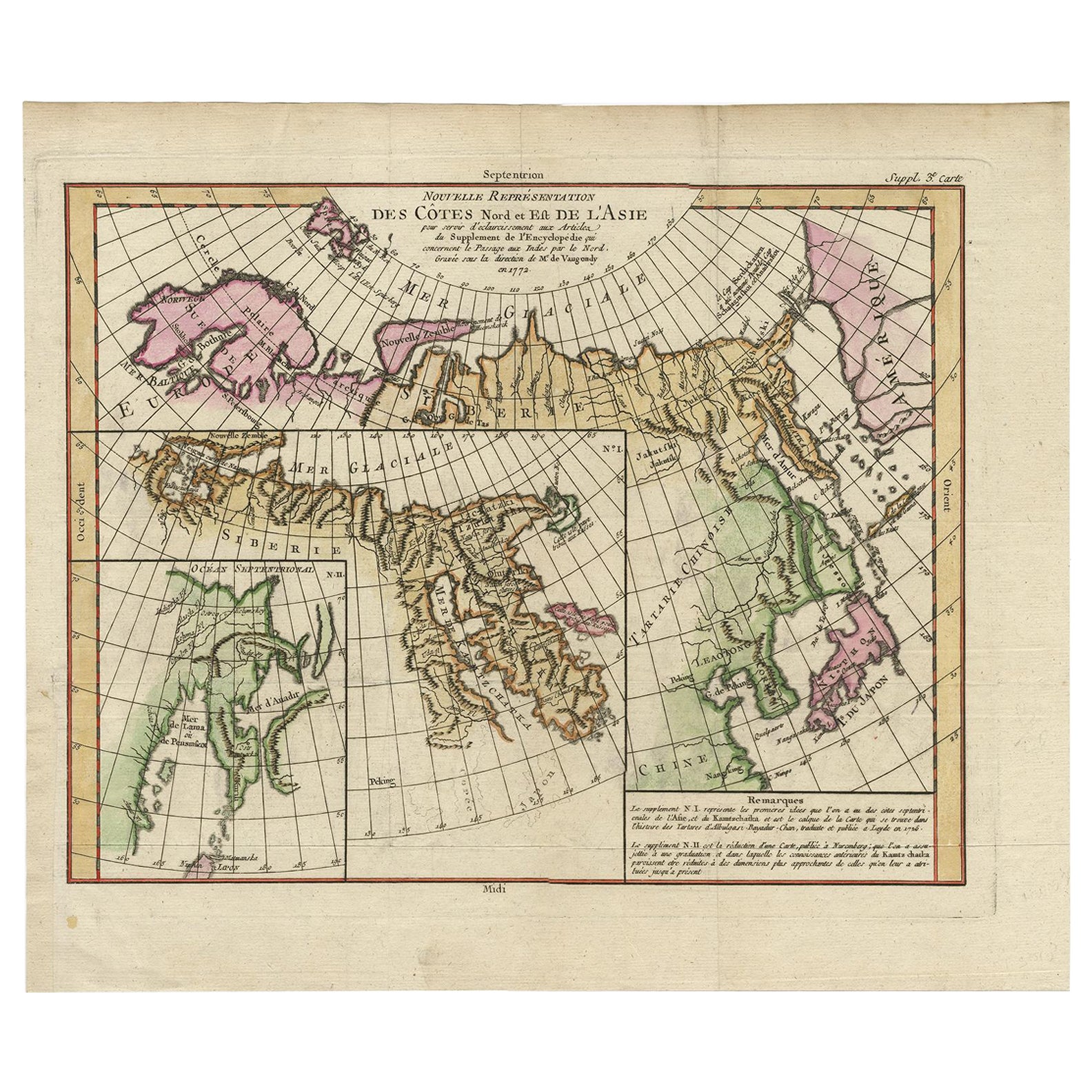
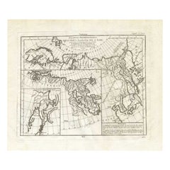
Antique Map of North Europe and East Asia by Vaugondy, circa 1750
About the Item
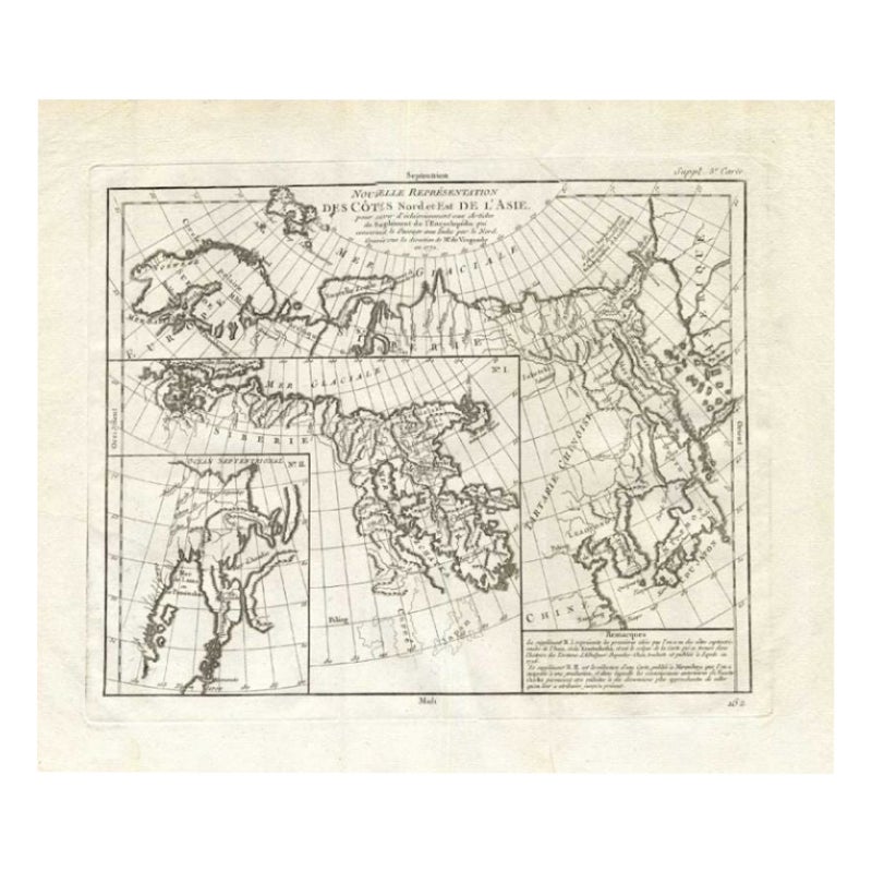
Antique map titled 'Carte des parties nord et est de L'Asie'. Map of the Northern parts and East Asia. Five maps on one sheet, showing California, Alaska and Syberia, Korea and Japan. South to Korea the island "Quelpaerts". This map shows the Bering Straits an extended Alaska, Japan and a curious Jesso and California as an peninsular.Originates from 'The Encyclopédie ou Dictionnaire raisonné des sciences, des arts et des métiers, par une Société de Gens de lettres.' which was published under the direction of Diderot and d'Alembert, with 17 volumes of text and 11 volumes of plates between 1751 and 1772. It contained 72,000 articles written by more than 140 contributors. This encyclopedia was a massive reference work for the arts and sciences, as well as a means to propagate the ideas of the French Enlightment. The impact of this encyclopedia was enormous.
- Dimensions:Height: 15.36 in (39 cm)Width: 16.54 in (42 cm)Depth: 0.02 in (0.5 mm)
- Period:
- Date of Manufacture:circa 1750
- Condition:Wear consistent with age and use. Minor losses. Few tiny tears, and a small repair in inset IV. please study images carefully.
- Seller Location:Langweer, NL
- Reference Number:
About the Seller
5.0
Platinum Seller
These expertly vetted sellers are 1stDibs' most experienced sellers and are rated highest by our customers.
Established in 2009
1stDibs seller since 2017
1,976 sales on 1stDibs
Typical response time: <1 hour
- ShippingRetrieving quote...Ships From: Langweer, Netherlands
- Return PolicyA return for this item may be initiated within 14 days of delivery.
More From This SellerView All
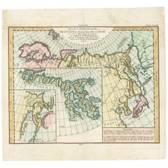
- Antique Map of the North and East Coast of Asia by Vaugondy, circa 1750Located in Langweer, NLAntique map titled 'Nouvelle representation des Cotes Nord et Est de L'Asie.' Map the north and east coast of Asia, showing an oddly shaped Japan and inset maps of Kamchatka. Origina...Category
Antique Mid-18th Century Maps
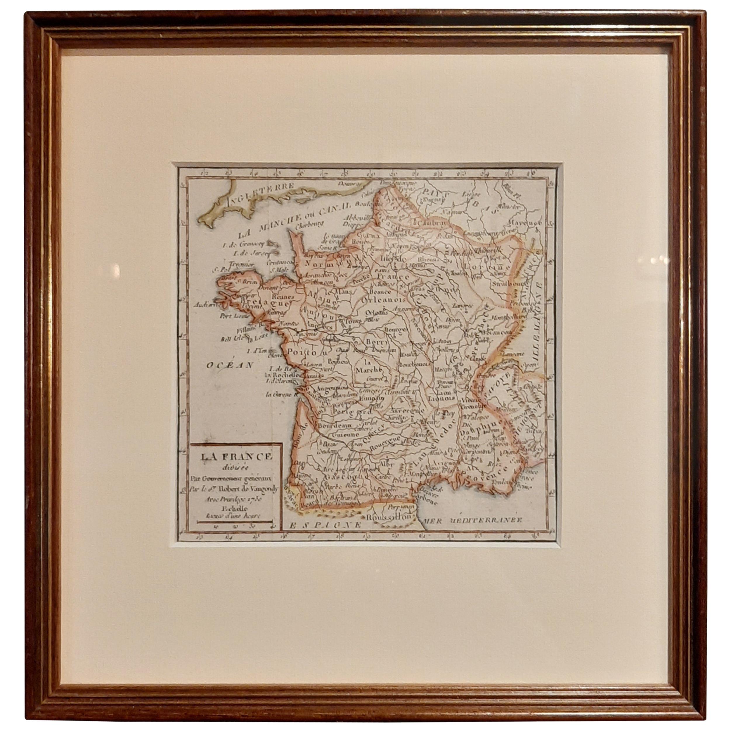
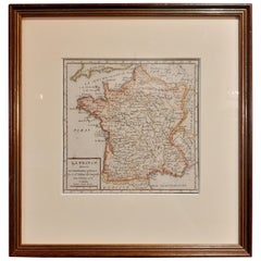
- Antique Map of France by Vaugondy, circa 1750Located in Langweer, NLAntique map titled 'La France divisée (..)'. Map of France published by Robert de Vaugondy, circa 1750. Frame included. We carefully pack our framed items to ensure safe shipping.Category
Antique Early 18th Century Maps
MaterialsPaper
- Antique Map of the Russian Empire in Europe by Vaugondy, 1750Located in Langweer, NLAntique map titled 'Partie Occidentale de l'Empire de Russie (..)'. Detailed map of the western part of Russia, extending south to the Caspian and east to Irkurkoy and Ilimskoy. A...Category
Antique 18th Century Maps
MaterialsPaper
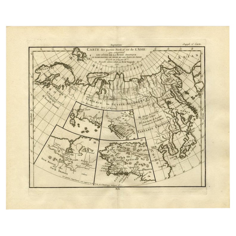
- Antique Map of North and East Asia, 1751Located in Langweer, NLMap 2: 'Carte des parties nord et est de L'Asie'. (Map of the Northern parts and East Asia.) Five maps on one sheet, showing California, Alaska and Siberia, Korea and Japan. South to...Category
Antique 18th Century Maps
MaterialsPaper
- Map of North and East coast of Asia with Japan & inset maps of Kamchatka, c1750Located in Langweer, NLAntique map titled 'Nouvelle representation des Cotes Nord et Est de L'Asie.' Map the north and east coast of Asia, showing an oddly shaped Japan and inset maps of Kamchatka. Thi...Category
Antique 1750s Maps
MaterialsPaper
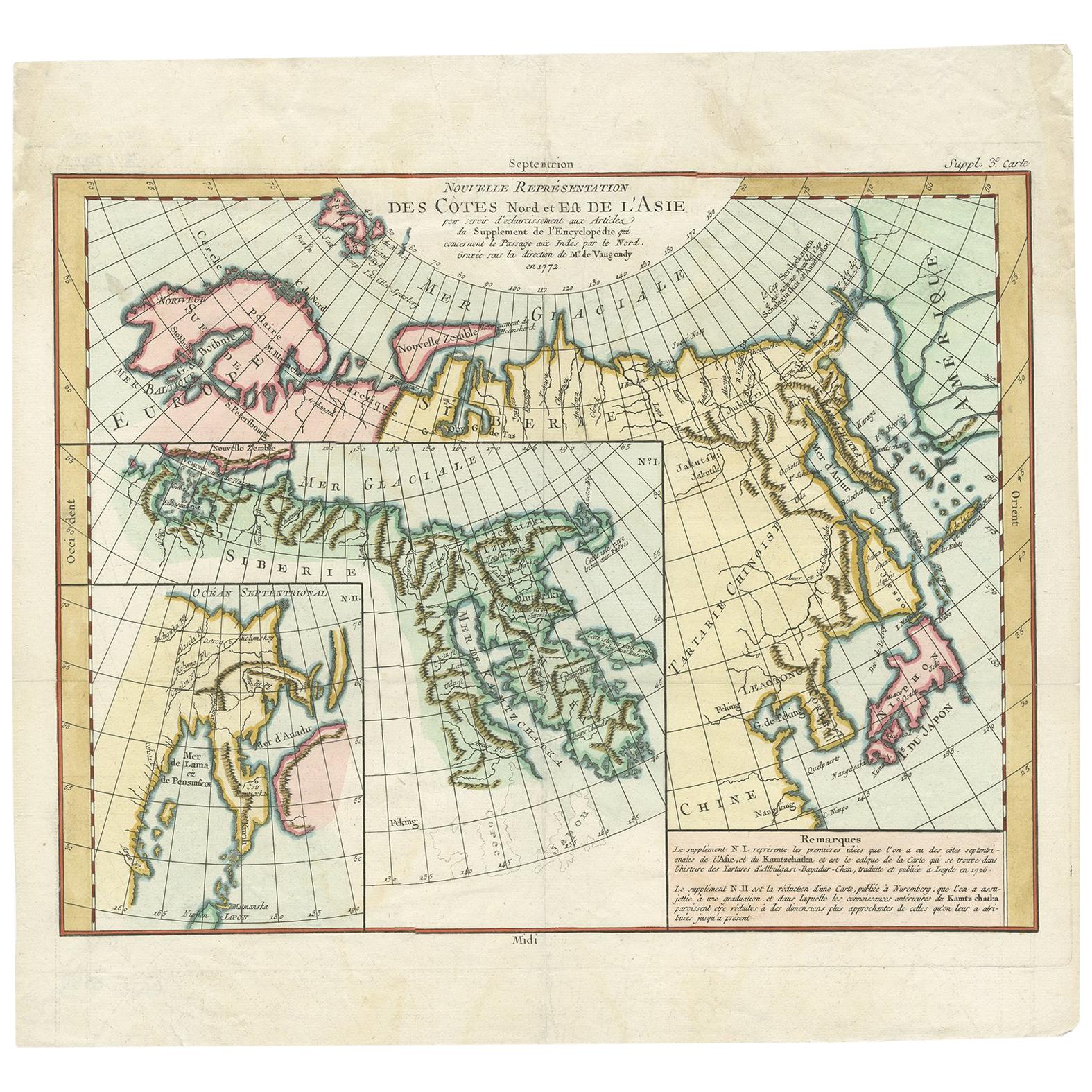
- Antique Map of the Coast of North and East Asia by Diderot, 1751By Denis DiderotLocated in Langweer, NLMap 3: 'Nouvelle Representation des Cotes Nord et Est de L'Asie'. (New map of the coast of North and East Asia.) Three maps on one sheet. Depicting three maps centered on mainland Ch...Category
Antique 18th Century Maps
MaterialsPaper


You May Also Like
- Original Antique Map of South East Asia by Becker, circa 1840Located in St Annes, LancashireGreat map of South East Asia Steel engraving with original color outline Engraved by Becker Published by Virtue, circa 1840. Unframed.Category
Antique 1840s English Other Maps
MaterialsPaper
- Original Antique Map of South East Asia, Arrowsmith, 1820Located in St Annes, LancashireGreat map of South East Asia Drawn under the direction of Arrowsmith Copper-plate engraving Published by Longman, Hurst, Rees, Orme and Brown, 1820 Unframed.Category
Antique 1820s English Maps
MaterialsPaper
- Original Antique Map of South East Asia by Thomas Clerk, 1817Located in St Annes, LancashireGreat map of South East Asia Copper-plate engraving Drawn and engraved by Thomas Clerk, Edinburgh. Published by Mackenzie And Dent, 1817 Unframed.Category
Antique 1810s English Maps
MaterialsPaper
- Large Original Vintage Map of South East Asia, circa 1920Located in St Annes, LancashireGreat map of South East Asia Original color. Good condition Published by Alexander Gross Unframed.Category
Vintage 1920s English Edwardian Maps
MaterialsPaper
- Huge Europe and Asia Vintage Wall MapLocated in San Diego, CAA huge Europe and Asia vintage wall map, circa 1950s. The map is in fair vintage condition and measures 78"W x 73"H". #2863Category
Mid-20th Century American Maps
MaterialsPaper
- Large Original Antique Map of North Dakota, USA, circa 1900Located in St Annes, LancashireFabulous map of North Dakota Original color Engraved and printed by the George F. Cram Company, Indianapolis. Published, circa 1900 Unframed Free shi...Category
Antique 1890s American Maps
MaterialsPaper


Recently Viewed
View AllMore Ways To Browse
17 South Antiques
Map Europe
Maps Europe
Antique European Plates
Antique Furniture South East
Antique Map Europe
Japan Maps
Map Of Japan
California Map
Map Of South Of France
Antique Japanese Map
Antique Japanese Maps
Encyclopedie Diderot
Asie Antique
Korean Plate
Antique Map Of The South Of France
Antique Map California
Antique Map Of California