Items Similar to Antique Map of the North Sea and Dunkirk


Want more images or videos?
Request additional images or videos from the seller
1 of 6
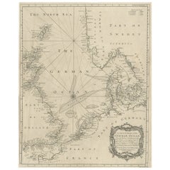
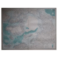
Antique Map of the North Sea and Dunkirk
About the Item
Untitled map of the North Sea, top left a large compass rose, bottom right Dunkirk (Duinkerke / Dunkerque), France. Part of a bundled collection of plans of battles and cities renowned in the Spanish succession war. Engraved by J. Harrewijn, published 1712.
- Dimensions:Height: 20.95 in (53.2 cm)Width: 24.14 in (61.3 cm)Depth: 0.02 in (0.5 mm)
- Materials and Techniques:
- Period:
- Date of Manufacture:1712
- Condition:General age-related toning. Original folding line, with small split. Minor wear and soiling. Blank verso. Please study image carefully.
- Seller Location:Langweer, NL
- Reference Number:
About the Seller
5.0
Platinum Seller
These expertly vetted sellers are 1stDibs' most experienced sellers and are rated highest by our customers.
Established in 2009
1stDibs seller since 2017
1,976 sales on 1stDibs
Typical response time: <1 hour
- ShippingRetrieving quote...Ships From: Langweer, Netherlands
- Return PolicyA return for this item may be initiated within 14 days of delivery.
More From This SellerView All
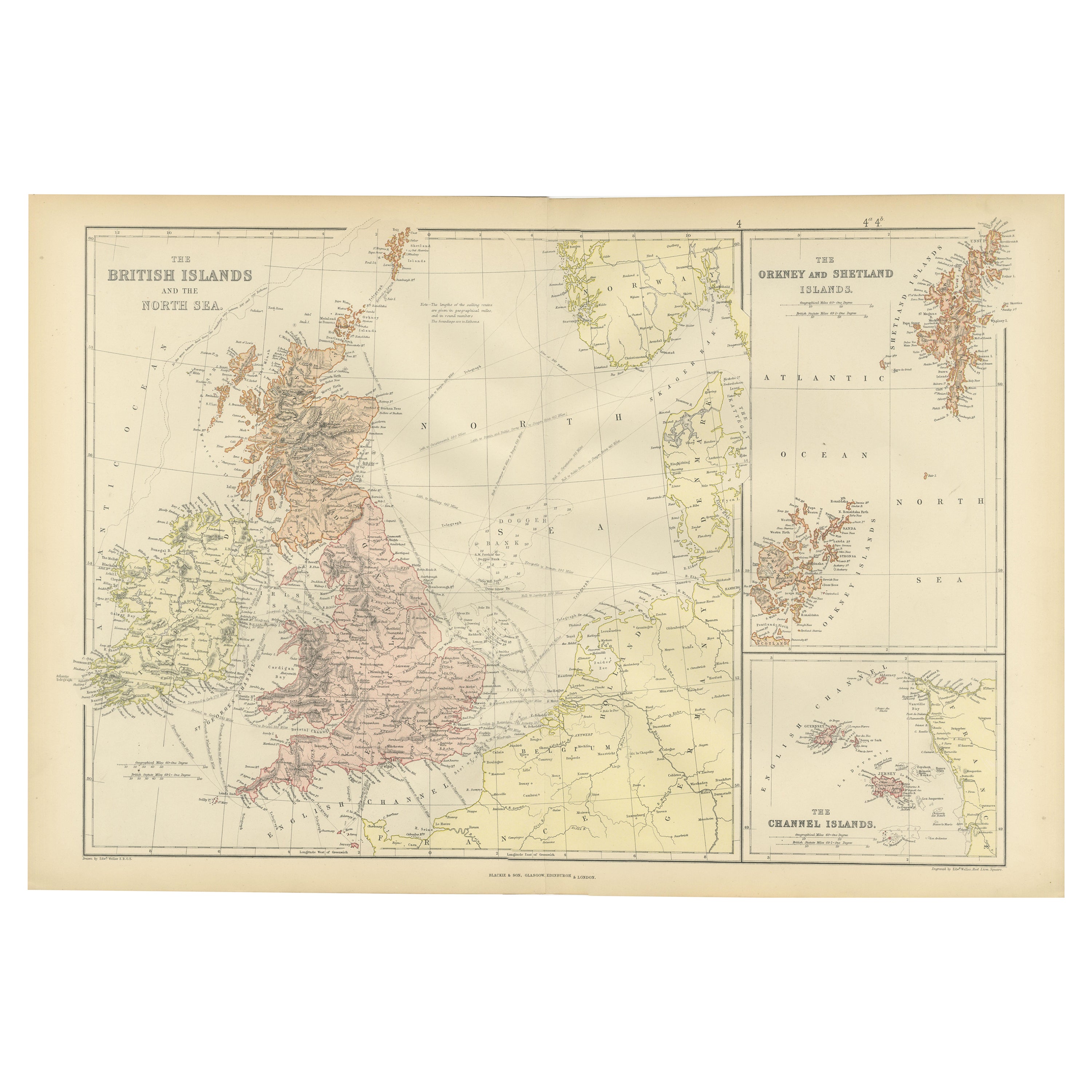
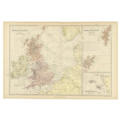
- Colorful Detailed Antique Map of The British Islands and `The North Sea, 1882Located in Langweer, NLDiscover 'The British Islands and The North Sea' Map with Insets of Orkney, Shetland, and Channel Islands! This captivating original antique map offers a detailed view of the British...Category
Antique 1880s Maps
MaterialsPaper
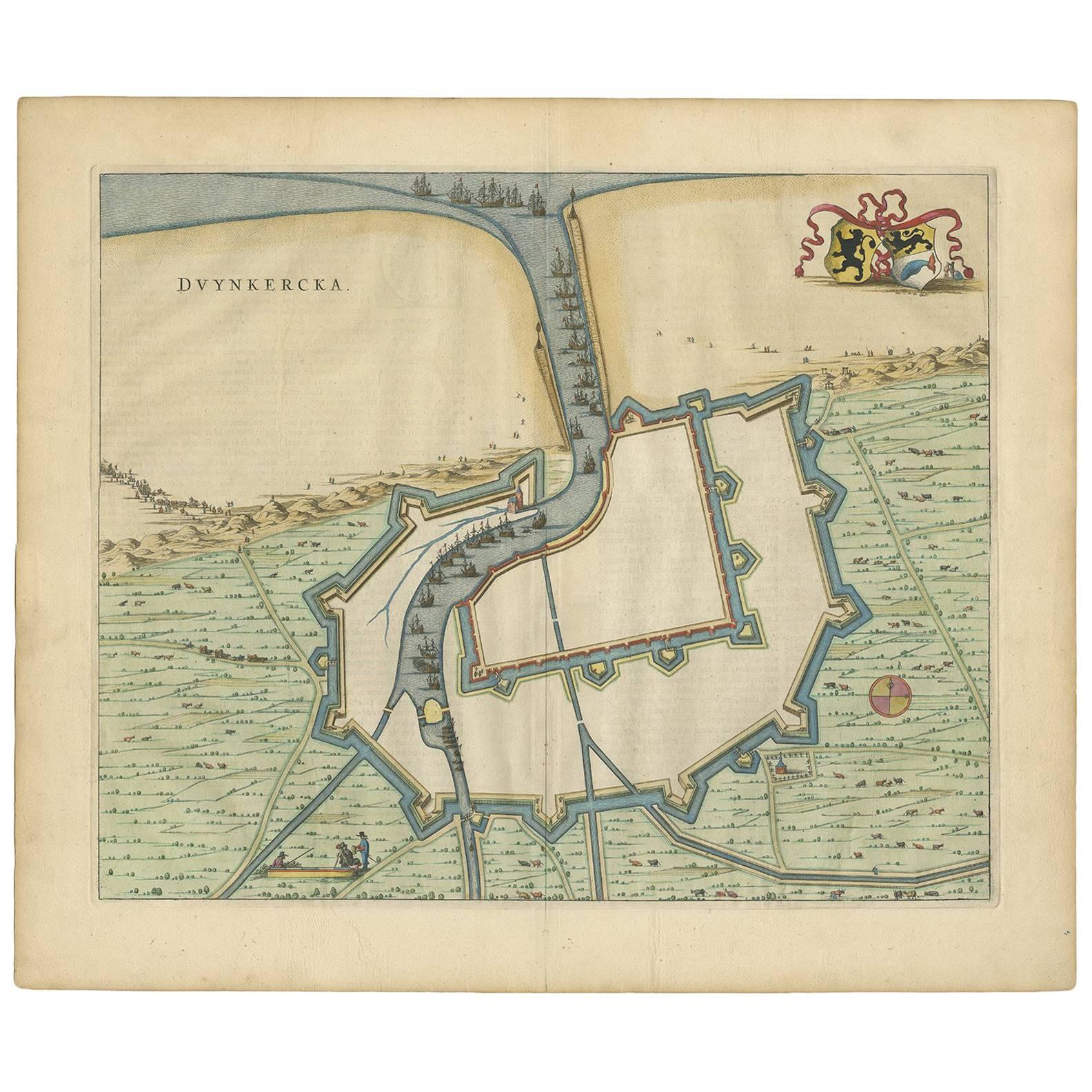
- Antique Map of Dunkirk 'France' by J. Blaeu, 1649Located in Langweer, NLAntique map titled 'Duynkercka'. Published by J. Blaeu, 1649. Dutch text on verso.Category
Antique Mid-17th Century Maps
MaterialsPaper
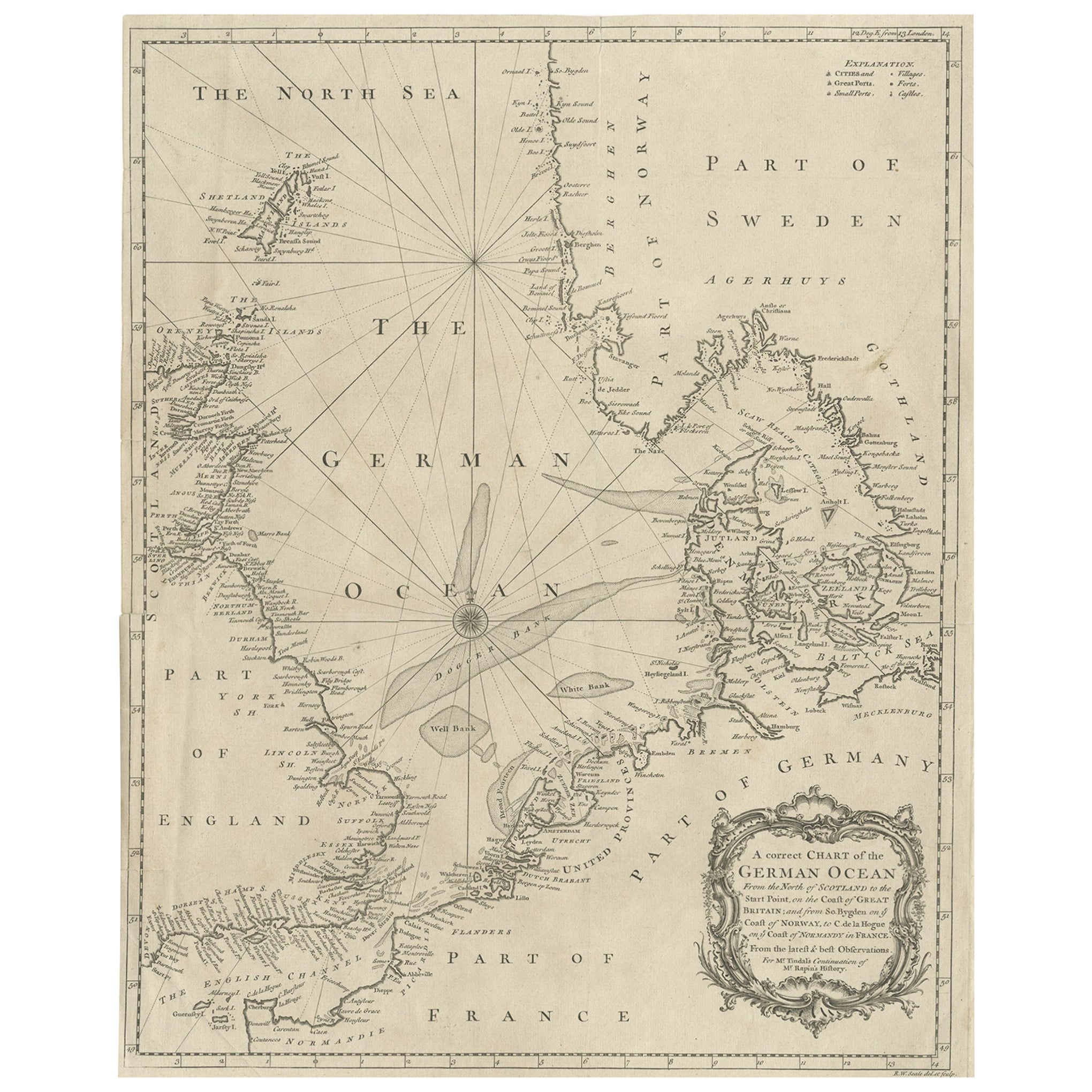
- Antique Map of the North Sea From the English Channel to Norway & Sweden, 1746Located in Langweer, NLAntique map titled 'A correct Chart of the German Ocean from the North of Scotland to the Start Point, on the Coast of Great Britain; and from So. Bygden on ye coast of Norway, to C....Category
Antique 1740s Maps
MaterialsPaper
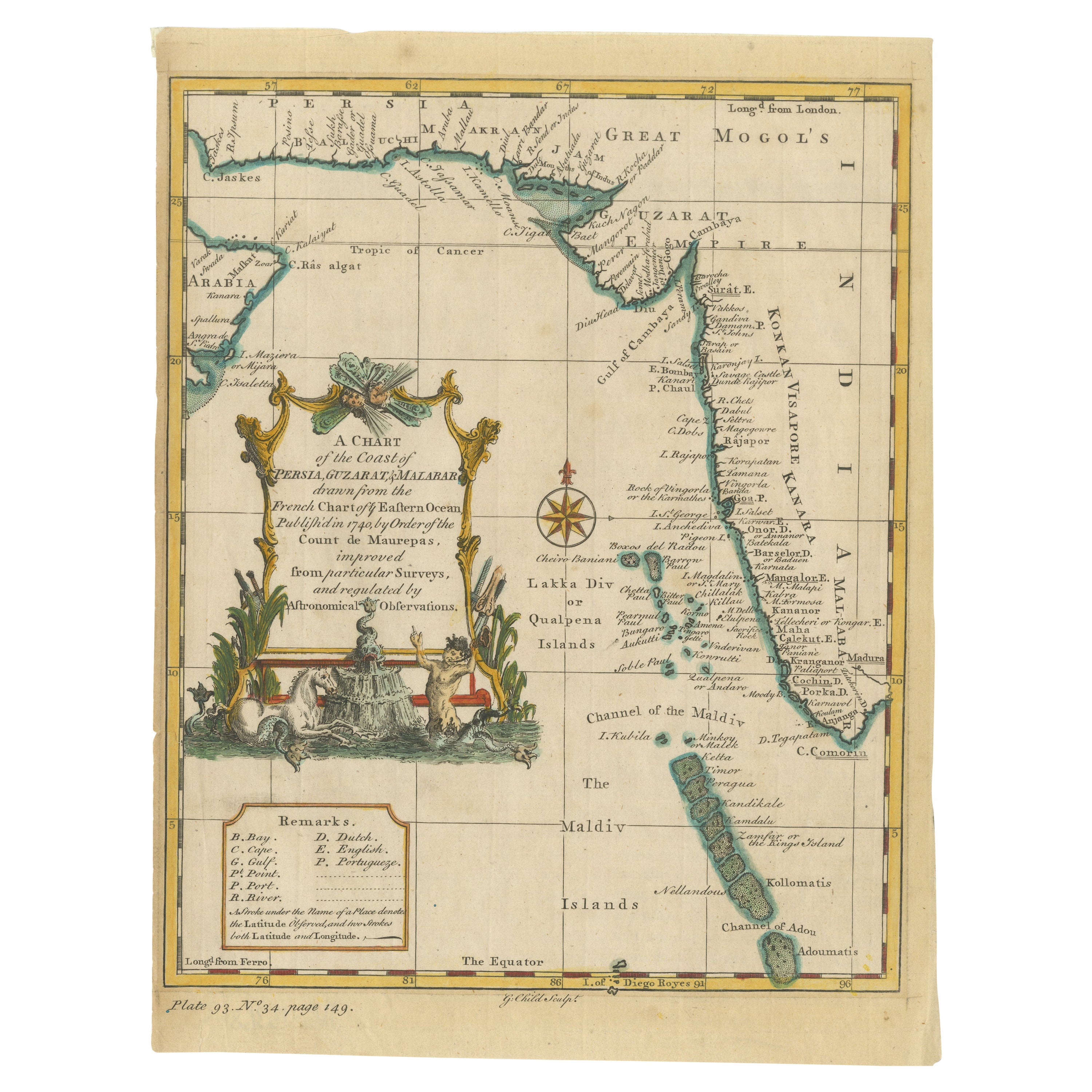
- Antique Map of the Region of the Arabian SeaLocated in Langweer, NLAntique map titled 'A Chart of the Coast of Persia, Guzarat & Malabar'. Old map centered on the Arabian Sea that shows some of the Persian Gulf and the Gulf of Oman, extending past P...Category
Antique Mid-18th Century Maps
MaterialsPaper
- Original Antique Map of Arabia and the Red SeaLocated in Langweer, NLAntique map titled 'Carte de la Coste d'Arabie (..) - Kaart van de Kust van Arabië (..)'. This is a Dutch version, engraved by J. van Schley, of Bellin's map of Arabia and the Red Se...Category
Antique Mid-18th Century Maps
MaterialsPaper
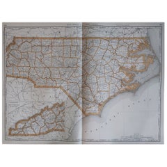
- Antique Map of North Carolina, with inset map of the western partLocated in Langweer, NLAntique map titled 'North Carolina'. Original antique map of North Carolina, United States. With inset map of the western part of North Carolina....Category
Antique Late 19th Century Maps
MaterialsPaper


You May Also Like
- Large Antique 1859 Map of North AmericaLocated in Sag Harbor, NYThis Map was made by Augustus Mitchell in 1859 It is in amazing condition for being 163 years old. This price is for the rolled up easy to ship version of this piece. I will be Frami...Category
Antique Mid-19th Century American Maps
MaterialsCanvas, Paper

- Large Original Antique Map of North Carolina, USA, 1894By Rand McNally & Co.Located in St Annes, LancashireFabulous map of North Carolina Original color By Rand, McNally & Co. Published, 1894 Unframed Free shipping.Category
Antique 1890s American Maps
MaterialsPaper
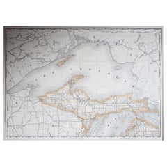
- Large Original Antique Map of Michigan 'North', USA, 1894By Rand McNally & Co.Located in St Annes, LancashireFabulous map of Michigan North. Original color. By Rand, McNally & Co. Published, 1894. Unframed. Free shipping.Category
Antique 1890s American Maps
MaterialsPaper
- 1864 Map of North America, Antique Hand-Colored Map, by Adolphe Hippolyte DufourLocated in Colorado Springs, COOffered is a map of North America entitled Amerique du Nord from 1864. This rare, separately published wall map was produced by Adolphe Hippolyte Dufour. This map includes vibrant an...Category
Antique 1860s French Maps
MaterialsPaper
- Large Original Vintage Map of The North Pole, circa 1920Located in St Annes, LancashireGreat maps of The North Pole. Unframed. Original color. By John Bartholomew and Co. Edinburgh Geographical Institute. Published, circa 1920. Free shipp...Category
Vintage 1920s British Maps
MaterialsPaper
- New Map of North America from the Latest Discoveries, 1763Located in Philadelphia, PAA fine antique 18th century map of the North American seaboard. Entitled "A New Map of North America from the Latest Discoveries 1763". By the Cartographer/Engraver - John Spil...Category
Antique Mid-18th Century English Georgian Maps
MaterialsPaper


Recently Viewed
View AllMore Ways To Browse
Sea Battle
War Compass
Charles Landseer
Hemisphere Antiques
Map Of Burgundy
Map Of Madagascar
Antique Maps Finland
Antique Pennsylvania Map
Croatia Antique Map
French School Map
Kentucky Antiques
Map Of Alps
Antique Furniture Western Cape
Antique Map New Jersey
Antique Maps Essex
Antique Physics
Antique Puerto Rico
Antique Vineyard Map