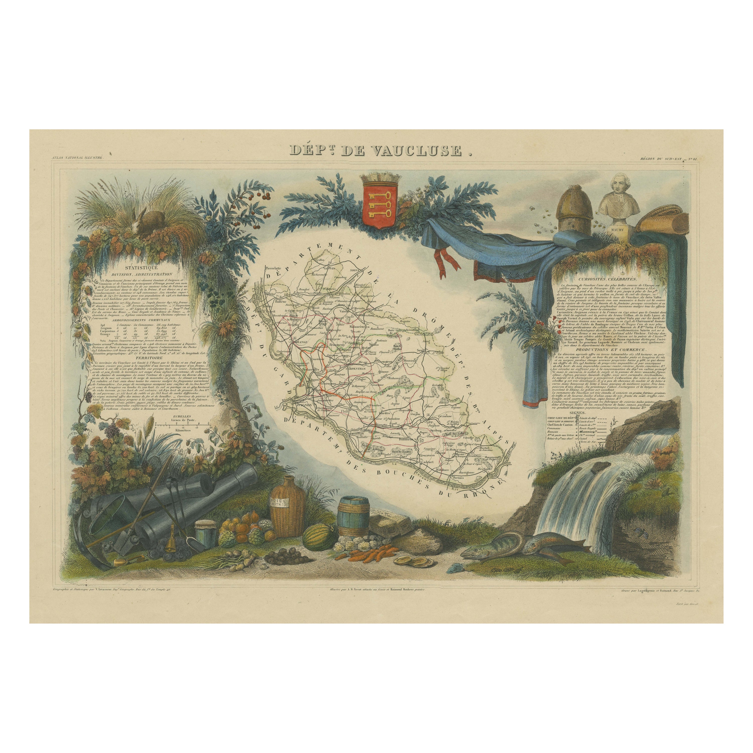
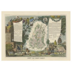
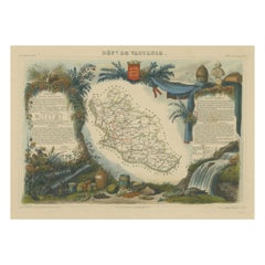
Items Similar to Old Map of Vaucluse, France: A Cartographic Celebration of Viticulture, 1852


Want more images or videos?
Request additional images or videos from the seller
1 of 8
Old Map of Vaucluse, France: A Cartographic Celebration of Viticulture, 1852
About the Item
This original hand-colored map is from the "Atlas National Illustré," a work by Victor Levasseur, a French geographer and cartographer known for his richly illustrated maps.
The map is a steel engraving, which was a common and precise method for creating maps at the time. The inclusion of the publisher's name, A. Combette from Paris, and the addresses of the various contributors to the map's creation, like the engravers Laguillermie and Rainaud, adds to the historical context of the piece.
The margins of the map are adorned with detailed illustrations that serve as a visual encyclopedic reference to the region's geography, economy, and notable figures. The use of color along the boundaries makes the map not only a tool for navigation but also an educational resource, providing insights into the department's landscape, economy, and cultural significance.
The text included in the map's design provides statistical information, a map legend, and discussions about the land, local curiosities, notable personalities, products, and commerce, which would have been invaluable for education and reference at the time.
The 'Atlas National Illustré' is celebrated for its combination of cartographic detail and artistic embellishment, making it a valuable cultural artifact. It represents the height of decorative map-making in the 19th century, alongside the works of John Tallis and Archibald Fullarton.
This particular map is an illustrated map of the 'Département de Vaucluse,' located in the Provence-Alpes-Côte d'Azur region of southeastern France.
The title 'Dépt. de Vaucluse' is displayed at the top of the map. The map itself is surrounded by elaborate margin illustrations that likely represent the local heritage, economy, and cultural symbols of Vaucluse. These typically include images of local produce, historical figures, landscapes, traditional clothing, and the coat of arms.
Key places and features of the Vaucluse department that are historically significant and may be highlighted on the map include:
1. **Avignon**: Known for the Palais des Papes (Papal Palace), where several popes and antipopes lived during the 14th century, and its well-preserved medieval city center.
2. **Orange**: Famous for its Roman theatre and the Triumphal Arch, both of which are UNESCO World Heritage Sites.
3. **Mont Ventoux**: A prominent mountain in the region, known as the "Giant of Provence" and famed for its challenging stage in the Tour de France bicycle race.
4. **Fontaine-de-Vaucluse**: The source of the Sorgue river, a spring that is the largest in France and the fifth largest in the world.
5. **The Luberon**: A massif in central Vaucluse that is part of the Parc Naturel Régional du Luberon, known for its picturesque villages like Gordes and Roussillon.
6. **Carpentras**: This town is known for its historical sites and as the former capital of the Comtat Venaissin.
7. **The Côtes du Rhône wine region**: Vaucluse is home to famous vineyards, including Châteauneuf-du-Pape.
8. **The Ochre of Roussillon**: The ochre sands and cliffs around the village of Roussillon are a notable tourist attraction.
The map would have served both as a practical guide to the department and as an educational tool, showcasing the riches and points of interest of the Vaucluse area. The inclusion of local statistics and discussions about the land, curiosities, personages, products, and commerce in the text around the map would have provided 19th-century map readers with a comprehensive view of the region.
- Dimensions:Height: 14.18 in (36 cm)Width: 20.99 in (53.3 cm)Depth: 0 in (0.02 mm)
- Materials and Techniques:
- Period:
- Date of Manufacture:1852
- Condition:Good. Some light soiling and browning around the edges, not affecting the image.Professionally hand-colored. Study the images carefully.
- Seller Location:Langweer, NL
- Reference Number:
About the Seller
5.0
Platinum Seller
These expertly vetted sellers are 1stDibs' most experienced sellers and are rated highest by our customers.
Established in 2009
1stDibs seller since 2017
1,965 sales on 1stDibs
Typical response time: <1 hour
- ShippingRetrieving quote...Ships From: Langweer, Netherlands
- Return PolicyA return for this item may be initiated within 14 days of delivery.
More From This SellerView All
- 1852 Map of Haut-Rhin: An Illustrated Gateway to Alsace's Viticultural SplendorsLocated in Langweer, NLThis original hand-colored map is from the "Atlas National Illustré," a work by Victor Levasseur, a French geographer and cartographer known for his richly illustrated maps. The map...Category
Antique 1850s Maps
MaterialsPaper
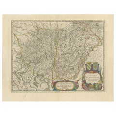
- Burgundy's Viticultural Landscape: A 1640 Cartographic Engraving by Willem BlaeuLocated in Langweer, NLAn hand-colored original antique map with the title "Utriusque Burgundiae tum Ducatus tum Comitatus Descriptio," which translates to "A Description of Both Burgundies, both the Duchy...Category
Antique 1640s Maps
MaterialsPaper
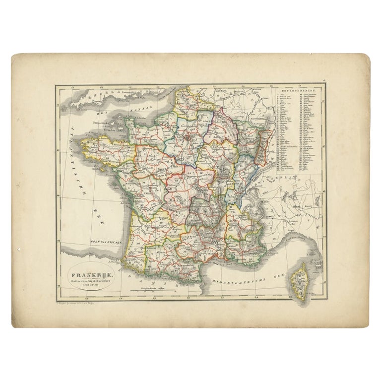
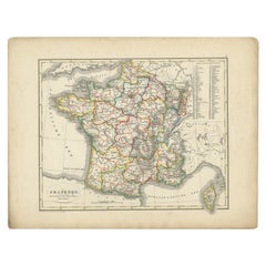
- Antique Map of France from an Old Dutch School Atlas, 1852Located in Langweer, NLAntique map titled 'Frankrijk'. Map of France. This map originates from 'School-Atlas van alle deelen der Aarde' by Otto Petri. Artists and Engravers: Published by A. Baedeker (Otto ...Category
Antique 19th Century Maps
MaterialsPaper
- Hand Colored Antique Map of the Department of Vaucluse, FranceBy Victor LevasseurLocated in Langweer, NLAntique map titled 'Dépt de Vaucluse'. Map of the French department of Vaucluse, France. Vaucluse is the center of wine production in the southern Rhone. Some of the smartest wines in France can be found here. There is also a very strong movement towards the adoption of organic and biodynamic viticulture and natural wine making...Category
Antique Mid-19th Century Maps
MaterialsPaper
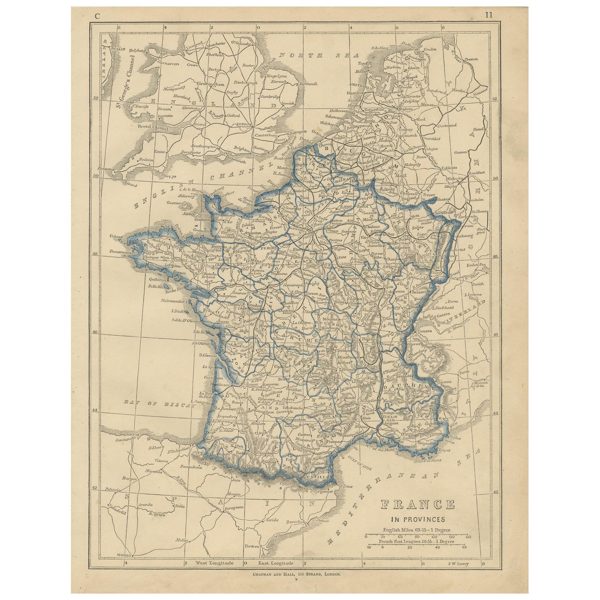
- Antique Map of France by Lowry, '1852'Located in Langweer, NLAntique map titled 'France in Provinces'. Original map of France. This map originates from 'Lowry's Table Atlas constructed and engraved from the most recent Authorities' by J.W. Low...Category
Antique Mid-19th Century Maps
MaterialsPaper
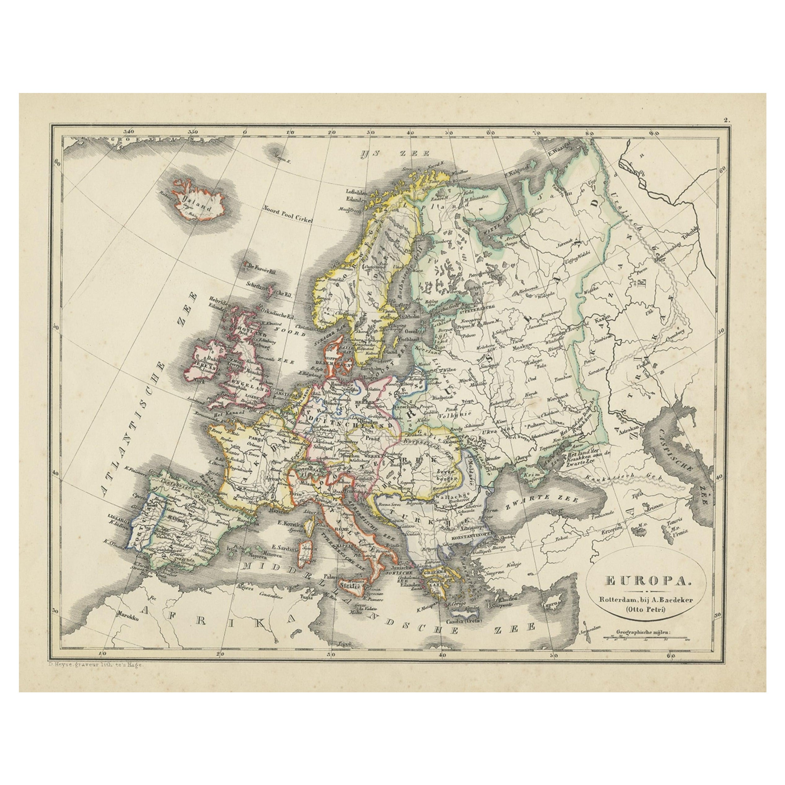
- Antique Map of Europe from an Old Dutch School-Atlas, 1852Located in Langweer, NLAntique map titled 'Europa'. Map of Europe. This map originates from 'School-Atlas van alle deelen der Aarde' by Otto Petri. Artists and Engravers: Published by A. Baedeker (Otto...Category
Antique 19th Century Maps
MaterialsPaper
You May Also Like
- Very Large Vintage Map of Canada, German, Education, Institution, CartographyLocated in Hele, Devon, GBThis is a very large vintage map of Canada. A German, quality printed educational or institution map, dating to the mid 20th century, circa 1965....Category
Mid-20th Century German Maps
MaterialsPaper
- Antique Lithography Map, Isle of Wight, English, Framed, Engraving, CartographyLocated in Hele, Devon, GBThis is an antique lithography map of the Isle of Wight. An English, framed atlas engraving of cartographic interest, dating to the early 19th century and later. Superb lithography ...Category
Antique Early 19th Century British Regency Maps
MaterialsWood
- Antique Lithography Map, Isle of Thanet, Kent, English, Cartography, VictorianLocated in Hele, Devon, GBThis is an antique lithography map of The Isle of Thanet in Kent. An English, framed atlas engraving of cartographic interest, dating to the mid 19th century and later. Superb litho...Category
Antique Mid-19th Century British Victorian Maps
MaterialsWood
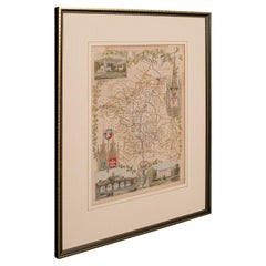
- Antique Lithography Map, Buckinghamshire, English, Framed Cartography, VictorianLocated in Hele, Devon, GBThis is an antique lithography map of Buckinghamshire. An English, framed atlas engraving of cartographic interest, dating to the mid 19th century and later. Superb lithography of B...Category
Antique Mid-19th Century British Victorian Maps
MaterialsWood, Paper
- Antique Lithography Map, Worcestershire, English, Framed Engraving, CartographyLocated in Hele, Devon, GBThis is an antique lithography map of Worcestershire. An English, framed atlas engraving of cartographic interest, dating to the early 19th centur...Category
Antique Early 19th Century British Regency Maps
MaterialsWood
- Antique Lithography Map, Northumberland, English, Framed, Engraving, CartographyLocated in Hele, Devon, GBThis is an antique lithography map of Northumberland. An English, framed atlas engraving of cartographic interest, dating to the mid 19th century a...Category
Antique Mid-19th Century British Victorian Maps
MaterialsWood