Items Similar to Large University Chart “Physical Map of Africa” by Bacon


Want more images or videos?
Request additional images or videos from the seller
1 of 7
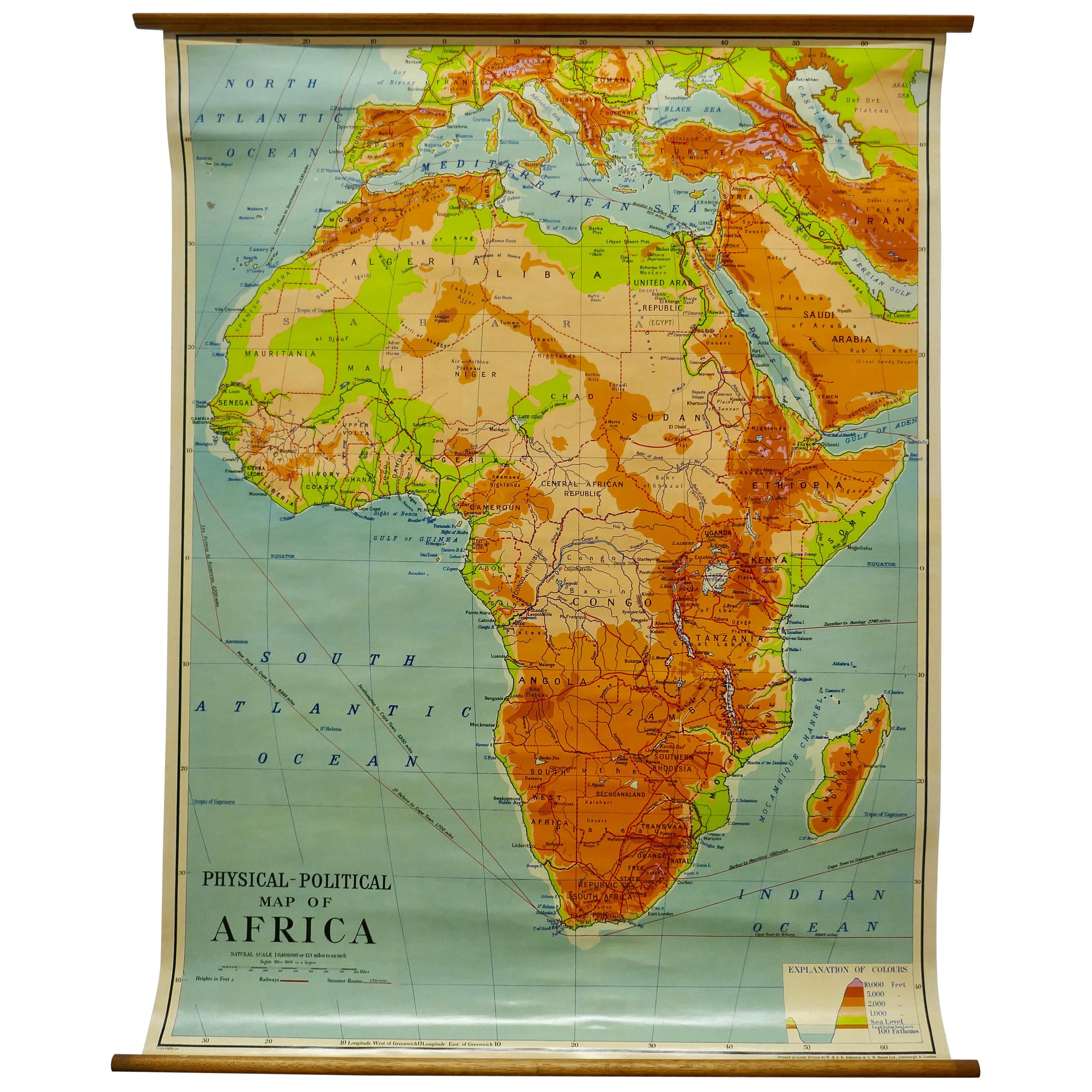
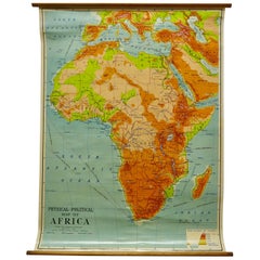
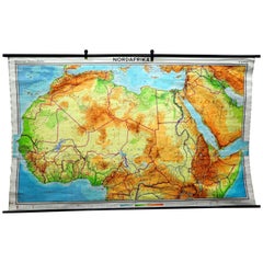
Large University Chart “Physical Map of Africa” by Bacon
About the Item
Large university chart “Physical Map of Africa” by Bacon
W&A K Johnston’s Charts of Physical Maps By G W Bacon,
This is colorful Physical map of North America, it is large lithograph set on Linen mounted on wooden rods, the chart is in very good bright condition, it is 35” high and 31” wide
GB80.
- Dimensions:Height: 35 in (88.9 cm)Diameter: 5 in (12.7 cm)
- Style:Folk Art (In the Style Of)
- Materials and Techniques:
- Period:
- Date of Manufacture:1920
- Condition:
- Seller Location:Chillerton, GB
- Reference Number:
About the Seller
4.9
Platinum Seller
These expertly vetted sellers are 1stDibs' most experienced sellers and are rated highest by our customers.
Established in 1980
1stDibs seller since 2017
696 sales on 1stDibs
Typical response time: 2 hours
- ShippingRetrieving quote...Ships From: Chillerton, United Kingdom
- Return PolicyA return for this item may be initiated within 7 days of delivery.
More From This SellerView All
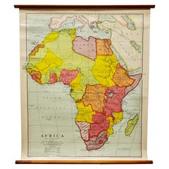
- Large University Chart “Africa Physical ” by BaconLocated in Chillerton, Isle of WightLarge University chart “Africa Physical ” by Bacon W&A K Johnston’s charts of physical maps by G W Bacon, This is a Physical map of Africa, it is lithograph set on Linen mounte...Category
Early 20th Century Beaux Arts Maps
MaterialsLinen
- Large University Chart “Political Map of North America” by BaconLocated in Chillerton, Isle of WightLarge University Chart “Political Map of North America” by Bacon W&A K Johnston’s Charts of Physical Maps By G W Bacon, This is colourful Physical map ...Category
Early 20th Century American Empire Posters
MaterialsLinen
- Large University Chart “Political Map of North America” by BaconLocated in Chillerton, Isle of WightLarge University chart “Political Map of North America” by Bacon W&A K Johnston’s Charts of Political Maps by G W Bacon, This is colorful Physical ...Category
Early 20th Century American Empire Posters
MaterialsLinen
- W&A K Johnston’s Charts of Physical Maps by G W BaconLocated in Chillerton, Isle of WightLarge University chart “Africa Physical Political” by Bacon W&A K Johnston’s charts of physical maps by G W Bacon, This is a Physical Political map...Category
Early 20th Century Rustic Posters
MaterialsLinen
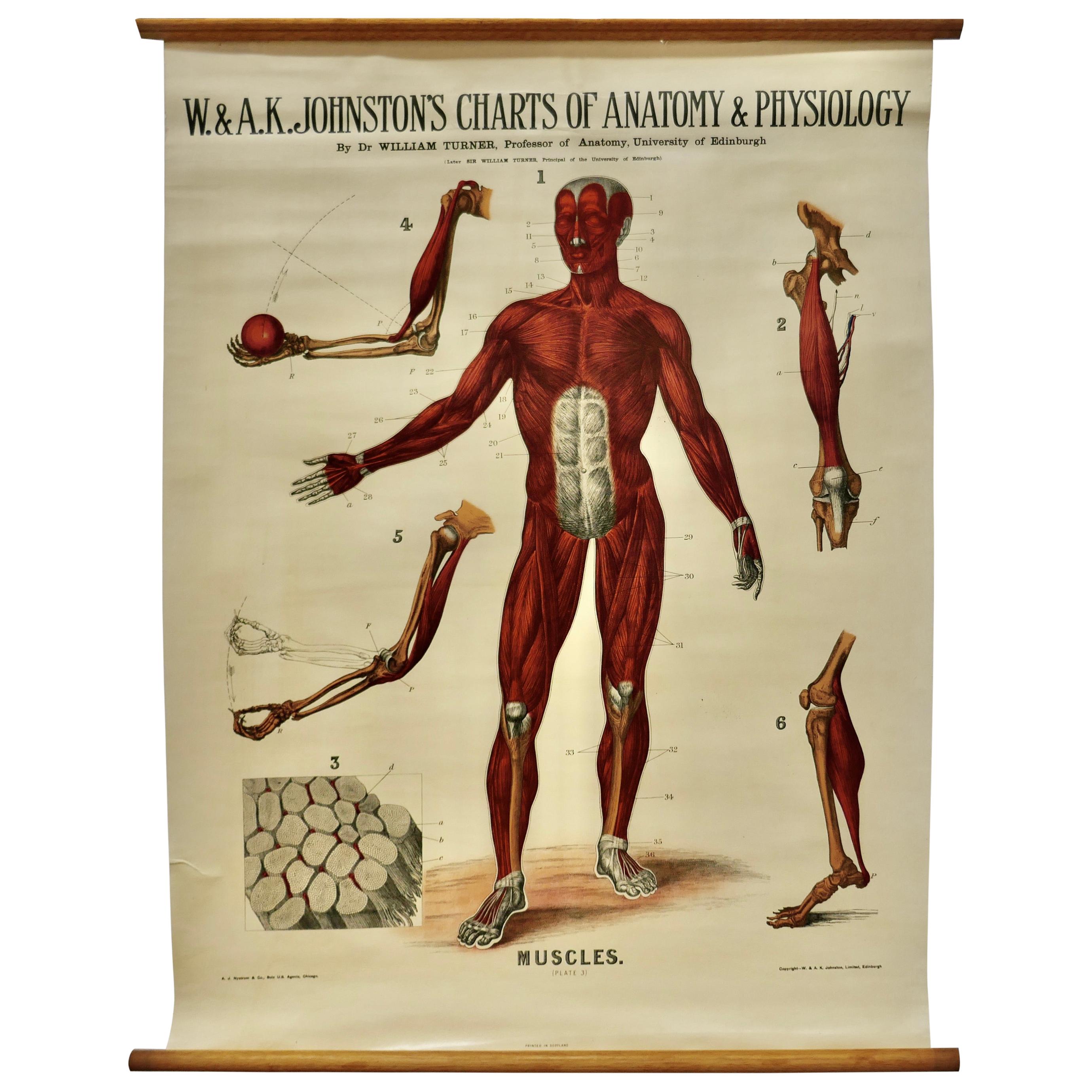
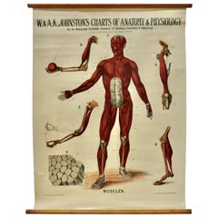
- Large University Anatomical Chart “Muscles” by TurnerLocated in Chillerton, Isle of WightLarge university anatomical chart “Muscles” by Turner W&A K Johnston’s Charts of Anatomy and Physiology by Dr William Turner, Professor of Anatomy University of Edinburgh/A J Nystrom & Co US Agents Chicago This is Plate 3, Muscles, by Turner, it is large lithograph set...Category
Early 20th Century Steampunk Posters
MaterialsLinen
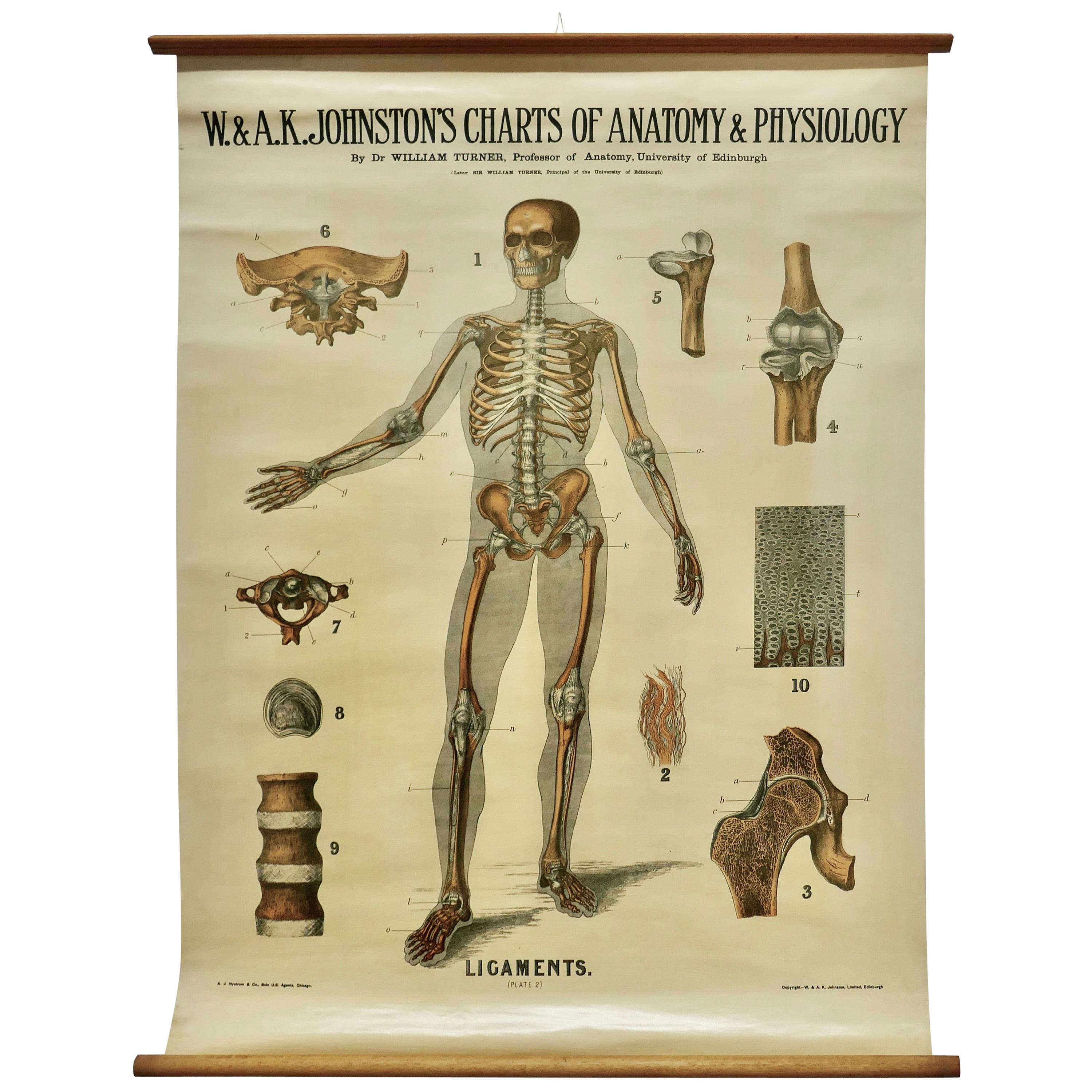
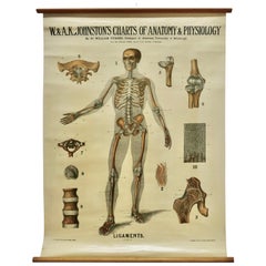
- Large University Anatomical Chart “Ligamnets” by TurnerLocated in Chillerton, Isle of WightLarge University Anatomical chart “Ligamnets” by Turner W&A K Johnston’s Charts of Anatomy and Physiology By Dr William Turner, Professor of Anatomy University of Edinburgh/A J Nystrom & Co US Agents Chicago This is Plate 2, Ligaments, by Turner, it is large lithograph set...Category
Early 20th Century International Style Posters
MaterialsLinen


You May Also Like
- Vintage Mural Map of North Africa Countrycore African Wall Chart DecorationLocated in Berghuelen, DEThe wall map shows North Africa. It was published by Westermann-Schulwandkarten. Used as teaching material in German schools. Colorful print on paper reinforced with canvas, Measurem...Category
Late 20th Century German Country Prints
MaterialsCanvas, Wood, Paper
- Large Detailed Map of Australia Wint Inset of Tasmania, 1937Located in Langweer, NLAntique map titled 'Australia'. Large folding map of Australia. With inset map of Tasmania. Printed by L.F. Johnston, Canberra. Artists and Engravers: Compiled and drawn by Propert...Category
20th Century Maps
MaterialsPaper
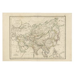
- Antique Map of Asia by Delamarche, 1826Located in Langweer, NLVaugondy's map plates and copyrights and later addes many plates from other sources as well. Charles Delamarche eventually passed control of the firm to his son Felix Delamarche (18t...Category
Antique 19th Century Maps
MaterialsPaper
- Mariner's Chart PosterLocated in Hamilton, OntarioMariner's chart poster (nautical).Category
20th Century Posters
- Set of 10 Large Scale Vintage Maps of The United Kingdom, circa 1900Located in St Annes, LancashireGreat set of maps of the UK Lithographs. By John Bartholomew & Co. Published by The Edinburgh Geographical Institute Unframed. The measurement ...Category
Antique Early 1900s English Maps
MaterialsPaper
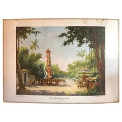
- Collection of 5 Vintage School-Charts of Indonesia, Incl Bali Ritual CremationLocated in Langweer, NLCollection of Old School Posters on cardboard of the early 20th century. Most of the images are still intact with bright colours, but the outer marg...Category
Early 20th Century Dutch Historical Memorabilia
MaterialsPaper

Recently Viewed
View AllMore Ways To Browse
Large Wall Map
Large Wall Maps
Antique Wall Chart
Large Antique Wall Map
Antique Map Poster
Film Posters Signed
Ford Vintage Poster
Framed French Art Deco Poster
Pull Down Wall Charts
Vintage Sports Wall Art
Flying Birds Wall
Vintage James Bond
Movie Theatre Vintage
Mid Century Airline Poster
Polish Circus Posters
Psychedelic Decoration
Vintage Polish Circus Posters
1980 Japanese Poster