Items Similar to Large University Chart “Political Map of North America” by Bacon


Want more images or videos?
Request additional images or videos from the seller
1 of 6
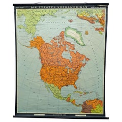
Large University Chart “Political Map of North America” by Bacon
About the Item
Large University chart “Political Map of North America” by Bacon
W&A K Johnston’s Charts of Political Maps by G W Bacon,
This is colorful Physical map of North America, it is large lithograph set on Linen mounted on wooden rods, the chart is in very good bright condition, it is 52” high and 41” wide
GB81.
- Dimensions:Height: 52 in (132.08 cm)Diameter: 5 in (12.7 cm)
- Style:American Empire (In the Style Of)
- Materials and Techniques:
- Period:
- Date of Manufacture:1920
- Condition:
- Seller Location:Chillerton, GB
- Reference Number:
About the Seller
4.9
Platinum Seller
These expertly vetted sellers are 1stDibs' most experienced sellers and are rated highest by our customers.
Established in 1980
1stDibs seller since 2017
696 sales on 1stDibs
Typical response time: 2 hours
- ShippingRetrieving quote...Ships From: Chillerton, United Kingdom
- Return PolicyA return for this item may be initiated within 7 days of delivery.
More From This SellerView All
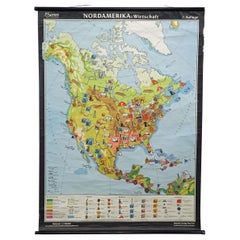
- Large University Chart “Political Map of North America” by BaconLocated in Chillerton, Isle of WightLarge University Chart “Political Map of North America” by Bacon W&A K Johnston’s Charts of Physical Maps By G W Bacon, This is colourful Physical map ...Category
Early 20th Century American Empire Posters
MaterialsLinen
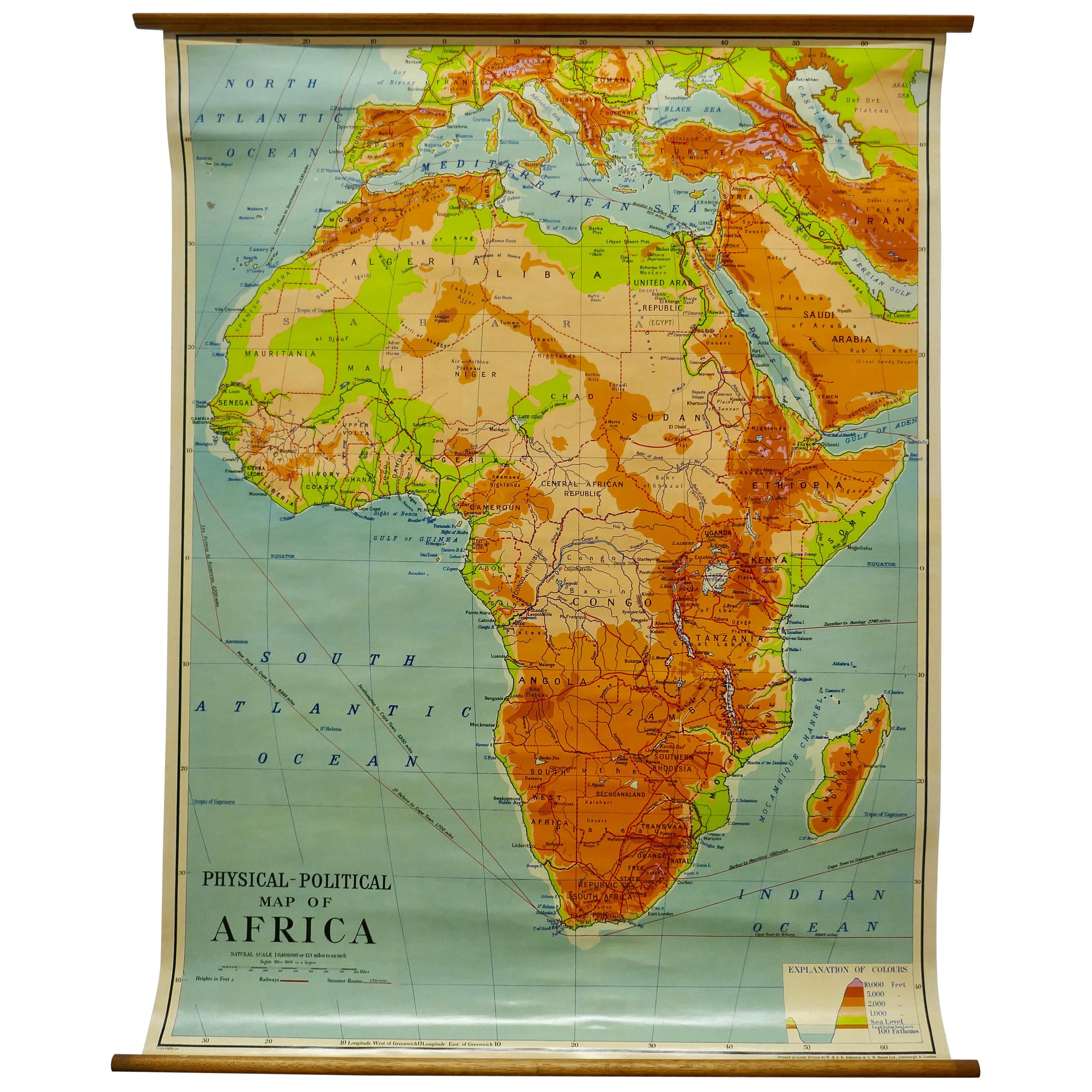
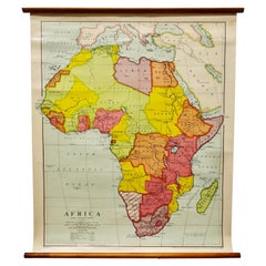
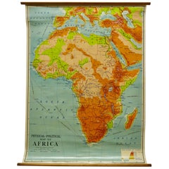
- Large University Chart “Physical Map of Africa” by BaconLocated in Chillerton, Isle of WightLarge university chart “Physical Map of Africa” by Bacon W&A K Johnston’s Charts of Physical Maps By G W Bacon, This is colorful Physical map of North America, it is large lithograph set...Category
Early 20th Century Folk Art Posters
MaterialsLinen
- University Chart “Black Map of North AmericaLocated in Chillerton, Isle of WightUniversity Chart “Black Map of North America W&A K Johnston’s Charts of Physical Maps By G W Bacon, This is a Black Physical map of North A...Category
Early 20th Century Industrial Maps
MaterialsLinen
- Large University Chart “Africa Physical ” by BaconLocated in Chillerton, Isle of WightLarge University chart “Africa Physical ” by Bacon W&A K Johnston’s charts of physical maps by G W Bacon, This is a Physical map of Africa, it is lithograph set on Linen mounte...Category
Early 20th Century Beaux Arts Maps
MaterialsLinen
- W&A K Johnston’s Charts of Physical Maps by G W BaconLocated in Chillerton, Isle of WightLarge University chart “Africa Physical Political” by Bacon W&A K Johnston’s charts of physical maps by G W Bacon, This is a Physical Political map...Category
Early 20th Century Rustic Posters
MaterialsLinen
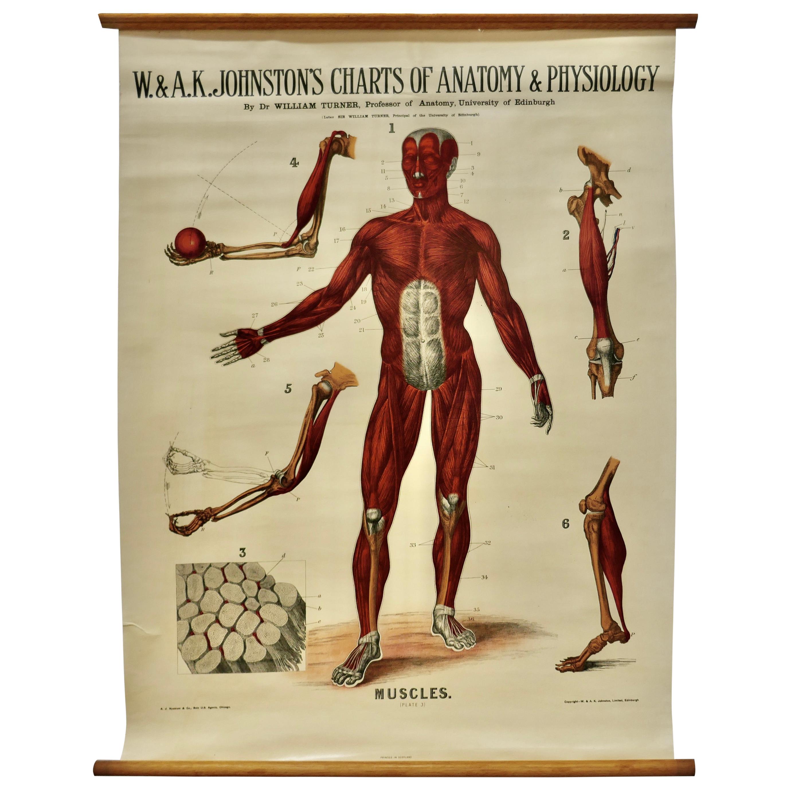
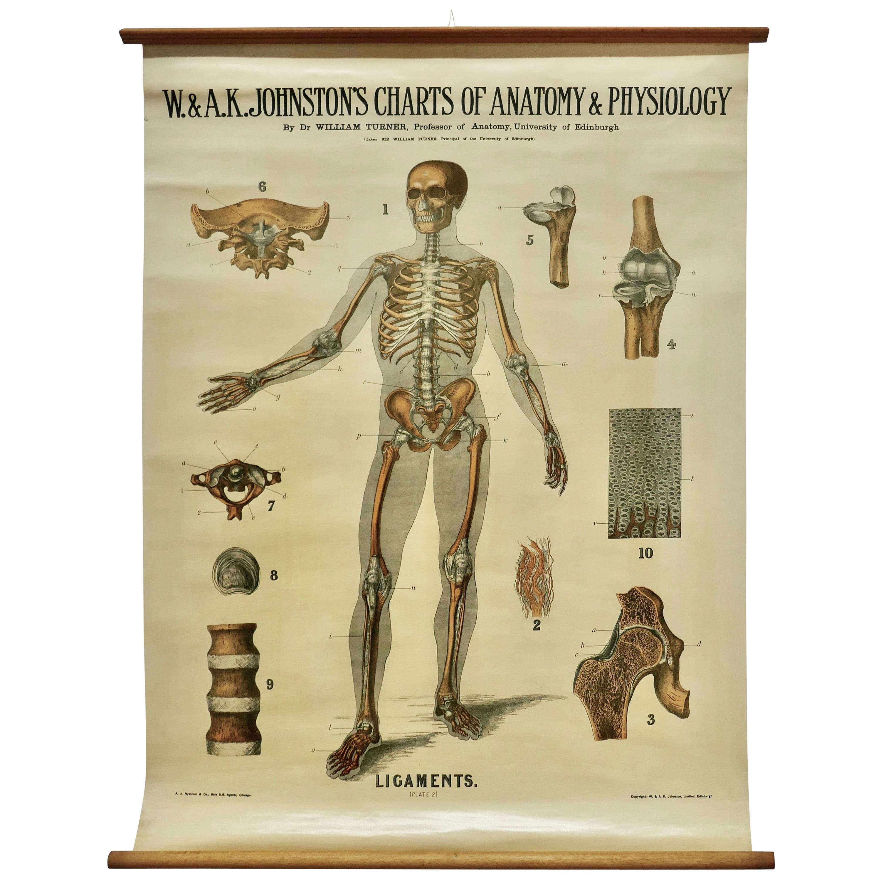
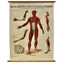
- Large University Anatomical Chart “Muscles” by TurnerLocated in Chillerton, Isle of WightLarge university anatomical chart “Muscles” by Turner W&A K Johnston’s Charts of Anatomy and Physiology by Dr William Turner, Professor of Anatomy University of Edinburgh/A J Nystrom & Co US Agents Chicago This is Plate 3, Muscles, by Turner, it is large lithograph set...Category
Early 20th Century Steampunk Posters
MaterialsLinen


You May Also Like
- Vintage Map Wall Chart Countries of North America Rollable Mural PosterLocated in Berghuelen, DEThe vintage pull-down school map illustrates the countries / states of North America. Published by Haack-Painke Justus Perthes Darmstadt. Colorful print on paper reinforced with canv...Category
Late 20th Century German Country Prints
MaterialsCanvas, Wood, Paper
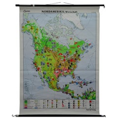
- North America Map Economy Wall Chart Rollable Poster Vintage MuralLocated in Berghuelen, DEA vintage pull-down map showing the economy of North America, published by Harms. Colorful print on paper reinforced with canvas. Measurements: Width 101 cm (39.76 inch) Height 169 c...Category
Late 20th Century German Country Prints
MaterialsCanvas, Wood, Paper
- Vintage Mural Map Pull Down Wall Chart North America Economy FinancesLocated in Berghuelen, DEA classical rollable wall chart showing the economy of North America. Publishd by the Paul List Verlag. Used as teaching material in German schools. Colorful print on paper reinforce...Category
Mid-20th Century German Country Prints
MaterialsCanvas, Wood, Paper
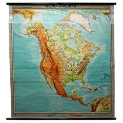
- North America Vintage Map Pull-Down Wall Chart Poster Countrycore PrintLocated in Berghuelen, DEA traditional vintage pull-down school map illustrating North America, published by Westermann. Colorful print on paper reinforced with canvas. Measurements: Width 156 cm (61.42 inc...Category
Late 20th Century German Country Prints
MaterialsWood, Paper, Canvas
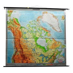
- Canada Greenland North America Map Vintage Mural Rollable Wall Chart CountrycoreLocated in Berghuelen, DEA classical pull-down map of Canada and Greenland (North American Continent). Used as teaching material in German schools. Colorful print on paper reinforced with canvas. Published b...Category
Vintage 1970s German Country Posters
MaterialsCanvas, Wood
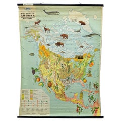
- Land Use and Livestock North America Picture Map Wall Chart Poster MuralLocated in Berghuelen, DEThe vintage rollable picture map of North- and Middle America shows land use and livestock. Published by JRO. Colorful print on paper reinforced with ca...Category
Late 20th Century German Country Prints
MaterialsCanvas, Wood, Paper
Recently Viewed
View AllMore Ways To Browse
Large Wall Map
Large Wall Maps
Antique Wall Chart
Large Antique Wall Map
Antique Map Poster
Film Posters Signed
Ford Vintage Poster
Framed French Art Deco Poster
Pull Down Wall Charts
Vintage Sports Wall Art
Flying Birds Wall
Vintage James Bond
Movie Theatre Vintage
Mid Century Airline Poster
Polish Circus Posters
Psychedelic Decoration
Vintage Polish Circus Posters
1980 Japanese Poster