Items Similar to Jerusalem, Antique Map from "Civitates Orbis Terrarum" - 1572-1617

Want more images or videos?
Request additional images or videos from the seller
1 of 5
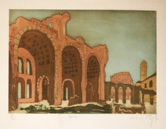
Franz HogenbergJerusalem, Antique Map from "Civitates Orbis Terrarum" - 1572-16171572-1617
1572-1617
About the Item
Braun G., Hogenberg F., Jerusalem, from the collection Civitates Orbis Terrarum, Cologne, T. Graminaeus, 1572-1617.
Image dimensions: cm 32.8 x 41; dimensions: cm 41 x 54; Passepartout dimensions: cm 50 x 64.4.
Interesting B/W etching on coeval paper, representing a detailed view of the holy city of Jerusalem, the “Hierosolyma urbs sancta”. The title is on plate at the top, whilst there is a caption in Latin in a cartouche at the bottom left. Good conditions, with the usual medial fold and some light foxings on the margins.
The Civitates Orbis Terrarum (Atlas of the Cities of the World) was the second oldest printed atlas in the history of world cartography and the first atlas totally dedicated to topographical views. The first volume of this collection was published in Cologne in 1572; the following in 1575, 1581, 1588, and 1598. The sixth and final volume appeared in 1617, shortly before the extensive devastation wreaked by the Thirty Years’ War.
This artwork is shipped from Italy. Under existing legislation, any artwork in Italy created over 70 years ago by an artist who has died requires a licence for export regardless of the work’s market price. The shipping may require additional handling days to require the licence according to the final destination of the artwork.
- Creator:Franz Hogenberg (1540 - 1590, Flemish)
- Creation Year:1572-1617
- Dimensions:Height: 16.15 in (41 cm)Width: 21.26 in (54 cm)Depth: 0.04 in (1 mm)
- Medium:
- Period:
- Framing:Framing Options Available
- Condition:Insurance may be requested by customers as additional service, contact us for more information.
- Gallery Location:Roma, IT
- Reference Number:

Franz Hogenberg
Braun and Hogenberg's 'The Civitates Orbis Terrarum' was the second atlas of maps ever published and the first atlas of cities and towns of the world. It is one of the most important books published in the 16th century. Most of the maps in the atlas were engraved by Franz Hogenberg and the text, with its descriptions of the history and additional factual information of the cities, was written by a team of writers and edited by Georg Braun. The work contained 546 bird-eye views and map views of cities and towns from all over the world. It gave graphic representation of the main features of the illustrated cities and towns, including the buildings and streets. Although the ordinary buildings are stylized, the principal buildings are reproduced from actual drawings created on location. The principal landmarks and streets can still be recognized today. In addition, the maps often include the heraldic arms of the city, the nature of the surrounding countryside, the important rivers, streams and harbors, even depicting stone bridges, wooden pontoons, flat-bottomed ferries, ships and working boats, wharves and jetties, as well as land-based activities, including horsemen, pedestrians, wagons, coaches, and palanquins. Small vignettes are often included which illustrate the trade, occupations and habits of the local inhabitants, such as agriculture, paper-making and textiles, as well as local forms of punishment, such as gibbets, wheels, floggings etc. Large figures dressed in their local costume are often presented out of proportion in the foreground. The aim of the authors was to give as much information as possible in a pleasing visual form. They succeeded in creating maps that were both informative and decorative works of art. The atlas is a wonderful glimpse of life in medieval Europe. Georg Braun (1541-1622) was German Catholic cleric who was born and who died in Cologne, Germany. He was the principal editor of 'The Civitates Orbis Terrarum', acquiring the tables, hiring the artists, and composing the texts. Abraham Ortelius, whose Theatrum Orbis Terrarum of 1570 was the first atlas of maps ever published, assisted Braun in his compilation of the details and maps for the atlas. The Civitates was intended as a companion for the Ortellius' Theatrum, as suggested by the similarity in the titles. Braun was the only survivor of the original team to live to see the publication of last volume (VI) in 1617. Franz Hogenberg (1535-1590) was a Flemish and German painter, engraver, and mapmaker. He was born in Mechelen (also known as Malines) in Flanders, the son of an engraver. After being expelled from Antwerp by the Duke of Alva, he moved to London and then eventually to Cologne, Germany, where he met Georg Braun and Abraham Ortellius. He engraved most of the plates for Ortelius's Theatrum and the majority of those in the Civitates. Many believe that he was responsible for originating the Civitates project.
About the Seller
4.9
Platinum Seller
These expertly vetted sellers are 1stDibs' most experienced sellers and are rated highest by our customers.
1stDibs seller since 2017
6,822 sales on 1stDibs
Typical response time: 3 hours
- ShippingRetrieving quote...Ships From: Rome, Italy
- Return PolicyA return for this item may be initiated within 14 days of delivery.
More From This SellerView All
- Huts - Etching by Pierre Boncompain - Late 20th CenturyBy Pierre BoncompainLocated in Roma, ITHuts is an original etching and drypoint on cream colored paper, hand-number and signed in pencil on the lower margin by Pierre Boncompain. Edition of 24 prints. In excellent condit...Category
Late 20th Century Landscape Prints
MaterialsEtching
- Landscape - Original Litho Reotuché by Fredy Lapenna - 1990sBy Fredy LapennaLocated in Roma, ITLandscape is a retouché on paper, realized by the Belgian artist Fredy Lapenna. This original print, representing a natural country landscape with sweet hills, is numbered in Roman ...Category
1990s Contemporary More Prints
MaterialsLithograph
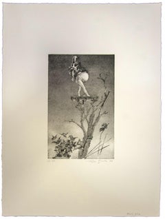
- The Pitfall - Original Etching by Walter PIacesi - 1965By Walter PiacesiLocated in Roma, ITHand Signed. Edition of 50 pieces. Original title: "L'insidia". Very good conditions.Category
1960s More Prints
MaterialsDrypoint, Etching
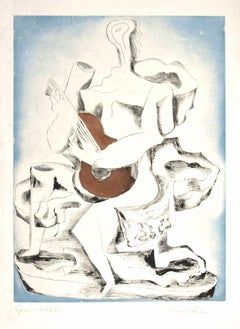
- Guitar Player - Etching by Ossip Zadkine - 1962By Ossip ZadkineLocated in Roma, ITGuitar Player is an original etching and aquatint, realized 1962 by Ossip Zadkine. Hand signed in pencil on lower right margin. Artist's proof (hand written on the lower left margi...Category
1960s Cubist More Prints
MaterialsEtching
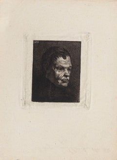
- Portrait - Etching by Auguste Danse - Late 19th CenturyLocated in Roma, ITPortrait is an original etching artwork realized by Auguste Danse (1829-1929) in the late 19th Century, signed on the plate on the top left. Image dimension: 7.5 x 6 cm. The state ...Category
Late 19th Century Modern More Prints
MaterialsEtching
- Composition - Etching by Leo Guida - 1972By Leo GuidaLocated in Roma, ITComposition is a Contemporary artwork realized by the italian artist Leo Guida. Original print. Hand-signed. Numbered, edition 16/30. Good conditions, with diffused foxing. Comp...Category
1970s Contemporary More Prints
MaterialsPaper, Etching
You May Also Like
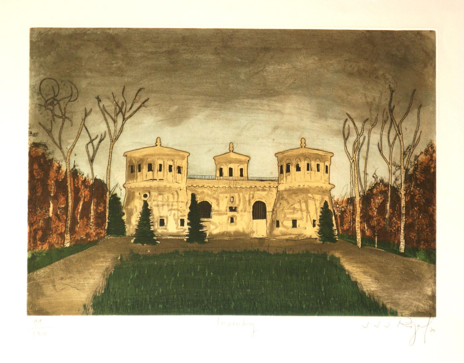
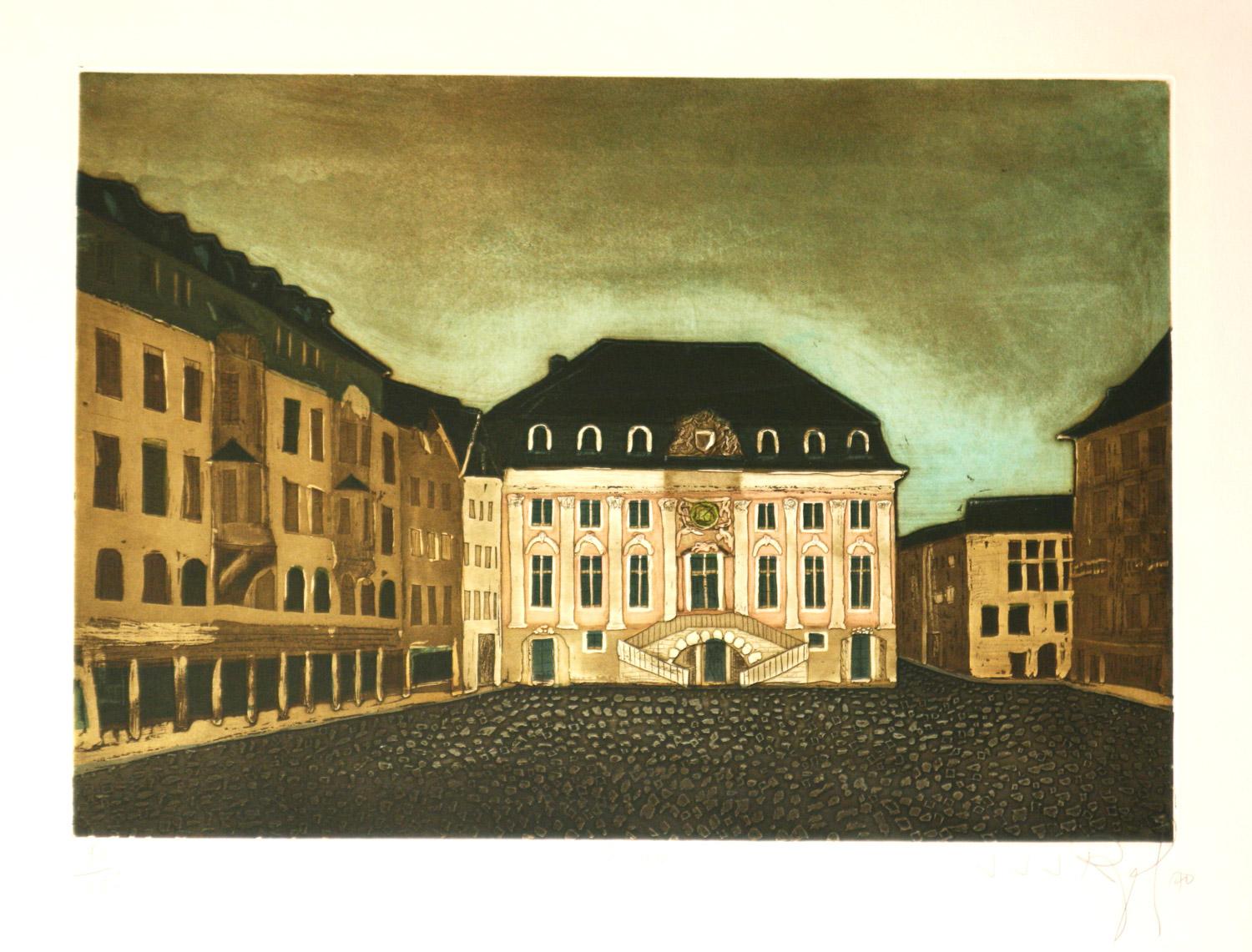
- Luxemberg original aquatint etching by J.J. RegalLocated in Paonia, COLuxemberg is an original signed limited edition aquatint etching by J.J. Regal printed on B F K Rives paper. This is a very bold design with an original depiction of a major Europe...Category
20th Century Expressionist Landscape Prints
MaterialsEtching
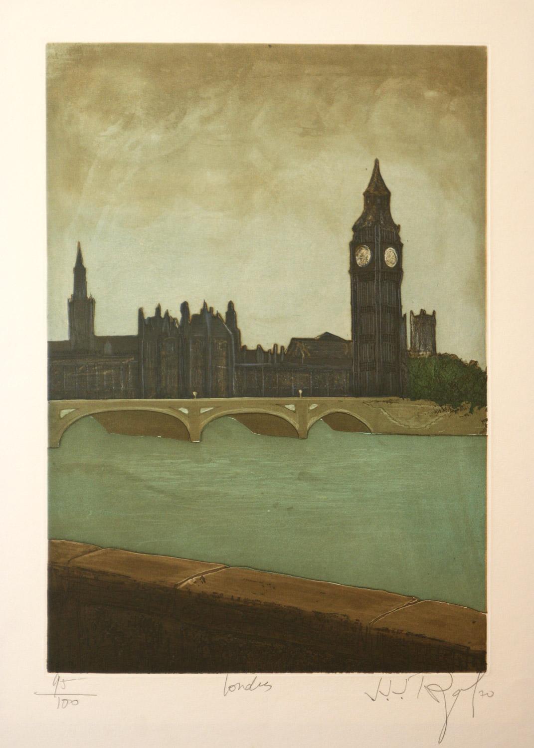
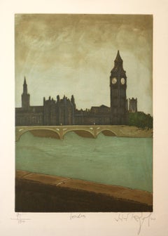
- London, England original signed original aquatint etching by J.J. RegalLocated in Paonia, COLondon, England is an original signed limited edition aquatint etching by French artist J.J. Regal printed on BFK Rives paper. This is a very bold design with an original depict...Category
20th Century Expressionist Landscape Prints
MaterialsEtching
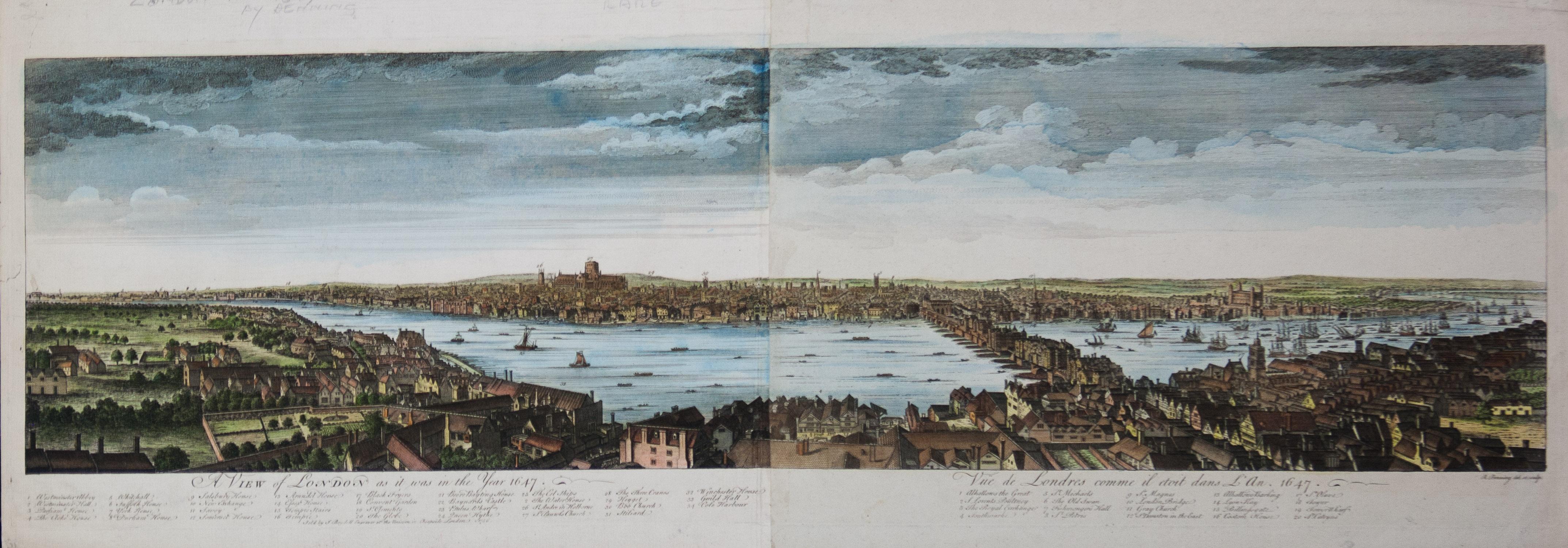
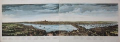
- A View of London as it was in the Year 1647 pub. by Boydell 1756Located in Paonia, COA View of London as it was in the Year 1647 is a hand colored copper engraving published by the well known British publisher and engraver John Boydell (1720-1804) and engraved by R.Benning sold at Cheapside London 1756. Panoramic view on two sheets conjoined as issued linen mounted. Lettered with title in French and English along the base of the image including a numbered key to the structures. In very good condition except for one 1/8 inch tear in the sky to the left of the middle seam that is barely noticeable. This is a large very detailed panorama of London...Category
1750s Other Art Style Landscape Prints
MaterialsEtching
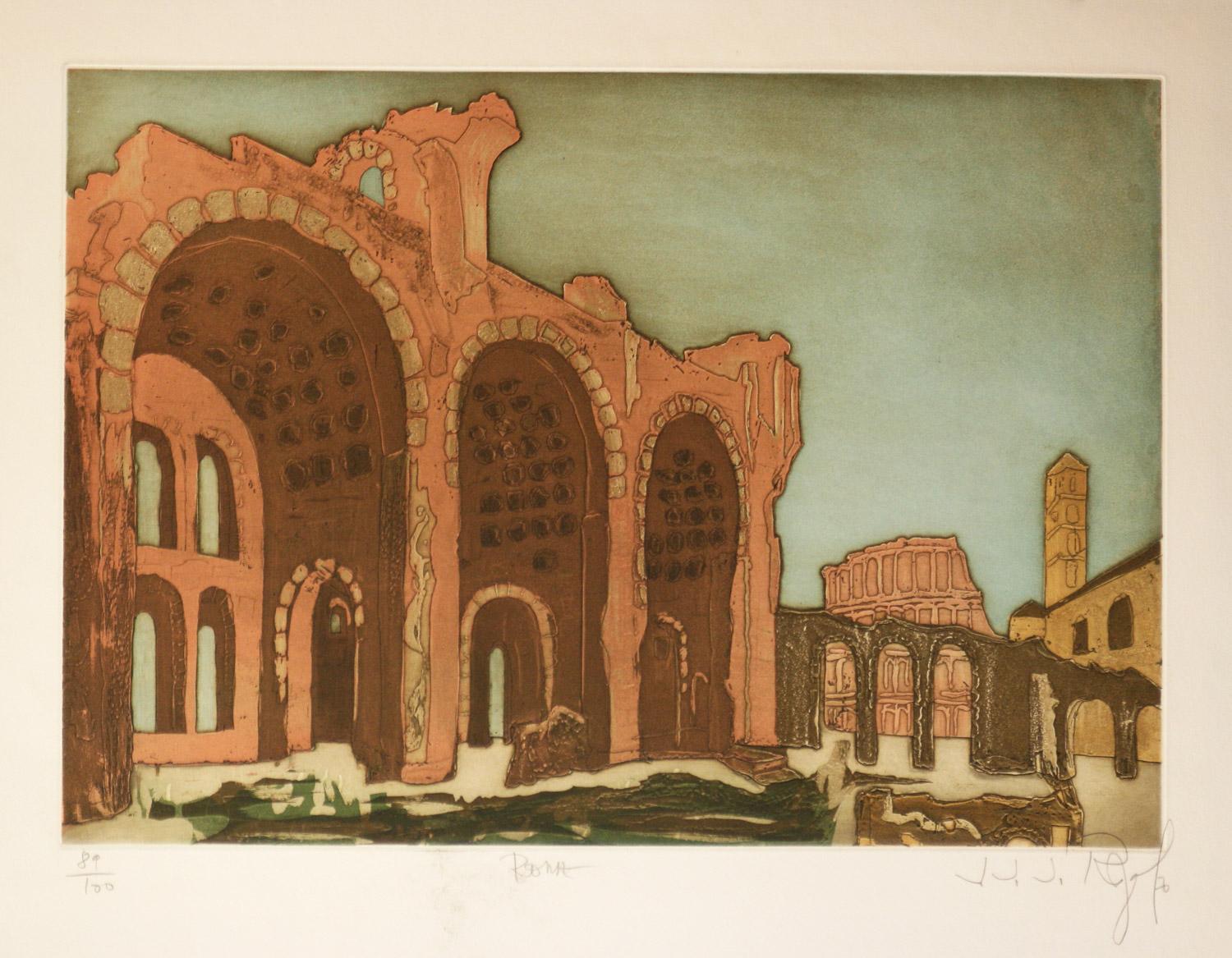
- Rome, Italy original signed limited edition aquatint etching by J.J. RegalLocated in Paonia, CORome, Italy original signed limited edition etching by French artist J.J. Regal This is a very bold design and an original depiction of a major European city. The print is in good...Category
20th Century Expressionist Landscape Prints
MaterialsEtching
- La Hage, Pyrenees , France original etching by J.J. RegalLocated in Paonia, COLa Hage, Pyrenees , France by French artist J.J. Regal is an original signed, limited edition aquatint etching printed on BFK Rives paper. This is a very bold design with an or...Category
20th Century Expressionist Landscape Prints
MaterialsEtching
- Bonn, Germany original limited edition aquatint etching by J.J. RegalLocated in Paonia, COBonn, Germany is an original signed, limited edition aquatint etching by French artist J.J. Regal. Printed on BFK Rives paper this is a very bold design with an original depiction ...Category
20th Century Expressionist Landscape Prints
MaterialsEtching

Recently Viewed
View AllMore Ways To Browse
Antique Jerusalem
Terrarum Orbis
Antique War Map
Antique War Maps
B And G Ship Plate
Antique Map Of Jerusalem
Geno Pettit
George Elbert Burr Etchings
Harold Altman Luxembourg
John Rollins
Jules Cavailles On Sale
Kasimir Of Manhattan
Lithographs Ellison
Mario Sportelli On Sale
Michael Graves Target
Nathan Gutman
Paolo Salvador
Roy Lichtenstein Cathedral