Items Similar to John Thomson (1777-1840) - 1830 Map Engraving, Chart of the World
Want more images or videos?
Request additional images or videos from the seller
1 of 6
John ThomsonJohn Thomson (1777-1840) - 1830 Map Engraving, Chart of the World1830
1830
About the Item
A fine engraved map of the world on Mercator's projection, from the second edition of John Thomson's 'New General Atlas' published in 1830. On paper.
- Creator:John Thomson (1941 - 1840, American)
- Creation Year:1830
- Dimensions:Height: 20.48 in (52 cm)Width: 24.41 in (62 cm)
- Medium:
- Period:
- Condition:The condition is typical for a picture of this age including some discolouration, foxing and small tears around the edges of the paper, with some creases and small losses to the lower right edge in the margin.
- Gallery Location:Corsham, GB
- Reference Number:

John Thomson
Thomson lives and paints in California, Mexico and the Caribbean. His paintings, drawings, prints, ceramics, and color photographs have been exhibited by many leading galleries and design firms throughout the United States, and abroad. Over 4000 of his abstract creations are represented in private, and public collections around the world. Thomson earned his BA in Arts, 1964 from Chico State College and MA in Painting, 1970, from Chico State University.
About the Seller
4.9
Platinum Seller
These expertly vetted sellers are 1stDibs' most experienced sellers and are rated highest by our customers.
Established in 2010
1stDibs seller since 2018
877 sales on 1stDibs
Typical response time: 5 hours
- ShippingRetrieving quote...Ships From: Corsham, United Kingdom
- Return PolicyA return for this item may be initiated within 30 days of delivery.
More From This SellerView All
- John Thomson (1777-1840) - 1830 Map Engraving, The Rivers of the WorldBy John ThomsonLocated in Corsham, GBA fine engraved chart table showing the lengths of the principal rivers across the world, from the second edition of John Thomson's 'New General Atlas' published in 1830. On paper.Category
Early 19th Century More Prints
MaterialsEngraving
- Henri Liebaux and Guillaume De L'Isle - 1706 Engraving, Map Of The MoscovitesLocated in Corsham, GBA early 18th Century map showing a section of Muscovite Russia. This is the lower half of the complete original map, finished with hand colouring. The artist's names are engraved in ...Category
18th Century More Prints
MaterialsEngraving
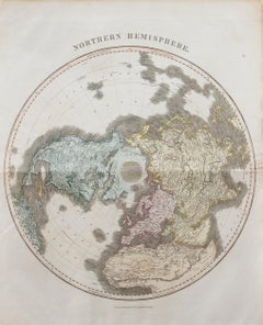
- John Thomson (1777-1840) - 1830 Map Engraving, Northern HemisphereBy John ThomsonLocated in Corsham, GBA fine engraved map of the Northern Hemisphere, from the second edition of John Thomson's 'New General Atlas' published in 1830. On paper.Category
Early 19th Century More Prints
MaterialsEngraving
- 18th Century Map Engraving - Mechlin, or MalinesLocated in Corsham, GBA map of Mechelen, known as Malines in French and Mechlin in English, a city and municipality in the province of Antwerp in the Flemish Region of Belgium. A birds-eye view plan of th...Category
18th Century More Prints
MaterialsEngraving
- 18th Century Map Engraving - Newport, a Strong Sea-Port Town in FlandersLocated in Corsham, GBA map of Nieuwpoort, anglicised to 'Newport', in northern Belgium. There is a panorama in the upper quarter depicting major landmarks. Below is a plan of the town, including its strong defences and ships at the port in the lower register. Inscribed with the title in plate to the lower edge, 'Newport a Strong Sea-Port Town...Category
18th Century More Prints
MaterialsEngraving
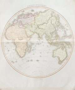
- John Thomson (1777-1840) - 1830 Map Engraving, Eastern HemisphereBy John ThomsonLocated in Corsham, GBA fine engraved map of the Eastern Hemisphere of Earth, from the second edition of John Thomson's 'New General Atlas' published in 1830. On paper.Category
Early 19th Century More Prints
MaterialsEngraving


You May Also Like
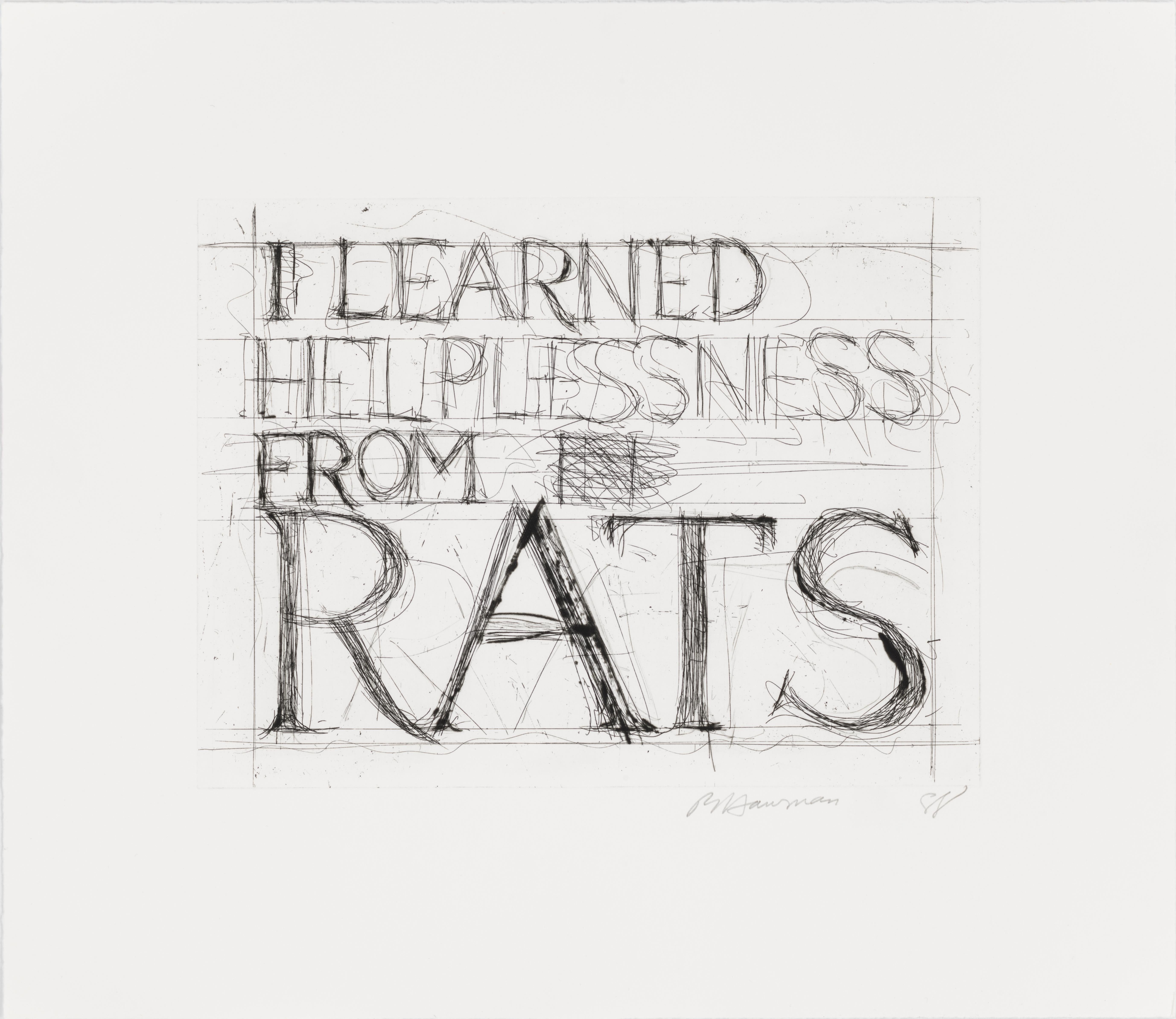
- I Learned Helplessness from RatsBy Bruce NaumanLocated in New York, NYFrame size: 23 x 25 3/8 inches Catalogue Raisonne: Cordes 61 Edition size: 35, plus proofs Signed, dated, and numbered in pencil, lower marginCategory
1980s More Prints
MaterialsDrypoint, Etching
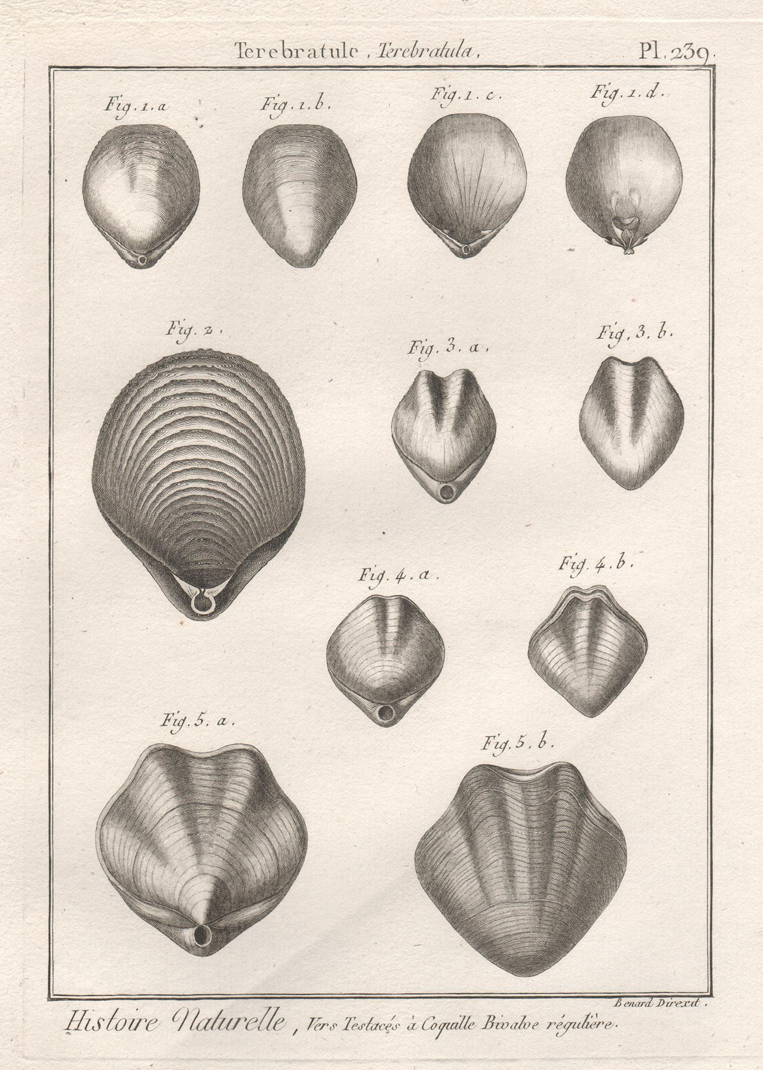
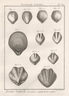
- Shells, French 18th century natural history marine sea shell engravingLocated in Melbourne, Victoria18th century natural history engraving depicting shells by Robert Benard after Henry Joseph Redoute. Henry Redoute was the bro...Category
Late 18th Century Victorian More Prints
MaterialsEngraving
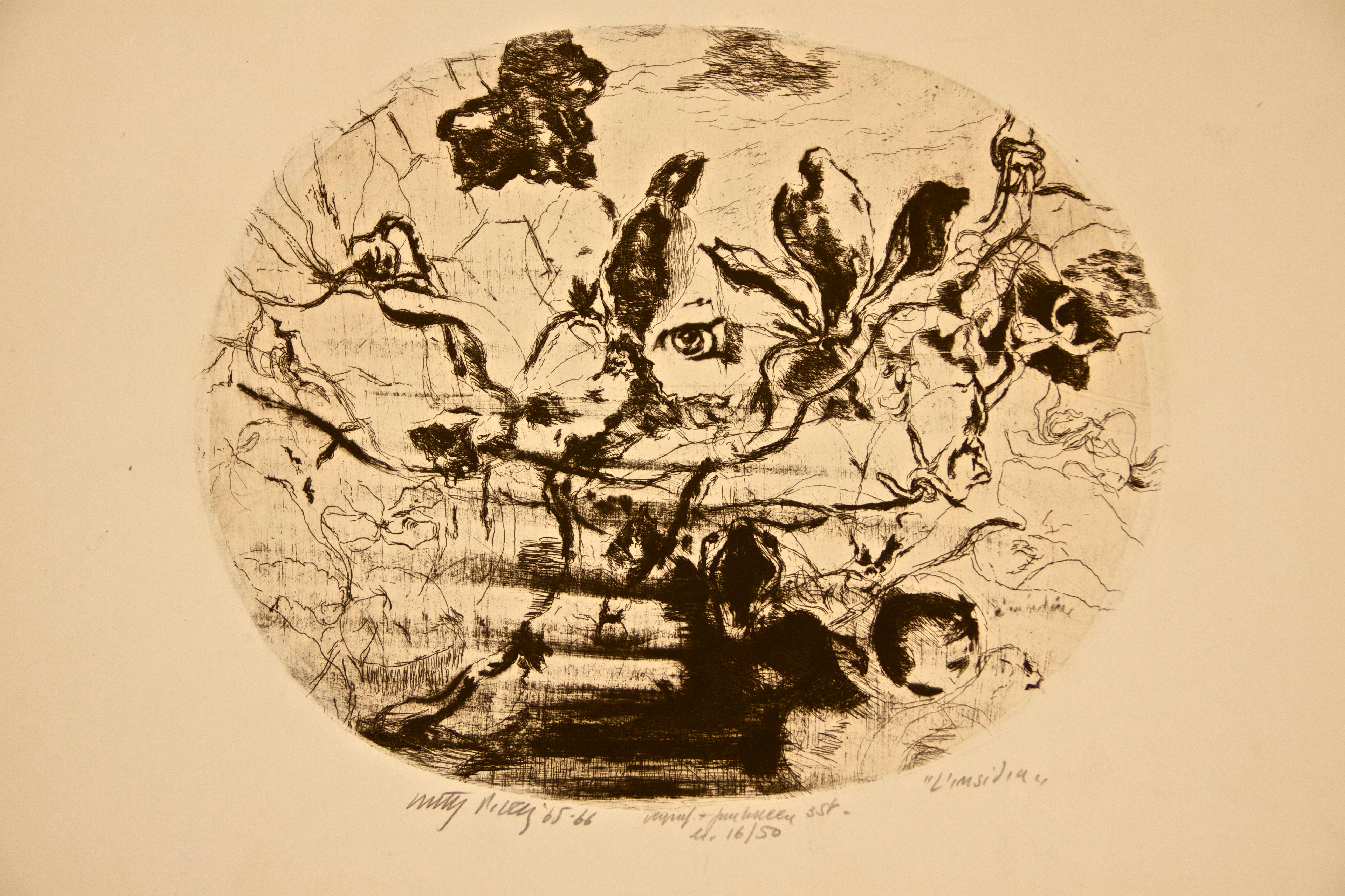
- The Pitfall - Original Etching by Walter PIacesi - 1965By Walter PiacesiLocated in Roma, ITHand Signed. Edition of 50 pieces. Original title: "L'insidia". Very good conditions.Category
1960s More Prints
MaterialsDrypoint, Etching
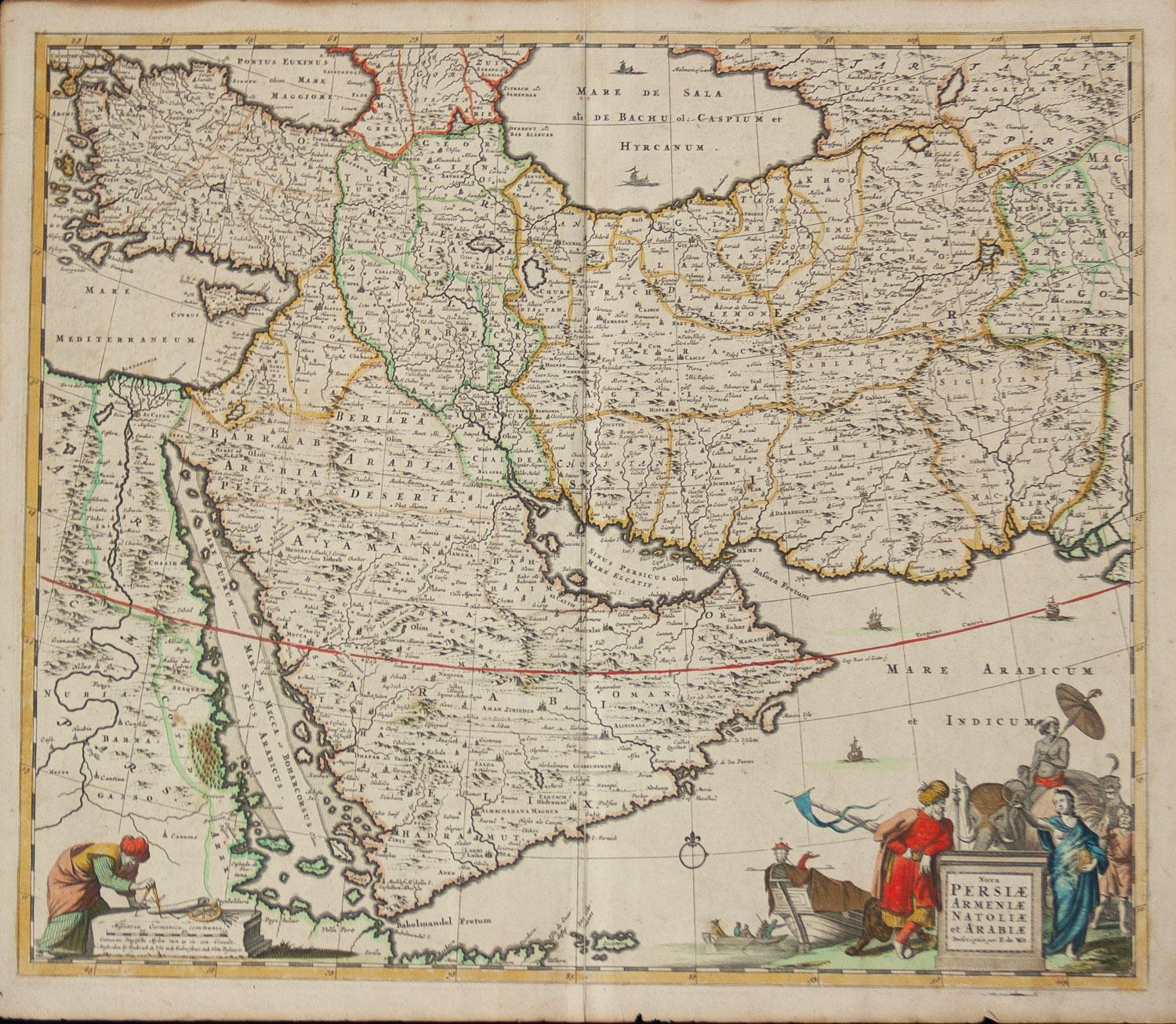
- Persiae, Armeniae, Natoliae et Arabiae Descriptio per Frederick deWit 1666 mapLocated in Paonia, COMap of Persiae, Armeniae, Natoliae et Arabiae Descriptio per F de Wit 1688 engraving from: Atlas Contractus Orbis Terrarum Praecipuas ac Novissimas Complectens Tabulas. Amsterdam, N. Visscher, 1656-77. (Koeman III, Vis5-8) This highly decorative map of the Middle East is by the Dutch engraver, publisher, and map seller...Category
1660s Realist Landscape Prints
MaterialsEngraving
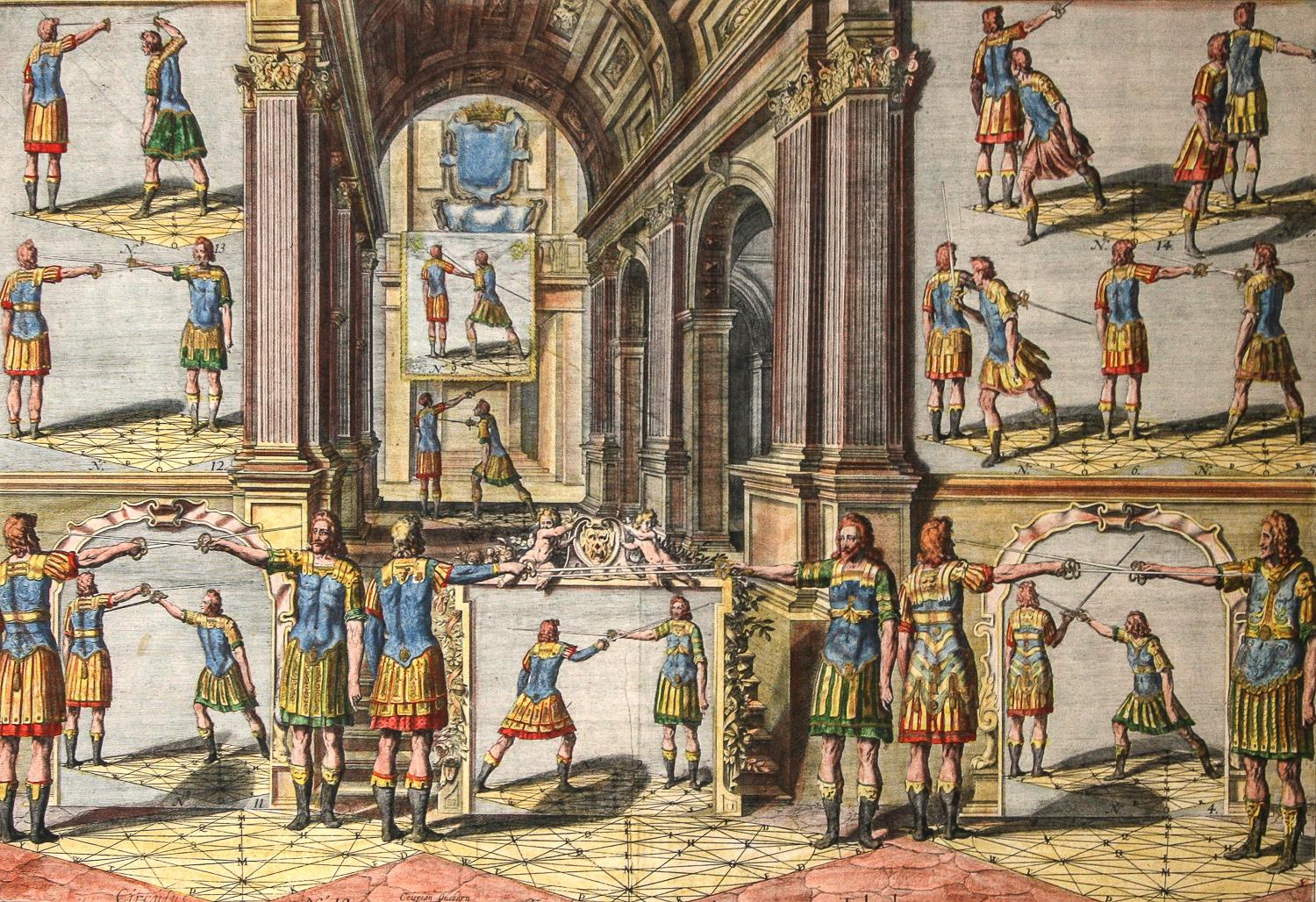
- Academie de l’Espee Tabula XXI by Girard Thibault 17thc fencing engravingBy Pierre ThibaultLocated in Paonia, COHand colored original engraving from the Academie de l’Espee ( full title can be translated as Academy of the Sword: wherein is demonstrated by mathematical rules on the foundation of a mysterious circle the theory and practice of the true and heretofore unknown secrets of handling arms on foot and horseback ) by Girard Thibault...Category
17th Century Other Art Style Figurative Prints
MaterialsEngraving
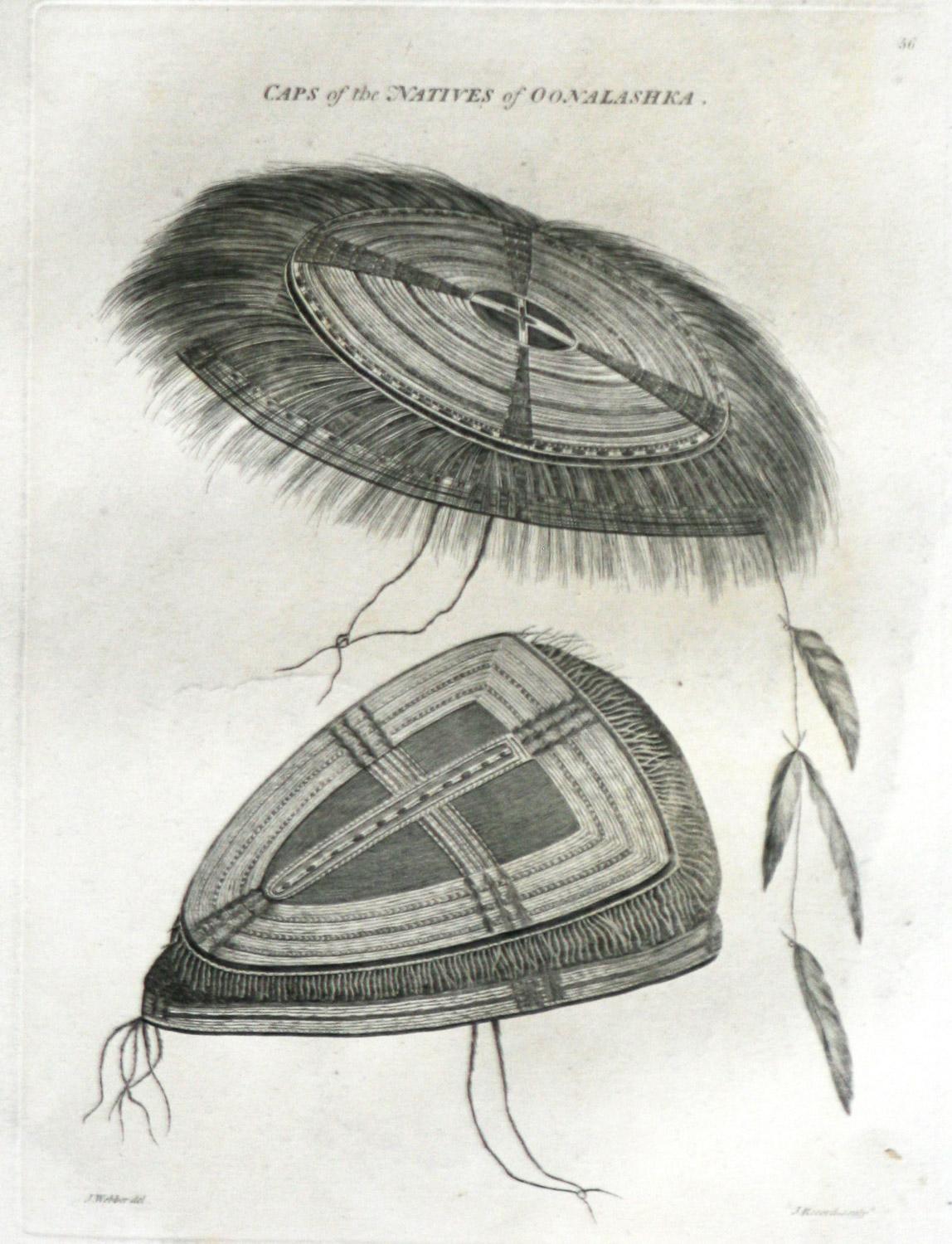
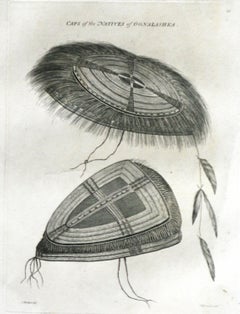
- Caps of the Natives of Oonalashka (Alaska) Captain Cooks Voyage by John WebberBy John WebberLocated in Paonia, COCaps of the Natives of Oonalashka (Alaska) is from the 1784 First Edition Atlas Accompanying Capt. James Cook and King; Third and Final Voyage of Captain James Cook. John Webber (175...Category
1780s Realist More Prints
MaterialsEngraving


Recently Viewed
View AllMore Ways To Browse
Map Of The World
Antique Maps Of The World
Antique Map Engraving
Mercator Antique
Antique World Chart
Vintage Labour Party Posters
Vintage Railway Posters Yorkshire
Vintage Sun Valley Ski Posters
Windows At Tiffany Book
Windows At Tiffanys Book
Andalusia Poster
Autumn Landscape Tiffany
Contemporary Mexican Piggy Bank
Dig For Victory Poster
Gibraltar Poster
Jenny Holzer Essay
Locomotive Lithograph
Lycee Charlemagne