John Thomson Art
American, 1941-1840
Thomson lives and paints in California, Mexico and the Caribbean. His paintings, drawings, prints, ceramics, and color photographs have been exhibited by many leading galleries and design firms throughout the United States, and abroad. Over 4000 of his abstract creations are represented in private, and public collections around the world. Thomson earned his BA in Arts, 1964 from Chico State College and MA in Painting, 1970, from Chico State University.(Biography provided by Robert Azensky Fine Art)
to
1
5
1
5
4
1
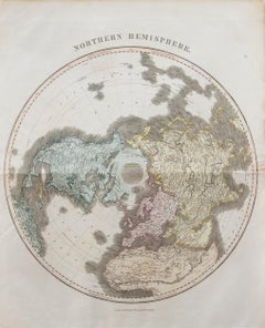
John Thomson (1777-1840) - 1830 Map Engraving, Northern Hemisphere
By John Thomson
Located in Corsham, GB
A fine engraved map of the Northern Hemisphere, from the second edition of John Thomson's 'New General Atlas' published in 1830. On paper.
Category
Early 19th Century John Thomson Art
Materials
Engraving
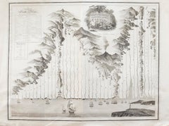
John Thomson (1777-1840) - 1830 Map Engraving, The Rivers of the World
By John Thomson
Located in Corsham, GB
A fine engraved chart table showing the lengths of the principal rivers across the world, from the second edition of John Thomson's 'New General Atlas' published in 1830. On paper.
Category
Early 19th Century John Thomson Art
Materials
Engraving
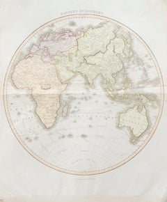
John Thomson (1777-1840) - 1830 Map Engraving, Eastern Hemisphere
By John Thomson
Located in Corsham, GB
A fine engraved map of the Eastern Hemisphere of Earth, from the second edition of John Thomson's 'New General Atlas' published in 1830. On paper.
Category
Early 19th Century John Thomson Art
Materials
Engraving
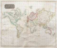
John Thomson (1777-1840) - 1830 Map Engraving, Chart of the World
By John Thomson
Located in Corsham, GB
A fine engraved map of the world on Mercator's projection, from the second edition of John Thomson's 'New General Atlas' published in 1830. On paper.
Category
Early 19th Century John Thomson Art
Materials
Engraving
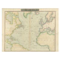
Interesting Map of the Atlantic Showing Nelson's and Trade Routes, 1817
By John Thomson
Located in Langweer, NL
Antique map titled 'Chart of the North Atlantic Ocean with Tracks of the Shipping to West Indies, North America, &cc'. Large map of the Atlantic, showing the tracks of the ships trad...
Category
19th Century Antique John Thomson Art
Materials
Paper
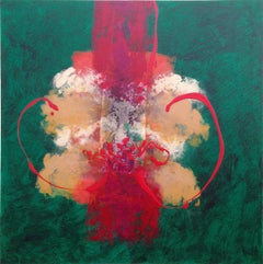
China Patch Abstract
By John Thomson
Located in Soquel, CA
Compelling and vibrant oil abstract work by Monterey Bay artist and gallery owner John O. Thomson. Signed lower right. Signed on verso John O Thomson and titled "China Patch 6-5-11 S...
Category
21st Century and Contemporary Abstract Expressionist John Thomson Art
Materials
Canvas, Oil
Related Items
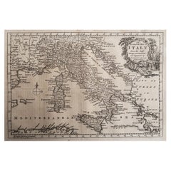
Original Antique Map of Italy. C.1780
Located in St Annes, Lancashire
Great map of Italy
Copper-plate engraving
Published C.1780
Unframed.
Category
Early 1800s English Georgian Antique John Thomson Art
Materials
Paper
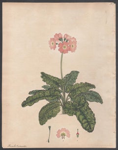
Primula Cortusoides - Siberian Primrose. Henry Andrews botanical engraving print
By Henry C Andrews
Located in Melbourne, Victoria
'Primula Cortusoides - Siberian Primrose'
Native of Siberia.
Original copper-line engraving with original hand-colouring from Henry Andrews' 'The Botanist's Repository', 1797-1812...
Category
Early 19th Century Naturalistic John Thomson Art
Materials
Engraving
St. Michael's Mount, Cornwall: A Framed 19th C. Engraving After Myles Foster
By Myles Birket Foster
Located in Alamo, CA
This beautiful 19th century framed hand-colored engraving is entitled "St. Michael's Mount, Cornwall" by J. Saddler after an original painting by the British artist Myles Birket Fost...
Category
Mid-19th Century Romantic John Thomson Art
Materials
Engraving
H 14.38 in W 17.88 in D 1.5 in
French Contemporary Abstract Painting Gold Highlights Expressionist Composition
Located in Cirencester, Gloucestershire
Artist/ School: French expressionist/ abstract contemporary artist, 21st century
Title: Abstract composition
Medium: oil/mixed media painting on canvas, unframed.
canvas: 25.75...
Category
21st Century and Contemporary Abstract Expressionist John Thomson Art
Materials
Oil, Canvas, Mixed Media
Original Antique Map of Asia. C.1780
Located in St Annes, Lancashire
Great map of Asia
Copper-plate engraving
Published C.1780
Two small worm holes to right side of map
Unframed.
Category
Early 1800s English Georgian Antique John Thomson Art
Materials
Paper
View of Emden, Germany: A 16th Century Hand-colored Map by Braun & Hogenberg
By Franz Hogenberg
Located in Alamo, CA
This is a 16th century original hand-colored copperplate engraved map of a bird's-eye View of Embden, Germany entitled " Emuda, vulgo Embden vrbs Frisia orientalis primaria" by Georg Braun & Franz Hogenberg, in volume II of their famous city atlas "Civitates Orbis Terrarum", published in Cologne, Germany in 1575.
This is a beautifully colored and detailed map of Emden, a seaport in northwestern Germany, along the Ems River and perhaps portions of over Dollart Bay, near the border with the Netherland. The map depicts a bird's-eye view of the city from the southwest, as well as a view of the harbor and an extensive system of canals. Numerous ships of various sizes, as well as two rowboats containing numerous occupants are seen in the main waterway in the foreground and additional boats line two canals in the center of the city. Two men and two women are shown on a hill in the foreground on the right, dressed in the 16th century style of nobility. Two ornate crests are included in each corner. A title strap-work cartouche is in the upper center with the title in Latin. The crest on the right including Engelke up de Muer (The Little Angel on the Wall) was granted by Emperor Maximilian I in 1495.
This is an English translation of an excerpt of Braun's description of Embden: "In Emden, the capital of East Frisia, rich merchants live in very fine houses. The city has a broad and well-situated harbour, which in my opinion is unique in Holland. Frisia and the whole of the Netherlands, for the ships can anchor here right under the city walls. They have also extended the harbour as far as the New Town, so that up to 400 ships can now find shelter here when the sea is rough."
The emphasis on the harbor and waterways within the city highlights the importance of Emden's place as a seaport at this time. Embden developed from a Dutch/Flemish trading settlement in the 7th-8th centuries into a city as late as late 14th century. In 1494 it was granted staple rights, and in 1536 the harbour was extended. In the mid-16th century Emden's port was thought to have the most ships in Europe. Its population then was about 5,000, rising to 15,000 by the end of the 16th century. The Ems River flowed directly under the city walls, but its course was changed in the 17th century by the construction of a canal. Emden has canals within its city limits, a typical feature of Dutch towns, which also enabled the extension of the harbor. In 1744 Emden was annexed by Prussia and is now part of Germany. It was captured by French forces in 1757 during the Seven Years' War, but recaptured by Anglo-German forces in 1758. During the Napoleonic French era, Emden and the surrounding lands of East Frisia were part of the short-lived Kingdom of Holland.
References:Van der Krogt 4, 1230, State 2; Taschen, Braun and Hogenberg...
Category
16th Century Old Masters John Thomson Art
Materials
Engraving
Echium Glaucophyllum, Henry Andrews antique botanical flower engraving print
By Henry C Andrews
Located in Melbourne, Victoria
'Echium Glaucophyllum - Sea-green-leaved Viper's Bugloss'
Native of Cape of Good Hope, South Africa.
Original copper-line engraving with original hand-colouring from Henry Andrews...
Category
Early 19th Century Naturalistic John Thomson Art
Materials
Engraving
Ireland: A Framed 17th Century Hand-colored Map by Jan Jannson
By Johannes Janssonius
Located in Alamo, CA
This is a 17th century hand-colored map entitled "Hibernia Regnum Vulgo Ireland" by Johannes Janssonius's (Jan Jansson), published in Amsterdam in 1640. This highly detailed map depicts the Emerald Isle with an extensive display of towns, roads, mountains, rivers, lakes and county borders, etc. It includes two decorative cartouches on the left. The title cartouche includes the Irish harp and the second, in the upper left, includes a lion wearing a crown on the left, a unicorn on the right and a coat-of-arms in the middle, which includes another Irish harp. A distance scale is seen in the lower right, augmented with two putti. The map is embellished with three sailing ships and a sea monster. Western portions of Scotland and England...
Category
Mid-17th Century Old Masters John Thomson Art
Materials
Engraving
H 17.88 in W 22 in D 0.75 in
Antique 18th Century Map of the Province of Pensilvania 'Pennsylvania State'
Located in Philadelphia, PA
A fine antique of the colony of Pennsylvania.
Noted at the top of the sheet as a 'Map of the province of Pensilvania'.
This undated and anonymous map is thought to be from the Gentleman's Magazine, London, circa 1775, although the general appearance could date it to the 1760's.
The southern boundary reflects the Mason-Dixon survey (1768), the western boundary is placed just west of Pittsburgh, and the northern boundary is not marked.
The map has a number of reference points that likely refer to companion text and appear to be connected to boundaries. The western and southern boundaries are marked Q, R, S, for example. A diagonal line runs from the Susquehanna R to the Lake Erie P. A broken line marked by many letters A, B, N, O, etc., appears in the east.
There are no latitude or longitude markings, blank verso.
Framed in a shaped contemporary gilt wooden frame and matted under a cream colored matte.
Bearing an old Graham Arader Gallery...
Category
18th Century British American Colonial Antique John Thomson Art
Materials
Paper
H 10.25 in W 13.25 in D 0.5 in
A View of Scarborough, England: A Framed 19th C. Engraving After J. M. W. Turner
By J.M.W. Turner
Located in Alamo, CA
This beautiful 19th century framed engraving "Scarborough" by W. Chapman is based on an original painting by the renowned British artist J.M.W. Turner. It was published in London by ...
Category
Mid-19th Century Romantic John Thomson Art
Materials
Engraving
H 18.25 in W 20.88 in D 1 in
Tournai (Tournay), Belgium: A 16th Century Hand-colored Map by Braun & Hogenberg
By Franz Hogenberg
Located in Alamo, CA
This is a 16th century original hand-colored copperplate engraved map of Tournai, Belgium, entitled "Tornacum" by Georg Braun & Franz Hogenberg, in volume IV of their famous city atlas "Civitates Orbis Terrarum", published in Cologne or Augsberg, Germany in 1575. The map provides a bird's-eye view of the walled city of Tournai, the second oldest city in Belgium. It lies approximately one hour by car southwest of Brussels or from Ghent. The names of thirty of its streets, prominent buildings, churches and squares are listed in a key within a strap-work cartouche in the lower left. These locations are numbered in the key corresponding to their locations on the map.
This colorful map of Tournai (Tornacum or Tournay as it was called in the 16th century) includes the title in Latin in a cartouche in the upper center. Three crests are present across the upper map. A man and two woman are standing on a hill in the foreground in the lower right dressed in the style of 16th century upper class residents of the town.
This is an English translation of an excerpt of Braun's description of Tornai: “Tornacum or Turnacum is a city in Gallia Belgica, situated on the Schelde in the territory of the Nervii, called Tournai by its French inhabitants, but Dorneck by the Germans. Tournai has always been a large and powerful city, with an abundance of goods and commercial activities and wonderfully resourceful craftsmen, who invent new articles every day, and although some of these go out of use they constantly conceive of other new things, both useful and delightful, so that they have at all times something that provides work and a means of livelihood for the poor."
ReferencesVan der Krogt 4, 4435, State 1; Taschen, Braun and Hogenberg...
Category
16th Century Old Masters John Thomson Art
Materials
Engraving
Foke-Luste-Hajo, Seminole Chief: Original Hand Colored McKenney & Hall Engraving
By McKenney & Hall
Located in Alamo, CA
This is an original 19th century hand-colored McKenney and Hall engraving of a Native American entitled "Foke-Luste-Hajo, A Seminole Chief, No. 84", published by Rice, Rutter & Co. i...
Category
Mid-19th Century Naturalistic John Thomson Art
Materials
Engraving
Previously Available Items
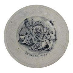
Historical Childs Toy Doll Plate, Indian Chiefs California Gold Rush, circa 1850
By John Thomson
Located in Philadelphia, PA
A circa 1850, pearlware historical childrens' miniature toy doll plate titled “Indian Chiefs,” one of a series of plates commemorating the California Gold Rush...
Category
Mid-19th Century Scottish Late Victorian Antique John Thomson Art
Materials
Pearlware
H 0.25 in Dm 2.25 in
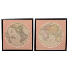
Antique Hand Colored Hemispheres by John Thomson
By John Thomson
Located in New York, NY
A pair of hand colored and engraved world maps depicting the eastern and western hemispheres. They are dated 1815 and were produced for John Thomson's New General Atlas (published i...
Category
19th Century British Antique John Thomson Art
Materials
Paper
John Thomson art for sale on 1stDibs.
Find a wide variety of authentic John Thomson art available for sale on 1stDibs. If you’re browsing the collection of art to introduce a pop of color in a neutral corner of your living room or bedroom, you can find work that includes elements of blue and other colors. You can also browse by medium to find art by John Thomson in canvas, fabric, oil paint and more. Much of the original work by this artist or collective was created during the 21st century and contemporary and is mostly associated with the abstract style. Not every interior allows for large John Thomson art, so small editions measuring 41 inches across are available. Customers who are interested in this artist might also find the work of Leslie Luverne Anderson, Daniel David Fuentes, and Richard Huntington. John Thomson art prices can differ depending upon medium, time period and other attributes. On 1stDibs, the price for these items starts at $1,996 and tops out at $1,996, while the average work can sell for $1,996.
