Items Similar to 1657 Janssonius Map of Vermandois and Cappelle, Ric. A-004


Want more images or videos?
Request additional images or videos from the seller
1 of 10
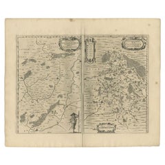
1657 Janssonius Map of Vermandois and Cappelle, Ric. A-004
About the Item
1657 Janssonius map of
Vermandois and Cappelle
Ric.a004
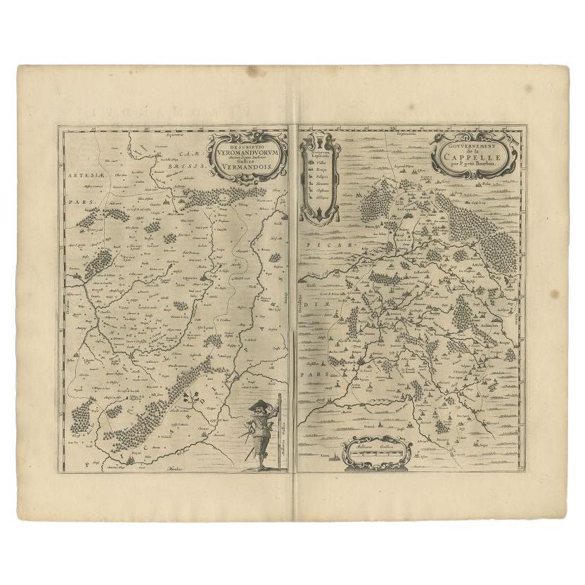
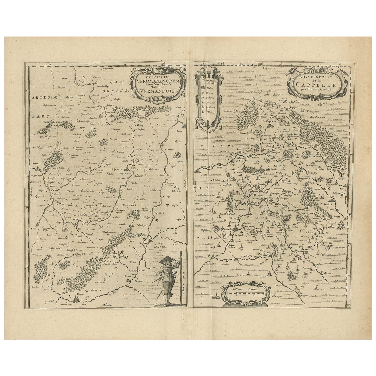
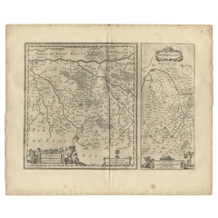
Description: Antique map of France titled 'Descriptio Veromanduorum - Gouvernement de la Cappelle'. Two detailed maps of France on one sheet. The Vermandois map is centered on the Oyse and Somme Rivers and shows Chatelet, Beaurevoir, S. Quintin, Preone, Lafere, Channi, and Noyon, among other larger towns in the region. The Cappelle map is centered on the Oyse and includes Vervins, La Cappelle, Aubanton, and Marle, among others. This map originates from 'Atlas Novus, Sive Theatrum Orbis Orbis Terrarum: In quo Galliae, Helvetiae (..)' by J. Janssonius (1656-1657).
Artists and Engravers: Johannes Janssonius also known as Jan Jansson (1588-1664) was born in Arnhem, Netherlands. His father was a bookseller and publisher (Jan Janszoon the Elder). When he married the daughter of the cartographer Jodocus Hondius he also set up a business as a book publisher in Amsterdam. His first map was published in 1616. Around 15 years later he set up a partnership with his brother-in-law Hondius add issued further editions of the Mercator/Hondius atlas. After his death, his heirs still have published several maps. Many of his plates have been acquired by Pieter Schenk and Gerard Valk.
Dimension: Paper Size: (66 cm W x 51.5 cm H)
Date: 17th century
Condition: good condition with age, please see photos.
- Dimensions:Height: 21.46 in (54.5 cm)Width: 25.99 in (66 cm)Depth: 0.4 in (1 cm)
- Materials and Techniques:
- Place of Origin:
- Period:
- Date of Manufacture:1657
- Condition:
- Seller Location:Norton, MA
- Reference Number:1stDibs: LU5848230268572
About the Seller
5.0
Platinum Seller
These expertly vetted sellers are 1stDibs' most experienced sellers and are rated highest by our customers.
Established in 2000
1stDibs seller since 2021
88 sales on 1stDibs
Typical response time: 1 hour
- ShippingRetrieving quote...Ships From: Norton, MA
- Return PolicyA return for this item may be initiated within 3 days of delivery.
More From This SellerView All
- 1590 Ortelius Map of Calais and Vermandois, France and Vicinity Ric.a014Located in Norton, MA1590 Ortelius map of Calais and Vermandois, France and Vicinity Ric.a014 Two rare regional Abraham Ortelius maps on a single folio sheet. Left map, entitled Caletensium, depic...Category
Antique 16th Century Dutch Maps
MaterialsPaper
- 1790 Thomas Stackhouse Map, Entitled "Russia in Europe, " , Ric.a004Located in Norton, MA1790 Thomas Stackhouse map, entitled "Russia in Europe" Ric.a004 Stackhouse, Thomas Russia in Europe [map] London: T. Stackhouse, 1783. Map. Matted hand-colored copper engraving. Image size: 14.5 x 15.25 inches. Mat size: 22.75 x 23.75 inches. A beautiful example of this map of Eastern Europe...Category
Antique 17th Century Unknown Maps
MaterialsPaper
- 1814 Map of "Russian Empire" Ric.r032Located in Norton, MA1814 Map of "Russian Empire" Ric.r032 Russian Empire. Description: This is an 1814 John Thomson map of the Russian Empire. The map depicts the region from the Baltic Sea, Prussia, and Sweden to the Aleutian Islands and from the Arctic Ocean to the Yellow River. Highly detailed, myriad cities, towns, and villages are labeled throughout, including St. Petersburg, Moscow, Minsk, Kiev, and Kharkov. Rivers and mountain ranges are also identified, as are islands and numerous locations along the coastlines. It is important to note that the long-disputed sea between Korea and Japan is identified as the 'Sea of Japan. Historical Context: In 1815, Tsarist Russia emerged from the Napoleonic Wars economically insolvent and politically fearful of the Revolutionary fervor that had just swept through Europe. In order to shore up Russia's economic position, the Tsars began an aggressive series of expansions into the Caucuses and Central Asia that would vastly increase the landmass of the Russian Empire. Publication History Thomson maps are known for their stunning color, awe inspiring size, and magnificent detail. Thomson's work, including this map, represents some of the finest cartographic art...Category
Antique 19th Century Unknown Maps
MaterialsPaper
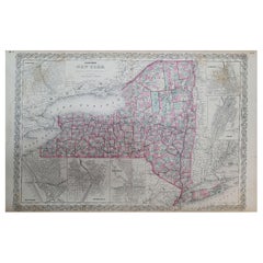
- 1858 Colton's Map of New York, Ric.B011Located in Norton, MAAn 1858 Colton's map of New York Ric.b011 Colton’s New York, 1858 - A large original color engraved and very detailed map of the state of New York,...Category
Antique 19th Century Unknown Maps
MaterialsPaper
- 1851 Map of "Independent Tartary", Ric. R018Located in Norton, MA1851 Map of Independent Tartary "Russia" Ric.r018 A highly decorative 1851 map of Independent Tartary by John Tallis and John Rapkin. Covers the regions between the Caspian Sea and Lake Bakquash and between Russia and Afghanistan. These include the ancient Silk Route kingdoms of Khiva, Tartaria, Kokand, and Bokhara. Today this region roughly includes Kazakhstan, Uzbekistan, Turkmenistan, Kyrgyzstan, and Tajikistan. This wonderful map offers a wealth of detail for anyone with an interest in the Central Asian portion of the ancient Silk Road. Identifies various caravan routes, deserts, wells, and stopping points, including the cities of Bokhara and Samarkand. Three vignettes by W. Bragg decorate the map, these including an image of Tartars on a Journey, a horseback Bride Chase, and a tartar camp site. Surrounded by a vine motif border. Engraved by J. Rapkin for John Tallis's 1851 Illustrated Atlas . Tartary Antique Map...Category
Antique 19th Century Unknown Maps
MaterialsPaper
- Antique German Bisque Doll 971 A 2 M Armand Marseille, Ric#004Located in Norton, MABeautiful Armand Marseille 14" bent knee baby in her factory original clothing and mohair wig. Her bisque socket head is good with no evidence of mish...Category
Vintage 1910s German Toys and Dolls
MaterialsComposition


You May Also Like
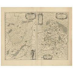
- Antique Map of the Region of Vermandois and Cappelle, France by Janssonius, 1657By Johannes JanssoniusLocated in Langweer, NLAntique map of France titled 'Descriptio Veromanduorum - Gouvernement de la Cappelle'. Two detailed maps of France on one sheet. The Vermandois map is centered on the Oyse and So...Category
Antique 17th Century Maps
MaterialsPaper
- Antique Map of the Region of Vermandois and Cappelle by Janssonius, circa 1650By Johannes JanssoniusLocated in Langweer, NLAntique map of France titled 'Descriptio Veromanduorum - Gouvernement de la Cappelle'. Two detailed maps of France on one sheet. The Vermandois map is centered on the Oyse and Somme ...Category
Antique Mid-17th Century Maps
MaterialsPaper
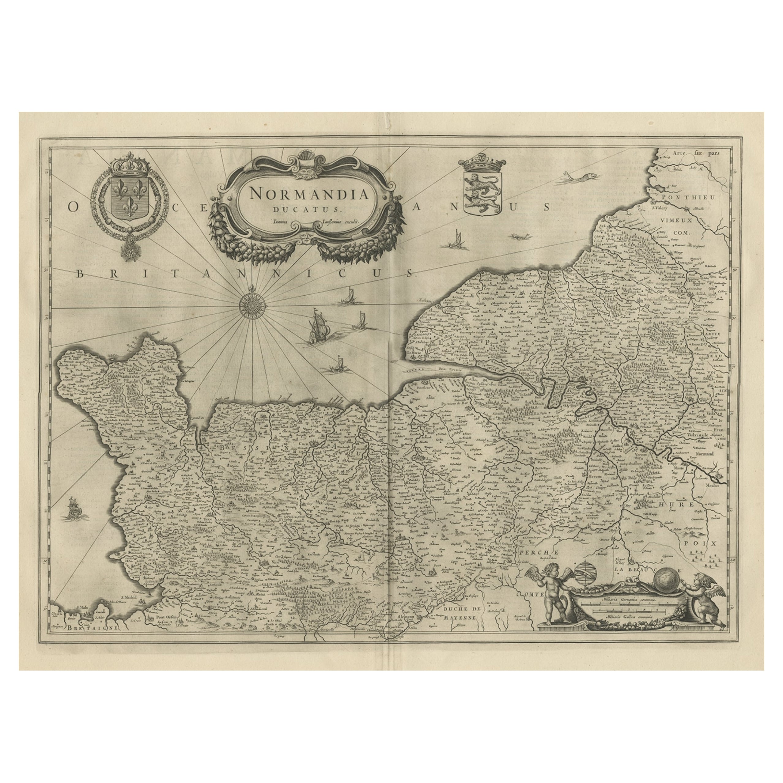
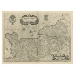
- Antique Map of Normandy by Janssonius, 1657Located in Langweer, NLAntique map of France titled 'Normandia Ducatus'. Decorative map of the Normandy region, including decorative cartouche, sailing ships and compass rose. This map originates from 'Atl...Category
Antique 17th Century Maps
MaterialsPaper
- Antique Map of Switzerland by Janssonius, 1657Located in Langweer, NLAntique map of Switzerland titled 'Helvetiae Rhetiae & Valesiae'. Decorative and detailed map of Switzerland. This map originates from 'Atla...Category
Antique 17th Century Maps
MaterialsPaper
- Antique Map of Beauce by Janssonius, 1657By Johannes JanssoniusLocated in Langweer, NLAntique map 'Belsia vulgo la Beausse'. Decorative map of the region of Beauce, a natural region in northern France, located between the Seine and Loire rivers. This map originates fr...Category
Antique Mid-17th Century Maps
MaterialsPaper
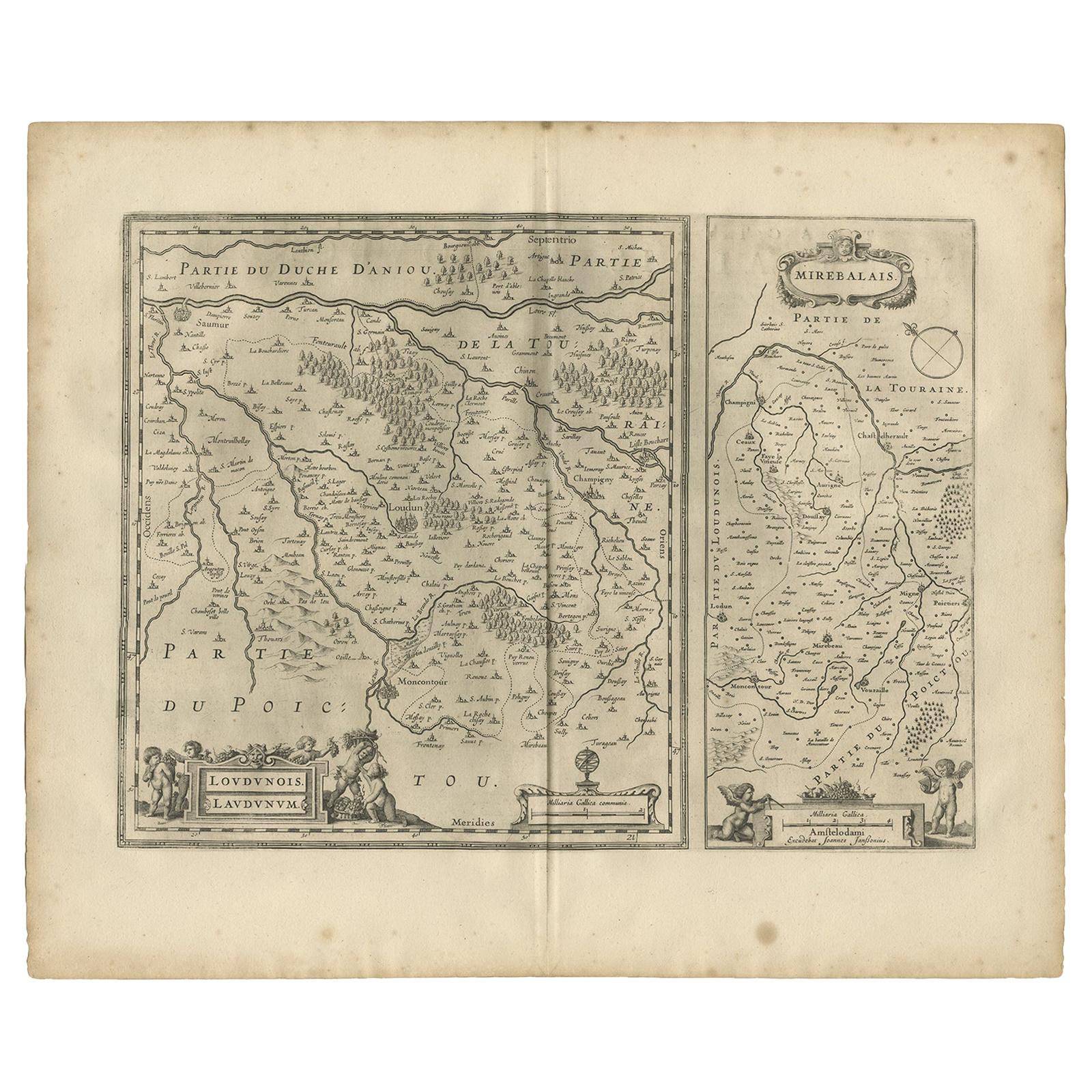
- Antique Map of Loudun and Mirebeau by Janssonius '1657'By Johannes JanssoniusLocated in Langweer, NLAntique map 'Loudunois Laudunum - Mirebalais'. Decorative map of the region of Loudun and Mirebeau. This map originates from 'Atlas Novus, Sive Theatrum Orbis Orbis Terrarum: In quo ...Category
Antique Mid-17th Century Maps
MaterialsPaper


Recently Viewed
View AllMore Ways To Browse
J Gerard S
Taiwan Antique
Antique Map Of Cyprus
Antique South East Asia Map
Cyprus Antique Maps
Map Cyprus
Speed Antique Map
Antique Map New Mexico
Antique Maps Caribbean Islands
Antique Maps New Mexico
Atlas Holding
Munster Map
South Pacific Map
Antique Ecuador
Antique Maps Of Philadelphia
Antique Navigation Tools
Antique Navigational Tools
John Speed Map