Maps


289
5,413
3
2
to
1,181
5,167
244
5,418
5,418
5,418
53
34
15
11
9
5
5
4
4
3
1
1
1
2,882
2,121
410
5
228
29
11
85
7
56
6
3
3
4
5
2
5,327
95
31
30
28
482
267
169
122
115
104
63
29
26
16
Maps For Sale
Three Antique Maps on One Folio: Turkey, Northern Egypt, and Ancient Carthage
Located in Langweer, NL
The map consists of three distinct sections on a single folio sheet:
1. **Map of Turkey**:
- Orientation: The map is oriented with the east at the top, which is a common practic...
Category
16th Century Antique Maps
Materials
Paper


Large Original Vintage Map of Australia, circa 1920
Located in St Annes, Lancashire
Great map of Australia
Original color. Good condition
Published by Alexander Gross
Unframed.
Category
1920s English Vintage Maps
Materials
Paper

Antique Map of a Bay of Borneo, Indonesia, c.1760
Located in Langweer, NL
Antique map titled 'La Baye de l'isle et Ville de Borneo'. Small map depicting a Bay of Borneo.
Artists and Engravers: Anonymous.
Condition: Good, general age-related toning. ...
Category
18th Century Antique Maps
Materials
Paper

Antique Map of Brazil, Uruguay, Paraguay and Guyana by A & C. Black, 1870
Located in Langweer, NL
Antique map titled 'Brazil'. Original antique map of Brazil, Uruguay, Paraguay and Guyana. This map originates from ‘Black's General Atlas of The...
Category
Late 19th Century Antique Maps
Materials
Paper

Antique Map of the Region of Tokyo and Nagasaki in Japan, 1922
Located in Langweer, NL
Antique map of Japan titled 'Japan - Environs of Tokio & Nagasaki'. Old map of Japan, includes inset maps of Tokyo, Nagasaki and surroundings. This map or...
Category
20th Century Maps
Materials
Paper

Antique Map of Jura, a Famous Wine Area in France, 1854
Located in Langweer, NL
Antique map titled 'Dépt. du Jura'. Map of the French department Jura, France.
Jura is a department in the Bourgogne-Franche-Comté region in Eastern France. Named after the Jura Mo...
Category
19th Century Antique Maps
Materials
Paper

Engraving of a Map of Florida, the Gulf Coast, Caribbean & Central America, 1728
Located in Langweer, NL
This exceptional antique map, titled "Nouvelle Carte Marine de Toute les Cotes de l´Amerique" and alternatively known as "Nieuwe groote en seer Curieuse Paskaart van Geheel-WestIndie...
Category
Mid-18th Century European Antique Maps
Materials
Paper

Antique Map of Brazil by Levasseur '1875'
Located in Langweer, NL
Antique map titled 'Carte du Brésil'. Large map of Brazil, with small fold out. This map originates from 'Atlas de Géographie Moderne Physique et Politiq...
Category
Late 19th Century Antique Maps
Materials
Paper

Antique Map of Brabant 'The Netherlands' by N. Visscher, circa 1690
Located in Langweer, NL
Antique map titled 'Brabantiae Batavae pars orientalis, comprehendens Tetrarchiam sive majoratum sylvaeducensem in ejusdem subjacentes ditiones (..)'. Map of the Dutch province 'Brab...
Category
Mid-18th Century Antique Maps
Materials
Paper

Oriental Realms: A Detailed Map of Persia, Afghanistan, and Beloochistan, 1882
Located in Langweer, NL
This historical map from the 1882 atlas published by Blackie & Son is a comprehensive depiction of Persia (modern-day Iran), Afghanistan, and Baluchistan (the region that includes pa...
Category
1880s Antique Maps
Materials
Paper

Antique Map of North and West Africa by J.B. Elwe, 1792
Located in Langweer, NL
Beautiful richly engraved map of North and West Africa, based upon the earlier maps of De L'Isle. Richly annotated throughout and with excellent regional detail. Too much detail to d...
Category
Late 19th Century Antique Maps
Materials
Paper

Antique Print of Persian Decorative Art by Racinet, 1869
Located in Langweer, NL
Old print of Persian decorative art. This print originates from 'L'Ornement polychrome'. A beautiful work containing about 2000 patterns of all the styles of Art old and Asian, middl...
Category
19th Century Antique Maps
Materials
Paper

Original Antique Map of South East Asia, Arrowsmith, 1820
Located in St Annes, Lancashire
Great map of South East Asia
Drawn under the direction of Arrowsmith
Copper-plate engraving
Published by Longman, Hurst, Rees, Orme and Brown, 1820
Unframed.
Category
1820s English Antique Maps
Materials
Paper

Ancient Crossroads: Albania to Assyria in Antiquity, Published in 1880
Located in Langweer, NL
The map titled "ALBANIA, IBERIA, COLCHIS, ARMENIA, MESOPOTAMIA, BABYLONIA, ASSYRIA" portrays the ancient regions that would encompass parts of modern-day Eastern Turkey, Armenia, Aze...
Category
1880s Antique Maps
Materials
Paper

Set of 6 Original Vintage Maps of American States, circa 1900
Located in St Annes, Lancashire
Wonderful set of 6 vintage maps.
Random American states including Maine, Utah, New Hampshire, Nevada, Vermont and New Mexico.
Monochrome with red color outline.
Published by Rand,...
Category
Early 1900s American Edwardian Antique Maps
Materials
Paper

Antique Map of Kentucky and Tennessee by Johnson, 1872
Located in Langweer, NL
Antique map titled 'Johnson's Kentucky (..)'. Original map of Kentucky and Tennessee. This map originates from 'Johnson's New Illustrated Family Atlas ...
Category
Late 19th Century Antique Maps
Materials
Paper

Antique Map of Russia by Tyrer, 1821
Located in Langweer, NL
Antique map titled 'Russia'. Beautiful antique map of Russia engraved by Tyrer. Artists and Engravers: Published by J. Souter, London.
Artist...
Category
19th Century Antique Maps
Materials
Paper

Antique Map of India during the height of the Mughal Imperial Expansion, 1713
Located in Langweer, NL
Antique map titled 'L'Inde de ca le Gange (..)'. Beautiful original antique map embracing most of India, made during the height of the Mughal imperial expansion. The map encompasses ...
Category
Early 18th Century Antique Maps
Materials
Paper

Antique Map of the City of Copenhagen in Denmark c.1720
Located in Langweer, NL
Antique map titled 'Copenhagen'. Original antique map of the city of Copenhagen, Denmark. This map originates from 'Unterschiedliche dieser Zeit Beruffene Laender, Gegenden, Staedte ...
Category
18th Century Antique Maps
Materials
Paper

Antique Map of the Northern Portion of the Philippines by J.N. Bellin, 1764
Located in Langweer, NL
Detailed map of the Northern portion of the Philippines, extending from Batanes and Babuyanes to Mindonoro and Masbate, and centered on Luzon. One of the most detailed maps of the pe...
Category
Mid-18th Century Antique Maps
Materials
Paper

Antique Map of the Cape of Good Hope by W. G. Blackie, 1859
Located in Langweer, NL
Antique map titled 'Cape of Good Hope'. Original antique map of the Cape of Good Hope. This map originates from ‘The Imperial Atlas of Modern Geography’. Published by W. G. Blackie, ...
Category
Mid-19th Century Antique Maps
Materials
Paper

Paviljoen der Stad Amsterdam, Emrik & Binger, 1885
Located in Langweer, NL
Antique Print 'Paviljoen der Stad Amsterdam.' (Pavillion of the city of Amsterdam.) This plate shows the Pavilion of Amsterdam on the World Exhibition of 1883 in Amsterdam. Published...
Category
19th Century Antique Maps
Materials
Paper

Antique Physical Chart of the Pacific Ocean by Johnston, '1850'
Located in Langweer, NL
Antique map titled 'Physical Chart of the Pacific Ocean showing the currents and temperature of the ocean'. Original antique chart of the Pacific Ocean. This map originates from 'The...
Category
Mid-19th Century Antique Maps
Materials
Paper

Antique Map of Japan by W. G. Blackie, 1859
Located in Langweer, NL
Antique map titled 'Japan'. Original antique map of Japan. This map originates from ‘The Imperial Atlas of Modern Geography’. Published by W. G. B...
Category
Mid-19th Century Antique Maps
Materials
Paper

Detailed Regional Map of the Gulf of Bengal and the Lower Ganges River, ca.1750
Located in Langweer, NL
Title of this original and rare antique map: Nouvelle Carte Du Royaume De Bengale
Mapmaker: Jacques-Nicolas Bellin (1703-1772).
He was among the most important mapmakers of the eighteenth century. In 1721, at only the age of 18, he was appointed Hydrographer to the French Navy. In August 1741, he became the first Ingénieur de la Marine of the Dépôt des cartes...
Category
1750s Antique Maps
Materials
Paper

Renaissance Mapping of Sumatra: Featuring Singapore in Münster’s Woodcut, c.1590
Located in Langweer, NL
Description: Antique map titled 'Sumatra ein grosse Insel / so von den alten Geographen Taprobana genennt worden'. Beautiful map of Sumatra and the southern part of Malaysia, with Si...
Category
16th Century Antique Maps
Materials
Paper

Antique Map of the City of Batavia by Van der Aa 'c.1730'
Located in Langweer, NL
Antique map titled 'Plan de la Ville et du Chateau de Batavia en l'Isle de Iava - Ware affbeeldinge wegens het Casteel ende Stadt Batavia gelegen op groot Eylant Java'. Detailed plan...
Category
Mid-18th Century Antique Maps
Materials
Paper

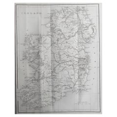
Original Antique Map of Ireland by Hughes. C.1850
Located in St Annes, Lancashire
Great map of Ireland
Engraved by W.Hughes
Published by Virtue, C.1850
Unframed.
Category
1850s Scottish Other Antique Maps
Materials
Paper
Original Antique Map of Scotland by Becker. C.1850
Located in St Annes, Lancashire
Great map of Scotland
Engraved by F.P Becker
Published by Virtue, C.1850
Unframed.
Category
1850s Scottish Other Antique Maps
Materials
Paper
Antique Lithography Map, Cumberland, English, Framed, Cartography, Victorian
Located in Hele, Devon, GB
This is an antique lithography map of Cumberland. An English, framed atlas engraving of cartographic interest, dating to the mid 19th century and later.
Superb lithography of the h...
Category
Mid-19th Century British Victorian Antique Maps
Materials
Wood
Antique Lithography Map, Westmoreland, English, Framed, Cartography, Victorian
Located in Hele, Devon, GB
This is an antique lithography map of Westmoreland. An English, framed atlas engraving of cartographic interest, dating to the mid 19th century and later.
Superb lithography of the ...
Category
Mid-19th Century British Victorian Antique Maps
Materials
Wood

Map of Ireland Titled "Hiberniae Britannicae Insulae Nova Descriptio Irland"
Located in San Francisco, CA
Abraham Ortelius (1527-1598) was a cartographer, geographer and maker from Antwerp in the Spanish Netherlands. He created the first modern atlas titled in Latin Theatrum Orbis Terrar...
Category
Early 18th Century Belgian Antique Maps
Materials
Paper

Antique Lithography Map, Shropshire, English, Framed, Cartography, Victorian
Located in Hele, Devon, GB
This is an antique lithography map of Shropshire. An English, framed atlas engraving of cartographic interest, dating to the mid 19th century and later.
Superb lithography of Shrop...
Category
Mid-19th Century British Victorian Antique Maps
Materials
Wood

Antique Map of the Coast of Southern France, 1793
Located in Langweer, NL
Antique map titled '14th Chart of the Coast of France, from Port Vendres to the Petit Rhône'. Original map with later hand coroling of the coast of Southern France. This map originat...
Category
Late 18th Century Antique Maps
Materials
Paper

19th Century Chart of Nantucket
Located in Nantucket, MA
Extremely Rare 19th Century Chart of Nantucket. circa 1850, with details of Nantucket Island, Eastern Martha's Vineyard, Monomoy Island and surrounding shoals. This is a unique, unpu...
Category
Mid-19th Century American Federal Antique Maps
Materials
Paper

Large European 1930's Nautical Map Reader Magnifying Glass
Located in Haddonfield, NJ
This European set of two nautical magnifying glass map-readers are quite unusual and rarely found. It is fully encased in it's heavy wooden and metal enforced box. Hailing from betwe...
Category
1930s German Industrial Vintage Maps
Materials
Metal
Framed 1838 North America & Recent Discoveries Map
Located in Stamford, CT
1838 map of North America & recent discoveries. Engraved color map by J. Wyld, London, England. This map shows Texas as a Republic without its panhandle.
Framed in brown carved wood...
Category
1830s American American Classical Antique Maps
Materials
Glass, Wood, Paper

Pl. 27 Antique Chart of the US Irish and German Population in 1870, '1874'
Located in Langweer, NL
Antique chart titled 'Maps showing the distribution, within the territory of the United States, east of the 100th Meridian, of certain foreign elements of the population. I. accordin...
Category
Late 19th Century Antique Maps
Materials
Paper

Large 1856 Mexico & Guatemala Framed Map by Charles Desilver
Located in Stamford, CT
Large 1856 Mexico & Guatemala Framed map. Published by Charles Desilver, Philadelphia, Pennsylvania.
As found high end custom framing with black giltwood frame, custom matting and UV...
Category
1850s American American Classical Antique Maps
Materials
Glass, Wood, Paper

1834 Mexico & Guatemala Framed Map by H.S. Tanner
Located in Stamford, CT
1834 Mexico & Guatemala map of published by H.S. Tanner, Philadelphia, Pennsylvania. Engraved by J. Knight.
As found high end custom framing with carved wood frame, custom matting a...
Category
1830s American American Classical Antique Maps
Materials
Glass, Wood, Paper

Large 1848 North America & Territories Map
Located in Stamford, CT
Framed 1848 S. Augustus and Mitchell, Philadelphia , PA North America and territories map.
Featuring the United States, Canada (British Territory) and Mexican Territories.
As found...
Category
1840s American American Classical Antique Maps
Materials
Glass, Wood, Paper

Ptolemaic Armillary Sphere Charles-François Delamarche Paris, 1805-1810 Circa
Located in Milano, IT
Charles-François Delamarche
Ptolemaic armillary sphere
Paris, circa 1805-1810
Wood and papier-mâché
covered with printed and partly hand-coloured paper
It measures 15.74” in height, ...
Category
Early 1800s French Empire Antique Maps
Materials
Paper, Wood
Antique Leicestershire Map, English, Framed Cartographic Interest, Victorian
Located in Hele, Devon, GB
This is an antique lithography map of Leicestershire. An English, framed atlas engraving of cartographic interest, dating to the mid 19th century and later.
Superb lithography of Le...
Category
Mid-19th Century British Victorian Antique Maps
Materials
Wood

Antique Nottinghamshire Map, English, Framed, Cartographic Interest, Victorian
Located in Hele, Devon, GB
This is an antique lithography map of Nottinghamshire. An English, framed atlas engraving of cartographic interest, dating to the mid 19th century and later.
Superb lithography of ...
Category
Mid-19th Century British Victorian Antique Maps
Materials
Wood

Antique County Map, Essex, English, Framed, Cartographic Interest, Victorian
Located in Hele, Devon, GB
This is an antique lithography map of Essex. An English, framed atlas engraving of cartographic interest, dating to the mid 19th century and later.
Superb lithography of Essex and ...
Category
Mid-19th Century British Victorian Antique Maps
Materials
Wood

Antique Map of the Island of Tahiti, Polynesia, 1803
Located in Langweer, NL
Antique map Tahiti titled 'Kaart van het Eiland Otahiti'.
Antique map of the Island of Tahiti, Polynesia. Originates from 'Reizen Rondom de Waereld door James Cook (..)'.
Art...
Category
Early 1800s Antique Maps
Materials
Paper

Antique German Hartleben's Volks Atlas Book World Maps
Located in Seguin, TX
Antique circa 1900 A. Hartleben's Volks-Atlas. Published by A. Hartleben's, Germany. Folio hardcover with decorated olive cloth binding and brown leather spine. Gilt title to spine...
Category
Early 20th Century German Aesthetic Movement Maps
Materials
Paper

Antique County Map, Oxfordshire, English, Framed Cartography Interest, Victorian
Located in Hele, Devon, GB
This is an antique lithography map of Oxfordshire. An English, framed atlas engraving of cartographic interest, dating to the mid 19th century and later.
Superb lithography of Oxfo...
Category
Mid-19th Century British Mid-Century Modern Antique Maps
Materials
Wood

Original Antique Bird's Eye View of Banten or Bantam in Java, Indonesia, 1725
Located in Langweer, NL
Antique print titled 'La Ville de Bantam capitale du Roiaume de meme nom'.
A bird's eye view of the city Banten or Bantam near the western end of Java in Indonesia. Several tall ...
Category
1720s Antique Maps
Materials
Paper

Dartmouth, England: A Hand-Colored 17th Century Sea Chart by Captain Collins
Located in Alamo, CA
This hand-colored sea chart of the area around Dartmouth, England is from "Great Britain's Coasting Pilot. Being a New and Exact Survey of the Sea-Coast of England", first published ...
Category
Late 17th Century English Antique Maps
Materials
Paper

Antique Map of the Philippines and Guam by Scherer, circa 1702
Located in Langweer, NL
Antique map titled 'Nova et Vera Exhibitio Geographica Insularum Marianarum (..)'. Rare and very attractive map of the Mariana Islands, Philippines, Ko...
Category
Early 18th Century Antique Maps
Materials
Paper

Map of New Zealand Showing Maori Culture and Early Colonial Settlements, 1851
Located in Langweer, NL
John Tallis & Company were renowned for their ornate and detailed maps in the mid-19th century. Their works often featured elaborate borders, decorative motifs, and insets of vignett...
Category
1850s Antique Maps
Materials
Paper

Ornate Cartography of Colonial Grandeur: The West India Islands around 1851
Located in Langweer, NL
This map is a part of John Tallis's series of maps, known for their detailed and ornamental style. John Tallis & Company, mentioned in the caption, was an English cartographic publisher active during the 19th century. The company was renowned for its detailed maps of countries and regions around the world, often including intricate border decorations, vignettes, and historically informative illustrations.
The map itself is a mid-19th-century depiction of the West Indies, which is a region of the North Atlantic Ocean in the Caribbean that consists of the island countries and surrounding waters of three major archipelagos: the Greater Antilles, the Lesser Antilles, and the Lucayan Archipelago. The detail on the map is quite accurate for its time, showing not only the geography but also marking important cities and ports, which would have been vital information during the era of British colonialism.
Robert Montgomery Martin, whose work is cited here, was a British author and colonial administrator, and his writings included comprehensive descriptions of the British colonies during the peak of the British Empire. His work was often used as the textual accompaniment to the maps produced by John Tallis.
The Tallis maps are characterized by their vignettes that illustrate local scenes, notable features, or important figures, which can be seen in the margins of the map. These vignettes are valuable for giving cultural and social context to the geographical information presented. It's not just a map but a piece of historical documentation that reflects the interests and perspectives of the British during the time it was made. The presence of these artistic elements makes Tallis maps not just navigational tools but also historical artifacts and works of art.
The map includes islands such as Cuba, Jamaica, Hispaniola (containing Haiti and the Dominican Republic), Puerto Rico, and various smaller islands of the Lesser Antilles, amongst others. The economic, geopolitical, and social conditions of these countries during the era when this map was made were heavily influenced by colonial powers, primarily by the empires of Europe, including the British Empire.
The screenshots from the map show various detailed sections of the West India Islands and surrounding areas, which include artistic elements and cartographic details typical of John Tallis maps...
Category
1850s Antique Maps
Materials
Paper

19th Century Illustrated Map of Ceylon (Sri Lanka) with Notable Landmarks
Located in Langweer, NL
John Tallis & Company is known for producing maps and atlases that were highly regarded for their accurate cartographic detail and their distinctive style. They often included ornate...
Category
1850s Antique Maps
Materials
Paper
 with Notable Landmarks")
A Tallis Map of British Guiana with Colonial Vignettes and Other Landmarks, 1851
Located in Langweer, NL
This Tallis map of British Guiana (now known as Guyana) is a richly decorated document, much like other maps from the esteemed cartographic publisher John Tallis & Company. The firm,...
Category
1850s Antique Maps
Materials
Paper

An Ornate and Historical Tallis Map of Jamaica with Decorative Vignettes, 1851
Located in Langweer, NL
This original antique map of Jamaica is part of the renowned series created by the Tallis Company, known for their detailed and decorative maps ...
Category
1850s Antique Maps
Materials
Paper

Map of Tasmania with Illustrations of Local Fauna and Colonial Landmarks, 1851
Located in Langweer, NL
John Tallis & Company was renowned for their detailed and ornate maps during the 19th century. Their maps are distinguished by the intricate borders and vignettes that are as informa...
Category
1850s Antique Maps
Materials
Paper

An Old Illustrated Tallis Map of Central America with Volcanic Vignettes, 1851
Located in Langweer, NL
This map of Central America, part of John Tallis & Company's series from "The British Colonies" by Robert Montgomery Martin, is a fine example of mid-19th century cartography and wou...
Category
1850s Antique Maps
Materials
Paper

Recently Viewed
View AllMore Ways To Browse
Nova Scotia Antique Furniture
Pilgrim Period Furniture
1500 Map
Albania Antique Map
Antique Gate Architectural Antiques
Antique Louisiana Map
Antique Map Louisiana
Antique Map Palestine
Antique Maps Of Louisiana
Antique Maps Of North Carolina
Armenia Map
Armenian Map
Brooklyn Map
Gibraltar Antique Map
Greenland Map
Hyde Park Antiques
Map Colorado
Map Of Armenia