Maps at Auction
326
to
325
326
326
326
326
12
4
76
189
61
60
1
9
47
326
1
1
146
142
98
48
48
28
2
1
1
1
Ways To Shop: Auction
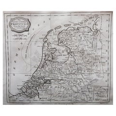
Original Antique Map of The Netherlands, Engraved by Barlow, Dated 1807
Located in St Annes, Lancashire
Great map of Netherlands
Copper-plate engraving by Barlow
Published by Brightly & Kinnersly, Bungay, Suffolk.
Dated 1807
Unframed.
Category
Antique Early 1800s English Maps
Materials
Paper
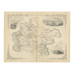
Map of Independent Tartary with Vignettes of the Region's Culture, 1851
Located in Langweer, NL
The map of Independent Tartary is part of the collection by John Tallis & Company, which were unique for their elaborate decorative elements and detailed illustrations.
**The Maker ...
Category
Antique 1850s Maps
Materials
Paper
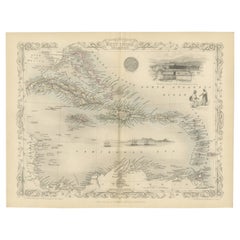
Ornate Cartography of Colonial Grandeur: The West India Islands around 1851
Located in Langweer, NL
This map is a part of John Tallis's series of maps, known for their detailed and ornamental style. John Tallis & Company, mentioned in the caption, was an English cartographic publis...
Category
Antique 1850s Maps
Materials
Paper
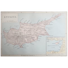
Original Antique Map of Cyprus. Circa 1880
Located in St Annes, Lancashire
Great map of Cyprus
Drawn and Engraved by R.Walker
Published W.Mackenzie, London
Original colour
Unframed.
Category
Antique 1880s English Maps
Materials
Paper
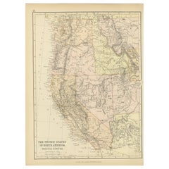
Antique Map of The United States of North America, Pacific States, 1882
Located in Langweer, NL
The map is from the same 1882 Blackie Atlas and focuses on the Pacific States of the United States of America during that period. Here are some details and historical context about t...
Category
Antique 1880s Maps
Materials
Paper
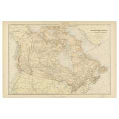
Antique Map of British North America, The Dominion of of Canada, 1882
Located in Langweer, NL
This map is titled "British North America, Dominion of Canada," from the 1882 Blackie Atlas. It features the geographical area that comprises modern-day Canada, with notable features...
Category
Antique 1880s Maps
Materials
Paper
Antique Decorative Coloured Map of North America, 1882
Located in Langweer, NL
This original antique map of North America is from the Blackie & Son Atlas published in 1882. Here are several points of interest about this map:
1. **Political Borders**: The map l...
Category
Antique 1880s Maps
Materials
Paper
Original Antique Coloured Map of Western Africa, Published in 1882
Located in Langweer, NL
This is a map of Western Africa from the 1882 Blackie & Son atlas. The map details the West African coast from the Sahara Desert in the north down to the Gulf of Guinea, including a ...
Category
Antique 1880s Maps
Materials
Paper
Old Map of the Chinese Empire and Japan, 1882
Located in Langweer, NL
An original antique map titled "The Chinese Empire and Japan," dating from an 1882 atlas by Blackie & Son. It is a color map with geographical features such as mountain ranges, river...
Category
Antique 1880s Maps
Materials
Paper
Original Antique Map of the American State of Washington, 1889
Located in St Annes, Lancashire
Great map of Washington
Drawn and Engraved by W. & A.K. Johnston
Published By A & C Black, Edinburgh.
Original colour
Unframed.
Category
Antique 1880s Scottish Victorian Maps
Materials
Paper
Gold Rush Era Masterpiece: The Tallis & Rapkin Rare Map of Pre-Queensland, 1851
Located in Langweer, NL
The image is an original historical map of Australia from the year 1851, created by John Rapkin with illustrations by J. Marchant and engravings by J. B. Allen. The map was published...
Category
Antique 1850s Maps
Materials
Paper
Roman Frontiers Engraved: Germania, Raetia, and Noricum, Published in 1880
Located in Langweer, NL
The map, titled "GERMANIA, RAETIA, NORICUM," depicts the regions of Germania, Raetia, and Noricum, which correspond to parts of modern-day Central and Eastern Europe, including areas of Germany, Austria, Switzerland, and the Balkans.
Features of the map include:
1. **Regional Divisions**: The map is divided into the regions of Germania, Raetia, and Noricum, each likely differentiated by color or shading.
2. **Topography**: It details the mountain ranges, rivers, and other geographical features of the region. The Alps, which are central to Raetia, are prominently displayed.
3. **Roman Settlements and Roads**: The map likely marks Roman...
Category
Antique 1880s Maps
Materials
Paper
Ancient Italy: Regions and Rome in the Roman Empire, Published in 1880
Located in Langweer, NL
This print is an original detailed map titled "ITALIAE REGIONES I VII VIII IX XI," representing the regions of ancient Italy.
Key Features of the Print:
1. **Regional Demarcations...
Category
Antique 1880s Maps
Materials
Paper
Original Map of Greece at the Time of the Dorian Migration, Published in 1880
Located in Langweer, NL
The map titled "GRAECIA TEMPORI MIGRATIONIS DORICAE," translates to "Greece at the Time of the Dorian Migration." This map showcases the regions of ancient Greece during the period f...
Category
Antique 1880s Maps
Materials
Paper
The Roman Empire from the Time of Constantine the Great, Published in 1880
Located in Langweer, NL
Antique map titled: "IMPERIUM ROMANORUM inde a Constantini Magni tempore," which translates to "The Roman Empire from the time of Constantine the Great."
This map is designed to re...
Category
Antique 1880s Maps
Materials
Paper
Ancient Iberia: Hispania Map from Spruner-Menke Atlas Antiquus, 1880
Located in Langweer, NL
This map is titled "HISPANIA," indicating it is a historical map of ancient Spain.
It is an original antique map from the "Spruner-Menke Atlas Antiquus," a 19th-century historical a...
Category
Antique 1880s Maps
Materials
Paper
Title: Mid-19th Century Map of Australasia by Carl Flemming - 1855
Located in Langweer, NL
Title: "Mid-19th Century Map of Australasia by Carl Flemming - 1855"
Description: This original 1855 antique map from the Sohr-Berghaus Atlas, created by Carl Flemming, is a detaile...
Category
Antique 1850s Maps
Materials
Paper
Large Original Antique Map of Arizona, Usa, C.1900
Located in St Annes, Lancashire
Fabulous map of Arizona
Original color.
Engraved and printed by the George F. Cram Company, Indianapolis.
Published, C.1900.
Unframed.
Free shipping.
Category
Antique 1890s American Maps
Materials
Paper
Large Original Antique Map of Ohio, Usa, C.1900
Located in St Annes, Lancashire
Fabulous map of Ohio
Original color.
Engraved and printed by the George F. Cram Company, Indianapolis.
Published, C.1900.
Unframed.
Free shipping.
Category
Antique 1890s American Maps
Materials
Paper
Large Original Antique Map of New Mexico, Usa, C.1900
Located in St Annes, Lancashire
Fabulous map of New Mexico.
Original color.
Engraved and printed by the George F. Cram Company, Indianapolis.
Published, C.1900.
Unframed.
Free shipping.
Category
Antique 1890s American Maps
Materials
Paper
Original Antique Map of the West Indies by J. Arrowsmith, 1842
Located in Langweer, NL
Title: "J. Arrowsmith's 19th Century Map of the West Indies"
This original antique map, crafted by J. Arrowsmith, details the West Indies with a focus on the Caribbean Sea and its s...
Category
Antique Early 19th Century Maps
Materials
Paper
1817 John Thomson's Handcolored Antique Map of St. Kitts, Nevis, and St. Lucia
Located in Langweer, NL
This is an antique map depicting the islands of St. Kitts (St. Christopher's) and Nevis in the West Indies, along with a smaller inset map of St. Lucia.
The main map focuses on St. Kitts, with detailed topographical features such as mountain ranges, volcanic peaks, and plantation areas indicated by cross-hatching and stippling. The coastline is meticulously outlined, with bays and capes labeled. The island of Nevis appears in a smaller inset on the right, detailed in a similar fashion with its own unique landscape features.
The inset of St. Lucia at the bottom left shows the rugged terrain of the island, including its mountains and natural harbors. Each island's map is framed within its own neat line border, with a title block for identification.
The map appears to be hand-colored, a common practice of the time for high-quality maps, which emphasizes the land against the sea. Pink shading outlines the islands, while green tones likely represent lower elevations and yellow tones for higher elevations.
The condition of the map suggests it has been well-preserved, with the paper maintaining its integrity and the colors remaining vivid. There are signs of aging, such as slight discoloration and possible foxing, but these are typical for documents of this era and do not significantly detract from the visual appeal or the information presented.
This map would have been an important navigational aid for sailors and a source of geographic knowledge for those interested in the West Indies during the period it was made. The craftsmanship and detail also make it a fine example of cartographic art...
Category
Antique Early 19th Century Maps
Materials
Paper
Large Antique Map of Guadeloupe and Antigua with Adjacent Isles, 19th Century
Located in Langweer, NL
Title: "Antique Map of Guadeloupe and Antigua with Adjacent Isles, 19th Century"
Source: New General Atlas (circa 1817), published in Edinburgh
Description: This detailed antique m...
Category
Antique Early 19th Century Maps
Materials
Paper
Original Antique Plan of The Battle of Abukir, Napoleon Bonaparte. Circa 1850
Located in St Annes, Lancashire
Great battle plan of The Battle of Abukir
Drawn by A.M Perrot
Steel engraving by Tardieu with original hand colour
Unframed.
The size given is the paper size
Category
Antique 1850s French Maps
Materials
Paper
An Insightful 19th Century Map of Syria and the Surrounding Regions, 1882
Located in Langweer, NL
This map, titled "SYRIA (SOUTH DIVISION) including PALESTINE & THE HAUARAN," is a historical cartographic work from the late 19th century, specifically from the 1882 atlas by Blackie...
Category
Antique 1880s Maps
Materials
Paper
Imperial Frontiers: A 19th Century Map of Southern Russia and the Caucasus, 1882
Located in Langweer, NL
This map, sourced from the comprehensive 1882 atlas by Blackie & Son, delineates the southern part of Russia and the Caucasus region, reflecting the geopolitical contours and topogra...
Category
Antique 1880s Maps
Materials
Paper
Oriental Realms: A Detailed Map of Persia, Afghanistan, and Beloochistan, 1882
Located in Langweer, NL
This historical map from the 1882 atlas published by Blackie & Son is a comprehensive depiction of Persia (modern-day Iran), Afghanistan, and Baluchistan (the region that includes pa...
Category
Antique 1880s Maps
Materials
Paper
Antique Map of Grenada, West Indies, 1758
Located in Langweer, NL
"Exquisite 1758 Map: 'CARTE DE L'ISLE DE LA GRENADE'
This alluring map presents a detailed depiction of the Island of Grenada, boasting remarkable intricacy for its time. Notably, i...
Category
Antique 1750s Maps
Materials
Paper
Original Historical Map of L'Ile De La Martinique by Vaugondy, 1749
Located in Langweer, NL
Description: De Vaugondy's map of Martinique, initially published in Paris in 1748 within his Atlas Portatif, Universel et Militaire, stands as a striking representation of the isla...
Category
Antique 1740s Maps
Materials
Paper
Original Antique Map of the Peninsula of India with Part of Ceylon by Wyld, 1844
Located in Langweer, NL
This extensive map of India, spanning two sheets, draws from Reynell’s original map and incorporates data provided by Sir Archibald Campbell, as well as surveys conducted by Colonel ...
Category
Antique Mid-18th Century Maps
Materials
Paper
Engraved Map by Bellin of Saint Lucia or Sainte Lucie in the West Indies, 1764
Located in Langweer, NL
The "Carte de L’Isle de Sainte Lucie" by Jacques Nicolas Bellin, a prominent figure as the Royal Hydrographer and engineer of the French Navy, is a remarkable antique map showcasing ...
Category
Antique Late 19th Century Maps
Materials
Paper
Original Antique Map of the American State of Pennsylvania, 1889
Located in St Annes, Lancashire
Great map of Pennsylvania
Drawn and Engraved by W. & A.K. Johnston
Published By A & C Black, Edinburgh.
Original colour
Unframed.
Repair to a minor tear on bottom edge.
Category
Antique 1880s Scottish Victorian Maps
Materials
Paper
Original Antique Map of Brasil, Published in the 16th Century, 1561
Located in Langweer, NL
This important Ruscelli map of Brazil, from his work La Geografia di Claudio Tolomeo Alessandrino, is one of the earliest obtainable modern maps of the re...
Category
Antique 1660s Maps
Materials
Paper
Original Antique Engrving of Chinese Tartary in the 18th Century, 1737
Located in Langweer, NL
The antique map titled " Ozieme feuille particuls de la Tartarie Chinoise, qui contient un pays dependant de la russie aucouchant de NIPTCHOU " translates to "Sixth sheet of parts of...
Category
Antique 1730s Maps
Materials
Paper
Set of 5 Large Original Vintage Sea Charts, circa 1920
Located in St Annes, Lancashire
5 great maps or charts of the oceans
I particularly like the color of these maps
Unframed
Original color
By John Bartholomew and Co. Edinburgh Geographical Institute
Published, ...
Category
Vintage 1920s British Maps
Materials
Paper
Large Original Vintage Map of Iceland, circa 1920
Located in St Annes, Lancashire
Great map of Iceland
Original color. Good condition
Published by Alexander Gross
Unframed.
Category
Vintage 1920s English Victorian Maps
Materials
Paper
Large Original Vintage Map of Sweden and Norway circa 1920
Located in St Annes, Lancashire
Great map of Sweden and Norway
Original color. Good condition
Published by Alexander Gross
Unframed.
Category
Vintage 1920s English Victorian Maps
Materials
Paper
Large Original Antique Map of The World, Fullarton, C.1870
Located in St Annes, Lancashire
Great map of the World. Showing both hemispheres
From the celebrated Royal Illustrated Atlas
Lithograph. Original color.
Published by Fullarton, Edinburgh, C.1870
Unframed.
Rep...
Category
Antique 1870s Scottish Maps
Materials
Paper
Large Original Antique Map of Wisconsin, USA, circa 1900
Located in St Annes, Lancashire
Fabulous map of Wisconsin
Original color
Engraved and printed by the George F. Cram Company, Indianapolis.
Published, circa 1900
Unframed
Category
Antique 1890s American Maps
Materials
Paper
Large Original Antique Map of Georgia, USA, circa 1900
Located in St Annes, Lancashire
Fabulous map of Georgia
Original color
Engraved and printed by the George F. Cram Company, Indianapolis.
Published, circa 1900
Unframed
Category
Antique 1890s American Maps
Materials
Paper
Large Original Vintage Map of The United Kingdom, circa 1920
Located in St Annes, Lancashire
Great map of The United Kingdom
Original color.
Published by Alexander Gross
Unframed.
Category
Vintage 1920s English Maps
Materials
Paper
Large Original Vintage Map of Japan, circa 1920
Located in St Annes, Lancashire
Great map of Japan
Unframed
Original color
By John Bartholomew and Co. Edinburgh Geographical Institute
Published, circa 1920
Free shipping.
Category
Vintage 1920s British Maps
Materials
Paper
Large Original Vintage Map of Greece, circa 1920
Located in St Annes, Lancashire
Great map of Greece
Original color.
Good condition
Published by Alexander Gross
Unframed.
Category
Vintage 1920s English Maps
Materials
Paper
Large Original Vintage Map of The South Pole, circa 1920
Located in St Annes, Lancashire
Great map of The South Pole
Original color.
Published by Alexander Gross
Unframed.
Repairs to minor edge tears
Category
Vintage 1920s English Maps
Materials
Paper
Antique Map of the Nassau Region in Western Germany
Located in Langweer, NL
Antique map titled 'Nassovia Principatus (..)'. Detailed map of the Nassau region in western Germany between Koblenz, Hadamar, Giessen, Frankfurt and Mainz. The map is filled with in...
Category
Antique Early 18th Century Maps
Materials
Paper
Antique Map op Siberia and Chinese Tartary with original hand coloring, 1732
Located in Langweer, NL
Antique map titled 'Nieuwe Kaart van Tartarie na de alderlaatste ontdekking int ligt gebragt'. Map op Siberia and Chinese tartary. In the north Novaya Zemlya curls back to attach its...
Category
Antique Mid-18th Century Maps
Materials
Paper
Large Antique Map of Ancient Spain and Portugal, Published in circa 1760
Located in Langweer, NL
Antique map titled 'Hispania Antiqua (..)'. Map of ancient Spain and Portugal. Engraved by G. Delahaye. Published circa 1760, by or after Sanson & Vaugondy.
Category
Antique Mid-18th Century Maps
Materials
Paper
Antique Map of the Holy Land, showing the travels of Abraham, Isaac and Jacob
Located in Langweer, NL
Antique map titled 'Tabula Itineraria Patriarcharum Abrahami, Isaaci et Iacobi'. Decorative regional map of the Holy Land, showing the travels of Abraham, Isaac and Jacob. Published ...
Category
Antique Mid-17th Century Maps
Materials
Paper
Original Hand-Colored Antique Map of Ancient Germany, circa 1630
Located in Langweer, NL
Antique map titled 'Germaniae Veteris typus'. Very attractive map of ancient Germany. Published by G. Blaeu after A. Ortelius, circa 1630.
Willem Jans...
Category
Antique Mid-17th Century Maps
Materials
Paper
Original Antique Map of the American State of Oregon, 1889
Located in St Annes, Lancashire
Great map of Oregon
Drawn and Engraved by W. & A.K. Johnston
Published By A & C Black, Edinburgh.
Original colour
Unframed.
Category
Antique 1880s Scottish Victorian Maps
Materials
Paper
Antique Map of Eastern Turkey, Caucasus, Israel through Iraq and part of Arabia
Located in Langweer, NL
Antique map titled 'Nieuwe Kaart van Irak Arabia, Kurdistan, Diarbek, Turkomannia, Syrie en het Heilige Land'. Beautiful map including eastern Turkey, the Caucasus, Israel through Ir...
Category
Antique Mid-18th Century Maps
Materials
Paper
Large Original Vintage Map of Mexico, circa 1920
Located in St Annes, Lancashire
Great map of Mexico
Original color.
Good condition
Published by Alexander Gross
Unframed.
Category
Vintage 1920s English Edwardian Maps
Materials
Paper
Large Original Vintage Map of Brazil, circa 1920
Located in St Annes, Lancashire
Great map of Brazil
Original color. Good condition
Published by Alexander Gross
Unframed.
Category
Vintage 1920s English Edwardian Maps
Materials
Paper
Mercator's Ptolemaic Map of the Holy Land, Cyprus and Syria, circa 1580
Located in Langweer, NL
Antique map titled 'Asiae IIII Tab'. Beautiful map of Mercator's Ptolemaic map of the Holy Land, Cyprus, Syria, etc. Originates from Mercator's 'Geographia'.
Gerard Mercator (1512 ...
Category
Antique 16th Century Maps
Materials
Paper
Original Antique Map of Missouri, 1889
Located in St Annes, Lancashire
Great map of Missouri
Drawn and Engraved by W. & A.K. Johnston
Published By A & C Black, Edinburgh.
Original colour
Unframed.
Category
Antique 1880s Scottish Victorian Maps
Materials
Paper
Original Antique Map of South America. C.1780
Located in St Annes, Lancashire
Great map of South America
Copper-plate engraving
Published C.1780
Two small worm holes to left side of map
Unframed.
Category
Antique Early 1800s English Georgian Maps
Materials
Paper
Original Antique Map of Asia. C.1780
Located in St Annes, Lancashire
Great map of Asia
Copper-plate engraving
Published C.1780
Two small worm holes to right side of map
Unframed.
Category
Antique Early 1800s English Georgian Maps
Materials
Paper
Original Antique Map of India. C.1780
Located in St Annes, Lancashire
Great map of India
Copper-plate engraving
Published C.1780
Three small worm holes to right side of map and one bottom left corner
Unframed.
Category
Antique Early 1800s English Georgian Maps
Materials
Paper
Recently Viewed
View AllMore Ways To Browse
Antique Sailing Map
Antique Sailing Maps
Bay Area Antique Furniture
West Coat Of Arms
Greek Asia Minor
Hemisphere World Map
Speed Map
Antique Maps Canada
Antique Map Canada
Canada Antique Map
West Indies Map
Malaysian Antique
Blaeu World Map
Charing Cross
Antique Map Denmark
Antique Maps Of Canada
Bali Map
Map Of Brazil
