Items Similar to The Roman Empire from the Time of Constantine the Great, Published in 1880
Want more images or videos?
Request additional images or videos from the seller
1 of 6
The Roman Empire from the Time of Constantine the Great, Published in 1880
About the Item
Antique map titled: "IMPERIUM ROMANORUM inde a Constantini Magni tempore," which translates to "The Roman Empire from the time of Constantine the Great."
This map is designed to represent the Roman Empire during its transition from paganism to Christianity under Emperor Constantine I, who reigned from 306 to 337 AD.
**Key Observations from the Map:**
1. **Geographical Coverage**: The map covers a vast territory, including Europe, parts of Asia, and North Africa, which constituted the Roman Empire during Constantine's reign.
2. **Color Coding**: The provinces and regions within the empire are color-coded, to differentiate administrative regions or to highlight areas of particular importance during Constantine’s rule.
3. **Major Cities**: Key cities like Rome, Constantinople (modern-day Istanbul), Antioch, and Alexandria are marked, reflecting their significance as centers of power, culture, and religion at the time.
4. **Military and Political Borders**: The boundaries of the Roman Empire are clearly delineated, and may also show the division of the empire into the Eastern and Western Roman Empires, which occurred later in the century.
5. **Inset Maps**: On the lower left corner, there are inset maps that provide detailed views of particular regions, possibly illustrating significant military, political, or administrative changes that took place during Constantine’s reign.
6. **Topographical Features**: Mountain ranges, rivers, and seas are intricately detailed, offering insights into the geographical challenges and the natural resources that influenced Roman politics and economics.
7. **Roads and Trade Routes**: The map might depict the network of Roman roads, vital for military logistics and commerce, which contributed to the empire's cohesion and prosperity.
8. **Historical Annotations**: The Latin inscriptions throughout the map likely offer historical context about the empire's extent, governance, and other noteworthy events of the period.
9. **Scale and Orientation**: The map includes a scale for distance, as well as possibly latitude and longitude lines, providing a sense of scale and aiding in navigation and historical analysis.
This map, titled "IMPERIUM ROMANORUM in a Constantini Magni tempore" (The Roman Empire during the time of Constantine the Great), is fascinating for several reasons. To name two:
Historical Period: It represents the Roman Empire during the reign of Emperor Constantine the Great, a pivotal figure who established Constantinople (present-day Istanbul) as a new capital and was instrumental in the spread of Christianity within the empire.
Geographical Scope: The map shows the vast extent of the Roman Empire, which covered a large portion of the known world at the time, from the British Isles to the Near East and North Africa.
This map serves as a historical document, capturing the grandeur of the Roman Empire during a pivotal moment in its history. It is both a work of art and an educational tool, reflecting the detailed scholarship and cartographic skills of its creators, intended for those studying the ancient world.
- Dimensions:Height: 15.56 in (39.5 cm)Width: 18.51 in (47 cm)Depth: 0 in (0.02 mm)
- Materials and Techniques:
- Period:
- Date of Manufacture:1880
- Condition:Good, given age. General age-related toning, especially around the edges. Vertical folding line as issued. Please study scan carefully.
- Seller Location:Langweer, NL
- Reference Number:Seller: BG-13686-2-41stDibs: LU3054338537182
About the Seller
5.0
Platinum Seller
These expertly vetted sellers are 1stDibs' most experienced sellers and are rated highest by our customers.
Established in 2009
1stDibs seller since 2017
1,916 sales on 1stDibs
Typical response time: <1 hour
- ShippingRetrieving quote...Ships From: Langweer, Netherlands
- Return PolicyA return for this item may be initiated within 14 days of delivery.
Auctions on 1stDibs
Our timed auctions are an opportunity to bid on extraordinary design. We do not charge a Buyer's Premium and shipping is facilitated by 1stDibs and/or the seller. Plus, all auction purchases are covered by our comprehensive Buyer Protection. Learn More
More From This SellerView All
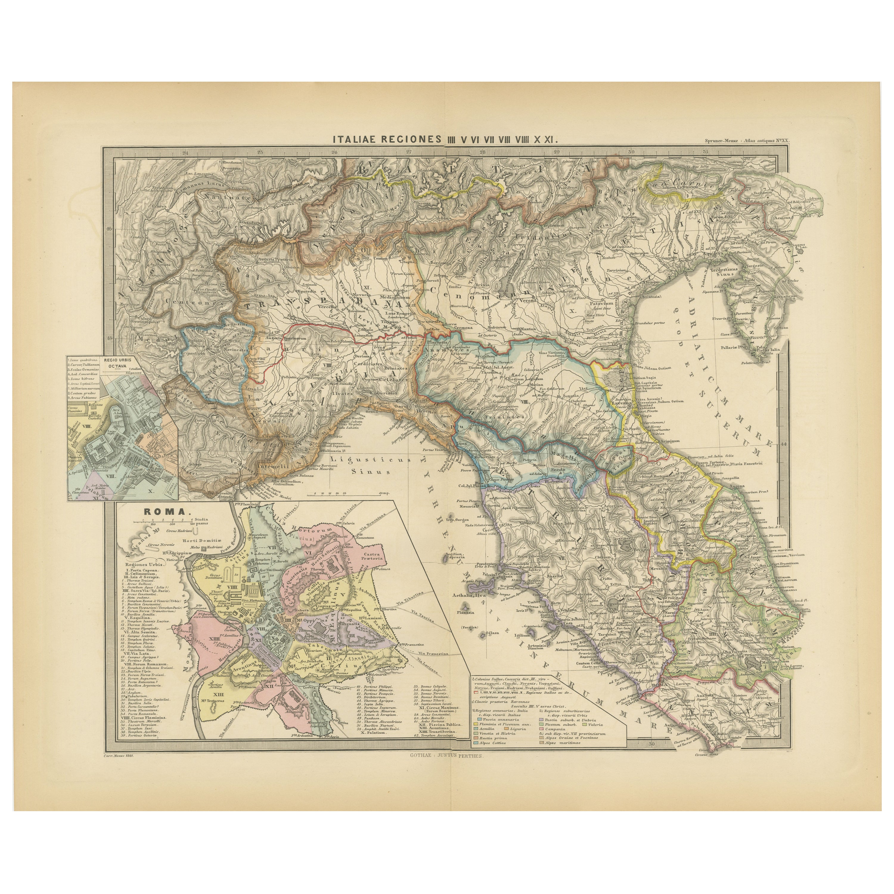
- Ancient Italy: Regions and Rome in the Roman Empire, Published in 1880Located in Langweer, NLThis print is an original detailed map titled "ITALIAE REGIONES I VII VIII IX XI," representing the regions of ancient Italy. Key Features of the Print: 1. **Regional Demarcations...Category
Antique 1880s Maps
MaterialsPaper
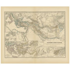
- Antique Map of The Kingdom of Alexander the Great, Published in 1880Located in Langweer, NLThe map is titled "ALEXANDRI MAGNI REGNUM," which translates to "The Kingdom of Alexander the Great." It depicts the vast territories conquered by Alexander the Great during his reig...Category
Antique 1880s Maps
MaterialsPaper
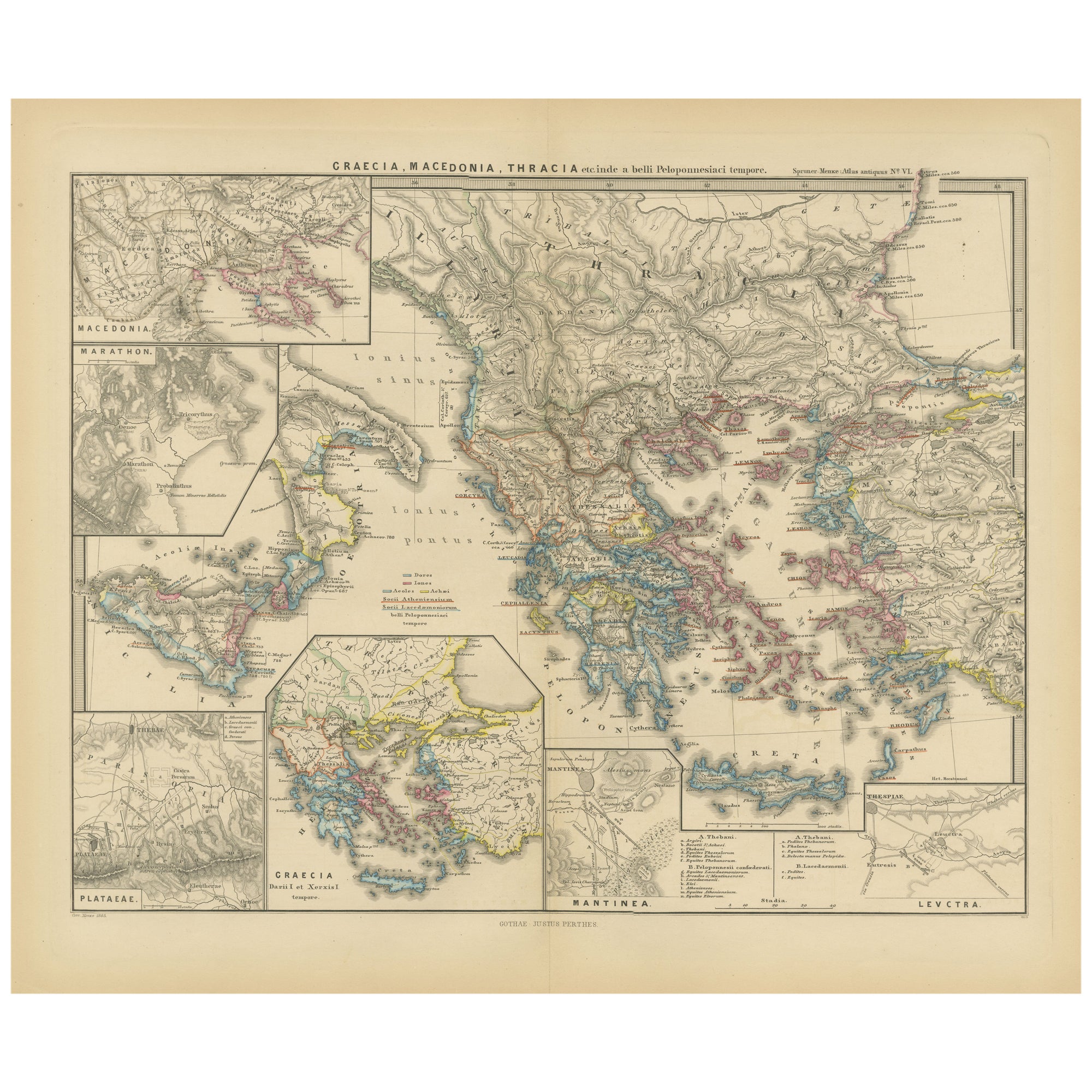
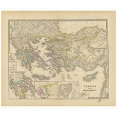
- Original Map of Greece at the Time of the Dorian Migration, Published in 1880Located in Langweer, NLThe map titled "GRAECIA TEMPORI MIGRATIONIS DORICAE," translates to "Greece at the Time of the Dorian Migration." This map showcases the regions of ancient Greece during the period f...Category
Antique 1880s Maps
MaterialsPaper
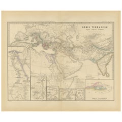
- The World in the Assyrian Empire's Era: A Historical Map, Published in 1880Located in Langweer, NLThis map from the "Spruner-Menke Atlas Antiquus" is titled "ORBIS TERRARVM regni Assyrii tempore," which translates to "The World at the Time of the Assyrian Kingdom." It depicts the...Category
Antique 1880s Maps
MaterialsPaper
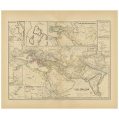
- Empires of Antiquity: The Persian Realm and Beyond Engraved, Published in 1880Located in Langweer, NLThe map is titled "ORBIS TERRARUM regni Persici tempore," which translates from Latin to "The World at the Time of the Persian Empire." This map is particularly interesting for sever...Category
Antique 1880s Maps
MaterialsPaper
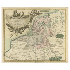
- Antique Map of the Netherlands in the time of the Domination by the Roman EmpireLocated in Langweer, NLOriginal antique map titled 'Carte Ancienne des Pays Bas et des Environs du Temps des Romains'. Copper engraved map of the Netherlands in the time of the domination by the Roman Empire. The map also includes portions of Belgium and Germany. With Renaissance title cartouche showing Roman armor...Category
Antique Mid-18th Century Maps
MaterialsPaper

You May Also Like
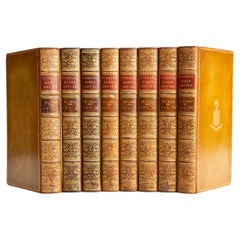
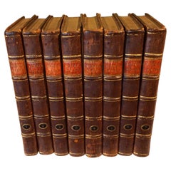
- 8 Vols. Edward Gibbon, The History of the Decline and Fall of the Roman EmpireLocated in New York, NY8 Volumes. Edward Gibbon, The History of the Decline and Fall of the Roman Empire. Bound in full tan calf with the covers displaying a floral border and a central crest, both gilt-to...Category
Antique 19th Century English Books
MaterialsLeather
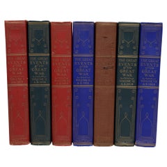
- The Great Events of Great War in 7 Volumes Complete, First EditionLocated in valatie, NYThe Great Events of Great War in 7 Volumes Complete. The National Alumni, 1920. 7 vols. First edition hardcovers. This set done for Henry J. McKenney, Lieutenant 46th Infantry, 9th Division U.S. Army. Plate signed by the Commander and Chief Huston and the Adjutant General Elton with the official embossed seal. Illustrated with full-page gravures and protective tissues guards over each. Each volume is a facsimile of a famous binding ("The original art binding of the official French copy of the Versailles Peace Treaty which was signed by President...Category
Vintage 1920s American Books
MaterialsPaper
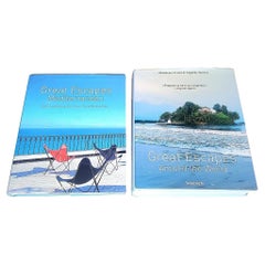
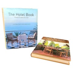
- Set of 2 Taschen Great Escape Books From the Estate of Christian AudigierLocated in Waxahachie, TX21 May 1958 – 9 July 2015 He was a French fashion designer known for the Ed Hardy and Von Dutch clothing lines. These are from his Los Angeles estate. TASC...Category
Early 2000s German Post-Modern Books
MaterialsPaper
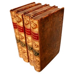
- The Works of Francis Rabelais in 4 Leatherbound Volumes Published In London 1784Located in San Francisco, CAThe works of Francis Rabelais, translated from the French in 4 full original calf bindings with gilt tooled spines published in London by T. Evans in the Strand in 1784. Rabelais was...Category
Antique Mid-18th Century English Georgian Books
MaterialsLeather, Paper
- Pair of Taschens Great Escapes Hotel Books From the Estate of Christian AudigierBy Angelika TaschenLocated in Waxahachie, TXFrom the estate of Christian Audigier 21 May 1958 – 9 July 2015 He was a French fashion designer known for the Ed Hardy and Von Dutch clothing lines. Chris...Category
Early 2000s German Post-Modern Books
MaterialsPaper
- The Works of Edmund Burke in Eight Leatherbound Volumes Published 1808Located in San Francisco, CAThe Works of the Right Honorable Edmund Burke in 8 volumes published for F.C. and J. Rivington, St. Paul's Yard, England by Luke Hanfard and Sons, near Lincoln's-Inn Fields. This att...Category
Antique Early 19th Century English Books
MaterialsLeather, Paper