Items Similar to Roman Frontiers Engraved: Germania, Raetia, and Noricum, Published in 1880
Want more images or videos?
Request additional images or videos from the seller
1 of 7
Roman Frontiers Engraved: Germania, Raetia, and Noricum, Published in 1880
About the Item
The map, titled "GERMANIA, RAETIA, NORICUM," depicts the regions of Germania, Raetia, and Noricum, which correspond to parts of modern-day Central and Eastern Europe, including areas of Germany, Austria, Switzerland, and the Balkans.
Features of the map include:
1. **Regional Divisions**: The map is divided into the regions of Germania, Raetia, and Noricum, each likely differentiated by color or shading.
2. **Topography**: It details the mountain ranges, rivers, and other geographical features of the region. The Alps, which are central to Raetia, are prominently displayed.
3. **Roman Settlements and Roads**: The map likely marks Roman settlements, forts, and roads, including the limes or frontier boundaries of the Roman Empire.
4. **Tribal Territories**: In Germania, the territories of various Germanic tribes are possibly indicated, reflecting the complex and often contentious relationship between these tribes and the Roman Empire.
5. **Latin Nomenclature**: All text is in Latin, including the names of geographical features, tribes, and Roman towns, which adds to its authenticity as a historical document.
6. **Inset Legend**: A legend or key is provided, detailing the symbols used to represent cities, military sites, and other points of interest.
7. **Water Bodies**: Rivers such as the Danube (Danubius) and bodies of water like the Black Sea (Mare Germanicum) are likely labeled and clearly depicted.
8. **Historical Context**: This map provides insights into the Roman administrative divisions and military logistics in these frontier regions, which were critical for defense and the expansion of Roman influence.
The map was part of a historical atlas designed for educational purposes, offering a detailed view of the region during the Roman era. It would be particularly valuable for those studying Roman military history, geography, and the spread of Roman culture into Central Europe.
This print is from the "Spruner-Menke Atlas Antiquus." This atlas, often known for its detailed historical maps of ancient civilizations and empires, was originally created by Karl Spruner von Merz and later revised by Theodorus Menke. The atlas was a significant educational resource in the 19th century, widely used for its comprehensive historical and geographic content. The style of the map, including its coloration, typography, and the inclusion of Latin text, is consistent with other known maps from this atlas.
- Dimensions:Height: 15.56 in (39.5 cm)Width: 18.51 in (47 cm)Depth: 0 in (0.02 mm)
- Materials and Techniques:
- Period:
- Date of Manufacture:1880
- Condition:Good, given age. General age-related toning, especially around the edges. Vertical folding line as issued. Please study scan carefully.
- Seller Location:Langweer, NL
- Reference Number:Seller: BG-13686-2-101stDibs: LU3054338540052
About the Seller
5.0
Platinum Seller
These expertly vetted sellers are 1stDibs' most experienced sellers and are rated highest by our customers.
Established in 2009
1stDibs seller since 2017
1,922 sales on 1stDibs
Typical response time: <1 hour
- ShippingRetrieving quote...Ships From: Langweer, Netherlands
- Return PolicyA return for this item may be initiated within 14 days of delivery.
Auctions on 1stDibs
Our timed auctions are an opportunity to bid on extraordinary design. We do not charge a Buyer's Premium and shipping is facilitated by 1stDibs and/or the seller. Plus, all auction purchases are covered by our comprehensive Buyer Protection. Learn More
More From This SellerView All
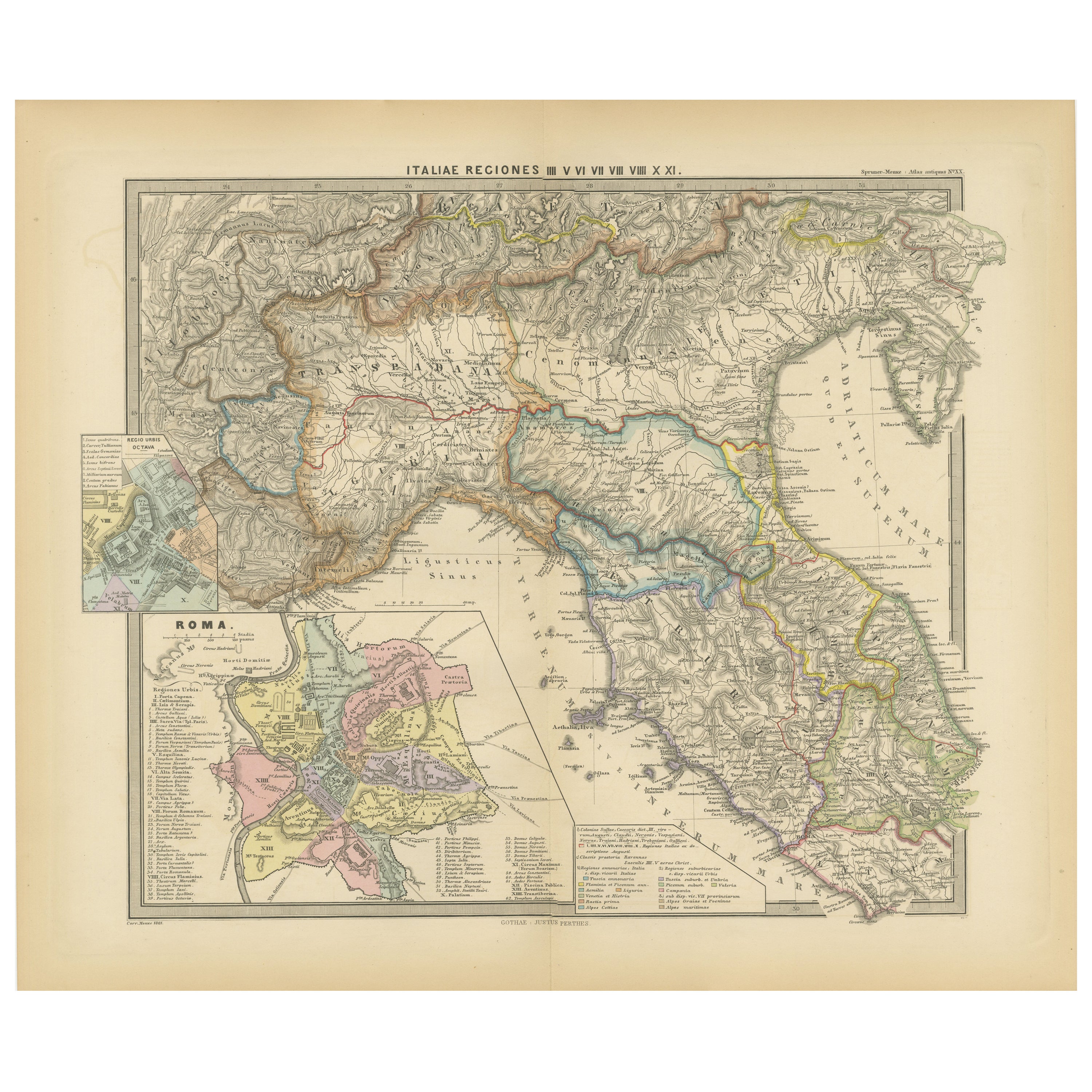
- Ancient Italy: Regions and Rome in the Roman Empire, Published in 1880Located in Langweer, NLThis print is an original detailed map titled "ITALIAE REGIONES I VII VIII IX XI," representing the regions of ancient Italy. Key Features of the Print: 1. **Regional Demarcations...Category
Antique 1880s Maps
MaterialsPaper
- Empires of Antiquity: The Persian Realm and Beyond Engraved, Published in 1880Located in Langweer, NLThe map is titled "ORBIS TERRARUM regni Persici tempore," which translates from Latin to "The World at the Time of the Persian Empire." This map is particularly interesting for sever...Category
Antique 1880s Maps
MaterialsPaper
- North African Coasts: Marmarica to Mauretania in Roman Times, Published in 1880Located in Langweer, NLThe map with the title "MARMARICA, CYRENAICA, AFRICA, NUMIDIA, MAURETANIA secundum Italiam Poetarum" presents a historical geographical view of the northern coast of Africa, detailin...Category
Antique 1880s Maps
MaterialsPaper
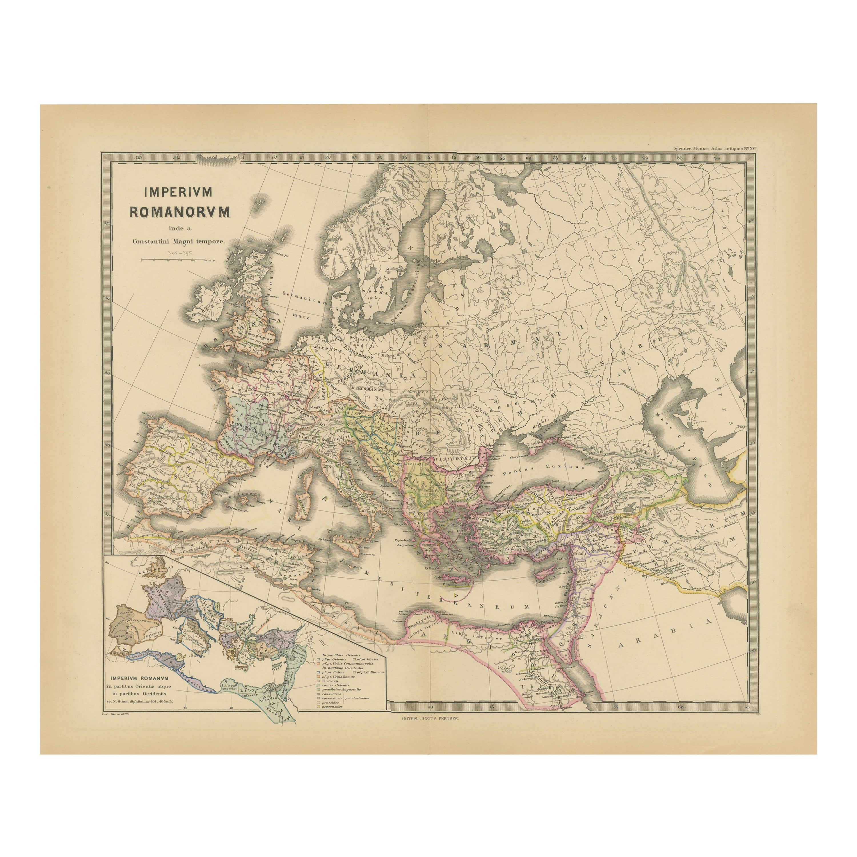
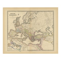
- The Roman Empire from the Time of Constantine the Great, Published in 1880Located in Langweer, NLAntique map titled: "IMPERIUM ROMANORUM inde a Constantini Magni tempore," which translates to "The Roman Empire from the time of Constantine the Great." This map is designed to re...Category
Antique 1880s Maps
MaterialsPaper
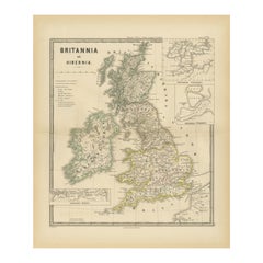
- Ancient Cartography of Britannia and Hibernia, Published in 1880Located in Langweer, NLThis map depicts the geographical area of Great Britain and Ireland, labeled "BRITANNIA et HIBERNIA." It is a historical map, as indicated by the Latin titles and the classical names of regions and tribes. In the main section of the map, Great Britain is depicted in fine detail, with topographical features such as mountains and rivers. The map is color-coded, to differentiate political or tribal boundaries. Various Roman place names are indicated, such as "Londinium" for London. To the left of Great Britain is Ireland, referred to as "Hibernia," similarly detailed with its own topographical features and ancient...Category
Antique 1880s Maps
MaterialsPaper
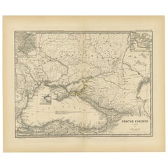
- Black Sea in Antiquity: Pontus Euxinus Map, Published in 1880Located in Langweer, NLThis map, titled "PONTUS EUXINUS," depicts the Black Sea region, historically known as the Pontus Euxinus. The Black Sea was central to ancient trade routes and cultural exchange, bo...Category
Antique 1880s Maps
MaterialsPaper

You May Also Like
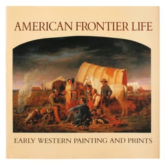
- American Frontier Life, Early Western Painting and PrintsLocated in valatie, NYAmerican Frontier Life, Early Western Painting and Prints. New York: Portland House, 1989. Hardcover with dust jacket. 202 pp. A coffee table book...Category
20th Century American Books
MaterialsPaper
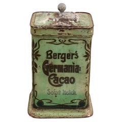
- Berger's Germania-Cacao Storage Tin 1900-1930Located in Oostrum-Venray, NLDiscover the charm of times gone by with this authentic Berger's Germania-Cacao storage tin. A unique piece of history, dating from the period 1900-1930, that is not only a beautifu...Category
Vintage 1920s German Art Nouveau Historical Memorabilia
MaterialsTin
- Map Holy Land La Terre Sainte Engraved van Loon Published N de Fer 1703 FrenchLocated in BUNGAY, SUFFOLKLa Terre Sainte, The Holy Land, Tiree Des Memoires De M.De.La Rue. Par N. de Fer. Geographe de Sa Majeste Catoliq et de Monseigneur le Dauphin. Avec Privil du Roi 1703 Detailed map of the Holy Land from Nicholas de Fer's L'Atlas Curieux ou le Monde. East is oriented at the top. MAKER Nicolas de Fer 1646-1720 The French cartographer and engraver, Nicolas de Fer, was a master at creating maps that were works of art. The maps that he published were printed during the Baroque period when the decorative arts were characterized by ornate detail. De Fer’s detailed maps and atlases were valued more for their decorative content than their geographical accuracy. Nicolas de Fer was born in 1646. His father, Antoine de Fer, owned a mapmaking firm. At the age of twelve, Nicolas was apprenticed to a Parisian engraver named Louis Spirinx. The family business was starting to decline when his father died in 1673. Nicolas de Fer’s mother, Genevieve, took over the business after the death of her husband. In 1687 the business was passed on to Nicolas and the profits increased after he took over the firm. Nicolas de Fer was a prolific cartographer who produced atlases and hundreds of single maps. He eventually became the official geographer to King Louis XIV of France and King Philip V...Category
Antique Early 1700s French Louis XIV Maps
MaterialsPaper
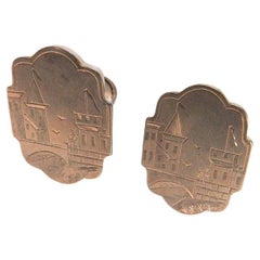
- Antique 1880s Victorian Gilded Age Engraved Cityscape Gold Filled CufflinksLocated in Seguin, TXAntique circa 1880's gilded age gold filled engraved cufflinks. Detailed engraving has castle, birds, flags, bridge on a cartouche shape. Back buttons flip up and still have good a...Category
Antique Late 19th Century American Victorian Collectible Jewelry
MaterialsGold Plate
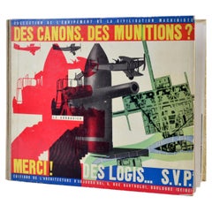
- Architecture book by Le Corbusier published in France in 1938By Le CorbusierLocated in SAINT-YRIEIX-SUR-CHARENTE, FR"Canons, ammunition? Thank you ! Homes... PLEASE" book by Le Corbusier in 1938. Editions l'Architecture d'Aujourd'hui, Collection de l'Equipement de la Civilisation Machiniste, 1938,...Category
Vintage 1930s French Art Deco Books
MaterialsPaper
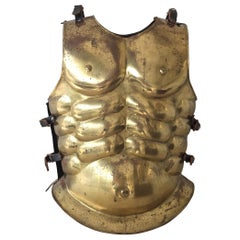
- Roman Gladiator Armour in BrassLocated in East Hampton, NYAnatomically correct chest plate/armor of a "True" Roman Gladiator, this Hollywood movie prop, is a wonderful full-sized brass piece with original leat...Category
Vintage 1960s American Classical Roman Busts
MaterialsBrass