Items Similar to Ancient Cartography of Britannia and Hibernia, Published in 1880

Want more images or videos?
Request additional images or videos from the seller
1 of 8
Ancient Cartography of Britannia and Hibernia, Published in 1880
About the Item
This map depicts the geographical area of Great Britain and Ireland, labeled "BRITANNIA et HIBERNIA." It is a historical map, as indicated by the Latin titles and the classical names of regions and tribes.
In the main section of the map, Great Britain is depicted in fine detail, with topographical features such as mountains and rivers. The map is color-coded, to differentiate political or tribal boundaries. Various Roman place names are indicated, such as "Londinium" for London.
To the left of Great Britain is Ireland, referred to as "Hibernia," similarly detailed with its own topographical features and ancient place names.
In the top right corner, there are three smaller inset maps:
1. "Orchades Ins.," which refers to the Orkney Islands.
2. "BRITANNIA PTOLEMAEI," which represents the British Isles according to Ptolemy's geography.
3. "BRITANNIA STRABONIS," showing the geographical perspective of the British Isles by Strabo, another ancient geographer.
At the bottom left, there is an illustration labeled "HADRIANI MVRVS," which represents Hadrian's Wall, the Roman defensive fortification in Northern Britain.
The text and inscriptions are in Latin, and the map has a grid overlay, suggesting it was meant for scholarly or educational use. The map’s detailed portrayal of ancient geographic knowledge indicates it was produced for a historical atlas, to illustrate the geographical understanding of the British Isles in ancient Roman times.
The map is from "Spruner-Menke Atlas Antiquus," which is a historical atlas compiled by Karl Spruner von Merz and edited by Theodorus Menke. This particular map, illustrating ancient Britain and Ireland (Britannia et Hibernia), is part of the series of maps found in this atlas, known for detailing the historical geography of different periods.
The atlas itself is a collection of maps that often includes supplementary information such as important historical notes, names of regions in Latin, and depictions of topographical features. These maps were used as educational tools and references for scholars interested in historical and classical studies.
Given the style and detail of the map, as well as the labeling in Latin, it is from a 19th-century edition of the atlas, which sought to present the classical and medieval geography of the world as understood at the time.
- Dimensions:Height: 18.51 in (47 cm)Width: 15.56 in (39.5 cm)Depth: 0 in (0.02 mm)
- Materials and Techniques:
- Period:
- Date of Manufacture:1880
- Condition:Good, given age. General age-related toning, especially around the edges. Horizontall folding line as issued. Please study scan carefully.
- Seller Location:Langweer, NL
- Reference Number:
About the Seller
5.0
Platinum Seller
These expertly vetted sellers are 1stDibs' most experienced sellers and are rated highest by our customers.
Established in 2009
1stDibs seller since 2017
1,916 sales on 1stDibs
Typical response time: <1 hour
- ShippingRetrieving quote...Ships From: Langweer, Netherlands
- Return PolicyA return for this item may be initiated within 14 days of delivery.
More From This SellerView All
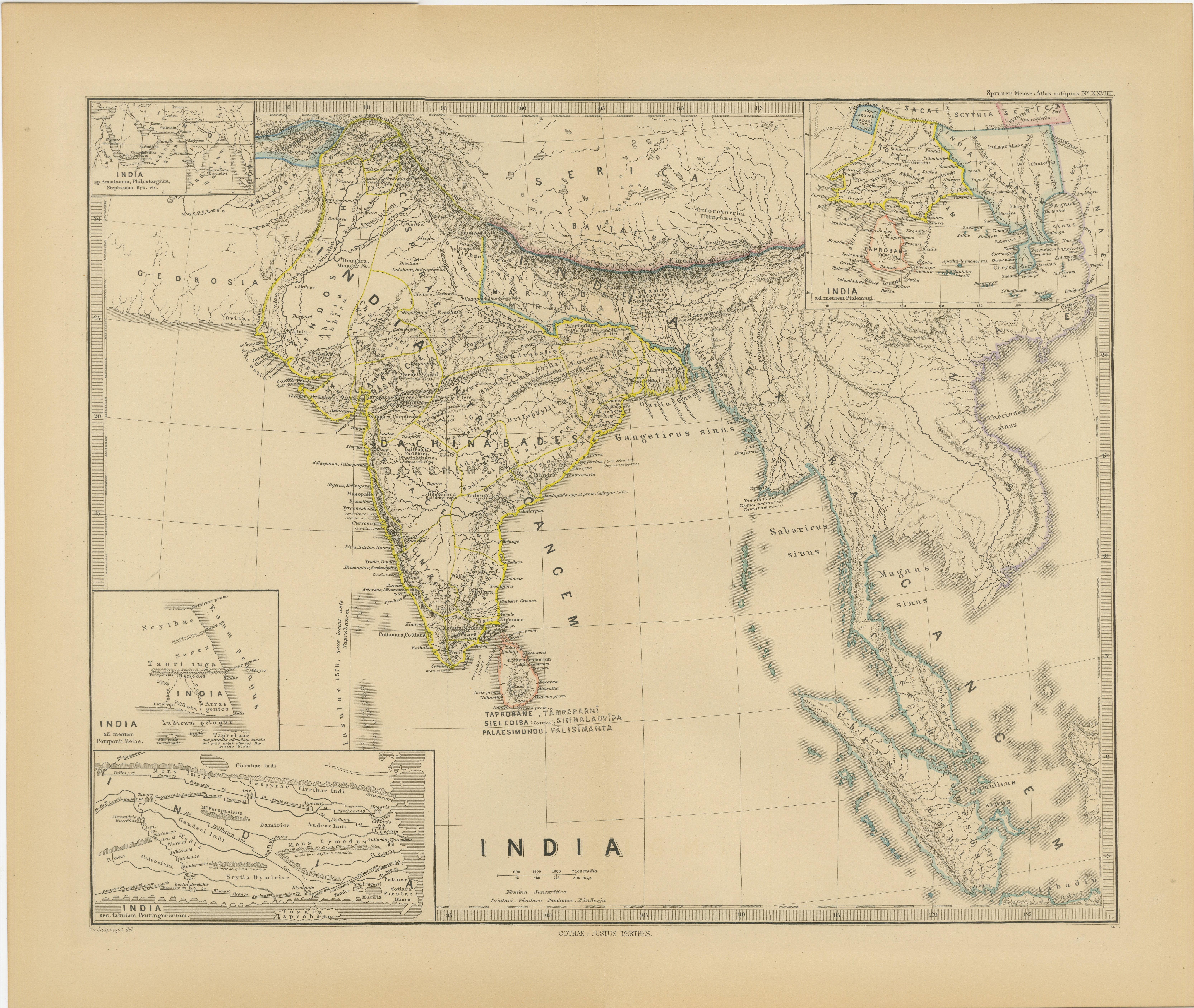
- Ancient Cartography of the Indian Subcontinent, Published in 1880Located in Langweer, NLThis map is titled "INDIA," and it provides a detailed view of the Indian subcontinent with various inset maps that offer additional historical and geographical context. The main ma...Category
Antique 1880s Maps
MaterialsPaper
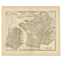
- Ancient Gaul: A Cartographic Overview of Gallic Tribes and Roman Provinces, 1880Located in Langweer, NLThe print titled "GALLIA," is a historical map of ancient Gaul, which corresponds to modern-day France and parts of its surrounding countries. Here are the features and details noted...Category
Antique 1880s Maps
MaterialsPaper
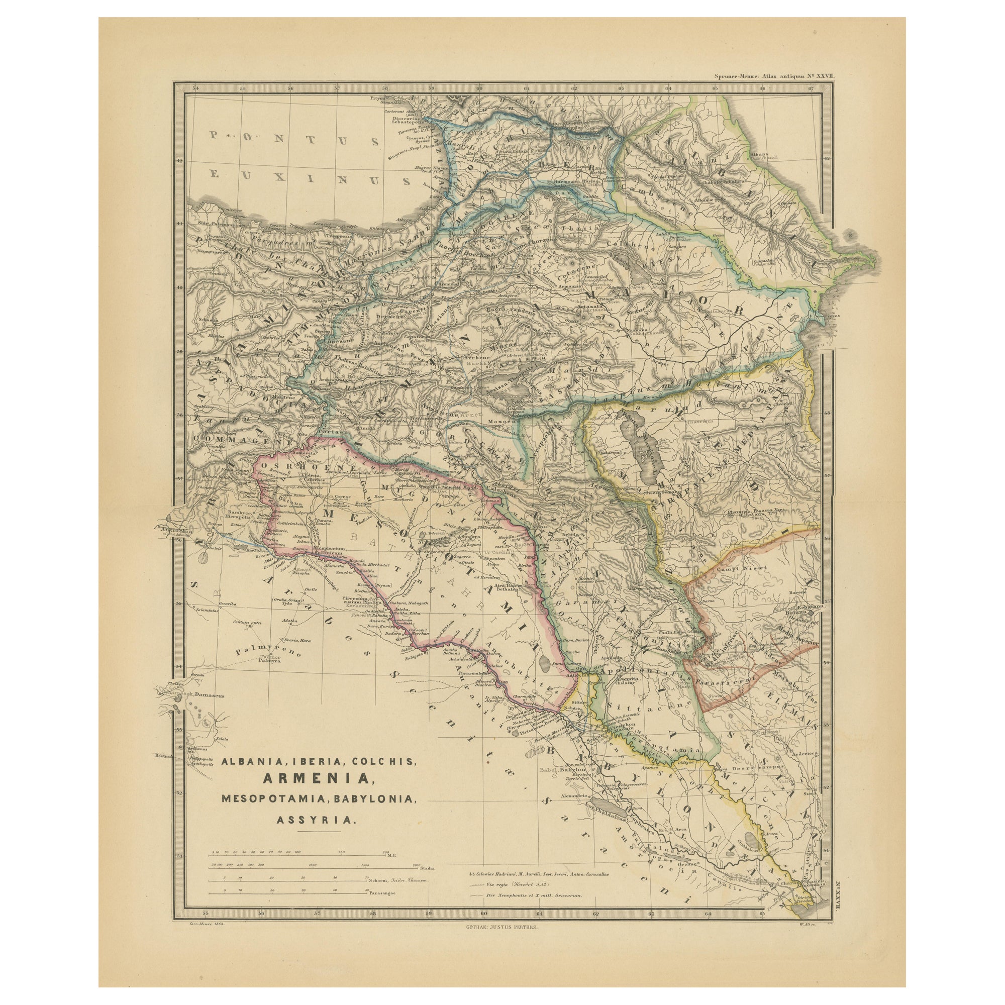
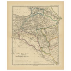
- Ancient Crossroads: Albania to Assyria in Antiquity, Published in 1880Located in Langweer, NLThe map titled "ALBANIA, IBERIA, COLCHIS, ARMENIA, MESOPOTAMIA, BABYLONIA, ASSYRIA" portrays the ancient regions that would encompass parts of modern-day Eastern Turkey, Armenia, Aze...Category
Antique 1880s Maps
MaterialsPaper
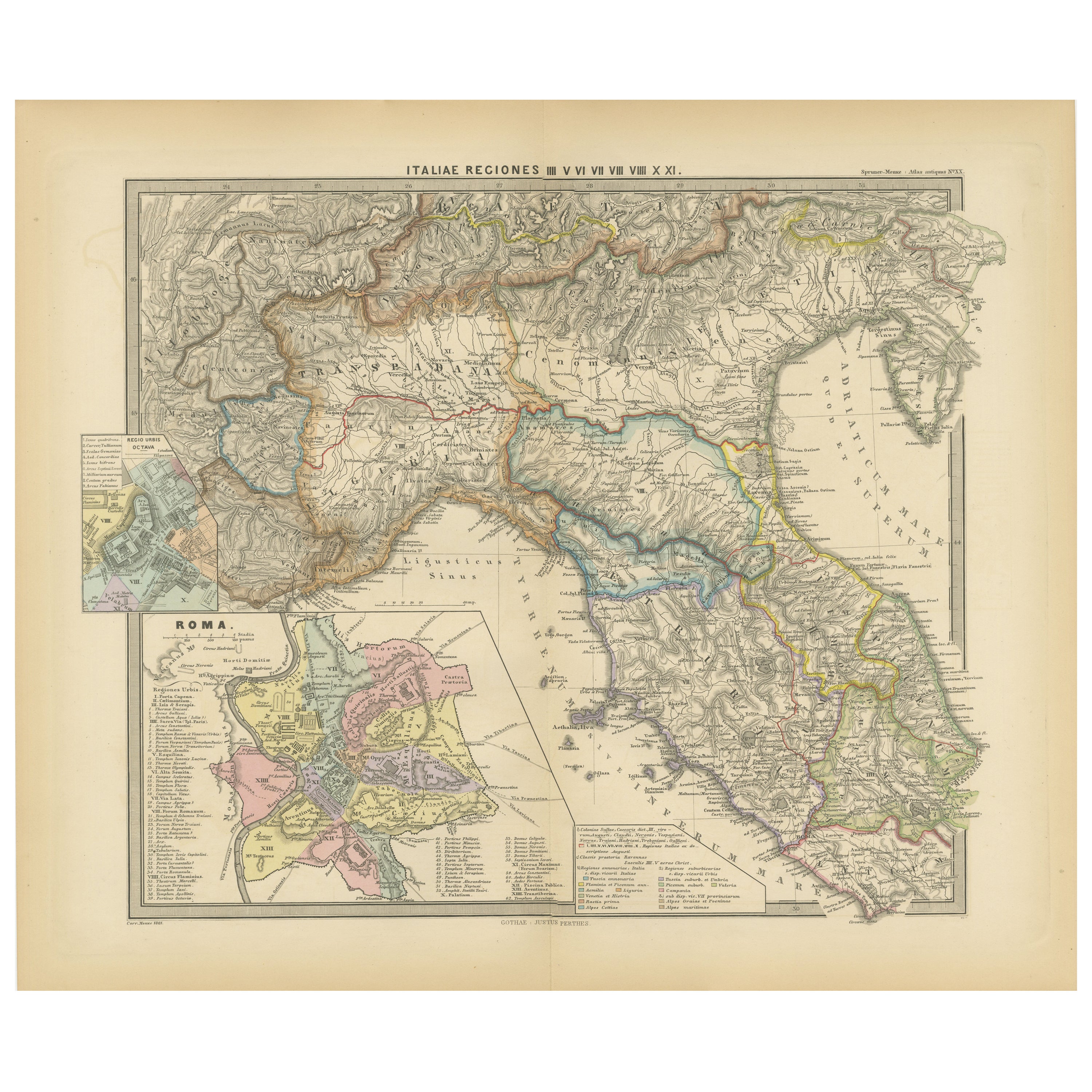
- Ancient Italy: Regions and Rome in the Roman Empire, Published in 1880Located in Langweer, NLThis print is an original detailed map titled "ITALIAE REGIONES I VII VIII IX XI," representing the regions of ancient Italy. Key Features of the Print: 1. **Regional Demarcations...Category
Antique 1880s Maps
MaterialsPaper
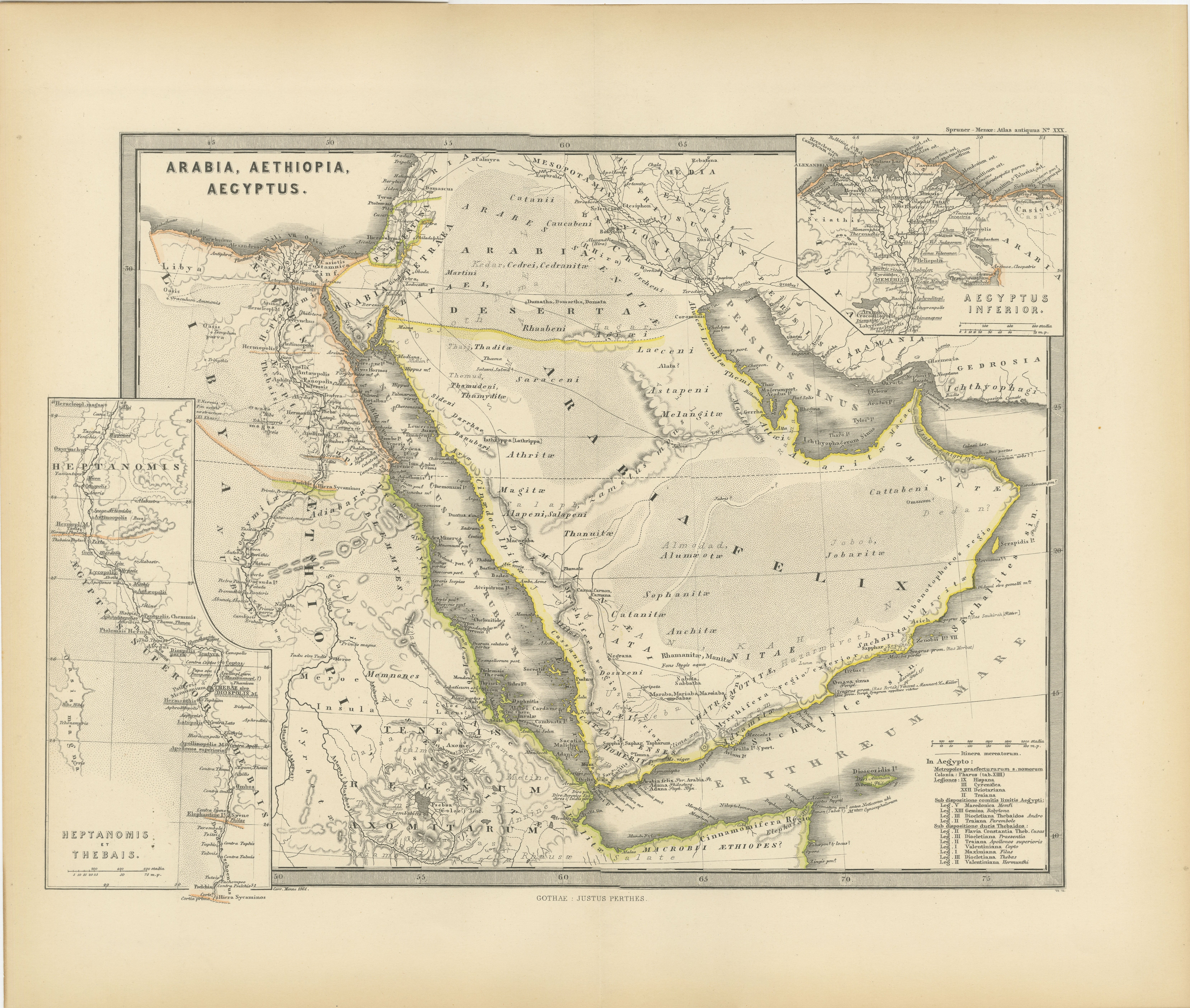
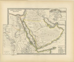
- Ancient Realms of Northeast Africa: Arabia, Ethiopia, and Egypt, Published 1880Located in Langweer, NLThis map, titled "ARABIA, AETHIOPIA, AEGYPTUS," illustrates the regions of ancient Arabia, Ethiopia, and Egypt. Features that make this map interesting include: 1. **Geographical ...Category
Antique 1880s Maps
MaterialsPaper
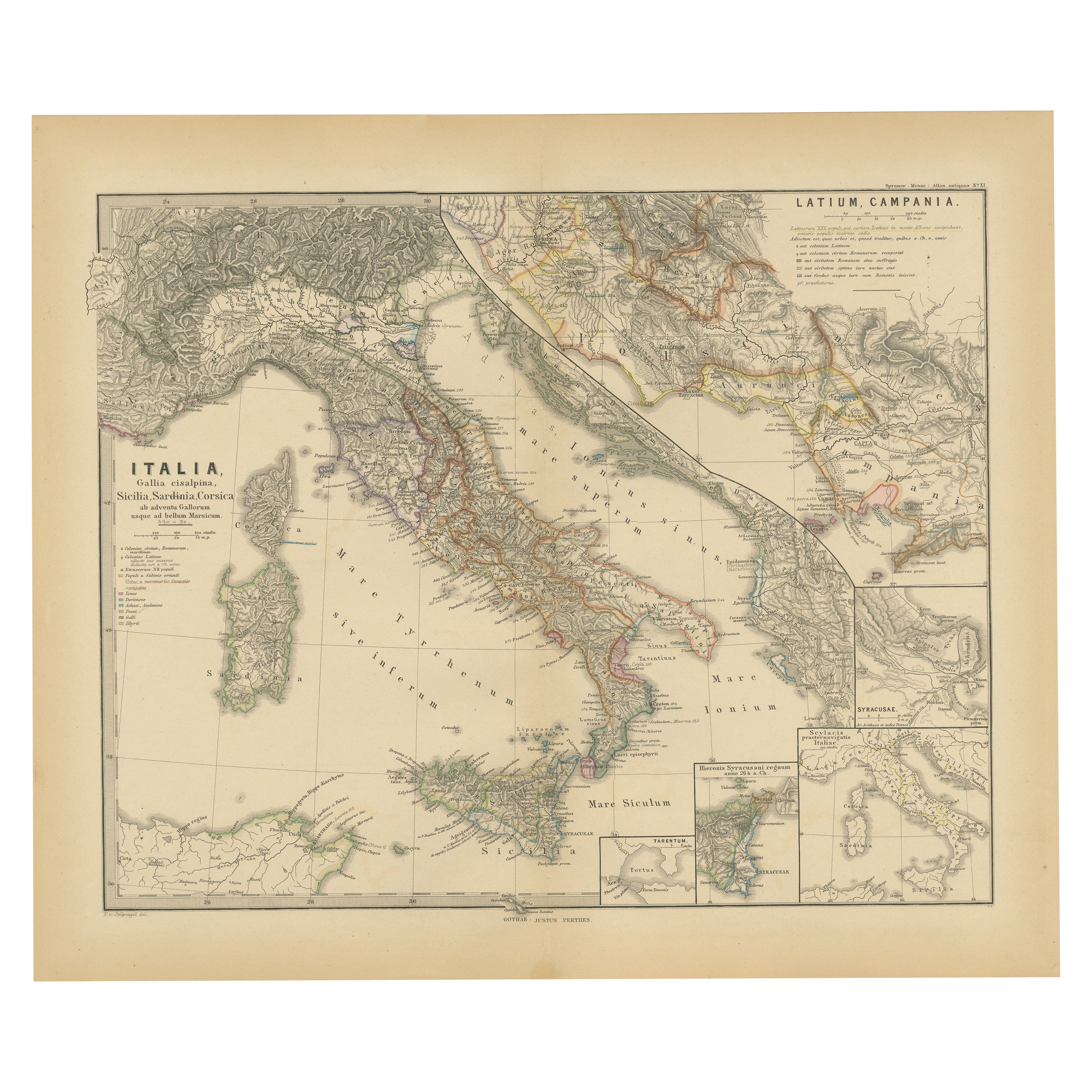
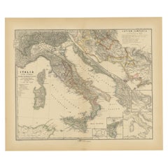
- Roman Italy and Provinces: A Cartographic Snapshot, 1880Located in Langweer, NLThe map titled "ITALIA, Gallia Cisalpina, Sicilia, Sardinia, Corsica" focuses on Italy and its surrounding regions during Roman times. It offers a detailed depiction of the Italian peninsula, the Po Valley (Gallia Cisalpina), and the islands of Sicily, Sardinia, and Corsica. Produced as part of the "Spruner-Menke Atlas Antiquus" by Karl Spruner von Merz and edited by Theodorus Menke, this map reflects the 19th-century European scholarship on ancient geography and history. The period represented is likely during the Roman Republic or early Roman Empire, suggested by the level of detail in regions like Latium and Campania, which were central to Roman culture and power. This era was marked by Roman expansion and consolidation of the Italian peninsula, as well as the Punic Wars, which led to Roman dominance over the Mediterranean. What makes this map interesting is its: 1. **Rich Detail**: The map delineates the intricate network of Roman roads, cities, and colonies, showing the infrastructure that facilitated Roman administration and control. 2. **Strategic Locations**: It identifies strategic locations like harbors and passes, crucial for trade and military campaigns. 3. **Geographic Accuracy**: It reflects the geographical knowledge of the time, with an accurate representation of the topography that shaped the development of these regions. 4. **Cultural and Historical Sites**: Insets of important sites like Syracuse offer a closer look at places of historical significance. 5. **Educational Purpose**: The map was designed to aid in the study of Roman history, providing a visual tool for understanding the ancient world...Category
Antique 1880s Maps
MaterialsPaper


You May Also Like
- Antique Oarsman's Map of the River Thames, English, Cartography, Published 1912Located in Hele, Devon, GBThis is an antique copy of The Oarsman's and Angler's Map of the River Thames - New Edition. An English, bound map book, published in English by Edward Stanford, London, this new edi...Category
Early 20th Century British Other Books
MaterialsPaper
- Sun and Moon a Story of Astronomy, Photography and CartographyLocated in New York City, NYA unique pictorial history of astronomical exploration from the earliest Prehistoric observatories to the latest satellite images with 280 spectacular images and an inspiring story i...Category
21st Century and Contemporary European Books
MaterialsPaper
- Antique Lithography Map of Cheshire, English, Framed, Cartography, VictorianLocated in Hele, Devon, GBThis is an antique lithography map of Cheshire. An English, framed atlas engraving of cartographic interest, dating to the mid 19th century and lat...Category
Antique Mid-19th Century British Victorian Maps
MaterialsWood
- Works of Alexander Pope Leatherbound in 9 Volumes Published 1757Located in San Francisco, CAA handsome set of the works of Alexander Pope (1688-1744) the famous English satirist and poet. Pope suffered various health issues throughout his life but with a fierce spirit and work ethic managed to produce a large volume of significant work. The volumes appear to retain their original full calf...Category
Antique Mid-18th Century English Georgian Books
MaterialsLeather, Paper
- Antique Lithography Map, Isle of Wight, English, Framed, Engraving, CartographyLocated in Hele, Devon, GBThis is an antique lithography map of the Isle of Wight. An English, framed atlas engraving of cartographic interest, dating to the early 19th century and later. Superb lithography ...Category
Antique Early 19th Century British Regency Maps
MaterialsWood
- Very Large Vintage Map of Canada, German, Education, Institution, CartographyLocated in Hele, Devon, GBThis is a very large vintage map of Canada. A German, quality printed educational or institution map, dating to the mid 20th century, circa 1965....Category
Mid-20th Century German Maps
MaterialsPaper