Items Similar to Ancient Cartography of the Indian Subcontinent, Published in 1880

Want more images or videos?
Request additional images or videos from the seller
1 of 7
Ancient Cartography of the Indian Subcontinent, Published in 1880
About the Item
This map is titled "INDIA," and it provides a detailed view of the Indian subcontinent with various inset maps that offer additional historical and geographical context.
The main map displays the Indian subcontinent with regions labeled in Latin, indicative of the territories as known in ancient and classical times. The map features:
1. **Geographical Features**: The Himalayas, the extensive river systems including the Ganges and Indus, and the outline of the subcontinent with its peninsular south.
2. **Political Divisions**: It might show ancient political divisions such as the Maurya and Gupta empires or regions under control of various dynasties and states before European colonization.
3. **Inset Maps**: These provide close-ups of significant regions or areas with historical importance, such as the Ganges river valley or trade routes.
4. **Historical Routes**: The map could include ancient trade routes like the Silk Road and maritime paths used by traders to reach Southeast Asia, the Middle East, and East Africa.
5. **Latin Labels**: Following the convention of the time it was created, the map uses Latin for place names, which aligns with its educational and scholarly purposes.
6. **Topographical Details**: Mountain ranges, plateaus, and coastal lines are depicted, showing the diverse topography of India.
This map is from the "Spruner-Menke Atlas Antiquus". The time period the map represents could span from the ancient Vedic period through successive empires like the Mauryan and Gupta empires up to the medieval period, reflecting the knowledge of India available to European scholars in the 19th century. This map would be of particular interest to historians of ancient India and those studying the historical geography of the subcontinent.
- Dimensions:Height: 15.56 in (39.5 cm)Width: 18.51 in (47 cm)Depth: 0 in (0.02 mm)
- Materials and Techniques:
- Period:
- Date of Manufacture:1880
- Condition:Good, given age. General age-related toning, especially around the edges. Vertical folding line as issued. Please study scan carefully.
- Seller Location:Langweer, NL
- Reference Number:
About the Seller
5.0
Platinum Seller
These expertly vetted sellers are 1stDibs' most experienced sellers and are rated highest by our customers.
Established in 2009
1stDibs seller since 2017
1,928 sales on 1stDibs
Typical response time: <1 hour
- ShippingRetrieving quote...Ships From: Langweer, Netherlands
- Return PolicyA return for this item may be initiated within 14 days of delivery.
More From This SellerView All
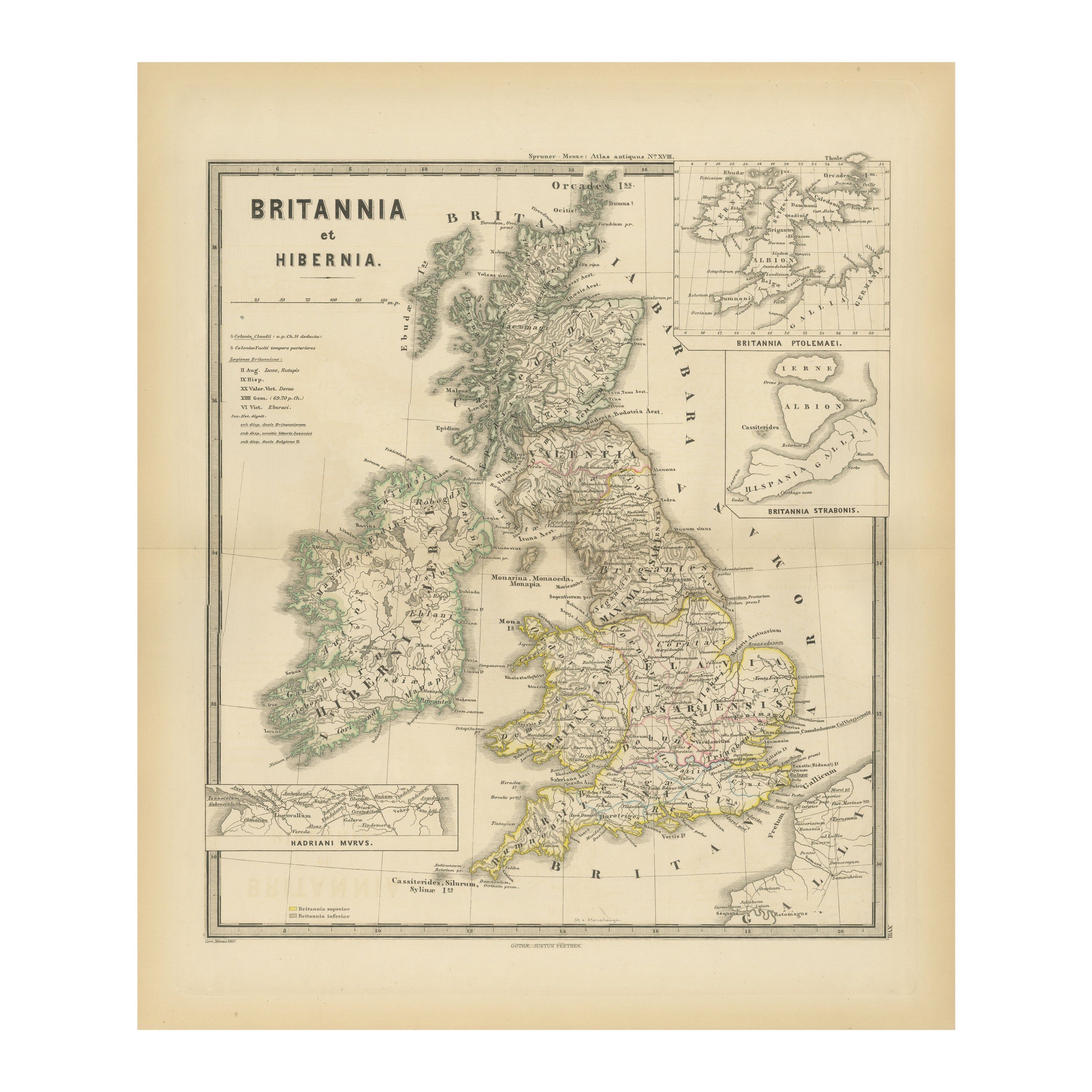
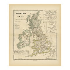
- Ancient Cartography of Britannia and Hibernia, Published in 1880Located in Langweer, NLThis map depicts the geographical area of Great Britain and Ireland, labeled "BRITANNIA et HIBERNIA." It is a historical map, as indicated by the Latin titles and the classical names of regions and tribes. In the main section of the map, Great Britain is depicted in fine detail, with topographical features such as mountains and rivers. The map is color-coded, to differentiate political or tribal boundaries. Various Roman place names are indicated, such as "Londinium" for London. To the left of Great Britain is Ireland, referred to as "Hibernia," similarly detailed with its own topographical features and ancient...Category
Antique 1880s Maps
MaterialsPaper
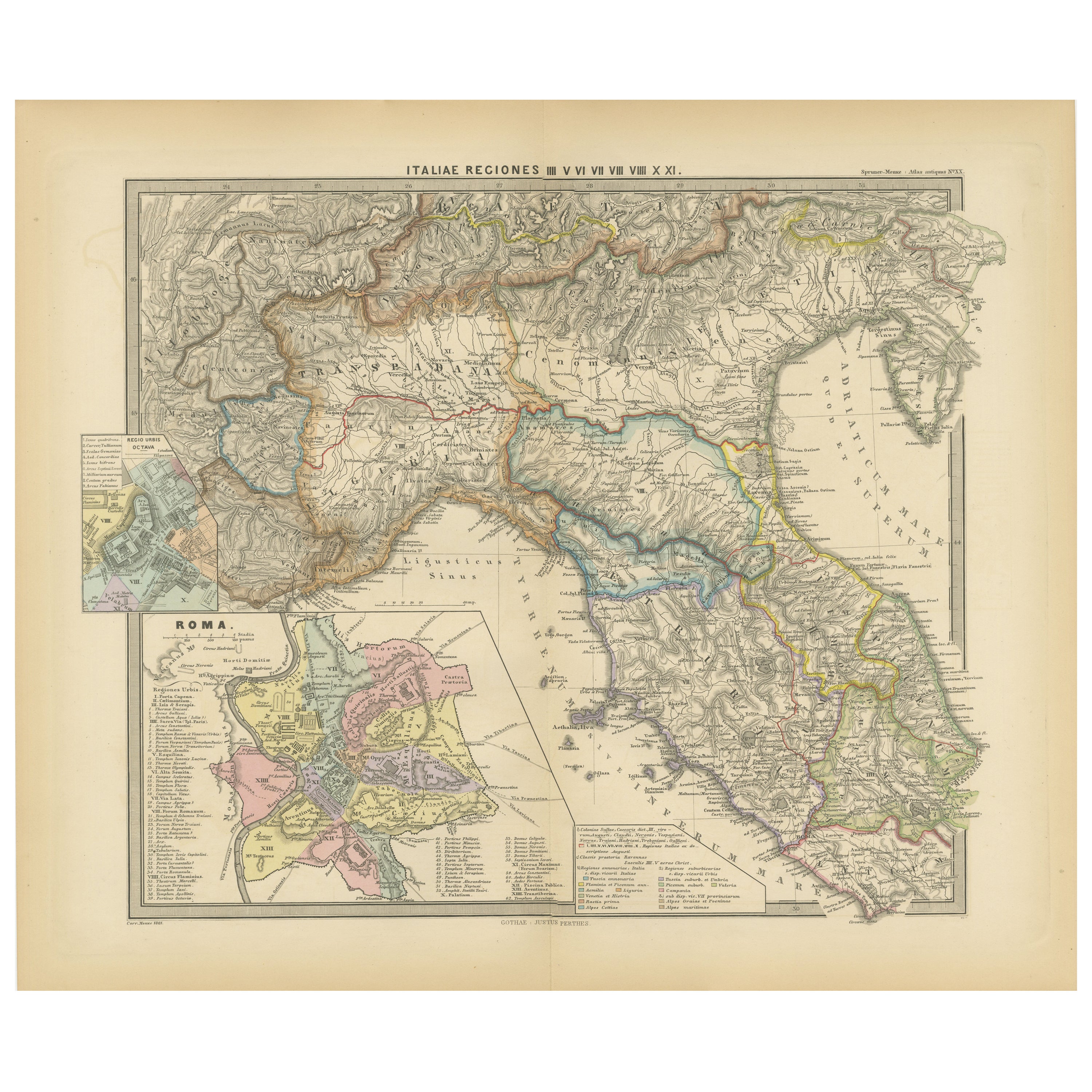
- Ancient Italy: Regions and Rome in the Roman Empire, Published in 1880Located in Langweer, NLThis print is an original detailed map titled "ITALIAE REGIONES I VII VIII IX XI," representing the regions of ancient Italy. Key Features of the Print: 1. **Regional Demarcations...Category
Antique 1880s Maps
MaterialsPaper
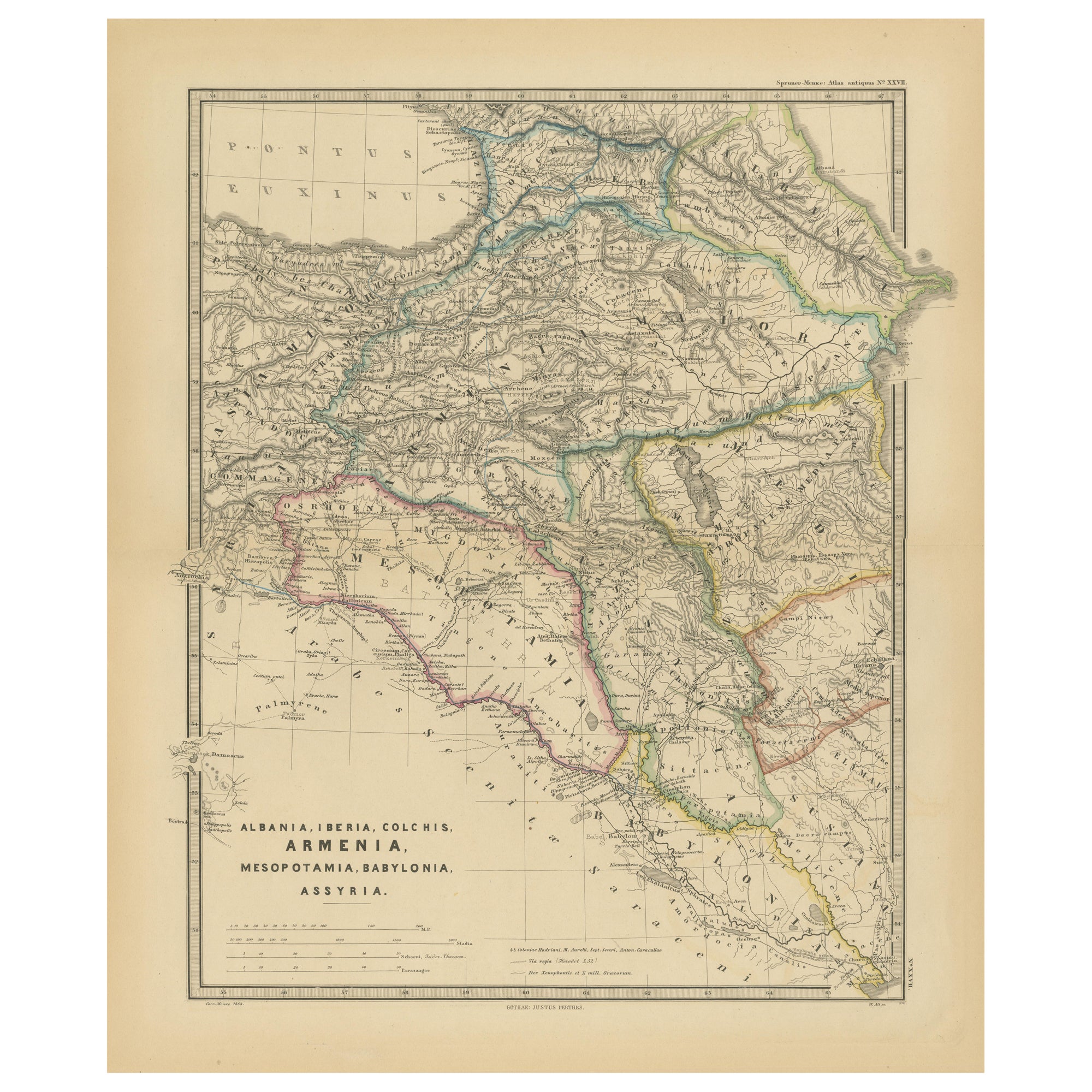
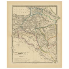
- Ancient Crossroads: Albania to Assyria in Antiquity, Published in 1880Located in Langweer, NLThe map titled "ALBANIA, IBERIA, COLCHIS, ARMENIA, MESOPOTAMIA, BABYLONIA, ASSYRIA" portrays the ancient regions that would encompass parts of modern-day Eastern Turkey, Armenia, Aze...Category
Antique 1880s Maps
MaterialsPaper
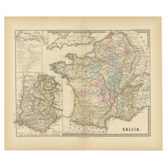
- Ancient Gaul: A Cartographic Overview of Gallic Tribes and Roman Provinces, 1880Located in Langweer, NLThe print titled "GALLIA," is a historical map of ancient Gaul, which corresponds to modern-day France and parts of its surrounding countries. Here are the features and details noted...Category
Antique 1880s Maps
MaterialsPaper
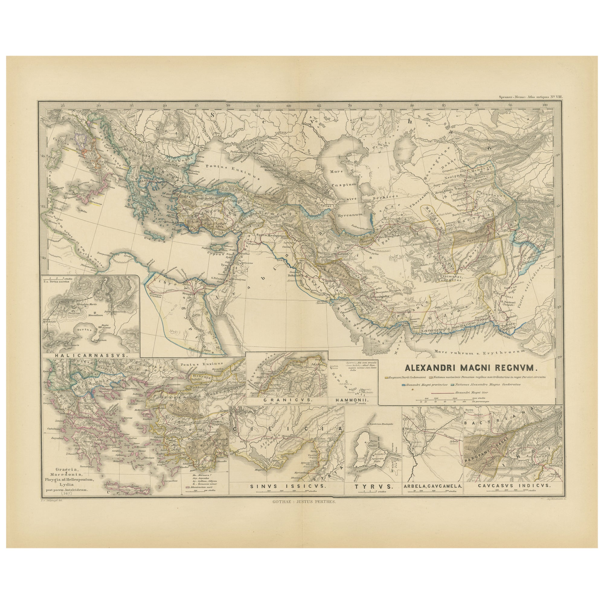
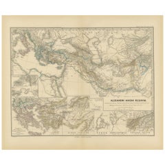
- Antique Map of The Kingdom of Alexander the Great, Published in 1880Located in Langweer, NLThe map is titled "ALEXANDRI MAGNI REGNUM," which translates to "The Kingdom of Alexander the Great." It depicts the vast territories conquered by Alexander the Great during his reig...Category
Antique 1880s Maps
MaterialsPaper
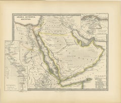
- Ancient Realms of Northeast Africa: Arabia, Ethiopia, and Egypt, Published 1880Located in Langweer, NLThis map, titled "ARABIA, AETHIOPIA, AEGYPTUS," illustrates the regions of ancient Arabia, Ethiopia, and Egypt. Features that make this map interesting include: 1. **Geographical ...Category
Antique 1880s Maps
MaterialsPaper

You May Also Like
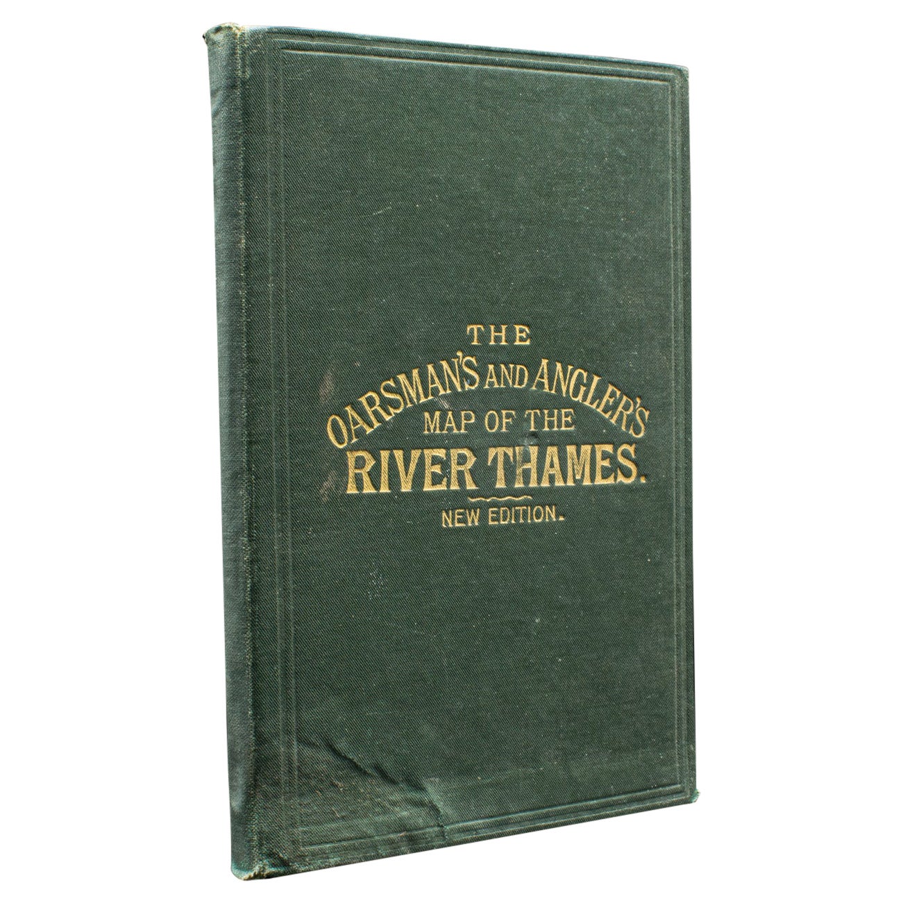
- Antique Oarsman's Map of the River Thames, English, Cartography, Published 1912Located in Hele, Devon, GBThis is an antique copy of The Oarsman's and Angler's Map of the River Thames - New Edition. An English, bound map book, published in English by Edward Stanford, London, this new edi...Category
Early 20th Century British Other Books
MaterialsPaper
- The Works of Francis Rabelais in 4 Leatherbound Volumes Published In London 1784Located in San Francisco, CAThe works of Francis Rabelais, translated from the French in 4 full original calf bindings with gilt tooled spines published in London by T. Evans in the Strand in 1784. Rabelais was...Category
Antique Mid-18th Century English Georgian Books
MaterialsLeather, Paper
- The Works of Edmund Burke in Eight Leatherbound Volumes Published 1808Located in San Francisco, CAThe Works of the Right Honorable Edmund Burke in 8 volumes published for F.C. and J. Rivington, St. Paul's Yard, England by Luke Hanfard and Sons, near Lincoln's-Inn Fields. This att...Category
Antique Early 19th Century English Books
MaterialsLeather, Paper
- The Works of Turgenev in 15 Leatherbound Volumes Published London: 1916Located in San Francisco, CAThe Works of Ivan Turgenev (1818-1883) in 15 volumes, the large type fine paper edition, bound in 3/4 leather, published by William Heinemann, London 1916. Includes the author's most...Category
Early 20th Century English Books
MaterialsLeather, Paper
- The Life of Benvenuto Cellini in 2 volumes. Published: 1906 by Brentanos.Located in San Francisco, CAThe Life of Benvenuto Cellini in 2 volumes. Published: 1906 by Brentanos. Top edges gilt. Cellini (1500-1571) was an Italian Renaissance goldsmith, sculptor, and author whose most fa...Category
Antique Early 1900s Books
MaterialsLeather, Paper
- Ancient Temple in Lacquered Wood from the End of the 1600sLocated in Cesena, FCBeautiful rare temple dating back to around the second half of the 17th century in the middle of the Baroque period made of finely carved and gilded wood. Rich sculpted decoration, carving with volute curls. The perforated and gilded dome is of great value. Beautiful old patina. The structure has 8 columns...Category
Antique 1680s Italian Baroque Architectural Models
MaterialsWood, Lacquer