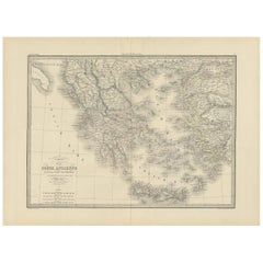
Maps From Greece
8
to
30
156
135
126
81
73
45
37
34
34
28
14
13
12
11
11
11
10
8
7
7
6
6
4
4
4
4
3
3
3
3
2
2
2
2
2
2
2
1
1
1
1
1
1
1
1
1
1
1
1
51
11
8
7
4
Sort By
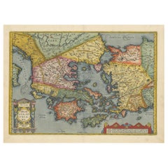
Antique Map of Greece from Ortelius's Theatrum Orbis Terrarum, 1595
Located in Langweer, NL
atlases, with maps that were the most up-to-date of their time.
The map depicts ancient Greece, and
Category
Antique 16th Century Maps
Materials
Paper
Free Shipping
H 17.92 in W 21.86 in D 0 in
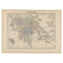
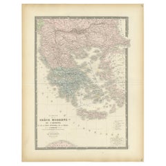
Antique Map of Greece from an Old French School Atlas, 1880
Located in Langweer, NL
Antique map titled 'Grèce Moderne '. Old map of Greece and surroundings. This map originates from
Category
Antique 19th Century Maps
Materials
Paper
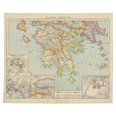
Antique Map of Southern Greece, 1892
Located in Langweer, NL
Antique map of Greece titled 'Griechenland. Südlicher Theil'. Old map of Southern Greece with inset
Category
Antique 19th Century Maps
Materials
Paper
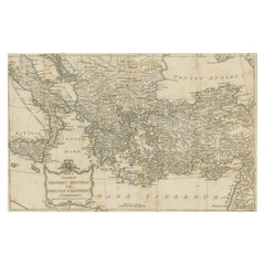
Antique Map of the Ancient Greek Colonization
Located in Langweer, NL
'. Original antique map of the ancient Greek colonization. Frontispiece map of 'The History of Ancient Greece
Category
Antique Late 18th Century Maps
Materials
Paper
Antique Map of Greece by Levasseur, '1875'
Located in Langweer, NL
Antique map titled 'Carte de la Grèce Modernde de l'Archipel'. Large map of Greece. This map
Category
Antique Late 19th Century Maps
Materials
Paper
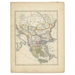
Antique Map of Turkey and Greece, 1852
Located in Langweer, NL
Antique map titled 'Europisch Turkije en Griekenland'. Map of Turkey in Europe and Greece. This map
Category
Antique 19th Century Maps
Materials
Paper
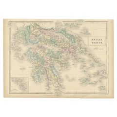
Antique Map of Greece with an Inset Map of Corfu, 1854
Located in Langweer, NL
Antique map titled 'Hellas or Greece'. Old map of Greece with an inset map of Corfu. This map
Category
Antique 19th Century Maps
Materials
Paper
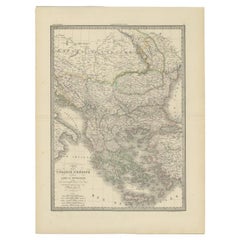
Antique Map of Turkey and Greece, 1842
By Pierre M. Lapie
Located in Langweer, NL
Antique map titled 'Carte de la Turquie d'Europe et de la Grèce Moderne'. Map of Turkey and Greece
Category
Antique 19th Century Maps
Materials
Paper
Antique Map of Greece by Lapie, 1842
Located in Langweer, NL
Antique map titled 'Carte de la Grèce Ancienne'. Map of Greece. This map originates from 'Atlas
Category
Antique Mid-19th Century Maps
Materials
Paper
Antique Map of Greece and Macedonia, 1848
Located in Langweer, NL
Antique map titled 'Graecia Epirus Macedonia Moesia Thracia'. Old map of Greece originating from
Category
Antique 19th Century Maps
Materials
Paper
Antique Map of Greece and Macedonia, 1825
Located in Langweer, NL
Antique map titled 'Graecia, Macedonia Thracia et Jllyricum'. Old map of Greece and Macedonia
Category
Antique 19th Century Maps
Materials
Paper
Large Scale Map of Greece with Inset Map of Macedonia, c.1786
Located in Langweer, NL
Antique map titled 'Graeciae Antiquae'. Large scale map of Greece, extends south to the island of
Category
Antique 18th Century Maps
Materials
Paper
Charming 18th Century Miniature Map of Greece, 1685
Located in Langweer, NL
Antique map titled 'Graeciae Descriptio.' Charming miniature map of Greece from the pocket atlas
Category
Antique 17th Century Maps
Materials
Paper
Antique Map of Greece with Two Small Inset Maps of Athens, c.1870
Located in Langweer, NL
Antique map titled 'Graecia'. Old map of Greece with two small inset maps of Athens. This map
Category
Antique 19th Century Maps
Materials
Paper
Original Antique Map of Greece and part of Turkey
Located in Langweer, NL
Greece and part of Turkey. This map originates from 'Le nouveau et curieux Atlas Geographique et
Category
Antique Early 18th Century Maps
Materials
Paper
Antique Map of Greece by Keizer & de Lat, 1788
Located in Langweer, NL
antique map of Greece. This map originates from 'Nieuwe Natuur- Geschied- en Handelkundige Zak- en
Category
Antique Late 18th Century Maps
Materials
Paper
Antique Map of European Turkey and Greece by Lowry '1852'
Located in Langweer, NL
Antique map titled 'European Turkey and Greece with the Ionian Islands'. Original map of European
Category
Antique Mid-19th Century Maps
Materials
Paper
Antique Map of Turkey and Greece by Petri, c.1873
Located in Langweer, NL
Greece. This map originates from 'School-Atlas van alle Deelen der Aarde'.
Artists and Engravers
Category
Antique 19th Century Maps
Materials
Paper
Antique Map of Greece with an Inset Map of the Upper Danube Region, c.1720
Located in Langweer, NL
of Greece, the Balkans and contiguous parts of the Adriatic and Aegean Seas. The map is decorated
Category
Antique 18th Century Maps
Materials
Paper
H 21.07 in W 25.2 in D 0 in
Decorative Original Antique Map of Greece by Ortelius, c.1609
Located in Langweer, NL
map of Greece and surrounding Islands and contiguous regions. Based on the work of Giacomo Gastaldi
Category
Antique 17th Century Maps
Materials
Paper
Antique Map of Greece and Its Colonies, with Frame Style Border
Located in Langweer, NL
Antique map titled 'La Grèce'. Attractive map of Greece and its Colonies. The map covers from the
Category
Antique Mid-19th Century Maps
Materials
Paper
Antique Map of the Islands of Schiatti and Scopoli, Greece, 1687
Located in Langweer, NL
Antique map titled 'Schiatti - Scopoli.' This original antique map shows the islands Schiatti and
Category
Antique 17th Century Maps
Materials
Paper
Greece 1660 Jan Jansson Watercolour Map Peloponesus Sive Morea I Laurenbergio
Located in GB
We are delighted to offer for sale this Jan Jansson Date: 1660 (published) Amsterdam map of Greece
Category
Antique 1660s Danish Dutch Colonial Maps
Materials
Copper
H 20.08 in W 23.43 in D 0.79 in
Antique Map of Italy and Greece by H. Kiepert, circa 1870
By Heinrich Kiepert
Located in Langweer, NL
Antique map titled 'Italiae pars media'. This map originates from 'Atlas Antiquus. Zwölf Karten zur
Category
Antique Late 19th Century Maps
Materials
Paper
Antique Map of Greece and Ionian Islands by A & C. Black, 1870
Located in Langweer, NL
Antique map titled 'Hellas or Greece'. Original antique map of Greece and Ionian Islands with inset
Category
Antique Late 19th Century Maps
Materials
Paper
Hand-Colored 18th Century Homann Map of the Danube, Italy, Greece, Croatia
By Johann Baptist Homann
Located in Alamo, CA
decorative cartouche and a large inset map of the Upper Danube region and excellent detail of the Greek and
Category
Antique Early 18th Century German Maps
Materials
Paper
H 20 in W 23.88 in D 0.07 in
Old Engraved Map of Hungary, European Balkan Countries, Greece and Crete, 1806
Located in Langweer, NL
Antique map titled 'Hongrie, Turquie Europe'.
Decorative map of Hungary, southeast European
Category
Antique 19th Century Maps
Materials
Paper
H 15.08 in W 11.34 in D 0 in
Antique Map of Nisari, Le Simie, Carchi Elimoia and Piscopia, Greece, 1687
Located in Langweer, NL
Antique map titled 'Carchi Elimoia, Nisari, Le Simie, Piscopia.' Sheet with four maps on one page
Category
Antique 17th Century Maps
Materials
Paper
H 15.24 in W 12.09 in D 0 in
Original Antique Map of Leros and Kalimnos, and other islands, Greece, 1687
Located in Langweer, NL
Antique map titled 'Lero, Calamo, Zanara e Levita, Amorgo.'
heet with four maps on one page
Category
Antique 17th Century Maps
Materials
Paper
H 15.56 in W 12.09 in D 0 in
Original Antique Map of Greece and Epirus after the Persian Wars, Published 1880
Located in Langweer, NL
The map titled "GRAECIA, EPIRUS post bella Persica," translates to "Greece and Epirus after the
Category
Antique 1880s Maps
Materials
Paper
Free Shipping
H 18.51 in W 15.56 in D 0 in
Antique Map of Asia Minor including part of the Greek Archipelago and Cyprus
Located in Langweer, NL
Antique map titled 'Chersonesi quae hodie Natolia Descriptio'. Decorative, smaller map of Asia
Category
Antique Mid-18th Century Maps
Materials
Paper
H 9.69 in W 11.42 in D 0.02 in
Balkan Convergence: A Map of Turkey and Greece with the Balkan States, 1882
Located in Langweer, NL
This map, "TURKEY AND GREECE including ROUMANIA, SERVIA, BULGARIA, BOSNIA & MONTENEGRO," extracted
Category
Antique 1880s Maps
Materials
Paper
H 22.45 in W 14.97 in D 0 in
Southern Greece: A Large 17th C. Hand-colored Map by Sanson and Jaillot
By Nicolas Sanson
Located in Alamo, CA
This large original hand-colored copperplate engraved map of southern Greece and the Pelopponese
Category
Antique 1690s French Maps
Materials
Paper
Original Map of Greece at the Time of the Dorian Migration, Published in 1880
Located in Langweer, NL
The map titled "GRAECIA TEMPORI MIGRATIONIS DORICAE," translates to "Greece at the Time of the
Category
Antique 1880s Maps
Materials
Paper
No Reserve
H 15.56 in W 18.51 in D 0 in
Map of the Ottoman Empire in Europe, incl. the Balkans, Greece & Turkey, c.1760
Located in Langweer, NL
'.
Map of the Ottoman Empire in Europe, the Balkans, Greece, and Turkey in Europe. Engraved for the 'New
Category
Antique 1760s Maps
Materials
Paper
No Reserve
H 8.67 in W 13.59 in D 0 in
Original Antique Map of the Coast of Part of Greece, with Athens and Thebes
Located in Langweer, NL
part of Greece. With inset maps of Athens and Thebes. This map originates from 'Philippi Cluveri
Category
Antique Early 18th Century Maps
Materials
Paper
H 9.77 in W 14.38 in D 0.02 in
Old Engraved Map of the Middle East, Arabia and Part of Greece 'Cyprus', 1706
Located in Langweer, NL
Mogol, opt spoor gevolgd'.
Old map of the Middle East, also depicting part of Greece (Cyprus). This
Category
Antique Early 1700s Maps
Materials
Paper
H 6.7 in W 11.62 in D 0 in
Antique Map of Greece, Albania, Macedonia and Parts of Turkey and Cyprus, c.1745
Located in Langweer, NL
Antique map titled 'Accurata Totius Archipelagi Et Graeciae Universae Tabula'.
Detailed map of
Category
Antique 18th Century Maps
Materials
Paper
H 21.86 in W 25.79 in D 0 in
Antique Map of Asia Minor, Route of the Retreat of Ten Thousand Greeks, c.1720
Located in Langweer, NL
Antique map Asia Minor titled 'The Retreat of the Ten Thousand Greeks according to Xenophon
Category
Antique 18th Century Maps
Materials
Paper
H 8.67 in W 11.03 in D 0 in
Asia Minor and Provinces: A Roman Empire Map from Spruner-Menke Atlas, 1880
Located in Langweer, NL
the cradle of numerous ancient civilizations and the map likely includes cities of ancient Greek
Category
Antique 1880s Maps
Materials
Paper
Free Shipping
H 15.56 in W 18.51 in D 0 in
Antique Map of the Region of Athens from a German Atlas of 1893
Located in Langweer, NL
Antique map titled 'Umgebung von Athen'. Original antique map of the region of Athens, Greece. This
Category
Antique 19th Century Maps
Materials
Paper
Antique Map of Moldova to Thessaly and from the Adriatic to the Black Sea, 1880
Located in Langweer, NL
Antique map titled 'Turquie d'Europe'.
Map of the european parts of Turkey. The map covers from
Category
Antique 1880s Maps
Materials
Paper
H 18.71 in W 13.59 in D 0 in
Antique Map of Friesland Also Know as the Peacock Map, C.1580
Located in Langweer, NL
Antique map titled ?Frisia Occidentalis?. Original antique map of the province of Friesland, the
Category
Antique 18th Century Maps
Materials
Paper
Antique Engraving with a Plan of Rhodes, Greece, 1688
Located in Langweer, NL
Description: Antique map, titled: 'Rhodos.' - Plan of Rhodes, Greece. This map originates from
Category
Antique 1680s Maps
Materials
Paper
Original Copper Engraving of Koroni 'or Corone', Greece, 1688
Located in Langweer, NL
'.
Copper engraving of Koroni (or Corone), Greece. This print originates from 'Ruhm-belorberter Triumph
Category
Antique 1680s Maps
Materials
Paper
Antique Map of East Frisia by Ortelius, c.1595
Located in Langweer, NL
Antique print, titled: 'Frisia Orientalis.' Map of East Frisia originating from 'Theatrum Orbis
Category
Antique 16th Century Maps
Materials
Paper
Rare and Interesting Small Antique Woodcut Map of the Mediterranean
Located in Langweer, NL
Very rare untitled antique woodcut map showing the region of the missionary journeys of Apostle
Category
Antique 16th Century Maps
Materials
Paper
Detailed Original Antique Map of Turkey in Europe, circa 1740
Located in Langweer, NL
Antique map Turkish Empire tilted 'Turky in Europe'. Beautiful, small antique map depicting modern
Category
Antique 18th Century Maps
Materials
Paper
Antique Map of Turkey in Europe by Russell, circa 1795
Located in Langweer, NL
day Northern Turkey, Greece, Albania, Romania, Hungary, Croatia, Bosnia Herzogovina, etc. This map
Category
Antique Late 18th Century Maps
Materials
Paper
Antique Map of the Island of Tinos by Dapper, 1687
Located in Langweer, NL
Antique map titled 'Tino.' This original antique map shows the island of Tinos, Greece. Source
Category
Antique 17th Century Maps
Materials
Paper
Antique Map of the Island of Psara by Dapper, 1688
Located in Langweer, NL
), Greece. This map originates from 'Nauwkeurige Beschrijving der eilanden in de Archipel der Middellantsche
Category
Antique 17th Century Maps
Materials
Paper
Black Sea in Antiquity: Pontus Euxinus Map, Published in 1880
Located in Langweer, NL
This map, titled "PONTUS EUXINUS," depicts the Black Sea region, historically known as the Pontus
Category
Antique 1880s Maps
Materials
Paper
Free Shipping
H 15.56 in W 18.51 in D 0 in
Girona 1902: Geographic and Infrastructural Map of Catalonia’s Northern Province
Located in Langweer, NL
The map provided is of the province of Girona (in Catalan, Girona), located in the northeast of
Category
Antique Early 1900s Maps
Materials
Paper
Free Shipping
H 14.77 in W 20.08 in D 0 in
Original Copper Engraving of Koroni or Corone, Greece, ca.1690
Located in Langweer, NL
beschossen und erobert worden Anno 1685'. Copper engraving of Koroni (or Corone), Greece. This print
Category
Antique 1690s Maps
Materials
Paper
Old Genuine Antique Map of Tartary in the Russian Far East
Located in Langweer, NL
Original antique map titled 'Tartaria sive Magni Chami Imperium'. This great map of Tartary covers
Category
Antique Mid-17th Century Maps
Materials
Paper
Antique Map of The Kingdom of Alexander the Great, Published in 1880
Located in Langweer, NL
Greece across the Near East to parts of India.
This map is particularly interesting for its depiction of
Category
Antique 1880s Maps
Materials
Paper
Free Shipping
H 15.56 in W 18.51 in D 0 in
Antique Map of the Island of Kyra Panagia by Dapper, 1688
Located in Langweer, NL
Antique map titled 'Pelagnisi.' Map of the island of Kyra Panagia, Pelagnisi (Pelagos), Greece
Category
Antique 17th Century Maps
Materials
Paper
Antique Map of Ukraine, Bulgaria, Romania, Servia & Surroundings by N. Visscher
Located in Langweer, NL
Antique map titled 'Exactissima Tabula qua tam Danubii Fluvii Pars Inferior, a Belgrado Urbe usq ad
Category
Antique Early 18th Century Maps
Materials
Paper
H 20.4 in W 24.02 in D 0.02 in
Antique Map of the Mediterranean, Telemachus' Journey, Publ. Early 18th Century
Located in Langweer, NL
of Odysseus and Penelope (Greek mythology ). This map appeared for the first time, engraved by Berey
Category
Antique Early 18th Century Maps
Materials
Paper
H 6.5 in W 10.63 in D 0 in
Charming Miniature Map of Thrace or Thrake in Southeast Europe, 1685
Located in Langweer, NL
Antique map titled 'Thraciae Descriptio.'
Charming miniature map of Thrace, from the pocket
Category
Antique 1680s Maps
Materials
Paper
- 1
Get Updated with New Arrivals
Save "Maps From Greece", and we’ll notify you when there are new listings in this category.
More Ways To Browse
Topographic Map
Tinos Greece
Omega Cosmic
Aka Coral Necklace
Greek Style Jewelry
Red Garnet Diamond
Aka Coral
Aka Coral Pendant
Coral And Yellow Gold Jewelry
Coral Necklace Jewellery
Royalty Jewelry
Man Diamond Jewelry
Blue Red Necklace
Red And Blue Necklace
Oxidized Silver And Gold Jewelry
Organic Gold Necklace
18kt Yellow Gold Bead Necklace
Multicolor Diamond Necklace
