Items Similar to Antique Map of Greece from Ortelius's Theatrum Orbis Terrarum, 1595


Want more images or videos?
Request additional images or videos from the seller
1 of 8
Antique Map of Greece from Ortelius's Theatrum Orbis Terrarum, 1595
About the Item
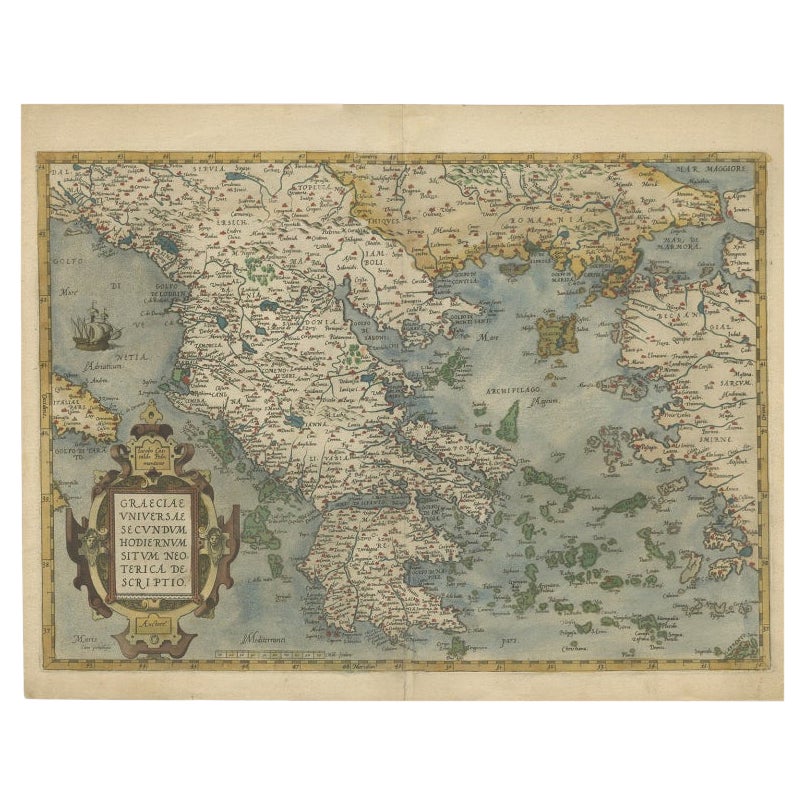
Original antique map titled "Graecia Sophiani." This is a very detailed and decorative engraved map, with two decorative cartouches and a hand-colored initial on the verso, from Abraham Ortelius's "Theatrum Orbis Terrarum," dated 1595. This work by Ortelius is considered to be one of the first modern atlases, with maps that were the most up-to-date of their time.
The map depicts ancient Greece, and there are several notable regions and places that could be of interest, especially for collectors or enthusiasts of historical maps:
1. **Athens (Athenae)** - The historic city-state, known for its rich contribution to the birth of democracy and classical philosophy, art, and architecture.
2. **Sparta (Lacedaemon/Sparta)** - Known for its military prowess and austere lifestyle, it was a significant power in ancient Greece.
3. **Macedonia (Macedonia)** - The region associated with Alexander the Great and the spread of Hellenistic culture.
4. **Crete (Creta)** - The largest island in Greece, which was the center of the Minoan civilization, one of the earliest recorded civilizations in Europe.
5. **Peloponnese (Peloponnesus)** - The large peninsula connected to the mainland by the Isthmus of Corinth, home to ancient cities like Corinth and Argos.
Own a piece of history with this exquisite 1595 Ortelius map of ancient Greece, 'Graecia Sophiani.' Rich in detail and beautifully hand-colored, it showcases notable regions such as Athens, Sparta, and Macedonia. The decorative cartouches and fine preservation make it a striking display piece. A rare find for collectors and connoisseurs of classical antiquity and historic cartography. Add this timeless treasure from the Theatrum Orbis Terrarum to your collection and embrace the legacy of the great civilizations of yore."
- Dimensions:Height: 17.92 in (45.5 cm)Width: 21.86 in (55.5 cm)Depth: 0 in (0.02 mm)
- Materials and Techniques:Paper,Engraved
- Period:
- Date of Manufacture:1595
- Condition:Condition: Good, given age. General age-related soiling but mainly outside the image in the margins. Beautiful hand-coloured, with some creasing along the centrefold. Latin text on the reverse. Restored tear in outer lower margin; otherwise fine.
- Seller Location:Langweer, NL
- Reference Number:
About the Seller
5.0
Platinum Seller
These expertly vetted sellers are 1stDibs' most experienced sellers and are rated highest by our customers.
Established in 2009
1stDibs seller since 2017
1,922 sales on 1stDibs
Typical response time: <1 hour
- ShippingRetrieving quote...Ships From: Langweer, Netherlands
- Return PolicyA return for this item may be initiated within 14 days of delivery.
More From This SellerView All
- Antique Map of East Frisia by Ortelius, c.1595Located in Langweer, NLAntique print, titled: 'Frisia Orientalis.' Map of East Frisia originating from 'Theatrum Orbis Terrarum'. It is based on the manuscript map by Jon Bloe...Category
Antique 16th Century Maps
MaterialsPaper
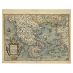
- Decorative Original Antique Map of Greece by Ortelius, c.1609Located in Langweer, NLAntique map titled 'Graeciae Universae secundum Hodiernum situm Neoterica descriptio'. Decorative map of Greece and surrounding Islands and contiguous regions. Based on the work of...Category
Antique 17th Century Maps
MaterialsPaper
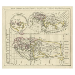
- Antique Map of the Old World Projection, Entitled Orbis Terrarum Ad Mentem, 1825Located in Langweer, NLAntique map titled 'Orbis Terrarum ad Mentem (..)'. Old map of the world originating from 'Atlas der Oude Wereld'. Artists and Engravers: Published by C. Ph. Funke and W. van Boe...Category
Antique 19th Century Maps
MaterialsPaper
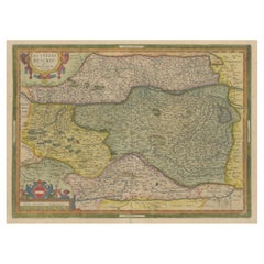
- Antique Map of Austria by Ortelius, c.1612Located in Langweer, NLAntique map titled 'Austriae Descrip. per Wolfgangum Lazium' Original antique map of Austria. Published by A. Ortelius, circa 1612. Artists a...Category
Antique 17th Century Maps
MaterialsPaper
- Antique Map of Southeast Asia by Ortelius '1587'By Abraham OrteliusLocated in Langweer, NLAntique map titled 'Indiae Orientalis Insularumque Adiacientium Typus'. Ortelius includes early European depictions of both Japan and China and is the first to name Formosa (Taiwan). The Philippines and East Indies or Spice Islands are shown based upon Portuguese and Spanish sources, and before their penetration by the Dutch. Japan is shown in kite form, as a large oval island...Category
Antique 16th Century Maps
MaterialsPaper

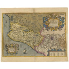
- Antique Map of Mexico by Ortelius, circa 1602By Abraham OrteliusLocated in Langweer, NLAntique map titled 'Hispaniae Novae Sivae Magnae Recens Et Vera Descriptio 1579'. Map of western New Spain, showing the recently-created Spanish settlements, many rivers, and large l...Category
Antique Early 17th Century Belgian Maps
MaterialsPaper

You May Also Like
- Original Antique Map of Ancient Greece, Achaia, Corinth, 1786Located in St Annes, LancashireGreat map of Ancient Greece. Showing the region of Thessaly, including Mount Olympus Drawn by J.D. Barbie Du Bocage Copper plate engraving by P.F Tardieu Original hand color...Category
Antique 1780s French Other Maps
MaterialsPaper
- Original Antique Map of Ancient Greece- Boeotia, Thebes, 1787Located in St Annes, LancashireGreat map of Ancient Greece. Showing the region of Boeotia, including Thebes Drawn by J.D. Barbie Du Bocage Copper plate engraving by P.F T...Category
Antique 1780s French Other Maps
MaterialsPaper
- Original Antique Map of Ancient Greece, Phocis, Gulf of Corinth, 1787Located in St Annes, LancashireGreat map of Ancient Greece. Showing the region of Phocis, including the Gulf of Corinth Drawn by J.D. Barbie Du Bocage Copper plate engraving by P.F Tardieu Original hand c...Category
Antique 1780s French Other Maps
MaterialsPaper
- 1590 Ortelius Map of Calais and Vermandois, France and Vicinity Ric.a014Located in Norton, MA1590 Ortelius map of Calais and Vermandois, France and Vicinity Ric.a014 Two rare regional Abraham Ortelius maps on a single folio sheet. Left map, entitled Caletensium, depic...Category
Antique 16th Century Dutch Maps
MaterialsPaper
- 1592 Abraham Ortelius Map "Lorraine: Lotharingiae Nova Descripti, Ric.A005Located in Norton, MA1592 Abraham Ortelius map entitled "Lorraine: Lotharingiae Nova Descripti Ric.a005 Description: Ortelius is best known for producing the atlas from which this map comes from, "...Category
Antique 16th Century Dutch Maps
MaterialsPaper
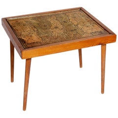
- Table Low Sofa Vintage 1950s Map Isle of Man John Speed 1610 Thomas Durham 1595Located in BUNGAY, SUFFOLK- The juxtaposition of modern design and this ancient map create a unique small table and conversation piece - This is the first map featuring the Isle of Man on its own. - It is also the first map of the Island based on an actual survey, undertaken by Thomas Durham 1595 and was first published by Speed in 1605-1611 and reprinted many times over the next century. This is the second state or print from 1610. The map is inset within a fruitwood box frame with a glass top. Supported by tapering stick legs. The map is based on a survey (and presumably a MS map) by Thomas Durham, of whom nothing is known other that he was paid by Sir Thomas Gerrard to make a survey of the Island. This survey, almost certainly for military purposes, arose from the disputed possession of the Island during which time Elizabeth had assumed control in order to prevent the Scots or the Spanish from using the Island as a base. Speed had used the Durham Map in his slightly earlier 4-sheet wall map showing invasions and battles of c1603/4 [ref: Shirley #261] - there are some differences from this 1605/10 map - Port Eran (rather than Earn on 1605);Knockalo point (= Contrary Hd) not on 1605;Spalbrecke shown west of Calf rather than E as on 1605/10. Thus it is possible that the Durham Map had even more detail than Speed used in his derived version. In sea are four mythical beasts with riders: to NW of Island Unicorn with Scottish flag...Category
Antique 1610s English Mid-Century Modern Sofa Tables
MaterialsPaper


Recently Viewed
View AllMore Ways To Browse
1859 Asia Map
Antique Map Antilles
Formosa Vintage Map
Map Zanzibar
Minature Map
Vincenzo Coronelli On Sale
Anguilla Map
Antique Cabbage Cutter
Antique Maps Denver
Antique Maps Washington Dc
Brinkman Co
Britton And Rey Lithograph
Cartier 1730
Christoph Weigel On Sale
Clivia Ducatus Et Ravestein Dominium
Collectible Barbies
Cyclades Map
Devonia Antique