Antique Map Antilles

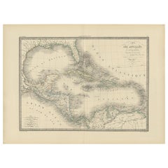
Antique Map of the Antilles by Lapie, '1842'
Located in Langweer, NL
Antique map titled 'Carte des Antilles du Golfe du Méxique'. Map of the Antilles. This map
Category

Antique Mid-19th Century Maps

Materials

Paper

Antique Map of the Antilles by Lapie, '1842'
H 19.89 in W 26.78 in D 0.02 in
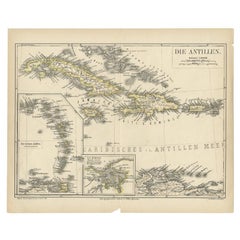
Antique Map of the Antilles by Meyer, 1878
Located in Langweer, NL
Antique map titled 'Die Antillen'. Old map of the Antilles, it shows Jamaica, Puerto Rico, the
Category

Antique 19th Century Maps

Materials

Paper

Antique Map of the Antilles in the Caribbean, '1875'
Located in Langweer, NL
Antique map titled 'Carte des Iles Antilles'. Large map of the Antilles. This map originates from
Category

Antique Late 19th Century Maps

Materials

Paper

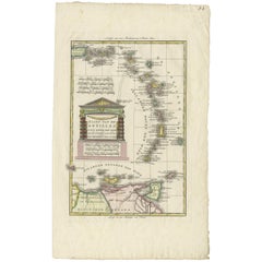
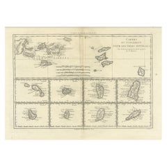
Antique Map of the Dutch Antilles 'Caribbean' by R. Bonne, circa 1780
Located in Langweer, NL
Antique map titled 'Kaart van de Antilles (..)'. Rare edition of this map illustrating the Dutch
Category

Antique Late 18th Century Maps

Materials

Paper

18th Century Antique Map of the Virgin Islands and Caribbean Inset Maps
Located in Langweer, NL
Antilles," featuring inset maps of various islands in the Caribbean, is from the "Atlas Encyclopedique" by
Category

Antique Late 18th Century Maps

Materials

Paper

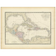
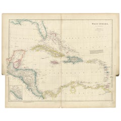
Antique Map of the West Indies by Wyld '1845'
Located in Langweer, NL
Antique map titled 'Map of the West India Islands'. Original antique map of the West Indies
Category

Antique Mid-19th Century Maps

Materials

Paper

Antique Map of the West Indies by Wyld '1845'
No Reserve
H 10.24 in W 14.18 in D 0.02 in
Detailed Antique Map of the Windward Islands in the Caribbean
By Covens & Mortier
Located in Langweer, NL
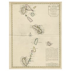
Antique map titled 'Carte des Antilles Francoises et des Isles Voisines'. Original antique map of
Category

Antique Early 18th Century Maps

Materials

Paper

Antique Map of the West Indies in Full Color, 1922
Located in Langweer, NL
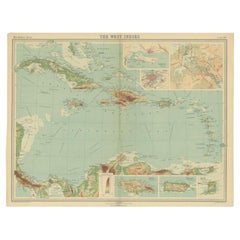
Antique map titled 'The West Indies.' A map of the West Indies, the Carribean region. This includes
Category

20th Century Maps

Materials

Paper

Antique Map the Windward or South Caribbean Islands and Guiana, 1859
Located in Langweer, NL
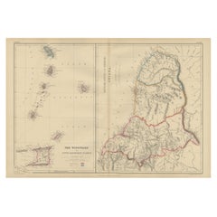
Antique map titled 'The Windward or South Caribbean Islands'. Original antique map of South
Category

Antique Mid-19th Century Maps

Materials

Paper

Original Antique Map of the West Indies by J. Arrowsmith, 1842
Located in Langweer, NL
Title: "J. Arrowsmith's 19th Century Map of the West Indies" This original antique map, crafted by
Category

Antique Early 19th Century Maps

Materials

Paper

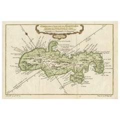
Martinique Island in the Caribbean by Bellin Original Original Antique Map, 1780
Located in Langweer, NL
distinctive and visually appealing quality to the map. Martinique, situated within the Lesser Antilles in the
Category

Antique Late 18th Century Maps

Materials

Paper

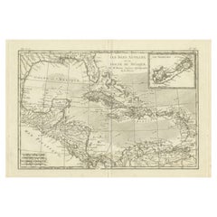
Authentic Antique Map of the Caribbean, Gulf Coast and Central America, 1787
Located in Langweer, NL
Antique map titled 'Les Isles Antilles et le Golfe du Méxique'. Original old map of the Caribbean
Category

Antique Late 18th Century Maps

Materials

Paper

1899 Poole Brothers Antique Railroad Map of the Illinois Central Railroad
Located in Colorado Springs, CO
This is an 1899 railroad map of the Illinois Central and Yazoo and Mississippi Valley Railroads
Category

Antique 1890s American Maps

Materials

Paper

Original Antique Map of the Virgin Islands with Insets of Caribbean Isles, 1787
Located in Langweer, NL
Antique map titled 'Supplément pour les Isles Antilles (..)'. Original old map of the Virgin
Category

Antique Late 18th Century Maps

Materials

Paper

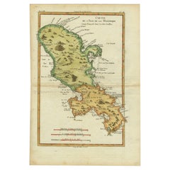
Original Antique Map of Martinique Island In The West Indies by Bonne, circa1780
Located in Langweer, NL
Antique map titled 'Carte de l'Isle de la Martinique Colonie Francoise dans les Isles Antilles
Category

Antique 18th Century Maps

Materials

Paper

Authentique Map by Pilon of The French Colonies in The West Indies, 1876
Located in Langweer, NL
The 1876 map titled "Carte des Colonies Françaises aux Antilles" represents a significant
Category

Antique Late 19th Century Maps

Materials

Paper

People Also Browsed

Antique American Empire Card/ Games Table in West Indies Mahogany with Pedestal
Located in Miami, FL
An American Empire games or card table with cylinder column resting on quatre-form base terminating with turned feet on casters. Swivel-top opens to a square with storage compartment...
Category

Antique 1830s American American Empire Game Tables

Materials

Mahogany

Antique Map of Cuba, Haiti and Porto Rico by W. G. Blackie, 1859
Located in Langweer, NL
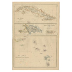
Antique map titled 'The Leeward or North Caribbean Islands'. Original antique map of Cuba, Haiti and Porto Rico. This map originates from ‘The Imperial Atlas of Modern Geography’. Pu...
Category

Antique Mid-19th Century Maps

Materials

Paper

Antique Religious Print "No. 35" the Crucifixion of Jesus, circa 1840
Located in Langweer, NL
Antique print titled ‘Histoire Sainte, Nouveau Testament, Crucifiement.’ This plate shows a scene from the New Testament; The Crucifixion of Jesus.’ This print originates from a r...
Category

Antique Mid-19th Century Prints

Materials

Paper

Large Original Vintage Map of Mexico, circa 1920
Located in St Annes, Lancashire
Great map of Mexico Original color. Good condition Published by Alexander Gross Unframed.
Category

Vintage 1920s English Edwardian Maps

Materials

Paper

Large Original Vintage Map of Mexico, circa 1920
No Reserve
H 25 in W 19.5 in D 0.07 in
Large Original Antique Map of New Mexico, Usa, C.1900
Located in St Annes, Lancashire
Fabulous map of New Mexico. Original color. Engraved and printed by the George F. Cram Company, Indianapolis. Published, C.1900. Unframed. Free shipping.
Category

Antique 1890s American Maps

Materials

Paper

Original Engraving of the West Indies, Gulf of Mexico, Antilles, Caribbean, 1780
Located in Langweer, NL
Rigobert Bonne and G. Raynal's 1780 map of the West Indies, Gulf of Mexico, Antilles, and the Caribbean stands as a remarkable cartographic piece, offering a detailed and expansive v...
Category

Antique Late 18th Century Maps

Materials

Paper

Antique Religious Print "No.26" the Institution of the Eucharist, circa 1840
Located in Langweer, NL
Antique print titled ‘Histoire Sainte, Nouveau Testament, Institution de L'Eucharistie.’ This plate shows a scene from the New Testament; The Institution of the Eucharist at the Last...
Category

Antique Mid-19th Century Prints

Materials

Paper

Antique French "Charles Field Haviland" Limoges Porcelain Oyster Plate c. 1890s
Located in New Orleans, LA
Rare petite antique French "Charles Filed Haviland" Limoges porcelain oyster plate, circa 1890s. Unusual size and in striking colors of deep golds, violet & umber. .
Category

Antique Late 19th Century French Porcelain

Materials

Porcelain

Engraving by Tallis and Rapkin of Map of the West Indies in The Caribbean, 1851
Located in Langweer, NL
John Tallis' 1851 map of the West Indies stands as a striking example of his renowned cartographic work. With meticulous detail and artistic embellishments, this map offers a compreh...
Category

Antique Mid-19th Century Maps

Materials

Paper

Original Antique Map of the Island of Dominica in the West Indies, 1794
Located in Langweer, NL
MAP OF THE ISLAND OF DOMINICA for the History of the West Indies, by Bryan Edwards. Esq. Dominica, an island renowned for its lucrative exports of sugar, cocoa, and coffee, operated...
Category

Antique 1790s Maps

Materials

Paper

Antique Map of Europe by Wyld '1845'
Located in Langweer, NL
Antique map titled 'Europe'. Original antique map of Europe. This map originates from 'An Atlas of the World, Comprehending Separate Maps of its Various Countries, constructed and dr...
Category

Antique Mid-19th Century Maps

Materials

Paper

Antique Map of Europe by Wyld '1845'
No Reserve
H 10.24 in W 14.18 in D 0.02 in
1908 "Map of Texas" by The Kenyon Company
Located in Colorado Springs, CO
Presented is an antique map of the state of Texas, printed as a pocket map in 1908 by The Kenyon Company. The state map is brightly colored by county, with principal cities and towns...
Category

Antique Early 1900s American Maps

Materials

Paper

American Federal Drop Leaf Dining Table in West Indies Mahogany New York, c 1820
Located in Miami, FL
A handsome American Federal or Empire Pembroke table in fine West Indies mahogany with two drop leaves. This period breakfast table is supported by a reeded, vase-turned column on a ...
Category

Antique Early 19th Century American Federal Drop-leaf and Pembroke Tables

Materials

Brass

Antique Religious Print 'No. 39' the Appearance to Mary Magdalene, circa 1840
Located in Langweer, NL
Antique print titled ‘Histoire Sainte, Nouveau Testament, Apparition à la Madeleine.’ This plate shows a scene from the New Testament; The Appearance to Mary Magdelene.’ This prin...
Category

Antique Mid-19th Century Prints

Materials

Paper

Antique Map of Baja California and parts of Alta California, Arizona and Sonora
Located in Langweer, NL
Antique map titled 'Kaart van het Westelyk Gedeelte van Nieuw Mexico en van California'. Beautiful map of Baja California and parts of Alta California, Arizona and Sonora. Isaac Tiri...
Category

Antique Mid-18th Century Maps

Materials

Paper

Antique Map with Hand Coloring of the United States and the Caribbean
Located in Langweer, NL
Antique map titled 'Verein-Staaten von Nord-America, Mexico, Yucatan u.a.'. Very detailed map of the United States of America showing the Caribbean. With an inset map of the surround...
Category

Antique Late 19th Century Maps

Materials

Paper

Recent Sales

Antique Map of Martinique in Decorative Colours, c.1780
Located in Langweer, NL
Antique map titled 'Carte de l'Isle de la Martinique Colonie Francoise dans les Isles Antilles
Category

Antique 18th Century Maps

Materials

Paper

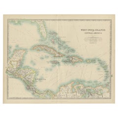
Antique Map of the West India Islands and Central America by Johnston '1909'
Located in Langweer, NL
Antique map titled 'West India Islands and Central America'. Depicting Venezuela, Caribbean, Puerto
Category

Early 20th Century Maps

Materials

Paper

Antique Map of the Antilles 'or West Indies' by Levasseur '1875'
Located in Langweer, NL
Antique map titled 'Iles Antilles ou Indes Occidentales'. Large map of the Antilles (or West Indies
Category

Antique Late 19th Century Maps

Materials

Paper

Antique Map of the West Indies, with Frame Style Border
Located in Langweer, NL
Antique map titled 'Antilles ou Indes Occidentales'. Attractive map of the West Indies. Covers from
Category

Antique Mid-19th Century Maps

Materials

Paper

Antique Map of the North Atlantic Ocean by A.K. Johnston, 1865
Located in Langweer, NL
Antique map titled 'Basin of the North Atlantic Ocean'. Depicting North America, Mexico, the
Category

Antique Mid-19th Century Maps

Materials

Paper

Antique Map of the West India Islands and Central America by A.K. Johnston
Located in Langweer, NL
Antique map titled 'West India Islands and Central America'. Depicting Venezuela, Caribbean, Puerto
Category

Antique Mid-19th Century Maps

Porto Rico (Puerto Rico) and The Lesser Antilles. Century Atlas antique map
Located in Melbourne, Victoria
'The Century Atlas. Porto Rico (Puerto Rico) and The Lesser Antilles.' Original antique map, 1903
Category

Early 20th Century Victorian More Prints

Materials

Lithograph

Get Updated with New Arrivals
Save "Antique Map Antilles", and we’ll notify you when there are new listings in this category.

Antique Map Antilles For Sale on 1stDibs

At 1stDibs, there are several options of antique map antilles available for sale. Frequently made of paper, all antique map antilles available were constructed with great care. There are all kinds of antique map antilles available, from those produced as long ago as the 18th Century to those made as recently as the 20th Century. Covens & Mortier produced beautiful antique map antilles that are worth considering.

Finding the Right collectibles-curiosities for You

Antique and vintage collectibles and curiosities can bring whimsy and wonder to any interior. 

Decorating with old scientific instruments, historical memorabilia and vintage musical instruments, as well as other authentic collectibles and curiosities that can be found on 1stDibs, presents an opportunity to create a unique, natural history museum-like atmosphere in your home that can provoke conversation as often as it pays tribute to how far we’ve come in understanding our world. 

And bringing collectibles and curiosities into your space is actually on trend — Wunderkammern, or curiosity cabinets, were all the rage in Europe during the 1500s and continued to have adherents there and in the U.S. in the following centuries. Today, however, they’re experiencing a real surge in popularity and influencing how many interior designers are furnishing and decorating homes — combining contemporary with antique, scientific with tribal, earthly with extraterrestrial, Les Lalanne tables with Flemish tapestries.

The original Wunderkammern were entire rooms filled with objects demonstrating their owners’ worldly knowledge: A proper one included artificiala or preciosa (objets d’art); naturalia (such as skeletons, shells, minerals); exotica (taxidermy or dried plants); and scientifica (scientific instruments), frequently alongside religious relics and ancient artifacts.

Pay tribute to a history of rich and diverse musical traditions that have taken shape all over the world by decorating your home with a collection of antique and vintage musical instruments — with a little help from strong hanging wire or some wall hooks, vintage brass instruments such as a gong, French horn or trumpet can help elevate a home office or complement the efforts you’ve made to ensure a welcoming vibe in your home’s entryway. Bells or antique wind instruments can add provocative metallic contrasts to dark woods as tabletop decorative objects.  

Create an intriguing focal point with Georgian scientific instruments, such as stick barometers with mahogany cases or lacquered brass telescopes. These items stem from an era named for the monarchies of the four King Georges, who ruled England in succession starting in 1714 (plus King William’s reign, which lasted until 1837). Just as there was beautiful jewelry produced during the period that today is coveted by collectors, there is much to be found in the collectibles and curiosities realm too.

Wanderlust, nostalgia and a shared love of good design are contributing factors to certain trends in decorating — just as vintage trunks and luggage have reappeared as furniture or home accents in a bedroom or foyer, decorating with globes, maps or nautical objects is similarly rooted in the allure of travel and a penchant for the stylish finishing touch that collectibles bring to our homes.

Find a wide range of antique and vintage collectibles and curiosities on 1stDibs.

Read More

Pamela Shamshiri Shares the Secrets behind Her First-Ever Book and Its Effortlessly Cool Interiors

The sought-after designer worked with the team at Hoffman Creative to produce a monograph that beautifully showcases some of Studio Shamshiri's most inspiring projects.

Moroccan Artworks and Objects Take Center Stage in an Extraordinary Villa in Tangier

Italian writer and collector Umberto Pasti opens the doors to his remarkable cave of wonders in North Africa.

Montecito Has Drawn Royalty and Celebrities, and These Homes Are Proof of Its Allure

Hollywood A-listers, ex-pat aristocrats and art collectors and style setters of all stripes appreciate the allure of the coastal California hamlet — much on our minds after recent winter floods.

Whaam! Blam! Pow! — a New Book on Pop Art Packs a Punch

Publishing house Assouline and writer Julie Belcove have teamed up to trace the history of the genre, from Roy Lichtenstein, Andy Warhol and Yayoi Kusama to Mickalene Thomas and Jeff Koons.

The Sparkling Legacy of Tiffany & Co. Explained, One Jewel at a Time

A gorgeous new book celebrates — and memorializes — the iconic jeweler’s rich heritage.

What Makes a Gem-Encrusted Chess Set Worth $4 Million?

The world’s most opulent chess set, weighing in at 513 carats, is literally fit for a king and queen.

Tauba Auerbach’s Geometric Pop-Up Book Is Mighty Rare, Thanks to a Hurricane

This sculptural art book has an epic backstory of its own.

Step inside the Storied Mansions of Palm Beach’s Most Effervescent Architect

From Spanish-style courtyards to fanciful fountains, these acclaimed structures abound in surprising and elegant details.