Antique Maps Of New Orleans
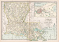
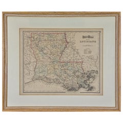
Louisiana. USA Century Atlas state antique vintage map
Located in Melbourne, Victoria
'The Century Atlas. Louisiana'
Inset map of 'New Orleans and Vicinity'.
Original antique map, 1903
Category
Early 20th Century Victorian Antique Maps Of New Orleans
Materials
Lithograph
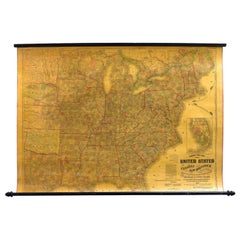
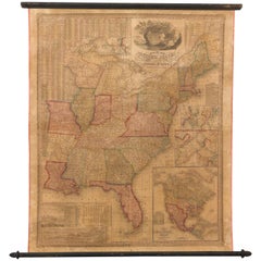
1863 "Lloyd's New Map of the United States, the Canadas, and New Brunswick"
Located in Colorado Springs, CO
Presented is “Lloyd's New Map of the United States, the Canadas and New Brunswick, From the latest
Category
1860s American Antique Maps Of New Orleans
Materials
Linen, Wood, Paper
H 37 in W 49.5 in D 1 in
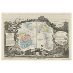
Original Steel Engraved Map of French Colonies in America, 1854
Located in Langweer, NL
remained strong in the region, particularly in New Orleans and surrounding areas.
4. **Québec**: This
Category
Mid-19th Century Antique Maps Of New Orleans
Materials
Paper
Free Shipping
H 13.12 in W 18.71 in D 0.02 in
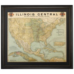
1899 Poole Brothers Antique Railroad Map of the Illinois Central Railroad
Located in Colorado Springs, CO
lead to the creation of the Louisville, New Orleans, and Texas Railway.
This map was first produced by
Category
1890s American Antique Maps Of New Orleans
Materials
Paper
1842 Wall Map of the United States by J. H. Young, Published by S. A. Mitchell
Located in Colorado Springs, CO
city map insets of the vicinities around Boston, New York, Philadelphia, Baltimore and Washington
Category
1840s American Antique Maps Of New Orleans
Materials
Paper
H 45 in W 38 in D 1 in
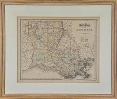
Louisiana: A Framed 19th Century Map by O. W. Gray
By Gray and Co
Located in Alamo, CA
Mexico and towns and cities, such as New Orleans, Baton Rouge and Lafayette. Ormando Wyllis (O.W.) Gray
Category
Mid-19th Century American Other Antique Maps Of New Orleans
Materials
Paper
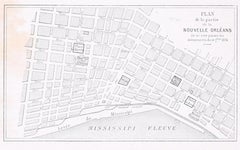
Plan de la Nouvelle Orléans - Original Lithograph - 1880
Located in Roma, IT
toponomastic map of the city of New Orleans, theatre of the Battle of Liberty Place, or Battle of Canal Street
Category
1880s Modern Antique Maps Of New Orleans
Materials
Lithograph
Louisiana: A Framed 19th Century Map by O.W. Gray
Located in Alamo, CA
Mexico and towns and cities, such as New Orleans, Baton Rouge and Lafayette. Ormando Wyllis (O.W.) Gray
Category
1870s Antique Maps Of New Orleans
Materials
Engraving
H 20 in W 22.63 in D 0.88 in
19th Century Animalier Bronze entitled "Panthere de l’Inde" by Antoine L Barye
By Antoine-Louis Barye
Located in London, GB
the army’s topographic brigade where he used clay to model raised relief maps. When the empire fell
Category
Mid-19th Century French Art Nouveau Antique Maps Of New Orleans
Materials
Bronze
H 4.73 in W 10.24 in D 3.75 in
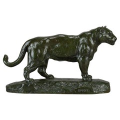
19th Century Animalier Bronze Study entitled "Jaguar Debout" by Antoine L Barye
By Antoine-Louis Barye
Located in London, GB
the army’s topographic brigade where he used clay to model raised relief maps. When the empire fell
Category
Late 19th Century French Art Nouveau Antique Maps Of New Orleans
Materials
Bronze
H 5.12 in W 8.86 in D 2.76 in
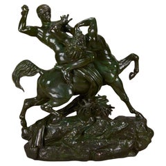
Animalier Bronze Sculpture "Theseus & The Centaur" by Antoine L Barye
By Antoine-Louis Barye
Located in London, GB
army’s topographic brigade where he used clay to model raised relief maps. When the empire fell, Barye
Category
Mid-19th Century French Art Nouveau Antique Maps Of New Orleans
Materials
Bronze
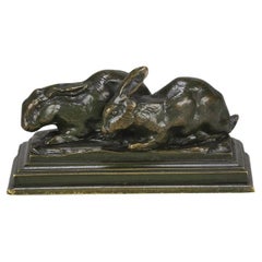
19th Century Animalier Bronze Sculpture "Group de Lapins" by Antoine L Barye
By Antoine-Louis Barye
Located in London, GB
the army’s topographic brigade where he used clay to model raised relief maps. When the empire fell
Category
Mid-19th Century French Art Nouveau Antique Maps Of New Orleans
Materials
Bronze
H 1.78 in W 3.55 in D 1.97 in
French Late 19th Century Animalier Bronze "Tortue" by Antoine L Barye
By Antoine-Louis Barye
Located in London, GB
the army’s topographic brigade where he used clay to model raised relief maps. When the empire fell
Category
Mid-19th Century French Art Nouveau Antique Maps Of New Orleans
Materials
Bronze
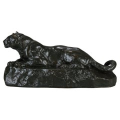
19th Century Art Nouveau Bronze "Panthère de L'Inde No.1" by Antoine L Barye
By Antoine-Louis Barye
Located in London, GB
brigade where he used clay to model raised relief maps. When the empire fell, Barye briefly studied with
Category
Mid-19th Century French Art Nouveau Antique Maps Of New Orleans
Materials
Bronze
H 5.12 in W 11.03 in D 3.55 in
19th Century French Animalier "Guerrier du Caucase" by Antoine L Barye
By Antoine-Louis Barye
Located in London, GB
army’s topographic brigade where he used clay to model raised relief maps. When the empire fell, Barye
Category
19th Century French Art Nouveau Antique Maps Of New Orleans
Materials
Bronze
Mid-19th Century French Bronze Entitled "Deux Chiens en Arret" by A L Barye
By Antoine-Louis Barye
Located in London, GB
relief maps. When the empire fell, Barye briefly studied with the sculptor François-Joseph Bosio, then
Category
Mid-19th Century French Art Nouveau Antique Maps Of New Orleans
Materials
Bronze
H 4.73 in W 9.85 in D 3.15 in
"Cerf Qui Marche" by A L Barye
By Antoine-Louis Barye
Located in London, GB
seventeen, he joined the army’s topographic brigade where he used clay to model raised relief maps. When the
Category
Mid-19th Century French Art Nouveau Antique Maps Of New Orleans
Materials
Bronze
19th Century Bronze entitled "Famille de Cerf" by Antoine Barye
By Antoine-Louis Barye
Located in London, GB
seventeen, he joined the army’s topographic brigade where he used clay to model raised relief maps. When the
Category
Late 19th Century French Art Nouveau Antique Maps Of New Orleans
Materials
Bronze
People Also Browsed
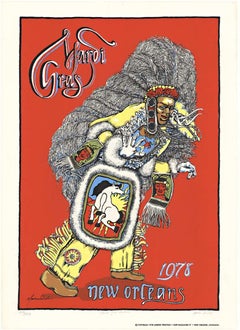
Original Mardi Gras New Orleans 1978 festival serigraph poster
Located in Spokane, WA
Original Mardi Gras, New Orleans, 1978 linen-backed poster. Dressed up in what would be an American Indian costume with full headgear, he is holding a shield with a horse on it. ...
Category
1970s American Modern Antique Maps Of New Orleans
Materials
Screen
H 32 in W 23 in D 0.05 in
"Boy on Carousel" large oil painting
By Helen Rayburn Caswell
Located in San Francisco, CA
This artwork "Boy on Carousel" c.1970 is an oil painting on canvas by noted California artist, Helen Rayburn Caswell, 1923-2018. It is signed at the right bottom corner by the artist...
Category
Late 20th Century American Impressionist Antique Maps Of New Orleans
Materials
Oil
Robert Gordy (New Orleans) "Folly, " Signed and Numbered Framed Abstract Print
By Robert Gordy
Located in New Orleans, LA
Number 84 in an edition of 100 prints. Signed.
Robert Gordy was an iconic New Orleans painter. He was part of the "Art and Decoration" movement that also included Keith Haring . This...
Category
1980s Abstract Antique Maps Of New Orleans
Materials
Screen
Henri Matisse (After) - Lithograph - Woman with Flowers in Her Hair
By (after) Henri Matisse
Located in Collonge Bellerive, Geneve, CH
after Henri MATISSE (1869-1954)
Lithograph
Signed in the plate
Vélin Paper
Dimensions: 32 x 24 cm (12 x 9")
This lithograph is one of a rare edition made during the Second World War ...
Category
1940s Modern Antique Maps Of New Orleans
Materials
Lithograph
H 12.6 in W 9.45 in D 0.04 in
English 18th Century Oak Dresser Base with 6 Drawers & 2 Cabinet Doors
Located in Atlanta, GA
Street
48 Society St.
300 W 14th St. Ste. 202
374 Broome St. Apt. 3N
3325B Sacramento St. Ste. 200
4310 Abbott Ave.
2171 Kingston Ct. Ste. A
3003 Larimer St.
2206 Pearl St.
44 River ...
Category
18th Century English Antique Maps Of New Orleans
Materials
Oak
Aesthetics Movement Antique Faux Bamboo Stool
Located in Norwood, NJ
English Aesthetics movement faux bamboo gilt stool. Finest quality spoke and ship wheel or wagon wheel aesthetic design.
Category
Late 19th Century English Aesthetic Movement Antique Maps Of New Orleans
Materials
Upholstery, Wood
Life of Napoleon Bonaparte by William Milligan Sloan, in Four Volumes, 1896
Located in Colorado Springs, CO
Sloane, William Milligan. The Life of Napoleon Bonaparte. New York: Century Co, 1896. Four volume quarto set. Handsomely bound in half red Moroccan leather and cloth boards, spines r...
Category
1890s American Antique Maps Of New Orleans
Materials
Paper
Ulysses S. Grant Signed Presidential Appointment, Dated February 28, 1871
By Ulysses S. Grant
Located in Colorado Springs, CO
Presented is an original Ulysses S. Grant signed Presidential Appointment, dating to February 28, 1871. Signed during the first term of Grant's presidency, the document appoints "Rob...
Category
1870s American Antique Maps Of New Orleans
Materials
Paper
H 24.75 in W 39.63 in D 2 in
Smith Rock
By Nancy Merkle
Located in San Francisco, CA
Artist Comments
Smith Rock is a nationally known rock climbing destination in the high desert of Central Oregon, a hub of outdoor recreation. As I walked the trail that circ...
Category
21st Century and Contemporary Abstract Impressionist Antique Maps Of New Orleans
Materials
Acrylic
Tattoo Parlour, New Orleans, Morgan Silk - Contemporary City Photography
By Morgan Silk
Located in Brighton, GB
Please bear in mind that all prints are produced to order. Lead times are expected between 15-20 days.
Image size: 14.5 x 14.5"
Sheet size: 17 x 24"
"Tattoo Parlour, New Orleans" b...
Category
21st Century and Contemporary Contemporary Antique Maps Of New Orleans
Materials
Photographic Paper, Black and White, Archival Ink, Inkjet
H 17 in W 24 in D 0.1 in
Dreaming Away - Highly Textured Dream-like Painting with Surreal Nautical Theme
By Victor Wang
Located in Chicago, IL
Victor Wang's subject is a female seemingly caught in a contemplative moment yet a war rages behind her. She dons a hat shaped as a boat and carries and oar as if to "Dream Away" th...
Category
21st Century and Contemporary Contemporary Antique Maps Of New Orleans
Materials
Canvas, Mixed Media, Oil
H 42.5 in W 56 in D 3 in
Ruins of Central City, Vintage 1935 Framed Colorado Modernist Landscape
By Vance Kirkland
Located in Denver, CO
Vintage lithograph titled "Ruins of Central City 31/70" is a modernist landscape with decaying buildings and mountains by Vance Hall Kirkland, from 1935. Presented in a custom black ...
Category
1930s American Modern Antique Maps Of New Orleans
Materials
Paper, Lithograph
H 25.75 in W 29.5 in D 0.5 in
1859 "Map of the United States of America..." by J. H. Colton
By J.H. Colton
Located in Colorado Springs, CO
Presented is an 1859 “Map of the United States of America, the British Provinces, Mexico, the West Indies and Central America with Part of New Granada and Venezuela” by John Hutchins...
Category
1850s American Antique Maps Of New Orleans
Materials
Paper
Ed Sketching at Red Rocks, Vintage 1940s Original Mountain Landscape, Colorado
By Vance Kirkland
Located in Denver, CO
Original vintage 1940s Modernist Landscape painting of Red Rocks Park, Colorado by Vance Kirkland (1904-1981). Titled, "Ed (Hicks) Sketching at Red Rocks". This regionalist mountai...
Category
1940s American Modern Antique Maps Of New Orleans
Materials
Watercolor
H 34.75 in W 42.75 in D 1.25 in
1847 Antique Map of Mexico, Texas and California by Samuel Augustus Mitchell
By Samuel Augustus Mitchell 1
Located in Colorado Springs, CO
Presented is the second edition of Samuel Augustus Mitchell's Map of Mexico, Including Yucatan & Upper California, an important map showing the progress of the Mexican-American War. ...
Category
1840s American Antique Maps Of New Orleans
Materials
Paper
H 32 in W 23.63 in D 0.5 in
Ship's Binnacle by Baker Lyman of New Orleans, Louisiana
Located in Norwell, MA
Ship's binnacle with maker's plate from Baker Lyman Company of New Orleans, Louisiana. Wonderfully restored binnacle with gimballed compass and interior lighting.
Overall dimensio...
Category
1930s American Antique Maps Of New Orleans
Materials
Metal
Recent Sales
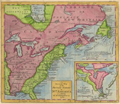
1762 Map of North America
By Thomas Kitchin
Located in New York, NY
", the Grand Banks and more.
The insert shows a chart Mississippi River from New Orleans to the Gulf of
Category
1760s Realist Antique Maps Of New Orleans
Materials
Engraving
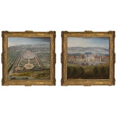
Pair of Topographical Portraits of the Pavillion and Village of Vaux-Sur-Seine
Located in London, Middlesex
would appear to have been set further back from the new house and with a fountain in front. The whole
Category
Early 18th Century French Louis XIV Antique Maps Of New Orleans
Materials
Canvas
H 60.24 in W 60.24 in D 3.94 in
Painting of a Cotton Picker by William Aiken Walker
By William Aiken Walker
Located in Alexandria, VA
split his residence between Charleston and Baltimore. However, on a visit to New Orleans in that year
Category
1870s American Antique Maps Of New Orleans
Materials
Composition
1846 "Traveller's Guide and Map of the United States" Antique Wall Map by Ensign
Located in Colorado Springs, CO
the vicinities of New York City, Philadelphia, Boston, Baltimore, New Orleans, Mobile, Cincinnati, St
Category
1840s American Antique Maps Of New Orleans
Materials
Paper
H 42.25 in W 53 in D 3.75 in
1845 United States Hanging Wall Map by T & E. H. Ensign
Located in Colorado Springs, CO
the vicinities of New York City, Philadelphia, Boston, Baltimore, New Orleans, Mobile, Cincinnati, St
Category
1840s American Antique Maps Of New Orleans
Materials
Paper
"Southern Gentleman" Unusal White Subject. Known for his African American
By William Aiken Walker
Located in San Antonio, TX
preparing maps for the Confederacy.
From 1876 to 1905, Walker regarded New Orleans as his home. There he
Category
1870s Realist Antique Maps Of New Orleans
Materials
Oil
1864s Paravia Milano Antique Rare Physical and Political Terrestrial Globe
Located in Milan, IT
territorial map, the globe shows the routes of famous navigators: The first voyage of Christopher Columbus
Category
1860s Antique Maps Of New Orleans
Materials
Paper
Original Antique City Plan of New Orleans, USA, 1894
By Rand McNally & Co.
Located in St Annes, Lancashire
Fabulous colorful map of New Orleans
Original color
By Rand, McNally & Co.
Published, 1894
Category
1890s American Antique Maps Of New Orleans
Materials
Paper
Original Antique City Plan of New Orleans, USA, circa 1900
By Rand McNally & Co.
Located in St Annes, Lancashire
Fabulous colorful map of New Orleans
Original color
By Rand, McNally & Co.
Published
Category
Early 1900s American Antique Maps Of New Orleans
Materials
Paper
Antique Map of the Southern Pacific Railroad, circa 1880
Located in Langweer, NL
Francisco to San Diego. By 1883, the line extended all the way to New Orleans. This map was published as a
Category
Late 19th Century Antique Maps Of New Orleans
Materials
Paper
Framed 19th Century Colton Map of Mexico, Texas, California and US Territories
By J.H. Colton
Located in Alamo, CA
in New York in 1855 in his General Atlas of the World on page No. 54 in volume 1. The map includes
Category
Mid-19th Century American Other Antique Maps Of New Orleans
Materials
Paper
H 20 in W 22.63 in D 0.88 in
American Cities Maps - Black and White Etching on Paper - 1835
Located in Roma, IT
, Charleston and vicinity, Savannah and vicinity, New Orleans and vicinity, Saint Louis and vicinity
Category
1830s Antique Maps Of New Orleans
Materials
Etching
Antoine-Louis Barye Bronze Elephant Du Senegal
By Antoine-Louis Barye
Located in Dallas, TX
used clay to model raised relief maps. When the Empire fell, Barye briefly studied with the sculptor
Category
1890s French Beaux Arts Antique Maps Of New Orleans
Materials
Bronze
Late 19th Century French Animalier bronze entitled "Cerf La Jambe Levée" byBarye
By Antoine-Louis Barye
Located in London, GB
used clay to model raised relief maps. When the empire fell, Barye briefly studied with the sculptor
Category
Late 19th Century French French Provincial Antique Maps Of New Orleans
Materials
Bronze
Free Shipping
H 7.09 in W 6.3 in D 2.37 in
“Lion au Serpent” Important Animalier Bronze by Antoine L Barye, circa 1860
By Antoine-Louis Barye
Located in London, GB
relief maps. When the empire fell, Barye briefly studied with the sculptor François-Joseph Bosio, then
Category
Mid-19th Century French Art Nouveau Antique Maps Of New Orleans
Materials
Bronze
Free Shipping
H 7.49 in W 11.03 in D 5.91 in
After Henri Matisse - Blue Nude
By (after) Henri Matisse
Located in Collonge Bellerive, Geneve, CH
times. The coming of the railway had put Bohain on the industrial map, but people still traveled
Category
1920s Abstract Impressionist Antique Maps Of New Orleans
Materials
Lithograph
Vegetables
By (after) Henri Matisse
Located in Collonge Bellerive, Geneve, CH
on the industrial map, but people still traveled everywhere on foot or horseback.
Matisse’s father
Category
1920s Modern Antique Maps Of New Orleans
Materials
Lithograph
Henri Matisse - The Saint Michel Bridge - Original Etching
By Henri Matisse
Located in Collonge Bellerive, Geneve, CH
on the industrial map, but people still traveled everywhere on foot or horseback.
Matisse’s father
Category
1920s Modern Antique Maps Of New Orleans
Materials
Etching
H 13 in W 10 in D 0.1 in
Antique Map of the Southern United States with Inset Map of New Orleans
Located in Langweer, NL
Antique map titled 'Die Staaten von Arkansas Mississippi, Louisiana & Alabama'. Detailed map of the
Category
Mid-19th Century Antique Maps Of New Orleans
Materials
Paper
H 9.06 in W 12.21 in D 0.02 in
1762 Map of North America
By Thomas Kitchin
Located in New York, NY
", the Grand Banks and more.
The insert shows a chart Mississippi River from New Orleans to the Gulf of
Category
1760s Realist Antique Maps Of New Orleans
Materials
Engraving
Get Updated with New Arrivals
Save "Antique Maps Of New Orleans", and we’ll notify you when there are new listings in this category.
Antique Maps Of New Orleans For Sale on 1stDibs
Find a variety of antique maps of new orleans available on 1stDibs. The range of distinct antique maps of new orleans — often made from paper, bronze and metal — can elevate any home. Antique maps of new orleans have been produced for many years, with earlier versions available from the 18th Century and newer variations made as recently as the 20th Century. Antique maps of new orleans made by Art Nouveau designers — are very popular at 1stDibs. There have been many well-made antique maps of new orleans over the years, but those made by Antoine-Louis Barye, Gray and Co and Rand McNally & Co. are often thought to be among the most beautiful.
How Much are Antique Maps Of New Orleans?
Antique maps of new orleans can differ in price owing to various characteristics — the average selling price at 1stDibs is $1,500, while the lowest priced sells for $85 and the highest can go for as much as $9,800.
More Ways To Browse
Antique Maps Michigan
Antique Puerto Rico Map
Antique Suitcase Art Collectibles
Charles Strain
Antique Leather Mallet
Mary Quant Original
Townhouse By Robert Brown
3 4 Antique Violin
Antique Maps Of Puerto Rico
Paper Hanging Mobile
Map Of Arizona
Antique Leaded Glass Transom Windows
Antique Map Of Michigan
Antique Map Of Puerto Rico
Sunny Worthing
Ballard Designs
Used Ballard Design Furniture
Mark Beale
