Small World Map
7
to
63
643
291
326
268
265
218
156
142
123
97
57
51
51
37
25
24
23
22
22
22
21
17
16
16
15
11
9
9
8
8
8
7
6
6
5
5
5
5
4
4
3
3
3
2
2
2
1
1
1
1
1
1
1
1
1
1
1
79
42
42
32
19
Sort By
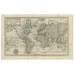
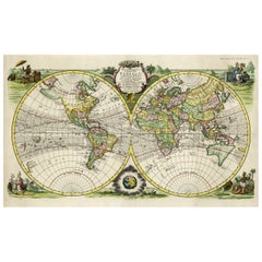
Antique Map of the World on Mercator's Projection, 1788
Located in Langweer, NL
Antique map titled 'Kaart van de Geheele Wereld (..)'. Uncommon small world map on Mercator's
Category
Antique Late 18th Century Maps
Materials
Paper
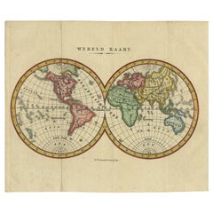
Small Antique World Map in Decorative Old Hand-Colouring, circa 1840
Located in Langweer, NL
Antique map titled 'Wereld Kaart'. Small and very decorative double hemisphere world map. Source
Category
Antique 19th Century Maps
Materials
Paper
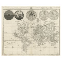
Antique Detailed World Map Drawn on Mercator's Projection, 1700
Located in Langweer, NL
Antique world map titled 'Carte generale du monde, ou description du monde terrestre & Aquatique
Category
Antique 17th Century Maps
Materials
Paper
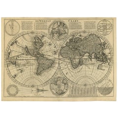
Antique Bible World Map by R. & J. Wetstein, 1743
Located in Langweer, NL
Antique world map titled 'De Werelt Caart'.
A scarce and richly detailed double hemisphere world
Category
Antique Mid-18th Century Maps
Materials
Paper
Rare Original Double Hemisphere World Map with Allegorical Figures, 1785
Located in Langweer, NL
hemisphere world map. Four allegorical figures in the corners represent Europe, Asia, Africa and America
Category
Antique 1780s Maps
Materials
Paper
H 17.05 in W 23.23 in D 0 in
Original Antique Hand-colored World Map with or without Frame, '1696'
Located in Langweer, NL
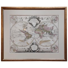
Antique world map titled 'Mappe-Monde dressee sur les Observations de Mrs. de l'Academie Royale des
Category
Antique Late 17th Century Maps
Materials
Paper
H 28.75 in W 33.67 in D 1.58 in
Two Impressive and Huge Midcentury World Map Wall Globes, Austria, 1950s
Located in Vienna, AT
We proudly offer this outstanding pair of very large wall-mounted modernist globes / world maps
Category
Mid-20th Century Austrian Mid-Century Modern Maps
Materials
Aluminum, Iron
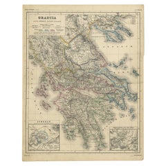
Antique Map of Greece with Two Small Inset Maps of Athens, c.1870
Located in Langweer, NL
Antique map titled 'Graecia'. Old map of Greece with two small inset maps of Athens. This map
Category
Antique 19th Century Maps
Materials
Paper
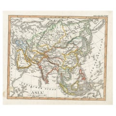
Charming Scarce Small Antique Map of Asia, 1837
Located in Langweer, NL
relatively small circulation and thus maps from it are only infrequently encountered today. Issued 1837
Category
Antique 19th Century Maps
Materials
Paper
Small Antique Map of the Asian Continent, 1841
Located in Langweer, NL
Antique map titled 'Azie.' Small map of the Asian continent. This map originates from 'De Aarde
Category
Antique 19th Century Maps
Materials
Paper
Small Detailed Antique Map of France, c.1780
Located in Langweer, NL
Antique map titled 'France'. Small, detailed map of France with legend. Also depicting the English
Category
Antique 18th Century Maps
Materials
Paper
Original Engraved Antique Map of the World, Colorful and Decorative, C.1780
By Pierre François Tardieu
Located in Langweer, NL
' - This handsome double hemisphere map presents a view of the physical world with particularly nice detail
Category
Antique 18th Century Maps
Materials
Paper
H 15.6 in W 20.32 in D 0 in
Antique Map of the World in Hemispheres by Keizer & de Lat, 1788
Located in Langweer, NL
double hemisphere world map on polar projections. In North America, there is a large Island of California
Category
Antique Late 18th Century Maps
Materials
Paper
Small Original Antique Map of Switzerland and Surroundings, 1807
Located in Langweer, NL
Antique map titled 'Switzerland with its subjects & allies from the best authorities'.
Small
Category
Antique Early 1800s Maps
Materials
Paper
Antique Map of the World with Polar Projections by Keizer & de Lat, 1788
Located in Langweer, NL
Antique map titled 'Schuine Ronde Aard-Klooten (..)'. Interesting double hemisphere world map with
Category
Antique Late 18th Century Maps
Materials
Paper
H 8.08 in W 11.03 in D 0.02 in
Rare Small Antique Map of the Persian Empire, 1692
Located in Langweer, NL
Antique map titled 'Perse'. Small engraved map of the Persian Empire, decorated with a simple
Category
Antique 17th Century Maps
Materials
Paper
Original Old Composite of Several Maps of the Ancient World on One Sheet, 1880
Located in Langweer, NL
Theodorus Menke. The map is a detailed depiction of the ancient world. The atlas it comes from is known for
Category
Antique 1880s Maps
Materials
Paper
Free Shipping
H 15.56 in W 18.51 in D 0 in
Very Decorative Original Antique Map of the World, Published in France in c.1780
By Rigobert Bonne
Located in Langweer, NL
Antique map titled 'L'Ancien Monde Et Le Nouveau en Deux Hemispheres' - Double hemisphere map of
Category
Antique 18th Century Maps
Materials
Paper
H 10.24 in W 17.6 in D 0 in
Antique Map of IJlst, Small Pitoresque City in Friesland, The Netherlands, 1868
Located in Langweer, NL
Antique map titled 'Provincie Friesland - Gemeente IJlst'.
Map of the township of IJlst
Category
Antique 19th Century Maps
Materials
Paper
H 10.44 in W 7.88 in D 0 in
Antique Map of Friesland Also Know as the Peacock Map, C.1580
Located in Langweer, NL
established a business in dealing with books and drawing maps. His first remarkable map was a 8 sheet world
Category
Antique 18th Century Maps
Materials
Paper
Antique Map of China, 1874
Located in Langweer, NL
interior decorators all over the world. Our collection includes a wide range of authentic antique maps from
Category
Antique 19th Century Maps
Materials
Paper
Antique Map of France with Inset Map of the Island of Corsica, 1820
Located in Langweer, NL
Antique map titled 'France in Departments'. Old map of France, with small inset map of the island
Category
Antique 19th Century Maps
Materials
Paper
Attractive Antique Map of Italy with Inset of Maps Showing The Regions, c.1870
Located in Langweer, NL
Antique map titled 'Italia'.
Old map of Italy, with a small inset map depicting the various
Category
Antique 19th Century Maps
Materials
Paper
H 13.78 in W 17.76 in D 0 in
Antique Map of Switzerland by Barlow, 1807
Located in Langweer, NL
Antique map titled 'Switzerland with its subjects & allies from the best authorities'. Small map of
Category
Antique 19th Century Maps
Materials
Paper
Antique Map of Turkey in Europe, c.1780
Located in Langweer, NL
antique maps to collectors, historians, educators and interior decorators all over the world. Our
Category
Antique 18th Century Maps
Materials
Paper
Antique Map of the Circle of Franconia, 1757
Located in Langweer, NL
Antique map titled 'Cercle de Franconie (..)'. Map of the Circle of Franconia, Germany. Centered on
Category
Antique 18th Century Maps
Materials
Paper
Antique Map of Trincomalee and Tambalagam Bay, 1758
Located in Langweer, NL
Antique map titled 'Bay de Trinquemale'. Map of Trincomalee and Tambalagam Bay in Sri Lanka. While
Category
Antique 18th Century Maps
Materials
Paper
Antique Map of France by Tirion, c.1740
Located in Langweer, NL
maps to collectors, historians, educators and interior decorators all over the world. Our collection
Category
Antique 18th Century Maps
Materials
Paper
Antique Map of the Netherlands by Petri, 1852
Located in Langweer, NL
all Dutch provinces. Also includes a small inset map of Luxembourg and the province of Limburg. This
Category
Antique 19th Century Maps
Materials
Paper
Antique Map of Denmark by Hall, circa 1820
Located in Langweer, NL
atlases containing maps of the United Kingdom and of the ancient world.
Condition: Very good, given age
Category
Antique 19th Century Maps
Materials
Paper
Antique Map of Province Friesland, The Netherlands, 1787
Located in Langweer, NL
Antique map titled 'Nieuwe Kaart van Friesland behoorende tot het Vaderlandsch Woordenboek van
Category
Antique 18th Century Maps
Materials
Paper
Antique Map of Gloucestershire by Camden, c.1607
Located in Langweer, NL
decorators all over the world. Our collection includes a wide range of authentic antique maps from the 16th
Category
Antique 17th Century Maps
Materials
Paper
Antique Map of Italy and Corsica, c.1860
Located in Langweer, NL
world. Our collection includes a wide range of authentic antique maps from the 16th to the 20th
Category
Antique 19th Century Maps
Materials
Paper
Antique Map of Austria by Ortelius, c.1612
Located in Langweer, NL
Antique map titled 'Austriae Descrip. per Wolfgangum Lazium' Original antique map of Austria
Category
Antique 17th Century Maps
Materials
Paper
Antique Map of Asia by Malte-Brun, 1880
Located in Langweer, NL
Map Pl. 63 - 64: 'Carte de l'Asie.' This map shows Asia. This original antique map originates from
Category
Antique 19th Century Maps
Materials
Paper
Antique Map of Novaya Zemlya by Bellin, 1758
Located in Langweer, NL
Antique map titled 'Partie de la Mer Glaciale Contenant la Nouvelle Zemle et le Pais des Samoiedes
Category
Antique 18th Century Maps
Materials
Paper
Antique Map of Northern Asia by Mallet, 1719
Located in Langweer, NL
star maps, maps of the ancient and modern world, and a synopsis of the customs, religion and government
Category
Antique 18th Century Maps
Materials
Paper
Antique Ptolemaic Map of Ceylon or nowadays Sri Lanka
Located in Langweer, NL
represented the most advanced account of the world's geography at that time. This map depicts the island with
Category
Antique Mid-18th Century Maps
Materials
Paper
Orginal Antique Handcolored Map of the Turkish Empire, 1748
Located in Langweer, NL
, small stain in inset map. Please study image carefully.
Date: 1748
Overall size: 32.5 x 22.5 cm
Category
Antique 18th Century Maps
Materials
Paper
Antique Map of the Netherlands by Brugsma, c.1870
Located in Langweer, NL
Antique map titled 'Het Koningrijk der Nederlanden'. Map of the Netherlands. This map originates
Category
Antique 19th Century Maps
Materials
Paper
Antique Map of the Middle East by Smith, 1809
Located in Langweer, NL
Antique map titled 'Regiones inter Euphraten et Indum'. Old map of the Middle East showing the
Category
Antique 19th Century Maps
Materials
Paper
Antique Map of the North Pole by Fullarton, 1856
Located in Langweer, NL
interior decorators all over the world. Our collection includes a wide range of authentic antique maps from
Category
Antique 19th Century Maps
Materials
Paper
Antique Map of the Pacific Ocean by Renneville, 1725
Located in Langweer, NL
Rare map of the Southern Pacific, illustrating Le Maire's tracks, extending from the La Maire
Category
Antique 18th Century Maps
Materials
Paper
Antique Map of the Low Countries by Cary, 1813
Located in Langweer, NL
all over the world. Our collection includes a wide range of authentic antique maps from the 16th to
Category
Antique 19th Century Maps
Materials
Paper
Antique Map of Friesland, A Dutch Province, c.1780
Located in Langweer, NL
Antique map titled 'Dominii Frisiae (..)'. Original antique map of Friesland. 3rd state, most
Category
Antique 18th Century Maps
Materials
Paper
Antique Map of England and Ireland by Lattre, 1789
Located in Langweer, NL
Antique map titled 'Les Royaumes d'Angleterre d'Ecosse et d'Irlande'. Original antique map of
Category
Antique 18th Century Maps
Materials
Paper
Antique Map of Gloucestershire in Britain by Camden, 1637
Located in Langweer, NL
decorators all over the world. Our collection includes a wide range of authentic antique maps from the 16th
Category
Antique 17th Century Maps
Materials
Paper
Antique Map of Asia Showing Its Political Divisions, 1874
Located in Langweer, NL
world. Our collection includes a wide range of authentic antique maps from the 16th to the 20th
Category
Antique 19th Century Maps
Materials
Paper
Antique Map of the Malabar Coast by Baldaeus, 1744
By Philip Baldaeus
Located in Langweer, NL
decorators all over the world. Our collection includes a wide range of authentic antique maps from the 16th
Category
Antique 18th Century Maps
Materials
Paper
Antique Map of Northern India by Blackie & Son, 1860
Located in Langweer, NL
holes lower part of the map and some small tears. Please study image carefully.
Date: 1860
Overall
Category
Antique 19th Century Maps
Materials
Paper
Antique Map of the Holy Land by Delamarche, 1806
By Charles Francois Delamarche
Located in Langweer, NL
Antique map titled 'Judee ou Terre Sainte sous les Turcs.' This map shows the holy land under the
Category
Antique 19th Century Maps
Materials
Paper
Antique Map of Friesland by De Wit, c.1690
Located in Langweer, NL
Netherlands. With a small inset map of the Wadden area. Third state of the map by Schotanus and De Wit
Category
Antique 17th Century Maps
Materials
Paper
Antique Map of China and Japan by Meyer, 1895
Located in Langweer, NL
, with small plans of Hong Kong and Kanton. This map originates from a 1885-1907 edition of a famous
Category
Antique 19th Century Maps
Materials
Paper
Antique Map of Banten Bay, Java, Indonesia, c.1725
Located in Langweer, NL
A small early 18th century map of Banten Bay showing the islands of Pulo Dua and Pulo Batto
Category
Antique 18th Century Maps
Materials
Paper
1859 Antique Swiss Panorama: Blackie's Detailed Map of Switzerland
Located in Langweer, NL
The "Antique Map of Switzerland" is a distinguished piece from 'The Imperial Atlas of Modern
Category
Antique Mid-19th Century Maps
Materials
Paper
Antique Map of Southeast Asia by Chatelain, c.1732
Located in Langweer, NL
the world. The maps in the Atlas Historique were mainly based on those of the French cartographer
Category
Antique 18th Century Maps
Materials
Paper
Detailed Original Antique Map of Turkey in Europe, circa 1740
Located in Langweer, NL
Antique map Turkish Empire tilted 'Turky in Europe'. Beautiful, small antique map depicting modern
Category
Antique 18th Century Maps
Materials
Paper
Antique Map of the Turkish Empire and Persia, circa 1890
By J. Migeon
Located in Langweer, NL
interior decorators all over the world. Our collection includes a wide range of authentic antique maps from
Category
Antique 19th Century Maps
Materials
Paper
Antique Map of a Bay of Borneo, Indonesia, c.1760
Located in Langweer, NL
Antique map titled 'La Baye de l'isle et Ville de Borneo'. Small map depicting a Bay of Borneo
Category
Antique 18th Century Maps
Materials
Paper
Antique Map of the Region of Bengkulu in Indonesia, 1900
Located in Langweer, NL
decorators all over the world. Our collection includes a wide range of authentic antique maps from the 16th
Category
20th Century Maps
Materials
Paper
- 1
- ...
Get Updated with New Arrivals
Save "Small World Map", and we’ll notify you when there are new listings in this category.
