Items Similar to Antique Map of the Pacific Ocean by Renneville, 1725

Want more images or videos?
Request additional images or videos from the seller
1 of 6
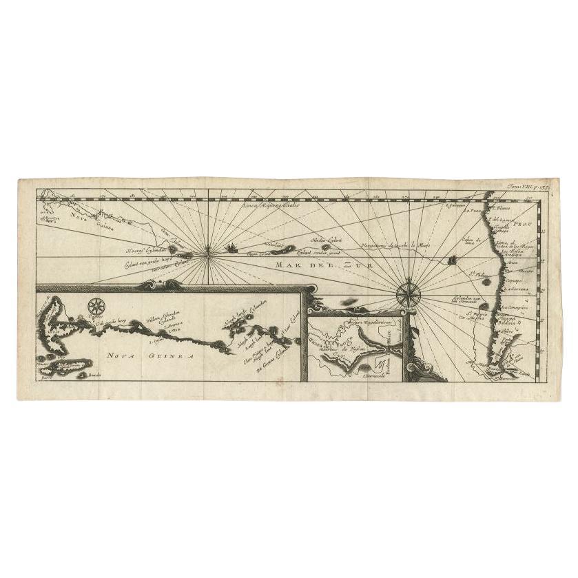
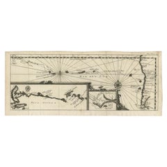
Antique Map of the Pacific Ocean by Renneville, 1725
About the Item
Rare map of the Southern Pacific, illustrating Le Maire's tracks, extending from the La Maire Straits to Nova Guinea, with a large inset of the northern Coastline of New Guinea and a smaller inset of Le Maire's Strait and Tierre del Fuego. From De Renneville's rare Recueil des Voyages, published in Paris in 1725.
Artists and Engravers: Author: Constantin de Renneville (ca. 1650-1723).
Condition: Good, given age. Original folds, as issued. General age-related toning and/or occasional minor defects from handling. Please study scan carefully.
Date: 1725
Coloring: Hand coloring
Overall size: 43.4 x 15.8 cm
Image size: 42.4 x 15.2 cm
We sell original antique maps to collectors, historians, educators and interior decorators all over the world. Our collection includes a wide range of authentic antique maps from the 16th to the 20th centuries. Buying and collecting antique maps is a tradition that goes back hundreds of years. Antique maps have proved a richly rewarding investment over the past decade, thanks to a growing appreciation of their unique historical appeal. Today the decorative qualities of antique maps are widely recognized by interior designers who appreciate their beauty and design flexibility. Depending on the individual map, presentation, and context, a rare or antique map can be modern, traditional, abstract, figurative, serious or whimsical. We offer a wide range of authentic antique maps for any budget.
- Dimensions:Height: 6.23 in (15.8 cm)Width: 17.09 in (43.4 cm)Depth: 0 in (0.01 mm)
- Materials and Techniques:
- Period:
- Date of Manufacture:1725
- Condition:Condition: Good, given age. Original folds, as issued. General age-related toning and/or occasional minor defects from handling. Please study scan carefully.
- Seller Location:Langweer, NL
- Reference Number:
About the Seller
5.0
Platinum Seller
These expertly vetted sellers are 1stDibs' most experienced sellers and are rated highest by our customers.
Established in 2009
1stDibs seller since 2017
1,929 sales on 1stDibs
Typical response time: <1 hour
- ShippingRetrieving quote...Ships From: Langweer, Netherlands
- Return PolicyA return for this item may be initiated within 14 days of delivery.
More From This SellerView All
- Antique Map of the Pacific Ocean by Renneville, 1702Located in Langweer, NLAntique map, untitled. A map of the Pacific Ocean, with the coast of Peru in the right edge and the outline of New Guinea in the left edge. In betwe...Category
Antique 18th Century Maps
MaterialsPaper
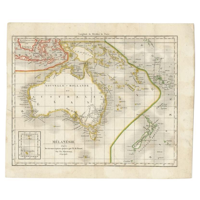
- Antique Map of the Pacific Ocean by Rienzi, 1836Located in Langweer, NLAntique map titled 'Mélanésie'. Map of the Pacific ocean around Australia, including Java, Timor, the Solomon Islands and New Zealand. This print or...Category
Antique 19th Century Maps
MaterialsPaper
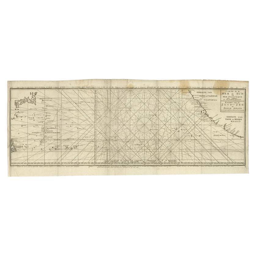
- Antique Map of the Pacific Ocean by Anson, 1765Located in Langweer, NLAntique map titled 'Carte de la Mer du Sud ou Mer Pacifique - Kaart van de Zuyd-Zee of stille oceaan (..)'. Nautical chart of the Pacific Ocean depicting the trade routes used by Spanish Galleons from Acapulco in Mexico to Manila in the Philippines. In particular this chart depicts the voyages of the Spanish Nostra Seigniora de Cabadonga and the British Navy Commodore George Anson. Anson succeed in capturing the Spanish treasure...Category
Antique 18th Century Maps
MaterialsPaper
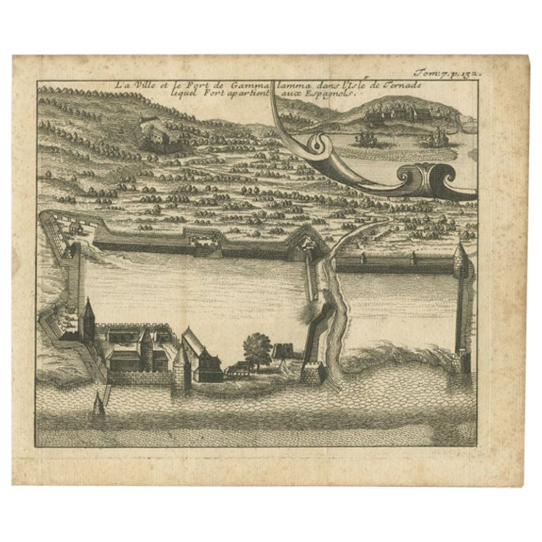
- Antique Print of the Town and Fortress of Ternate by Renneville, 1725Located in Langweer, NLAntique print Ternate titled 'La Ville et la Fort de Gamma lamma dans l'isle de Ternade lequel Fort apartient aux Espagnols'. Antique print of the town and fortress of the island of Ternate. Originates from 'Recueil des voyages qui ont servi à l’établissement et aux progrès de la compagnie des Indes orientales...Category
Antique 18th Century Prints
MaterialsPaper
- Antique Map of the Islands in the Pacific Ocean by Wyld, '1845'Located in Langweer, NLAntique map titled 'Islands in the Pacific Ocean'. Original antique map of the islands in the Pacific Ocean. This map originates from 'An Atlas of the World, Comprehending Separate M...Category
Antique Mid-19th Century Maps
MaterialsPaper
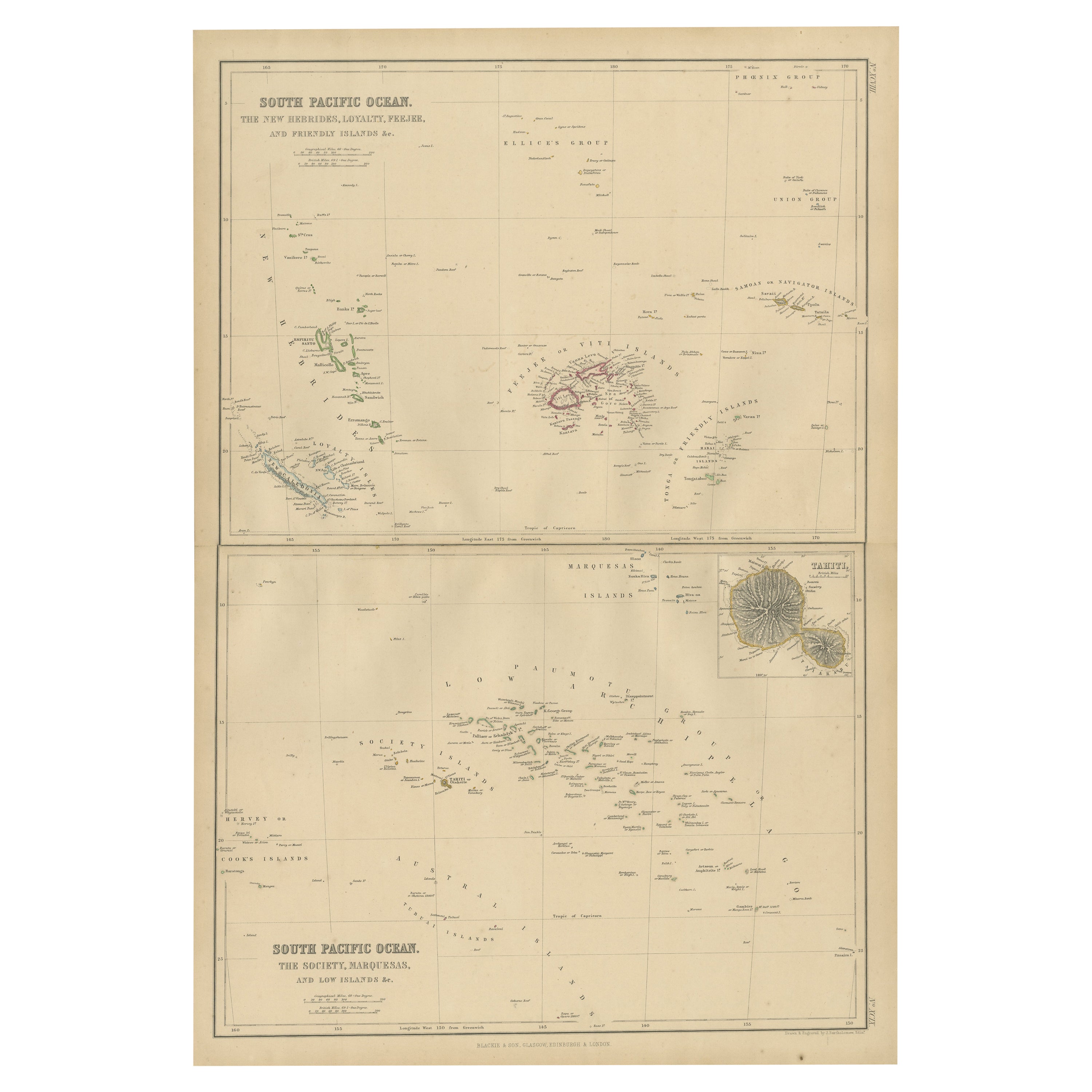
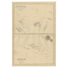
- Antique Map of South Pacific Ocean by W. G. Blackie, 1859Located in Langweer, NLAntique map titled 'South Pacific Ocean'. Original antique map of South Pacific Ocean with inset Map of Tahiti. This map originates from ‘The Imperial Atlas of Modern Geography’. Pub...Category
Antique Mid-19th Century Maps
MaterialsPaper


You May Also Like
- Large Original Antique Map of The Pacific Ocean, Fullarton, C.1870Located in St Annes, LancashireGreat map of The Pacific Ocean From the celebrated Royal Illustrated Atlas Lithograph by Swanston. Original color. Published by Fullarton,...Category
Antique 1870s Scottish Maps
MaterialsPaper
- Large Original Vintage Map of The South Pacific, circa 1920Located in St Annes, LancashireGreat map of The South Pacific Original color. Good condition / repairs to minor edge tears on top edge Published by Alexander Gross Unf...Category
Vintage 1920s English Edwardian Maps
MaterialsPaper
- Large Original Vintage Map of The Pacific Islands Including HawaiiLocated in St Annes, LancashireGreat map of The Pacific Islands Unframed Original color By John Bartholomew and Co. Edinburgh Geographical Institute Published, circa 1...Category
Vintage 1920s British Maps
MaterialsPaper
- 1861 Topographical Map of the District of Columbia, by Boschke, Antique MapLocated in Colorado Springs, COPresented is an original map of Albert Boschke's extremely sought-after "Topographical Map of the District of Columbia Surveyed in the Years 1856 ...Category
Antique 1860s American Historical Memorabilia
MaterialsPaper
- Vintage 1970s Ocean Pacific Wave Mural SurfboardLocated in Haleiwa, HIVintage 1970s Ocean Pacific (Op) wave mural surfboard. Features stunning airbrushed work of art depicting a nocturnal wave mural. Rounded pintail shape design. A beautiful example of...Category
Vintage 1970s American Sports Equipment and Memorabilia
MaterialsFiberglass, Foam, Softwood
- Original Antique Map of The World by Thomas Clerk, 1817Located in St Annes, LancashireGreat map of The Eastern and Western Hemispheres On 2 sheets Copper-plate engraving Drawn and engraved by Thomas Clerk, Edinburgh. Published by Mackenzie And Dent, 1817 ...Category
Antique 1810s English Maps
MaterialsPaper


Recently Viewed
View AllMore Ways To Browse
Pacific Modern
Southern Pacific
Southern New And Used Furniture
Pacific Map
Large Antique Map Of Paris
Pacific Ocean Antique Map
Large Maps Of Paris
Hand Painted Antique Map
Antique Furniture Depot
17th Century Scottish
Antique Road Maps
Antique Road Map
Antique Map Of Mexico
Antique Maps Of Mexico
Antique Style Atlas
Nautical Map
Nautical Maps
Antique Ship Decor