Items Similar to Large Original Antique Map of The Pacific Ocean, Fullarton, C.1870


Want more images or videos?
Request additional images or videos from the seller
1 of 5
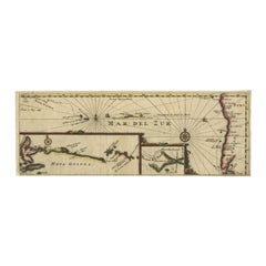
Large Original Antique Map of The Pacific Ocean, Fullarton, C.1870
About the Item
Great map of The Pacific Ocean
From the celebrated Royal Illustrated Atlas
Lithograph by Swanston. Original color.
Published by Fullarton, Edinburgh. C.1870
Repairs to minor edge tears
Unframed.
- Dimensions:Height: 18.5 in (46.99 cm)Width: 22.5 in (57.15 cm)Depth: 0.07 in (1.78 mm)
- Materials and Techniques:Paper,Other
- Place of Origin:
- Period:
- Date of Manufacture:1870
- Condition:Wear consistent with age and use.
- Seller Location:St Annes, GB
- Reference Number:1stDibs: LU1836324007722
About the Seller
4.9
Platinum Seller
These expertly vetted sellers are 1stDibs' most experienced sellers and are rated highest by our customers.
1stDibs seller since 2016
2,558 sales on 1stDibs
Typical response time: <1 hour
Associations
International Confederation of Art and Antique Dealers' Associations
- ShippingRetrieving quote...Ships From: St Annes, United Kingdom
- Return PolicyA return for this item may be initiated within 3 days of delivery.
Auctions on 1stDibs
Our timed auctions are an opportunity to bid on extraordinary design. We do not charge a Buyer's Premium and shipping is facilitated by 1stDibs and/or the seller. Plus, all auction purchases are covered by our comprehensive Buyer Protection. Learn More
More From This SellerView All
- Large Original Antique Map of The World, Fullarton, C.1870Located in St Annes, LancashireGreat map of the World. Showing both hemispheres From the celebrated Royal Illustrated Atlas Lithograph. Original color. Published by Fullarton, Edinburgh, C.1870 Unframed. Rep...Category
Antique 1870s Scottish Maps
MaterialsPaper
- Large Original Antique Map of Australia, Fullarton, C.1870Located in St Annes, LancashireGreat map of Australia From the celebrated Royal Illustrated Atlas Engraved by Swanston after the drawing by Augustus Petermann Lithograph. Original color. Published by ...Category
Antique 1870s Scottish Maps
MaterialsPaper
- Large Original Antique Map of China, Fullarton, C.1870Located in St Annes, LancashireGreat map of China From the celebrated Royal Illustrated Atlas Lithograph by Swanston. Original color. Published by Fullarton, Edinburgh. C.1870 Repairs to minor edge te...Category
Antique 1870s Scottish Maps
MaterialsPaper
- Large Original Antique Map of the World, Fullarton, circa 1870Located in St Annes, LancashireGreat map of the World. From the celebrated Royal Illustrated Atlas Lithograph. Original color. Published by Fullarton, Edinburgh, circa 1870. Unframed.Category
Antique 1870s Scottish Maps
MaterialsPaper
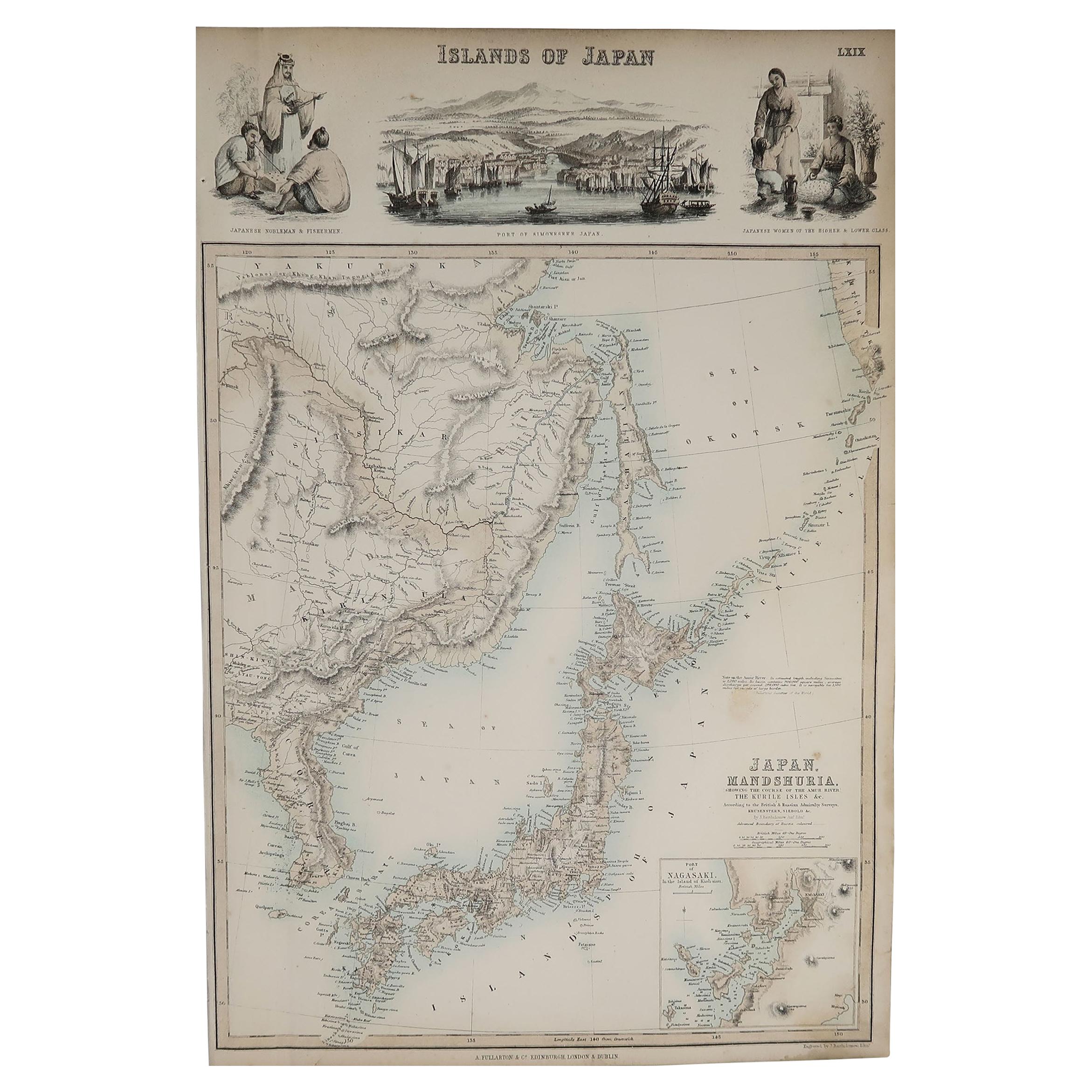
- Original Antique Decorative Map of Japan, Fullarton, C.1870Located in St Annes, LancashireGreat map of Japan Wonderful figural border From the celebrated Royal Illustrated Atlas Lithograph. Original color. Published by Fullarton, Edinburgh, C.1870 Unframed...Category
Antique 1870s Scottish Maps
MaterialsPaper
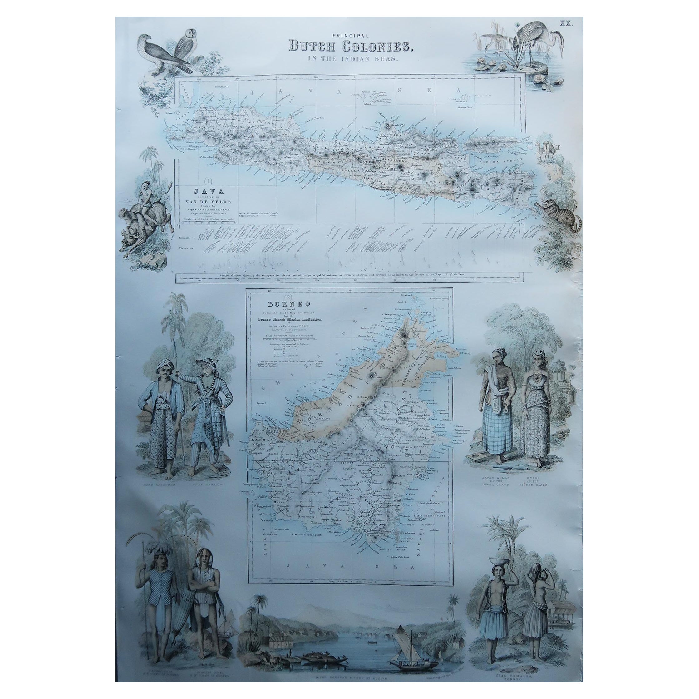
- Large Original Antique Map of Java and Borneo, Fullarton, C.1870Located in St Annes, LancashireGreat map of Java and Borneo Wonderful figurative borders From the celebrated Royal Illustrated Atlas Lithograph. Original color. Published by Fullarton, Edinburgh. C.1870 Unfr...Category
Antique 1870s Scottish Maps
MaterialsPaper


You May Also Like
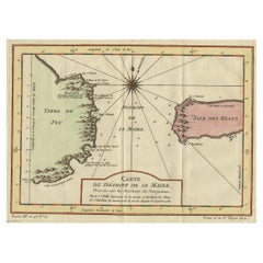
- Antique Map of the Passage Between the Atlantic and Pacific Oceans, circa 1753Located in Langweer, NLAntique print, titled: 'Carte du Detroit de le Maire (…)' - This chart illustrates the important passage between the Atlantic and Pacific oceans. Jacob Le Maire and Willem Schouten d...Category
Antique 18th Century Maps
MaterialsPaper
- Antique Map of the Region Near the Gulf of Zula, 1870Located in Langweer, NLAntique map titled 'Map of the Country between Annesley Bay and the Plain of Salt'. Lithographed map of the region near the Gulf of Zula, also known as Annesley Bay, Baia di Arafali ...Category
Antique Mid-19th Century Maps
MaterialsPaper
- Antique Map of the Pacific Ocean by Rienzi, 1836Located in Langweer, NLAntique map titled 'Mélanésie'. Map of the Pacific ocean around Australia, including Java, Timor, the Solomon Islands and New Zealand. This print or...Category
Antique 19th Century Maps
MaterialsPaper
- Antique Map of the Pacific Ocean by Anson, 1765Located in Langweer, NLAntique map titled 'Carte de la Mer du Sud ou Mer Pacifique - Kaart van de Zuyd-Zee of stille oceaan (..)'. Nautical chart of the Pacific Ocean depicting the trade routes used by Spanish Galleons from Acapulco in Mexico to Manila in the Philippines. In particular this chart depicts the voyages of the Spanish Nostra Seigniora de Cabadonga and the British Navy Commodore George Anson. Anson succeed in capturing the Spanish treasure...Category
Antique 18th Century Maps
MaterialsPaper
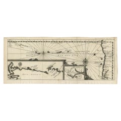
- Antique Map of the Pacific Ocean by Renneville, 1702Located in Langweer, NLAntique map, untitled. A map of the Pacific Ocean, with the coast of Peru in the right edge and the outline of New Guinea in the left edge. In betwe...Category
Antique 18th Century Maps
MaterialsPaper
- Antique Map of the Pacific Ocean by Renneville, 1725Located in Langweer, NLRare map of the Southern Pacific, illustrating Le Maire's tracks, extending from the La Maire Straits to Nova Guinea, with a large inset of the northern Coastline of New Guinea and a...Category
Antique 18th Century Maps
MaterialsPaper


Recently Viewed
View AllMore Ways To Browse
Great Pacific
Ocean Antiques
Antique Large Maps
Used Office Furniture Edinburgh
Ocean Map
Ocean Maps
Scotland Map
Map Of The Pacific
Antique Scottish Maps
Antique Map Scotland
Antique Map Of Scotland
Antique Maps Scotland
Antique Scotland Map
Scotland Antique Map
Map Of Scotland
Map Edinburgh
Antique Ocean Map
Antique Map Edinburgh