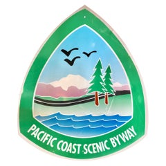
Large Pacific Coast Scenic Highway Sign
Located in Los Angeles, CA
Large vintage Pacific Coast Highway sign reading "Pacific Coast Scenic Byway."
Category
1970s American Pacific Coast Vintage
Materials
Steel
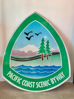
Large Pacific Coast Scenic Highway Sign
Located in Los Angeles, CA
Large vintage Pacific Coast Highway sign reading "Pacific Coast Scenic Byway."
Steel
$780Sale Price|20% Off
H 16 in W 19.25 in D 0.75 in
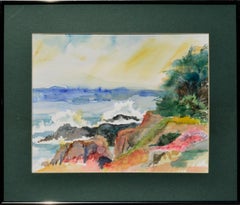
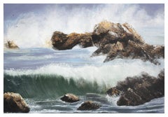
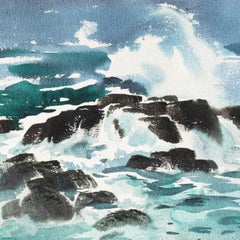
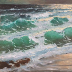
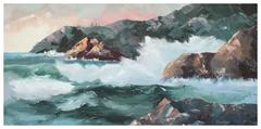
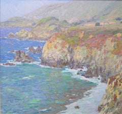
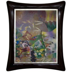
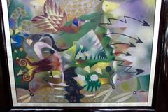
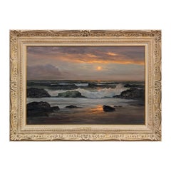
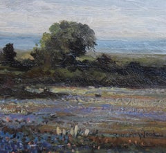
Pacific Coast in Spring - Watercolor Landscape
Located in Soquel, CA
Pacific Coast in Spring - Watercolor Landscape Vibrant watercolor of Pacific coastal waters crashing in the the cliffs, by an unknown artist (American, 20th Century).
Watercolor, Laid Paper
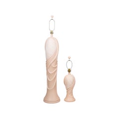
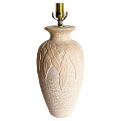
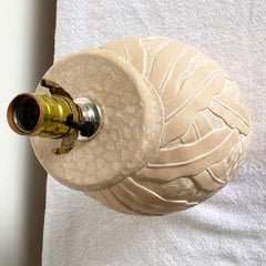
Postmodern Sculptural Lamps by Pacific Coast - a Pair
Located in Bradenton, FL
A pair of postmodern lamps by Pacific Coast dated 1991. Postmodern sculptural style vases in peach are cast with flowing folds draped to give the look of fabric.
Ceramic
$880Sale Price|20% Off
H 23 in W 29 in D 1 in
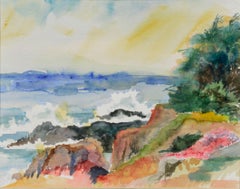
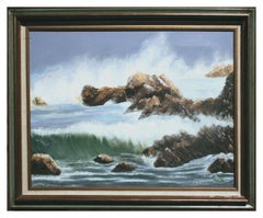
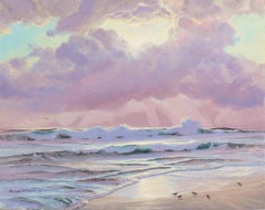
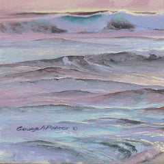
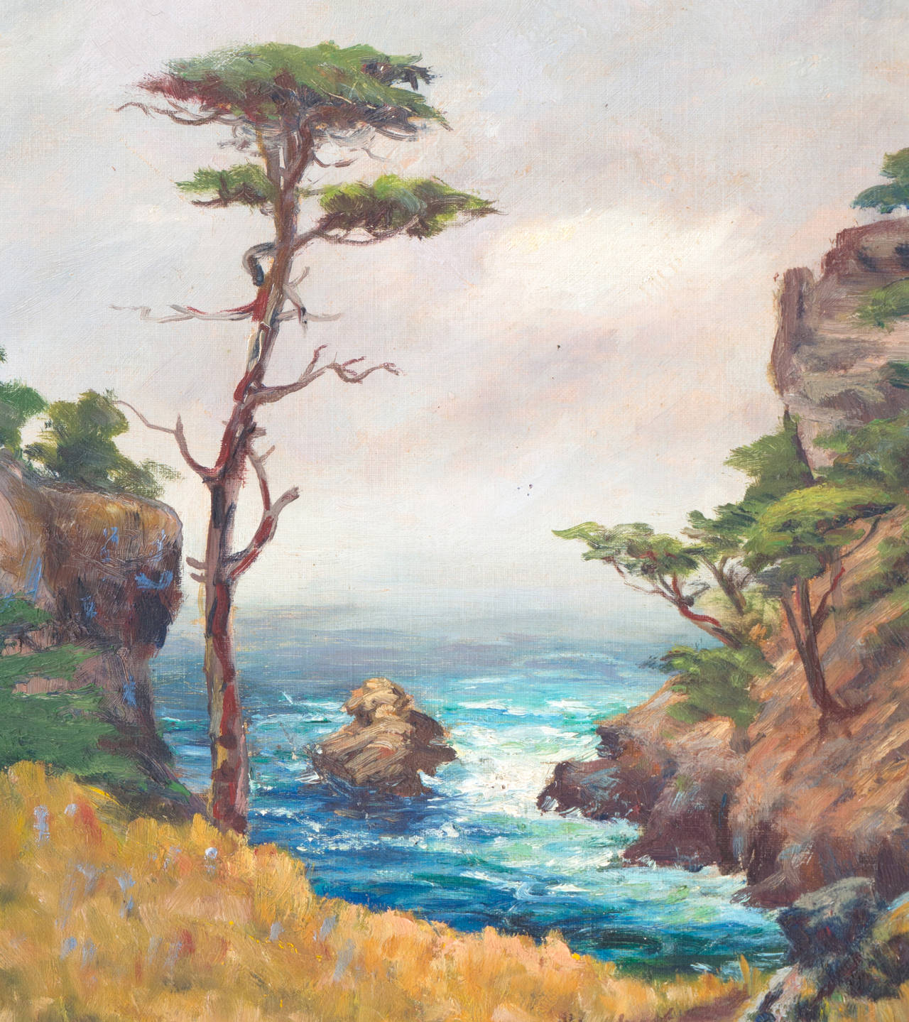
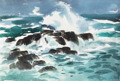
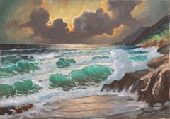
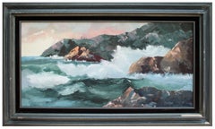
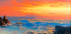
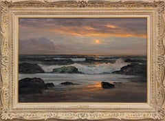
Crashing Barrel Waves, Mid Century Pacific Coast Seascape
Located in Soquel, CA
Crashing Barrel Waves, Mid Century Pacific Coast Seascape Dynamic mid-century seascape of Pacific waves crashing against the rocks by California artist Elsie Grace (American, 1930-2...
Canvas, Oil
$1,320 / set
H 21 in W 9 in D 9 in
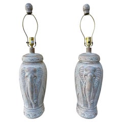
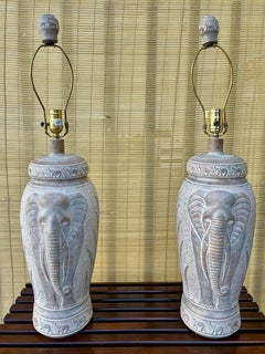
A Pair of Large 1990s Coastal Style Elephant Table Lamps By Pacific Coast Lamps.
Located in Miami, FL
A Pair of Large 1990s Coastal / Bohemian Style Elephant Table Lamps By Pacific Coast Lamps. Features large bases with Elephants and Botanical Pattern etched details in neutral colors...
Plaster
$2,750
H 24 in W 30 in D 0.75 in
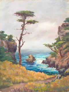
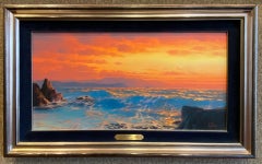
'Pacific Coast Sunset', Art Institute of Chicago, Mendocino, California Artist
Located in Santa Cruz, CA
This listed California artist lives on the Mendocino Coast where he devotes his time to painting the many moods of the Pacific Ocean.
Canvas, Oil


$3,600
H 20 in W 24 in
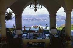
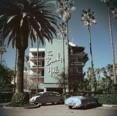
Acapulco Villa, Estate Edition, Landscape Photograph on the Pacific Coast
By Slim Aarons
Located in Los Angeles, CA
This midcentury landscape photograph, captured by society photographer Slim Aarons, features Las Brisas Residencias, home of Eustaquio Escandon in Acapulco, where Henry Kissinger spe...
Lambda

$3,900
H 20 in W 30 in
Acapulco Villa, Estate Edition, Landscape Photograph on the Pacific Coast
By Slim Aarons
Located in Los Angeles, CA
This midcentury landscape photograph, captured by society photographer Slim Aarons, features Las Brisas Residencias, home of Eustaquio Escandon in Acapulco, where Henry Kissinger spe...
Lambda


$3,000
H 16 in W 20 in
Acapulco Villa, Estate Edition, Landscape Photograph on the Pacific Coast
By Slim Aarons
Located in Los Angeles, CA
This midcentury landscape photograph, captured by society photographer Slim Aarons, features Las Brisas Residencias, home of Eustaquio Escandon in Acapulco, where Henry Kissinger spe...
Lambda


$2,400
H 12 in W 16 in
Acapulco Villa, Estate Edition, Landscape Photograph on the Pacific Coast
By Slim Aarons
Located in Los Angeles, CA
This midcentury landscape photograph, captured by society photographer Slim Aarons, features Las Brisas Residencias, home of Eustaquio Escandon in Acapulco, where Henry Kissinger spe...
Lambda

$4,200
H 30 in W 40 in
Acapulco Villa, Estate Edition, Landscape Photograph on the Pacific Coast
By Slim Aarons
Located in Los Angeles, CA
This midcentury landscape photograph, captured by society photographer Slim Aarons, features Las Brisas Residencias, home of Eustaquio Escandon in Acapulco, where Henry Kissinger spe...
Lambda


$5,400
H 40 in W 60 in
Acapulco Villa, Estate Edition, Landscape Photograph on the Pacific Coast
By Slim Aarons
Located in Los Angeles, CA
This midcentury landscape photograph, captured by society photographer Slim Aarons, features Las Brisas Residencias, home of Eustaquio Escandon in Acapulco, where Henry Kissinger spe...
Lambda
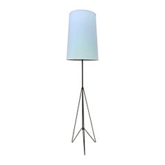
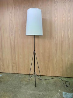
1950s Canadian Mid Century West Coast Modern Floor Lamp
Located in Victoria, BC
New to our collection, this stunning architectural floor lamp hails from the Pacific coast of Canada, crafted in the 1950s. Its elegantly angled iron base is paired with a freshly fi...
Iron
$3,500
H 16 in W 12 in D 0.25 in
'Carmel Coast', California Plein Air Impressionist oil, Oakland Museum, Stanford
By Francis Harvey Cutting
Located in Santa Cruz, CA
We are pleased to offer this fresh and breezy view of the dramatic Pacific coast near Carmel, California.
Oil, Board, Canvas
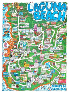
Original Laguna Beach, South Laguna fun map poster, 1998
Located in Spokane, WA
The map shows Pacific Coast Highway and side streets as they wind through the town.
Offset

$45
H 10.25 in W 10.25 in D 1 in
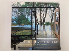
Northwest Style: Interior Design and Architecture in the Pacific Northwest Hardc
Located in Moreno Valley, CA
With its lush forests, rugged coast, and long rainy season, the Pacific Coast has spawned a style that is informal, organic, and above all eclectic.
Paper
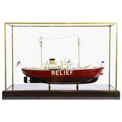
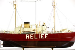
Lightship "Relief" of Oakland, California
Located in Norwell, MA
She was then given the name "Relief", assigned duty to relieve other lightships on the Pacific coast. She was retired from service in 1975 and decommissioned the following year.
$1,400Sale Price|20% Off
H 11 in W 14 in
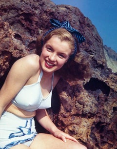
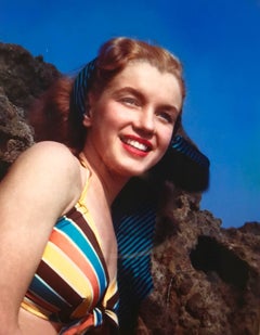
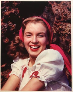
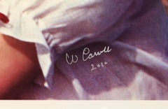
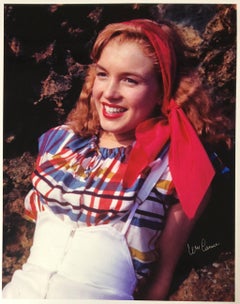
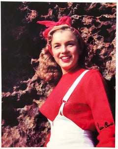
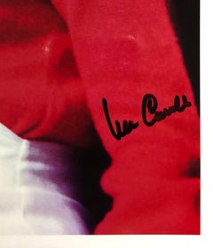
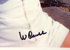
William Carroll, "Norma Jeane #27, " original photograph, hand signed
By William Carroll
Located in Chatsworth, CA
It depicts a young Marilyn Monroe (then known as Norma Jeane) in front of Castle Rock in Santa Monica off of the Pacific Coast Highway. This image is from Norma Jeane's first paid ph...
Photographic Paper
$2,200
H 14.5 in W 21.5 in D 0.01 in
'Coastal Breakers', Mid-century California, American Watercolor Society, CWS
By Arthur Irwin Riley
Located in Santa Cruz, CA
A fresh and dynamic watercolor showing a view of the eternal rendezvous of rocks and water on California's Northern Pacific coast. Art Riley first studied at the Art Center School ...
Paper, Watercolor
Price Upon Request
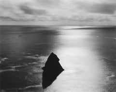
Northern California Coast, Pacific Ocean
By Chip Hooper
Located in Carmel-by-the-Sea, CA
Signed, dated and editioned. Signed, titled, editioned and dated on back of mount on artist copyright stamp. Available in 20 x 24, 26 x 32 and 44 1/2 x 56 inches (largest size includ...
Silver Gelatin
$5,250
H 49.5 in W 37.5 in D 2.5 in
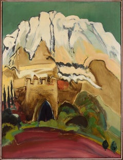
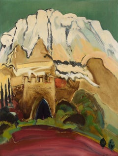
"Montserrat with Gothic Arch" Mid Century Modern Landscape in Oil on Canvas
Located in Soquel, CA
Selected Group Exhibitions: Pennsylvania Academy of Fine Arts; University of Illinois; Fort Worth Museum; Los Angeles County Museum; National Academy; Oakland Art Museum; Rotunda Gal...
Stretcher Bars, Oil, Canvas
$3,540
H 37.01 in W 27.17 in D 0.04 in
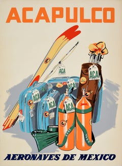
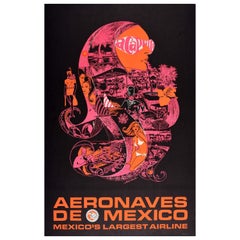
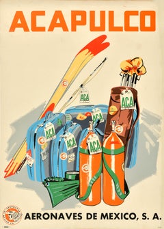
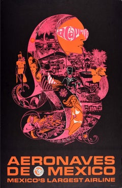
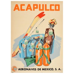
Original Vintage Travel Poster Acapulco Aeronaves De Mexico Scuba Golf Skiing
Located in London, GB
Original vintage air travel poster for Acapulco issued by Aeronaves De Mexico (Aeromexico; founded 1934) featuring a great image depicting scuba diving tanks and water sport equipmen...
Paper
$1,950
H 5 in W 7 in
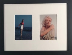
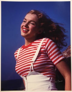
Bill Carroll/George Barris, "First and Last Diptych, " original photographs
By William Carroll
Located in Chatsworth, CA
The photograph on the left by William Carroll was taken off the Pacific Coast Highway at Castle Rock in 1945, which was the first photo-shoot in which Marilyn Monroe (then Norma Jean...
Photographic Paper
$2,360Sale Price|32% Off
H 27 in W 21 in
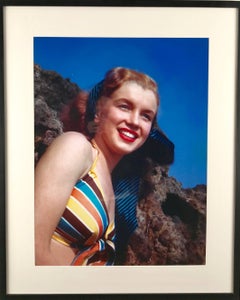
William Carroll, "Norma Jeane #26, " original photograph, hand signed
By William Carroll
Located in Chatsworth, CA
It depicts a young Marilyn Monroe (then known as Norma Jeane) in front of Castle Rock in Santa Monica off of the Pacific Coast Highway. This image is from Norma Jeane's first paid ph...
Photographic Paper
$1,032Sale Price|70% Off
H 14 in W 11 in
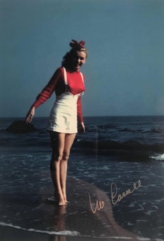
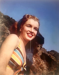
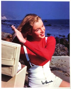
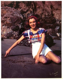
William Carroll, "Norma Jeane #21", original photograph
By William Carroll
Located in Chatsworth, CA
This photo and the others from the series were taken on the beach off the Pacific Coast Highway, just north of Santa Monica, CA.
Photographic Paper
$1,260Sale Price|64% Off
H 14 in W 11 in
William Carroll, "Norma Jeane #17", original photograph
By William Carroll
Located in Chatsworth, CA
This photo and the others from the series were taken on the beach off the Pacific Coast Highway, just north of Santa Monica, CA.
Photographic Film
Norma Jeane #22
By William Carroll
Located in Chatsworth, CA
This photo and the others from the series were taken on the beach off the Pacific Coast Highway, just north of Santa Monica, CA.
Photographic Paper

$2,500
H 17.25 in W 30.75 in
William Carroll, Norma Jeane Triptych, original photograph
By William Carroll
Located in Chatsworth, CA
These photos and the others from the series were taken on the beach off the Pacific Coast Highway, just north of Santa Monica, CA.
Photographic Paper
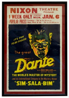

SIM SALA BIM - Lithographic poster of Dante the Great, 1970s
Located in Napoli, IT
Dante fece la sua ultima apparizione pubblica una settimana prima della sua morte alla convention combinata della Society of American Magicians e della Pacific Coast Association of M...
Paper, Lithograph
$1,260Sale Price|28% Off
H 14 in W 11 in
Bill Carroll , Norma Jeane #15 (Marilyn Monroe), hand signed
By William Carroll
Located in Chatsworth, CA
This photo and the others from the series were taken on the beach off the Pacific Coast Highway, just north of Santa Monica, CA.
Photographic Paper

Norma Jeane #13
By William Carroll
Located in Chatsworth, CA
This photo and the others from the series were taken on the beach off the Pacific Coast Highway, just north of Santa Monica, CA.
Photographic Paper
Norma Jeane #11
By William Carroll
Located in Chatsworth, CA
This photo and the others from the series were taken on the beach off the Pacific Coast Highway, just north of Santa Monica, CA.
Photographic Paper
Norma Jeane #23
By William Carroll
Located in Chatsworth, CA
This photo and the others from the series were taken on the beach off the Pacific Coast Highway, just north of Santa Monica, CA.
Photographic Paper
$1,633
H 37.41 in W 24.41 in D 0.04 in
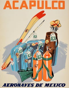
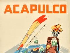
Original Vintage Airline Travel Poster Acapulco Aeronaves De Mexico Psychedelic
Located in London, GB
The beach resort of Acapulco is located on the Pacific coast near the Sierra Madre del Sur mountains becoming popular with tourists from the 1940s-1960s; the eagle knight airline log...
Paper
$889Sale Price|44% Off
H 33 in W 5 in D 5 in
Vintage Signed Ivory White Porcelain and Gilt Hand Painted Table Lamp
Located in Lomita, CA
Provenance This lamps was purchased at a Pacific Coast Highway antique store in the South Bay that was a neighborhood fixture for years: Antique Effects.
Porcelain

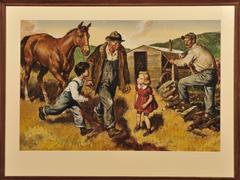
Hunters
By Amos Sewell
Located in Fort Washington, PA
Evenings were spent studying art, and vacations consisted of trips up and down the Pacific Coast, sketching and etching. In 1931, in the middle of the Depression, he decided he was t...
Oil, Board
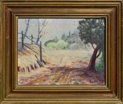
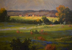
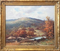
Mid-Century Country Lane Landscape
By Frank Leslie True
Located in Soquel, CA
During this period he painted in the western states of the Pacific Coast, New Mexico, Utah, and Arizona. Upon retirement in 1943, he worked in Berkeley for Cutter Laboratories for on...
Masonite, Oil
$2,280Sale Price|20% Off
H 34 in W 20 in D 0.5 in
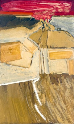
"February 21st - Red" Abstract Expressionist Landscape by William Morehouse
Located in Soquel, CA
He soon began dividing his time between the two coasts. Morehouse eventually settled in Bodega Bay permanently, where he continued to paint as part of the group the "Sonoma Four" ...
Canvas, Oil, Stretcher Bars
$3,812
H 16 in W 20 in D 0.1 in
Beverly Hills Hotel, 1957 - Sunset Boulevard Hollywood California Landscape
By Slim Aarons
Located in Brighton, GB
The iconic Beverly Hills Hotel sits proudly on Sunset Boulevard, the stretch of road from Figueroa Street in downtown Los Angeles to the Pacific Coast Highway in the Pacific Palisade...
Photographic Paper, C Print, Color, Digital
$950
H 18 in W 24 in D 0.75 in
'Sunset Breakers, Rocky Coast'. Pacific Ocean Beach, Seascape, Cypress Trees
Located in Santa Cruz, CA
American School coastal landscape showing a view of breakers crashing in towards a rocky coast with cypress trees in the distance. Unsigned and painted circa 1995.
Canvas, Oil
$595
H 14.5 in W 3.5 in D 3.5 in
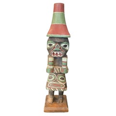
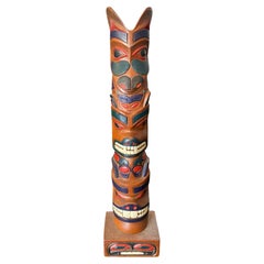
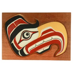
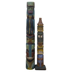
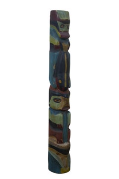
Pacific Northwest Coast Indigenous Native American Signed Wood Carved Totem Pole
Located in Studio City, CA
A beautifully designed, wonderfully carved Pacific Northwest Coast First Nation Native American indigenous hand carved wood totem pole.
Wood, Paint
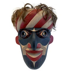
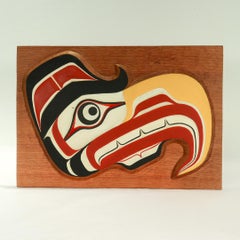
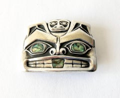
Carved Tribal Mask from Pacific Northwest Coast by David Frankel
Located in Atlanta, GA
A striking carved and painted mask in the tradition of the Native Indian tribes from Pacific Northwest Coast by David Frankel in 1994.
Natural Fiber, Wood
$595
H 17.75 in W 4.25 in D 3.5 in
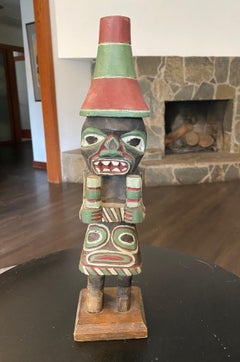
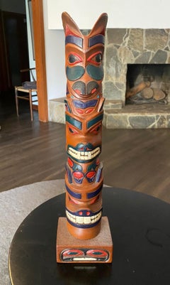
Pacific Northwest Coast Indigenous Native American Signed Wood Carved Totem Pole
Located in Studio City, CA
A beautifully designed, wonderfully carved Pacific Northwest Coast First Nation Native American (perhaps Haida, Tlingit, or Nootka) indigenous hand carved wood Three-figure totem pol...
Wood, Paint
$595 / set
H 11 in W 3.5 in D 4 in
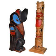
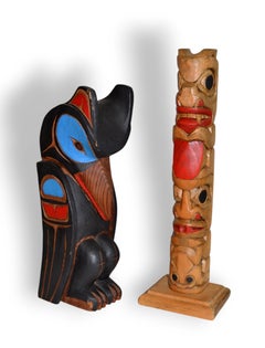
Pair of Mid-Century Pacific Northwest Coast Indigenous Wood Totem Carvings
Located in Fort Lauderdale, FL
Pair of Mid-Century Pacific Northwest Coast Indigenous Wood Totem Carvings A finely carved pair of Northwest Coast cedar wood sculptures, offered as a single lot.
Cedar
$1,021
H 20.08 in W 14.57 in D 0.04 in
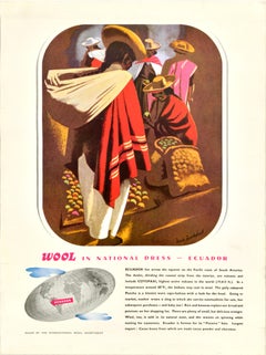
Original Vintage Poster Wool In National Dress Ecuador Drake Brookshaw Clothing
Located in London, GB
Original vintage poster from the Wool in National Dress series featuring a colourful image by Drake Brookshaw (1907-1993) depicting people in traditional clothing and wide brimmed ha...
Paper
$576Sale Price|53% Off
H 15.63 in W 11.25 in D 0.75 in
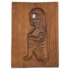
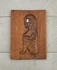
Ron Aleck Carved Wood Plaque, Pacific North West Coast, 20th Century
Located in San Juan Capistrano, CA
Ron Aleck Wood Carving Plaque, Pacific North West Coast, 20th Century. Signed to the back.
Wood
$1,480Sale Price|20% Off
H 22 in W 37 in D 2 in
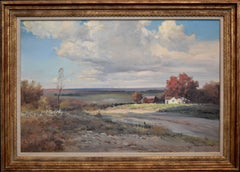
Big Sur Coast, Vintage 1970s Panoramic Pacific Seascape by John Zaccheo
By John Zaccheo
Located in Soquel, CA
Big Sur Coast, Vintage 1970s Panoramic Pacific Seascape by John Zaccheo Gorgeous vintage oil painting of waves crashing along the rocks on the coast of Big Sur, California by John Z...
Canvas, Oil

Man Leading Horse
By Amos Sewell
Located in Fort Washington, PA
Evenings were spent studying art, and vacations consisted of trips up and down the Pacific Coast, sketching and etching. In 1931, in the middle of the Depression, he decided he was t...
Gouache
$5,170
H 54.5 in W 63.5 in D 0.5 in
Yellow Totem Abstract New Age Surreal Sculpture by Mickey Kane
Located in Soquel, CA
Image 54.5"H x 63.5"W x .5"D Mickey “Kano” Kane (American, 1939-2002) was born in Illinois and grew up in Sacramento, CA. Kane moved to the Pacific Coast and worked on mixed media p...
Plywood, Acrylic Polymer, Acrylic
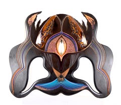
$3,670
H 47.5 in W 58 in D 0.5 in
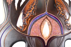
Scarab Totem Abstract New Age Surreal Sculpture by Mickey Kane
Located in Soquel, CA
Size" 47.5"H x 58"W x .5"D Mickey “Kano” Kane (American, 1939-2002) was born in Illinois and grew up in Sacramento, CA. Kane moved to the Pacific Coast and worked on mixed media pan...
Plywood, Acrylic Polymer, Acrylic
$16,500
H 36.5 in W 38.25 in D 3.75 in
California Coastal Landscape by Rod Goebel (American 1946-1993)
By Rod Goebel
Located in Dallas, TX
SPRING LIGHT, American West / California rocky Pacific coast oil on canvas landscape picture by American painter / artist Rod Goebel (1946-1993) impressionist style, signed front low...
Canvas
$895
H 10.63 in W 15.38 in D 1 in
Vintage Pacific Northwest Coast Native Wooden Hawk Carving by William Wasden Jr
Located in Philadelphia, PA
A fine vintage Pacific Northwest Native wooden carving. The carving in the form of an hawk with red, black, white, and yellow tones set on a brown wooden board. By William Wasden J...
Wood
$3,500
H 12.75 in W 20 in D 0.13 in
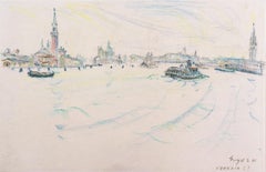
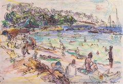
'Venice', Post-Impressionist Woman Artist, Salon d'Automne, Paris, France, SFMA
By Irma Engel Grabhorn
Located in Santa Cruz, CA
Reference: Who Was Who in American Art 1564-1975: 400 Years of Artists in America, Peter Hastings Falk, Sound View Press 1999, Vol. 1, p. 1048; Artists in California 1786-1940, Third...
Paper, Crayon

$7,500
H 28 in W 22 in D 0.75 in
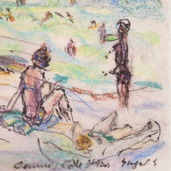
'Summer Flowers', Paris, Salon d'Automne, Post-Impressionist California Artist
By Irma Engel Grabhorn
Located in Santa Cruz, CA
Reference: Who Was Who in American Art 1564-1975: 400 Years of Artists in America, Peter Hastings Falk, Sound View Press 1999, Vol. 1, p. 1048; Artists in California 1786-1940, Third...
Canvas, Oil
$3,800
H 49 in W 22 in D 2.5 in
Abstract Asymmetric Totem New Age Surreal Sculpture by Mickey Kane
Located in Soquel, CA
Size: 49"H x 22"W Mickey “Kano” Kane (American, 1939-2002) was born in Illinois and grew up in Sacramento, CA. Kane moved to the Pacific Coast and worked on mixed media panels - whi...
Plywood, Acrylic Polymer, Acrylic
$7,500
H 12 in W 17.75 in
'The Cote d'Azur', Paris, Salon d'Automne, Post-Impressionist California Artist
By Irma Engel Grabhorn
Located in Santa Cruz, CA
Reference: Who Was Who in American Art 1564-1975: 400 Years of Artists in America, Peter Hastings Falk, Sound View Press 1999, Vol. 1, p. 1048; Artists in California 1786-1940, Third...
Paper, Oil Pastel, Ink
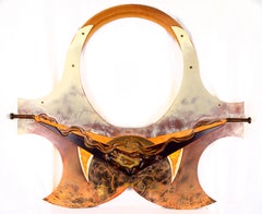
"Internal Release" Abstract Relief Sculpture
Located in Soquel, CA
Titled and signed on verso "Internal Release" Kano 96 Panel size: 48"H x 72"W Mickey “Kano” Kane (American, 1939-2002) was born in Illinois and grew up in Sacramento, CA. Kane moved...
Resin, Found Objects, Acrylic, Wood Panel, Handmade Paper
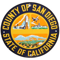
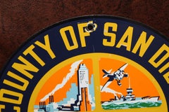
San Diego County California Truck Door Porcelain Sign
Located in Orange, CA
San Diego is a city on the Pacific coast of California known for its beaches, parks and warm climate.
Porcelain
Unavailable
H 82 in W 50 in D 22.25 in
Silver Leaf, Armoire, Tall Chest, Cabinet, Handcrafted, Bruce Andrews Design
By Bruce Andrews Design
Located in Evans, GA
Our woodworkers who use Pacific Coast maple to showcase the unique, natural wood grain in a timeless design.
Nickel, Silver Leaf
Unavailable
H 37.8 in W 27.17 in
Original Vintage Travel Poster Acapulco Aeronaves De Mexico Diving Golf Waterski
Located in London, GB
Original vintage air travel poster for Acapulco issued by Aeronaves De Mexico (Aeromexico; founded 1934) featuring a great image depicting scuba diving tanks and water sport equipmen...
Paper
Unavailable
H 18 in W 24 in
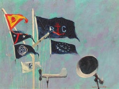
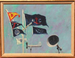
Mission Bay Yacht Club Flag Staff, Oil on Canvas, American, 1960
By Henry Koehler
Located in NEW YORK, NY
HENRY KOEHLER American, born 1927 Mission Bay Yacht Club Flag Staff Signed HENRY KOEHLER; also signed, titled, dated 1960 and inscribed PACIFIC COAST YACHTING ASSO. REGATTA/ SAN DI...
Canvas, Oil

Unavailable
H 37.41 in W 24.41 in
Original Vintage Airline Travel Poster Acapulco Aeronaves De Mexico Psychedelic
Located in London, GB
The beach resort of Acapulco is located on the Pacific coast near the Sierra Madre del Sur mountains becoming popular with tourists from the 1940s-1960s; the eagle knight airline log...
Paper

Unavailable
H 20 in W 16 in
Natalie Wood in Coat for "The Great Race" Globe Photos Fine Art Print
Located in Las Vegas, NV
This image is credited to Globe Photos/Avalon/Pacific Coast News. This is a limited edition fine art C-Print, hand numbered out of an edition of 125 with an accompanying certificate...
Archival Ink, Archival Paper, C Print, Archival Pigment
Natalie Wood "The Great Race" Globe Photos Fine Art Print
Located in Las Vegas, NV
This image is credited to Globe Photos/Avalon/Pacific Coast News. This is a limited edition fine art C-Print, hand numbered out of an edition of 125 with an accompanying certificate...
Archival Ink, Archival Paper, C Print, Archival Pigment
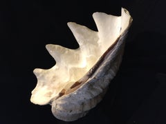
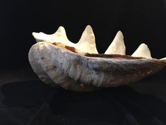
South Pacific Shell
Located in Rome, IT
South Asian Clam Shell of Tridacna Gigas, This clam was found off the South Pacific Ocean from the coast of South Asia. By the rings on this particular shell, it estimated lived up ...
Unavailable
H 108 in W 21.5 in D 10 in
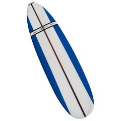
Jacobs Surfboard Fully Restored, Blue, White and Red, Early 1960s
By Hap Jacobs
Located in Los Angeles, CA
In 1960 Jacobs opened his first store along Pacific Coast Highway in Hermosa Beach and introduced the iconic red-diamond logo seen on this board.
Fiberglass, Foam, Paint, Wood
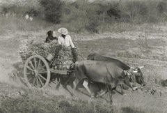
Manuel Carrillo, Untitled, Mexico. C. 1960-70s.
By Manuel Carrillo
Located in Santa Fe, NM
It turns out that he photographed throughout Mexico, from Veracruz on the Gulf of Mexico to Guanajuato in the interior, as well as in his very favorite and magnificent spot on the Me...
Silver Gelatin
Manuel Carrillo, Untitled, Mexico. C. 1960-70s.
By Manuel Carrillo
Located in Santa Fe, NM
It turns out that he photographed throughout Mexico, from Veracruz on the Gulf of Mexico to Guanajuato in the interior, as well as in his very favorite and magnificent spot on the Me...
Silver Gelatin
Manuel Carrillo, Untitled, Mexico. C. 1960-70s.
By Manuel Carrillo
Located in Santa Fe, NM
It turns out that he photographed throughout Mexico, from Veracruz on the Gulf of Mexico to Guanajuato in the interior, as well as in his very favorite and magnificent spot on the Me...
Silver Gelatin
Unavailable
H 8 in W 10.25 in D 0.1 in
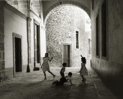
Manuel Carrillo, Untitled, Mexico. C. 1960-70s. (kids playing in archway)
By Manuel Carrillo
Located in Santa Fe, NM
It turns out that he photographed throughout Mexico, from Veracruz on the Gulf of Mexico to Guanajuato in the interior, as well as in his very favorite and magnificent spot on the Me...
Silver Gelatin

Unavailable
H 8 in W 7 in D 0.1 in
Untitled, Mexico. C. 1960-70s. (description, woman with child in serape)
By Manuel Carrillo
Located in Santa Fe, NM
It turns out that he photographed throughout Mexico, from Veracruz on the Gulf of Mexico to Guanajuato in the interior, as well as in his very favorite and magnificent spot on the Me...
Silver Gelatin
Postmodern Peach Ceramic Lamp by Pacific Coast Lighting
Located in Delray Beach, FL
Exceptional vintage postmodern ceramic table lamp by pacific coast lighting. Features a fact as tic leach color with leaves etched around the belly.
Ceramic
1960s Pacific Coast Myrtlewood Bowl Coos Bay, Oregon
By Dansk
Located in Chula Vista, CA
1960s MCM Pacific Coast Myrtlewood Bowl from Coos Bay, Oregon maker stamped House of Myrtlewood Coos Bay Oregon 4.25 x 7 diameter Original unrestored vintage condition See images sh...
Wood
Sold
H 19.5 in W 8.5 in D 8.5 in
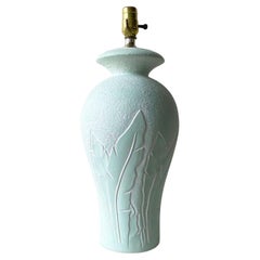
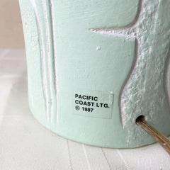
Postmodern Mint Green Banana Leaf Ceramic Table Lamp by Pacific Coast Lighting
Located in Delray Beach, FL
Amazing Postmodern ceramic table lamp by Pacific Coast Lighting. Features a mint green finish with etched banana leaves.
Ceramic
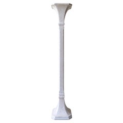
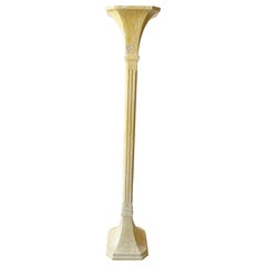
Art Deco White Plaster Torchiere Floor Lamp
Located in Delray Beach, FL
Square body and top with a white finish. By pacific coast lighting.
Ceramic
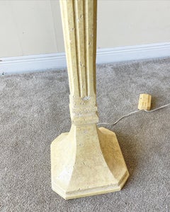
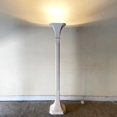
Art Deco Plaster Torchiere Floor Lamp
Located in Delray Beach, FL
Square bad and top, finished with a light yellow. By pacific coast lighting.
Plaster
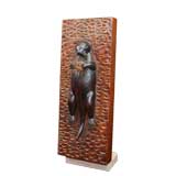

Otter
Located in Greenwich, CT
From an important Northern Pacific Coast collection. ca 1940
Wood
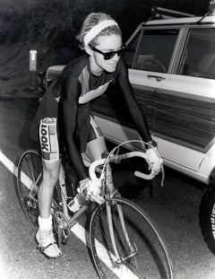

Vintage Madonna Photograph, Malibu California "PCH" (Los Angeles)
Located in NEW YORK, NY
Vintage Madonna Photograph Madonna cycling on PCH (Pacific Coast Highway) A dynamic, vintage Madonna press photograph, Los Angeles, 1987.
Silver Gelatin
Sold
H 8.88 in W 8.88 in D 1 in
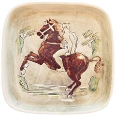
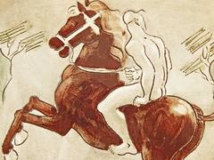
"Rider in the Surf, " Highly Rare Mid-Century Ceramic Piece, Laguna Beach
By Pat and Covey Stewart
Located in Philadelphia, PA
One of the rarest pieces created by Pat and Covey Stewart in Laguna Beach, "Rider the Surf" shows a nude male figure riding a rearing horse along the rocky Pacific coast. The decorat...
Clay
Sold
H 35 in W 44 in D 1.5 in
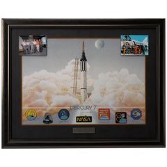
Mercury 7 Lithograph, Signed by 6 of the 7 Original Astronauts and Betty Grissom
Located in Colorado Springs, CO
The Right Stuff: Mercury Seven Astronauts, Limited Edition Lithograph Signed by Six of the Original Astronauts as well as Betty Grissom This is an extremely attractive and desira...
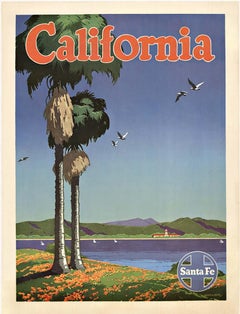
California Santa Fe original vintage railroad poster
Located in Spokane, WA
A beautiful original railway poster created by Bryn for the Santa Fe Railroad traveling to the Golden State of California. The Pacific coast featuring palm trees and seagulls flyin...
Offset
Brown Saltman Coffee Table
By Brown Saltman, John Keal
Located in Cambridge, US
Working with designers such as Paul Laszlo, Paul Frankl, and John Keal, Brown Saltman effortlessly combined the restraint of European modernism with the casual vibe of the Pacific Co...
Walnut

Edward Wormley for Dunbar side table inset with Natzler tiles
By Edward Wormley
Located in Chicago, IL
About this line, from the Janus Collection catalog: "'We believe that the Janus Collection for the first time in 50 years gives recognition to the strength inherent in the work of...
Walnut

Sold
H 37.8 in W 27.56 in D 0.04 in
Original Vintage Travel Poster Acapulco Diving Golf Sport Aeronaves De Mexico
Located in London, GB
Original vintage air travel poster for Acapulco issued by Aeronaves De Mexico (Aeromexico; founded 1934) featuring a great image depicting scuba diving tanks and equipment including ...
Paper


Sold
H 37.8 in W 27.17 in D 0.04 in
Original Vintage Travel Poster Acapulco Aeronaves De Mexico Diving Golf Waterski
Located in London, GB
Original vintage air travel poster for Acapulco issued by Aeronaves De Mexico (Aeromexico; founded 1934) featuring a great image depicting scuba diving tanks and water sport equipmen...
Paper
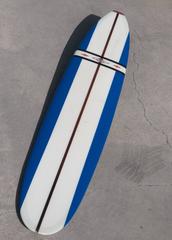
Vintage 1960s Jacobs Longboard Surfboard
By Hap Jacobs
Located in Haleiwa, HI
Jacobs opened his own store in 1960 along Pacific Coast Highway in Hermosa Beach. It was then that Jacobs developed his iconic red-diamond logo.
Fiberglass, Foam, Softwood
Sold
H 36 in W 36 in
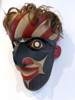
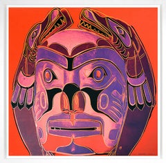
Northwest Coast Mask, from Cowboys and Indians, Unique Trial Proof, 1986
By Andy Warhol
Located in Palo Alto, CA
The tradition of ceremonial masks in the Northwest Coast culture area, stretching along the Pacific Coast north of California, has existed for several thousand years.
Screen
Sold
H 16.75 in W 2.25 in D 1.75 in
2 Hudson Bay Pacific Northwest Coast Native American Totem Pole Sculptures
Located in Dayton, OH
Mid to early 20th century hand carved and painted Pacific Northwest Native American folk art totem pole sculptures / figurines. Produced for the Hudson Bay Fur Company circa 1950s. ...
Hardwood
World Friendship Monument, c.1991
Located in Pasadena, CA
In 1972, Strong was commissioned to paint the royal invitation for the opening of the Sydney Opera House by Queen Elizabeth II In 1977, Strong carved John Wayne's face in a 12½-ton b...
Bronze
Sold
H 16.5 in W 18.5 in D 1.25 in
John Thomas Blue and Orange Still Life Signed Modern Oil Painting on Canvas 1958
By John Thomas
Located in Keego Harbor, MI
Group shows include the Kootz Gallery, New York (1950); Galleria Schneider, Rome (1955); Wichita Art Museum, Kansas (1957); Pacific Coast Biennial – Santa Barbara Museum of Art, San ...
Canvas
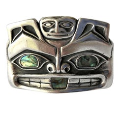
Pacific Northwest Native American Sterling Silver Abalone Mask Money Clip
Located in Palm Springs, CA
Native American Pacific northwest coast sterling silver mask money clip accented with abalone eyes and mouth.
Sterling Silver
Sold
H 18 in W 30 in D 2 in
"The Opalesence" Seascape Ocean AMAZINGLY BEAUTIFUL Image 12 x 24
Located in San Antonio, TX
During the past 46 years he has lived and painted scenes of the entire Pacific coast from Baja to the Inland passage of northern British Columbia, the gulf coast from Yucatan to Galv...
Oil
Sold
H 32.5 in W 27.5 in D 4 in
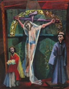
Trampas Altar, 1950s Figurative Devotional Oil Painting by Charles Stewart
By Charles Stewart, 1922-2011
Located in Denver, CO
From there, they decided to return to La Paz via a dirt road along the Pacific coast and found themselves in the small farming village of Todos Santos and soon became enchanted by th...
Oil, Canvas
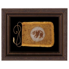
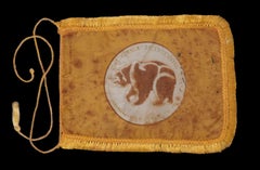
California Bear Flag Made in 1969 for the 200th Anniversary
Located in York County, PA
Inhabited by Native Americans, the territory had previously been claimed by the Spanish Empire in 1542 via right of discovery, when an explorer named Juan Rodríguez Cabrillo visited ...
Silk
Sold
H 18 in W 30 in D 2 in
"Capriccio In Sea Minor" Seascape Ocean AMAZINGLY BEAUTIFUL Image 12 x 24
Located in San Antonio, TX
During the past 46 years he has lived and painted scenes of the entire Pacific coast from Baja to the Inland passage of northern British Columbia, the gulf coast from Yucatan to Galv...
Oil
Sold
H 35.83 in W 24.22 in D 0.04 in
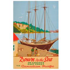
Original Vintage Canadian Pacific Poster - Down by the Sea - Digby Pines Hotel
Located in London, GB
Original vintage travel advertising poster “Down by the Sea on Canada's East Coast via Canadian Pacific” The Digby Pines Hotel.
Paper
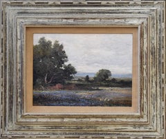
Limpia Creek
By Robert W. Wood
Located in Denver, CO
The following year, Wood was in a near fatal car accident on the Pacific Coast Highway. An amateur female artist by the name of Caryl helped him around the house during his recovery ...
Oil

Dressing Room
Located in Los Angeles, CA
Santa Barbara Museum of Art, California: Second Pacific Coast Biennial, purchase award, September 10 – October 13 1961 Santa Barbara Museum of Art, California: Two Hundred Years of A...
Oil Pastel
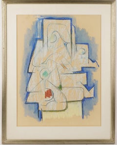

The Studio
Located in Los Angeles, CA
Santa Barbara Museum of Art, California: Second Pacific Coast Biennial, purchase award, September 10 – October 13 1961 Santa Barbara Museum of Art, California: Two Hundred Years of A...
Pastel
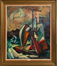
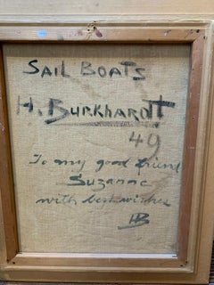
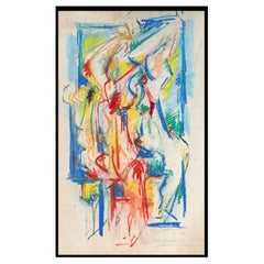
Sail Boats
By Hans Burkhardt
Located in Los Angeles, CA
Santa Barbara Museum of Art, California: Second Pacific Coast Biennial, purchase award, September 10 – October 13 1961 Santa Barbara Museum of Art, California: Two Hundred Years of A...
Canvas, Oil
Leonel Maciel Whimsical Painting
By Leonel Maciel
Located in Palm Springs, CA
I took mr Maciel's biography off wiki, Maciel was born in the small village of La Soledad de Maciel, located in the municipality of Petatlán, Guerrero on Mexico’s Pacific coast. He ...
Paint
Sold
H 24 in W 28 in D 2.5 in
"Old Mill" Naturalistic Green Toned Pastoral Country Oil Landscape Painting
Located in Houston, TX
The following year, Wood was hit by a car on Pacific Coast Highway and nearly died. His friend and amateur artist Caryl Price helped him around the house during his recovery and the ...
Oil, Canvas
Sold
H 33.25 in W 45.25 in D 1.75 in
"Laguna Moonlight" Early Impressionist Landscape of Laguna Beach, California
By Robert William Wood
Located in Houston, TX
The following year, Wood was hit by a car on Pacific Coast Highway and nearly died. His friend and amateur artist Caryl Price helped him around the house during his recovery and the ...
Canvas, Oil

Sold
H 33 in W 44 in D 3 in
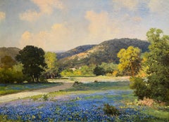
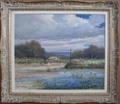
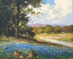
"AROUND THE BEND" TEXAS HILL COUNTRY BLUEBONNET IMAGE SIZE 26 X 36 Circa 1940
By Robert William Wood
Located in San Antonio, TX
The following year, Wood was hit by a car on Pacific Coast Highway and nearly died. His friend and amateur artist Caryl Price helped him around the house during his recovery and the ...
Oil

Sold
H 34 in W 39 in D 3 in
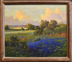
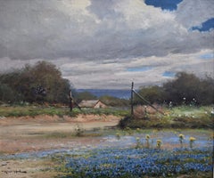
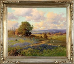
"SPRING MIX" TEXAS HILL COUNTRY WILDFLOWERS IMAGE: 25 X 30
By Robert William Wood
Located in San Antonio, TX
The following year, Wood was hit by a car on Pacific Coast Highway and nearly died. His friend and amateur artist Caryl Price helped him around the house during his recovery and the ...
Oil

Sold
H 31 in W 39 in D 3 in
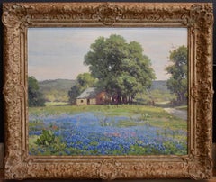
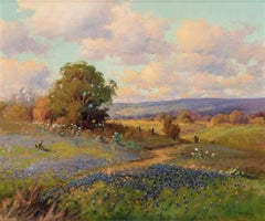
"PATH THROUGH THE BLUE" BLUEBONNET TEXAS HILL COUNTRY IMAGE: 23 X 31 CIRCA 1940S
By Robert William Wood
Located in San Antonio, TX
The following year, Wood was hit by a car on Pacific Coast Highway and nearly died. His friend and amateur artist Caryl Price helped him around the house during his recovery and the ...
Oil
Sold
H 25 in W 30 in D 3 in
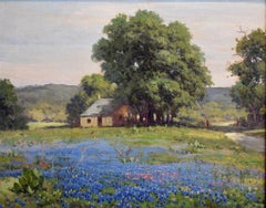
"Splash of Blue" Circa 1930s Bluebonnet Robert Wood (1889-1979) Original frame
Located in San Antonio, TX
The following year, Wood was hit by a car on Pacific Coast Highway and nearly died. His friend and amateur artist Caryl Price helped him around the house during his recovery and the ...
Oil

Sold
H 31 in W 43 in D 4 in
"Freedom" Texas Hill Country Ranch Landscape
By Robert William Wood
Located in San Antonio, TX
The following year, Wood was hit by a car on Pacific Coast Highway and nearly died. His friend and amateur artist Caryl Price helped him around the house during his recovery and the ...
Oil
Sold
H 33 in W 38 in D 4 in
"Boerne Texas" Bluebonnets Texas Hill Country Ranch
By Robert William Wood
Located in San Antonio, TX
The following year, Wood was hit by a car on Pacific Coast Highway and nearly died. His friend and amateur artist Caryl Price helped him around the house during his recovery and the ...
Oil
"Texas Bluebonnets" Hill Country Lanscape
By Robert William Wood
Located in San Antonio, TX
The following year, Wood was hit by a car on Pacific Coast Highway and nearly died. His friend and amateur artist Caryl Price helped him around the house during his recovery and the ...
Oil
Sold
H 22 in W 26 in D 4 in
"Bluebonnets" Texas Hill Country Ranch Bluebonnet
By Robert William Wood
Located in San Antonio, TX
The following year, Wood was hit by a car on Pacific Coast Highway and nearly died. His friend and amateur artist Caryl Price helped him around the house during his recovery and the ...
Oil

"Boerne Hills" Texas Hill Countruy
By Robert William Wood
Located in San Antonio, TX
The following year, Wood was hit by a car on Pacific Coast Highway and nearly died. His friend and amateur artist Caryl Price helped him around the house during his recovery and the ...
Oil
"Bluebonnets Texas Hill Country"
Located in San Antonio, TX
The following year, Wood was hit by a car on Pacific Coast Highway and nearly died. His friend and amateur artist Caryl Price helped him around the house during his recovery and the ...
Oil
Sold
H 32 in W 38 in D 3 in
"TEXAS HILL COUNTRY TRAIL" BLUEBONNET IMAGE: 25 X 30 FRAME: 32 X 38 CIRCA 1942
Located in San Antonio, TX
The following year, Wood was hit by a car on Pacific Coast Highway and nearly died. His friend and amateur artist Caryl Price helped him around the house during his recovery and the ...
Oil
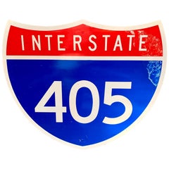
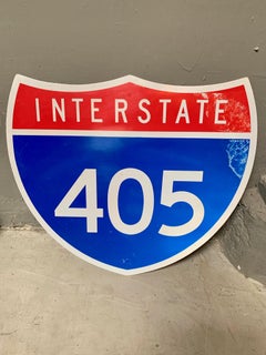
405 Freeway Sign
Located in Los Angeles, CA
Interstate 405 freeway sign. Cool piece of California signage. Good vintage condition. Little stars imprinted thought the metal sign.
Steel
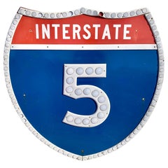
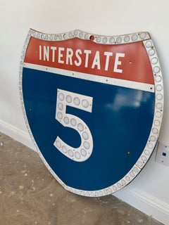
Los Angeles 5 Freeway Shield
Located in Los Angeles, CA
Vintage Los Angeles freeway shield from the 5 freeway in Los Angeles. Interstate 5 runs from the Tijuana/California border all the way up to the Canadian border near Blaine, Washingt...
Steel