Items Similar to Antique Map of Australasia, New Zealand, Polynesia & the Pacific Ocean, 1840

Want more images or videos?
Request additional images or videos from the seller
1 of 5
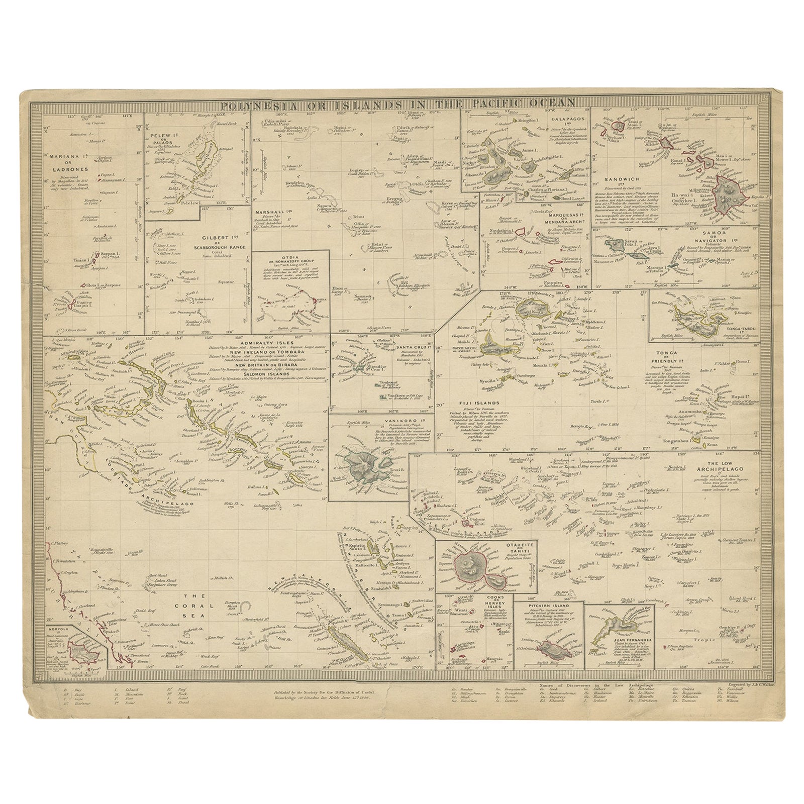
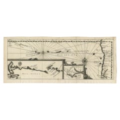
Antique Map of Australasia, New Zealand, Polynesia & the Pacific Ocean, 1840
About the Item
Antique map titled 'The Pacific Ocean'.
This map depicts Australasia, New Zealand, Polynesia and islands in the Pacific Ocean including the Sandwich Islands.
Artists and Engravers: Published by the Society for the Diffusion of Useful Knowledge, 1840. Engraved by J. & C. Walker.
Condition:
Good, general age-related toning. Few tiny tears, please study image carefully.
- Dimensions:Height: 13.39 in (34 cm)Width: 16.15 in (41 cm)Depth: 0 in (0.02 mm)
- Materials and Techniques:Abalone,Paper
- Period:
- Date of Manufacture:1840
- Condition:
- Seller Location:Langweer, NL
- Reference Number:
About the Seller
5.0
Platinum Seller
These expertly vetted sellers are 1stDibs' most experienced sellers and are rated highest by our customers.
Established in 2009
1stDibs seller since 2017
1,916 sales on 1stDibs
Typical response time: <1 hour
- ShippingRetrieving quote...Ships From: Langweer, Netherlands
- Return PolicyA return for this item may be initiated within 14 days of delivery.
More From This SellerView All
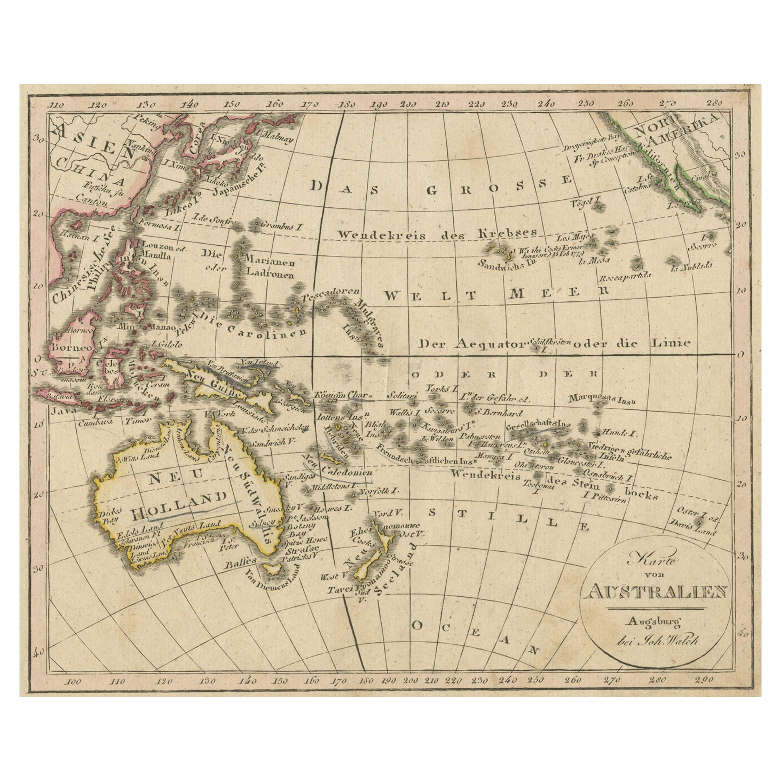
- Antique Map of Oceania and the Pacific Ocean, Australia and New Zealand, 1826Located in Langweer, NLAntique map of Australia titled 'Karte von Australien'. Old map of Australia and New Zealand. Published in Walch's 'Neuester Schul-Atlas'. Artists and Engravers: Johann, or Johan...Category
Antique 19th Century Maps
MaterialsPaper
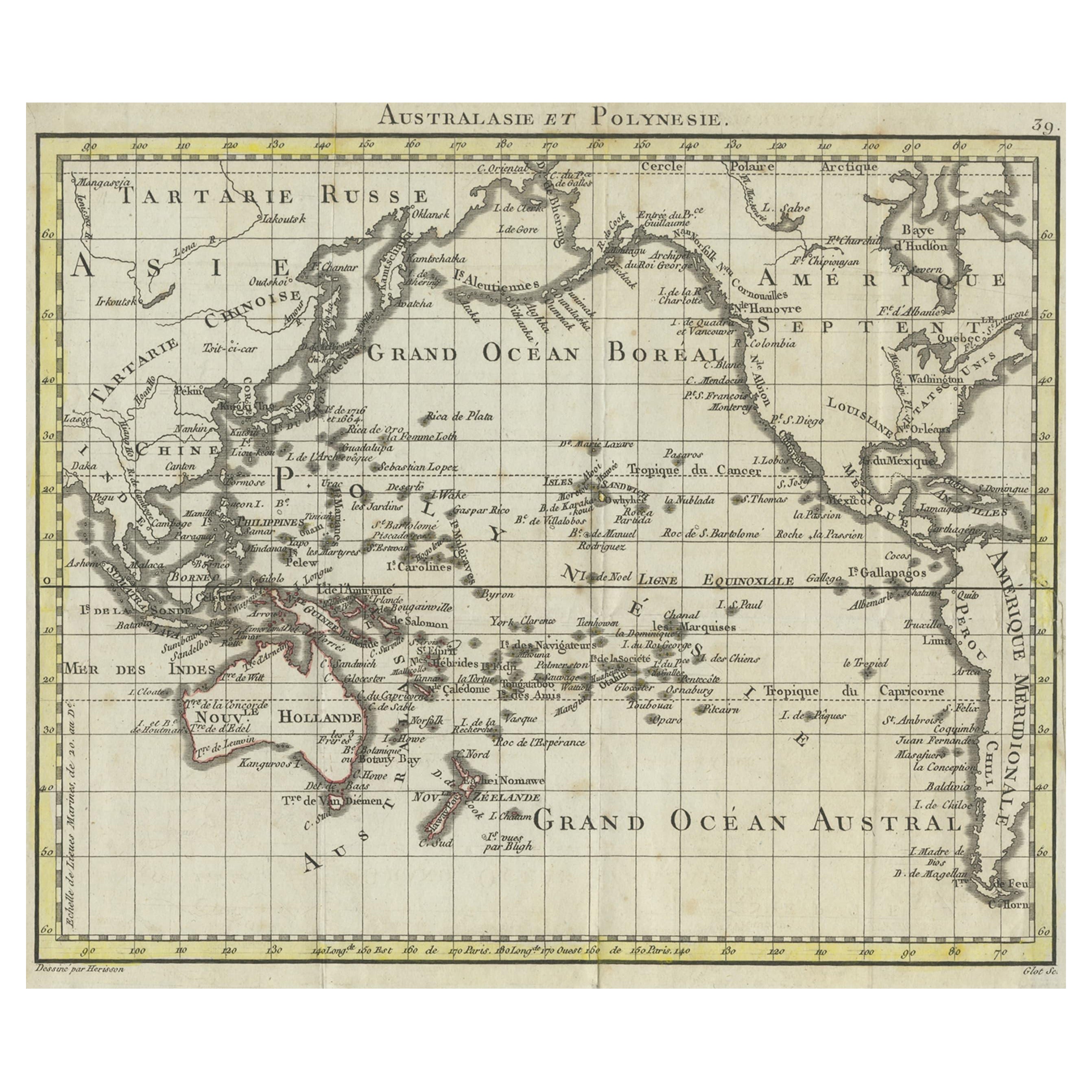
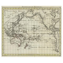
- Antique French Map of the Pacific Ocean with Australia and Polynesia, 1806Located in Langweer, NLAntique map titled 'Australasie et Polynesie'. Old map of Oceania and the Pacific Ocean. Originates from 'Atlas Portatif contenant la Géographie Universelle Ancienne et Moderne' by H...Category
Antique 19th Century Maps
MaterialsPaper
- Antique Map of Polynesia and Australasia by Neele, 1825Located in Langweer, NLAntique map titled 'Polynesia and Australasia'. It shows Australia (New Holland), part of Asia, New Zealand and many islands. This map originates from 'Encyclopedia Londinensis'.Category
Antique Early 19th Century Maps
MaterialsPaper
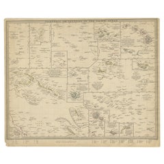
- Antique Map of Polynesia by Walker, 1840Located in Langweer, NLAntique map titled 'Polynesia or Islands in the Pacific Ocean'. This map depicts various islands including the Lousiade Archipelago, Tahiti, Pitcairn Island, Juan Fernandez, The low ...Category
Antique 19th Century Maps
MaterialsPaper
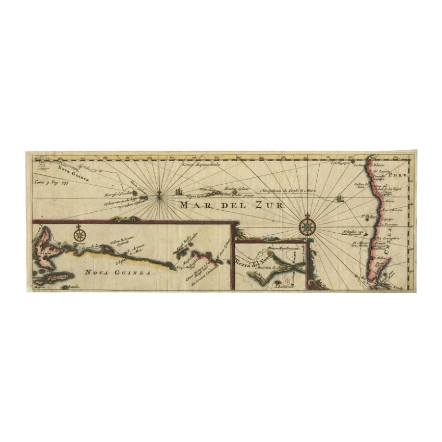
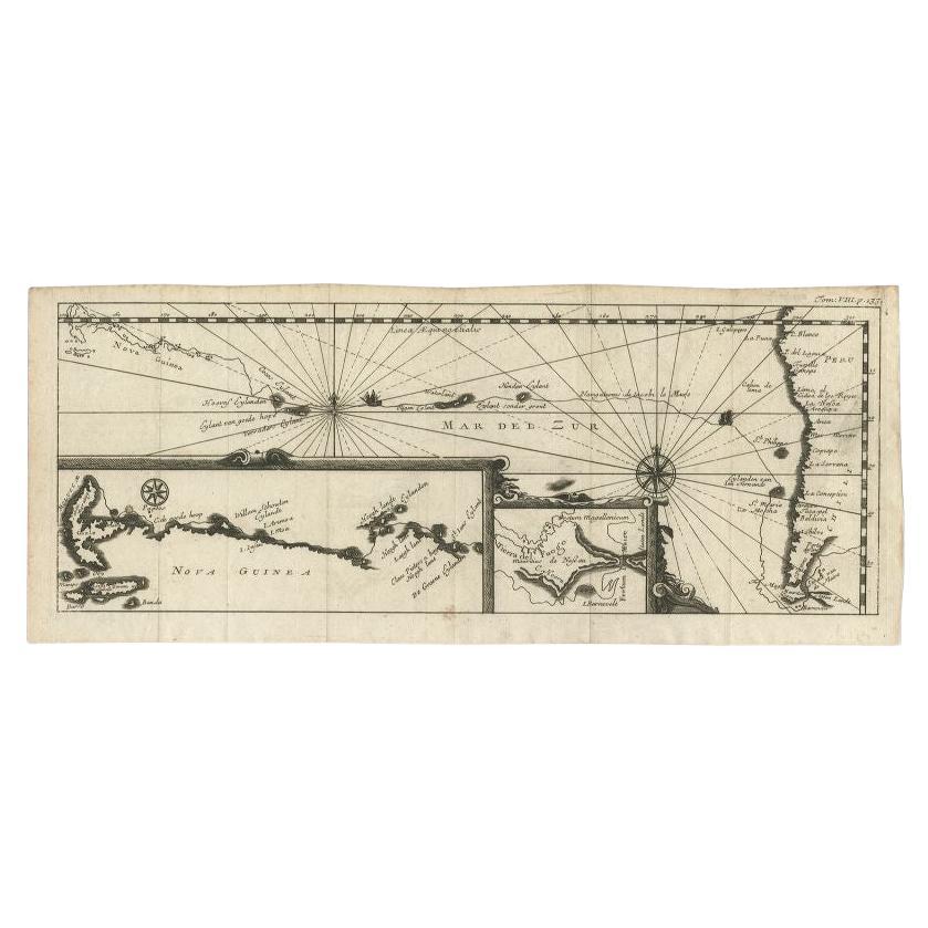
- Antique Map of the Pacific Ocean by Renneville, 1725Located in Langweer, NLRare map of the Southern Pacific, illustrating Le Maire's tracks, extending from the La Maire Straits to Nova Guinea, with a large inset of the northern Coastline of New Guinea and a...Category
Antique 18th Century Maps
MaterialsPaper
- Antique Map of the Pacific Ocean by Renneville, 1702Located in Langweer, NLAntique map, untitled. A map of the Pacific Ocean, with the coast of Peru in the right edge and the outline of New Guinea in the left edge. In betwe...Category
Antique 18th Century Maps
MaterialsPaper


You May Also Like
- Large Original Antique Map of The Pacific Ocean, Fullarton, C.1870Located in St Annes, LancashireGreat map of The Pacific Ocean From the celebrated Royal Illustrated Atlas Lithograph by Swanston. Original color. Published by Fullarton,...Category
Antique 1870s Scottish Maps
MaterialsPaper
- 1840 "New Map of the City of New York With Part of Brooklyn & Williamsburg"Located in Colorado Springs, COPresented is a hand-colored, engraved folding map titled "New Map of the City of New York With Part of Brooklyn & Williamsburg" by J. Calvin Smith. The map was issued bound in the bo...Category
Antique 1840s American Maps
MaterialsPaper
- Original Antique Map of Ireland- Kerry. C.1840Located in St Annes, LancashireGreat map of Kerry Steel engraving Drawn under the direction of A.Adlard Published by How and Parsons, C.1840 Unframed.Category
Antique 1840s English Maps
MaterialsPaper
- Large Original Vintage Map of New Zealand, South Island, circa 1920Located in St Annes, LancashireGreat map of South Island, New Zealand Original color. Good condition / repair to a minor tear on right edge Published by Alexander Gross Unframed.Category
Vintage 1920s English Edwardian Maps
MaterialsPaper
- Large Original Vintage Map of New Zealand, North Island, circa 1920Located in St Annes, LancashireGreat map of North Island, New Zealand Original color. Good condition / minor foxing to right edge Published by Alexander Gross Unframed.Category
Vintage 1920s English Edwardian Maps
MaterialsPaper
- Large Original Vintage Map of The South Pacific, circa 1920Located in St Annes, LancashireGreat map of The South Pacific Original color. Good condition / repairs to minor edge tears on top edge Published by Alexander Gross Unf...Category
Vintage 1920s English Edwardian Maps
MaterialsPaper


Recently Viewed
View AllMore Ways To Browse
New Zealand Artist
Pacific Islands
Ocean Map
Ocean Maps
Antique Sandwich
Map Of The Pacific
Antique New Zealand
Antique Abalone
Antique Ocean Map
Antique Furniture New Zealand
New Zealand Antique Furniture
Pacific Map
Map Zealand
New Zealand Map
Map Of New Zealand
Pacific Ocean Antique Map
New Zealand Antique Map
Antique New Zealand Map