Pacific Map

13
199
4
3
to
29
131
71
206
206
206
5
4
4
3
2
2
1
74
84
41
7
17
21
3
1
5
5
5
7
3
182
15
7
6
4
56
53
39
21
14
7
2
2
2
2
Sort By
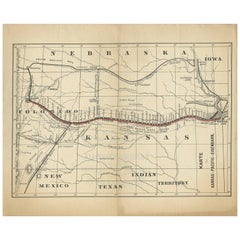
Antique Map of the Kansas Pacific Railroad, circa 1900
Located in Langweer, NL
Antique map titled 'Karte der Kansas-Pacific-Eisenbahn'. Lithographed map of the Kansas Pacific
Category

Early 20th Century Maps

Materials

Paper

Antique Map of the Kansas Pacific Railroad, circa 1900
No Reserve
H 9.26 in W 11.23 in D 0.02 in
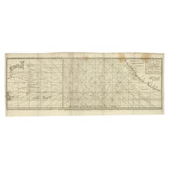
Antique Map of the Pacific Ocean by Anson, 1765
Located in Langweer, NL
capture of the Nostra the treasures were paraded through the streets of London. The map shows the pacific
Category

Antique 18th Century Maps

Materials

Paper

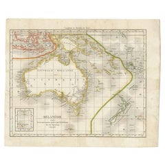
Antique Map of the Pacific Ocean by Rienzi, 1836
Located in Langweer, NL
Antique map titled 'Mélanésie'. Map of the Pacific ocean around Australia, including Java, Timor
Category

Antique 19th Century Maps

Materials

Paper

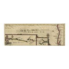
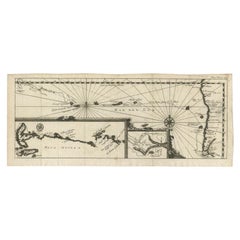
Antique Map of the Pacific Ocean by Renneville, 1725
Located in Langweer, NL
Rare map of the Southern Pacific, illustrating Le Maire's tracks, extending from the La Maire
Category

Antique 18th Century Maps

Materials

Paper

Antique Map of the Pacific Ocean by Renneville, 1702
Located in Langweer, NL
Antique map, untitled. A map of the Pacific Ocean, with the coast of Peru in the right edge and the
Category

Antique 18th Century Maps

Materials

Paper

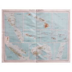
Large Original Vintage Map of The Pacific Islands Including Hawaii
Located in St Annes, Lancashire
Great map of The Pacific Islands Unframed Original color By John Bartholomew and Co
Category

Vintage 1920s British Maps

Materials

Paper

Large Original Vintage Map of The South Pacific, circa 1920
Located in St Annes, Lancashire
Great map of The South Pacific Original color. Good condition / repairs to minor edge tears
Category

Vintage 1920s English Edwardian Maps

Materials

Paper

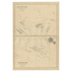
Antique Map of South Pacific Ocean by W. G. Blackie, 1859
Located in Langweer, NL
Antique map titled 'South Pacific Ocean'. Original antique map of South Pacific Ocean with inset
Category

Antique Mid-19th Century Maps

Materials

Paper

Antique Map of Australasia, New Zealand, Polynesia & the Pacific Ocean, 1840
Located in Langweer, NL
Antique map titled 'The Pacific Ocean'. This map depicts Australasia, New Zealand, Polynesia
Category

Antique 1840s Maps

Materials

Abalone, Paper

Large Original Antique Map of The Pacific Ocean, Fullarton, C.1870
Located in St Annes, Lancashire
Great map of The Pacific Ocean From the celebrated Royal Illustrated Atlas Lithograph by
Category

Antique 1870s Scottish Maps

Materials

Paper

Antique Map of the Islands in the Pacific Ocean by Wyld, '1845'
Located in Langweer, NL
Antique map titled 'Islands in the Pacific Ocean'. Original antique map of the islands in the
Category

Antique Mid-19th Century Maps

Materials

Paper

Antique Map of The United States of North America, Pacific States, 1882
Located in Langweer, NL
The map is from the same 1882 Blackie Atlas and focuses on the Pacific States of the United States
Category

Antique 1880s Maps

Materials

Paper

Antique French Map of the Pacific Ocean with Australia and Polynesia, 1806
Located in Langweer, NL
Antique map titled 'Australasie et Polynesie'. Old map of Oceania and the Pacific Ocean. Originates
Category

Antique 19th Century Maps

Materials

Paper

Old Map of the Pacific, Incl Australia, Polynesia, Melanesia and Malaysia, 1872
Located in Langweer, NL
'. Map of the Pacific, including Australia, Polynesia, Melanesia and Malaysia. Covers the region in
Category

Antique 1870s Maps

Materials

Paper

Antique Map of the Passage Between the Atlantic and Pacific Oceans, circa 1753
Located in Langweer, NL
passage between the Atlantic and Pacific oceans. Jacob Le Maire and Willem Schouten discovered the strait
Category

Antique 18th Century Maps

Materials

Paper

Antique Map of Oceania and the Pacific Ocean, Australia and New Zealand, 1826
Located in Langweer, NL
Antique map of Australia titled 'Karte von Australien'. Old map of Australia and New Zealand
Category

Antique 19th Century Maps

Materials

Paper

Print of Maps of Islands of the South Pacific, Incl. Pitcairn & Dusky Bay, 1788
Located in Langweer, NL
Pickersgill / I de Pasques.' Detailed set of maps of the islands of the South Pacific, with a large compass
Category

Antique 1780s Maps

Materials

Paper

1889 "The Pacific States and Territories"
Located in Colorado Springs, CO
Presented is an uncommon 1889 map of the western United States, titled “The Pacific States and
Category

Antique 1880s American Maps

Materials

Paper

1889 "The Pacific States and Territories"
H 16.25 in W 14.25 in D 1 in
Antique Chart of the Pacific Coast '1874'
Located in Langweer, NL
Antique chart titled 'Maps of the Pacific Coast exhibiting various subjects. Compiled from the
Category

Antique Late 19th Century Maps

Materials

Paper

Antique Chart of the Pacific Coast '1874'
H 21.66 in W 16.15 in D 0.02 in
"Clason's Guide Map of Montana" by The Clason Map Company, Circa 1920s
Located in Colorado Springs, CO
Presented is “Clason's Guide Map of Montana,” published in the early 1920s by the Clason Map
Category

Vintage 1920s American Art Deco Maps

Materials

Paper

Antique Map of Western Polynesia, 1849
Located in Langweer, NL
Antique map titled 'Ost-Polynesien'. Detailed map of the western Pacific extending from the Celebes
Category

Antique Mid-19th Century Maps

Materials

Paper

Antique Map of Western Polynesia, 1849
H 15.08 in W 18.51 in D 0.02 in
Antique World Map by Lesage, 1823
Located in Langweer, NL
Antique world map titled 'Mappe Monde Historique'. The map depicts both the Eastern and Western
Category

Antique Early 19th Century Maps

Materials

Paper

Antique World Map by Lesage, 1823
H 21.07 in W 27.56 in D 0.02 in
Antique Physical Chart of the Pacific Ocean by Johnston, '1850'
Located in Langweer, NL
Antique map titled 'Physical Chart of the Pacific Ocean showing the currents and temperature of the
Category

Antique Mid-19th Century Maps

Materials

Paper

Antique Map of America by Vaugondy, 1778
Located in Langweer, NL
Antique map titled 'Amerique ou Indes Occidentales (..)'. Vaugondy's map of America, pre-dating
Category

Antique Late 18th Century Maps

Materials

Paper

Antique Map of America by Vaugondy, 1778
H 20.87 in W 27.56 in D 0.02 in
Antique Map of Polynesia by Walker, 1840
Located in Langweer, NL
Antique map titled 'Polynesia or Islands in the Pacific Ocean'. This map depicts various islands
Category

Antique 19th Century Maps

Materials

Paper

Antique Map of Polynesia by Walker, 1840
H 13.19 in W 15.95 in D 0 in
Antique Chart of the Mid-Pacific Ocean by Anson, 'c.1784'
Located in Langweer, NL
Antique map titled 'Carte de la Mer du Sud ou Mer Pacifique'. Original chart of the mid-Pacific
Category

Antique Late 18th Century Maps

Materials

Paper

Antique Map of the Admiralty Islands, Bismarck Archipelago
Located in Langweer, NL
Antique map titled 'Trois Vues des Isles de l'Amirauté'. Several coastal views of the Admiralty
Category

Antique Late 18th Century Maps

Materials

Paper

Antique Map of German Colonies by Meyer, 1895
Located in Langweer, NL
, German Southeast-Africa, Cameroon, Marshall-Islands, German Colonies in the Pacific. This map originates
Category

Antique 19th Century Maps

Materials

Paper

1908 "Map of Texas" by The Kenyon Company
Located in Colorado Springs, CO
Presented is an antique map of the state of Texas, printed as a pocket map in 1908 by The Kenyon
Category

Antique Early 1900s American Maps

Materials

Paper

Antique Detailed World Map Drawn on Mercator's Projection, 1700
Located in Langweer, NL
Antique world map titled 'Carte generale du monde, ou description du monde terrestre & Aquatique
Category

Antique 17th Century Maps

Materials

Paper

Antique Map of the Low Countries by Brué, 1822
Located in Langweer, NL
Antique map titled 'Carte du Royaume des Pays-Bas'. Large format map of the Low Countries. This map
Category

Antique 19th Century Maps

Materials

Paper

Antique Map of South America by G. Anson, 1749
Located in Langweer, NL
Antique map titled 'Kaart van het Zuidelykste Gedeelte van Zuider Amerika (..) - Carte de la Partie
Category

Antique Mid-18th Century Dutch Maps

Materials

Paper

Antique Map of South America by G. Anson, 1749
H 20.87 in W 20.48 in D 0.02 in
Antique Map of Juan Fernandez Island by Anson '1749'
Located in Langweer, NL
Antique map titled 'l'Ile de Juan Fernandes dans la Mer du Sud (..) - Het Eiland Juan Fernandes in
Category

Antique Mid-18th Century Maps

Materials

Paper

Old Engraving of the Track of the Resolution Captain Cook in the Pacific, 1780
Located in Langweer, NL
Antique map titled 'Carte des Découvertes faites dans la Mer Pacifique sur la Vaisse au de Roi, La
Category

Antique 18th Century Maps

Materials

Paper

1865 "Johnson's Nebraska, Dakota, Colorado, Idaho & Kansas" Map, Johnson & Ward
Located in Colorado Springs, CO
Pacific R.R.” marked on the map. This 1865 Johnson and Ward publication of “Johnson's New Illustrated
Category

Antique Mid-19th Century Maps

Materials

Paper

Map of Polynesia Highlighting Cultural Landscapes and Maritime Activities, 1851
Located in Langweer, NL
John Tallis & Company was a London-based map publisher that flourished during the 19th century
Category

Antique 1850s Maps

Materials

Paper

1865 "Johnson's California, Utah, Nevada, Colorado, New Mexico, Arizona" Map
Located in Colorado Springs, CO
, New Mexico, and Arizona” map. First published in 1864, this map was issued as pages 66 and 67 in the
Category

Antique Mid-19th Century Maps

Materials

Paper

Antique Map of Harvey Island and Surroundings by Cook, 1803
Located in Langweer, NL
largely uncharted areas of the globe. He mapped lands from New Zealand to Hawaii in the Pacific Ocean in
Category

Antique 19th Century Maps

Materials

Paper

Antique Map of Harvey Island and Surroundings by Cook, 1803
Free Shipping
H 13.19 in W 16.34 in D 0 in
Antique Map of Central America Showing the Communication Lines, 1850
Located in Langweer, NL
Antique map titled 'Map of Central America Shewing the Different Lines of Atlantic & Pacific
Category

Antique 19th Century Maps

Materials

Paper

Antique Map of Manipa and Other Maluku Islands, Indonesia, 1726
Located in Langweer, NL
Maluku Province of Indonesia, in the Pacific Ocean. This map originates from 'Oud en Nieuw Oost-Indiën
Category

Antique 18th Century Maps

Materials

Paper

Title: Mid-19th Century Map of Australasia by Carl Flemming - 1855
Located in Langweer, NL
the broader Pacific Ocean. The map is annotated in German, with "Australië" indicating the focus on
Category

Antique 1850s Maps

Materials

Paper

Antique Map of Polynesia with Details of Many Islands, 1840
Located in Langweer, NL
Antique map titled 'Polynesia or Islands in the Pacific Ocean'. This map depicts various islands
Category

Antique 19th Century Maps

Materials

Paper

New Map of North America from the Latest Discoveries, 1763
Located in Philadelphia, PA
A fine antique 18th century map of the North American seaboard. Entitled "A New Map of North
Category

Antique Mid-18th Century English Georgian Maps

Materials

Paper

1915 "San Francisco City and County" Hanging Map by W. Bashford Smith
Located in Colorado Springs, CO
-Pacific International Exposition, with a smaller guide to "Exhibit Palaces." The map is printed in black
Category

Vintage 1910s American Art Deco Maps

Materials

Wood, Paper

Antique Map of the Netherlands and Belgium by Homann, circa 1710
By Johann Baptist Homann
Located in Langweer, NL
Antique map titled 'Tabula Generalis Totius Belgii Provinciae XVII. Infer. Germaniae (..)'. Map of
Category

Antique Early 18th Century German Maps

Materials

Paper

Antique Map of the Netherlands and Belgium by Homann, circa 1710
Free Shipping
H 20.87 in W 24.02 in D 0.02 in
Antique Map of the Eastside of Coiba Island 'Quibo', Panama, 1749
Located in Langweer, NL
Antique map titled 'Plan de la partie orientale de l'Isle de Quibo'. Map of the eastside of Coiba
Category

Antique 18th Century Maps

Materials

Paper

Antique Map of the Bay of Terney by La Pérouse, 1797
Located in Langweer, NL
Antique map titled 'Plan de la Baie de Ternai'. Old map of the north eastern coast of Russia. This
Category

Antique 18th Century Maps

Materials

Paper

1899 Poole Brothers Antique Railroad Map of the Illinois Central Railroad
Located in Colorado Springs, CO
This is an 1899 railroad map of the Illinois Central and Yazoo and Mississippi Valley Railroads
Category

Antique 1890s American Maps

Materials

Paper

Antique Map of the War Situation in Europe and Asia, 1944
Located in Langweer, NL
Antique map titled 'Newsmap for the Armed Forces'. This "newsmap" was issued on Monday, December 18
Category

20th Century Maps

Materials

Paper

An Old Illustrated Tallis Map of Central America with Volcanic Vignettes, 1851
Located in Langweer, NL
This map of Central America, part of John Tallis & Company's series from "The British Colonies" by
Category

Antique 1850s Maps

Materials

Paper

Antique Map with Details of Berings' Expedition into Russians' Far East, 1737
Located in Langweer, NL
Siberia and to chart much of the Pacific Coast. The present map extends from Tobolsk in the west, the
Category

Antique 1730s Maps

Materials

Paper

Antique Map of Manipa, Nusa-Laut, Saparua & Haruku 'Indonesia' by F. Valentijn
Located in Langweer, NL
Four maps of islands and two figures in native dress. The islands are: Manipa, Nusa-Laut (Noessa
Category

Antique Early 18th Century Maps

Materials

Paper

Antique Map of the Coast of Juan Fernandez by Van Schley, 1757
Located in Langweer, NL
Antique map titled 'Cote du Nord Est de l'Isle de Juan Fernandez (..).' Map of the Chilean South
Category

Antique 18th Century Maps

Materials

Paper

California, Alaska and Mexico: 18th Century Hand-Colored Map by de Vaugondy
By Didier Robert de Vaugondy
Located in Alamo, CA
This an 18th century hand-colored map of the western portions of North America entitled "Carte de
Category

Antique 1770s French Maps

Materials

Paper

Captain Cook's Exploration of Tahiti 18th C. Hand-Colored Map by Bellin
By Jacques-Nicolas Bellin
Located in Alamo, CA
, Cook was the first to map Newfoundland prior to making his famous three voyages to the Pacific Ocean
Category

Antique Mid-18th Century French Maps

Materials

Paper

Antique Map of Asia, Showing Tradewinds, Silke Route Cities Etc, c.1780
Located in Langweer, NL
Antique map titled 'L'Asie.' Map of Asia. Offers considerable detail considering the size, showing
Category

Antique 18th Century Maps

Materials

Paper

Important and Scarce Antique Map of Asia from Jesuit Sources, C.1713
Located in Langweer, NL
north of Japan. Inset in the North Pacific is a map of that same region based on the information from
Category

Antique 18th Century Maps

Materials

Paper

Crossroads of Empires: A John Tallis Map of the Isthmus of Panama, 1851
Located in Langweer, NL
The Tallis map of the Isthmus of Panama is a beautifully detailed work, characteristic of the maps
Category

Antique 1850s Maps

Materials

Paper

North & South America: A 17th Century Hand-colored Map by Jansson & Goos
By Johannes Janssonius
Located in Alamo, CA
A 17th century hand-colored map of North & South America entitled "Americae Descriptio" by the
Category

Antique 1620s Dutch Maps

Materials

Paper

Map of Guatemala or the Former United Provinces of Central America, 1845
Located in Langweer, NL
The image is an antique map titled "Guatemala or United States of Central America," which is drawn
Category

Antique Mid-19th Century Maps

Materials

Paper

  • 1
Get Updated with New Arrivals
Save "Pacific Map", and we’ll notify you when there are new listings in this category.

Pacific Map For Sale on 1stDibs

Choose from an assortment of styles, material and more with respect to the pacific map you’re looking for at 1stDibs. Frequently made of paper, every pacific map was constructed with great care. You’ve searched high and low for the perfect pacific map — we have versions that date back to the 18th Century alongside those produced as recently as the 20th Century are available. A pacific map, designed in the style, is generally a popular piece of furniture. You’ll likely find more than one pacific map that is appealing in its simplicity, but James Cook produced versions that are worth a look.

How Much is a Pacific Map?

The average selling price for a pacific map at 1stDibs is $284, while they’re typically $76 on the low end and $7,450 for the highest priced.

Read More

Pamela Shamshiri Shares the Secrets behind Her First-Ever Book and Its Effortlessly Cool Interiors

The sought-after designer worked with the team at Hoffman Creative to produce a monograph that beautifully showcases some of Studio Shamshiri's most inspiring projects.

Moroccan Artworks and Objects Take Center Stage in an Extraordinary Villa in Tangier

Italian writer and collector Umberto Pasti opens the doors to his remarkable cave of wonders in North Africa.

Montecito Has Drawn Royalty and Celebrities, and These Homes Are Proof of Its Allure

Hollywood A-listers, ex-pat aristocrats and art collectors and style setters of all stripes appreciate the allure of the coastal California hamlet — much on our minds after recent winter floods.

Whaam! Blam! Pow! — a New Book on Pop Art Packs a Punch

Publishing house Assouline and writer Julie Belcove have teamed up to trace the history of the genre, from Roy Lichtenstein, Andy Warhol and Yayoi Kusama to Mickalene Thomas and Jeff Koons.

The Sparkling Legacy of Tiffany & Co. Explained, One Jewel at a Time

A gorgeous new book celebrates — and memorializes — the iconic jeweler’s rich heritage.

What Makes a Gem-Encrusted Chess Set Worth $4 Million?

The world’s most opulent chess set, weighing in at 513 carats, is literally fit for a king and queen.

Tauba Auerbach’s Geometric Pop-Up Book Is Mighty Rare, Thanks to a Hurricane

This sculptural art book has an epic backstory of its own.

Step inside the Storied Mansions of Palm Beach’s Most Effervescent Architect

From Spanish-style courtyards to fanciful fountains, these acclaimed structures abound in surprising and elegant details.