Items Similar to Map of Polynesia Highlighting Cultural Landscapes and Maritime Activities, 1851


Want more images or videos?
Request additional images or videos from the seller
1 of 6
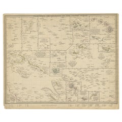
Map of Polynesia Highlighting Cultural Landscapes and Maritime Activities, 1851
About the Item
John Tallis & Company was a London-based map publisher that flourished during the 19th century. Their maps, characterized by elaborate borders and decorative vignettes, are some of the last examples of large-scale decorative cartography before the trend moved towards more utilitarian and scientific mapping.
The Tallis map of Polynesia is a fine example of their work. It would likely depict the many islands spread across the central and southern Pacific Ocean, an area often referred to as Polynesia. The map probably emphasizes not only the geography but also the cultural and natural history of the region through its detailed vignettes.
Robert Montgomery Martin's involvement would suggest that the map contains explanatory text providing context about the British presence and interests in the region, reflecting the broader imperial narrative of the time.
The countries and territories within Polynesia would include a wide range of island groups, many of which had significant cultural ties but were colonially influenced by different European powers, including the British. Strategic locations for trade and military outposts would be highlighted.
The Tallis series of maps are important historical documents that capture a world in transition, showing how the British saw their empire and its global context. These maps remain valuable for their rich artistic detail and as artifacts of the Victorian era's cultural and political milieu.
The images on the map in more detail:
The images in the insets of the Tallis map of Polynesia seem to depict various cultural and natural scenes relevant to the region, emphasizing the beauty and uniqueness of the places and the people who inhabit them.
1. **Resolution Bay, Marquesas**: This inset likely depicts a scene from Resolution Bay in the Marquesas Islands. It shows a traditional boat with what appears to be a group of local Polynesians in traditional attire navigating the waters with a mountainous backdrop, indicative of the volcanic origins of many islands in the region.
2. **Otahiete (Tahiti)**: Featuring traditional Polynesian canoes with a distinctive sail, possibly in the waters of Tahiti, known locally as Otahiti. This might capture a moment of daily life or transport methods, with thatched structures on the water's edge and the lush, mountainous landscapes that are characteristic of the island.
3. **Harbour of Dory, New Guinea**: This scene likely illustrates a harbor in New Guinea, with more rudimentary and utilitarian canoes shown. The background may show a European vessel, indicating contact or trade with outsiders, set against a vista of the rugged, densely vegetated coastline.
4. **Kalakakooa, Sandwich Islands (Hawaii)**: The image probably shows Kalakakooa (Kealakekua Bay) on the Island of Hawaii, also known as the Sandwich Islands at that time. It was famous for being the place where British explorer Captain James Cook was killed in 1779. This depiction emphasizes the interaction between the local people and European explorers or traders.
These detailed engravings are typical of the Tallis style, aiming to provide not only geographical information but also a sense of the life, environment, and interactions taking place in the depicted regions. They also reflect the European interest in and romanticization of "exotic" locales during the era of colonial expansion.
- Dimensions:Height: 10.71 in (27.2 cm)Width: 14.26 in (36.2 cm)Depth: 0 in (0.02 mm)
- Materials and Techniques:
- Period:
- Date of Manufacture:1851
- Condition:Good given age. Original fold in middle as published. General age-related toning, please study scan carefully.
- Seller Location:Langweer, NL
- Reference Number:
About the Seller
5.0
Platinum Seller
These expertly vetted sellers are 1stDibs' most experienced sellers and are rated highest by our customers.
Established in 2009
1stDibs seller since 2017
1,928 sales on 1stDibs
Typical response time: <1 hour
- ShippingRetrieving quote...Ships From: Langweer, Netherlands
- Return PolicyA return for this item may be initiated within 14 days of delivery.
More From This SellerView All
- Antique Map of Eastern Polynesia, 1849Located in Langweer, NLAntique map titled 'Ost-Polynesien'. Interesting variant issue, with large detailed insets top right of Hawaii volcanos near Kilauea. Insets lower right of Honolulu harbour, island o...Category
Antique Mid-19th Century Maps
MaterialsPaper
- Antique Map of Western Polynesia, 1849Located in Langweer, NLAntique map titled 'Ost-Polynesien'. Detailed map of the western Pacific extending from the Celebes to Samoa and including part of Australia. Insets of...Category
Antique Mid-19th Century Maps
MaterialsPaper
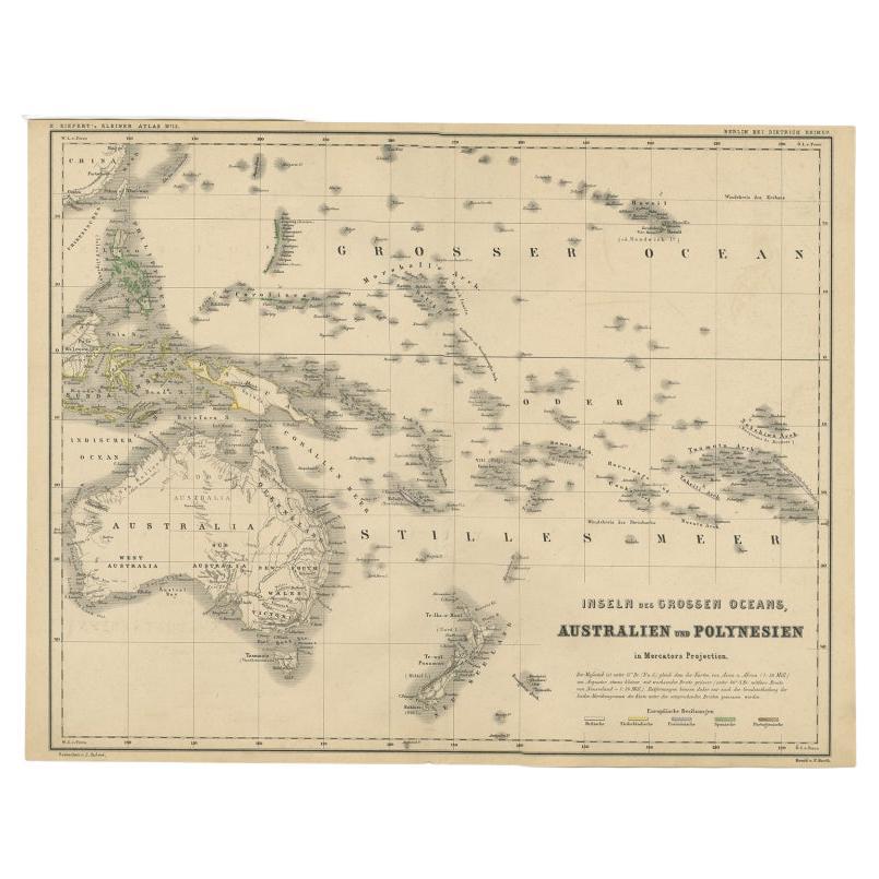
- German Antique Map of Australia and Polynesia, c.1870Located in Langweer, NLAntique map titled 'Inseln des Grossen Oceans, Australien und Polynesien'. Old map of Australia and Polynesia. This map originates from 'H. Kiepert's Kleiner Atlas der Neueren Geogra...Category
Antique 19th Century Maps
MaterialsPaper
- Antique Map of Polynesia and Australasia by Neele, 1825Located in Langweer, NLAntique map titled 'Polynesia and Australasia'. It shows Australia (New Holland), part of Asia, New Zealand and many islands. This map originates from 'Encyclopedia Londinensis'.Category
Antique Early 19th Century Maps
MaterialsPaper
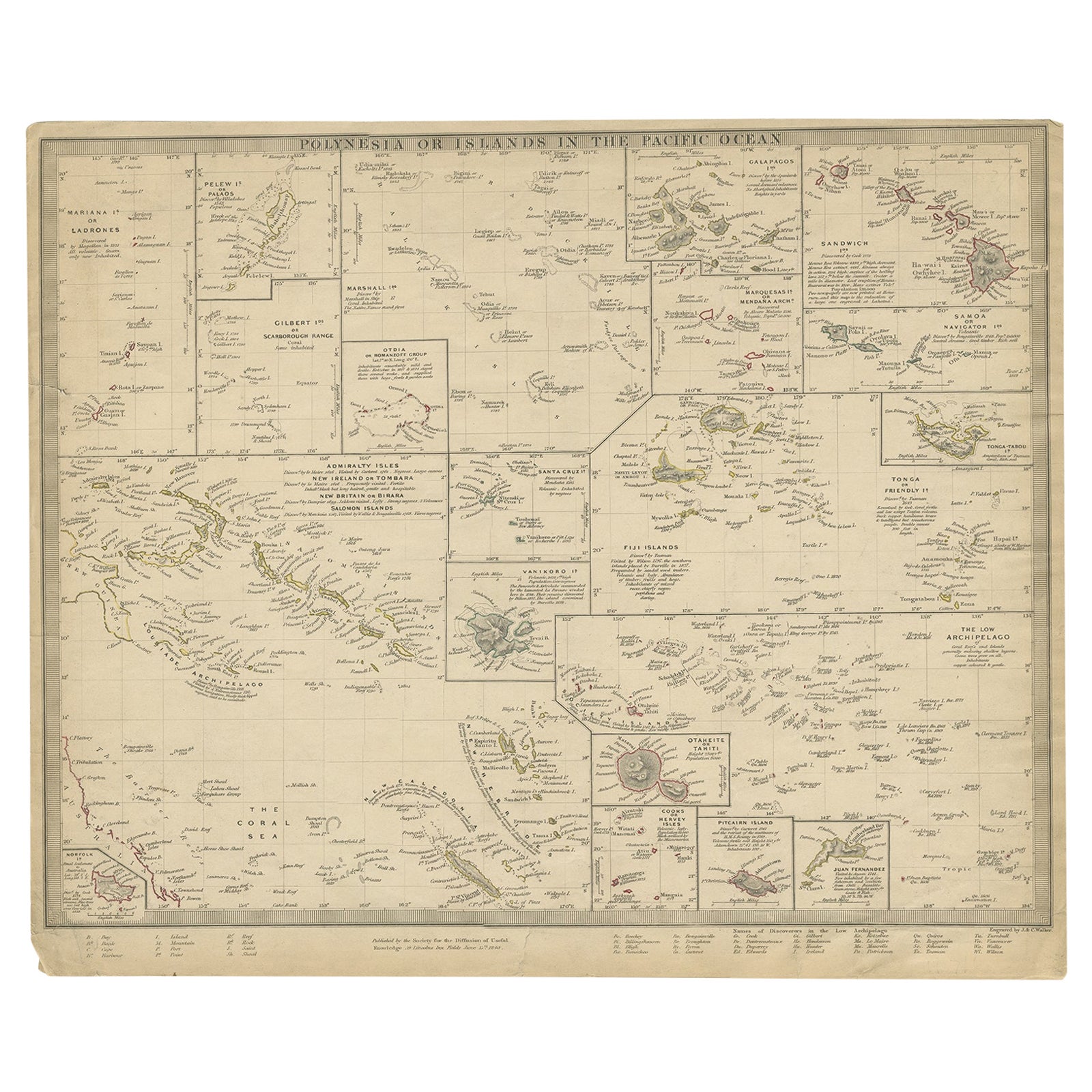
- Antique Map of Polynesia by Walker, 1840Located in Langweer, NLAntique map titled 'Polynesia or Islands in the Pacific Ocean'. This map depicts various islands including the Lousiade Archipelago, Tahiti, Pitcairn Island, Juan Fernandez, The low ...Category
Antique 19th Century Maps
MaterialsPaper
- Antique Map of Australia and Polynesia, inset of Tasmania c.1860Located in Langweer, NLGerman antique map titled 'Australien und Polynesien'. Old map of Australia (New Holland) and Polynesia. With an inset map of Southern Australia including Tasmania (Van Diemen's Land...Category
Antique 19th Century Maps
MaterialsPaper


You May Also Like
- 1851 Map of "Independent Tartary", Ric. R018Located in Norton, MA1851 Map of Independent Tartary "Russia" Ric.r018 A highly decorative 1851 map of Independent Tartary by John Tallis and John Rapkin. Covers the regions between the Caspian Sea and Lake Bakquash and between Russia and Afghanistan. These include the ancient Silk Route kingdoms of Khiva, Tartaria, Kokand, and Bokhara. Today this region roughly includes Kazakhstan, Uzbekistan, Turkmenistan, Kyrgyzstan, and Tajikistan. This wonderful map offers a wealth of detail for anyone with an interest in the Central Asian portion of the ancient Silk Road. Identifies various caravan routes, deserts, wells, and stopping points, including the cities of Bokhara and Samarkand. Three vignettes by W. Bragg decorate the map, these including an image of Tartars on a Journey, a horseback Bride Chase, and a tartar camp site. Surrounded by a vine motif border. Engraved by J. Rapkin for John Tallis's 1851 Illustrated Atlas . Tartary Antique Map...Category
Antique 19th Century Unknown Maps
MaterialsPaper
- "San Francisco, Upper California” 1851 Antique Map of San FranciscoLocated in Colorado Springs, COThis is a pictorial lettersheet view of the city and harbor of San Francisco. This lithograph was printed on grey wove paper, across a double sheet, by famed lithographers Britton & ...Category
Antique 1850s American Prints
MaterialsPaper
- Original Antique English County Map, Herefordshire, J & C Walker, 1851Located in St Annes, LancashireGreat map of Herefordshire Original colour By J & C Walker Published by Longman, Rees, Orme, Brown & Co. 1851 Unframed.Category
Antique 1850s English Other Maps
MaterialsPaper
- Original Antique English County Map, Rutland, J & C Walker, 1851Located in St Annes, LancashireGreat map of Rutland Original colour By J & C Walker Published by Longman, Rees, Orme, Brown & Co. 1851 Unframed.Category
Antique 1850s English Other Maps
MaterialsPaper
- Original Antique English County Map, Durham, J & C Walker, 1851Located in St Annes, LancashireGreat map of Durham Original colour By J & C Walker Published by Longman, Rees, Orme, Brown & Co. 1851 Unframed.Category
Antique 1850s English Other Maps
MaterialsPaper
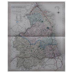
- Original Antique English County Map, Northumberland, J & C Walker, 1851Located in St Annes, LancashireGreat map of Northumberland Original colour By J & C Walker Published by Longman, Rees, Orme, Brown & Co. 1851 Unframed.Category
Antique 1850s English Other Maps
MaterialsPaper