Items Similar to California, Alaska and Mexico: 18th Century Hand-Colored Map by de Vaugondy


Want more images or videos?
Request additional images or videos from the seller
1 of 9
California, Alaska and Mexico: 18th Century Hand-Colored Map by de Vaugondy
About the Item
This an 18th century hand-colored map of the western portions of North America entitled "Carte de la Californie et des Pays Nord-Ouest separés de l'Asie par le détroit d'Anian, extraite de deux cartes publiees au commencement de 17e Siecle" (Map of California and the Northwestern Countries separated from Asia by the Anian Strait, from two maps published at the beginning of the 17th century), created by Didier Robert De Vaugondy and published in Paris in 1772 in Diderot's Encyclopedie. The map and its inset are based on earlier maps from 1612 by and 1641 by the Dutch cartographers Petrus Plancius (1552-1622) and Nicolaes Visscher I (1618- 1679) relying on information included on maps by Gerardus Mercator (1512-1594).
The main portions of the map depicts the west coast of North America from Present day Alaska in the north to Baja California in the south. The map includes the Strait of Anian in the region of Alaska, which refers to the legendary but nonexistent Northwest Passage, hoped to be a link between the Atlantic and Pacific oceans and a desirable trade route from Europe to North America. Captain James Cook eventually disproved its existence during his third and final voyage in 1778.
A large inset map of the same region curiously depicts the coastline differently than in the larger portion of the map. The larger map shows Mendocino in Northern California, the Bay of San Miguel (present day San Diego) and Cabo de California (Cabo San Lucas) at the southern tip of Baja California, while the smaller inset map includes C. de San Francisco and los Farilones (the Farallon Islands) and Isle De Paxaros, possibly representing Catalina Island. The larger map shows Nova Albion, the name given to Northern California by Sir Francis Drake when he claimed the area for England in 1579. His point of landfall is now called Drake's Cove, which is part of Point Reyes National Seashore. The smaller inset map identifies the entire region as "Mexicana".
These maps are based on maps by Vischer of 1612 and 1641, and appeared in the Supplement to Denis Diderot's Encyclopedie. Both maps showing the fictitious Strait of Anian at the top; it was part of the legendary Northwest Passage, the long hoped for link of the Pacific and Atlantic Oceans, whose existence many explorers attempted to prove, and which The smaller inset map shows much more of the Strait, along with an open sea, making a suggestion of a Northwest Passage. The coastlines vary in both maps, with the smaller one listing important place names such as . Image sie: 12 3/4 x 12". Paper size: 18 1/2 x 15 1/4".
The map is printed on watermarked laid, chain-linked paper with wide margins. The sheet measures 13.75" high x 16.63" wide. The are vertical and horizontal fold, as issued, with reinforcement of a left vertical fold on the verso. There is minimal discoloration of the edges of the left and lower margins and a few faint spots on the right, but the map is otherwise in excellent condition.
Didier Robert de Vaugondy (1723-1786) was the son of Gilles Robert de Vaugondy, who was a prominent French cartographer, printmaker and publisher. The two worked together in the family business, they publishing atlases. The best know publication was the Atlas Universel (1757). Didier followed his father as the royal cartographer/hydrographer to King Louis XV of France. He held a similar position in the court of the Duke of Lorraine and King of Poland. He later became the royal censor for information published in French geography texts, sea charts and publication describing travel and exploration.
- Creator:Didier Robert de Vaugondy (Artist)
- Dimensions:Height: 13.75 in (34.93 cm)Width: 16.63 in (42.25 cm)Depth: 0.13 in (3.31 mm)
- Materials and Techniques:Paper,Engraved
- Place of Origin:
- Period:1770-1779
- Date of Manufacture:1772
- Condition:Wear consistent with age and use.
- Seller Location:Alamo, CA
- Reference Number:
About the Seller
5.0
Vetted Seller
These experienced sellers undergo a comprehensive evaluation by our team of in-house experts.
1stDibs seller since 2020
12 sales on 1stDibs
- ShippingRetrieving quote...Ships From: Alamo, CA
- Return PolicyA return for this item may be initiated within 7 days of delivery.
More From This SellerView All
- 18th Century Hand Colored Map of Spain and Portugal by VisscherBy Nicolaes Visscher IILocated in Alamo, CAThis is an early 18th century map of Spain and Portugal, with attractive original hand-coloring, entitled "Hispaniae et Portugalliae Regna per Nicolaum Visscher cum Privilegio Ordinu...Category
Antique Early 18th Century Dutch Maps
MaterialsPaper
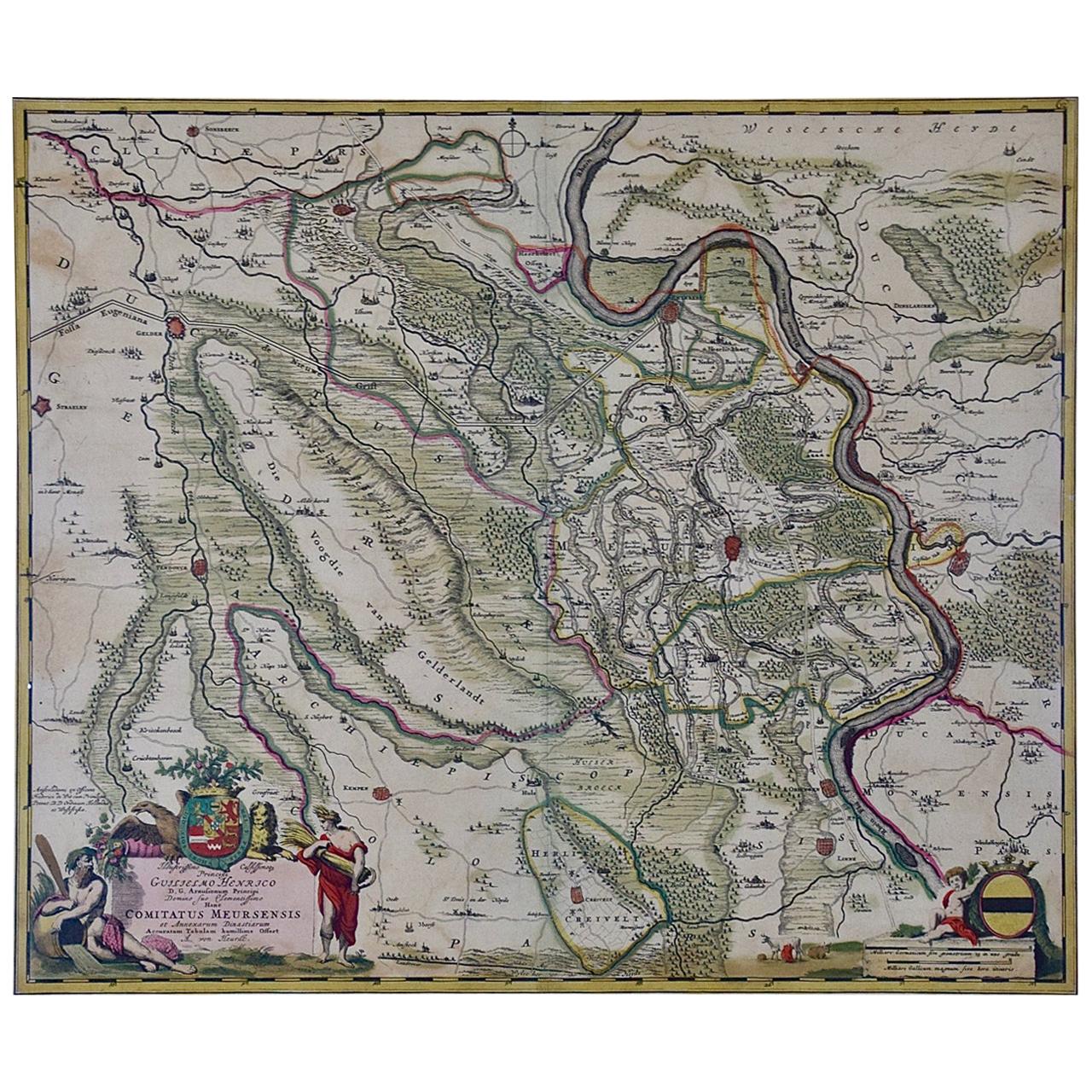
- Germany West of the Rhine: A Hand-colored 18th Century Map by de WitBy Frederick de WitLocated in Alamo, CAThis original 18th century hand-colored map of the county of Moers, Germany entitled "Illustrissimo Celsissmo Principi GUILIELMO HENRICO D.G. Arausionum Principi Domino suo Clementis...Category
Antique Early 18th Century Dutch Maps
MaterialsPaper
- South America: Hand-colored 18th Century Framed Map by Thomas JefferysBy Thomas JefferysLocated in Alamo, CAThis detailed hand-colored map of South America by Thomas Jefferys was published in London in 1750. The map shows countries, early colonial possessions, towns, rivers, mountains, and...Category
Antique Mid-18th Century English Maps
MaterialsPaper
- 18th Century Hand-Colored Homann Map of Germany, Including Frankfurt and BerlinBy Johann Baptist HomannLocated in Alamo, CAAn 18th century hand-colored map entitled "Tabula Marchionatus Brandenburgici et Ducatus Pomeraniae quae sunt Pars Septentrionalis Circuli Saxoniae Superioris" by Johann Baptist Homa...Category
Antique Early 18th Century German Maps
MaterialsPaper
- Scandinavia & Portions of Eastern Europe: 18th Century Hand-Colored Homann MapBy Johann Baptist HomannLocated in Alamo, CAAn early 18th century hand-colored copper-plate map entitled "Regni Sueciae in omnes suas Subjacentes Provincias accurate divisi Tabula Generalis" by Johann Baptist Homann (1663-1724...Category
Antique Early 18th Century German Maps
MaterialsPaper
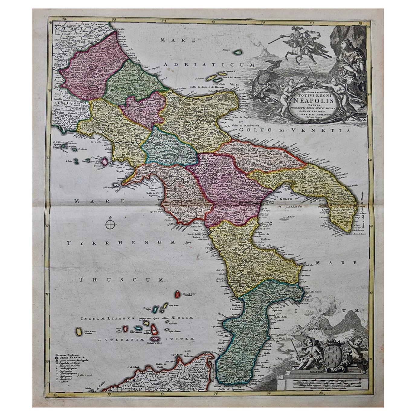
- The Kingdom of Naples and Southern Italy: A Hand-Colored 18th Century Homann MapBy Johann Baptist HomannLocated in Alamo, CA"Novissima & exactissimus Totius Regni Neapolis Tabula Presentis Belli Satui Accommo Data" is a hand colored map of southern Italy and the ancient Kingdom of Naples created by Johann...Category
Antique Early 18th Century German Maps
MaterialsPaper


You May Also Like
- Antique Map of the Indonesian and Philippine Archipelagos by R. de VaugondyLocated in Langweer, NLStriking and highly detailed map of the region from Sumatra and Malaca and Southern China to the Philipines, New Guinea and Northern Australia, centered on Borneo. Includes a large i...Category
Antique Mid-18th Century Maps
MaterialsPaper
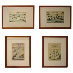
- 18th century Set Hand Colored Nautical EngravingsBy M. OgierLocated in Savannah, GASigned M. Ogier (Fecit:by), this set of four hand colored engravings is part of a larger edition of plates. These plates are numbered PL 16, 347, 365 and 386. The subject is probably...Category
Antique 18th Century Unknown Elizabethan Prints
MaterialsGlass, Wood, Paper
- Antique Map of America by Vaugondy, 1778Located in Langweer, NLAntique map titled 'Amerique ou Indes Occidentales (..)'. Vaugondy's map of America, pre-dating information from any of the Cook Voyages. The NW Coast of Amer...Category
Antique Late 18th Century Maps
MaterialsPaper
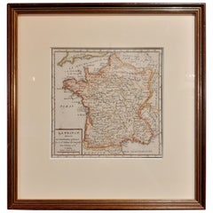
- Antique Map of France by Vaugondy, circa 1750Located in Langweer, NLAntique map titled 'La France divisée (..)'. Map of France published by Robert de Vaugondy, circa 1750. Frame included. We carefully pack our framed items to ensure safe shipping.Category
Antique Early 18th Century Maps
MaterialsPaper
- Antique Albertus Seba Pair 18th Century Hand-Colored Engravings ButterflyBy Albertus Seba 1Located in Washington, DCRare pair of original hand-colored prints from Sir Albertus Seba's cabinet of natural curiosities. Prints come from published volumes in Amste...Category
Antique Mid-18th Century Dutch Prints
MaterialsPaper
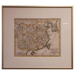
- Antique Map of China Including Korea and Taiwan by Vaugondy, 1749Located in Langweer, NLAntique map titled 'Empire de la Chine'. Beautiful map of China including Korea and Taiwan (Formosa). This map originates from 'Atlas Universel (..)' by Gilles Robert de Vaugondy, 17...Category
Antique Mid-18th Century Maps
MaterialsPaper


Recently Viewed
View AllMore Ways To Browse
Early California Furniture
Antique Furniture California
Mexican Country Furniture
Country French Provence
Used Furniture Southern California
Robert Holland
18c French Furniture
Map North America
Map Of North America
Mexican 18th Century
Map South America
Map Of South America
Antique Hand Router
Mexican 18th Century Furniture
Ocean Map
Ocean Maps
Mexican Map
Mexico Map