Ocean Maps
12
to
54
394
214
188
182
179
117
115
96
93
82
59
44
43
32
32
31
29
27
21
20
17
16
15
12
12
11
10
10
9
9
8
8
7
6
5
5
5
5
5
5
4
4
3
3
3
2
2
2
2
2
2
2
2
1
1
1
1
1
1
18
16
14
11
9
Sort By
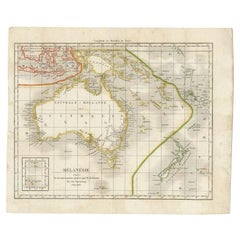
Antique Map of the Pacific Ocean by Rienzi, 1836
Located in Langweer, NL
Antique map titled 'Mélanésie'. Map of the Pacific ocean around Australia, including Java, Timor
Category
Antique 19th Century Maps
Materials
Paper
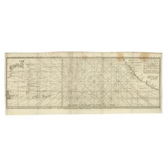
Antique Map of the Pacific Ocean by Anson, 1765
Located in Langweer, NL
Antique map titled 'Carte de la Mer du Sud ou Mer Pacifique - Kaart van de Zuyd-Zee of stille
Category
Antique 18th Century Maps
Materials
Paper
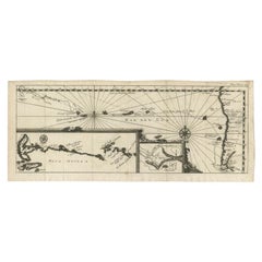
Antique Map of the Pacific Ocean by Renneville, 1702
Located in Langweer, NL
Antique map, untitled. A map of the Pacific Ocean, with the coast of Peru in the right edge and the
Category
Antique 18th Century Maps
Materials
Paper
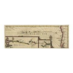
Antique Map of the Pacific Ocean by Renneville, 1725
Located in Langweer, NL
Rare map of the Southern Pacific, illustrating Le Maire's tracks, extending from the La Maire
Category
Antique 18th Century Maps
Materials
Paper
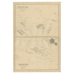
Antique Map of South Pacific Ocean by W. G. Blackie, 1859
Located in Langweer, NL
Antique map titled 'South Pacific Ocean'. Original antique map of South Pacific Ocean with inset
Category
Antique Mid-19th Century Maps
Materials
Paper
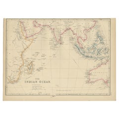
Antique Map of the Indian Ocean by W. G. Blackie, 1859
Located in Langweer, NL
Antique map titled 'The Indian Ocean'. Original antique map of the Indian Ocean. This map
Category
Antique Mid-19th Century Maps
Materials
Paper
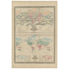
Antique Map Showing the Ocean Currents and Temperature of Air, '1872'
Located in Langweer, NL
Two maps on one sheet titled 'Johnson's Oceans Currents (..)' and 'Johnson's World showing the
Category
Antique Late 19th Century Maps
Materials
Paper
H 26.78 in W 18.12 in D 0.02 in
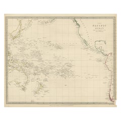
Antique Map of Australasia, New Zealand, Polynesia & the Pacific Ocean, 1840
Located in Langweer, NL
Antique map titled 'The Pacific Ocean'.
This map depicts Australasia, New Zealand, Polynesia
Category
Antique 1840s Maps
Materials
Abalone, Paper
H 13.39 in W 16.15 in D 0 in
Large Original Antique Map of The Pacific Ocean, Fullarton, C.1870
Located in St Annes, Lancashire
Great map of The Pacific Ocean
From the celebrated Royal Illustrated Atlas
Lithograph by
Category
Antique 1870s Scottish Maps
Materials
Paper
No Reserve
H 18.5 in W 22.5 in D 0.07 in
Antique Map of the Islands in the Pacific Ocean by Wyld, '1845'
Located in Langweer, NL
Antique map titled 'Islands in the Pacific Ocean'. Original antique map of the islands in the
Category
Antique Mid-19th Century Maps
Materials
Paper
Old Map of the Oceans Around Australia, Indonesia and New Zealand, 1880
Located in Langweer, NL
Antique map titled 'Océanie'.
Old map of the oceans around Australia, Indonesia and New Zealand
Category
Antique 1880s Maps
Materials
Paper
Antique Map of the Arctic Ocean and Novaya Zemlya by Bellin '1759'
Located in Langweer, NL
(..)'. Original antique map of the Arctic Ocean containing Novaya Zemlya and the country of the Samoyedic people
Category
Antique Mid-18th Century Maps
Materials
Paper
Antique French Map of the Pacific Ocean with Australia and Polynesia, 1806
Located in Langweer, NL
Antique map titled 'Australasie et Polynesie'. Old map of Oceania and the Pacific Ocean. Originates
Category
Antique 19th Century Maps
Materials
Paper
H 8.08 in W 9.65 in D 0 in
Antique Map of South East Asia, Australia and the Indian Ocean, 1726
By F. Valentijn
Located in Langweer, NL
Asia and the Indian Ocean. The map features a fine depiction of the outlines of the western two-thirds
Category
Antique Mid-18th Century Dutch Maps
Materials
Paper
Free Shipping
H 20.67 in W 27.17 in D 0.02 in
Antique Map of Africa with Ocean Currents and Other Details, C.1780
Located in Langweer, NL
Antique map titled 'Afrique.' Detailed map of Africa, showing towns, rivers, some topographical
Category
Antique 18th Century Maps
Materials
Paper
Antique Map of Southeast Asia and the Indian Ocean by Valentijn, 1726
By Thomas Kitchin
Located in Langweer, NL
and the Indian Ocean. The map features a fine depiction of the outlines of the western two-thirds of
Category
Antique 18th Century Maps
Materials
Paper
Antique Map of the Islands in the Atlantic Ocean including Bermuda & Cape Verde
Located in Langweer, NL
Ocean. It shows 16 individual maps on one sheet. Covers the Azores or Western Isles, Faeroe Isles
Category
Antique Mid-19th Century Maps
Materials
Paper
H 17.05 in W 14.38 in D 0.02 in
Charting the Course of Empire: Bonne's 1770 Masterpiece Maps of the Indian Ocean
Located in Langweer, NL
A voyage through history with an exquisite collection of Rigobert Bonne's 1770 maps, as featured in
Category
Antique 1770s Maps
Materials
Paper
Free Shipping
H 14.18 in W 20.28 in D 0 in
Old Map of Indian Ocean & Sumatra, Java, Borneo, India, Arabia, Africa, c.1783
Located in Langweer, NL
map depicting the Indian Ocean and surroundings including Sumatra, Java, Borneo, India, Arabia, Africa
Category
Antique 1780s Maps
Materials
Paper
H 20.87 in W 25.4 in D 0 in
Antique Map of the Passage Between the Atlantic and Pacific Oceans, circa 1753
Located in Langweer, NL
passage between the Atlantic and Pacific oceans. Jacob Le Maire and Willem Schouten discovered the strait
Category
Antique 18th Century Maps
Materials
Paper
H 9.61 in W 12.8 in D 0 in
Curious Map of the Laptev Sea 'Arctic Ocean' and the Mediterranean, ca.1700
Located in Langweer, NL
Antique map, untitled.
Map of the Laptev Sea (Arctic Ocean) and the Mediterranean, printed for
Category
Antique Early 1700s Maps
Materials
Paper
H 10.63 in W 8.31 in D 0 in
Antique Map of Oceania and the Pacific Ocean, Australia and New Zealand, 1826
Located in Langweer, NL
Antique map of Australia titled 'Karte von Australien'. Old map of Australia and New Zealand
Category
Antique 19th Century Maps
Materials
Paper
H 8.47 in W 9.85 in D 0 in
Map & Views of the Cape Verde Islands, in the Atlantic Ocean, West-Africa, 1775
Located in Langweer, NL
view of Praya Bay (..)'.
Map and views of the Cape Verde islands, in the Atlantic Ocean west of
Category
Antique 1770s Maps
Materials
Paper
H 21.46 in W 14.57 in D 0 in
Antique Map of Southern Asia, the East Indies and the Indian Ocean, ca.1840
Located in Langweer, NL
Original antique map of Southern Asia, the East Indies and the Indian Ocean. Also shows part of
Category
Antique 1840s Maps
Materials
Paper
H 13.39 in W 16.15 in D 0 in
Antique World Map by Lesage, 1823
Located in Langweer, NL
Antique world map titled 'Mappe Monde Historique'. The map depicts both the Eastern and Western
Category
Antique Early 19th Century Maps
Materials
Paper
1814 Map of "Russian Empire" Ric.r032
Located in Norton, MA
1814 Map of
"Russian Empire"
Ric.r032
Russian Empire. Description: This is an 1814 John
Category
Antique 19th Century Unknown Maps
Materials
Paper
Antique Map of Polynesia by Walker, 1840
Located in Langweer, NL
Antique map titled 'Polynesia or Islands in the Pacific Ocean'. This map depicts various islands
Category
Antique 19th Century Maps
Materials
Paper
Antique Map of Stavoren by Blaeu, 1649
Located in Langweer, NL
Antique map titled 'Staveren'. Original antique map of the city of Stavoren, Friesland, The
Category
Antique 17th Century Maps
Materials
Paper
Antique Map of Stavoren by Blaeu, 1649
Located in Langweer, NL
Antique map titled 'Staveren'. Original antique map of the city of Stavoren, Friesland, The
Category
Antique 17th Century Maps
Materials
Paper
Antique Map of Stavoren by Blaeu, 1649
Located in Langweer, NL
Antique map titled 'Staveren'. Original antique map of the city of Stavoren, Friesland, The
Category
Antique 17th Century Maps
Materials
Paper
Historical Map Depicting the Continent of Asia, 1882
Located in Langweer, NL
Asia.
Furthermore, the map features maritime lines and oceanic depths, indicating the knowledge and
Category
Antique 1880s Maps
Materials
Paper
Antique Map of the Admiralty Islands, Bismarck Archipelago
Located in Langweer, NL
Antique map titled 'Trois Vues des Isles de l'Amirauté'. Several coastal views of the Admiralty
Category
Antique Late 18th Century Maps
Materials
Paper
Antique Map of Northern Asia by Arrowsmith, 1834
Located in Langweer, NL
Antique map titled 'Northern Asia, from the Himalaya Mountains to the Arctic Ocean'. Large and
Category
Antique 19th Century Maps
Materials
Paper
Antique Map of Prussia by Blaeu, c.1680
Located in Langweer, NL
Antique map titled 'Prussiae nova Tabula'. Later edition of Blaeu's map of Prussia, embellished
Category
Antique 17th Century Maps
Materials
Paper
Antique Map of the East Indies by Wyld '1845'
Located in Langweer, NL
Antique map titled 'Archipelago of the Indian Ocean'. Original antique map of the East Indies. This
Category
Antique Mid-19th Century Maps
Materials
Paper
Antique Physical Chart of the Pacific Ocean by Johnston, '1850'
Located in Langweer, NL
Antique map titled 'Physical Chart of the Pacific Ocean showing the currents and temperature of the
Category
Antique Mid-19th Century Maps
Materials
Paper
Antique Physical Chart of the Indian Ocean by Johnston, 1850
Located in Langweer, NL
Antique map titled 'Physical Chart of the Indian Ocean'. This map shows the temperature of the
Category
Antique 19th Century Maps
Materials
Paper
Antique Map of the Empire of the Great Mogul
Located in Langweer, NL
Antique map titled 'Magni Mogolis Imperium'. This map depicts the Empire of the Great Mogul in
Category
Antique Late 17th Century Maps
Materials
Paper
Antique Physical Chart of the Indian Ocean by Johnston '1850'
Located in Langweer, NL
Antique map titled 'Physical Chart of the Indian Ocean showing the temperature of the water
Category
Antique Mid-19th Century Maps
Materials
Paper
Antique Physical Chart of the Atlantic Ocean by Johnston '1850'
Located in Langweer, NL
Antique map titled 'Physical Chart of the Atlantic Ocean showing the form and direction of the
Category
Antique Mid-19th Century Maps
Materials
Paper
Antique Map of the East Indies by Moll '1745'
Located in Langweer, NL
, Moluca and Sunda Islands'. Detailed map of the Indian Ocean, Southeast Asia, China, Formosa, the
Category
Antique Mid-18th Century Maps
Materials
Paper
Antique Map of Bourbon, or Reunion, Colony of France
Located in Langweer, NL
Original antique map titled 'Ile de la Réunion'. This is a fascinating map of the French department
Category
Antique Mid-19th Century Maps
Materials
Paper
German Antique Map of Australia and Polynesia, c.1870
Located in Langweer, NL
Antique map titled 'Inseln des Grossen Oceans, Australien und Polynesien'. Old map of Australia and
Category
Antique 19th Century Maps
Materials
Paper
Antique Map of Southeast Asia by Walker, c.1845
Located in Langweer, NL
"Untitled map of southeast Asia. This map depicts India, Indonesia, Australia and surrounding
Category
Antique 19th Century Maps
Materials
Paper
Antique Map of Juan Fernandez Island by Anson '1749'
Located in Langweer, NL
Antique map titled 'l'Ile de Juan Fernandes dans la Mer du Sud (..) - Het Eiland Juan Fernandes in
Category
Antique Mid-18th Century Maps
Materials
Paper
Antique Map of Southern Asia by Walker, c.1840
Located in Langweer, NL
"Original antique map of Southern Asia, the East Indies and the Indian Ocean. Also shows part of
Category
Antique 19th Century Maps
Materials
Paper
Four Physical Maps of the World on One Sheet , 1872
Located in Langweer, NL
lands. The other maps show world's races, ocean current and volcanoes, and magnetic declination. This
Category
Antique Late 19th Century Maps
Materials
Paper
Map of Polynesia Highlighting Cultural Landscapes and Maritime Activities, 1851
Located in Langweer, NL
John Tallis & Company was a London-based map publisher that flourished during the 19th century
Category
Antique 1850s Maps
Materials
Paper
H 10.71 in W 14.26 in D 0 in
Antique Map of the City of Grave by Blaeu, 1649
Located in Langweer, NL
Antique map titled 'Grave'. Original antique map of the city of Grave, the Netherlands. Published
Category
Antique 17th Century Maps
Materials
Paper
Rare Original Double Hemisphere World Map with Allegorical Figures, 1785
Located in Langweer, NL
. Small arrows indicate the prevalent ocean current. Rare. The map is dated 1772 in the lower middle. All
Category
Antique 1780s Maps
Materials
Paper
H 17.05 in W 23.23 in D 0 in
Antique Map of Bourbon/Reunion 'France' by V. Levasseur, 1854
By Victor Levasseur
Located in Langweer, NL
Antique map titled 'Ile de la Réunion'. Map of the French department of Ile. Bourbon or Reunion
Category
Antique Mid-19th Century Maps
Materials
Paper
Antique Map of the City of Goch by Blaeu, 1649
Located in Langweer, NL
Antique map titled 'Gochum vernacule Goch'. Old map of the city of Goch, Germany. This map
Category
Antique 17th Century Maps
Materials
Paper
Antique Map of Harvey Island and Surroundings by Cook, 1803
Located in Langweer, NL
largely uncharted areas of the globe. He mapped lands from New Zealand to Hawaii in the Pacific Ocean in
Category
Antique 19th Century Maps
Materials
Paper
Free Shipping
H 13.19 in W 16.34 in D 0 in
Antique Map of Manipa and Other Maluku Islands, Indonesia, 1726
Located in Langweer, NL
Maluku Province of Indonesia, in the Pacific Ocean. This map originates from 'Oud en Nieuw Oost-Indiën
Category
Antique 18th Century Maps
Materials
Paper
Antique Map of the City of Geldern by Blaeu, 1649
Located in Langweer, NL
Antique map titled 'Gelre'. Old map of the city of Geldern, Germany. This map originates from
Category
Antique 17th Century Maps
Materials
Paper
Antique Map of the City of Sneek by Blaeu, 1649
Located in Langweer, NL
Antique map Friesland titled 'Sneeck'. Bird's-eye view plan of Sneek, the Netherlands. This map
Category
Antique 17th Century Maps
Materials
Paper
Antique Map of the City of Tiel by Blaeu, 1649
Located in Langweer, NL
Antique map titled 'Tyel'. Beautiful map of the city of Tiel, The Netherlands. With a coat of arms
Category
Antique 17th Century Maps
Materials
Paper
Antique Map of the City of Workum by Blaeu, 1649
Located in Langweer, NL
Antique map titled 'Worckum'. Old map of the city of Workum, Friesland. Originates from J. Blaeu's
Category
Antique 17th Century Maps
Materials
Paper
Title: Mid-19th Century Map of Australasia by Carl Flemming - 1855
Located in Langweer, NL
the broader Pacific Ocean. The map is annotated in German, with "Australië" indicating the focus on
Category
Antique 1850s Maps
Materials
Paper
No Reserve
H 14.06 in W 17.52 in D 0 in
Antique Map of the City of Sneek by Blaeu, 1652
Located in Langweer, NL
Antique map titled: 'Sneeck.' Bird's-eye view plan of Sneek, Friesland, The Netherlands. From a
Category
Antique 17th Century Maps
Materials
Paper
- 1
- ...
Get Updated with New Arrivals
Save "Ocean Maps", and we’ll notify you when there are new listings in this category.
Ocean Maps For Sale on 1stDibs
An assortment of ocean maps is available at 1stDibs. The range of distinct ocean maps — often made from paper, wood and metal — can elevate any home. Find 318 antique and vintage ocean maps at 1stDibs now, or shop our selection of 28 modern versions for a more contemporary example of this long-cherished furniture. Ocean maps have been made for many years, and versions that date back to the 18th Century alongside those produced as recently as the 21st Century. Ocean maps are generally popular furniture pieces, but Georgian, Art Deco and mid-century modern styles are often sought at 1stDibs. Ocean maps have been a part of the life’s work for many furniture makers, but those produced by Todomuta Studio, James Cook and Lucien Boucher are consistently popular.
How Much are Ocean Maps?
Ocean maps can differ in price owing to various characteristics — the average selling price at 1stDibs is $1,400, while the lowest priced sells for $1 and the highest can go for as much as $275,000.
