Items Similar to Historical Map Depicting the Continent of Asia, 1882


Want more images or videos?
Request additional images or videos from the seller
1 of 6
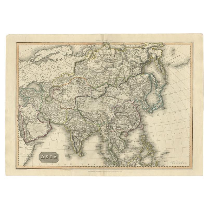
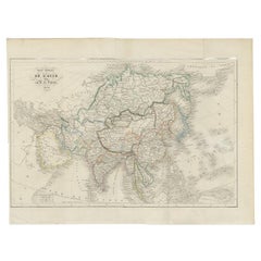
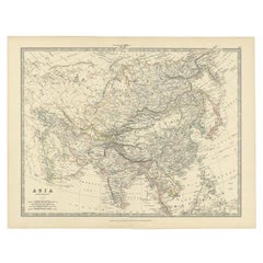
Historical Map Depicting the Continent of Asia, 1882
About the Item
This 1882 map presents a meticulously detailed representation of the continent of Asia, a testament to the cartographic skills of the era. Published as a part of 'Comprehensive Atlas and Geography of the World' by Blackie and Son, it stands as a rich historical document, illustrating the vast and diverse geography of the largest continent.
The map captures the full breadth of Asia, from the desolate Siberian tundra in the north to the tropical archipelagos of Southeast Asia. Its scope includes the extensive mountain ranges such as the Himalayas, the vast plateaus like the Tibetan Plateau, and significant rivers like the Yangtze and the Ganges, all of which are drawn with astonishing accuracy for the period.
Political boundaries are outlined, providing a fascinating insight into the territorial divisions of the time. The map is color-coded to differentiate between the various countries, regions, and their subdivisions, making it a useful tool for understanding the historical geopolitical landscape of 19th-century Asia.
Furthermore, the map features maritime lines and oceanic depths, indicating the knowledge and importance of sea routes for trade and exploration. Each nation is populated with its major cities, railways, and roads, signaling the progress of industrialization and infrastructure development.
The precision in the cartographic details, combined with the aesthetic design, reflects the high standards of Blackie and Son's publishing, making it both an educational resource and a piece of art. For historians, geographers, and collectors, this map is a valuable window into the past, revealing how the 19th century understood and interacted with the complex tapestry that is Asia.
- Dimensions:Height: 14.97 in (38 cm)Width: 22.45 in (57 cm)Depth: 0 in (0.02 mm)
- Materials and Techniques:
- Period:
- Date of Manufacture:1882
- Condition:Good condition, folding line in the middle. The outer borders are slightly discolored due to age, but not the image. One very small tear at bottom left, touching the image. This map is ideal for framing. Study the image carefully.
- Seller Location:Langweer, NL
- Reference Number:
About the Seller
5.0
Platinum Seller
These expertly vetted sellers are 1stDibs' most experienced sellers and are rated highest by our customers.
Established in 2009
1stDibs seller since 2017
1,922 sales on 1stDibs
Typical response time: <1 hour
- ShippingRetrieving quote...Ships From: Langweer, Netherlands
- Return PolicyA return for this item may be initiated within 14 days of delivery.
More From This SellerView All
- Antique Map of the European Continent, 1882Located in Langweer, NLAntique map titled 'Europe'. Old map of the European continent. This map originates from 'The Royal Atlas of Modern Geography, Exhibiting, in a Series of Entirely Original and Authen...Category
Antique 19th Century Maps
MaterialsPaper
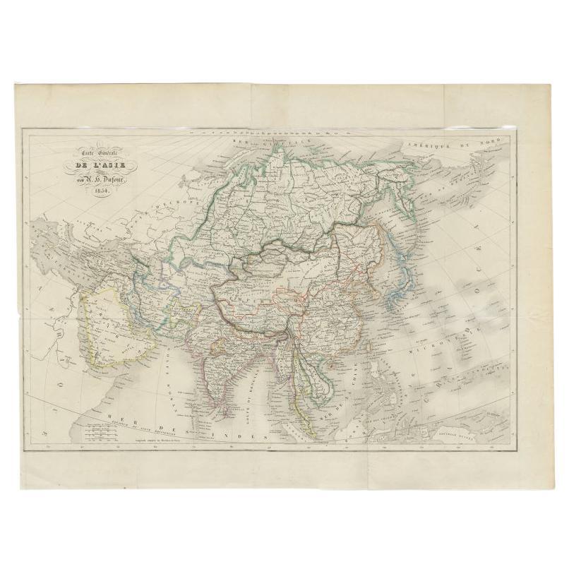
- Antique Map of The Asian Continent, 1855Located in Langweer, NLAntique map titled 'Carte Générale de l 'Asie'. Beautiful map of the Asian continent. This map originates from 'Voyage en Asie et en Afrique, d'aprés les récits des derniers voyageur...Category
Antique 19th Century Maps
MaterialsPaper
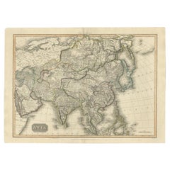
- Large Antique Map of the Asian Continent, 1814Located in Langweer, NLAntique map titled 'Asia'. Large antique map of the Asian continent. Drawn under the direction of Mr. Pinkerton by L. Hebert. Artists and Engraver...Category
Antique 19th Century Maps
MaterialsPaper
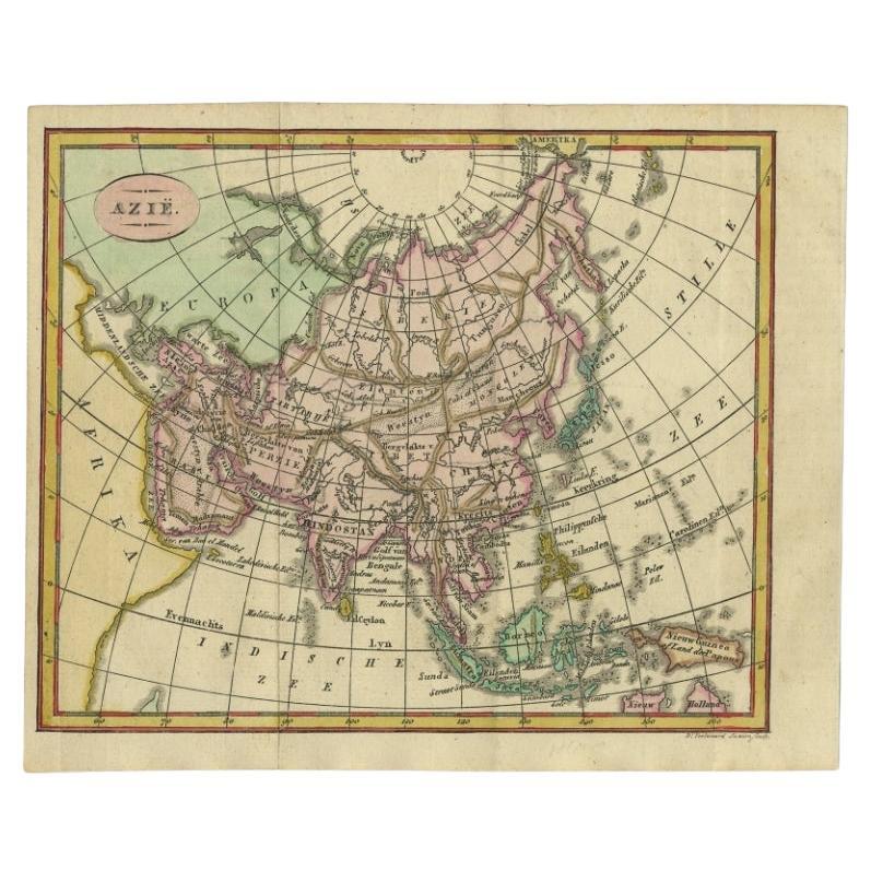
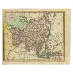
- Small Antique Map of the Asian Continent, 1841Located in Langweer, NLAntique map titled 'Azie.' Small map of the Asian continent. This map originates from 'De Aarde, beschouwd in haren Natuurlijken Toestand en Verdeeling (..)' by N.G. van Kampen. Publ...Category
Antique 19th Century Maps
MaterialsPaper
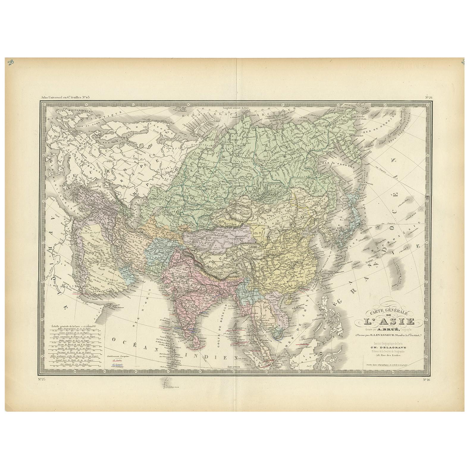
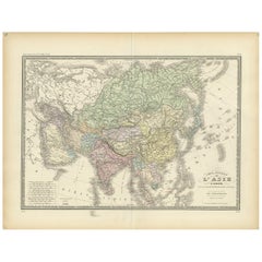
- Antique Map of the Asian Continent by Levasseur, '1875'Located in Langweer, NLAntique map titled 'Carte générale de l'Asie'. Large map of the Asian Continent. This map originates from 'Atlas de Géographie Moderne Physique et Politique' by A. Levasseur. Publish...Category
Antique Late 19th Century Maps
MaterialsPaper
- Antique Map of the Asian Continent by Johnston, 1885Located in Langweer, NLAntique map titled 'Asia'. Beautiful map of the Asian continent by Keith Johnston F.R.S.E. Artists and Engravers: Engraved, printed and published by A.K. Johnston. Condition: ...Category
Antique 19th Century Maps
MaterialsPaper

You May Also Like
- Africa: the Fashion ContinentBy Rizzoli International PublicationsLocated in New York, NYGain new perspective on the vibrant and innovative world of contemporary African fashion design, bursting with fresh creativity and free from reductive stereotypes. From the runway in Lagos and music festivals in Casablanca or Nairobi, to the “image makers” of Marrakech and the influencers of Dakar or Accra, a new generation of African fashion designers, photographers, bloggers, and hair and makeup artists are redefining the aesthetic contours of the continent. Audacious, humorous, disruptive, and innovative are the bywords of these young creatives who, while drawing upon and revalorizing their heritage, offer an ultra-contemporary perspective on fashion today. A creative revolution is spreading in an extension of continental revindication through cultural reappropriation and the invention of a visual language. Appliqué figures straight from Ghanaian Asafo flags seem to chant modern slogans as they march across silk dresses, traditional textile prints give power back to women, and Xhosa beaded embroidery serves as an inspiration for modern knitwear. Body-artists transform themselves into platforms for activism, and photographers—using clothing...Category
21st Century and Contemporary Books
MaterialsPaper
- Original Antique Map of Asia. C.1780Located in St Annes, LancashireGreat map of Asia Copper-plate engraving Published C.1780 Two small worm holes to right side of map Unframed.Category
Antique Early 1800s English Georgian Maps
MaterialsPaper

- 1812 United States Map, by Pierre Tardieu, Antique French Map Depicting the U.S.By Pierre François TardieuLocated in Colorado Springs, CO1812 "United States of Nth America -- Carte des Etats-Unis De L'Amerique Septentrionale" Two-Sheet Map by Tardieu This attractive map, published in Paris in 1812, is one of the most rare large format maps from the period. It features a view of the East Coast of the U.S. from Maryland to just below South Carolina. Additionally, Ellicott’s plan for the City of Washington D.C. is included at the top right and an illustration of Niagara Falls is shown at the bottom right with a description in both French and English. This extremely detailed map not only depicts the mountainous regions of the southeastern U.S., but also includes names of regions, rivers, and towns. Based on the first state of Arrowsmith’s 4-sheet map of the United States, this map is completely engraved by Tardieu in Paris and showcases high quality engravings. This detailed map of the recently independent United States includes one of the largest and earliest examples of the Ellicott plan of Washington DC. The artist, Pierre François Tardieu (PF Tardieu) was a very well-known map engraver, geographer, and illustrator. Awarded a bronze medal by King Louis-Phillipe for the accuracy and beauty of his map-making, Tardieu produced many fine works including maps of Louisiana...Category
Antique 1810s French Maps
MaterialsPaper
- 1882 The Works of Henry Fielding, Esq.By Henry FieldingLocated in Bath, GBA limited edition ten-volume set of the works of Henry Fielding, edited with a biography by Leslie Stephen. A ten-volume set in half morocco bindings. All edges gilt. No. 92 of a t...Category
Antique 1880s British Books
MaterialsPaper
- Vintage World Map Mirror Based on the Original by Johnson 1882 Military CampaignLocated in GBWe are delighted to offer for sale this lovely Antique style pictorial plan map of the globe based on the original by Johnson in 1882 This is a very interesting and decorative pie...Category
20th Century English Campaign Maps
MaterialsMirror
- Africa Aeterna the Pictorial Chronicle of a Continent Hardcover BookLocated in North Hollywood, CAAfrica Aeterna The Pictorial Chronicle of a Continent New York: International Book Society Time Life Books, 1965. Henry, Paul Marc; Carmichael, Joel (translator) Published by Sed...Category
Mid-20th Century African Tribal Books
MaterialsPaper


Recently Viewed
View AllMore Ways To Browse
Engraved Cross
Collectors And Curiosities
Minature Map
Anguilla Map
James Calvert Smith
Winkler Prins
A Plan City And Castle Of Batavia
Malacca Strait Map
John Speed Isle Of Wight Maps
Antique Map Of Shanghai
Heinrich Kiepert On Sale
Old Teak Petite Artisan
Antique Maps Of Amsterdam
Antique Map Coats Of Arms
Albania Antique Map
Framed Map India
Maps Balkans
Paraguay Antique Map