Amsterdam Map

22
807
42
to
122
732
116
849
840
848
17
7
4
2
1
1
1
1
716
46
45
42
5
6
1
1
1
1
1
1
2
1
778
22
14
11
11
138
95
17
11
9
36
30
15
13
9
Sort By
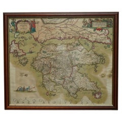
Greece 1660 Jan Jansson Watercolour Map Peloponesus Sive Morea I Laurenbergio
Located in GB
We are delighted to offer for sale this Jan Jansson Date: 1660 (published) Amsterdam map of Greece
Category

Antique 1660s Danish Dutch Colonial Maps

Materials

Copper

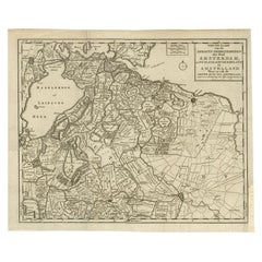
Antique Map of the Region of Amsterdam by Wagenaar, c.1760
Located in Langweer, NL
Antique map titled 'Nieuwe Kaart van de Ambagts - Heerlykheden der Stad Amsterdam, in Rynland
Category

Antique 18th Century Maps

Materials

Paper

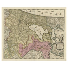
Original Antique Map of the Netherlands Incl Amsterdam, Leiden and Haarlem, 1700
Located in Langweer, NL
Antique map titled ‘Rhinolandiae Amsterlandiae et circumjacent (..)’. Map of the regions of
Category

Antique Early 1700s Maps

Materials

Paper

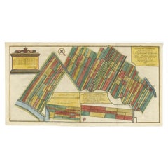
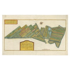
Antique Map Showing Estates of 1669 in Amsterdam, Published in c.1767
Located in Langweer, NL
Antique map titled 'Kaart der landeryen, gelegen aan of onder de honderd gaarden, zo in de
Category

Antique 18th Century Maps

Materials

Paper

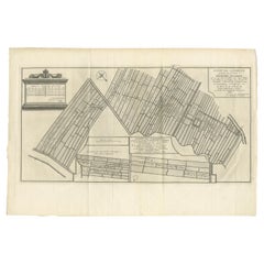
Antique Map Showing Estates of 1669 in Amsterdam, Published in c.1767
Located in Langweer, NL
Antique map titled 'Kaart der landeryen, gelegen aan of onder de honderd gaarden, zo in de
Category

Antique 18th Century Maps

Materials

Paper

Antique Map of Estates of The Year 1669 in Amsterdam, Published c.1767
Located in Langweer, NL
(..)'. Map showing estates in Amsterdam in 1669. Published by Yntema and Tieboel, 1767. Artists and
Category

Antique 18th Century Maps

Materials

Paper

1718 Ides & Witsen Map "Route D'amsterdam a Moscow Et De La Ispahan Et Gamron
Located in Norton, MA
1718 Ides & Witsen map, entitled "Route D'Amsterdam A Moscow Et De La Ispahan Et Gamron
Category

Antique Early 18th Century Dutch Maps

Materials

Paper

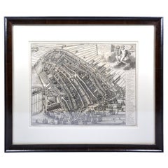
Amsterdam city plan - Joost van Sassen
Located in UTRECHT, UT
of Dirck Jacobsz. In 1538 he painted the first complete and (relatively) accurate map of Amsterdam
Category

Antique 1720s Dutch Other Maps

Materials

Paper

Amsterdam city plan - Joost van Sassen
H 17.52 in W 20.48 in D 0.79 in
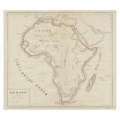
Original Antique Map of Africa
Located in Langweer, NL
Antique map titled 'Afrika'. Original antique map of Africa, drawn by Van Beusekom. Published by
Category

Antique Late 19th Century Maps

Materials

Paper

Original Antique Map of Africa
H 13.39 in W 17.09 in D 0.02 in
Map of the Mozambique and Tanzania Coast & Inset Map of Anjouan Island, ca.1700
Located in Langweer, NL
Antique map titled 'Carte particuliere des Costes de l'Afrique'. Depicts the coasts of
Category

Antique Early 1700s Maps

Materials

Paper

Antique Map centered on Nuremberg, Germany
Located in Langweer, NL
Amsterdam, where he sold instruments and globes, published maps, and edited the works of intellectuals like
Category

Antique Mid-17th Century Maps

Materials

Paper

Antique Map centered on Nuremberg, Germany
H 16.42 in W 21.46 in D 0.02 in
Framed View of the Brouwersgracht in Amsterdam, the Netherlands, 1708
Located in Langweer, NL
(..)'. Despite the title suggesting this print is a view of the West-Indisch House in Amsterdam, this is actually
Category

Antique Early 1700s Maps

Materials

Paper

Antique Map of Westphalia, West Orientation
Located in Langweer, NL
Antique map titled 'Nova totius Westphaliae Descriptio'. Detailed map of Westphalia, Northern
Category

Antique Late 17th Century Maps

Materials

Paper

Antique Map of Westphalia, West Orientation
H 19.89 in W 24.1 in D 0.02 in
Antique Map of Upper Bavaria, Germany
Located in Langweer, NL
Nicolaus Visscher (1649-1702). The Visscher family were art and map dealers in Amsterdam during the 17th
Category

Antique Late 17th Century Maps

Materials

Paper

Antique Map of Upper Bavaria, Germany
H 25.2 in W 20.79 in D 0.02 in
Antique Map of Germany and Central Europe
Located in Langweer, NL
. Published by N. Visscher, circa 1690. The Visscher family were art and map dealers in Amsterdam during the
Category

Antique Late 17th Century Maps

Materials

Paper

Antique Map of Germany and Central Europe
H 20.67 in W 24.22 in D 0.02 in
Antique Map of West Sumatra, Indonesia, 1900
Located in Langweer, NL
Antique map titled 'Sumatra, Bangka, Blitoeng en de Riouw-Archipel'. Old map of West Sumatra
Category

20th Century Maps

Materials

Paper

Antique Hand-colored Map of Brandenburg, Germany
Located in Langweer, NL
known for his volume of English county maps, published in 1646. Janssonius died in Amsterdam in 1664
Category

Antique Mid-17th Century Maps

Materials

Paper

Antique Map of the Niederrhein region, Germany
Located in Langweer, NL
engraver, cartographer and map dealer who ran a prominent and productive printing business in Amsterdam
Category

Antique Late 17th Century Maps

Materials

Paper

Antique Map of Silesia centered on Glogau
Located in Langweer, NL
skills. Blaeu set up shop in Amsterdam, where he sold instruments and globes, published maps, and edited
Category

Antique Mid-17th Century Maps

Materials

Paper

Antique Map of Silesia centered on Glogau
H 19.97 in W 23.51 in D 0.02 in
Curaçao map - C. van Baarsel en zoon
Located in UTRECHT, UT
Amsterdam op Curaçao” from the atlas “Atlas der overzeesche bezittingen van Zijne Majesteit den Koning der
Category

Antique 1810s Dutch Other Maps

Materials

Paper

Curaçao map - C. van Baarsel en zoon
H 21.86 in W 27.56 in D 0.79 in
Antique Map of Padang, Sumatra, Indonesia, 1900
Located in Langweer, NL
Antique map titled 'De Padangsche Beneden-en Bovenlanden van de Koninginnedbaai tot Fort de Kock
Category

20th Century Maps

Materials

Paper

Antique Map of Persia with Dedication Cartouche
Located in Langweer, NL
set up shop in Amsterdam, where he sold instruments and globes, published maps, and edited the works
Category

Antique Mid-17th Century Maps

Materials

Paper

Antique Map of Persia with Dedication Cartouche
Free Shipping
H 20.01 in W 24.02 in D 0.02 in
Antique Map of Groningen, the Netherlands, 1771
Located in Langweer, NL
Antique map titled 'De Synode van Stad en Landen in VII Klassen verdeeld (..)'. Map of the
Category

Antique 18th Century Maps

Materials

Paper

Antique Map of Groningen, the Netherlands, 1771
No Reserve
H 12.21 in W 9.45 in D 0 in
Antique Map of Asia by Gravius, 1788
Located in Langweer, NL
Antique map titled 'Kaartje van Asia'. Original antique map of Asia. This map originates from
Category

Antique 18th Century Maps

Materials

Paper

Antique Map of Asia by Gravius, 1788
H 8.08 in W 11.03 in D 0 in
Antique Map of Normandy by Janssonius, 1657
Located in Langweer, NL
cartographer Jodocus Hondius he also set up a business as book publisher in Amsterdam. His first map was
Category

Antique 17th Century Maps

Materials

Paper

Antique Map of Oostergo by Tirion, 1744
Located in Langweer, NL
Antique map titled 'Oostergo'. Original antique map of Oostergo, part of the province of Friesland
Category

Antique 18th Century Maps

Materials

Paper

Antique Map of Oostergo by Tirion, 1744
H 14.57 in W 17.13 in D 0 in
Antique Map of Oostergo by Tirion, 1744
Located in Langweer, NL
Antique map titled 'Oostergo'. Original antique map of Oostergo, part of the province of Friesland
Category

Antique 18th Century Maps

Materials

Paper

Antique Map of Oostergo by Tirion, 1744
H 14.77 in W 16.93 in D 0 in
Antique Map of London by Tirion '1754'
Located in Langweer, NL
Antique map titled 'Kaart van Londen enz. en van het naby gelegen land ruim een Uur gaans rondsom
Category

Antique Mid-18th Century Maps

Materials

Paper

Antique Map of London by Tirion '1754'
H 12.8 in W 18.31 in D 0.02 in
Antique Map of Switzerland by Janssonius, 1657
Located in Langweer, NL
business as book publisher in Amsterdam. His first map was published in 1616. Around 15 years later he set
Category

Antique 17th Century Maps

Materials

Paper

Antique Map of Friesland by Guicciardini, 1613
Located in Langweer, NL
Antique map titled 'Frisia Occidenta.' (Map of the province of Friesland, the Netherlands.) This
Category

Antique 17th Century Maps

Materials

Paper

Antique Map of Stavoren by Blaeu, 1649
Located in Langweer, NL
Antique map titled 'Staveren'. Original antique map of the city of Stavoren, Friesland, The
Category

Antique 17th Century Maps

Materials

Paper

Antique Map of Stavoren by Blaeu, 1649
H 21.78 in W 25.32 in D 0 in
Antique Map of Stavoren by Blaeu, 1649
Located in Langweer, NL
Antique map titled 'Staveren'. Original antique map of the city of Stavoren, Friesland, The
Category

Antique 17th Century Maps

Materials

Paper

Antique Map of Stavoren by Blaeu, 1649
H 19.69 in W 24.1 in D 0 in
Antique Map of Stavoren by Blaeu, 1649
Located in Langweer, NL
Antique map titled 'Staveren'. Original antique map of the city of Stavoren, Friesland, The
Category

Antique 17th Century Maps

Materials

Paper

Antique Map of Stavoren by Blaeu, 1649
H 17.88 in W 25.52 in D 0 in
Antique Map of Overijssel by Colom, 1635
Located in Langweer, NL
Antique map titled 'Ditio Trans-Isulana'. Original antique map of the province of Overijssel, the
Category

Antique 17th Century Maps

Materials

Paper

Antique Map of Overijssel by Colom, 1635
H 7.88 in W 10.04 in D 0 in
Antique Map of the Westphalia region of Germany
Located in Langweer, NL
Antique map titled 'Circulus Westphaliae (..)'. Original old map of the Westphalia region, Germany
Category

Antique Late 17th Century Maps

Materials

Paper

Antique Map of the Westphalia region of Germany
Free Shipping
H 21.03 in W 23.63 in D 0.02 in
Antique Map of Africa with Original Hand Coloring
Located in Langweer, NL
Antique map titled 'Kaart van Afrika door den Heer d'Anville'. Detailed original old map of Africa
Category

Antique Mid-18th Century Maps

Materials

Paper

Antique Map of the Archdiocese of Cologne, Germany
Located in Langweer, NL
Antique map titled 'Archevesche et Eslectorat de Cologne avec ses Enclaves'. Original old map of
Category

Antique Late 17th Century Maps

Materials

Paper

Detailed Antique Map of Italy and surrounding Islands
Located in Langweer, NL
Antique map titled 'Italie volgens de allernieuwste Uitgave van den Heere d'Anville'. Very detailed
Category

Antique Mid-18th Century Maps

Materials

Paper

Rare Hand-Colored Antique Map of Asia, 1788
Located in Langweer, NL
Antique map titled 'Kaartje van Asia'. Original antique map of Asia. This map originates from
Category

Antique 1780s Maps

Materials

Paper

Antique Map of West Kalimantan, Borneo, Indonesia, 1900
Located in Langweer, NL
Antique map titled 'Borneo en Belitoeng'. Old map of West Kalimantan, Borneo. This map originates
Category

20th Century Maps

Materials

Paper

Antique Map of Part of Java, Indonesia, 1900
Located in Langweer, NL
Antique map of West Java. This map originates from 'Atlas van Nederlandsch Oost- en West-Indië' by
Category

20th Century Maps

Materials

Paper

Antique Map of the Region of Oldenburg, Germany
By Willem Blaeu
Located in Langweer, NL
Amsterdam, where he sold instruments and globes, published maps, and edited the works of intellectuals like
Category

Antique Mid-17th Century Maps

Materials

Paper

Antique Map of Overijssel by Visscher, c.1652
Located in Langweer, NL
Engravers: The Visscher family were art and map dealers in Amsterdam during the 17th century. Founded by C
Category

Antique 17th Century Maps

Materials

Paper

Antique Map of Overijssel by Visscher, c.1660
Located in Langweer, NL
Engravers: The Visscher family were art and map dealers in Amsterdam during the 17th century. Founded by C
Category

Antique 17th Century Maps

Materials

Paper

Antique Map of Denmark by Covens & Mortier, 1730
By Covens & Mortier
Located in Langweer, NL
Antique Map of Denmark from: 'Atlas Nouveau ... Par Guillaume de l'Isle' Amsterdam, Covens
Category

Antique Mid-18th Century Maps

Materials

Paper

Antique Map of Friesland in the Netherlands, 1770
Located in Langweer, NL
Amsterdam. Van Jagen worked alone or together with other engravers/artists and produced multiple maps of the
Category

Antique 18th Century Maps

Materials

Paper

Antique Map of the Mentawai Islands, Sumatra, 1900
Located in Langweer, NL
Antique map of the Mentawai Islands, Sumatra. Also depicting the region of Padang. This map
Category

20th Century Maps

Materials

Paper

Antique Map of the Northwestern Coast of Spain
Located in Langweer, NL
Antique map titled 'Gallaecia Regnum'. Original old map of the northwestern coast of Spain
Category

Antique Mid-17th Century Maps

Materials

Paper

Antique Map of the Northwestern Coast of Spain
H 19.53 in W 22.92 in D 0.02 in
Antique Map of France by Tirion, c.1740
Located in Langweer, NL
Antique map titled 'Nieuwe Kaart van Frankryk.' - Attractive detailed map showing France. Title in
Category

Antique 18th Century Maps

Materials

Paper

Antique Map of France by Tirion, c.1740
H 17.21 in W 21.82 in D 0 in
Antique Map of Oostergo, Friesland by Tirion, 1785
Located in Langweer, NL
publisher in Amsterdam. He produced serveral Atlases and Dutch town plans. The maps mainly based on those of
Category

Antique 18th Century Maps

Materials

Paper

Framed Mercator Hondius Hispania Nova Atlas Minor Map
Located in Stamford, CT
Framed colored example of this decorative and important minature map. Newly framed in brown wood
Category

Antique 17th Century Dutch Spanish Colonial Maps

Materials

Glass, Wood, Paper

Antique Map of Aceh in Sumatra, Indonesia, 1900
Located in Langweer, NL
Antique map titled 'Groot-Atjeh en aangrenzende Kuststaten'. Old map of Aceh, with surrounding
Category

20th Century Maps

Materials

Paper

Antique Map of Oostergo, Friesland by Tirion, 1785
Located in Langweer, NL
publisher in Amsterdam. He produced serveral Atlases and Dutch town plans. The maps mainly based on those of
Category

Antique 18th Century Maps

Materials

Paper

1646 Jansson Map Entitled "Procinvia Connactiae, " Ric.a006
Located in Norton, MA
publisher in Amsterdam. His first map was published in 1616. Around 15 years later he set up a partnership
Category

Antique 17th Century Unknown Maps

Materials

Paper

Old Map of Java, Indonesia by Stemler, 1875
By Stemler
Located in Langweer, NL
Antique map titled 'Hoofddriehoeken - Java en madoera.' (Main triangles measured by the
Category

Antique 19th Century Maps

Materials

Paper

Antique Map of Oostergo, Friesland by Tirion, 1785
Located in Langweer, NL
publisher in Amsterdam. He produced serveral Atlases and Dutch town plans. The maps mainly based on those of
Category

Antique 18th Century Maps

Materials

Paper

Antique Map of Switzerland by Jaillot, c.1705
Located in Langweer, NL
Antique map Switerzland titled 'La Suisse Divisee en ses Treze Cantons, ses Alliez & ses Sujets
Category

Antique 18th Century Maps

Materials

Paper

Antique Map of Buru Island, Indonesia, c.1725
Located in Langweer, NL
Joannes van Braam and Gerard onder de Linden (Dordrecht and Amsterdam). We sell original antique maps to
Category

Antique 18th Century Maps

Materials

Paper

Antique Map of France by Janssonius, c.1650
Located in Langweer, NL
Hondius he also set up a business as book publisher in Amsterdam. His first map was published in 1616
Category

Antique 17th Century Maps

Materials

Paper

Antique Map of France by Janssonius, c.1650
Located in Langweer, NL
Hondius he also set up a business as book publisher in Amsterdam. His first map was published in 1616
Category

Antique 17th Century Maps

Materials

Paper

  • 1
  • ...
Get Updated with New Arrivals
Save "Amsterdam Map", and we’ll notify you when there are new listings in this category.

Amsterdam Map For Sale on 1stDibs

Choose from an assortment of styles, material and more with respect to the amsterdam map you’re looking for at 1stDibs. Each amsterdam map for sale was constructed with extraordinary care, often using paper, glass and wood. You’ve searched high and low for the perfect amsterdam map — we have versions that date back to the 18th Century alongside those produced as recently as the 20th Century are available. A amsterdam map is a generally popular piece of furniture, but those created in styles are sought with frequency. Many designers have produced at least one well-made amsterdam map over the years, but those crafted by The Society for the Diffusion of Useful Knowledge and Townsend MacCoun are often thought to be among the most beautiful.

How Much is a Amsterdam Map?

A amsterdam map can differ in price owing to various characteristics — the average selling price 1stDibs is $636, while the lowest priced sells for $289 and the highest can go for as much as $5,203.

Read More

Pamela Shamshiri Shares the Secrets behind Her First-Ever Book and Its Effortlessly Cool Interiors

The sought-after designer worked with the team at Hoffman Creative to produce a monograph that beautifully showcases some of Studio Shamshiri's most inspiring projects.

Moroccan Artworks and Objects Take Center Stage in an Extraordinary Villa in Tangier

Italian writer and collector Umberto Pasti opens the doors to his remarkable cave of wonders in North Africa.

Montecito Has Drawn Royalty and Celebrities, and These Homes Are Proof of Its Allure

Hollywood A-listers, ex-pat aristocrats and art collectors and style setters of all stripes appreciate the allure of the coastal California hamlet — much on our minds after recent winter floods.

Whaam! Blam! Pow! — a New Book on Pop Art Packs a Punch

Publishing house Assouline and writer Julie Belcove have teamed up to trace the history of the genre, from Roy Lichtenstein, Andy Warhol and Yayoi Kusama to Mickalene Thomas and Jeff Koons.

The Sparkling Legacy of Tiffany & Co. Explained, One Jewel at a Time

A gorgeous new book celebrates — and memorializes — the iconic jeweler’s rich heritage.

What Makes a Gem-Encrusted Chess Set Worth $4 Million?

The world’s most opulent chess set, weighing in at 513 carats, is literally fit for a king and queen.

Tauba Auerbach’s Geometric Pop-Up Book Is Mighty Rare, Thanks to a Hurricane

This sculptural art book has an epic backstory of its own.

Step inside the Storied Mansions of Palm Beach’s Most Effervescent Architect

From Spanish-style courtyards to fanciful fountains, these acclaimed structures abound in surprising and elegant details.