
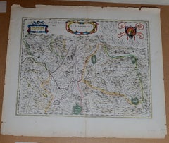
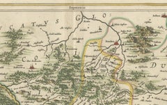
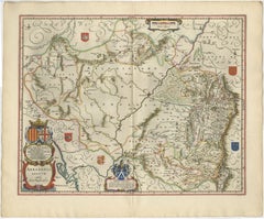
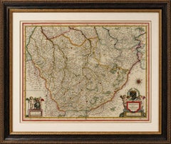
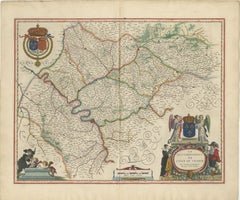
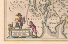
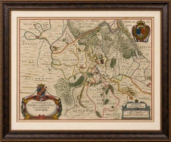
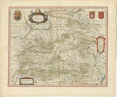
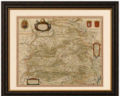
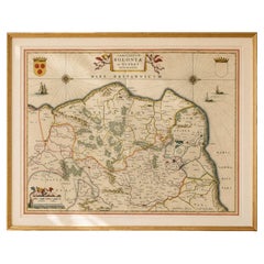
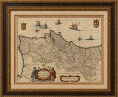
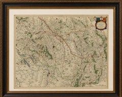
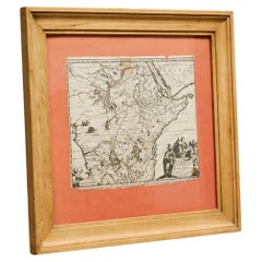
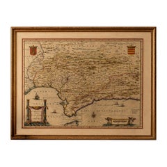
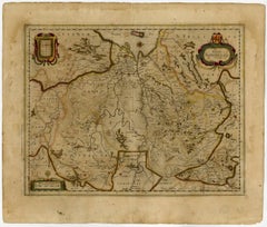
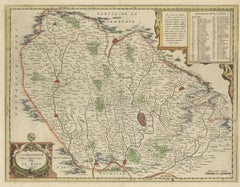
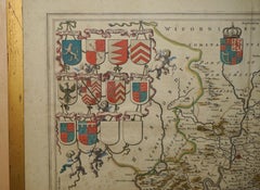
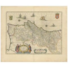
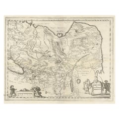
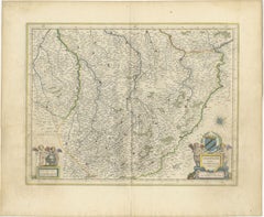
1571-1638 Willem Blaeu map entitled, "Ilcadorino, " Hand Colored Ric0009
Located in Norton, MA
Willem Blaeu map entitled, "Ilcadorino,". Hand colored.
Category
Antique 16th Century Dutch Maps
Materials
Paper
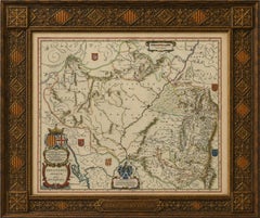
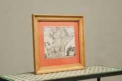
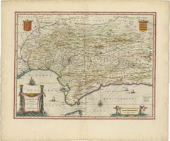
1571-1638 Willem Blaeu map entitled, "Ilcadorino, " Hand Colored Ric0009
Located in Norton, MA
Willem Blaeu map entitled, "Ilcadorino,". Hand colored.
Paper
$1,157Sale Price|20% Off
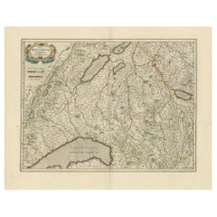
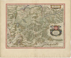
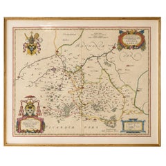
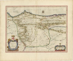
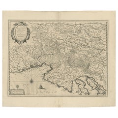
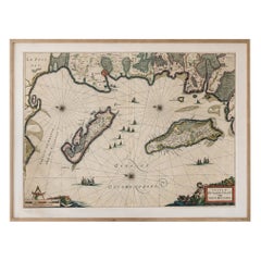
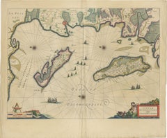
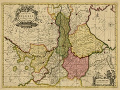
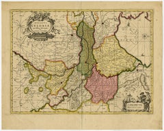
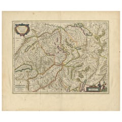
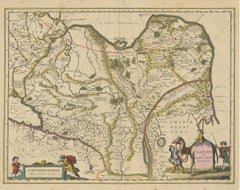
Circa 1659 Willem Blaeu Map: Southwestern Switzerland with Geneva & Lakes
Located in Langweer, NL
Circa 1659 Willem Blaeu Map: Southwestern Switzerland with Geneva & Lakes This detailed map from circa 1659 by Willem Blaeu, titled "Das Wiflispurgergow," highlights the southwester...
Paper
$1,026Sale Price|20% Off
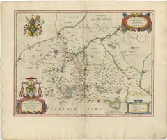
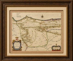
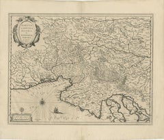
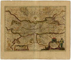
Circa 1659 Johannes Blaeu Map: Ducatus Silesiae Ligniciensis, Legnica Region
Located in Langweer, NL
Circa 1659 Johannes Blaeu Map: Ducatus Silesiae Ligniciensis, Legnica Region This hand-colored map from circa 1659 by Johannes Blaeu, titled "Ducatus Silesiae Ligniciensis," depicts...
Paper
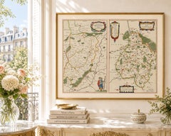
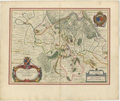
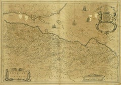
Antique Blaeu Map Vermandois & La Capelle France, Dual Sheet - 1642
Located in Langweer, NL
Antique Blaeu Map Vermandois & La Capelle France, Dual Sheet - 1642 A beautifully composed double map depicting the regions of Vermandois and La Capelle, engraved by Willem Jansz.
Paper
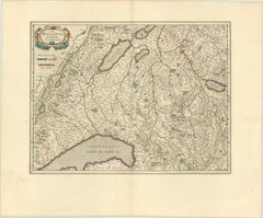
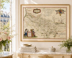
Blaeu Map of Savoy & Alps, Geneva Piedmont France Italy, c.1642
Located in Langweer, NL
Keywords: Savoy map, Alps map, Geneva map, Piedmont map, Blaeu Savoy, 17th century Alps map, Switzerland antique map, northern Italy map, French Alps map, Blaeu atlas map, Lacus Lema...
Paper
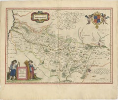
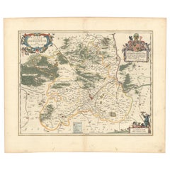
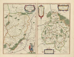
Decorative Blaeu Map of Picardy with Costume Figures, France 1642
Located in Langweer, NL
Antique Blaeu Map Picardy Region France, Decorative Costume Cartouche 1642 This elegant map of Picardy (Picardia) in northern France was engraved and published by Willem Jansz.
Paper

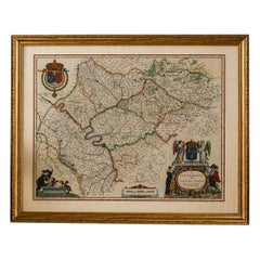
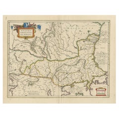
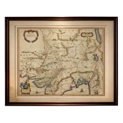
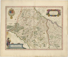
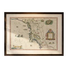
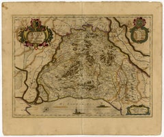
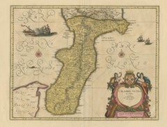
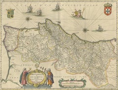
1640 Willem Blaeu Map Entitled "Contado di molise et principato vltra, " Ric.a003
By Willem Blaeu
Located in Norton, MA
1640 Willem Blaeu map entitled "Contado di molise et principato vltra," Colored Ric. a003 Measures: 38 x 49.6 cm and wide margins DBLAEU.
Paper
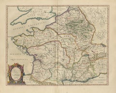
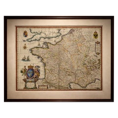
Caesar’s Gallia Veteris – Blaeu Map of Ancient Gaul, France c.1642
Located in Langweer, NL
Caesar’s Gallia Veteris – Blaeu Map of Ancient Gaul, France c.1642 Description: A finely engraved and highly decorative 17th-century map of ancient Gaul, titled Typus Galliae Veteri...
Paper
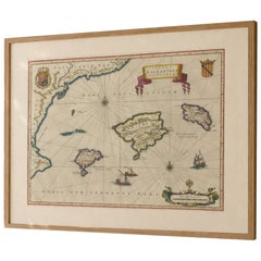
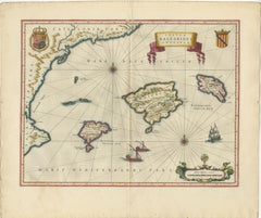
Antique Blaeu Map Mallorca Ibiza Balearic Islands, Mediterranean, 1642
Located in Langweer, NL
Technique: Copperplate engraving Maker: Willem Jansz. Blaeu, Amsterdam, c.1642 Keywords: Balearic Islands map, Mallorca map, Ibiza map, Menorca map, antique Mallorca map, antique Ib...
Paper
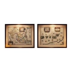
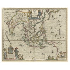
Antique Blaeu Maps, Indonesia & Moluccas – VOC Era, c.1642
Located in Langweer, NL
Antique Blaeu Maps, Indonesia & Moluccas – VOC Era, c.1642 A rare and highly decorative pair of original 17th-century maps by Willem Blaeu, depicting Indonesia and the Moluccas—...
Paper
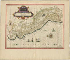
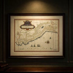
Blaeu Map of Peru, Antique Hand-Colored Engraving, South America 1642
Located in Langweer, NL
Blaeu Map of Peru, Antique Hand-Colored Engraving, South America 1642 A finely engraved and beautifully hand-colored map of Peru, published by Willem and Joan Blaeu in Amsterdam aro...
Paper
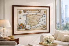
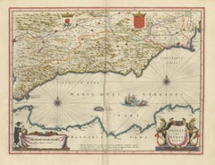
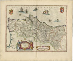
Blaeu Map of Aragon – Arragonia Regnum, Decorative Spain Atlas Map, 1642
Located in Langweer, NL
Blaeu Map of Aragon – Arragonia Regnum, Decorative Spain Atlas Map 1642 A finely engraved and highly decorative map of the historic Kingdom of Aragon in northeastern Spain, publishe...
Paper
Blaeu Map of Cambrai, Artois & Hainaut – Heraldic France c.1642
Located in Langweer, NL
Title: Blaeu Map of Cambrai, Artois & Hainaut – Heraldic France c.1642 Description: A finely engraved and richly decorated 17th-century map of the historic Archbishopric of Cambrai,...
Paper
Caesar’s Gallia Antiqua – Blaeu Map of Ancient France, c.1642
Located in Langweer, NL
Caesar’s Gallia Antiqua – Blaeu Map of Ancient France, c.1642 Description: A superb and highly decorative 17th-century map of ancient Gaul, titled Gallia Vetus, published by Willem ...
Paper

1635 Willem Blaeu Map of Northern France"Comitatvs Bellovacvm" Ric.a08
Located in Norton, MA
Blaeu, c. 1635. Fine engraved map with original hand-coloring.
Paper
Antique Blaeu Map of Spain & Portugal “Hispania”, Cartouche, c.1642
Located in Langweer, NL
Blaeu Map of Spain & Portugal “Hispania”, Decorative Cartouche, c.1642 Description: An exceptional and highly decorative map of Spain and Portugal, titled “Hispania,” engraved and p...
Paper
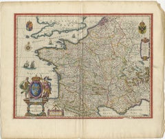
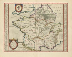
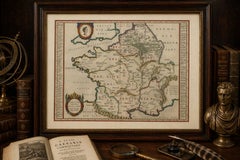
17th Century Blaeu Map of France, Gallia, Hand Colored, c.1642
Located in Langweer, NL
17th Century Blaeu Map of France, Gallia, Hand Colored, c.1642 Description: A beautifully engraved and highly decorative map of France, titled “Gallia,” published by Willem Jansz.
Paper
Antique Blaeu Map of Champagne France, Campania Comitatus, c. 1642
Located in Langweer, NL
Title: Antique Blaeu Map of Champagne France, Campania Comitatus, c. 1642 Description: A magnificent and highly decorative antique map of the historic Champagne region of France, en...
Paper
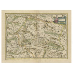
An Original Antique Mid-17th Century Blaeu Map of Styria in Southeastern Austria
Located in Langweer, NL
This is an antique map of Styria (referred to as “Stiria” or “Steyrmarck”), published by the renowned Dutch cartographer Willem Janszoon Blaeu (often simply “Blaeu”).
Paper
Blaeu Map of Île-de-France – Paris Region with Royal Arms, c.1642
Located in Langweer, NL
Blaeu Map of Île-de-France – Paris Region with Royal Arms, c.1642 Description: A richly detailed and highly decorative 17th-century map of the Île-de-France region, centered on Pari...
Paper
Blaeu Map of León & Asturias – Legionis Regnum, Antique Spain Chart, 1642
Located in Langweer, NL
Blaeu Map of León & Asturias – Legionis Regnum, Antique Spain Chart 1642 A finely engraved and highly decorative map of the historic kingdoms of León and Asturias in northern Spain,...
Paper
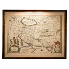
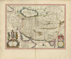
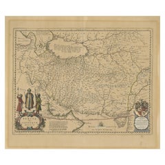
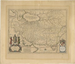
Blaeu Map of Persia, Caspian Sea & Arabia, Hand Colored, c.1642
Located in Langweer, NL
Blaeu Map of Persia, Caspian Sea & Arabia, Hand Colored, c.1642 Description: A richly detailed and highly decorative 17th-century map of Persia (modern-day Iran) and the surrounding...
Paper


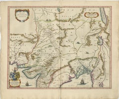
1643 Willem&Joan Blaeu Map NW Flanders "Flandriae Teutonicae Pars Prientalior
Located in Norton, MA
1643 Willem and Joan Blaeu map of northwest Flanders, entitled "Flandriae Teutonicae Pars Prientalior," Ric0012 " Authentic" - Map of the northwest Flanders, entitled "Flandria...
Paper
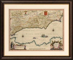
Blaeu Map of Granada & Murcia Spain, Andalusia Mediterranean Coast, 1642
Located in Langweer, NL
Technique: Copperplate engraving with original hand coloring Maker: Willem Janszoon Blaeu and Joan Blaeu, Amsterdam, circa 1642 Keywords: Granada, Murcia, Andalusia, Andalucia, Spa...
Paper
$1,020Sale Price|30% Off
1645 Blaeu Map of Westmorland, Northern England – Hand Colored, Decorative
Located in Langweer, NL
Keywords: Willem Blaeu, Westmorland map, northern England, 17th-century map, antique map, English county map, John Speed, Windermere, decorative cartography, hand-colored map, rare m...
Paper
Original Antique Blaeu Map of Karst, Carniola, Istria, and Trieste, circa 1640
Located in Langweer, NL
Blaeu Map of Karst, Carniola, Istria, and Trieste, circa 1640 This is an original antique map titled “Karstia, Carniola, Histria et Windorum Marchia,” published by Willem Blaeu in A...
Paper
Antique Blaeu Map of Sedan & Donchery France, c. 1642 Hand Color
Located in Langweer, NL
Title: Antique Blaeu Map of Sedan & Donchery France, c. 1642 Hand Color Description: A finely engraved and beautifully hand-colored antique map depicting the Sovereignty of Sedan, R...
Paper
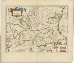
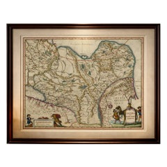
Blaeu Map of Ottoman Balkans – Walachia Bulgaria Romania, circa 1665
Located in Langweer, NL
Blaeu Map of Ottoman Balkans – Walachia Bulgaria Romania, circa 1665 This is an original hand-coloured antique map titled “Walachia, Servia, Bulgaria, Romania,” published by Joan Bl...
Paper

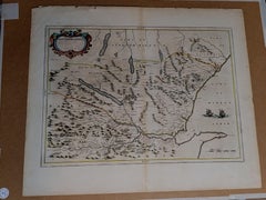
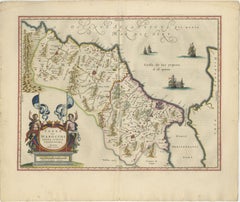
1654 Joan Blaeu Map the Sutherland, Scotland, Entitled "Southerlandia, "Ric0007
Located in Norton, MA
1654 Joan Blaeu map of the Sutherland, Scotland, entitled "Southerlandia," Hand Colored Ric0007 Description: Lovely map centered on Sedan and Doncheri and the Meuze Rive...
Paper
Antique Blaeu Map of Castile Spain, Castilla León Madrid Toledo, 1642
Located in Langweer, NL
Technique: Copperplate engraving with original hand coloring Maker: Willem Janszoon Blaeu and Joan Blaeu, Amsterdam, circa 1642 Keywords: Castile, Castilla, Castilla y León, Castil...
Paper


Antique Blaeu Map of Beauce & Perche France, c. 1642 Hand Color
Located in Langweer, NL
Title: Antique Blaeu Map of Beauce & Perche France, c. 1642 Hand Color Description: A magnificent and highly decorative antique map depicting the historic French regions of Beauce a...
Paper
Blaeu Map of Île de Ré & Oléron, La Rochelle Coast France, c.1642
Located in Langweer, NL
Keywords: Isle de Ré map, Oléron map, La Rochelle map, Atlantic coast France map, Blaeu France map, 17th century French map, nautical map France, maritime chart France, Dutch Golden ...
Paper

Blaeu Map of Boulogne & Calais Coast – Maritime France, Ships c.1642
Located in Langweer, NL
Blaeu Map of Boulogne, Calais & Guînes – Coastal France, Ships c.1642 A striking and highly decorative 17th-century map of the northern French coast, centered on Boulogne-sur-Mer, C...
Paper
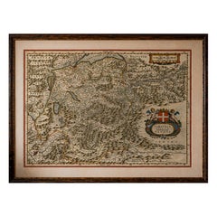
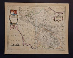
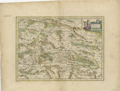
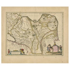
Antique Blaeu Map of Bresse & Dombes, Eastern France – Hand-Colored, c.1642
Located in Langweer, NL
Maps from the Blaeu atlases remain among the most desirable examples of early Dutch mapmaking.
Paper
Blaeu Map of Galicia Spain, Decorative Dutch Golden Age Map, 1642
Located in Langweer, NL
Blaeu Map of Galicia Spain & Santiago de Compostela, circa 1642 Fine original hand-colored copperplate engraved map of Galicia in northwestern Spain, engraved and published by Wille...
Paper
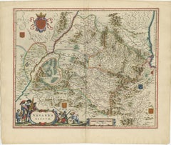
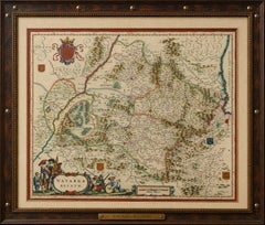
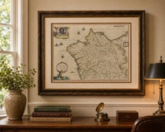
Blaeu Map of Navarra – Navarra Regnum, Decorative Pyrenees Chart, 1642
Located in Langweer, NL
Blaeu Map of Navarra – Navarra Regnum, Decorative Pyrenees Chart, 1642 A finely engraved and highly decorative map of the Kingdom of Navarra, published by Willem and Joan Blaeu in A...
Paper
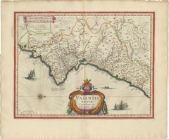
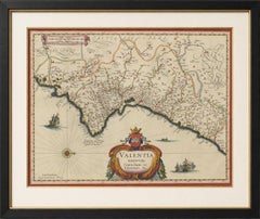
Blaeu Map of Valencia – Valentia Regnum, Decorative Mediterranean Chart, 1642
Located in Langweer, NL
Blaeu Map of Valencia – Valentia Regnum, Decorative Mediterranean Chart 1642 A finely engraved and highly decorative map of the Kingdom of Valencia in eastern Spain, published by Wi...
Paper
Imperial Tartary Blaeu Map, Central Asia Caravan Scene c.1642
Located in Langweer, NL
Imperial Tartary Blaeu Map, Central Asia Caravan Scene c.1642 A visually captivating and highly decorative map of Tartary and Central Asia, extending from Eastern Europe across Sibe...
Paper
Blaeu Map of Portugal – Portugallia et Algarbia, Antique Iberia Map, 1642
Located in Langweer, NL
Blaeu Map of Portugal – Portugallia et Algarbia, Antique Iberia Map, 1642 A highly decorative and historically important map of Portugal, titled Portugallia et Algarbia quae olim Lu...
Paper
Imperial Mughal India Blaeu Map, Ganges Delta & Persia c.1642
Located in Langweer, NL
Imperial Mughal India Blaeu Map, Ganges Delta & Persia c.1642 A richly detailed and highly decorative map of the Mughal Empire, centered on northern India and extending from Per...
Paper
Antique Map Morocco Fez & Marrakesh, Blaeu Map, Hand-Colored c.1642
Located in Langweer, NL
Antique Map Morocco Fez & Marrakesh, Blaeu Atlas, Hand-Colored c.1640 This finely engraved and richly hand-colored map of Morocco is one of the most decorative and desirable regiona...
Paper
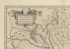
17th Century Blaeu Map – Ottoman Balkans: Walachia, Bulgaria, Romania, ca. 1650
Located in Langweer, NL
Blaeu Map of Walachia, Servia, Bulgaria, Romania, circa 1640 This is an original antique map titled “Walachia, Servia, Bulgaria, Romania,” published by Joan Blaeu in Amsterdam betwe...
Paper
Antique Blaeu Map of Reims & Rethel Champagne France, c. 1642
Located in Langweer, NL
Title: Antique Blaeu Map of Reims & Rethel Champagne France, c. 1642 Description: An elegant and highly detailed antique map depicting the Diocese and region of Reims and Rethel in ...
Paper
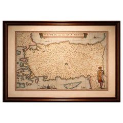
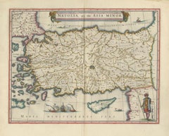
Blaeu Map of Anatolia, Asia Minor & Aegean, Ottoman Figure, c.1642
Located in Langweer, NL
Blaeu Map of Anatolia, Asia Minor & Aegean, Ottoman Figure, c.1642 A highly decorative and historically important map of Anatolia (Asia Minor), engraved and published by Willem ...
Paper
Antique Blaeu Map of Gâtinais & Sénonais France, c. 1642 Hand Color
Located in Langweer, NL
Title: Antique Blaeu Map of Gâtinais & Sénonais France, c. 1642 Hand Color Description: A finely engraved and beautifully hand-colored antique map depicting the historic French prov...
Paper

Antique Blaeu Map of China, Japan & Korea, Exotic Cartouches & Ships, c.1642
Located in Langweer, NL
Antique Blaeu Map of China, Japan & Korea, Exotic Cartouches & Ships, c.1642 A highly desirable and visually striking map of East Asia, centered on China and extending to Ko...
Paper

$3,266Sale Price|20% Off
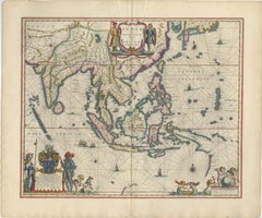
Original Blaeu Map of Southeast Asia from India to Tibet and Japan to New Guinea
Located in Langweer, NL
He studied with the famous Danish astronomer Tycho Brahe, with whom he honed his instrument and globe making skills. Blaeu set up shop in Amsterdam, where he sold instruments and glo...
Paper

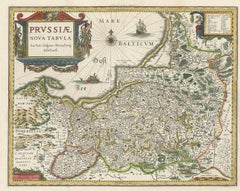
Antique Map of Prussia – Blaeu “Prussiae Nova Tabula”, c.1635
By Willem Blaeu
Located in Langweer, NL
Antique Map of Prussia – Blaeu “Prussiae Nova Tabula”, c.1635 Original antique engraved map titled “Prussiae Nova Tabula,” depicting the historic region of Prussia along the southea...
Paper
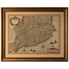
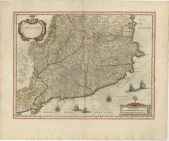
Blaeu Catalonia Map, Barcelona & Mediterranean Coast Spain, c.1642
Located in Langweer, NL
Keywords: Catalonia map, Barcelona map, Spain antique map, Blaeu Catalonia, 17th century map Spain, Mediterranean map, Barcelona antique map, Blaeu atlas map, Dutch Golden Age cartog...
Paper
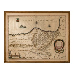
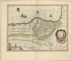
Blaeu Biscay Map, Basque Country Bilbao Cantabria Spain, c.1642
Located in Langweer, NL
Keywords: Biscay map, Basque Country map, Bilbao map, Cantabria map, northern Spain map, Blaeu Biscay, 17th century Spain map, Atlantic coast map Spain, Basque antique map, Spanish c...
Paper
Willem Janszoon Blaeu Rare Original 17th Century Map of Ethiopia in a Pine Frame
By Willem Blaeu
Located in Meer, VAN
Willem Janszoon Blaeu Rare Original 17th Century Map of Ethiopia in a Pine Frame Rare early 17th century map of Ethiopia by Willem Janszoon Blaeu.
Pine, Paper
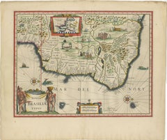
Blaeu Brazil Map, Novus Brasiliae Typus, Antique Hand-Colored Map 1642
Located in Langweer, NL
Blaeu Brazil Map, Novus Brasiliae Typus, Antique Hand-Colored Map 1642 A highly important and visually striking map of Brazil, titled Novus Brasiliae Typus, published by Willem and ...
Paper
Blaeu Andalusia Map, Seville Cordoba Granada Spain, c.1642
Located in Langweer, NL
Keywords: Andalusia map, Seville map, Cordoba map, Granada map, Spain antique map, Blaeu Andalusia, 17th century Spain map, Mediterranean map Spain, Spanish cartography, Blaeu atlas ...
Paper
Antique New England Map Blaeu c.1642 – Nova Belgica & Anglia, Ships
Located in Langweer, NL
As noted by Burden, it is unlikely that Blaeu could have produced this map before circa 1630.
Paper
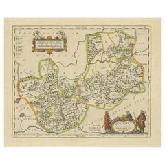
OriginaAntique 17th-Century Map of Guizhou Province, China – (Qveichev) by Blaeu
Located in Langweer, NL
Title: Antique 17th-Century Map of Guizhou Province, China – "Qveichev" by Blaeu, Richly Illustrated and Colored Description: This remarkable map of Guizhou Province, historically k...
Paper

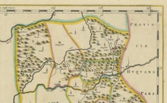
17th-Century Original Antique Map of Hunan and Hubei Provinces, China – by Blaeu
Located in Langweer, NL
Title: 17th-Century Antique Map of Hunan and Hubei Provinces, China – "Hvqvang" by Blaeu, Richly Detailed and Illustrated Description: This beautiful 17th-century map of the regio...
Paper
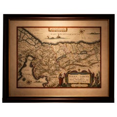
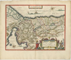
Blaeu Holy Land Map, Terra Sancta Palestina, Figural Cartouche, 1642
Located in Langweer, NL
Blaeu Holy Land Map, Terra Sancta Palestina, Figural Cartouche, 1629 A highly decorative and historically important Blaeu map of the Holy Land, “Terra Sancta… Palestina” (1629), cel...
Paper
Unavailable
H 19 in W 24 in D 0.2 in
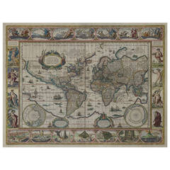
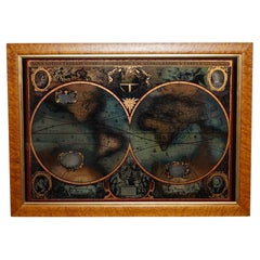
Nova Totius Terrarum Orbis Geographica Ac Hydrographica Tabula, 1638
By Willem Blaeu
Located in Houston, TX
This is a particularly fine copy of Blaeu's world map based on Mercator's projection first published on its own in 1606 as a reduced version of his large world map of 1605.
Unavailable
H 20.95 in W 24.85 in
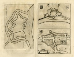
Antique map of Crevecoeur, Helmond and Ravenstein by Blaeu - Engraving - 17th c.
By Joan (Johannes) Blaeu
Located in Zeeland, Noord-Brabant
Description: This plan originates from the famous city Atlas: 'Toneel der Steeden' published by Joan Blaeu 1649. Artists and Engravers: Anonymous. Subject: Antique print, titled: '...
Engraving
Extremely Rare 1695 Hand-Colored Map on Vellum
By Willem Blaeu
Located in La Jolla, CA
“A scientific and artistic document of the first order”, one of the most important sea charts of the 17th century. Exceptionally rare Johannes Loots issue of Guillaume Blaeu's lan...
Paper
Unavailable
H 18.23 in W 22.8 in
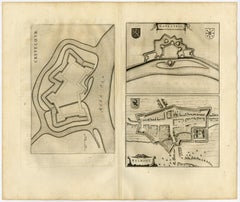
Antique map of Gelderland by Valk - Schenk - Handcoloured engraving - 17th c.
By Joan (Johannes) Blaeu
Located in Zeeland, Noord-Brabant
Description: Source unknown, to be determined. Artists and Engravers: Anonymous. Subject: Antique print, titled: 'Ducatus Geldriae novissima descriptio.' - This map shows duchy of ...
Engraving
Unavailable
H 19.61 in W 23.23 in
Ducatus Gelriae pars prima quae est Neomagensis.
By Johannes Janssonius
Located in Zeeland, Noord-Brabant
Janssonius maps are similar to those of Blaeu, and he is often accused of copying from his rival, but many of his maps predate those of Blaeu and/or covered different regions.
Engraving, Etching
Trasisalania vulgo Overyssel.
Located in Zeeland, Noord-Brabant
Janssonius' maps are similar to those of Blaeu, and he is often accused of copying from his rival, but many of his maps predate those of Blaeu and/or covered different regions.
Engraving, Etching
Unavailable
H 19.61 in W 23.35 in
Ducatus Gelriae pars quarta quae est Arnhemiensis, sive Velavia.
By Johannes Janssonius
Located in Zeeland, Noord-Brabant
Janssonius' maps are similar to those of Blaeu, and he is often accused of copying from his rival, but many of his maps predate those of Blaeu and/or covered different regions.
Engraving, Etching
![Tabula Castelli ad Sandflitam, qua simul inundati agri, alluviones, [...].](https://a.1stdibscdn.com/archivesE/upload/a_5923/1509441013669/cb3408_master.jpg?width=240)
Unavailable
H 19.53 in W 23.31 in
Tabula Castelli ad Sandflitam, qua simul inundati agri, alluviones, [...].
By Johannes Janssonius
Located in Zeeland, Noord-Brabant
Janssonius' maps are similar to those of Blaeu, and he is often accused of copying from his rival, but many of his maps predate those of Blaeu and/or covered different regions.
Engraving, Etching
1648 Engraving - Johannes Blaeu's Map of Sussex
Located in Corsham, GB
Suthexia Vernacule Sussex', Latin text to the reverse. From the Atlas by Johannes Blaeu, published Amsterdam, 1648, hand coloured. On laid.
Engraving

Sold
H 20.08 in W 23.23 in D 0.02 in
Antique Map of the Region of Le Mans 'France' by Blaeu, circa 1640
By Willem Blaeu
Located in Langweer, NL
Antique Map: Cenomanorum Galliae regionis typus vulgo le Mans – Blaeu, circa 1640 This beautifully engraved and hand-colored map depicts the historical province of Maine in northw...
Paper
Sold
H 22.05 in W 25.6 in D 0.99 in
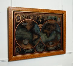
World Map Silver Leaf Print Based on Original Willem Blaeu Wall Map 1571-1638
Located in West Sussex, Pulborough
We are delighted to offer for sale this lovely Antique style pictorial plan map of the globe based on the original Willem Blaeu 1571-1638 engraved in silver leaf foil This is a v...
Silver Leaf
Sold
H 20.08 in W 23.63 in D 0.79 in
1650 JOHANNES BLAEU WATERCOLOUR MAP OF GLOUCESTERSHIRE WiTH GOLD GILTWOOD FRAME
Located in West Sussex, Pulborough
Royal House Antiques Royal House Antiques is delighted to offer for sale this lovely antique Atlas page map of Gloucestershire by Johannes Blaeu circa 1650 in a lovely giltwood fram...
Giltwood, Paper

Sold
H 21.82 in W 25.63 in D 0 in
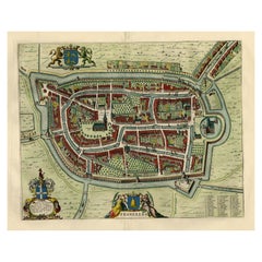
Old Map by Blaeu of the City of Franeker, Friesland, The Netherlands, 1649
Located in Langweer, NL
Also shows two cartouches, coats of arms and legend. This map originates from a Latin edition of the town atlas 'Toneel der Steden', published by Joan Blaeu, Amsterdam: 1652.
Paper
Sold
H 21.82 in W 25.63 in D 0 in
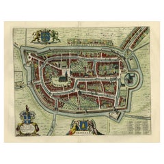
Old Map of the City of Franeker, Friesland by the Famous Mapmaker Blaeu, 1652
Located in Langweer, NL
Also shows two cartouches, coats of arms and legend. This map originates from a Latin edition of the town atlas 'Toneel der Steden', published by Joan Blaeu, Amsterdam: 1652.
Paper

Sold
H 17.92 in W 22.52 in D 0 in
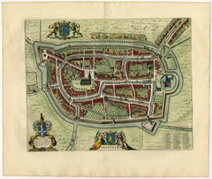
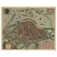
Original Antique Bird's Eye View Plan of Hoorn, The Netherlands by Blaeu, c.1700
Located in Langweer, NL
Janssonius' maps are similar to those of Blaeu, and he is often accused of copying from his rival, but many of his maps predate those of Blaeu and/or covered different regions.
Paper
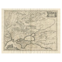
Antique Map of Ukraine and Surroundings, ca.1650
Located in Langweer, NL
Made after the map by Blaeu. Artists and Engravers: Published by J.
Paper

Sold
H 25.25 in W 30.25 in D 2 in
Rare 17th Century American Map of Virginia and Florida by Jan Janssonius
By Jan Johansson
Located in Wiscasset, ME
Janssonius' maps are similar to those of Blaeu, and he is often accused of copying from his rival, but many of his maps predate those of Blaeu and/or covered different regions.
Sold
H 25.01 in W 34.85 in D 0.6 in
FRAMED BURR MAPLE PRINT BASED ON ORIGINAL WiLLEM BLAEU WALL MAP 1571-1638
Located in Pulborough, GB
We are delighted to offer for Presenting a beautifully framed burr maple print inspired by the original wall maps of the illustrious cartographer Willem Blaeu, dating from 1571 to 1...
Maple
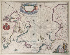

BLAEU MAP OF NORTH POLE and ARTIC
By Willem Blaeu
Located in Santa Monica, CA
Generally good condition, minor foxing in the margins. Classic map of the Arctic with Polar Bears and Sailing ships.
Engraving

Sold
H 19.69 in W 23.63 in D 0 in
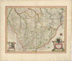
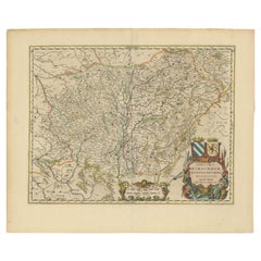
Masterful Cartography and Heraldic Art: Blaeu's Map of the Duchy of Burgundy
Located in Langweer, NL
Description of the Map: This beautifully detailed map is characteristic of Blaeu's work, with fine engraving and rich decorative elements: - Geographical Features: It meticulously o...
Paper
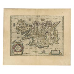
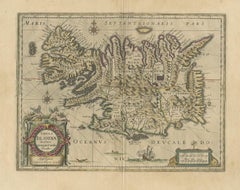
Antique Map of Iceland by Blaeu, circa 1640
By Willem Blaeu
Located in Langweer, NL
Published by G. Blaeu, circa 1640.
Paper
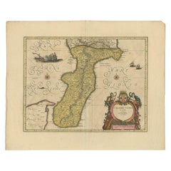
Antique Map of Calabria 'Italy' by Blaeu, circa 1690
By Joan (Johannes) Blaeu
Located in Langweer, NL
Antique map titled 'Calabre Ultra'. Beautiful and rare map of Calabria, Italy. Calabria, known in antiquity as Bruttium, is a region in Southern Italy. Very decorative example with o...
Paper
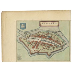

Antique Map of Sloten by Blaeu, 1649
Located in Langweer, NL
Antique map titled 'Slooten'. Original antique map of the city of Sloten, Friesland, the Netherlands.
Paper
Antique Map of Portugal by W. Blaeu, 1650
Located in Langweer, NL
Antique map titled 'Portugallia et Algarbia quae olim Lusitania'.
Paper
Antique Map of Switzerland by G. Blaeu, circa 1634
Located in Langweer, NL
Antique map titled 'Helvetia cum sinitimis regionibus confoederatis'. Beautiful map of Switzerland with Basel at the top of the map and the Italian Alps with Lakes Maggiore Como, etc...
Antique Map of Persia, Also Showing the Indus River, circa 1673
By Joan (Johannes) Blaeu
Located in Langweer, NL
Antique map titled 'Persia sive Sophorum Regnum'. Original old map of Persia.
Paper
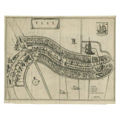

Antique Map of the City of IJlst by Blaeu, c.1649
Located in Langweer, NL
Joan became the official cartographer of the Dutch East India Company. Around 1649 Joan Blaeu published a collection of Dutch city maps named Tooneel der Steeden (Views of Cities).
Paper
Sold
H 20.08 in W 23.43 in D 0.02 in
Antique Map of China, Tartary and Central Asia by Blaeu, circa 1645
Located in Langweer, NL
Blaeu relied on the journals of Marco Polo to compile most of the map.
Paper

Antique Map of China, Tartary and Central Asia by Blaeu, c.1645
Located in Langweer, NL
Blaeu relied on the journals of Marco Polo to compile most of the map.
Paper

Sold
H 26.78 in W 30.52 in D 0.6 in
Antique Map of the Languedoc Region of France by Blaeu, 'circa 1650'
Located in Langweer, NL
Antique map titled 'Languedoc'. Engraved map of the Languedoc region in France.
Paper

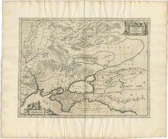
Antique Map of the Southern Part of Russia by Blaeu, circa 1650
Located in Langweer, NL
Antique map titled 'Russiae vulgo Moscovia pars Australis'.
Paper
Sold
H 21.26 in W 13.19 in D 0.02 in
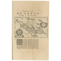
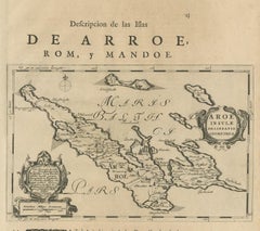
Antique Map of Ærø, Denmark – 'Aroe Insulae' from Blaeu’s Spanish Atlas, c.1665
Located in Langweer, NL
Antique Map of Ærø, Denmark – 'Aroe Insulae' from Blaeu’s Spanish Atlas, c.1665 Antique map titled 'Aroe Insulae delineatio geometrica'.
Paper

Sold
H 17.72 in W 21.66 in D 0 in
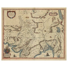
Antique Map by Mapmaker Blaeu of Northern India and Central Asia, c.1650
Located in Langweer, NL
Description: Antique map titled 'Magni Mogolis Imperium.' A handsome map of northern India and Central Asia.
Paper

Sold
H 18.51 in W 23.43 in D 0 in
Burgundy's Viticultural Landscape: A 1640 Cartographic Engraving by Willem Blaeu
Located in Langweer, NL
An hand-colored original antique map with the title "Utriusque Burgundiae tum Ducatus tum Comitatus Descriptio," which translates to "A Description of Both Burgundies, both the Duchy...
Paper
Sold
H 20.08 in W 23.82 in D 0 in
Champagne: The Sparkling Heart of France - A Blaeu Cartographic Engraving, c1650
Located in Langweer, NL
This means the map was produced in Amsterdam by the Blaeu family, specifically by Willem Blaeu and his son Joan Blaeu.
Paper

Sold
H 21.15 in W 24.49 in D 0.02 in
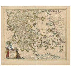
Scarce Antique Map of Greece, the Aegean, Crete and part of Asia Minor
Located in Langweer, NL
Indeed, they are commonly regarded as second only to the Blaeus among Dutch map-makers for the high quality of engraving and decoration and the geographical accuracy of their many ma...
Paper

Sold
H 22.5 in W 27 in
AYX Map of Aix en Provence, France by J. Blaeu 17th c.
By Joan (Johannes) Blaeu
Located in Paonia, CO
This print is a hand -colored double sheet engraving by the famous cartographer Joan (Johannes) Blaeu ( 1596 - 1673 ). The left side of the sheet is a detailed map of the city of Ai...
Engraving

Antique Edinburgh Scotland Map
By Willem Blaeu
Located in Houston, TX
Engraved map of the region around Edinburgh, Scotland by famed cartographer Willem Blaeu, 1654.
Ink, Paper


Antique Roxburghshire, Scotland Map
By Willem Blaeu
Located in Houston, TX
Engraved map of the historic region of Teviotdale, near the county of Roxburghshire, Scotland, by famed cartographer Willem Blaeu, 1654.
Ink, Paper
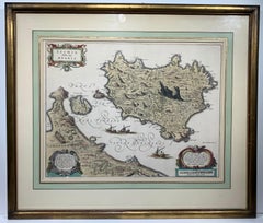
Ischia Isola, olim Aenaria (Antique Italian Map Italy)
By Willem Blaeu
Located in Wilton Manors, FL
Gold leaf detailing. Willem Blaeu (1571-1638) was a prolific Dutch mapmaker who started one of the most famous map publishing firms of the 17th century.
Laid Paper, Engraving


Sold
H 17.88 in W 22 in D 0.75 in
Ireland: A Framed 17th Century Hand-colored Map by Jan Jannson
By Johannes Janssonius
Located in Alamo, CA
After Hondius' death in 1629, Janssonius took over the business and continued to produce high-quality maps and atlases. He worked with some of the leading cartographers of his time, ...
Engraving

Sold
H 23.25 in W 28 in D 1 in
Willem Blaeu Map of Hollandia Comitatus Steel Engraving
Located in Hallowell, ME
Rare engraving by William Blaeu, Map of Hollandia Comitatus. Margins are presumed to be 16" x 21" but have not been examined out of frame.
Engraving
Sold
H 19.13 in W 25.63 in D 0.5 in
Two 17th Century Axonometric Maps by Dutch Cartographer Joan Blaeu
By Joan (Johannes) Blaeu
Located in Brooklyn, NY
Two hand colored copper engravings by Dutch cartographer Joan Blaeu (1596 - 1673). Blaeu was the official cartographer for the Dutch East India Company in the mid 1600s.

Danckerts Map of Florida, the West Indies and the Caribbean.
Located in Coral Gables, FL
Cartographically influenced by Blaeu's 1636 map of the same region, this map covers from Mexico to the Antilles and from Florida to the Spanish Main, inclusive of Cuba, the Bahamas, ...
Sold
H 20 in W 25.5 in D 1 in
Rare 17th Cenury Hand Colored “Mappa Aestivarum Insularum Alias Barmudas”
Located in Gallatin, TN
As Willem Blaeu died in 1638 most of his maps are actually published by his son Joan.
Laid Paper, Color Pencil
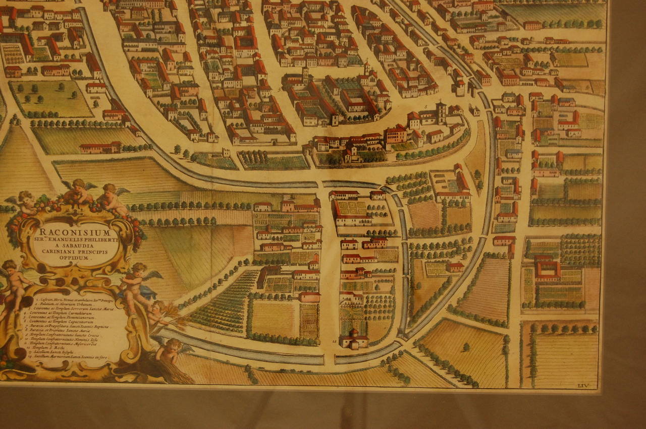
17th Century Water Color Map of Racconigi, Italy, 1668 by J. Blaeu
By Joan (Johannes) Blaeu
Located in Pittsburgh, PA
Detailed hand-colored copper engraving of Racconigi, Italy, circa 1668. Very good condition. We can provide additional pictures of the edges if you desire, taken prior to being frame...
Paper
Antique and vintage collectibles and curiosities can bring whimsy and wonder to any interior.
Decorating with old scientific instruments, historical memorabilia and vintage musical instruments, as well as other authentic collectibles and curiosities that can be found on 1stDibs, presents an opportunity to create a unique, natural history museum-like atmosphere in your home that can provoke conversation as often as it pays tribute to how far we’ve come in understanding our world.
And bringing collectibles and curiosities into your space is actually on trend — Wunderkammern, or curiosity cabinets, were all the rage in Europe during the 1500s and continued to have adherents there and in the U.S. in the following centuries. Today, however, they’re experiencing a real surge in popularity and influencing how many interior designers are furnishing and decorating homes — combining contemporary with antique, scientific with tribal, earthly with extraterrestrial, Les Lalanne tables with Flemish tapestries.
The original Wunderkammern were entire rooms filled with objects demonstrating their owners’ worldly knowledge: A proper one included artificiala or preciosa (objets d’art); naturalia (such as skeletons, shells, minerals); exotica (taxidermy or dried plants); and scientifica (scientific instruments), frequently alongside religious relics and ancient artifacts.
Pay tribute to a history of rich and diverse musical traditions that have taken shape all over the world by decorating your home with a collection of antique and vintage musical instruments — with a little help from strong hanging wire or some wall hooks, vintage brass instruments such as a gong, French horn or trumpet can help elevate a home office or complement the efforts you’ve made to ensure a welcoming vibe in your home’s entryway. Bells or antique wind instruments can add provocative metallic contrasts to dark woods as tabletop decorative objects.
Create an intriguing focal point with Georgian scientific instruments, such as stick barometers with mahogany cases or lacquered brass telescopes. These items stem from an era named for the monarchies of the four King Georges, who ruled England in succession starting in 1714 (plus King William’s reign, which lasted until 1837). Just as there was beautiful jewelry produced during the period that today is coveted by collectors, there is much to be found in the collectibles and curiosities realm too.
Wanderlust, nostalgia and a shared love of good design are contributing factors to certain trends in decorating — just as vintage trunks and luggage have reappeared as furniture or home accents in a bedroom or foyer, decorating with globes, maps or nautical objects is similarly rooted in the allure of travel and a penchant for the stylish finishing touch that collectibles bring to our homes.
Find a wide range of antique and vintage collectibles and curiosities on 1stDibs.
It's hard to resist the allure of a beautiful pool. So, go ahead and daydream about whiling away your summer in paradise.
It’s never too early for good design. These interiors combine elevated furnishings and a youthful spirit, resulting in spaces that are at once elegant and whimsical.
Produced in 1843, the well-preserved volume is evidence of the author's exacting specifications.
New or old, the coverlets add old-time charm to any space.
Get into the games! These items celebrate the events, athletes, host countries and sporting spirit.
French trendsetter and serial collector Daniel Rozensztroch tells us about his obsession with objects related to seafaring men.
The sought-after designer worked with the team at Hoffman Creative to produce a monograph that beautifully showcases some of Studio Shamshiri's most inspiring projects.
Italian writer and collector Umberto Pasti opens the doors to his remarkable cave of wonders in North Africa.