Items Similar to 1571-1638 Willem Blaeu map entitled, "Ilcadorino, " Hand Colored Ric0009
Want more images or videos?
Request additional images or videos from the seller
1 of 11
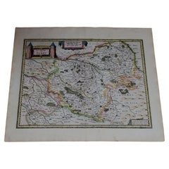
1571-1638 Willem Blaeu map entitled, "Ilcadorino, " Hand Colored Ric0009
About the Item
Willem Blaeu map entitled,
"Ilcadorino,".
Hand colored.
Description: large, unusual, and nice antique copper engraved map of Ilcadorino, by Willem BLAEU (1571-1638), XVIIe century.
Dimension: paper: 22.6" W x 20.3" H (60 cm W x 51.5 cm H) ; sight: 19.7" x 15" H (50 cm W x 38 cm H).
Condition: good condition with aged toning and weird on the outside paper edges, please see photos.
- Dimensions:Height: 20.28 in (51.5 cm)Width: 23.63 in (60 cm)Depth: 0.4 in (1 cm)
- Materials and Techniques:
- Place of Origin:
- Period:
- Date of Manufacture:1571
- Condition:
- Seller Location:Norton, MA
- Reference Number:1stDibs: LU5848230191632
About the Seller
5.0
Platinum Seller
These expertly vetted sellers are 1stDibs' most experienced sellers and are rated highest by our customers.
Established in 2000
1stDibs seller since 2021
85 sales on 1stDibs
Typical response time: <1 hour
- ShippingRetrieving quote...Ships From: Norton, MA
- Return PolicyA return for this item may be initiated within 3 days of delivery.
More From This SellerView All
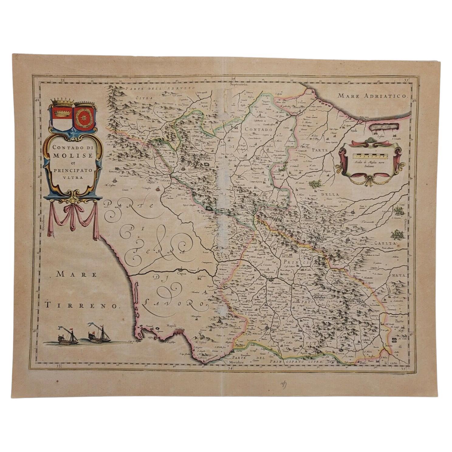
- 1640 Willem Blaeu Map Entitled "Contado di molise et principato vltra, " Ric.a003By Willem BlaeuLocated in Norton, MA1640 Willem Blaeu map entitled "Contado di molise et principato vltra," Colored Ric. a003 Measures: 38 x 49.6 cm and wide margins DBLAEU. Cou...Category
Antique 17th Century Dutch Maps
MaterialsPaper
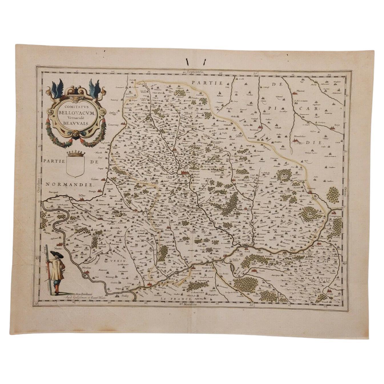
- 1635 Willem Blaeu Map of Northern France"Comitatvs Bellovacvm" Ric.a08Located in Norton, MA1635 Willem Blaeu map of northern France, entitled. "Comitatvs Bellovacvm Vernacule Beavvais," Colored Ric.a008 “COMITATVS BELLOVACVM…” Amsterdam: W...Category
Antique 17th Century Unknown Maps
MaterialsPaper
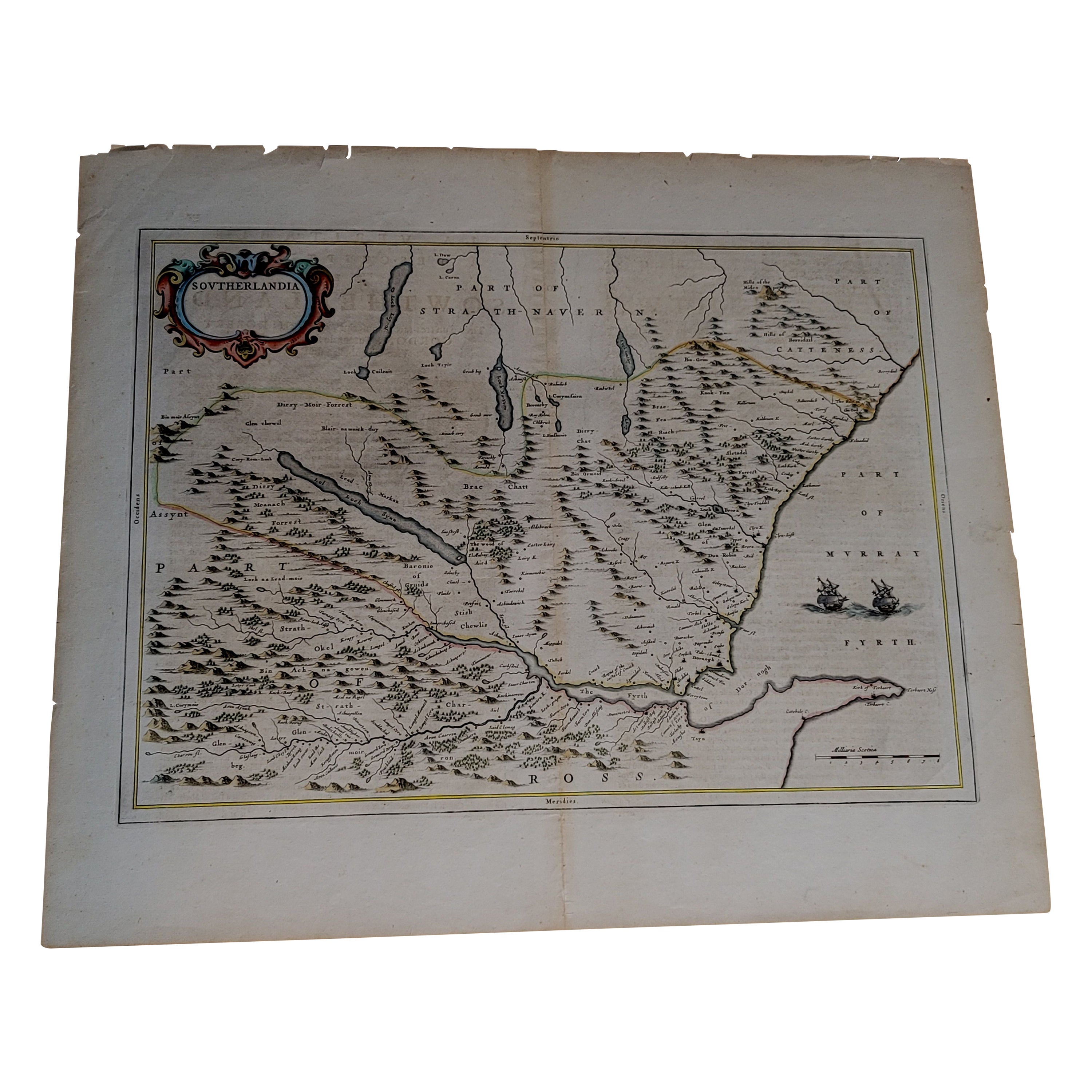
- 1654 Joan Blaeu Map the Sutherland, Scotland, Entitled "Southerlandia, "Ric0007Located in Norton, MA1654 Joan Blaeu map of the Sutherland, Scotland, entitled "Southerlandia," Hand Colored Ric0007 Description: Lovely map centered on Sedan and D...Category
Antique 17th Century Dutch Maps
MaterialsPaper
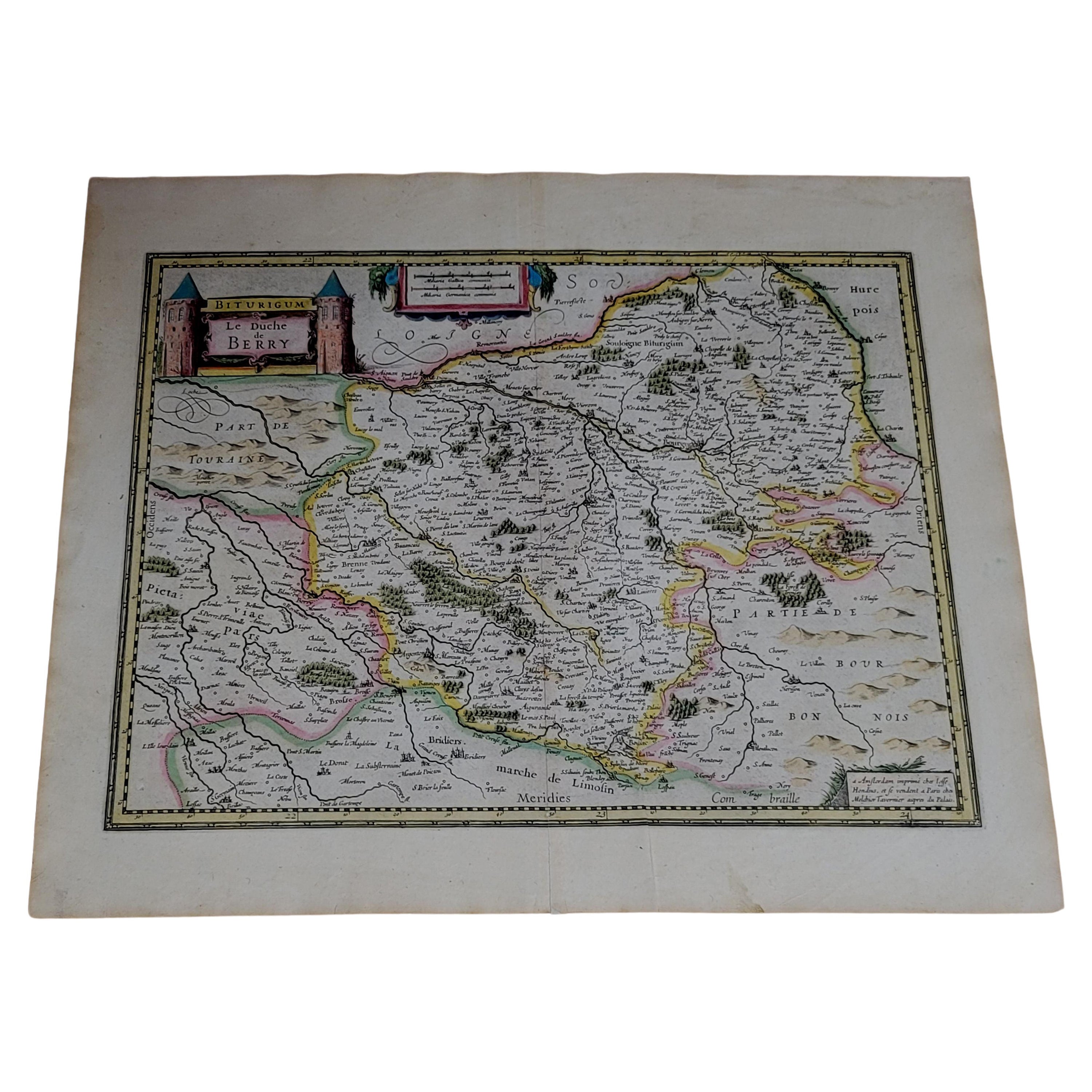
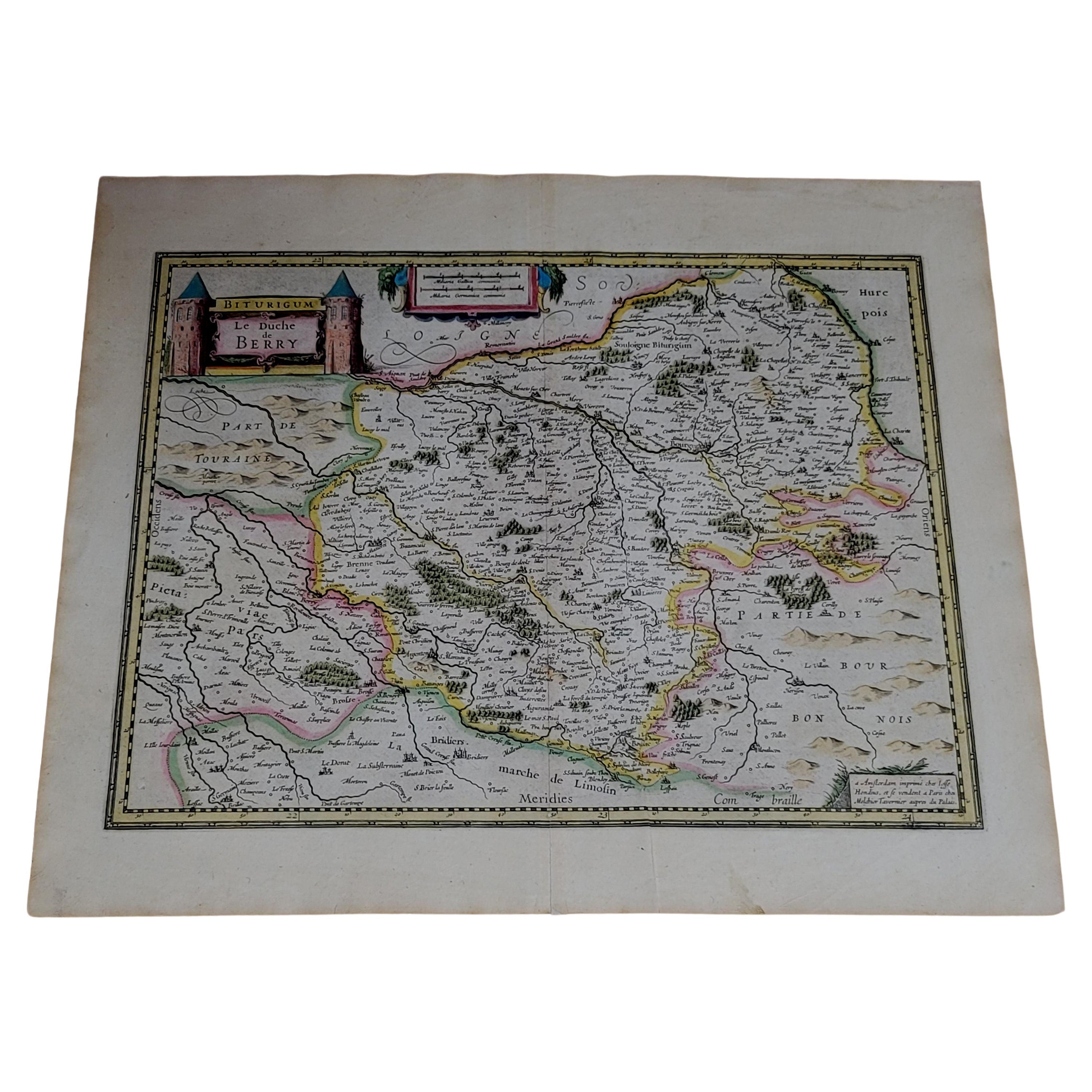
- 1633 map, entitled "La douche de Berry, " Original Hand Colored Ric.0005Located in Norton, MA1633 map, entitled "La douche de Berry," Hand Colored Ric.0005 Description: 1633 map, entitled "La douche de Berry," Dimension: Paper: 23.3" W x 20.3" H (59 cm W x 51.7 cm H) ; ...Category
Antique 17th Century Dutch Maps
MaterialsPaper
- 1633 Map, Entitled "La Douche De Berry, " Original Hand Colored Ric.0005Located in Norton, MA1633 map, entitled. "La douche de Berry," Hand Colored Ric.0005 Description: 1633 map, entitled "La douche de Berry,". Dimension: Paper: 23.3" W x 20.3" H (59 cm W x 51.7...Category
Antique 17th Century Unknown Maps
MaterialsPaper
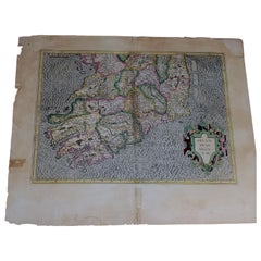
- 1585 Mercator Map of Ireland, Entitled "Irlandiae Regnvm, " Hand Colored Ric0006Located in Norton, MA1585 Mercator map of Ireland, entitled "Irlandiae Regnvm." Hand Colored Description: Published in Amsterdam by Mercator/Hondius ca. 1585. Artists and Engravers: 1585 Mercator map of Ireland, entitled "Irlandiae Regnvm." Copperplate engraving on verge type hand laid paper with watermark. Description: Published in Amsterdam by Mercator/Hondius ca. 1585.Artists and Engravers: Mercator was born in Rupelmonde in Flanders and studied in Louvain under Gemma Frisius, Dutch writer, astronomer and mathematician. The excellence of his work brought him the patronage of Charles V, but in spite of his favor with the Emperor he was caught up in the persecution of Lutheran protestants and charged with heresy, fortunately without serious consequences. No doubt the fear of further persecution influenced his move in 1552 to Duisburg, where he continued the production of maps, globes and instruments. Mercator's sons and grandsons, were all cartographers and made their contributions in various ways to his atlas. Rumold, in particular, was responsible for the complete edition in 1595. The map plates...Category
Antique 16th Century Dutch Maps
MaterialsPaper


You May Also Like
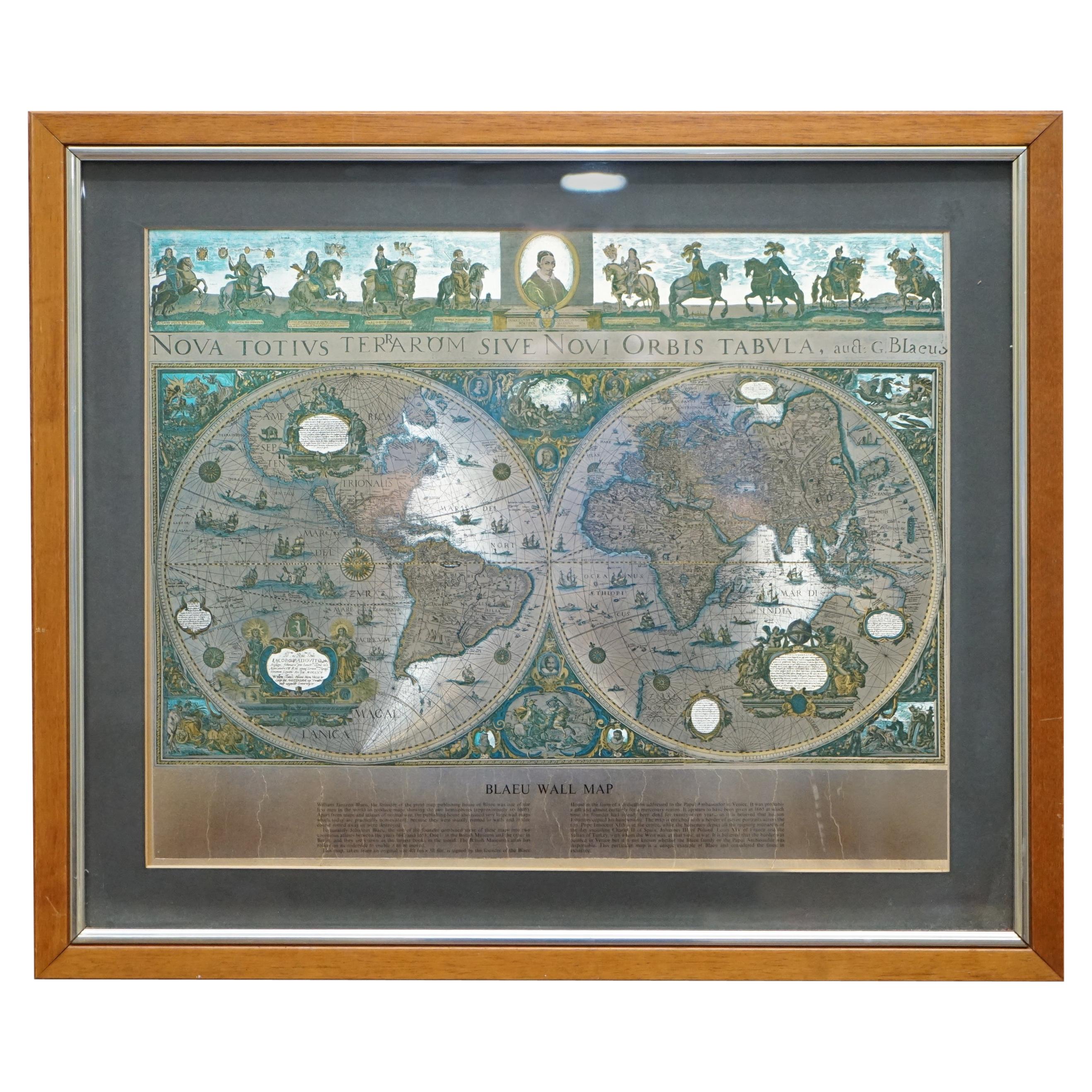
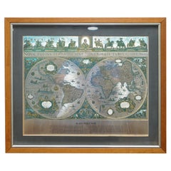
- World Map Silver Leaf Print Based on Original Willem Blaeu Wall Map 1571-1638Located in GBWe are delighted to offer for sale this lovely Antique style pictorial plan map of the globe based on the original Willem Blaeu 1571-1638 engraved in silver leaf foil This is a v...Category
20th Century English Campaign Maps
MaterialsSilver Leaf
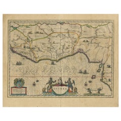
- Antique Map of Guinea in West Africa by Blaeu, c.1638Located in Langweer, NLAntique map titled 'Guinea'. Decorative map of West Africa, including numerous animals in the interior, sailing ships and several elegant cartouches. Both the map and the sea are s...Category
Antique 17th Century Maps
MaterialsPaper
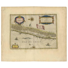
- Orignal Hand-Colored Antique Map of Chili by W. Blaeu, 1658By Willem BlaeuLocated in Langweer, NLVery decorative antique map of Chili published by W. Blaeu, 1658. This map depicts Chile from Copiapo southward to the island of Chiloé with ships and sea monsters adorning the sea. ...Category
Antique Mid-17th Century Maps
MaterialsPaper
- West Africa Entitled "Guinea Propria": An 18th Century Hand Colored Homann MapBy Johann Baptist HomannLocated in Alamo, CAThis is a scarce richly hand colored copper plate engraved map of Africa entitled "Guinea Propria, nec non Nigritiae vel Terrae Nigrorum Maxima Pars" by Johann Baptist Homann (1664-1...Category
Antique Mid-18th Century German Maps
MaterialsPaper
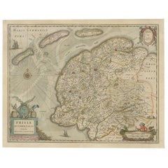
- Antique Map of Friesland, The Netherlands, 1638Located in Langweer, NLAntique map titled 'Frisia Occidentalis'. Original antique map of Friesland, the Netherlands. First state, originating from 'Atlantis novi pars secunda' published 1638. Artis...Category
Antique 17th Century Maps
MaterialsPaper
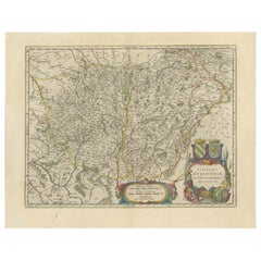
- Burgundy's Viticultural Landscape: A 1640 Cartographic Engraving by Willem BlaeuLocated in Langweer, NLAn hand-colored original antique map with the title "Utriusque Burgundiae tum Ducatus tum Comitatus Descriptio," which translates to "A Description of Both Burgundies, both the Duchy...Category
Antique 1640s Maps
MaterialsPaper

Recently Viewed
View AllMore Ways To Browse
Large Map Of The Netherlands
16th Century Hand Colored Map
Weird Furniture
Willem Blaeu
Antique Style Atlas
Nautical Map
Nautical Maps
Pacific Map
Antique Ship Decor
Coastal Maps
Antique Maps Mexico
Antique Sea Charts
Antique Sea Chart
Mexico Antique Map
Antique Roman Map
Amsterdam Coat Of Arms
Antique Texas Collectables
Large Map Of The Netherlands