Items Similar to Antique Map of Friesland, The Netherlands, 1638

Want more images or videos?
Request additional images or videos from the seller
1 of 5
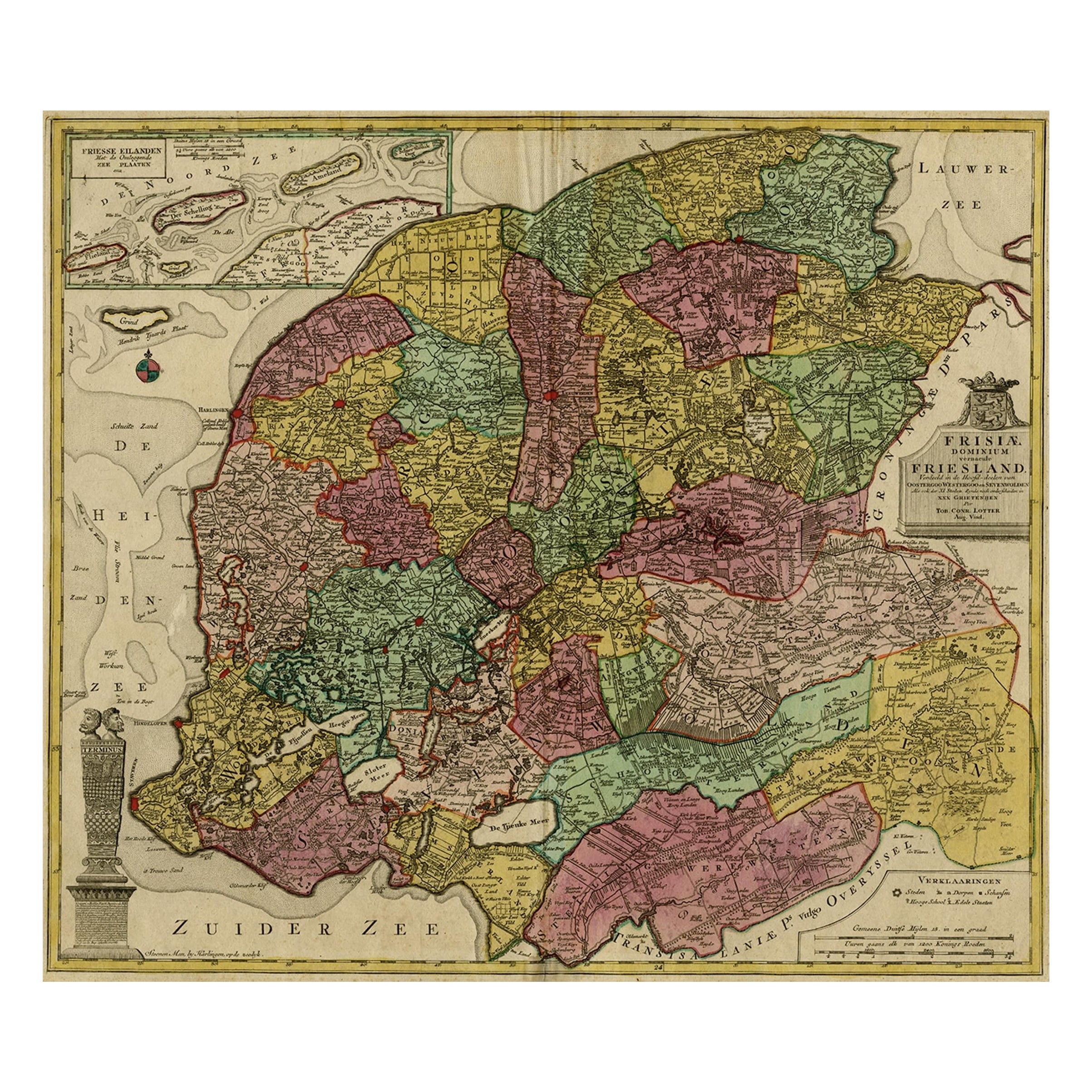
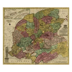
Antique Map of Friesland, The Netherlands, 1638
About the Item
Antique map titled 'Frisia Occidentalis'.
Original antique map of Friesland, the Netherlands. First state, originating from 'Atlantis novi pars secunda' published 1638.
Artist: Henricus Hondius II (1597 - 16 August 1651) was a Dutch engraver, cartographer, and publisher.
Condition: Fair/good, general age-related toning. Minor wear, repair on folding line. Latin text on verso. Please study image carefully.
Date: 1638
We sell original antique maps to collectors, historians, educators and interior decorators all over the world. Our collection includes a wide range of authentic antique maps from the 16th to the 20th centuries. Buying and collecting antique maps is a tradition that goes back hundreds of years. Antique maps have proved a richly rewarding investment over the past decade, thanks to a growing appreciation of their unique historical appeal. Today the decorative qualities of antique maps are widely recognized by interior designers who appreciate their beauty and design flexibility. Depending on the individual map, presentation, and context, a rare or antique map can be modern, traditional, abstract, figurative, serious or whimsical. We offer a wide range of authentic antique maps for any budget.
- Dimensions:Height: 16.93 in (43 cm)Width: 21.26 in (54 cm)Depth: 0 in (0.01 mm)
- Materials and Techniques:
- Period:
- Date of Manufacture:1638
- Condition:Wear consistent with age and use.
- Seller Location:Langweer, NL
- Reference Number:
About the Seller
5.0
Platinum Seller
These expertly vetted sellers are 1stDibs' most experienced sellers and are rated highest by our customers.
Established in 2009
1stDibs seller since 2017
1,947 sales on 1stDibs
Typical response time: <1 hour
- ShippingRetrieving quote...Ships From: Langweer, Netherlands
- Return PolicyA return for this item may be initiated within 14 days of delivery.
More From This SellerView All
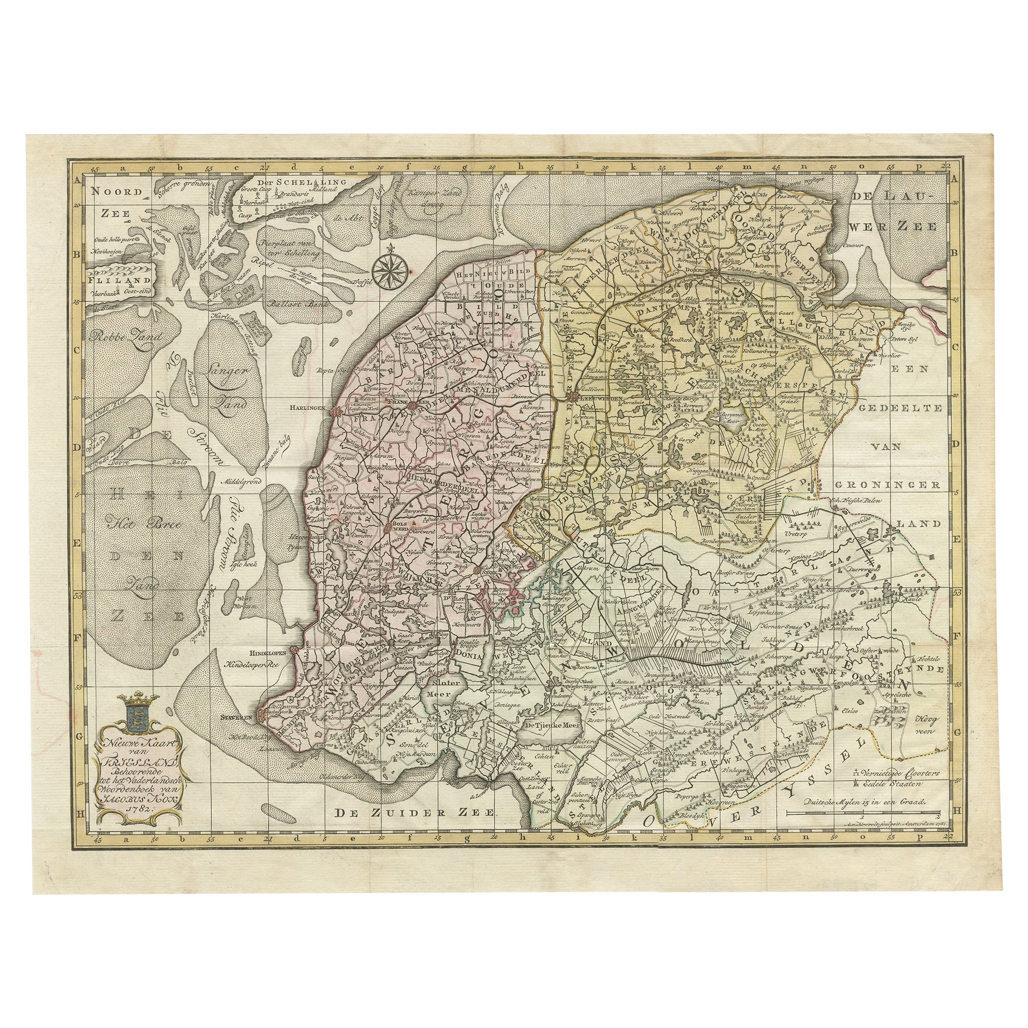
- Antique Map of Province Friesland, The Netherlands, 1787Located in Langweer, NLAntique map titled 'Nieuwe Kaart van Friesland behoorende tot het Vaderlandsch Woordenboek van Jacobus Kok'. Original antique map of the province of Friesland, the Netherlands. This ...Category
Antique 18th Century Maps
MaterialsPaper
- Antique Map of Friesland in the Netherlands, 1770Located in Langweer, NLAntique map titled 'De Synode van Friesland, in VI Klassen verdeeld door W.A. Bachiene?. Map of the province of Friesland, the Netherlands. This map originates from 'Nieuwe kerkelyke...Category
Antique 18th Century Maps
MaterialsPaper
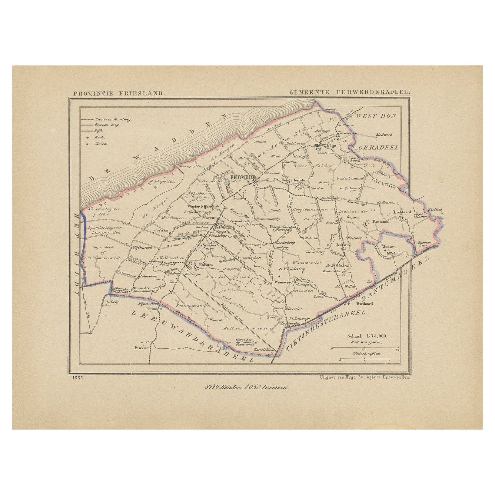
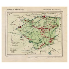
- Antique Map of Ferwerderadeel, Friesland, the Netherlands, 1868Located in Langweer, NLAntique map titled 'Provincie Friesland - Gemeente Ferwerderadeel'. Map of the township of Ferwerderadeel including Ferwerd, Blija and many other villages. This map originates from '...Category
Antique 19th Century Maps
MaterialsPaper
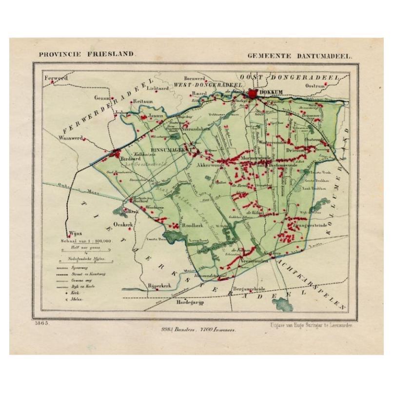
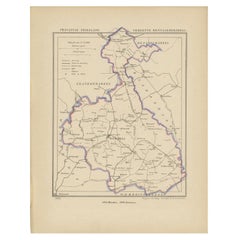
- Antique Map of Dantumadeel, Friesland, The Netherlands, 1868Located in Langweer, NLAntique map titled 'Provincie Friesland - Gemeente Dantumadeel'. Map of the township of Dantumadeel including Birdaard, Rinsumageest, Veenwouden and many other villages. This map ori...Category
Antique 19th Century Maps
MaterialsPaper
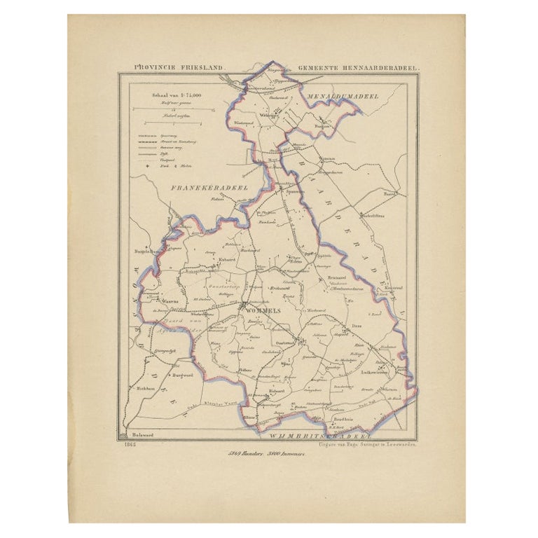
- Antique Map of Hennaarderadeel, Friesland, the Netherlands, 1868Located in Langweer, NLAntique map titled 'Provincie Friesland - Gemeente Hennaarderadeel'. Map of the township of Hennarderadeel including Oosterend, Wommels and many other villages. This map originates f...Category
Antique 19th Century Maps
MaterialsPaper
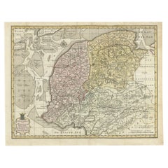
- Antique Map of the Province of Friesland, The Netherlands, c.1760Located in Langweer, NLAntique map titled 'Frisiae Dominium vernacule Friesland, verdeeld in de Hoofd-deelen van Oostergoo, Westergoo en Sevenwolden, Als ook der XI Steden Zynde noch onderscheiden in XXX G...Category
Antique 18th Century Maps
MaterialsPaper
You May Also Like
- Original Antique Map of The Netherlands, Engraved by Barlow, Dated 1807Located in St Annes, LancashireGreat map of Netherlands Copper-plate engraving by Barlow Published by Brightly & Kinnersly, Bungay, Suffolk. Dated 1807 Unframed.Category
Antique Early 1800s English Maps
MaterialsPaper
- Original Antique Map of The Netherlands, Sherwood, Neely & Jones, Dated 1809Located in St Annes, LancashireGreat map of The Netherlands Copper-plate engraving by Cooper Published by Sherwood, Neely & Jones. Dated 1809 Unframed.Category
Antique Early 1800s English Maps
MaterialsPaper
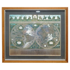
- World Map Silver Leaf Print Based on Original Willem Blaeu Wall Map 1571-1638Located in GBWe are delighted to offer for sale this lovely Antique style pictorial plan map of the globe based on the original Willem Blaeu 1571-1638 engraved in silver leaf foil This is a v...Category
20th Century English Campaign Maps
MaterialsSilver Leaf
- School Chart or Pull Down Map of Geography of the Netherlands, 1950sLocated in Hemiksem, VANA beautiful old school map of the Netherlands, painted on linen. The map shows the 3 different reliefs (low, middle, high) of the Netherlands. The beau...Category
Vintage 1950s Belgian Mid-Century Modern Maps
MaterialsLinen, Paint
- 1571-1638 Willem Blaeu map entitled, "Ilcadorino, " Hand Colored Ric0009Located in Norton, MAWillem Blaeu map entitled, "Ilcadorino,". Hand colored. Description: large, unusual, and nice antique copper engraved map of Ilcadorino, by Willem BL...Category
Antique 16th Century Dutch Maps
MaterialsPaper
- 1861 Topographical Map of the District of Columbia, by Boschke, Antique MapLocated in Colorado Springs, COPresented is an original map of Albert Boschke's extremely sought-after "Topographical Map of the District of Columbia Surveyed in the Years 1856 ...Category
Antique 1860s American Historical Memorabilia
MaterialsPaper


Recently Viewed
View AllMore Ways To Browse
The Netherlands
Furniture From The Netherlands
Antique Netherlands
Antique Furniture Netherlands
Netherlands Antique
Antique The Netherlands
Antique Furniture From Netherlands
Netherlands 16th Century
Netherlands Antique Map
Antique State Maps
17th Century World Map
Antique 17th Century World Map
Antique Map Fair
Map Hondius
Henricus Hondius
Atlantis Antique
Netherlands 16th Century
Antique Furniture In Texas