Antique Map Fair
3
to
24
438
16
250
172
132
112
32
32
16
12
12
10
10
7
7
6
5
4
4
4
3
3
3
3
3
3
3
2
2
2
2
2
2
1
1
1
1
1
1
1
1
13
6
6
4
3
Sort By
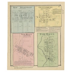
Antique Map of New Westville, Gettysburg, New Hope & Fair Haven, 1871
Located in Langweer, NL
Antique map titled 'New Westville, Gettysburg, New Hope, Fair Haven'. Original antique map of
Category
Late 19th Century Antique Map Fair
Materials
Paper
H 14.97 in W 12.41 in D 0.02 in
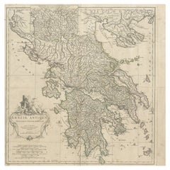
Large Scale Map of Greece with Inset Map of Macedonia, c.1786
Located in Langweer, NL
standards of map-making.
Condition: Fair, general age-related toning. Shows some wear and soiling. Repair
Category
18th Century Antique Map Fair
Materials
Paper
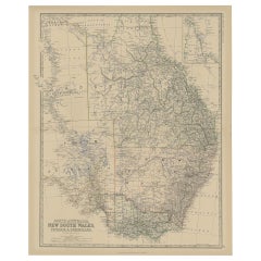
Old Map of Southern Australia, with an Inset Map of Cape York Peninsula, 1882
Located in Langweer, NL
Antique map titled 'South Australia, New South Wales, Victoria & Queensland'.
Old map of
Category
1880s Antique Map Fair
Materials
Paper
H 24.22 in W 19.53 in D 0 in
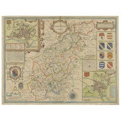
Antique Map of Northamptonshire by Speed, 1676
Located in Langweer, NL
Antique map titled 'Norhamtonshire'. Map of Norhamptonshire, England. Includes inset town plans of
Category
17th Century Antique Map Fair
Materials
Paper
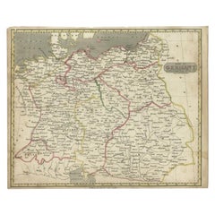
Antique Map of Germany by Walker, 1820
By R. Walker
Located in Langweer, NL
Antique map Germany titled 'Map of Germany as defined by the Peace of Paris'. Detailed antique map
Category
19th Century Antique Map Fair
Materials
Paper
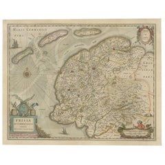
Antique Map of Friesland, The Netherlands, 1638
Located in Langweer, NL
Antique map titled 'Frisia Occidentalis'.
Original antique map of Friesland, the Netherlands
Category
17th Century Antique Map Fair
Materials
Paper
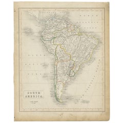
Antique Map of South America, c.1840
Located in Langweer, NL
Antique map titled 'South America'. Original, antique map depicting South America. With outline
Category
19th Century Antique Map Fair
Materials
Paper
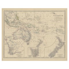
Antique Map of Oceania by Johnston, 1882
Located in Langweer, NL
Antique map titled 'Oceania'. Old map of Oceania with inset maps of Western Australia, Tasmania and
Category
19th Century Antique Map Fair
Materials
Paper
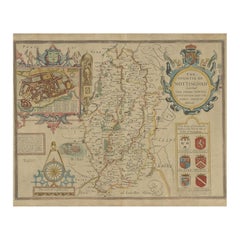
Antique Map of Nottinghamshire by Speed, 1676
Located in Langweer, NL
Antique map titled 'The Countie of Nottingham (..)'. Map of Nottinghamshire, England. Includes an
Category
17th Century Antique Map Fair
Materials
Paper
Antique Map of Surrey by Speed, 1676
Located in Langweer, NL
Antique map titled 'Surrey described and divided into hundreds'. Map of Surrey, England. Includes
Category
17th Century Antique Map Fair
Materials
Paper
Antique Map of Polynesia by Walker, 1840
Located in Langweer, NL
Antique map titled 'Polynesia or Islands in the Pacific Ocean'. This map depicts various islands
Category
19th Century Antique Map Fair
Materials
Paper
Antique Map of Overijssel by Visscher, 1632
Located in Langweer, NL
Antique map titled 'De Heerlyckheyt van Over-IJssel'. Old map of the province of Overijssel, the
Category
17th Century Antique Map Fair
Materials
Paper
Antique Map of the Circle of Franconia, 1757
Located in Langweer, NL
Antique map titled 'Cercle de Franconie (..)'. Map of the Circle of Franconia, Germany. Centered on
Category
18th Century Antique Map Fair
Materials
Paper
Antique Map of the Holy Land, c.1710
Located in Langweer, NL
Antique map titled 'Totius Terrae Sanctae Delineatio'. Map of the Holy Land extending to Egypt and
Category
18th Century Antique Map Fair
Materials
Paper
Antique Map of Gloucestershire by Camden, c.1607
Located in Langweer, NL
county maps in Britannia were based on the work of Christopher Saxton and John Norden.
Condition: Fair
Category
17th Century Antique Map Fair
Materials
Paper
Antique Map of the Lorraine Region, c.1760
Located in Langweer, NL
.
Artists and Engravers: Anonymous. Most likely part of a two sheet map.
Condition: Fair/good, general
Category
18th Century Antique Map Fair
Materials
Paper
Antique Map of North America by Johnston, 1882
By Alexander Keith Johnston
Located in Langweer, NL
W. and A. K. Johnston.
Condition: Fair, map is in half (seperated at folding line). Age-related
Category
19th Century Antique Map Fair
Materials
Paper
Antique Map of Friesland in the Netherlands, 1770
Located in Langweer, NL
Antique map titled 'De Synode van Friesland, in VI Klassen verdeeld door W.A. Bachiene?. Map of the
Category
18th Century Antique Map Fair
Materials
Paper
Antique Map of Austria by Ortelius, c.1612
Located in Langweer, NL
Antique map titled 'Austriae Descrip. per Wolfgangum Lazium' Original antique map of Austria
Category
17th Century Antique Map Fair
Materials
Paper
Antique Map of the Antilles by Meyer, 1878
Located in Langweer, NL
Antique map titled 'Die Antillen'. Old map of the Antilles, it shows Jamaica, Puerto Rico, the
Category
19th Century Antique Map Fair
Materials
Paper
Antique Map of South America by Kelly, 1835
Located in Langweer, NL
Antique map titled 'South America'. Old map of South America engraved by A. Findley. With
Category
19th Century Antique Map Fair
Materials
Paper
Antique Map of South Australia by Johnston, 1882
By Thomas Kitchin
Located in Langweer, NL
Antique map titled 'South Australia, New South Wales, Victoria & Queensland'. Old map of Southern
Category
19th Century Antique Map Fair
Materials
Paper
Antique Map of Northern Scotland by Johnston, 1882
Located in Langweer, NL
Antique map titled 'Scotland'. Old map of Northern Scotland. This map originates from 'The Royal
Category
19th Century Antique Map Fair
Materials
Paper
Antique Map of Northern India by Bonne, 1780
Located in Langweer, NL
Marine.
Condition: Fair, age-related toning. Defect and stain lower part of map. Please study image
Category
18th Century Antique Map Fair
Materials
Paper
Antique Map of Prussia by Blaeu, c.1680
Located in Langweer, NL
Antique map titled 'Prussiae nova Tabula'. Later edition of Blaeu's map of Prussia, embellished
Category
17th Century Antique Map Fair
Materials
Paper
Rare Antique Map of Calcutta 'Kolkata' in India, 1893
Located in Langweer, NL
Antique map titled 'Calcutta (India)'. Old map of Calcutta/Kolkata, India. On verso, a map of Egypt
Category
19th Century Antique Map Fair
Materials
Paper
Antique Map of Zevenwouden in Friesland by Schotanus, 1664
Located in Langweer, NL
Antique map titled 'Septem silvae vulgo Seven Wolden olim forestensis.' Map of the region of
Category
17th Century Antique Map Fair
Materials
Paper
Antique Map of the Kamchatka Peninsula by Bellin, 1757
By J. Laurent
Located in Langweer, NL
J.N. Bellin.
Condition: Fair, staining lower part of the map. Please study image carefully.
Date
Category
18th Century Antique Map Fair
Materials
Paper
Antique Map of South America by Philip & Son, 1875
Located in Langweer, NL
Antique map titled 'South America'. Old map of South America. Source unknown, to be determined
Category
19th Century Antique Map Fair
Materials
Paper
Antique Map of the Netherlands by Brugsma, c.1870
Located in Langweer, NL
Antique map titled 'Het Koningrijk der Nederlanden'. Map of the Netherlands. This map originates
Category
19th Century Antique Map Fair
Materials
Paper
Antique Map of North America by Laarman, c.1860
Located in Langweer, NL
Antique map titled 'Noord Amerika'. Original antique map of North America. Published circa 1860
Category
19th Century Antique Map Fair
Materials
Paper
Antique Copper Engraved Map of Gloucestershire in England, 1637
Located in Langweer, NL
Antique map titled 'Glocestriae comitatus olim sedes Dobunorum'. Map of Gloucestershire, England
Category
17th Century Antique Map Fair
Materials
Paper
Antique Map of Flanders and Zeeland by Merian, 1659
Located in Langweer, NL
Antique map titled 'Flandria et Zeelandia Comitatus'. Original antique map of Flanders, Belgium
Category
17th Century Antique Map Fair
Materials
Paper
Antique Map of Gloucestershire in Britain by Camden, 1637
Located in Langweer, NL
Antique map titled 'Glocestriae comitatus olim sedes Dobunorum'. Map of Gloucestershire, England
Category
17th Century Antique Map Fair
Materials
Paper
Antique Map of Hertfordshire in England by Speed, 1627
Located in Langweer, NL
Antique map titled 'Hartfordshire described the sittuations of Hartford (..)'.
Map of
Category
17th Century Antique Map Fair
Materials
Paper
Antique Map of the Low Countries by Ortelius, 1584
By Abraham Ortelius
Located in Langweer, NL
Antique map titled 'Belgii Veteris Typus'. Beautiful map of the Low Countries, extending to the
Category
16th Century Antique Map Fair
Materials
Paper
Antique Map of the Low Countries by Brué, 1822
Located in Langweer, NL
Antique map titled 'Carte du Royaume des Pays-Bas'. Large format map of the Low Countries. This map
Category
19th Century Antique Map Fair
Materials
Paper
Antique Map of the German Empire by Johnston, 1882
By Alexander Keith Johnston
Located in Langweer, NL
Antique map titled 'Empire of Germany'. Old map of the German Empire with an inset map of Berlin
Category
19th Century Antique Map Fair
Materials
Paper
Antique Map of the East Indies by Rossi, 1683
Located in Langweer, NL
Antique map titled 'Isole Dell'India cioe le Molucche la Filippine e della Sonda Parte de Paesi di
Category
17th Century Antique Map Fair
Materials
Paper
Antique Map of Denmark and Southern Sweden, c.1658
Located in Langweer, NL
Antique map titled 'Royaume de Danemarq.' Map centered on Sjaelland and covers all of Denmark and
Category
17th Century Antique Map Fair
Materials
Paper
Antique Map of North Africa by Ortelius, c.1600
Located in Langweer, NL
Antique map titled 'Barbariae et Biledulgerid nova descriptio'.
Old map of coastal North Africa
Category
17th Century Antique Map Fair
Materials
Paper
Antique Map of Southeast Asia by Walker, c.1845
Located in Langweer, NL
"Untitled map of southeast Asia. This map depicts India, Indonesia, Australia and surrounding
Category
19th Century Antique Map Fair
Materials
Paper
Antique Map of North Africa by Ortelius, c.1580
Located in Langweer, NL
Antique map titled 'Barbariae et Biledulgerid Nova Descriptio'. Original antique map of North
Category
16th Century Antique Map Fair
Materials
Paper
Antique Map of Persia and Afghanistan by Johnston, 1882
Located in Langweer, NL
Antique map titled 'Persia and Afghanistan'.
Old map of Persia and Afghanistan. This map
Category
19th Century Antique Map Fair
Materials
Paper
Antique Map of the Bildt Region by Schotanus, 1664
Located in Langweer, NL
Antique map titled 'De Grietenije van der Bildt (..)' Map of the Grietenij of Het Bildt, Friesland
Category
17th Century Antique Map Fair
Materials
Paper
Antique Map of Southeast Asia by Chatelain, c.1732
Located in Langweer, NL
"Antique map titled 'La Royaume de Siam avec les Royaumes qui luy sont Tributaires et les Isles de
Category
18th Century Antique Map Fair
Materials
Paper
Antique Map of the British Isles by Lotter, 1764
Located in Langweer, NL
Antique map titled 'Le Grand Bretagne ou les Royaumes d'Angleterre et d'Ecosse'. Old engraved map
Category
18th Century Antique Map Fair
Materials
Paper
Road Map, John Ogilby, No 54, London, Yarmouth, Britannia
By John Ogilby
Located in BUNGAY, SUFFOLK
-sixth year, as a publisher of maps and geographical accounts.
Ogilby was born outside Dundee, in
Category
1670s English Baroque Antique Map Fair
Materials
Paper
Antique Map of North and South America by Walker, 1828
Located in Langweer, NL
Antique map titled 'Geographical, Historical and Statistical Map of America'. Two maps on one sheet
Category
19th Century Antique Map Fair
Materials
Paper
Antique Map of Warwickshire in England by Speed, c.1614
Located in Langweer, NL
Antique map titled 'The Counti of Warwick the Shire Towne and Citie of Coventre described'. Map of
Category
17th Century Antique Map Fair
Materials
Paper
Antique Map of the City of Leeuwarden by Merian, 1659
Located in Langweer, NL
publishers in the Baroque period
Condition: Fair. Map is mount to paper. Please study image carefully
Category
17th Century Antique Map Fair
Materials
Paper
Antique Map of the Arabian Desert by Cellarius, 1731
Located in Langweer, NL
Antique map titled 'Arabia Petraea et Deserta.' Arabian desert with present day Israel, Jordania
Category
18th Century Antique Map Fair
Materials
Paper
Antique Map of the County of Hainaut by Jaillot, 1692
Located in Langweer, NL
joined the Sanson heirs and redrew Nicolas Sanson's maps on a larger scale.
Condition: Fair, original
Category
17th Century Antique Map Fair
Materials
Paper
Antique Map of the Region of Dantumadeel by Schotanus, 1664
Located in Langweer, NL
Antique map titled 'De Grietenye van Dantumadeel (..)'. Map of the Grietenij of Dantumadeel
Category
17th Century Antique Map Fair
Materials
Paper
Antique Map of the Kingdom of Sweden by Güssefeld, 1793
Located in Langweer, NL
Antique map titled 'Charte über das Konigreich Schweden (..)'. Original antique map of the Kingdom
Category
18th Century Antique Map Fair
Materials
Paper
Antique Map of the City of Groningen by Merian, 1659
Located in Langweer, NL
Antique map titled 'Gröningen'. This print depicts the city of Groningen, the Netherlands. This
Category
17th Century Antique Map Fair
Materials
Paper
Antique Map of the City of Haarlem by Tirion, 1742
By Isaak Tirion
Located in Langweer, NL
Antique map titled 'Grondtekening van Haarlem (..)'. Original antique map of the city of Haarlem
Category
18th Century Antique Map Fair
Materials
Paper
Antique Map of the Region of Meissen by Schreiber, 1749
Located in Langweer, NL
Antique map titled 'Der Ertz-Gebürgische Creis in Meissen (..)'. Map of the region of Meissen
Category
18th Century Antique Map Fair
Materials
Paper
Antique Map of the City of Franeker by Guicciardini, 1613
Located in Langweer, NL
Antique map titled 'Franicher'. Plan of the city of Franeker, Friesland, the Netherlands. This map
Category
17th Century Antique Map Fair
Materials
Paper
Antique Map of the City of Leeuwarden by Guicciardini, 1613
Located in Langweer, NL
Antique map tited 'Lewardum'. Plan of the city of Leeuwarden, Friesland, the Netherlands. This map
Category
17th Century Antique Map Fair
Materials
Paper
- 1
Get Updated with New Arrivals
Save "Antique Map Fair", and we’ll notify you when there are new listings in this category.
Antique Map Fair For Sale on 1stDibs
With a vast inventory of beautiful furniture at 1stDibs, we’ve got just the antique map fair you’re looking for. Each antique map fair for sale was constructed with extraordinary care, often using paper, metal and wood. There are many kinds of the antique map fair you’re looking for, from those produced as long ago as the 18th Century to those made as recently as the 20th Century. An antique map fair is a generally popular piece of furniture, but those created in Baroque, Art Nouveau and folk art styles are sought with frequency. Schreiber, B. Schotanus and Johannes Janssonius each produced at least one beautiful antique map fair that is worth considering.
How Much is a Antique Map Fair?
An antique map fair can differ in price owing to various characteristics — the average selling price 1stDibs is $298, while the lowest priced sells for $65 and the highest can go for as much as $425,000.
