Naples Map
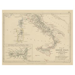
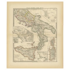
Antique Map of South Italy, illustrating the Invasion of Naples in, 1806
Located in Langweer, NL
Antique battle map titled 'Map of South Italy, to illustrate the invasion of Naples in 1806 etc
Category
Antique Mid-19th Century Maps
Materials
Paper
H 7.09 in W 8.98 in D 0.02 in
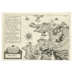
Old Original Map of Pozzuoli Near Naples in the Campania Region, Italy, ca.1740
Located in Langweer, NL
Antique map titled 'Hic Jacent Puteolorum Bajarum (..)'. Old map of the region of Pozzuoli showing
Category
Antique 1740s Maps
Materials
Paper
H 9.65 in W 13.19 in D 0 in
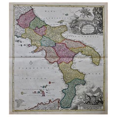
The Kingdom of Naples and Southern Italy: A Hand-Colored 18th Century Homann Map
By Johann Baptist Homann
Located in Alamo, CA
hand colored map of southern Italy and the ancient Kingdom of Naples created by Johann Baptist Homann
Category
Antique Early 18th Century German Maps
Materials
Paper
H 20 in W 23.88 in D 0.07 in
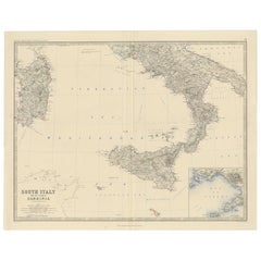
Map of Southern Italy inlcluding Sardinia and Inset of the Bay of Naples, c.1860
Located in Langweer, NL
island of Sardinia. With an inset map of the Bay of Naples. Originates from 'The Royal Atlas Of Modern
Category
Antique 1860s Maps
Materials
Paper
H 19.3 in W 24.41 in D 0 in
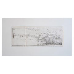
Antique Italian Map of Viaggio da Roma a Napoli 1775
Located in Roma, IT
An original print from 1775 showing an early route map of the journey from Rome to Naples. This
Category
Antique 1770s Italian Maps
Materials
Parchment Paper
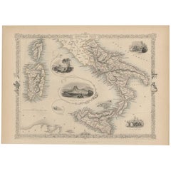
Antique Map of Southern Italy by J. Tallis, circa 1851
Located in Langweer, NL
Decorative and detailed mid-19th century map of Southern Italy which was drawn and engraved by John
Category
Antique Mid-19th Century Maps
Materials
Paper
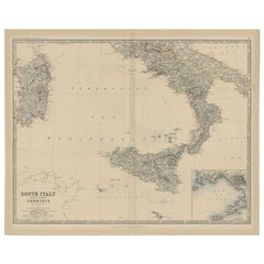
Antique Map of Southern Italy and Sardinia by Johnston, 1882
Located in Langweer, NL
island of Sardinia. With an inset map of the Bay of Naples. This map originates from 'The Royal Atlas of
Category
Antique 19th Century Maps
Materials
Paper
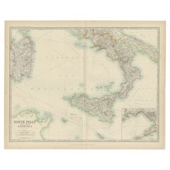
Antique Map of South Italy and the Island of Sardinia by Johnston (1909)
Located in Langweer, NL
and the Island of Sardinia. With inset map of Naples. This map originates from the ‘Royal Atlas of
Category
Early 20th Century Maps
Materials
Paper
H 19.49 in W 24.41 in D 0.02 in
Antique Map of The Regions of Italy and Sicily during the Roman Empire, 1880
Located in Langweer, NL
.
- **Campanian Plains (CAMPANIAE PARS)**: A focused map of the Campania region around the Bay of Naples, an area
Category
Antique 1880s Maps
Materials
Paper
Free Shipping
H 18.51 in W 15.56 in D 0 in
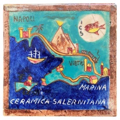
"Map of Naples, Vesuvius and Vietri Sul Mar, " Unique ICS Tile, Perhaps Gambone
By ICS
Located in Philadelphia, PA
located, along the Mediterranean south of Naples. The map shows Vesuvius spewing smoke, ships in the water
Category
Vintage 1930s Italian Art Deco Ceramics
Materials
Ceramic
H 5.75 in W 5.75 in D 0.5 in
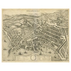
Antique Bird's-Eye View of the City of Naples in Italy
Located in Langweer, NL
Antique print titled 'Neapolis'. Bird's-Eye View of the city of Naples, Italy. Published by
Category
Antique Mid-17th Century Prints
Materials
Paper
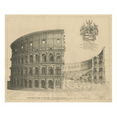
Venerable Vespasian's Arena: The Colosseum in its Prime, circa 1705
Located in Langweer, NL
the golden age of Dutch map-making. This particular engraving was part of a larger work that
Category
Antique Early 18th Century Prints
Materials
Paper
Free Shipping
H 18.9 in W 22.64 in D 0 in
19th Century French Bronze Equestrian Figure of Joachim Murat on Marble Base
Located in Milan, IT
inspired to a famous painting and depicting the king of Naples and of Two Sicilies, wearing one of his
Category
Antique Mid-19th Century French Figurative Sculptures
Materials
Bronze, Ormolu
H 3.94 in W 5.12 in D 3.15 in
Ray Bret Koch, Original Air France Poster, Far East, Elephant Cornac, India 1938
Located in SAINT-OUEN-SUR-SEINE, FR
promote tourism from Europe to the Far East.
A Dewoitine D.338 plane flies over a map on which different
Category
Early 20th Century French Art Deco Posters
Materials
Paper
Free Shipping
H 19.41 in W 12.29 in D 0.4 in
Baron Rais d'Eisenberg, Hand-Colored Equestrian Engraving c. 1747, "Le Brillant"
By Eisenberg
Located in Morristown, NJ
the Emperor. He then spent six years in Naples as the Master of Horse of the Viceroy before returning
Category
Antique 1740s German Rococo Drawings
Materials
Plexiglass, Wood, Paint, Paper
H 16.5 in W 19.25 in D 0.5 in
Italian Ancient Marble Sculpture Fountain, Late 16th Century
Located in Milano, IT
element linked to water (on this theme see: Chet Van Duzer, Sea Monsters on Medieval and Renaissance Maps
Category
Antique 16th Century Italian Renaissance Animal Sculptures
Materials
Carrara Marble
People Also Browsed
Ancient Roman Intaglio from 1st-2nd Century AD Carved Carnelian Stone
Located in Chicago, IL
Ancient Roman Carnelian Intaglio. An intaglio is defined as a small Gemstone, generally semi-precious, that has been carved with images or inscriptions only on the face. This style o...
Category
Antique 15th Century and Earlier Italian Classical Roman Antiquities
Materials
Carnelian, Stone
Bronze Age amphoriskos
Located in EL CAMPELLO, ES
ITEM: Amphoriskos
MATERIAL: Pottery
CULTURE: Bronze Age
PERIOD: 2400 – 2000 B.C
DIMENSIONS: 140 mm x 145 mm
CONDITION: Good condition
PROVENANCE: Ex Emeritus collection (USA), collec...
Category
Antique 15th Century and Earlier Israeli Prehistoric Antiquities
Materials
Pottery
Antique Religious Print "No.26" the Institution of the Eucharist, circa 1840
Located in Langweer, NL
Antique print titled ‘Histoire Sainte, Nouveau Testament, Institution de L'Eucharistie.’ This plate shows a scene from the New Testament; The Institution of the Eucharist at the Last...
Category
Antique Mid-19th Century Prints
Materials
Paper
H 15.44 in W 19.34 in D 0.02 in
Carambola Stool
By Sergio Matos
Located in Campina Grande, Paraiba
The concept for the stool from the shape of a carambola (starfruit). The structure can be produced in either carbon steel or aluminium. The rest is handmade using naval rope.
Category
21st Century and Contemporary Brazilian Stools
Materials
Aluminum
Antique Religious Print "No. 35" the Crucifixion of Jesus, circa 1840
Located in Langweer, NL
Antique print titled ‘Histoire Sainte, Nouveau Testament, Crucifiement.’ This plate shows a scene from the New Testament; The Crucifixion of Jesus.’
This print originates from a r...
Category
Antique Mid-19th Century Prints
Materials
Paper
H 15.36 in W 19.22 in D 0.02 in
Christopher Dresser Elkington & Co. Silver-Plate Cruet
By Christopher Dresser
Located in Sharon, CT
Rare Classic original. Has engraved monogram FEA. Fully signed.
Category
Antique Late 19th Century English Aesthetic Movement Sheffield and Silve...
Materials
Silver Plate
Highly Detailed Antique Map of the Holy Land Showing 12 Tribes of Israel, c.1720
Located in Langweer, NL
Antique map titled 'Heylige Land verdeeld in de Twaalf Stammen Israels (..).'
Highly detailed map of the Holy Land divided into 12 tribes of Israel. With beautiful large title ca...
Category
Antique 1720s Maps
Materials
Paper
Free Shipping
H 17.72 in W 20.28 in D 0 in
Hand-Colored 18th Century Homann Map of the Danube, Italy, Greece, Croatia
By Johann Baptist Homann
Located in Alamo, CA
"Fluviorum in Europa principis Danubii" is a hand colored map of the region about the Danube river created by Johann Baptist Homann (1663-1724) in his 'Atlas Novus Terrarum', publish...
Category
Antique Early 18th Century German Maps
Materials
Paper
H 20 in W 23.88 in D 0.07 in
A Rare Annamese blue and white with green glaze plate, Hoi an ship, 15th Century
Located in seoul, KR
Plate with abstract flowers and Lotus. Stoneware with underglaze blue and painted green. Four abstract flowers. Green-paint was the originality of annamese ceramic at the time.
Year...
Category
Antique 15th Century and Earlier Vietnamese Ming Decorative Bowls
Materials
Stoneware
H 1.97 in Dm 9.45 in
Antique 18th Century J.&E. Baddeley Earthenware Shaped Dessert Dish, Shelton
By Baddely
Located in Charleston, SC
Very rare antique English J. and E. Baddeley earthenware shaped dessert dish, Shelton
Shape attributed to J. and E. Baddeley (unmarked)
Shelton, Staffordshire
(see plate No. 2,...
Category
Antique Late 18th Century English Dinner Plates
Materials
Earthenware
H 1.63 in W 7.75 in D 7.75 in
Scandinavia & Portions of Eastern Europe: 18th Century Hand-Colored Homann Map
By Johann Baptist Homann
Located in Alamo, CA
An early 18th century hand-colored copper-plate map entitled "Regni Sueciae in omnes suas Subjacentes Provincias accurate divisi Tabula Generalis" by Johann Baptist Homann (1663-1724...
Category
Antique Early 18th Century German Maps
Materials
Paper
H 20.75 in W 23.5 in D 0.07 in
"Nova Barbariae Descriptio", a 17th Century Hand-Colored Map of North Africa
By Johannes Janssonius
Located in Alamo, CA
This original attractive 17th century hand-colored map of North Africa entitled "Nova Barbariae Descriptio" by Johannes Janssonius was published in Paris in 1635. It includes the Med...
Category
Antique Mid-17th Century Dutch Maps
Materials
Paper
H 22.38 in W 29 in D 0.13 in
"Africae Accurata", a Hand-Colored 17th Century Map of Africa by Visscher
By Nicolaes Visscher II
Located in Alamo, CA
An 18th century hand-colored map of Africa entitled "Africae Accurata Tabula ex officina" by Nicolaes Visscher, published in Amsterdam in 1680. This beautiful, colorful and detailed ...
Category
Antique Late 17th Century Dutch Maps
Materials
Paper
H 23.75 in W 28.13 in D 0.13 in
Antique Print of the Dutch Trading Post Deshima in Japan, circa 1738
By Giambattista Albrizzi
Located in Langweer, NL
Antique print titled 'Isoletta Desima abittata Dagli Olandesi nel Giappone secondo la delineazione del Sigr. Voogt'. Bird's-eye view of Deshima (or Dejima) copied from a manuscript b...
Category
Antique 18th Century Prints
Materials
Paper
Christopher Dresser Aesthetic Movement Claret, Hukin and Heath, 1880s
By Christopher Dresser
Located in Sharon, CT
A rare silver plate and glass claret from the English Aesthetic Movement designed by Christopher Dresser for Hukin and Heath. Signed, bears engraving as an athletic award.
Category
Antique 1880s English Aesthetic Movement Serving Pieces
Materials
Silver Plate
Antique Religious Print "No. 22" the Resurrection of Lazarus, circa 1840
Located in Langweer, NL
Antique print titled ‘Histoire Sainte, Nouveau Testament, Lazare Ressuscité.’ This plate shows a scene from the New Testament; The Resurrection of Lazarus.
This print originates ...
Category
Antique Mid-19th Century Prints
Materials
Paper
H 15.36 in W 19.06 in D 0.02 in
Recent Sales
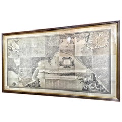
19th Century Big Italian Print Map and History of Naples
Located in Toledo, Castilla La Mancha
Beautiful 19th century big Italian print, map and history of Naples.
Various framed prints
Category
Antique 19th Century Italian Napoleon III Prints
Materials
Wood, Paper
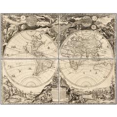
Highly Decorative Italian Wall Map of the World
By Paolo Petrini
Located in La Jolla, CA
.
This large-scale double-hemisphere world map represents the high point of geographic printing in Naples
Category
Antique Early 1700s Italian Baroque Prints
Materials
Paper
Early French Louis XVI Mantel Clock 'Hannibal & Hasdrubal, circa 1760
Located in Amsterdam, NL
supports his brother Hannibal, commander of the Carthaginian army in Italy. Both are overviewing a map
Category
Antique 18th Century and Earlier French Louis XVI Clocks
Materials
Bronze
H 17.92 in W 13.78 in D 5.52 in
Pair of Classical Lyre-Back Mahogany Side Chairs with Paw Feet, Phyfe school
Located in Providence, RI
d'Hancarville, Collection of Etruscan, Greek, and Roman Antiquities (Naples: 1766-67) (illustrating antique vase
Category
Antique 1810s American American Classical Chairs
Materials
Mahogany
Decorative Map of Sicily, Malta and a Bit of Naples and Sardinia 'Italy', c.1680
Located in Langweer, NL
Antique map titled 'Regnum Siciliae cum circumjacentribus Regnis et Insulis'.
Decorative map of
Category
Antique 1680s Maps
Materials
Paper
H 20.67 in W 25.2 in D 0 in
17th Century Geographical Map of Italy
By Matthäus Merian the Elder
Located in Roma, IT
, The kingdom of Naples and the Papal States.
Mount: W49cm x H 41cm Map: W37cm x H30cm
Category
Antique Mid-17th Century Italian Maps
Materials
Parchment Paper
Antique Map of Southern Italy, Hand-Colored, circa 1720
Located in Colorado Springs, CO
kingdoms of Naples and Sicily, showing the southern half of Italy and much of the Balkans. The map labels
Category
Antique 1720s European Maps
Materials
Paper
19th Century French Bronze Statue of a Adolphe Nourrit
Located in Dallas, TX
Adolphe Nourrit (1802-1839) commemorates the famous tenor who almost literally put French opera on the map
Category
Antique 1850s French More Furniture and Collectibles
Materials
Bronze
An English Sailor's Woolie of H.M.S. Tribune,
Located in Downingtown, PA
, France and Naples, Britain's main allies in its war against Russia, the Crimea War.
A rope
Category
Antique 19th Century English Nautical Objects
Materials
Wool
Antique Map of Naples Italy by F. de Wit, circa 1690
Located in Langweer, NL
An attractive map of the Kingdom of Naples. Embellished with a large title-cartouche with twelve
Category
Antique Late 17th Century Maps
Materials
Paper
Antique Map of the Kingdom of Naples and Sicily by Keizer & de Lat, 1788
Located in Langweer, NL
Kingdom of Naples and Sicily, Italy. This map originates from 'Nieuwe Natuur- Geschied- en Handelkundige
Category
Antique Late 18th Century Maps
Materials
Paper
H 10.83 in W 8.08 in D 0.02 in
Antique Map of South Italy by A.K. Johnston, 1865
Located in Langweer, NL
Antique map titled 'South Italy and the Island of Sardinia'. With an inset map of the Bay of Naples
Category
Antique Mid-19th Century Maps
Materials
Paper
1763 Nautical Portolano Chart of Guascogna Bay from Le Petit Neptune François
By G. A. Rizzi-zannoni
Located in Milan, IT
kingdom of Naples. Back in Padua in 1776, he conceived the project of a general map of Italy on
Category
Antique 1760s French Nautical Objects
Materials
Paper
H 12.21 in W 14.18 in D 0.79 in
Pompei Past and Present Illustrated By Luigi Fischetti, 1st Ed
Located in valatie, NY
Naples, Italy, 1906, English text. 1st Ed hardcover no dust jacket as issued. 110 pp. Green oil cloth
Category
Antique Early 1900s Italian Books
Materials
Paper
Get Updated with New Arrivals
Save "Naples Map", and we’ll notify you when there are new listings in this category.
Naples Map For Sale on 1stDibs
With a vast inventory of beautiful furniture at 1stDibs, we’ve got just the naples map you’re looking for. A naples map — often made from paper, bronze and carrara marble — can elevate any home. There are many kinds of the naples map you’re looking for, from those produced as long ago as the 18th Century to those made as recently as the 20th Century. When you’re browsing for the right naples map, those designed in Art Deco and Rococo styles are of considerable interest. Eisenberg, G. A. Rizzi-zannoni and ICS each produced at least one beautiful naples map that is worth considering.
How Much is a Naples Map?
A naples map can differ in price owing to various characteristics — the average selling price 1stDibs is $995, while the lowest priced sells for $108 and the highest can go for as much as $13,004.
More Ways To Browse
Ancient Greek Map
Map Of Ancient Greece
Framed Maps Italy
Wooden Pig
Map Of Eastern Europe
Straits Chinese
Bernard Picart Framed
18th C German Hand Colored Engravings
G T Johnson
Captain Scott
Antique Mahogany Lyre Back Chairs
Antique Map Of Poland
American Federal Mahogany Desk
Civil War Guns
Antique School Desk Other
Maritime Chart
William Camp Furniture
Biblical Maps
