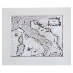
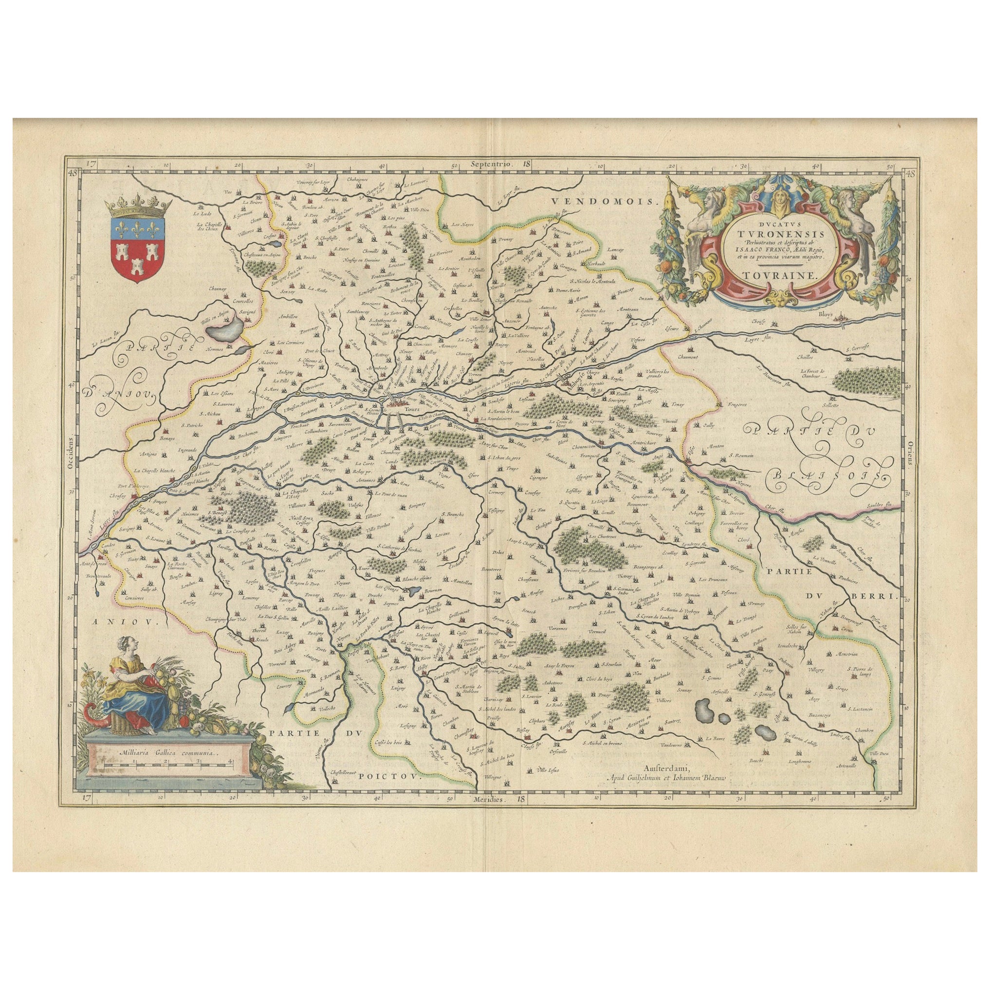
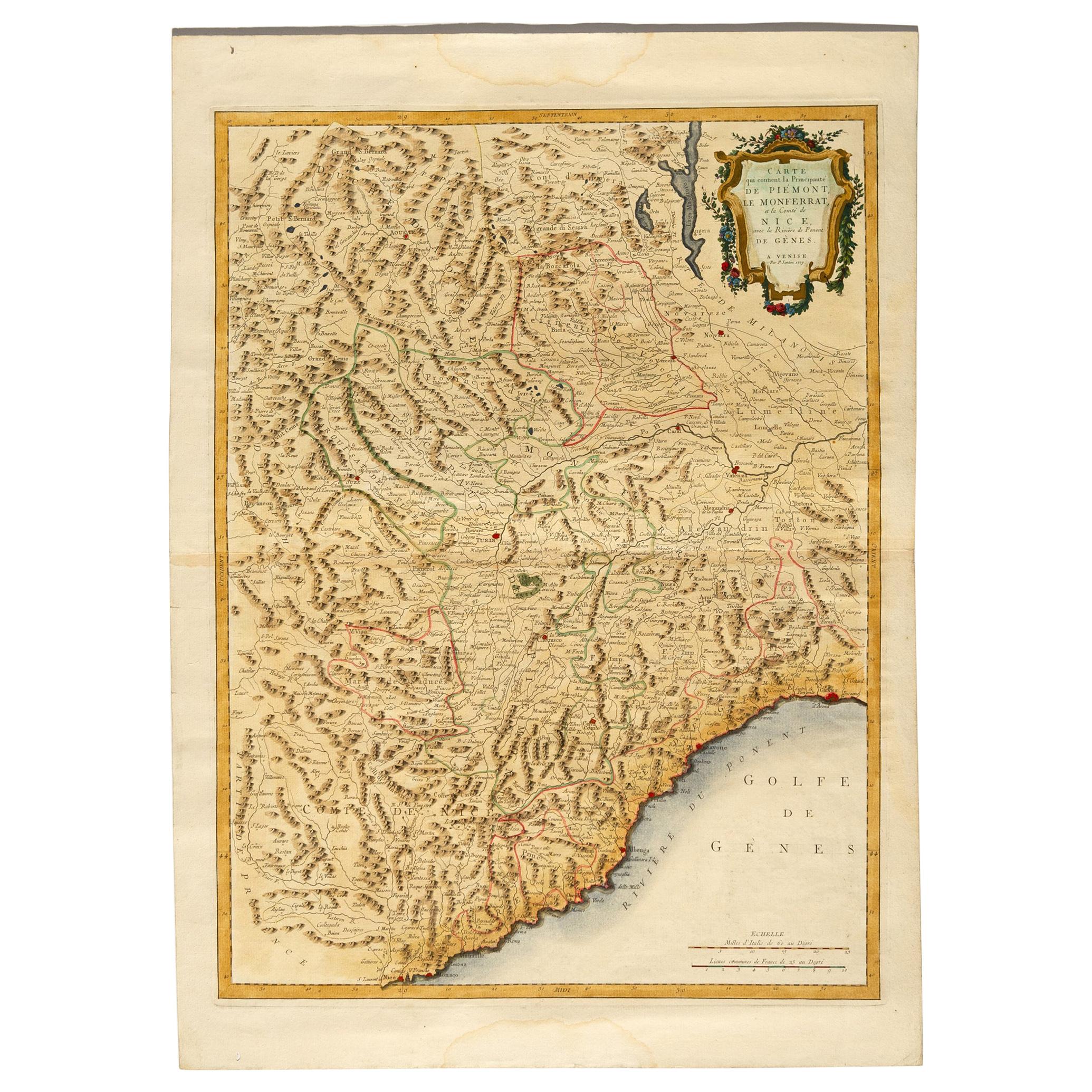
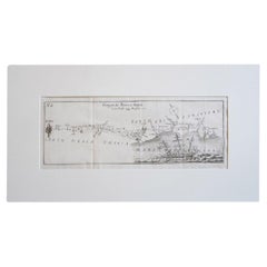
17th Century Geographical Map of Italy
View Similar Items


Want more images or videos?
Request additional images or videos from the seller
1 of 7
17th Century Geographical Map of Italy
About the Item
- Creator:Matthäus Merian the Elder (Illustrator)
- Dimensions:Height: 0.04 in (1 mm)Width: 11.82 in (30 cm)Depth: 14.57 in (37 cm)
- Materials and Techniques:
- Place of Origin:
- Period:Mid-17th Century
- Date of Manufacture:1640
- Condition:
- Seller Location:Roma, IT
- Reference Number:1stDibs: LU8425236317512
Matthäus Merian the Elder
Matthäus Merian is one of the most respected Swiss/German artists and engravers of the 17th century. In addition to creating a large number of illustrations and maps, he passed his knowledge and skill to his children, who followed in the family tradition. His son Matthäus Merian, the Younger was an accomplished engraver. His daughter Maria Sybella Merian in addition to becoming a prominent artist, became one of the greatest woman scientists of the 18th century as an entomologist. Her engravings of insects in their natural habitats are as sought after by collectors as are her father's illustrations.
About the Seller
5.0
Gold Seller
These expertly vetted sellers are highly rated and consistently exceed customer expectations.
1stDibs seller since 2023
23 sales on 1stDibs
Typical response time: 5 hours
More From This SellerView All
- Italian Parchment Map of the City of Pisa Dated, 1640By Matthäus Merian the ElderLocated in Roma, ITAn antique map of the Tuscan city of Pisa engraved for The 'Itinerarium Italiæ Nov-antiquæ' by Matthäus Merian the Elder and printed in 1640....Category
Antique 1640s Italian Maps
MaterialsPaper
- Pair of 17th Century Italian Travertine MantlesLocated in Roma, ITA pair of 300 year old travertine mantles salvaged from a 17th century church in Le Marche. The stone is absolutely beautiful and the pieces have aged allowing for us still to see th...Category
Antique 17th Century Italian Abstract Sculptures
MaterialsTravertine
- Antique Italian Map of Viaggio da Roma a Napoli 1775Located in Roma, ITAn original print from 1775 showing an early route map of the journey from Rome to Naples. This route map was part of a collection of travellers routes published in a book translated...Category
Antique 1770s Italian Maps
MaterialsParchment Paper
- 1880s Map of The Italian Alps from Milan to Lake GardaLocated in Roma, ITGeographical Map of the Profile and Elevation of the Italian Alps from Milano to Lake Garda. The map features the name of each peak and key cities including Monza, Brescia and Bergam...Category
Antique 1880s Italian Maps
MaterialsParchment Paper
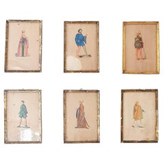
- A Set of Six French Prints of French and Italian Noble CostumesLocated in Roma, ITA beautiful set of Six prints each dipicting French and Italian noblemen in their formal 18th and 19h century costumes. The prints are in good condition considering their age but al...Category
20th Century French Prints
MaterialsPaint, Paper
- A Pair of Italian Liwans 1970s Chrome Picture FramesBy Liwan's RomeLocated in Roma, ITA wonderful pair of original chrome Frames by the Italian designers, LIWANS. The larger frame has the iconic Liwans double border and backed with black felt. The second frame has a h...Category
Mid-20th Century Italian Mid-Century Modern Picture Frames
MaterialsGlass
 $1,484 / item


You May Also Like
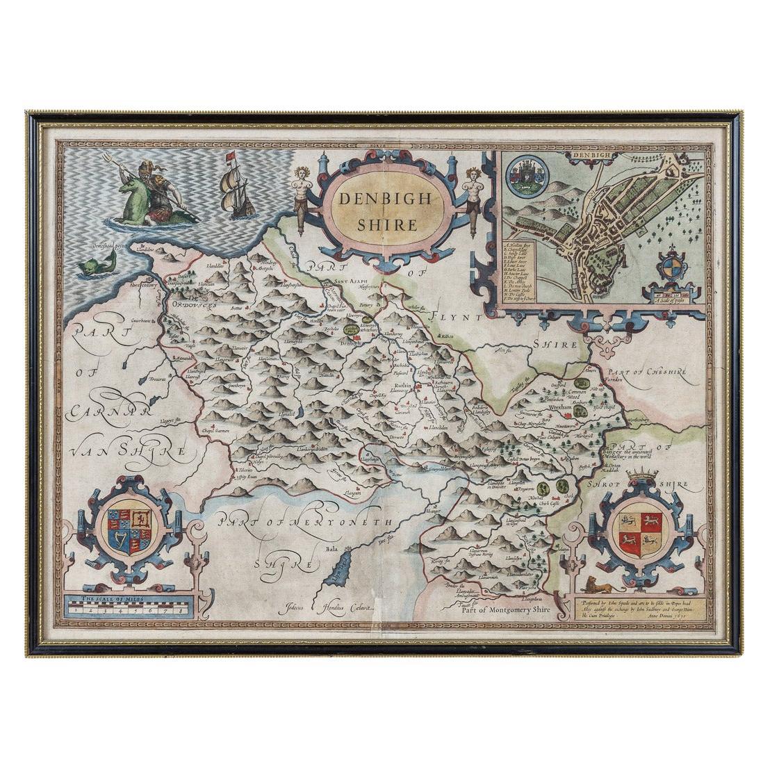
- 17th Century John Speed Map of Denbighshire, c.1610By John SpeedLocated in Royal Tunbridge Wells, KentAntique early 17th century British very rare and original John Speed, hand coloured map of Denbighshire, dated 1610, by John Sunbury and George Humble. John...Category
Antique 17th Century British Maps
MaterialsWood, Paper
- 17th Century Nicolas Visscher Map of Southeastern EuropeLocated in Hamilton, OntarioA beautiful, highly detailed map of southeastern Europe by Nicolas Visscher. Includes regions of Northern Italy (showing the cities Bologna, Padua, and Venice), Bohemia, Austria (sho...Category
Antique 17th Century Dutch Maps
MaterialsPaper
 $1,350 Sale Price38% Off
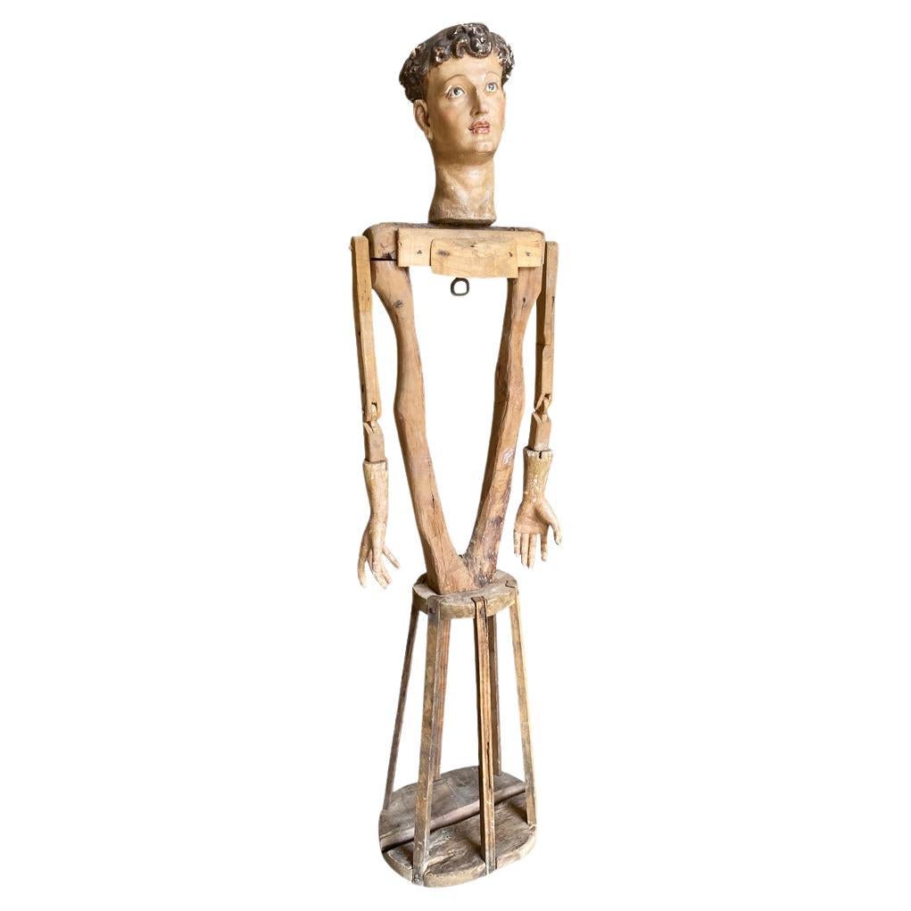
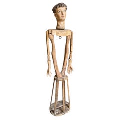
 - Italian 17th Century MannequinLocated in Atlanta, GAA very beautiful 17th century articulating Mannequin from the Veneto region of Italy. Beautifully carved from polychromed wood with very handsome features. Mannequins such as this ...Category
Antique 17th Century Italian Religious Items
MaterialsWood
- Italy, Sicily, Sardinia, Corsica and Dalmatian Coast: A 17th Century Dutch MapBy Theodorus DanckertsLocated in Alamo, CAThis hand colored 17th century Dutch map entitled "Novissima et Accuratissima totius Italiae Corsicae et Sardiniae Descriptio" by Theodore Danckerts depicts the Italian Peninsula in ...Category
Antique Late 17th Century Dutch Maps
MaterialsPaper
- Vintage Reproduction 17th Century Map of Europe, American, Cartography, BlaeuwLocated in Hele, Devon, GBThis is a vintage reproduction map of Europe. An American, paper stock cartography print in frame after the work by Blaeuw, dating to the late 20t...Category
Late 20th Century Central American Mid-Century Modern Maps
MaterialsGlass, Wood, Paper
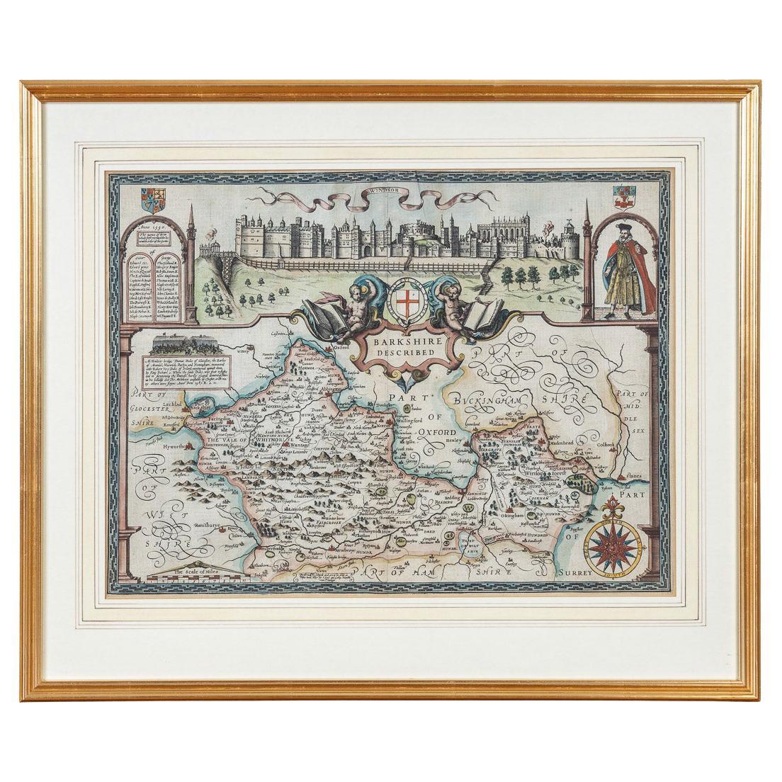
- 17th Century John Speed Map of the Barkshire Described, c.1616By John SpeedLocated in Royal Tunbridge Wells, KentAntique 17th century British very rare and original John Speed (1551-1629) map of the Barkshire Described, J. Sud and Georg Humble, publication (1616 or lat...Category
Antique 17th Century British Maps
MaterialsPaper


Recently Viewed
View AllMore Ways To Browse
Antique Maps Of British Isles
Masque Theatre No
Utah Map
Antique Furniture Perth Australia
Antique Map Of Tuscany
Antique Maps Perth
Antique Route 66
Kiels Antiques
Antique Map Bermuda
Historic Map Virginia
Montana Maps
Palliser Furniture
Georgetown Map
Guatemala Antique Map
J Thayer
18th Engineer
Paraguay Antique Map
Antique Map Mexico City