Items Similar to Vintage Reproduction 17th Century Map of Europe, American, Cartography, Blaeuw

Want more images or videos?
Request additional images or videos from the seller
1 of 11
Vintage Reproduction 17th Century Map of Europe, American, Cartography, Blaeuw
About the Item
This is a vintage reproduction map of Europe. An American, paper stock cartography print in frame after the work by Blaeuw, dating to the late 20th century, circa 1970.
Fascinating reproduction of the historic cartography by Guilielmo Blaeuw (1571 - 1638)
Displays a desirable aged patina and in good order throughout
Appealing map print on quality paper stock, behind clear, bright glass
Framed within a quality, attractive wooden frame with beaded detail
After the original from 1630, the map shows 17th century Europe in colour
Annotated with countries, key cities and examples of national dress
Dressed to the eye-catching rear with mounting wire for ease of hanging
Custom framed in California for Lesko & Associates - an educational architecture specialist founded in 1953
This is a charming vintage reproduction map of Europe, with a nicely presented 17th century map of Europe presented in a quality frame. Delivered ready to display.
Under the pseudonym Guilielmo Blaeuw, Dutch cartographer, atlas maker and publisher Willem Janszoon Blaeu had an enviable body of published work. Mapping Europe, the Americas and providing much of the works in the Atlus Maior, Blaeuw was a comprehensive name in 17th century mapping.
Dimensions:
Max Width: 97.5cm (38.5'')
Max Depth: 3.5cm (1.5'')
Max Height: 77cm (30.25'')
Map Width: 48cm (19'')
Map Height: 69.5cm (27.25'')
- Dimensions:Height: 30.32 in (77 cm)Width: 38.39 in (97.5 cm)Depth: 1.38 in (3.5 cm)
- Style:Mid-Century Modern (Of the Period)
- Materials and Techniques:
- Place of Origin:Central America
- Period:
- Date of Manufacture:circa 1970
- Condition:Wear consistent with age and use. Presented in very good vintage condition.
- Seller Location:Hele, Devon, GB
- Reference Number:
About the Seller
5.0
Platinum Seller
These expertly vetted sellers are 1stDibs' most experienced sellers and are rated highest by our customers.
Established in 2005
1stDibs seller since 2017
834 sales on 1stDibs
Typical response time: 2 hours
- ShippingRetrieving quote...Ships From: Hele, Devon, United Kingdom
- Return PolicyA return for this item may be initiated within 14 days of delivery.
More From This SellerView All
- Antique Lithography Map, South America, English, Framed, Cartography, VictorianLocated in Hele, Devon, GBThis is an antique lithography map of South America. An English, framed atlas engraving of cartographic interest by John Rapkin , dating to the early Victorian period and later, circ...Category
Antique Mid-19th Century British Early Victorian Maps
MaterialsWood
- Very Large Vintage Map of Canada, German, Education, Institution, CartographyLocated in Hele, Devon, GBThis is a very large vintage map of Canada. A German, quality printed educational or institution map, dating to the mid 20th century, circa 1965....Category
Mid-20th Century German Maps
MaterialsPaper
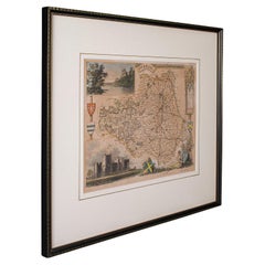
- Antique Lithography Map of Cheshire, English, Framed, Cartography, VictorianLocated in Hele, Devon, GBThis is an antique lithography map of Cheshire. An English, framed atlas engraving of cartographic interest, dating to the mid 19th century and lat...Category
Antique Mid-19th Century British Victorian Maps
MaterialsWood
- Antique Lithography Map, Isle of Wight, English, Framed, Engraving, CartographyLocated in Hele, Devon, GBThis is an antique lithography map of the Isle of Wight. An English, framed atlas engraving of cartographic interest, dating to the early 19th century and later. Superb lithography ...Category
Antique Early 19th Century British Regency Maps
MaterialsWood
- Antique Lithography Map, Isle of Thanet, Kent, English, Cartography, VictorianLocated in Hele, Devon, GBThis is an antique lithography map of The Isle of Thanet in Kent. An English, framed atlas engraving of cartographic interest, dating to the mid 19th century and later. Superb litho...Category
Antique Mid-19th Century British Victorian Maps
MaterialsWood
- Antique Lithography Map, County Durham, English, Framed Cartography, VictorianLocated in Hele, Devon, GBThis is an antique lithography map of County Durham. An English, framed atlas engraving of cartographic interest, dating to the mid 19th century and later. Superb lithography of Cou...Category
Antique Mid-19th Century British Mid-Century Modern Maps
MaterialsWood


You May Also Like
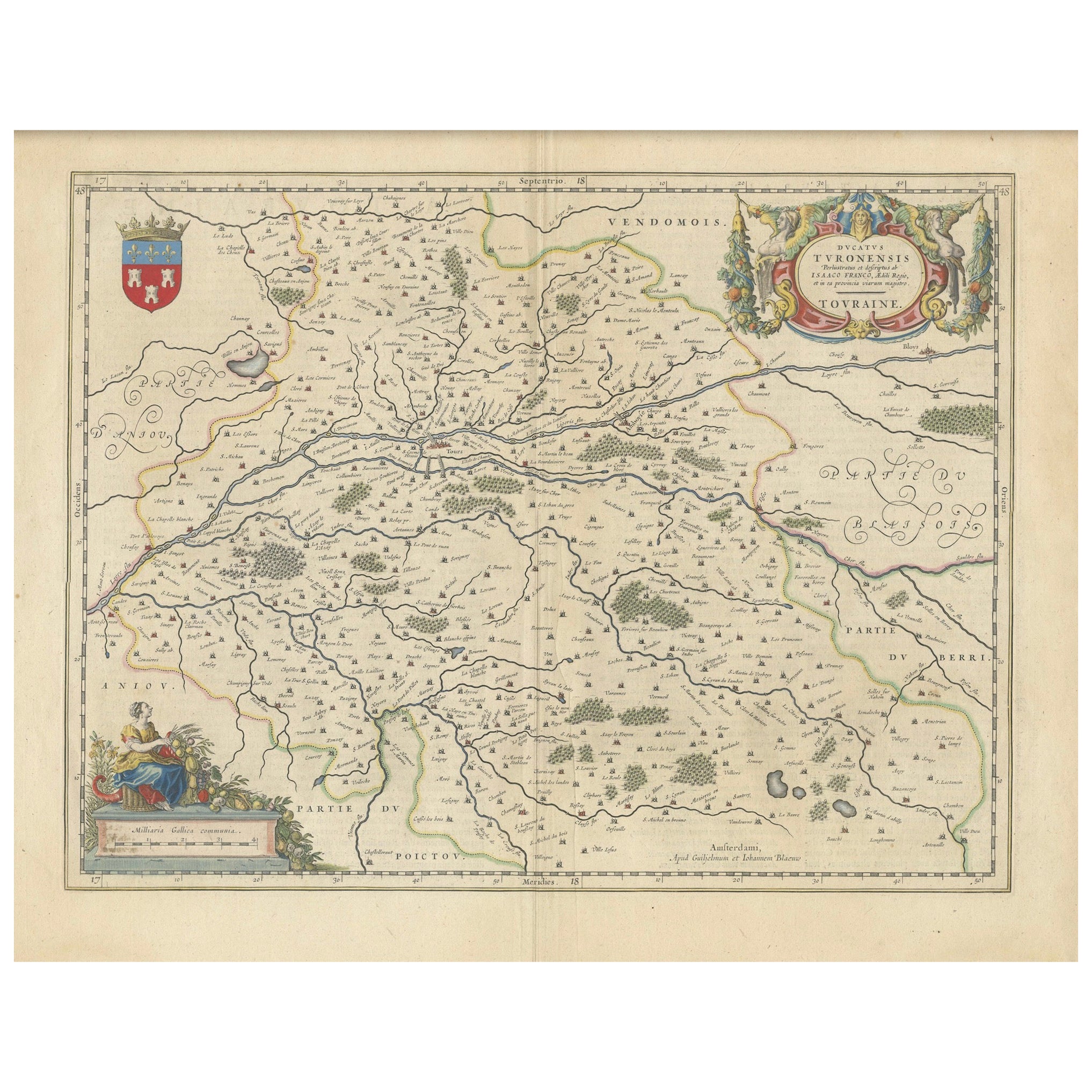
- Cartographic Elegance of Touraine: A 17th-Century Map Showing French HeritageLocated in Langweer, NL"Ducatus Turonensis - Touraine," is a original antique historical map of the Touraine region, which is located in the heart of France, centered...Category
Antique 1630s Maps
MaterialsPaper
- 17th Century Nicolas Visscher Map of Southeastern EuropeLocated in Hamilton, OntarioA beautiful, highly detailed map of southeastern Europe by Nicolas Visscher. Includes regions of Northern Italy (showing the cities Bologna, Padua, and Venice), Bohemia, Austria (sho...Category
Antique 17th Century Dutch Maps
MaterialsPaper
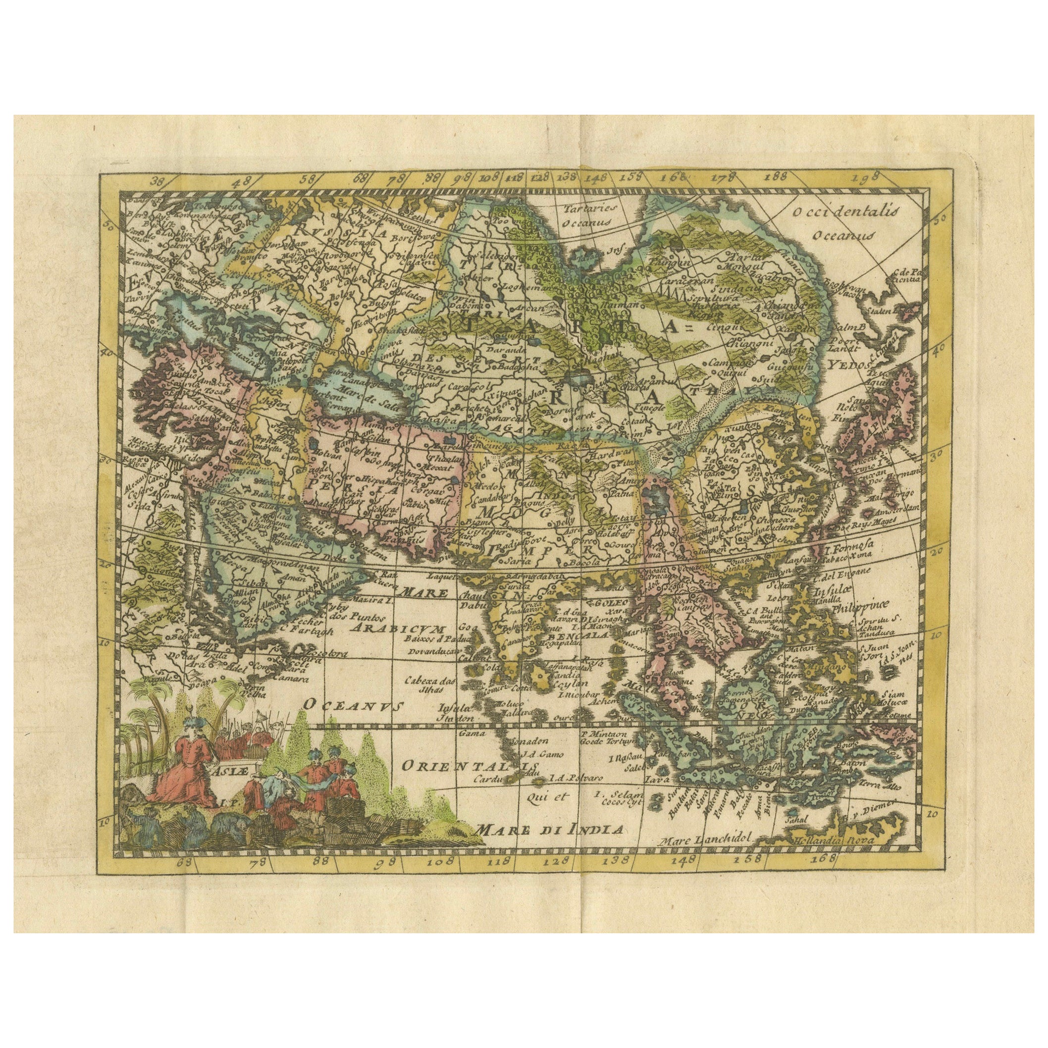
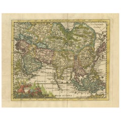
- Cartographic Elegance: The Art and Science of 17th-Century Asian Maps, ca.1681Located in Langweer, NLThis original antique map is an artifact from a pivotal era in cartography, reflecting not only the geographical knowledge of its time but also the intertwining of art and science in...Category
Antique 1680s Maps
MaterialsPaper
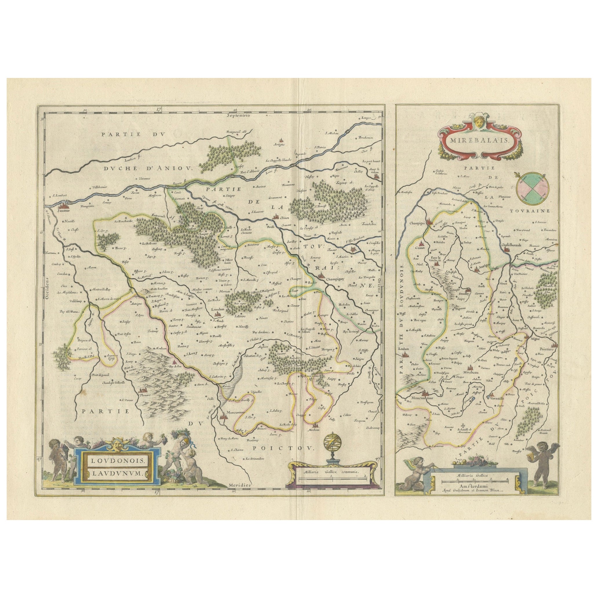
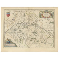
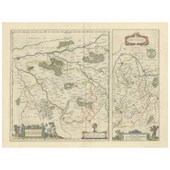
- Loudun and Mirebeau: A Cartographic Masterpiece of 17th Century France by BlaeuLocated in Langweer, NLCartography, 17th century. Willem (1571-1638) and Joan Blaeu (1596-1673), Theatrum Orbis Terrarum sive Atlas Novus..., 1635. Figure: Loudonois. Laudunum (Loudun); Mirebalais (Mirebea...Category
Antique 1650s Maps
MaterialsPaper
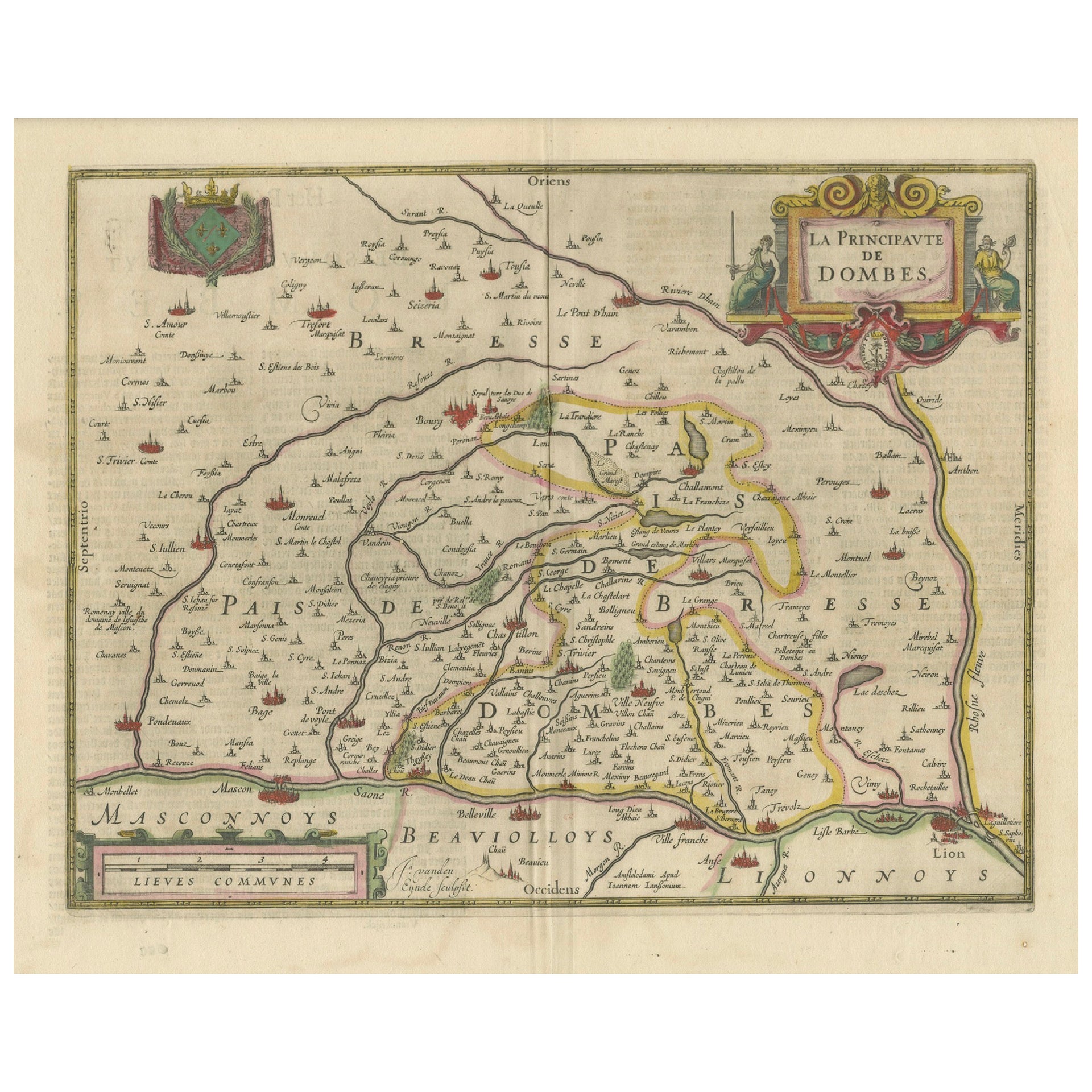
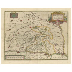
- The Principality of Dombes: A 17th-Century Cartographic Jewel by Jan JanssonLocated in Langweer, NLThe text on the map "La principaute de Dombes; J. van den Eynde sculpit.; La Principavte de Dombes" indicates that it is a map of the principality of Dombes, engraved by J. van den E...Category
Antique 1630s Maps
MaterialsPaper
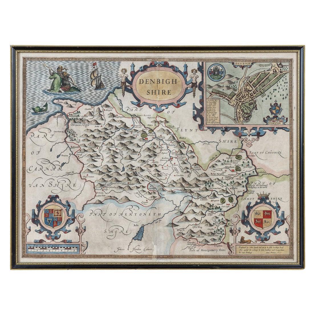
- 17th Century John Speed Map of Denbighshire, c.1610By John SpeedLocated in Royal Tunbridge Wells, KentAntique early 17th century British very rare and original John Speed, hand coloured map of Denbighshire, dated 1610, by John Sunbury and George Humble. John...Category
Antique 17th Century British Maps
MaterialsWood, Paper


Recently Viewed
View AllMore Ways To Browse
Antique Map Of Illinois
Petite Point Hand Bag
Antique Map Of Southeastern Us
Antique Map Alabama
Malay Archipelago Map
Antique Map Of Sydney
Fiji Map
Small Map
The Malay Archipelago
Pilgrim Period Furniture
Map Prussia Germany
Bad Bentheim
1890 Map Of Illinois
English County Maps By Blaeu
Carte Egypte Antique
Gabon Antique Map
Warwickshire Antique Map
Antique Map Of New Hampshire