Map Prussia Germany

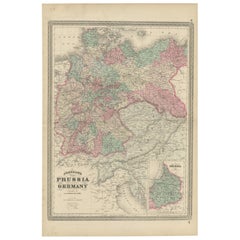
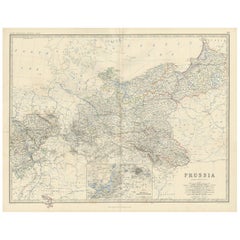
Antique Map of Prussia and Germany by Johnson, 1872
Located in Langweer, NL
Antique map titled 'Johnson's Prussia and Germany (..)'. Original map of Prussia and Germany, with
Category

Antique Late 19th Century Maps

Materials

Paper

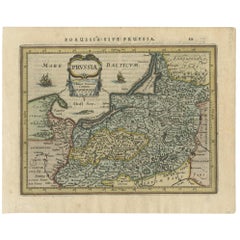
Antique Map of Prussia by Janssonius, 1628
Located in Langweer, NL
Antique map titled 'Prussia'. Original antique map of Prussia, a historically prominent German
Category

Antique Mid-17th Century Maps

Materials

Paper

Antique Map of Prussia by Janssonius, 1628
H 7.09 in W 8.86 in D 0.02 in
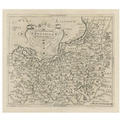
Original Antique Map of Prussia, ca.1630
Located in Langweer, NL
Antique map titled 'Prussia - Preussen'. Original map of Prussia, a historically prominent German
Category

Antique 1630s Maps

Materials

Paper

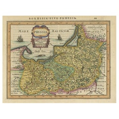
Original Decorative Antique Map of Prussia, 1628
Located in Langweer, NL
Antique map titled 'Prussia'. Original antique map of Prussia, a historically prominent German
Category

Antique 1620s Maps

Materials

Paper

Prussia, Poland, N. Germany, Etc: A Hand-colored 17th Century Map by Janssonius
By Johannes Janssonius
Located in Alamo, CA
This is an attractive hand-colored copperplate engraved 17th century map of Prussia entitled
Category

Antique Mid-17th Century Dutch Maps

Materials

Paper

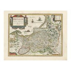
Antique Map of Prussia by Blaeu, circa 1635
By Willem Blaeu
Located in Langweer, NL
Antique map titled 'Prussiae Nova Tabula'. Rare early edition of Blaeu's map of Prussia
Category

Antique Mid-17th Century Maps

Materials

Paper

Antique Map of Prussia by Blaeu, circa 1635
H 17.52 in W 22.45 in D 0.02 in
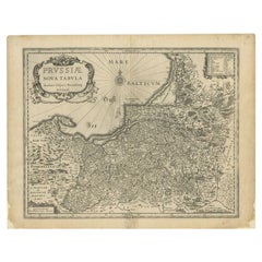
Antique Map of Prussia by Blaeu, c.1680
Located in Langweer, NL
Antique map titled 'Prussiae nova Tabula'. Later edition of Blaeu's map of Prussia, embellished
Category

Antique 17th Century Maps

Materials

Paper

Antique Map of Prussia by Blaeu, c.1680
H 17.13 in W 21.86 in D 0 in
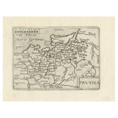
Extremele Rare, Original Miniature Map of Prussia, ca.1640
Located in Langweer, NL
Antique map titled 'Prussia'. Extremele rare, original miniature map of Prussia, a historically
Category

Antique 1640s Maps

Materials

Paper

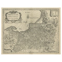
Old Map of Prussia, Embellished with a Large Cartouche and Compass Rose, ca.1680
Located in Langweer, NL
Antique map titled 'Prussiae nova Tabula'. Later edition of Blaeu's map of Prussia, embellished
Category

Antique 1680s Maps

Materials

Paper

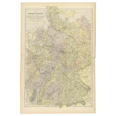
Antique Map of The German Empire (West Sheet), 1882
Located in Langweer, NL
Transport yourself to the heart of history with an original Antique Map of The German Empire (west
Category

Antique 1880s Maps

Materials

Paper

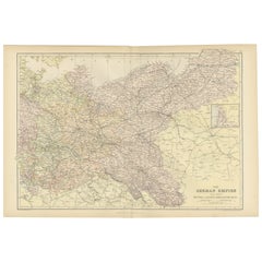
Antique Map of The German Empire (East Sheet), 1882
Located in Langweer, NL
Step into history with an authentic Antique Map of The German Empire (East Sheet) from the esteemed
Category

Antique 1880s Maps

Materials

Paper

Antique Map of Southern Germany by F. de Wit, circa 1680
Located in Langweer, NL
This antique map depicts a portion of southern Germany that included the historic regions of
Category

Antique Late 17th Century Maps

Materials

Paper

Antique Map of Germany with the Empire of Austria by Wyld '1845'
Located in Langweer, NL
of Prussia and Poland'. Original antique map of Germany with the Empire of Austria. This map
Category

Antique Mid-19th Century Maps

Materials

Paper

Old Original Engraving of Prussia on the Southeast Coast of the Baltic Sea, 1632
Located in Langweer, NL
Description: Antique map titled 'Prussia'. Original map of Prussia, a historically prominent
Category

Antique 1630s Maps

Materials

Paper

Antique Map of the Region of Sagan by Schreiber, 1749
By Schreiber
Located in Langweer, NL
Sagan, Prussia. This map originates from 'Atlas Selectus von allen Konigreichen und Landern der Welt' by
Category

Antique 18th Century Maps

Materials

Paper

A Hand Colored 17th Century Janssonius Map of Prussia: Poland, N. Germany, etc.
By Johannes Janssonius
Located in Alamo, CA
An attractive hand-colored copperplate engraved 17th century map of Prussia entitled "Prussia
Category

Mid-17th Century Old Masters Landscape Prints

Materials

Engraving

View of Emden, Germany: A 16th Century Hand-colored Map by Braun & Hogenberg
By Franz Hogenberg
Located in Alamo, CA
in 1575. This is a beautifully colored and detailed map of Emden, a seaport in northwestern Germany
Category

16th Century Old Masters Landscape Prints

Materials

Engraving

First Edition Guthrie's Geographical Grammmar in Miniature, 1807
Located in Langweer, NL
Netherlands"), Prussia and Poland, the German Empire and Switzerland, Spain and Portugal, Italy, East Indies
Category

Antique Early 19th Century Books

Materials

Paper

People Also Browsed

Four 18th Century Engraved and Hand-Colored Maps by Weigel
By Christoph Weigel
Located in Copenhagen, K
Small collection of four engraved maps of Italy, Balkan and of Central Asia. Two are of Italy, one Corsica and Northern Italy and the other of the Southern Italian boot. All are...
Category

Antique 18th Century German Maps

Materials

Paper

Antique Map of Switzerland by N. Visscher, circa 1690
Located in Langweer, NL
Beautifully detailed map of Switzerland and surrounding regions in present-day France, Germany, and Italy. This map features two decorative cartouches: the larger is flanked by two p...
Category

Antique Late 17th Century Maps

Materials

Paper

Re-Purposed Industrial Ship Hatch Captain's Lounge Chair
Located in Lafayette, IN
This custom-made piece started its life as an authentic US Naval scuttle hatch that was then re-imagined in our workshop as a truly unique lounge chair. Hatch was cleaned, polished, ...
Category

21st Century and Contemporary American Industrial Lounge Chairs

Materials

Brass, Steel

Unique Folk Art Copper Viking Ship Table Piece with Shields and Boxes on Deck
Located in Lisse, NL
High quality Viking Folk Art. This all handcrafted, realistic and detailed Viking ship was undoubtedly designed and crafted by a Scandinavian artisan. This impressive table piece is...
Category

Early 20th Century European Medieval Nautical Objects

Materials

Copper, Brass, Bronze

Antique Map of Gorée Island ‘Senegal’ by J.N. Bellin, 1764
Located in Langweer, NL
Nautical antique chart of Gorée Senegal including a letter key to the island's fortifications. Gorée is known as the location of the House of Slaves built by an Afro-French Métis fam...
Category

Antique Mid-18th Century Maps

Materials

Paper

Pair of Italian Armillary Spheres Vane began 20th Century H: 80cm
By Europa Antiques
Located in Madrid, ES
Pair of Italian Armillary Spheres Vane began 20th Century material: iron and stone HEIGHT 80 cm DIAMETER 60 cm WIDTH 60 cm DEPTH 85 cm good conditions
Category

Early 20th Century Italian Modern Nautical Objects

Materials

Stone, Iron

Antique Map of Denmark and Oldenburg ‘Germany’ by A. Ortelius, circa 1598
Located in Langweer, NL
Antique map titled 'Daniae Regni Typus' and 'Oldenburg Comit'. A nice example of Ortelius maps of Denmark and Oldenburg, which first appeared in the 1584 edition of his Theatrum Orbi...
Category

Antique 16th Century Maps

Materials

Paper

Nautical Inspired Wrought Iron Wall Lantern In Grey, by Britt Jewett
By Britt Jewett
Located in Santa Paula, CA
In the 1940's, the Miramar hotel became a coastal landmark, as the weekend getaway for Los Angelinos looking to escape the city. With its cozy cottages and beachy clean appeal, the M...
Category

2010s American American Craftsman Wall Lights and Sconces

Materials

Wrought Iron

Antique Map of the Saxony Region 'Germany' by F. de Wit, circa 1680
Located in Langweer, NL
A detailed map of a region in eastern Germany. Cartouches depict coat of arms surrounded by cherubs. The map is fully engraved with towns, political boundaries, rivers and forests. P...
Category

Antique Late 17th Century Maps

Materials

Paper

Historical Map of Canaan with Insets of Jerusalem and Surrounding Regions, 1880
Located in Langweer, NL
The map titled "CANAAN" depicts the historical region known as Canaan, located in the Levant, which corresponds to modern-day Israel, Palestinian territories, Lebanon, and parts of S...
Category

Antique 1880s Maps

Materials

Paper

Antique Decorative Lead Plaque, Scandinavian, Viking, Arts and Crafts, Victorian
Located in Hele, Devon, GB
This is a heavy antique decorative lead plaque. A Scandinavian, relief panel with Viking long ship scene, dating to the Arts & Crafts movement of the late Victorian period, circa 190...
Category

Antique Late 19th Century Scandinavian Late Victorian Nautical Objects

Materials

Lead

Cartographic Tapestry: Antique Map of Asia Minor, circa 1640
Located in Langweer, NL
Title: "Historical Tapestry: Antique Map of Asia Minor, circa 1640" Description: This authentic antique map, created by Willem Blaeu and published in Amsterdam circa 1640, is a capt...
Category

Antique Mid-17th Century Maps

Materials

Paper

Original High Detailed Antique Map of France by C. Weigel, 1719
By Christoph Weigel
Located in Langweer, NL
Antique map titled 'Gallia'. This highly detailed map shows France divided up into its provinces. The map provides a lot of information on place names, rivers, mountains, etc. The ...
Category

Antique Early 18th Century Maps

Materials

Paper

Antique Map of Germany, Bohemia, Hungary and Part of Poland by R. Bonne ‘1780’
Located in Langweer, NL
Antique map titled "L'Allemagne, La Bohême, et la Hongrie avec une partie de la Pologne" by Rigobert Bonne (1729-1795) for "Atlas de toutes les parties connues du globe terrestre" by...
Category

Antique Late 18th Century Maps

Materials

Paper

Nautical Early 20th Century Jackwood Water Wheel Accessory from Kerala, India
Located in Atlanta, GA
An antique water wheel from Kerala, India. This Kerala water wheel, also known as a "chakram chavittal," would have originally been used as a manually operated agriculture irrigation...
Category

20th Century Indian Rustic Nautical Objects

Materials

Wood

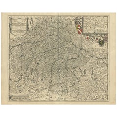
Antique Map of Bavaria with many details, Germany
Located in Langweer, NL
Antique map titled 'Bavariae Circulus atq Electoratus tam cum Adiacentibus quam insertis Regionibus (..)'. Dutch map of Bavaria, showing the many cities, towns, and other features of...
Category

Antique Late 17th Century Maps

Materials

Paper

Recent Sales

Antique Map of Prussia by A.K. Johnston, 1865
Located in Langweer, NL
Antique map titled 'Prussia'. Depicting Germany, Denmark and more. With an inset map of Berlin and
Category

Antique Mid-19th Century Maps

Materials

Paper

Antique Map of Prussia by A.K. Johnston, 1865
H 19.1 in W 24.41 in D 0.02 in
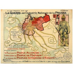
Original Antique WWI Poster Map War Is The National Industry Of Prussia Octopus
Located in London, GB
Original antique World War One map poster portraying Prussia as an octopus stretching its tentacles
Category

Vintage 1910s French Posters

Materials

Paper

18th Century Engraving Frederick II of Prussia, Joh. D. Schleuen (1711-1771)
Located in Berlin, DE
18th century Engraving: Frederick II of Prussia, Joh. D. Schleuen (1711-1771) Rectangular
Category

Antique Mid-18th Century German Rococo Prints

Materials

Paper

Antique Map of Prussia and German States by Lowry, 1852
Located in Langweer, NL
Antique map titled 'Prussia and German States'. Original map of Prussia and German States. This map
Category

Antique Mid-19th Century Maps

Materials

Paper

Military Plan Showing the Battle of Chocenice in 1757, Published, c.1760
Located in Langweer, NL
rise of Prussia in Germany (eventually replacing Austria as the leading German state), the beginning of
Category

Antique 18th Century Maps

Materials

Paper

Original Antique WWI Poster Map War Is The National Industry Of Prussia Octopus
Located in London, GB
Original antique World War One map poster portraying Prussia as an octopus stretching its tentacles
Category

1910s More Prints

Materials

Paper

Rare World Globe by Doppelmayr 'Doppelmeier', First Edition, 1728
By Johann Gabriel Doppelmayr 1
Located in Unteriberg, Schwyz
King George II of England, Maria Theresa of Austria Frederick II (the Great) of Prussia and Tsar Peter
Category

Antique 1720s German Other Globes

Materials

Paper

Get Updated with New Arrivals
Save "Map Prussia Germany", and we’ll notify you when there are new listings in this category.

Map Prussia Germany For Sale on 1stDibs

Choose from an assortment of styles, material and more with respect to the map prussia germany you’re looking for at 1stDibs. Each map prussia germany for sale was constructed with extraordinary care, often using paper. Your living room may not be complete without a map prussia germany — find older editions for sale from the 18th Century and newer versions made as recently as the 19th Century. You’ll likely find more than one map prussia germany that is appealing in its simplicity, but Johannes Janssonius and Schreiber produced versions that are worth a look.

How Much is a Map Prussia Germany?

The average selling price for a map prussia germany at 1stDibs is $597, while they’re typically $100 on the low end and $1,275 for the highest priced.

Read More

Pamela Shamshiri Shares the Secrets behind Her First-Ever Book and Its Effortlessly Cool Interiors

The sought-after designer worked with the team at Hoffman Creative to produce a monograph that beautifully showcases some of Studio Shamshiri's most inspiring projects.

Moroccan Artworks and Objects Take Center Stage in an Extraordinary Villa in Tangier

Italian writer and collector Umberto Pasti opens the doors to his remarkable cave of wonders in North Africa.

Montecito Has Drawn Royalty and Celebrities, and These Homes Are Proof of Its Allure

Hollywood A-listers, ex-pat aristocrats and art collectors and style setters of all stripes appreciate the allure of the coastal California hamlet — much on our minds after recent winter floods.

Whaam! Blam! Pow! — a New Book on Pop Art Packs a Punch

Publishing house Assouline and writer Julie Belcove have teamed up to trace the history of the genre, from Roy Lichtenstein, Andy Warhol and Yayoi Kusama to Mickalene Thomas and Jeff Koons.

The Sparkling Legacy of Tiffany & Co. Explained, One Jewel at a Time

A gorgeous new book celebrates — and memorializes — the iconic jeweler’s rich heritage.

What Makes a Gem-Encrusted Chess Set Worth $4 Million?

The world’s most opulent chess set, weighing in at 513 carats, is literally fit for a king and queen.

Tauba Auerbach’s Geometric Pop-Up Book Is Mighty Rare, Thanks to a Hurricane

This sculptural art book has an epic backstory of its own.

Step inside the Storied Mansions of Palm Beach’s Most Effervescent Architect

From Spanish-style courtyards to fanciful fountains, these acclaimed structures abound in surprising and elegant details.