Items Similar to Old Original Engraving of Prussia on the Southeast Coast of the Baltic Sea, 1632
Want more images or videos?
Request additional images or videos from the seller
1 of 5
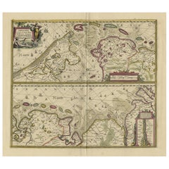
Old Original Engraving of Prussia on the Southeast Coast of the Baltic Sea, 1632
About the Item
Description: Antique map titled 'Prussia'.
Original map of Prussia, a historically prominent German state that originated in 1525 with a duchy centered on the region of Prussia on the southeast coast of the Baltic Sea. This map originates from 'G. Marcatoris Atlas de Novo plurimis in locis' by G. Mercator.
Artists and Engravers: Gerardus Mercator was a 16th-century geographer, cosmographer and cartographer from the County of Flanders. He is most renowned for creating the 1569 world map based on a new projection which represented sailing courses of constant bearing (rhumb lines) as straight lines—an innovation that is still employed in nautical charts.
Condition:
Good, general age-related toning. Minor wear, few small spots slightly affecting image. Latin text on verso. Please study image carefully.
- Dimensions:Height: 8.47 in (21.5 cm)Width: 11.03 in (28 cm)Depth: 0 in (0.02 mm)
- Materials and Techniques:
- Period:1630-1639
- Date of Manufacture:1632
- Condition:
- Seller Location:Langweer, NL
- Reference Number:
About the Seller
5.0
Platinum Seller
These expertly vetted sellers are 1stDibs' most experienced sellers and are rated highest by our customers.
Established in 2009
1stDibs seller since 2017
1,928 sales on 1stDibs
Typical response time: <1 hour
- ShippingRetrieving quote...Ships From: Langweer, Netherlands
- Return PolicyA return for this item may be initiated within 14 days of delivery.
More From This SellerView All
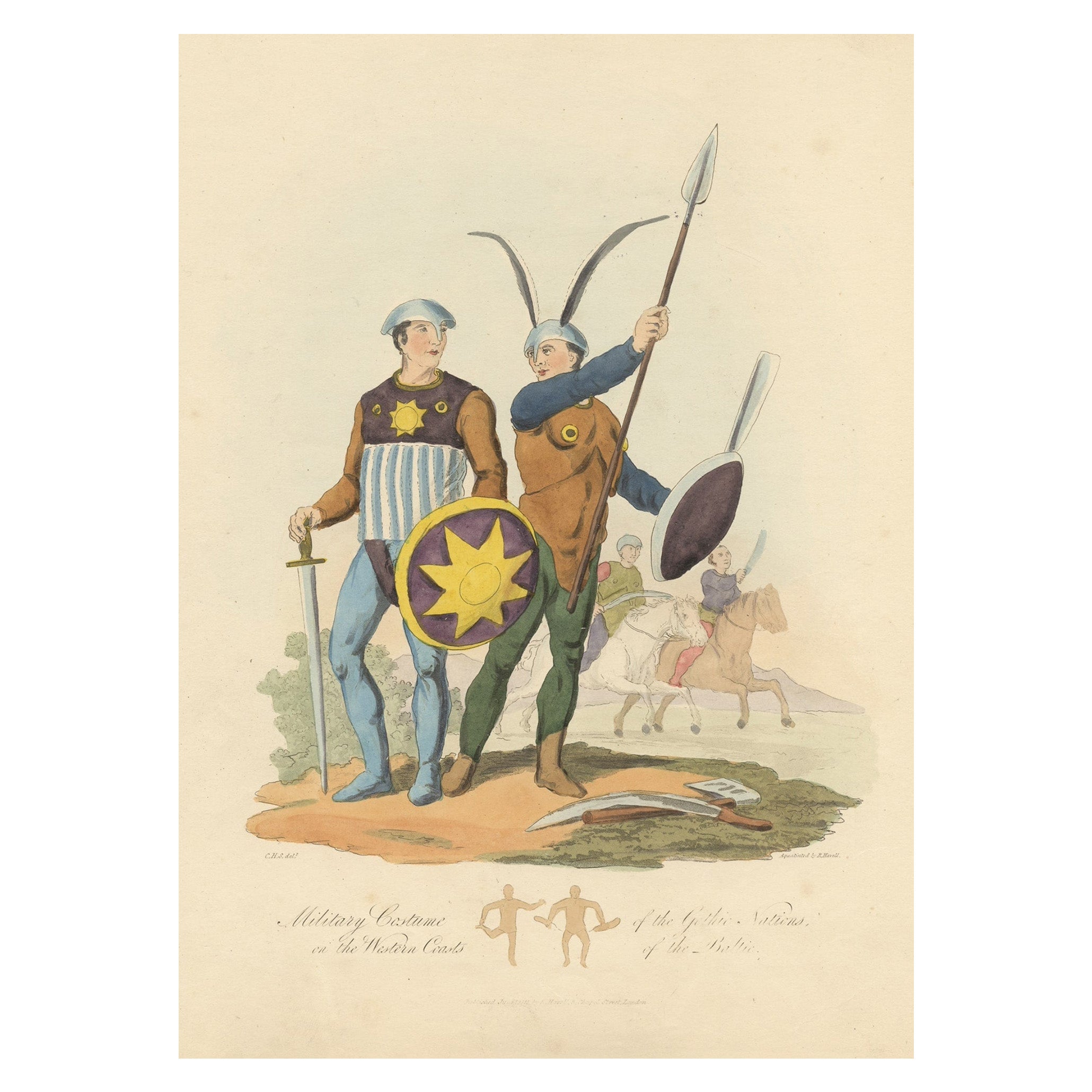
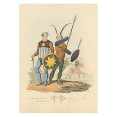
- Military Costume of the Gothic Nations on the Western Coasts of the Baltic, 1815Located in Langweer, NLAntique print titled 'Military Costume of the Gothic Nations on the Western Coasts of the Baltic'. Old print of Baltic military costumes. Originates from 'The costume of the origin...Category
Antique 1810s Prints
MaterialsPaper
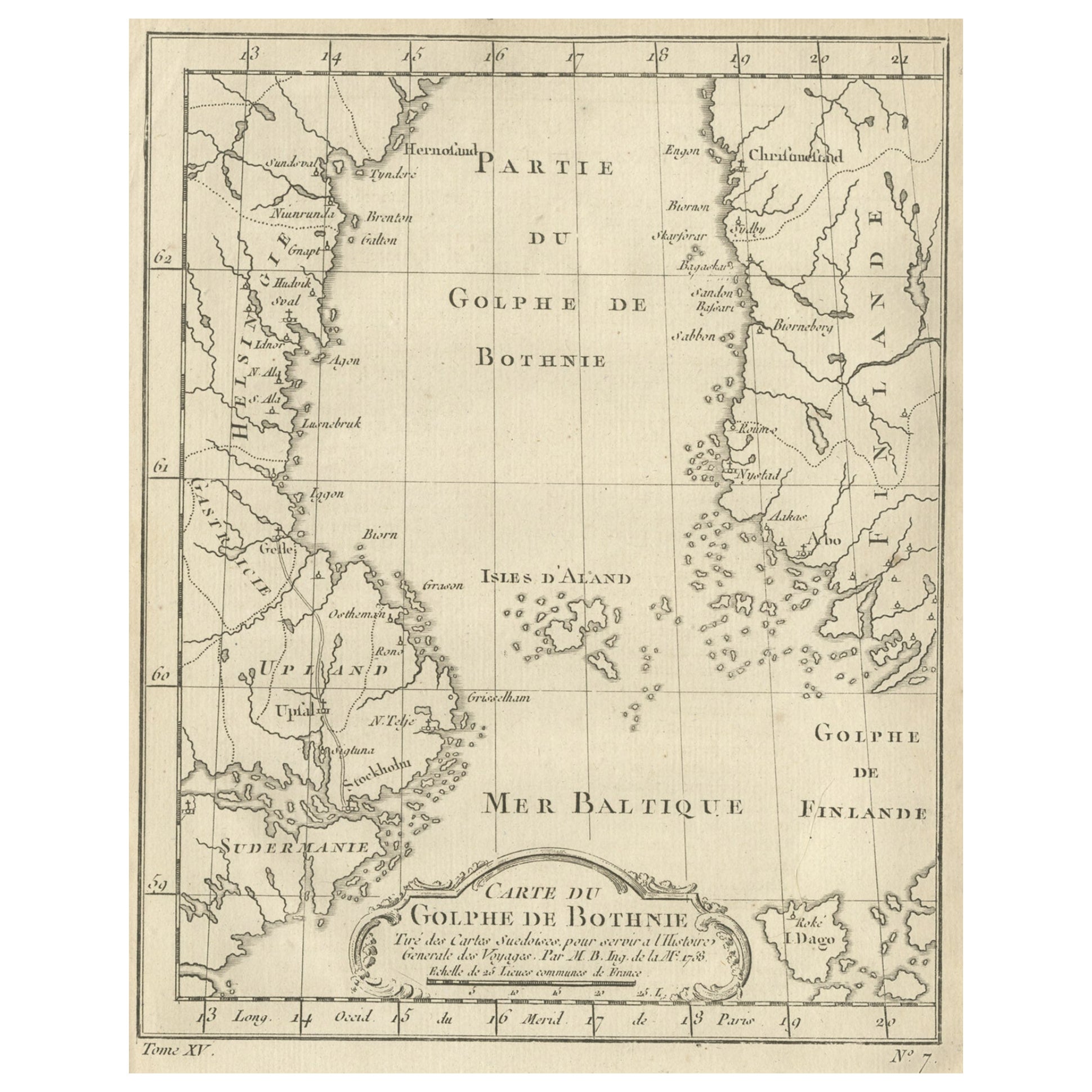
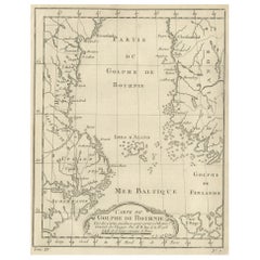
- Old Map of the Gulf of Bothnia, the Northernmost Arm of the Baltic Sea, 1759Located in Langweer, NLAntique map titled 'Carte du Golphe de Bothnie'. Original antique map of the Gulf of Bothnia, the northernmost arm of the Baltic Sea. It is situated between Finland's west coast ...Category
Antique 1750s Maps
MaterialsPaper
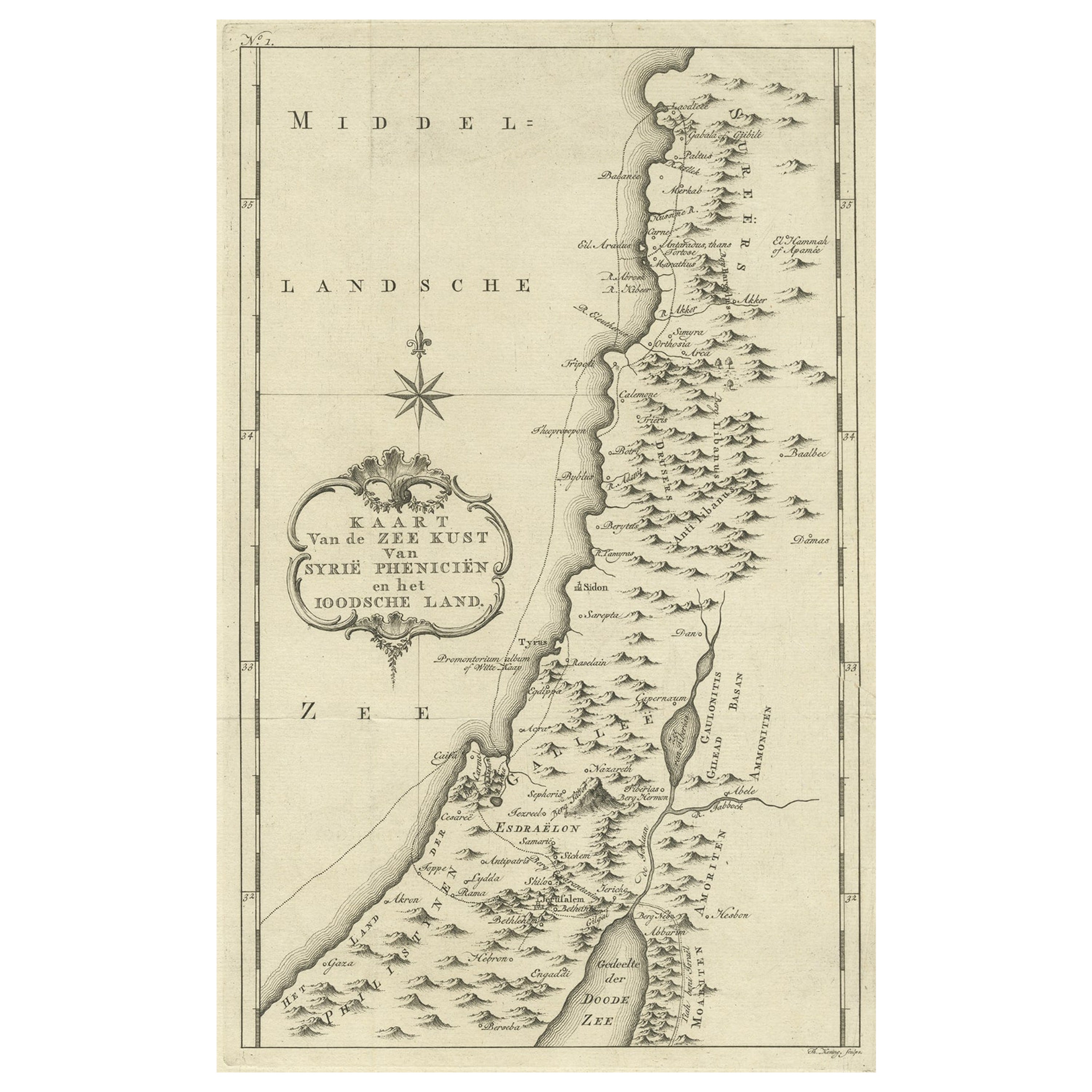
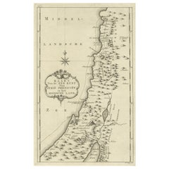
- Original Old Map of the Coast of Syria and Phoenicia, 1773Located in Langweer, NLAntique map titled 'Kaart van de Zee Kust van Syrië (..)'. Old map of the coast of Syria and Phoenicia. Originates from the first Dutch editon of an interesting travel account of...Category
Antique 1770s Maps
MaterialsPaper
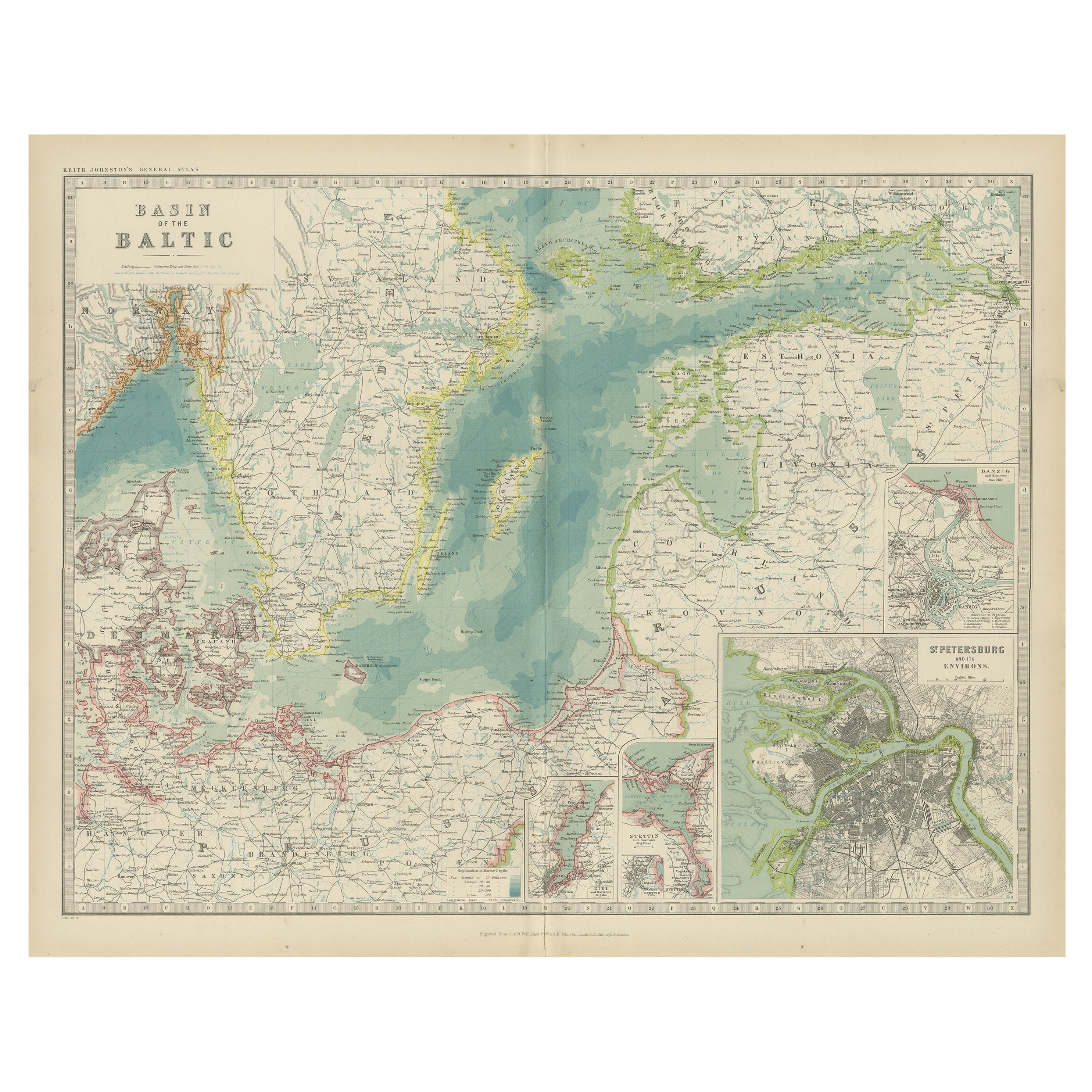
- Antique Map of the Baltic Sea by Johnston, '1909'Located in Langweer, NLAntique map titled 'Basin of the Baltic'. Original antique map of Baltic Sea. With inset maps of Kiel, Stettin, Danzig and St Petersburg. This map originate...Category
Early 20th Century Maps
MaterialsPaper
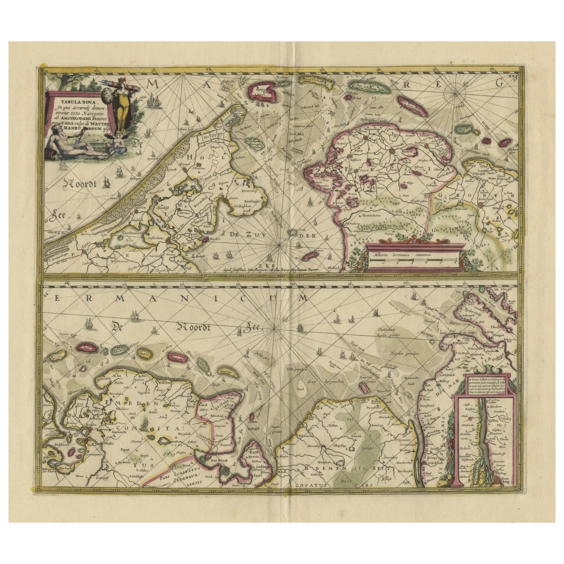
- Antique Engraving of Dutch and German North Sea Coast of Friesland, ca.1680Located in Langweer, NLAntique map titled 'Tabula Nova In qua accuratè demonstratur tota Navigatio ab Amstelodami Statione per Vada vulgo de Watten Hamburgum usq.' - Two maps with the Dutch and German North Sea coast of Friesland, with West Frisian Islands and below East Frisian Islands with inset map of the Elbe around Hamburg. With title and a scale cartouche. Map by Henricus Hondius...Category
Antique 1680s Maps
MaterialsPaper
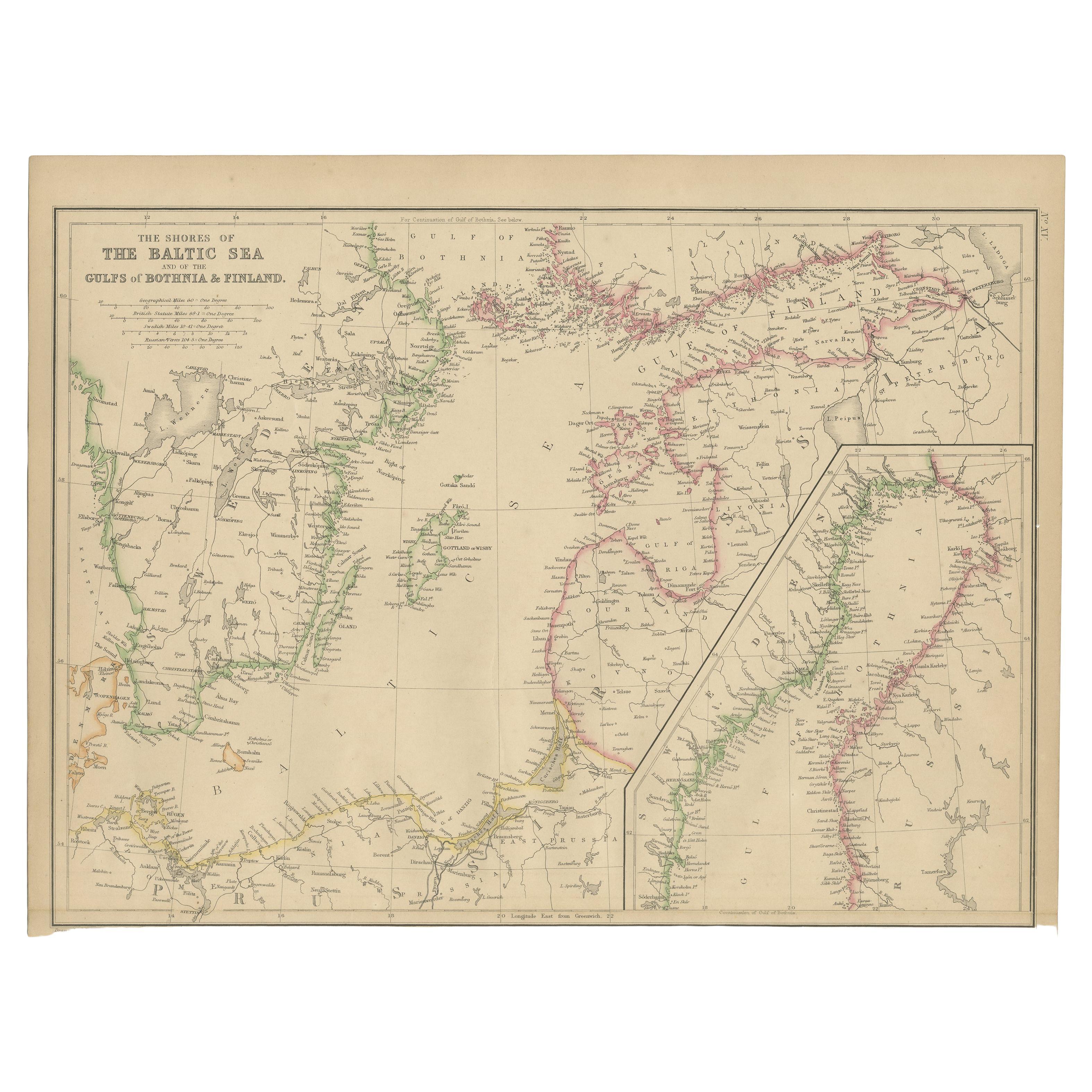
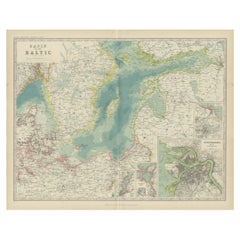
- Antique Map of the Shores of The Baltic Sea by W. G. Blackie, 1859Located in Langweer, NLAntique map titled 'The shores of The Baltic sea and of the Gulfs of Bothnia & Finland'. Original antique map of the Shores of the Baltic Sea. This map originates from ‘The Imperial ...Category
Antique Mid-19th Century Maps
MaterialsPaper
You May Also Like
- Hand-Colored 18th Century Homann Map of Denmark and Islands in the Baltic SeaBy Johann Baptist HomannLocated in Alamo, CAAn 18th century copper plate hand-colored map entitled "Insulae Danicae in Mari Balthico Sitae utpote Zeelandia, Fionia, Langelandia, Lalandia, Falstria, Fembria Mona" created by Joh...Category
Antique Early 18th Century German Maps
MaterialsPaper
- “The Restaurant of the House of Representatives” Engraving by Harper's WeeklyLocated in Colorado Springs, COThis original wood engraving is titled “The Restaurant of the House of Representatives, Washington, DC.” It was published as a double-page image, in the August 12, 1893 issue of the famous 19th century newspaper Harper’s Weekly. The print was illustrated by Charles Stanley Reinhardt. The House Restaurant, a unique part of life in the Capitol, has been in the same location since the 1857 Capitol Expansion. Congressional members’ busy work schedule made the availability of food on site a necessity. But the restaurant also served as an informal meeting spot for members to continue conversations and deal making. This 1893 print illustrates the convivial atmosphere. Details including elegantly dressed tables...Category
Antique 1890s American Prints
MaterialsPaper
- 1876 "Gettysburg, The Repulse of Longstreet's Assault." EngravingLocated in Colorado Springs, COPresented here is an 1876 engraving of John B. Bachelder and James Walker’s Gettysburg. The Repulse of Longstreet’s Assault. The engraved scene depicts the decisive battle on the final day of the Battle of Gettysburg. Researched by the photographer and topographer John B. Bachelder and painted by James Walker, the original painting was created in 1870. This detailed engraving was done by H. B. Hall Jr. and published by James Drummond Ball. Otherwise called Pickett’s Charge, the battle occurred on July 3, 1863. Pickett’s corp commander, Lieutenant General James Longstreet was placed in charge of the attack despite his hesitations. Longstreet’s central role led to the title of the work, Repulse of Longstreet’s Assault. In an attempt to gain control of an important supply route, nine Confederate brigades charged across three-quarters of a mile of open ground against cannon fire to take Cemetery Ridge from the defending Union Army. Despite their overwhelming numbers, the Confederate forces were repelled with considerable casualties marking not only a decisive victory for the Union, but also the beginning of the slow defeat of Lee’s Army. The furthest the charging forces advanced before being repulsed would forever be known as the “High Water Mark of the Confederacy.” The Confederate army never recovered from the losses at Gettysburg and it effectively ended Lee’s campaign into Pennsylvania. The engraving gives the perspective from the Union rear, one that encompasses most of the battlefield, from Big Round Top on the left to the northern reaches of Cemetery Ridge on the right. The Confederate lines at Seminary Ridge are in the far distance, partially obscured by bursting shells. The image centers on the main Confederate assault, in the vicinity of what today are known as "The Copse" and "The Bloody Angle." The composition has elemen...Category
Antique 1870s American Prints
MaterialsPaper
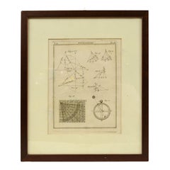
- Engraving on Copper Print from the Volume Navigazione Nautical Subject 1790Located in Milan, ITPrint by engraving on copper plate Tav III TIX fig. 17-22 from the volume Navigazione; with frame 28 x 33. Some calculations are depicted. Very good condition. Shipping is insured by...Category
Antique 1790s Italian Nautical Objects
MaterialsPaper
- Set of Twelve Colored Engravings of the Defeat of the Spanish Armada by J. PineLocated in Essex, MABy John Pine considered the foremost heraldic and decorative engraver of his generation. Depicting the defeat of the Spanish by the English Fleet in 1588. These are after a set of tapestries that hung in the House of Commons...Category
Antique 1740s English Prints
MaterialsPaper
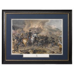
- "On the March to the Sea" Print by Alexander Hay Ritchie, after F.O.C DarleyBy Alexander Hay RitchieLocated in Colorado Springs, COThis color print of On The March to the Sea by Felix O.C. Darley, and engraved by A.H. Ritchie, is a stunning portrayal of William T. Sherman’s notorious Georgia Campaign. Originally...Category
Antique 1860s American Prints
MaterialsPaper