Sailing Maps
1
to
30
226
62
154
122
111
73
43
39
32
31
25
24
17
17
14
13
13
11
10
10
7
7
6
5
5
5
4
4
4
3
3
3
3
2
2
2
2
1
1
1
1
1
1
1
1
1
1
1
1
1
9
7
6
5
4
Sort By
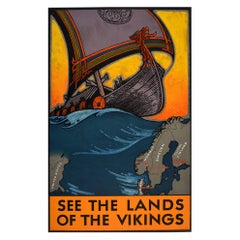
Original Vintage Travel Poster See The Lands Of The Vikings Atlantic Sailing Map
By Benjamin Blessum
Located in London, GB
Original vintage travel poster for the Nordic countries marked on a map - Christiania (Oslo) Norway
Category
Vintage 1930s Swedish Posters
Materials
Paper
H 39.38 in W 24.81 in D 0.04 in
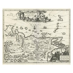
Antique Map of Venezuela by Montanus, 1671
By Arnoldus Montanus
Located in Langweer, NL
Antique map titled 'Venezuela cum parte Australi Novae Andalusiae'. The map extends from Coquibocoa
Category
Antique Mid-17th Century English Maps
Materials
Paper
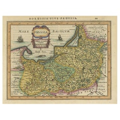
Original Decorative Antique Map of Prussia, 1628
Located in Langweer, NL
Antique map titled 'Prussia'. Original antique map of Prussia, a historically prominent German
Category
Antique 1620s Maps
Materials
Paper
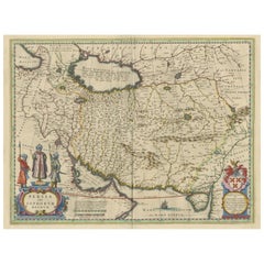
Antique Map of Persia with Dedication Cartouche
Located in Langweer, NL
Antique map titled 'Persia sive Sophorum Regnum'. Original old map of Persia. The map extends from
Category
Antique Mid-17th Century Maps
Materials
Paper
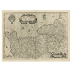
Antique Map of Normandy by Janssonius, 1657
Located in Langweer, NL
decorative cartouche, sailing ships and compass rose. This map originates from 'Atlas Novus, Sive Theatrum
Category
Antique 17th Century Maps
Materials
Paper
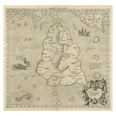
Mercator's Ptolemaic map of Taprobana, (Ceylon) Sri Lanka
Located in Langweer, NL
Antique map titled 'Asiae XII Tab'. Mercator's Ptolemaic map of Taprobana. The map shows Ptolemy's
Category
Antique 16th Century Maps
Materials
Paper
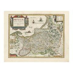
Antique Map of Prussia by Blaeu, circa 1635
By Willem Blaeu
Located in Langweer, NL
Antique map titled 'Prussiae Nova Tabula'. Rare early edition of Blaeu's map of Prussia
Category
Antique Mid-17th Century Maps
Materials
Paper
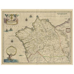
Antique Map of the Northwestern Coast of Spain
Located in Langweer, NL
Antique map titled 'Gallaecia Regnum'. Original old map of the northwestern coast of Spain
Category
Antique Mid-17th Century Maps
Materials
Paper
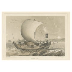
Antique Lithograph of a Japanese Junk, a Type of Sailing Ship, 1856
Located in Langweer, NL
Antique print titled ‘Japanese Junk'.
Lithograph of a Japanese junk, a type of sailing ship
Category
Antique 1850s Maps
Materials
Paper
Original Antique Map of Turkey, Asia Minor and Cyprus
By Gerard Mercator
Located in Langweer, NL
Antique map titled 'Natoliae sive Asia Minor'. Original old map of Turkey, Asia Minor and Cyprus
Category
Antique Early 17th Century Maps
Materials
Paper
Antique Lithography Map, Cumbria, English, Framed Cartography Interest, Georgian
Located in Hele, Devon, GB
This is an antique lithography map of Cumbria. An English, framed engraving of cartographic
Category
Antique Early 18th Century British Georgian Maps
Materials
Wood
H 21.86 in W 25.2 in D 0.79 in
Antique Map of the Holy Land by Schut, 1710
Located in Langweer, NL
Antique map of the Holy Land titled 'Het Beloofde Landt Canaan.' Very detailed and decorative map
Category
Antique 18th Century Maps
Materials
Paper
Antique Map of Portugal by P. Schenk, circa 1700
Located in Langweer, NL
Antique map titled 'Portugalliae et Algarbia'. Striking example of Schenk's rare map of Portugal
Category
Antique Early 18th Century Maps
Materials
Paper
Cartographic Tapestry: Antique Map of Asia Minor, circa 1640
Located in Langweer, NL
Title: "Historical Tapestry: Antique Map of Asia Minor, circa 1640"
Description:
This authentic
Category
Antique Mid-17th Century Maps
Materials
Paper
Antique Map of Portugal by J. De Ram, circa 1680
Located in Langweer, NL
A detailed map of Portugal. Embellished with beautiful cartouche, sailing vessels and many putti
Category
Antique Late 17th Century Maps
Materials
Paper
Antique Map of New South Wales in Australia, ca. 1850
Located in Langweer, NL
Antique map of Victoria, or Port Phillip (12.7 x 10.0") in Australia. Superb map of Victoria
Category
Antique Mid-19th Century European Maps
Materials
Paper
Decorative Original Antique Map of Greece by Ortelius, c.1609
Located in Langweer, NL
. It is very detailed and includes the islands in the Aegean Sea. The map is embellished by a sailing
Category
Antique 17th Century Maps
Materials
Paper
Antique Map of Sri Lanka with an unusual five-sided shape
Located in Langweer, NL
Antique map titled 'Ins. Ceilan quae incolis Tenarisin dicitur'. This exquisite, early map of Sri
Category
Antique Early 17th Century Maps
Materials
Paper
Decorative Original Antique Map of Valencia in Southern Spain, circa 1601
Located in Langweer, NL
This is an original antique map titled 'Valentiae Regni olim Contestanorum Si Ptolemaeo
Category
Antique Early 17th Century Maps
Materials
Paper
Free Shipping
H 17.52 in W 22.45 in D 0.02 in
Original Antique Map of the Northern Part of Scotland, circa 1640
Located in Langweer, NL
The antique map, titled 'Scotiae pars septentrionalis,' depicts the northern part of Scotland
Category
Antique Mid-17th Century Maps
Materials
Paper
Beautiful Original Copper Engraved Map of Lake Geneva in Switzerland, 1613
Located in Langweer, NL
Description: Antique map titled 'Lacus Lemanus'.
Old map of Lake Geneva with good detail of
Category
Antique 1610s Maps
Materials
Paper
Antique Map of Victoria, or Port Phillip in Australia, ca. 1850
Located in Langweer, NL
This antique map, measuring approximately 12.7 x 10.0 inches, showcases Victoria, specifically
Category
Antique Mid-19th Century European Maps
Materials
Paper
Original Hand-Colored Antique Map of America by Danckerts, circa 1680
Located in Langweer, NL
Antique map titled 'Novissima et Accuratissima Totius Americae Descriptio per I. Danckerts
Category
Antique Late 17th Century Maps
Materials
Paper
H 20.48 in W 24.22 in D 0.02 in
Hampshire County, Britain/England: A Map from Camden's" Britannia" in 1607
By John Norden
Located in Alamo, CA
An early hand-colored map of Britain's Hampshire county, published in the 1607 edition of William
Category
Antique Early 17th Century English Maps
Materials
Paper
H 17.13 in W 18.75 in D 0.88 in
Antique Map of the Moluccas in Indonesia by Janssonius, C.1650
By Johannes Janssonius
Located in Langweer, NL
Antique map titled 'Insularum Moluccarum Nova Descriptio.' Old map of the Moluccas. The famous
Category
Antique 17th Century Maps
Materials
Paper
Antique Map of Guinea in West Africa by Blaeu, c.1638
Located in Langweer, NL
interior, sailing ships and several elegant cartouches. Both the map and the sea are shown with Rhumb lines
Category
Antique 17th Century Maps
Materials
Paper
Greece, "Graeciae Antiquae"" A 17th Century Hand-colored Map by Sanson
By Nicolas Sanson
Located in Alamo, CA
Tavernier (1594–1665) in 1636 in Paris. The map is embellished by seven sailing ships and seven sea monsters
Category
Antique Mid-17th Century French Maps
Materials
Paper
H 24.75 in W 29.75 in D 0.13 in
An Ornate and Historical Tallis Map of Jamaica with Decorative Vignettes, 1851
Located in Langweer, NL
This original antique map of Jamaica is part of the renowned series created by the Tallis Company
Category
Antique 1850s Maps
Materials
Paper
H 10.71 in W 14.26 in D 0 in
Imperial Splendor: Antique Map of the Ottoman Empire by Blaeu, circa 1640
Located in Langweer, NL
the empire.
3. **Sailing Ships**:
- The map includes depictions of sailing ships in both the
Category
Antique Mid-17th Century Maps
Materials
Paper
No Reserve
H 17.33 in W 21.54 in D 0.02 in
Antique Map of the Malay Archipelago with Images of Indigenous People, 1851
Located in Langweer, NL
John Tallis & Company, often simply known as Tallis, was renowned for the production of maps and
Category
Antique 1850s Maps
Materials
Paper
H 10.71 in W 14.26 in D 0 in
Antique Map of the Wallis and Futuna Islands, French Overseas Territory, 1778
Located in Langweer, NL
Antique map titled 'Walliss Inseln, Isles de Wallis'. Old map of the Wallis and Futuna Islands
Category
Antique 18th Century Maps
Materials
Paper
H 10.63 in W 8.27 in D 0 in
Antique Map of Denmark and Oldenburg ‘Germany’ by A. Ortelius, circa 1598
Located in Langweer, NL
Antique map titled 'Daniae Regni Typus' and 'Oldenburg Comit'. A nice example of Ortelius maps of
Category
Antique 16th Century Maps
Materials
Paper
H 18.12 in W 21.74 in D 0.02 in
Very Decorative Rare Antique Map of the Northern Part of Africa, 1702
Located in Langweer, NL
Antique map titled 'Africae Pars Borealis.'
Very decorative antique map of the northern part of
Category
Antique Early 1700s Maps
Materials
Paper
Beautiful Antique Map of the Moluccas or Spice Islands, Indonesia, ca.1650
Located in Langweer, NL
Antique map titled 'Insularum Moluccarum Nova Descriptio.'
Beautiful map of the Moluccas. The
Category
Antique 1650s Maps
Materials
Paper
H 20.87 in W 22.64 in D 0 in
Map of East Friesland, The Netherlands & the Area Emden & Norden, Germany, 1635
Located in Langweer, NL
Antique map titled 'Typus Frisiae Orientalis.'
Map of East Friesland and the area around Emden
Category
Antique 1630s Maps
Materials
Paper
H 20.48 in W 24.34 in D 0 in
Antique Map of the Provinces of Gelderland and Overijssel by Kaerius, 1617
Located in Langweer, NL
Overijssel in the Netherlands. Large cartouche with coat of arms and sailing ship on the Zuyderzee. This map
Category
Antique 17th Century Maps
Materials
Paper
H 15.75 in W 20.67 in D 0 in
Antique Map of Morocco Showing Towns of Marakesh, Taradant and Fez, 1636
Located in Langweer, NL
Antique map titled 'Fezzae et Marocchi regna Africae Celeberrima'. Map of Morocco, showing large
Category
Antique 17th Century Maps
Materials
Paper
"Nova Barbariae Descriptio", a 17th Century Hand-Colored Map of North Africa
By Johannes Janssonius
Located in Alamo, CA
This original attractive 17th century hand-colored map of North Africa entitled "Nova Barbariae
Category
Antique Mid-17th Century Dutch Maps
Materials
Paper
H 22.38 in W 29 in D 0.13 in
Antique Map of Friesland, Groningen and German East Friesland by Ortelius, 1603
Located in Langweer, NL
: Descriptio. 1568.' Detailed map of Friesland, the Netherlands. Includes a larger compass rose, sailing ships
Category
Antique 17th Century Maps
Materials
Paper
H 17.52 in W 22.45 in D 0 in
Antique Map of Friesland with Elaborate Cartouche by Mapmaker Ortelius, c.1570
Located in Langweer, NL
: Descriptio. 1568.' Detailed map of Friesland, the Netherlands. Includes a larger compass rose, sailing ships
Category
Antique 16th Century Maps
Materials
Paper
H 17.45 in W 22.72 in D 0 in
Italy, Sicily, Sardinia, Corsica and Dalmatian Coast: A 17th Century Dutch Map
By Theodorus Danckerts
Located in Alamo, CA
be seen sailing in the waters as a naval battle rages in the Tyrrhenian Sea.
The map is presented
Category
Antique Late 17th Century Dutch Maps
Materials
Paper
H 18.13 in W 31.25 in D 1.38 in
"Africae Accurata", a Hand-Colored 17th Century Map of Africa by Visscher
By Nicolaes Visscher II
Located in Alamo, CA
An 18th century hand-colored map of Africa entitled "Africae Accurata Tabula ex officina" by
Category
Antique Late 17th Century Dutch Maps
Materials
Paper
H 23.75 in W 28.13 in D 0.13 in
17th Century Hand-Colored Map of Valencia and Murcia, Spain by Mercator/Hondius
By Gerard Mercator
Located in Alamo, CA
lower part of the map. It is embellished with a sea monster and a sailing ship in the Mediterranean and
Category
Antique Mid-17th Century Dutch Maps
Materials
Paper
H 12 in W 16 in D 0.13 in
Prussia, Poland, N. Germany, Etc: A Hand-colored 17th Century Map by Janssonius
By Johannes Janssonius
Located in Alamo, CA
This is an attractive hand-colored copperplate engraved 17th century map of Prussia entitled
Category
Antique Mid-17th Century Dutch Maps
Materials
Paper
H 21.25 in W 24.63 in D 0.07 in
Old Ptolemaic Map of the Region Between the Persian Gulf and Caspian Sea, 1598
Located in Langweer, NL
editions contained maps based on his original writings, known as Ptolemaic maps. As geographic knowledge
Category
Antique 16th Century Maps
Materials
Paper
H 7.09 in W 9.81 in D 0 in
Old Map of the Moluccas, Known as the Famous Spice Islands, Indonesia, ca.1730
Located in Langweer, NL
Antique map titled 'Insularum Moluccarum Nova Descriptio.'
Old map of the Moluccas. The famous
Category
Antique 1730s Maps
Materials
Paper
H 17.33 in W 23 in D 0 in
Detailed Map of the Holy Land, Showing the Travels of Christ & Apostles, ca.1650
Located in Langweer, NL
Antique map titled 'Het Beloofde Landt Canaan door wandelt van onsen Salichmaeker Jesu Christo
Category
Antique 1650s Maps
Materials
Paper
H 44.2 in W 52.3 in D 0.002 in
Engraving by Tallis and Rapkin of Map of the West Indies in The Caribbean, 1851
Located in Langweer, NL
John Tallis' 1851 map of the West Indies stands as a striking example of his renowned cartographic
Category
Antique Mid-19th Century Maps
Materials
Paper
H 10.44 in W 14.57 in D 0 in
Antique Map of Asia and the East Indies and Korea as a Peninsula, ca.1660
Located in Langweer, NL
Antique map titled 'Asiae nova delineatio'. Decorative map of Asia and the East Indies. The map
Category
Antique 17th Century Maps
Materials
Paper
Free Shipping
H 19.69 in W 24.02 in D 0 in
Old Original Engraving of Prussia on the Southeast Coast of the Baltic Sea, 1632
Located in Langweer, NL
Description: Antique map titled 'Prussia'.
Original map of Prussia, a historically prominent
Category
Antique 1630s Maps
Materials
Paper
H 8.47 in W 11.03 in D 0 in
Antique Sea Chart of the Western Coast of Africa
Located in Langweer, NL
Antique map titled 'Nieuwe Paskaert van de Kust van Genehoa (..)'. This attractive sea chart covers
Category
Antique Late 17th Century Maps
Materials
Paper
Mariners Chart of Quicks Hole and Tarpaulin Cove by George Eldridge 1901
Located in Norwell, MA
Washington Eldridge (1845-1912) were leading sea chart and sailing guide publishers from the mid 19th to the
Category
Antique Early 1900s North American Maps
Materials
Paper
Antique Chart of the Straits of Makassar, Indonesia with Borneo and Celebes-1820
Located in Langweer, NL
Description: Antique map titled 'A New Chart of the Straits of Macassar with various additions
Category
Antique 1820s Maps
Materials
Paper
H 37.8 in W 25.99 in D 0 in
Decorative Original Antique Panoramic View of Atjeh on Sumatra, Indonesia, 1756
Located in Langweer, NL
, Indonesia. On this engraving a pagode like building is visible in the background. In the foreground sailing
Category
Antique 1750s Maps
Materials
Paper
H 10.36 in W 14.97 in D 0 in
VOC Ships, Native People & Coastal Views of Islands near Papua New Guinea, 1726
Located in Langweer, NL
.) sailing ships and various local craft fill the foreground. This print originates from 'Oud en Nieuw Oost
Category
Antique 1720s Maps
Materials
Paper
H 13.39 in W 15.75 in D 0 in
Edinburgh, Scotland Coast: A 17th Century Hand-Colored Sea Chart by Collins
By Captain Greenvile Collins
Located in Alamo, CA
, as well as St. Andrews and Dunbar, Scotland. It includes a compass rose, a sailing ship and multiple
Category
Antique Late 17th Century English Maps
Materials
Paper
H 23 in W 27.75 in D 0.5 in
Plymouth, England: A Hand-Colored 17th Century Sea Chart by Captain Collins
By Captain Greenvile Collins
Located in Alamo, CA
depicts Plymouth Sound and Harbor, as well as Pline River. The chart is adorned with four sailing ships
Category
Antique Late 17th Century English Maps
Materials
Paper
H 23 in W 27.75 in D 0.5 in
Dartmouth, England: A Hand-Colored 17th Century Sea Chart by Captain Collins
By Captain Greenvile Collins
Located in Alamo, CA
most technologically advanced sailing yacht in the world, the Maltese Falcon. I have 16 of his sea
Category
Antique Late 17th Century English Maps
Materials
Paper
H 23 in W 27.75 in D 0.5 in
Flanders, Holland & Norfolk: Hand-Colored 17th Century Sea Chart by Collins
By Captain Greenvile Collins
Located in Alamo, CA
most technologically advanced sailing yacht in the world, the Maltese Falcon. I have 16 of his sea
Category
Antique Late 17th Century English Maps
Materials
Paper
H 23 in W 27.75 in D 0.5 in
Original Vintage Rail Travel Map Poster France Map SNCF National French Railway
Located in London, GB
Original vintage rail travel map poster - France Societe Nationale des Chemins de Fer Francais
Category
Vintage 1950s French Posters
Materials
Paper
H 39.38 in W 24.41 in D 0.04 in
- 1
Get Updated with New Arrivals
Save "Sailing Maps", and we’ll notify you when there are new listings in this category.
Sailing Maps For Sale on 1stDibs
Find a variety of sailing maps available on 1stDibs. The range of distinct sailing maps — often made from paper, ceramic and fabric — can elevate any home. Sailing maps have been made for many years, and versions that date back to the 18th Century alongside those produced as recently as the 21st Century. Art Deco, modern and neoclassical sailing maps are consistently popular styles. There have been many well-made sailing maps over the years, but those made by Captain Greenvile Collins, Ottomar Anton and Gerard Mercator are often thought to be among the most beautiful.
How Much are Sailing Maps?
Prices for sailing maps start at $115 and top out at $45,439 with the average selling for $1,404.
More Ways To Browse
Papua New Guinea Antique Map
Antique Maps Of Lithuania
Philippines Vintage Travel Poster
Sri Lanka Vintage Travel Poster
Boat Brochure
Aer Lingus Poster
Cornelis Schut
Vintage Aer Lingus
Aer Lingus Vintage Posters
Land Cruiser
Retro Aer Lingus
Mexican Movie Poster
Vintage Isle Of Wight Posters
Dog Show Poster
Vintage Viking Map
Vintage Dessert Poster
Montreux Oberland Bernois Railway
Straits Settlement
