Items Similar to Beautiful Original Copper Engraved Map of Lake Geneva in Switzerland, 1613
Want more images or videos?
Request additional images or videos from the seller
1 of 5
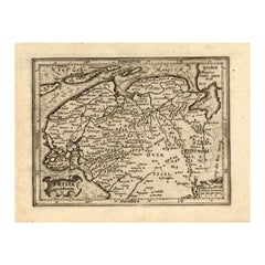
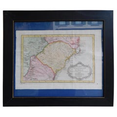
Beautiful Original Copper Engraved Map of Lake Geneva in Switzerland, 1613
About the Item
Description: Antique map titled 'Lacus Lemanus'.
Old map of Lake Geneva with good detail of surrounding towns and villages. Decorated with a large compass rose with two sailing boats and a sea monster in the lake. Originates from 'Atlas Minor'.
Artists and Engravers: Henricus Hondius II or Hendrik Hondius the Younger (1597 – 16 August 1651) was a Dutch engraver, cartographer and publisher. He was born in Amsterdam, the son of the famous cartographer Jodocus Hondius who had started a map-making business in the city.
Condition: Very good, general age-related toning. Small worm track outside image border, French text on verso. Please study image carefully.
- Dimensions:Height: 6.7 in (17 cm)Width: 8.67 in (22 cm)Depth: 0 in (0.02 mm)
- Materials and Techniques:
- Period:1610-1619
- Date of Manufacture:1613
- Condition:
- Seller Location:Langweer, NL
- Reference Number:
About the Seller
5.0
Platinum Seller
These expertly vetted sellers are 1stDibs' most experienced sellers and are rated highest by our customers.
Established in 2009
1stDibs seller since 2017
1,922 sales on 1stDibs
Typical response time: <1 hour
- ShippingRetrieving quote...Ships From: Langweer, Netherlands
- Return PolicyA return for this item may be initiated within 14 days of delivery.
More From This SellerView All
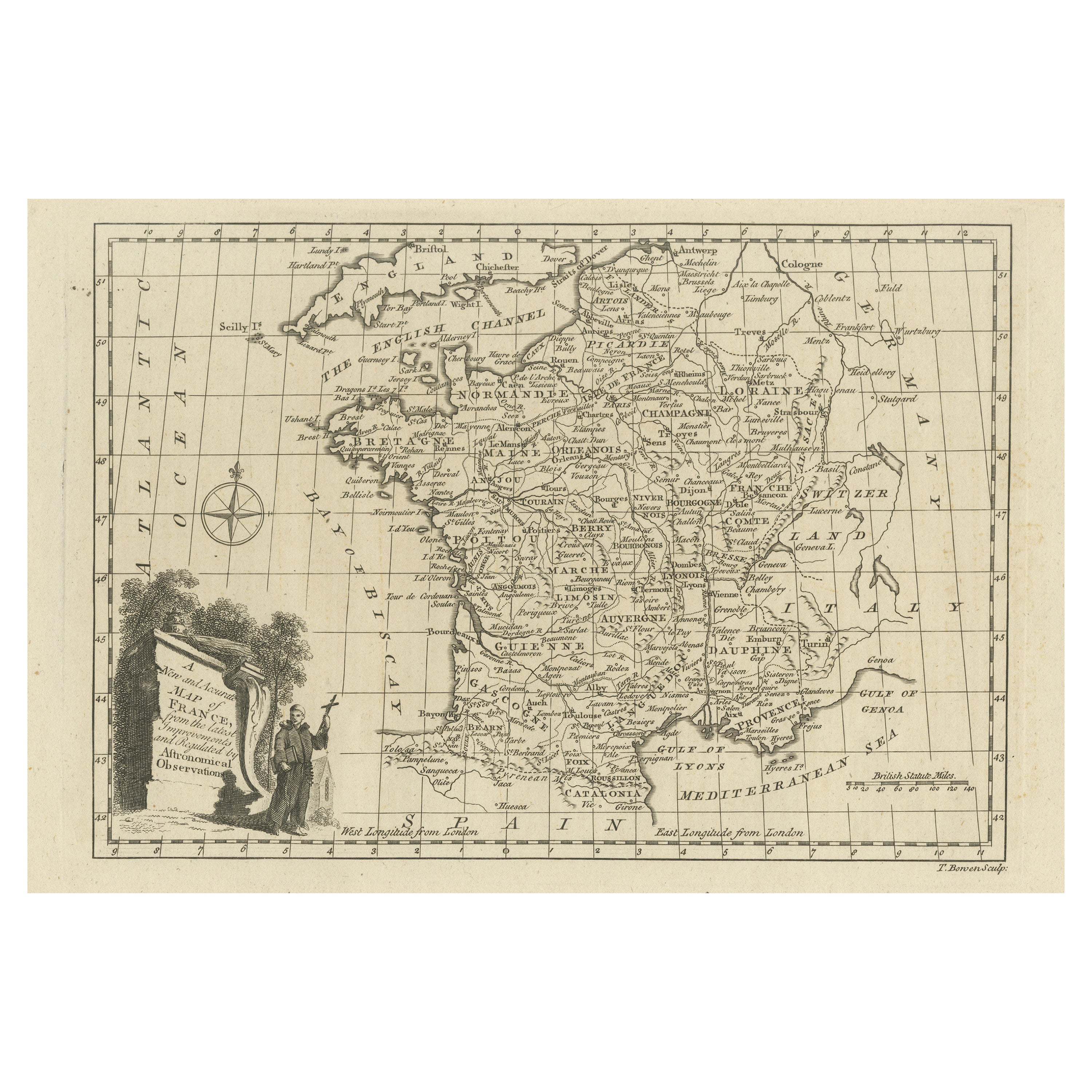
- Original Copper Engraved Map of FranceLocated in Langweer, NLAntique map titled 'New and Accurate Map of France from the latest improvements'. Original copper engraved map of France. Engraved by T. Bowen, published circa 1771.Category
Antique Late 18th Century Maps
MaterialsPaper
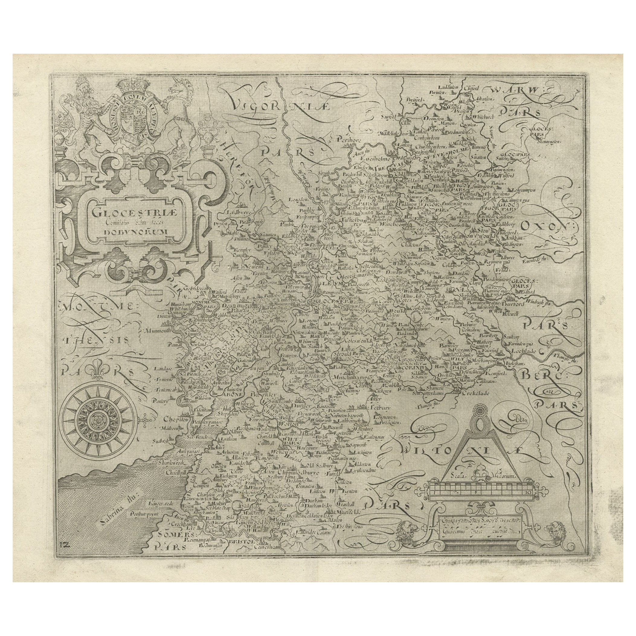
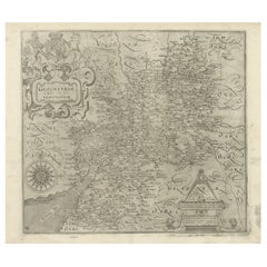
- Antique Copper Engraved Map of Gloucestershire in England, 1637Located in Langweer, NLAntique map titled 'Glocestriae comitatus olim sedes Dobunorum'. Map of Gloucestershire, England. This map originates from Camden?s 'Britannia' ...Category
Antique 17th Century Maps
MaterialsPaper
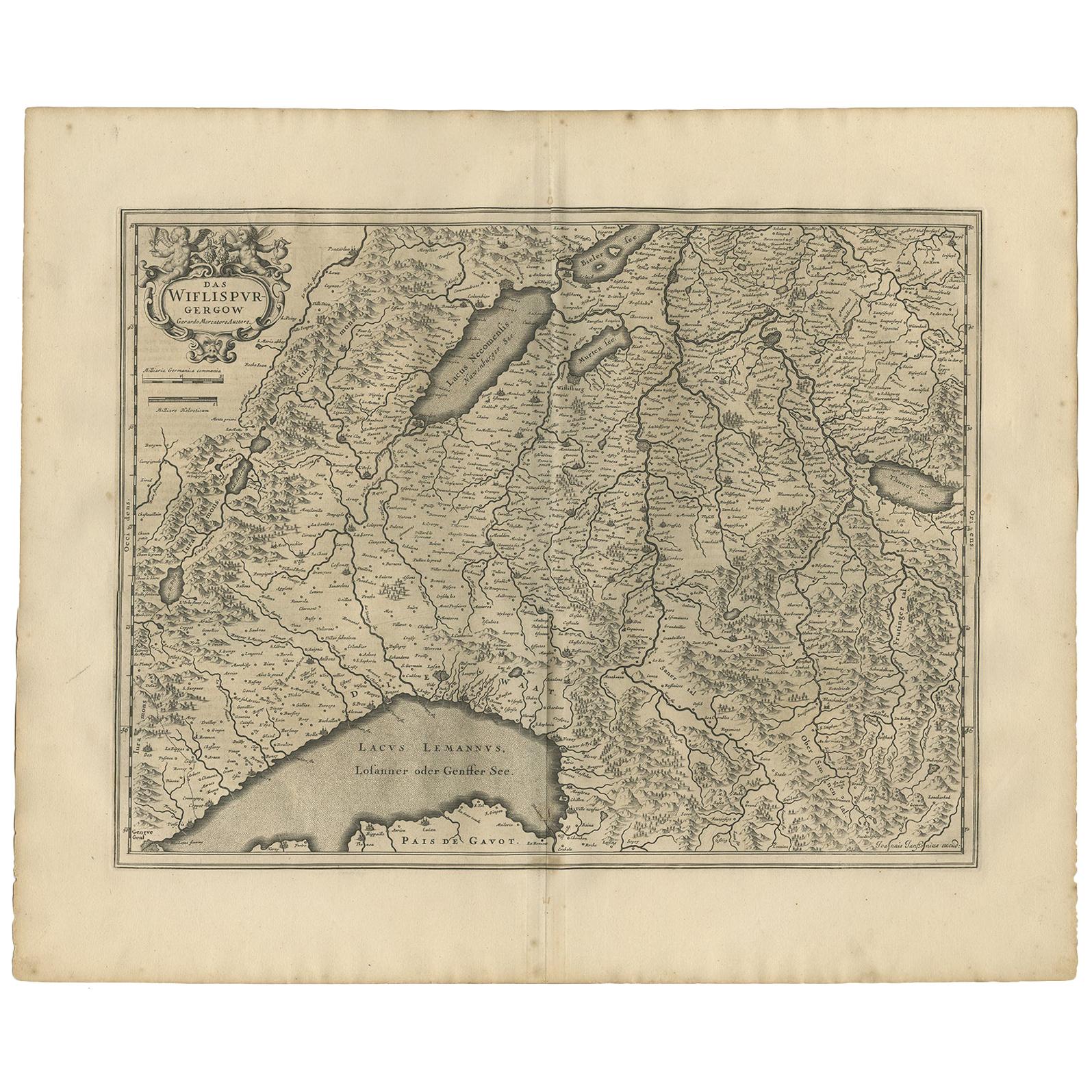
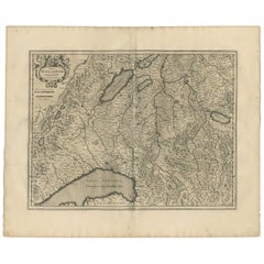
- Antique Map of the Region of Lake Geneva by Janssonius '1657'By Johannes JanssoniusLocated in Langweer, NLAntique map 'Das Wiflispur Gergow'. Detailed map of Switzerland showing Waadt and the Lake of Geneva and the city of Geneva, Fribourg and partly Bern. This map originates from 'Atlas...Category
Antique Mid-17th Century Maps
MaterialsPaper
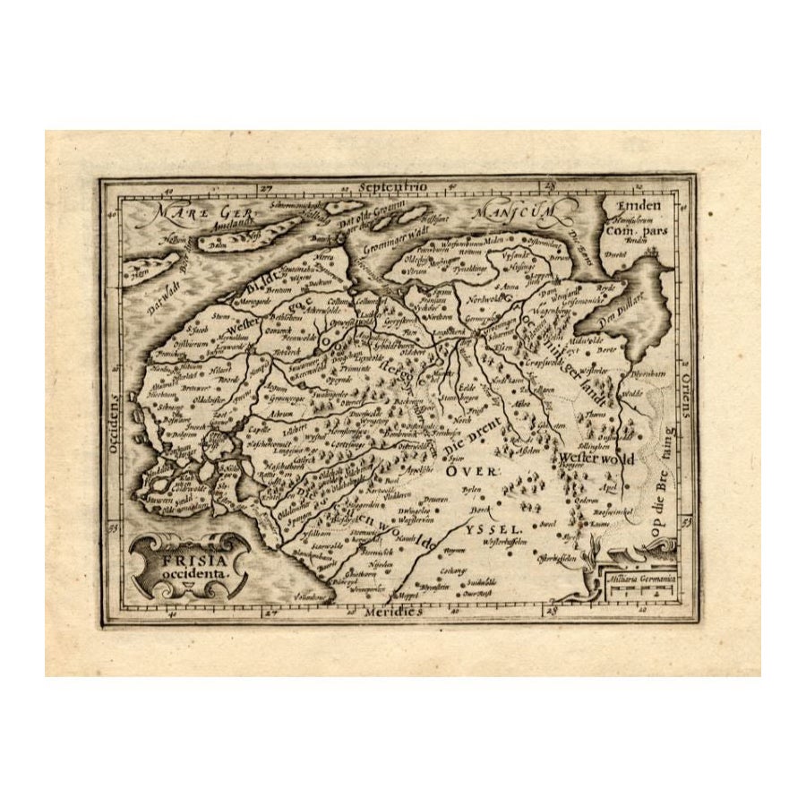
- Antique Map of Friesland by Guicciardini, 1613Located in Langweer, NLAntique map titled 'Frisia Occidenta.' (Map of the province of Friesland, the Netherlands.) This original old antique print / plate originates from the scarse French edition of 'Desc...Category
Antique 17th Century Maps
MaterialsPaper
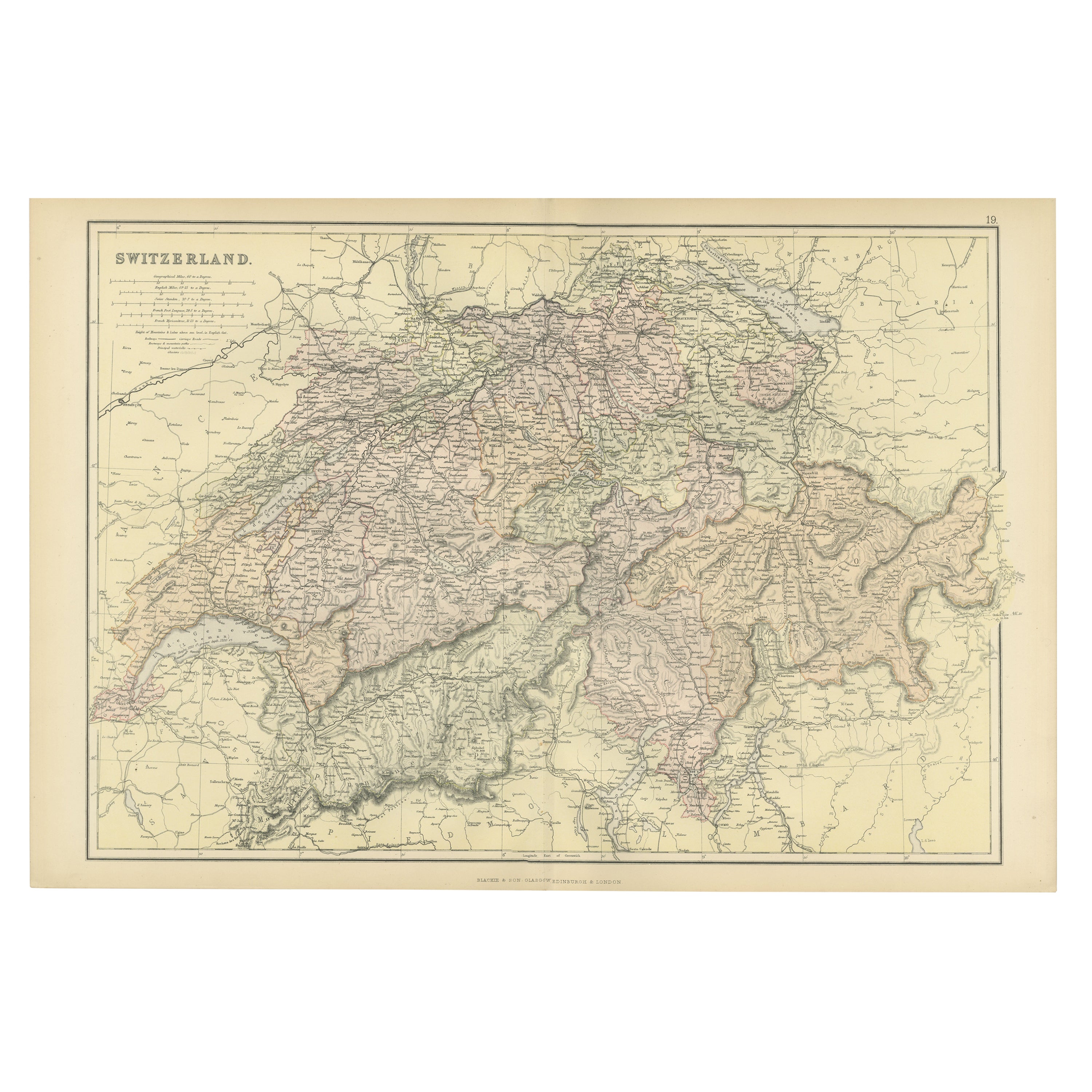
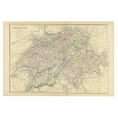
- Original Antique Map of Switzerland, 1882Located in Langweer, NLEmbark on a historical journey with an original Antique Map of Switzerland from the renowned 'Comprehensive Atlas and Geography of the World...Category
Antique 1880s Maps
MaterialsPaper
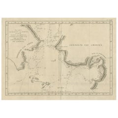
- Original Copper Engraved Map of the Bering Strait by Captain Cook, 1803Located in Langweer, NLAntique map titled 'Kaart van den Mond van Norton, en van de Engte van Bhering, toonende de meest Oostlijke Kaap van Asien, en den meest Westlijken Urthoek van Amerika'. Map of t...Category
Antique Early 1800s Maps
MaterialsPaper

You May Also Like
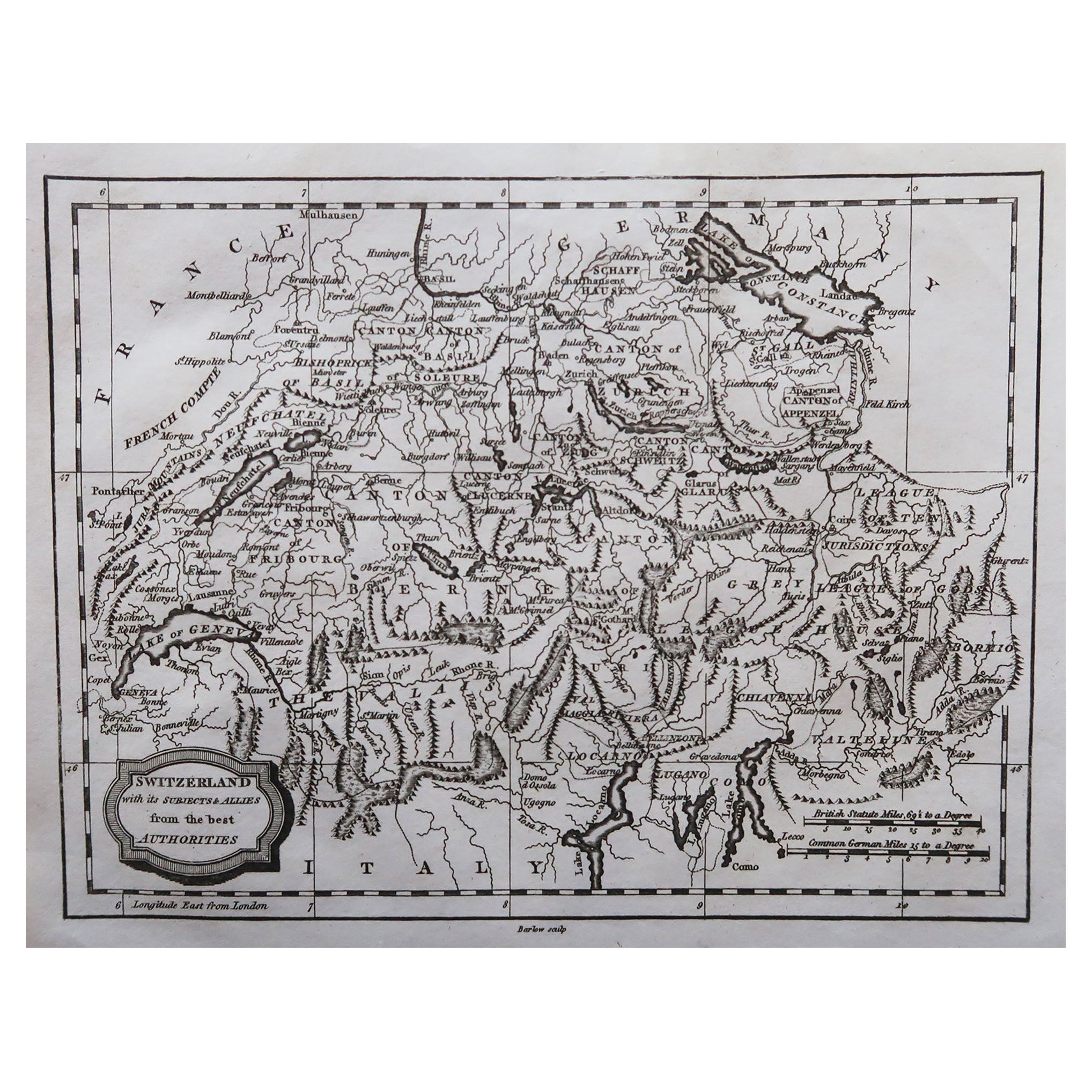
- Original Antique Map of Switzerland, Engraved By Barlow, Dated 1807Located in St Annes, LancashireGreat map of Switzerland Copper-plate engraving by Barlow Published by Brightly & Kinnersly, Bungay, Suffolk. Dated 1807 Unframed.Category
Antique Early 1800s English Maps
MaterialsPaper
- Large Original Vintage Map of Switzerland, circa 1920Located in St Annes, LancashireGreat map of Switzerland Original color. Good condition Published by Alexander Gross Unframed.Category
Vintage 1920s English Maps
MaterialsPaper
- French Framed Copper Engraved Hand Colored Map of Carolina & Georgia, Circa 1757Located in Hollywood, SCFrench copper engraved hand colored map of Carolina & Georgia matted under glass with a painted frame, mid-18th centuryCategory
Antique 1750s French Louis XV Maps
MaterialsGlass, Wood, Paint, Paper
- Original Antique Map of The Netherlands, Engraved by Barlow, Dated 1807Located in St Annes, LancashireGreat map of Netherlands Copper-plate engraving by Barlow Published by Brightly & Kinnersly, Bungay, Suffolk. Dated 1807 Unframed.Category
Antique Early 1800s English Maps
MaterialsPaper
- Original Antique Map of Spain and Portugal, Engraved By Barlow, 1806Located in St Annes, LancashireGreat map of Spain And Portugal Copper-plate engraving by Barlow Published by Brightly & Kinnersly, Bungay, Suffolk. 1806 Unframed.Category
Antique Early 1800s English Maps
MaterialsPaper
- Original Antique Map of Italy. C.1780Located in St Annes, LancashireGreat map of Italy Copper-plate engraving Published C.1780 Unframed.Category
Antique Early 1800s English Georgian Maps
MaterialsPaper


Recently Viewed
View AllMore Ways To Browse
Engraved Copper
Swiss Old Furniture
Boat Collectables
Used Furniture Geneva
Dutch Copper
Copper Map
Antique Sailing Boat
Compass Rose
Compass Map
Antique Map Border
Small Compasses
Small Compass
Antique Monster
Compass Rose Antique
Antique Compass Rose
Antique Rose Compass
Sea Monster
Swiss Antiques And Collectables