Compass Map
10
to
43
381
103
285
159
154
126
112
50
42
42
36
35
32
31
28
24
21
17
16
16
14
13
11
10
9
8
6
6
6
5
5
5
5
4
4
3
3
3
3
3
3
3
3
2
2
2
2
2
2
2
2
2
2
2
2
1
1
1
1
1
1
11
10
10
6
4
Sort By
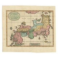
Antique Map of Japan with Scale and Compass Rose, c.1730
Located in Langweer, NL
Japan. With scale and compass rose. This map originates from 'Hedendaegsche historie, of tegenwoordige
Category
Antique 18th Century Maps
Materials
Paper
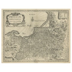
Old Map of Prussia, Embellished with a Large Cartouche and Compass Rose, ca.1680
Located in Langweer, NL
Antique map titled 'Prussiae nova Tabula'.
Later edition of Blaeu's map of Prussia, embellished
Category
Antique 1680s Maps
Materials
Paper
H 17.13 in W 21.86 in D 0 in
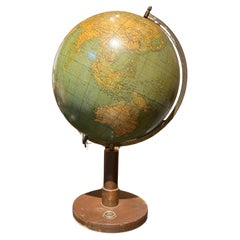
European Vintage Earth Globe on Stand with Compass
Located in Sofia, BG
Vintage handmade world globe standing on a base with small compass in the bottom. The piece is in
Category
Mid-20th Century French Maps
Materials
Plastic, Paper
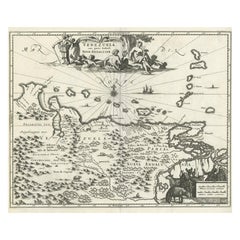
Antique Map of Venezuela by Montanus, 1671
By Arnoldus Montanus
Located in Langweer, NL
Antique map titled 'Venezuela cum parte Australi Novae Andalusiae'. The map extends from Coquibocoa
Category
Antique Mid-17th Century English Maps
Materials
Paper
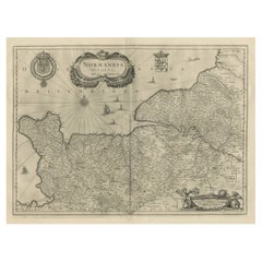
Antique Map of Normandy by Janssonius, 1657
Located in Langweer, NL
decorative cartouche, sailing ships and compass rose. This map originates from 'Atlas Novus, Sive Theatrum
Category
Antique 17th Century Maps
Materials
Paper
Antique Map of the North Sea and Dunkirk
Located in Langweer, NL
Untitled map of the North Sea, top left a large compass rose, bottom right Dunkirk (Duinkerke
Category
Antique Early 18th Century Maps
Materials
Paper
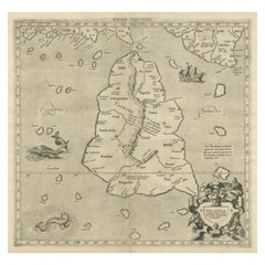
Mercator's Ptolemaic map of Taprobana, (Ceylon) Sri Lanka
Located in Langweer, NL
Antique map titled 'Asiae XII Tab'. Mercator's Ptolemaic map of Taprobana. The map shows Ptolemy's
Category
Antique 16th Century Maps
Materials
Paper
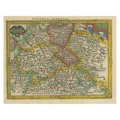
Small Original Antique Map of Upper Saxony, Germany
Located in Langweer, NL
constant compass bearing on a flat map.
Category
Antique Early 17th Century Maps
Materials
Paper
Large Antique Map of Delfland by Cruquius, 1712
Located in Langweer, NL
Map no. 20 of a large wall map of Delfland, The Netherlands. The map covers the region of Pijnacker
Category
Antique 18th Century Maps
Materials
Paper
Antique Map of Groningen with Contemporary Hand Coloring
Located in Langweer, NL
Antique map titled 'Tabulae dominii Groeningae quae et complecititur maximam partem Dreniae
Category
Antique Late 17th Century Maps
Materials
Paper
Antique Map of Greece by Allard (c.1698)
Located in Langweer, NL
Antique map titled 'Hellas seu Graecia Universa' Detailed map of Greece, with Crete, the Aegean
Category
Antique Late 17th Century Maps
Materials
Paper
Antique Map of Trincomalee and Tambalagam Bay, 1758
Located in Langweer, NL
Antique map titled 'Bay de Trinquemale'. Map of Trincomalee and Tambalagam Bay in Sri Lanka. While
Category
Antique 18th Century Maps
Materials
Paper
Antique Map of Prussia by Blaeu, circa 1635
By Willem Blaeu
Located in Langweer, NL
Antique map titled 'Prussiae Nova Tabula'. Rare early edition of Blaeu's map of Prussia
Category
Antique Mid-17th Century Maps
Materials
Paper
Antique Map of the Northwestern Coast of Spain
Located in Langweer, NL
Antique map titled 'Gallaecia Regnum'. Original old map of the northwestern coast of Spain
Category
Antique Mid-17th Century Maps
Materials
Paper
Antique Map of France by Tirion, c.1740
Located in Langweer, NL
Antique map titled 'Nieuwe Kaart van Frankryk.' - Attractive detailed map showing France. Title in
Category
Antique 18th Century Maps
Materials
Paper
Antique Map of the Philippines by Anson '1749'
Located in Langweer, NL
. Includes a large compass rose and rhumb lines. This map originates from 'Reize rondsom de Werreld (..)' by
Category
Antique Mid-18th Century Maps
Materials
Paper
Original Antique Map of the Duchy of Holstein
By Willem Blaeu
Located in Langweer, NL
Antique map titled 'Ducatus Holsatiae Nova Tabula'. Original old map of the Duchy of Holstein, the
Category
Antique Mid-17th Century Maps
Materials
Paper
Antique Map of the Region of the Arabian Sea
Located in Langweer, NL
, and major harbors. The map is decorated with a compass rose with fleur-de-lys at center and a rococo
Category
Antique Mid-18th Century Maps
Materials
Paper
Original Antique Map of England, Ireland, Scotland and Wales
Located in Langweer, NL
political and administrative divisions, landmarks and place names. Includes index and compass rose. This map
Category
Antique Early 18th Century Maps
Materials
Paper
Antique Map of Prussia by Blaeu, c.1680
Located in Langweer, NL
Antique map titled 'Prussiae nova Tabula'. Later edition of Blaeu's map of Prussia, embellished
Category
Antique 17th Century Maps
Materials
Paper
Antique Map of Java 'Indonesia' by Arkstee & Markus (1763)
Located in Langweer, NL
the island of Java, Indonesia. With cartouche, scale and compass rose. This map originates from
Category
Antique Mid-18th Century Maps
Materials
Paper
Antique Map of the World on Mercator's Projection, 1788
Located in Langweer, NL
Antique map titled 'Kaart van de Geheele Wereld (..)'. Uncommon small world map on Mercator's
Category
Antique Late 18th Century Maps
Materials
Paper
1726 Valentyn's Map of Bali and Lombok, Original Engraving
Located in Langweer, NL
. The presence of the compass rose indicates the orientations. The map is in good condition with visible
Category
Antique Early 18th Century Maps
Materials
Paper
Original Antique Map of Arabia and the Red Sea
Located in Langweer, NL
far north. This map is more elaborately decorated with a flourishing title cartouche and a compass
Category
Antique Mid-18th Century Maps
Materials
Paper
Antique Map of part of Central and Southern Asia
Located in Langweer, NL
Antique map titled 'Carte de la Partie Superieure de l'Inde en deca du Gange. Comprise entre la
Category
Antique Late 18th Century Maps
Materials
Paper
Antique Map of England by Mercator/Hondius, circa 1600
Located in Langweer, NL
Antique map titled 'Westmorlandia, Lancastria, Caernvan, Denbigh, Flint, Merionidh, Dalopia cum
Category
Antique 16th Century Maps
Materials
Paper
Two Charts of The English Channel, Each Adorned with Nice Compass Roses, ca.1700
Located in Langweer, NL
Antique map titled 'Hydrographia Canalis Marini Inter Angliam et Galiiam de Fluentis.'
Sheet
Category
Antique Early 1700s Maps
Materials
Paper
H 10.63 in W 8.08 in D 0 in
Antique Map of Herefordshire 'England' by R. Morden, 1708
Located in Langweer, NL
This antique County map of Herefordshire by Robert Morden was first published in 1701 in a work
Category
Antique Early 18th Century Maps
Materials
Paper
Antique Map of the Holy Land by Schut, 1710
Located in Langweer, NL
Antique map of the Holy Land titled 'Het Beloofde Landt Canaan.' Very detailed and decorative map
Category
Antique 18th Century Maps
Materials
Paper
Antique Map of Northern Brazil by Bonne, c.1780
Located in Langweer, NL
Antique map titled 'Carte de la Partie Septentrionale du Bresil.' Detailed map of the northern
Category
Antique 18th Century Maps
Materials
Paper
Antique Map of Switzerland by N. Visscher, circa 1690
Located in Langweer, NL
Beautifully detailed map of Switzerland and surrounding regions in present-day France, Germany, and
Category
Antique Late 17th Century Maps
Materials
Paper
Antique Map of Northern Europe by Bonne, c.1780
Located in Langweer, NL
Antique map titled 'Le Nord de L'Europe, Contenant Le Danemark, La Norwege; La Suede et La Laponie
Category
Antique 18th Century Maps
Materials
Paper
Antique Map of Southern Norway by Janssonius, c.1650
Located in Langweer, NL
"Antique map titled 'Nova et Accurata Tabula Episcopatuum Stavangriensis et Asloiensis'. Old map of
Category
Antique 17th Century Maps
Materials
Paper
Original Antique Map of the Cape Verde Islands, 1746
Located in Langweer, NL
Antique map titled 'Carte Des Isles Du Cap Verd.' Original antique map of the Cape Verde Islands
Category
Antique 18th Century Maps
Materials
Paper
Small Original Antique Map of the Lower Alsace region, Germany
Located in Langweer, NL
Projection, a system which allowed navigators to plot the same constant compass bearing on a flat map.
Category
Antique Early 17th Century Maps
Materials
Paper
Road Map, John Ogilby, No 54, London, Yarmouth, Britannia
By John Ogilby
Located in BUNGAY, SUFFOLK
-sixth year, as a publisher of maps and geographical accounts.
Ogilby was born outside Dundee, in
Category
Antique 1670s English Baroque Maps
Materials
Paper
Original Antique Hand-Colored Map of Southern Scotland, ca.1600
Located in Langweer, NL
constant compass bearing on a flat map.
Condition: Good, original/contemporary hand coloring. General
Category
Antique Early 1600s Maps
Materials
Paper
Original Antique Map of the Road from London to Bensington
Located in Langweer, NL
road from London to Bensington. The map is ornamented with numerous compass roses, and a decorative
Category
Antique Late 17th Century Maps
Materials
Paper
Antique Map of the Region of Batavia by Conrade, 1782
Located in Langweer, NL
Antique map titled 'Carte des environs de Batavia.' (Map of Batavia and its surroundings.) Map of
Category
Antique 18th Century Maps
Materials
Paper
Antique Map of the Island of Java by Conrade, 1782
Located in Langweer, NL
Antique map titled 'Nouvelle Carte de l' Isle de Java.' (New Map of Java.) This very detailed map
Category
Antique 18th Century Maps
Materials
Paper
Original Antique Map of the Road from Marlborough to Huntspil
Located in Langweer, NL
Antique map titled 'The Continuation of the Road from London to Bristol (..)'. A strip map of the
Category
Antique Late 17th Century Maps
Materials
Paper
Antique Map of the Province of Groningen by Blaeu, 1635
Located in Langweer, NL
Antique map titled 'Groninga Dominium.' A map of the Dutch province Groningen. This includes the
Category
Antique 17th Century Maps
Materials
Paper
Antique Map of the City of Leeuwarden by Bast, 1603
Located in Langweer, NL
Antique map titled 'Leeuwerden de hooft stadt van Frislant. Leoverdia Metropolis Frisiae (…) 1603
Category
Antique 17th Century Maps
Materials
Paper
Antique Map of the Low Countries by Seutter, c.1745
Located in Langweer, NL
map of the Low Countries. Includes colored decorative cartouche, compass rose and coat of arms. Shows
Category
Antique 18th Century Maps
Materials
Paper
Antique Plan of the City of Grave in Holland With Coats of Arms and Compass Rose
By Isaak Tirion
Located in Langweer, NL
Antique map titled 'Grondtekening der Stad Graave'. Plan of Grave, The Netherlands. With coats of
Category
Antique 18th Century Maps
Materials
Paper
H 7.6 in W 9.38 in D 0 in
Antique Map of Italy, Corsica, Sardinia and Sicily, ca.1780
Located in Langweer, NL
Description: Antique map titled 'L'Italie.'
Map of Italy, Corsica, Sardinia and Sicily. Highly
Category
Antique 1780s Maps
Materials
Paper
Antique Map of Northern Europe and European Russia, ca.1780
Located in Langweer, NL
Antique map titled 'Le Nord de L'Europe, Contenant Le Danemark, La Norwege; La Suede et La Laponie
Category
Antique 1780s Maps
Materials
Paper
Antique Map of Spain and Portugal by Tirion, c.1760
Located in Langweer, NL
Antique map titled 'Nieuwe Kaart van Spanje en Portugal.' Attractive detailed map showing Spain and
Category
Antique 18th Century Maps
Materials
Paper
Antique Map of the City of Enkhuizen by Tirion, 1743
Located in Langweer, NL
Antique map titled ?Grondtekening der Stad Enkhuisen?. Beautiful map of the City of Enkhuizen. With
Category
Antique 18th Century Maps
Materials
Paper
Stunning Large Scale Antique Map of Martinique, Rare, Published 1758
Located in Langweer, NL
Antique map titled 'Carte Reduite de l'Isle de la Martinique Dressee au Depost des Cartes Plans et
Category
Antique 18th Century Maps
Materials
Paper
Antique Map of Peru in South America by Blaeu, circa 1645
Located in Langweer, NL
Antique map titled 'Peru'. Original antique map of Peru. With cartouche, compass rose, ships and
Category
Antique Mid-17th Century Maps
Materials
Paper
Antique Map of Sri Lanka with an unusual five-sided shape
Located in Langweer, NL
Antique map titled 'Ins. Ceilan quae incolis Tenarisin dicitur'. This exquisite, early map of Sri
Category
Antique Early 17th Century Maps
Materials
Paper
Original Antique Map of Juan Fernandez by Van Schley, 1757
Located in Langweer, NL
adorned with a decorative title cartouche and a compass rose with fleur-de-lys. The map was based on
Category
Antique 18th Century Maps
Materials
Paper
Detailed Antique Map of the Black Sea, Balkans and Asia Minor
Located in Langweer, NL
detailed map of the Black Sea, Balkans, and Asia Minor. It is embellished with a simple compass rose and
Category
Antique Mid-18th Century Maps
Materials
Paper
Antique Map of Israel Filled with Biblical Scenes, Published in 1748
Located in Langweer, NL
Christo neffens zyne Apostelen'.
Antique map of Israel filled with biblical scenes. A compass rose
Category
Antique 1740s Maps
Materials
Paper
Antique Map of the Maluku Islands by Van der Aa, 1714
By Pieter Van Der Aa
Located in Langweer, NL
Antique Map Moluccas titled 'Les Isles Moluques'. Rare map of the Spice Islands made after a map
Category
Antique 18th Century Maps
Materials
Paper
Beautiful Original Copper Engraved Map of Lake Geneva in Switzerland, 1613
Located in Langweer, NL
Description: Antique map titled 'Lacus Lemanus'.
Old map of Lake Geneva with good detail of
Category
Antique 1610s Maps
Materials
Paper
Beautiful Antique Map of Madagascar, The Comoros Islands & Reunion Island, 1667
Located in Langweer, NL
Antique map titled 'Isle d'Auphine, communement Nommée par les Europeens Madagascar, et St. Laurens
Category
Antique 1660s Maps
Materials
Paper
H 22.64 in W 18 in D 0 in
Antique Map of the Region of Amsterdam by Wagenaar, c.1760
Located in Langweer, NL
Netherlands around 1750. With compass rose and scale. This map originates from: 'Amsterdam, In Zyne Opkomst
Category
Antique 18th Century Maps
Materials
Paper
Authentic 1644 Janssonius Map of the Champagne Region (Campania) in France
Located in Langweer, NL
"1644 Janssonius Map of Champagne, France"
This meticulously detailed original antique map
Category
Antique 1640s Maps
Materials
Paper
Free Shipping
H 21.86 in W 25.99 in D 0 in
- 1
Get Updated with New Arrivals
Save "Compass Map", and we’ll notify you when there are new listings in this category.
Compass Map For Sale on 1stDibs
At 1stDibs, there are many versions of the ideal compass map for your home. Each compass map for sale was constructed with extraordinary care, often using paper, glass and wood. There are many kinds of the compass map you’re looking for, from those produced as long ago as the 18th Century to those made as recently as the 20th Century. Each compass map bearing Art Nouveau hallmarks is very popular. You’ll likely find more than one compass map that is appealing in its simplicity, but J.C. Vickery produced versions that are worth a look.
How Much is a Compass Map?
The average selling price for a compass map at 1stDibs is $1,212, while they’re typically $278 on the low end and $4,083 for the highest priced.
More Ways To Browse
Antique Sri Lanka Map
Peru Map
Antique Map Of Israel
Antique Maps Of Israel
Antique Map Poland
Antique Map Sicily
Antique Sicily Map
Study Of Two German Shepherd
Framed Africa Maps
Nautical Map Vintage
Nautical Vintage Maps
Vintage Map Co
Framed Map Asia
Antique Army Compass
Antique Furniture Leicestershire
Map Of Jamaica
Antique African Wooden Sculptures
Pirate Sculpture
