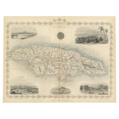
Map Of Jamaica
An Ornate and Historical Tallis Map of Jamaica with Decorative Vignettes, 1851
Located in Langweer, NL
This original antique map of Jamaica is part of the renowned series created by the Tallis Company
Category
Antique 1850s Maps
Materials
Paper
H 10.71 in W 14.26 in D 0 in
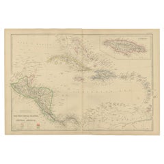
Antique Map of the West Indies and Central America by W. G. Blackie, 1859
Located in Langweer, NL
Indies and Central America, with inset map of Jamaica. This map originates from ‘The Imperial Atlas of
Category
Antique Mid-19th Century Maps
Materials
Paper
H 14.57 in W 21.26 in D 0.02 in
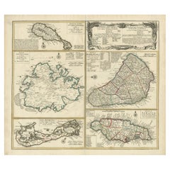
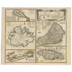
Original Old Map of St Kitts, Antigua, Bermuda, Barbados, and Jamaica, ca.1745
Located in Langweer, NL
Antique map titled 'Dominia Anglorum in praecipuis Insulis Americae ut sunt Insula S. Christophori
Category
Antique 1740s Maps
Materials
Paper
Free Shipping
H 21.26 in W 24.22 in D 0 in
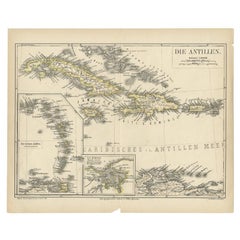
Antique Map of the Antilles by Meyer, 1878
Located in Langweer, NL
Antique map titled 'Die Antillen'. Old map of the Antilles, it shows Jamaica, Puerto Rico, the
Category
Antique 19th Century Maps
Materials
Paper
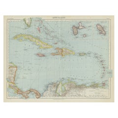
Vintage Map of the Greater Antilles and Lesser Antilles
Located in Langweer, NL
Vintage map titled 'Antilles'. Original map of the Antilles. Shows the Cayman Islands, Cuba
Category
20th Century Maps
Materials
Paper
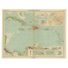
Antique Map of the West Indies in Full Color, 1922
Located in Langweer, NL
, Trinidad, Puerto Rico and Jamaica. Plate 96 from 'The Times Atlas'. Maps from the Edinburgh Geographical
Category
20th Century Maps
Materials
Paper
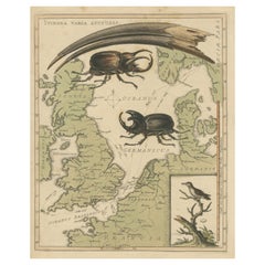
Interesting Map of Great Britain and Northern Europe with various Illustrations
Located in Langweer, NL
beetles from Borneo and in lower right the Least Hummingbird of Jamaica.
This fascinating map was
Category
Antique Mid-18th Century Maps
Materials
Paper
H 11.23 in W 8.9 in D 0.02 in
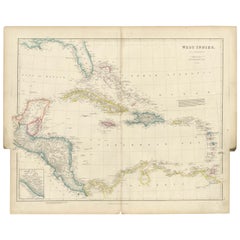
Original Antique Map of the West Indies by J. Arrowsmith, 1842
Located in Langweer, NL
Title: "J. Arrowsmith's 19th Century Map of the West Indies"
This original antique map, crafted by
Category
Antique Early 19th Century Maps
Materials
Paper
No Reserve
H 20.87 in W 27.17 in D 0 in
Old 18th Century Composite Map of Key Caribbean Islands with Descriptive Texts
Located in Langweer, NL
Antique map titled 'Dominia Anglorum in praecipuis Insulis Americae ut sunt Insula S. Christophori
Category
Antique 1740s Maps
Materials
Paper
Free Shipping
H 21.26 in W 24.22 in D 0 in
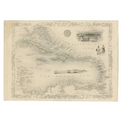
Engraving by Tallis and Rapkin of Map of the West Indies in The Caribbean, 1851
Located in Langweer, NL
John Tallis' 1851 map of the West Indies stands as a striking example of his renowned cartographic
Category
Antique Mid-19th Century Maps
Materials
Paper
H 10.44 in W 14.57 in D 0 in
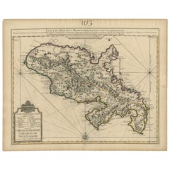
Antique Map of Martinique, Showing Roads, Houses, Sugar Plantations, etc. c.1750
Located in Langweer, NL
Antique map titled 'Carte de l'Isle de la Martinique'.
Detailed map of Martinique. Shows hilly
Category
Antique 18th Century Maps
Materials
Paper
H 25.79 in W 20.67 in D 0 in
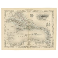
Ornate Cartography of Colonial Grandeur: The West India Islands around 1851
Located in Langweer, NL
but also historical artifacts and works of art.
The map includes islands such as Cuba, Jamaica
Category
Antique 1850s Maps
Materials
Paper
No Reserve
H 10.71 in W 14.26 in D 0 in
North America: A Framed Hand-colored 19th Century German Map by Adolph Stieler
By Adolf Stieler
Located in Alamo, CA
and The Osage District. The map does include Canada, Mexico, Central America, Cuba, Jamaica, Haiti
Category
1830s Landscape Prints
Materials
Engraving
H 19.5 in W 22 in D 0.88 in
Kincaid's Plait Bracelet, Handmade Wild Tamarind Seedwork
Located in Oxford, MD
Jamaica Kincaid is a world-renowned Antiguan-American novelist born in St. John's, Antigua, living
Category
21st Century and Contemporary Antiguan Artisan Beaded Bracelets
A truly delightful miniature terrestrial pocket globe
By Nathaniel Mills
Located in ZWIJNDRECHT, NL
turning overhead. In line with its counterpart, the terrestrial globe, celestial globes are mapped by a
Category
Antique Mid-18th Century British Dutch Colonial Globes
Materials
Other
"Stag Beetle & Longicorn Beetle, " Original Color Lithograph by Louis Prang
By Louis Prang
Located in Milwaukee, WI
materials. The firm became quite successful, and became known for war maps, printed during the American
Category
1880s Academic Animal Prints
Materials
Lithograph
People Also Browsed
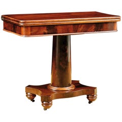
Antique American Empire Card/ Games Table in West Indies Mahogany with Pedestal
Located in Miami, FL
An American Empire games or card table with cylinder column resting on quatre-form base terminating with turned feet on casters. Swivel-top opens to a square with storage compartment...
Category
Antique 1830s American American Empire Game Tables
Materials
Mahogany
H 30 in W 36 in D 17 in
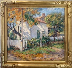
Sunlight and Shadow, White House, American Impressionist Landscape
By Albert Van Nesse Greene
Located in Doylestown, PA
"Sunlight and Shadow, The White House" is an Impressionist landscape by American painter Albert Van Nesse Greene. The painting is a 28" x 30.25" oil on canvas, framed, and signed in ...
Category
Early 20th Century American Impressionist Landscape Paintings
Materials
Oil, Canvas
Antique Map of Cuba, Haiti and Porto Rico by W. G. Blackie, 1859
Located in Langweer, NL
Antique map titled 'The Leeward or North Caribbean Islands'. Original antique map of Cuba, Haiti and Porto Rico. This map originates from ‘The Imperial Atlas of Modern Geography’. Pu...
Category
Antique Mid-19th Century Maps
Materials
Paper
Albert Leon Wilson Signed Mid-Century Modern Abstract Owl Bird Buckle Sculpture
By Albert Leon Wilson
Located in Studio City, CA
A fantastic, quite whimsical, engaging Mid-century Modern abstract owl/bird sculpture/belt buckle by New York artist Albert Leon Wilson.
Wilson was born in 1920 in Jamaica, New Yo...
Category
Vintage 1960s American Mid-Century Modern Figurative Sculptures
Materials
Metal, Iron
H 4.5 in W 3.25 in D 2 in
"Beverly Hills Hotel" Photography 30" x 40" inch Edition of 5 by Oleg Char
Located in Culver City, CA
"Beverly Hills Hotel" Photography 30" x 40" inch Edition of 5 by Oleg Char
Medium: Hahnemühle Baryta Paper
Not framed. Ships in a tube.
Other sizes available:
Edition of 5: 28.8...
Category
21st Century and Contemporary Contemporary Black and White Photography
Materials
Digital
H 30 in W 40 in D 0.1 in
Original Engraving of the West Indies, Gulf of Mexico, Antilles, Caribbean, 1780
Located in Langweer, NL
Rigobert Bonne and G. Raynal's 1780 map of the West Indies, Gulf of Mexico, Antilles, and the Caribbean stands as a remarkable cartographic piece, offering a detailed and expansive v...
Category
Antique Late 18th Century Maps
Materials
Paper
H 9.85 in W 15.16 in D 0 in
Antique Merriman Nautical Maritime Sailboat Boat Ship Winch Copper Wood Handle
Located in Dayton, OH
Antique sailboat winch by Merriman Brothers. Made of copper with wooden handle. Marked with Merriman's trident logo.
The MERRIMAN Bros. Inc. was founded in 1898, and published catal...
Category
Early 20th Century American Nautical Objects
Materials
Copper
H 5.5 in W 8 in D 3 in
"Jamaican Scene 03.30.2021" contemporary abstract landscape oil painting, framed
By Nelson H. White
Located in Sag Harbor, NY
"Jamaican Scene 03.30.2021" by Nelson H. White, is an abstraction of a landscape in Jamaica. One can see the suggestion of natural light peeking through the loose rendering of trees....
Category
21st Century and Contemporary American Impressionist Landscape Paintings
Materials
Oil, Panel
'Caribbean Balcony', Post Impressionist Oil Still Life, Jamaica, West Indies
By Lloyd Van Pitterson
Located in Santa Cruz, CA
Signed lower right, 'Van Pitterson' for Lloyd H. Van Pitterson (Jamaican, 1926-1997) and created circa 1985. Additionally, inscribed, verso, 'Pink Balcony'.
Born in Jamaica in the W...
Category
Late 20th Century Post-Impressionist Interior Paintings
Materials
Acrylic, Canvas
The Conversation, American Impressionist Landscape with Figures, Oil on Canvas
By Albert Van Nesse Greene
Located in Doylestown, PA
"The Conversation" is an American Regional town scene and landscape in Pennsylvania by American Impressionist painter Albert Van Nesse Greene.
The painting is a 10" x 12.5" oil on c...
Category
Early 20th Century American Impressionist Landscape Paintings
Materials
Canvas, Oil, Board
Original Antique Map of the Island of Dominica in the West Indies, 1794
Located in Langweer, NL
MAP OF THE ISLAND OF DOMINICA for the History of the West Indies, by Bryan Edwards. Esq.
Dominica, an island renowned for its lucrative exports of sugar, cocoa, and coffee, operated...
Category
Antique 1790s Maps
Materials
Paper
Benton, The Gaze (Dorothy Canfield Fisher) monoprint with Chine collé, Feminist
By Suzanne Benton
Located in Darien, CT
Pioneer Activists is an ongoing series of artworks by Suzanne Benton. Consisting largely of monoprints with Chine collé where the artist references suffragists, feminists, writers an...
Category
1990s Feminist Portrait Prints
Materials
Silver
Old Swede's Church in Winter, Philadelphia City Scene, American Impressionist
By Albert Van Nesse Greene
Located in Doylestown, PA
"Old Swede's Church in Winter" is an American Regional city scene in Philadelphia, Pennsylvania by American Impressionist painter Albert Van Nesse Greene.
The painting is a 20" x 24...
Category
Early 20th Century American Impressionist Landscape Paintings
Materials
Canvas, Oil
Brenet, Original Vintage Poster, CGT, Antilles, Jamaica Venezuela Colombia 1955
By Albert Brenet
Located in SAINT-OUEN-SUR-SEINE, FR
This poster was produced to promote tourism in Central America, particularly in Colombia, Venezuela, Jamaica and Antilles, via cruises by the Compagnie Générale Transatlantique.
Ar...
Category
20th Century French Mid-Century Modern Posters
Materials
Paper
Free Shipping
H 22.96 in W 15.67 in D 0.4 in
Authentique Map by Pilon of The French Colonies in The West Indies, 1876
Located in Langweer, NL
The 1876 map titled "Carte des Colonies Françaises aux Antilles" represents a significant contribution to cartography within the "Grand Atlas Départemental de la France de L'Algérie ...
Category
Antique Late 19th Century Maps
Materials
Paper
H 14.38 in W 16.54 in D 0 in
American Federal Drop Leaf Dining Table in West Indies Mahogany New York, c 1820
Located in Miami, FL
A handsome American Federal or Empire Pembroke table in fine West Indies mahogany with two drop leaves. This period breakfast table is supported by a reeded, vase-turned column on a ...
Category
Antique Early 19th Century American Federal Drop-leaf and Pembroke Tables
Materials
Brass
H 28.5 in W 42 in D 22.75 in
Recent Sales
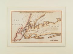
Sketch of the Country Illustrating the late Engagement in Long Island.
Located in New York, NY
Beautiful hand-colored map fold out map from the October 1776 issue of "The Gentleman's Magazine
Category
1770s Realist Landscape Prints
Materials
Engraving
Sea chart of Santa Domingo and its surroundings - Engraving - 18th century
Located in Zeeland, Noord-Brabant
pour servir aux Vaisseaux du Roy [...]' - (Reduced map of the island of Santa Domingo and surroundings
Category
1750s Old Masters More Prints
Materials
Engraving
West Indies, 1606
By Gerard Mercator
Located in Houston, TX
, Hispaniola, Jamaica, Puerto Rica, and Margarita, embellished with strapwork title cartouches, an inset plan
Category
Antique Early 1600s Belgian Prints
Bye Felicia
By Cosmo Whyte
Located in Atlanta, GA
. Cosmo Whyte was born in St. Andrew, Jamaica in 1982. The Jamaican born artist attended Bennington
Category
2010s Contemporary Figurative Drawings and Watercolors
Materials
Gold Leaf
Large Nautical Map of New York Entrance, 1870
Located in Haddonfield, NJ
Large rectangular nautical map of the New York Entrance, 1857.
Sandy Hook Bay, Coney Island
Category
Antique 19th Century American Nautical Objects
Gulf of Mexico, Florida, C. America, Cuba: 18th C. Hand-colored Map by Bellin
By Jacques-Nicolas Bellin
Located in Alamo, CA
This beautiful 18th century hand-colored map entitled "Carte du Golphe du Mexique et des Isles de
Category
1750s Landscape Prints
Materials
Engraving
Original Vintage Poster KLM Air Travel West Indies Caribbean Islands Route Map
Located in London, GB
featuring a map of the Caribbean islands and the Atlantic Ocean Caribbean Sea Gulf of Mexico and Pacific
Category
Vintage 1950s Trinidadian Posters
Materials
Paper
H 20.87 in W 30.71 in D 0.04 in
Original Vintage London Underground Poster Visit The Empire Map Tube Travel Art
Located in London, GB
Dinkel (1894-1983) showing a map marking the British Empire islands and areas in North America and South
Category
Vintage 1930s British Posters
Materials
Paper
H 39.77 in W 25.01 in D 0.04 in
Original Vintage Pacific Line Cruise Ship Poster Sunshine Route to South America
Located in London, GB
Bermuda Bahamas Havana Jamaica Panama Canal - The Pacific Steam Navigation Co., Liverpool or principal
Category
Vintage 1930s British Posters
Materials
Paper
H 40.16 in W 25.01 in D 0.04 in
Original Vintage Poster Brasil Africa Reise Cruise Travel Hamburg Sud Windrush
By Ottomar Anton
Located in London, GB
sea on an orange shaded background with a route map showing the stops from Europe and Africa across
Category
Vintage 1930s German Art Deco Posters
Materials
Paper
H 23.63 in W 33.08 in D 0.04 in
Antique Map of Jamaica with Decorative Vignettes
Located in Langweer, NL
Antique map titled 'Jamaica'. Includes decorative vignettes of Kingston, Port Antonio, Port Royal
Category
Antique Mid-19th Century Maps
Materials
Paper
Highly Detailed Antique Map of Jamaica in the Caribbean, c.1780
Located in Langweer, NL
Antique map titled 'Carte de l'Isle de la Jamaique.'
Highly detailed map of Jamaica, showing
Category
Antique 18th Century Maps
Materials
Paper
Free Shipping
H 14.97 in W 10.24 in D 0 in
Antique Map of the West Indies by A & C, Black, 1870
Located in Langweer, NL
an inset map of Jamaica. This map originates from ‘Black's General Atlas of The World’. Published by
Category
Antique Late 19th Century Maps
Materials
Paper
Antique Map of the Island of Jamaica by Bellin, '1758'
Located in Langweer, NL
Antique map titled 'Carte de l'Isle de la Jamaique'. Original antique map of the island of Jamaica
Category
Antique Mid-18th Century Maps
Materials
Paper
Original Antique Decorative Map of Bermuda & Jamaica, Fullarton, C.1870
Located in St Annes, Lancashire
Great map of Bermuda and Jamaica
Wonderful figural border
From the celebrated Royal
Category
Antique 1870s Scottish Maps
Materials
Paper
No Reserve
H 18.5 in W 12.5 in D 0.07 in
Antique Map of the Island of Jamaica by G.H. Swanston, 1860
Located in Langweer, NL
This map was published in London, for his Royal Illustrated Atlas. Parishes, mountains, rivers
Category
Antique Mid-19th Century Maps
Stunning Map of Caribbean Islands, Incl Jamaica, Bermuda, Barbados and St. Kitts
By Homann Heirs
Located in Langweer, NL
. Kitts, Antigua, Bermuda, Barbados and Jamaica. All these maps were copied from separate maps made by
Category
Antique Mid-18th Century Maps
Materials
Paper
H 19.89 in W 23.23 in D 0.02 in
Antique Map of Cuba, Haïti, Jamaica, Puerto Rico and St Margareta, Havanna, 1630
Located in Langweer, NL
(one below the other on 1 sheet), with 3 small additional maps (Jamaica, St. John and S. Margarete) and
Category
Antique 1630s Maps
Materials
Paper
H 18.51 in W 22.45 in D 0 in
Antique Map of the West Indies, with Frame Style Border
Located in Langweer, NL
Antique map titled 'Antilles ou Indes Occidentales'. Attractive map of the West Indies. Covers from
Category
Antique Mid-19th Century Maps
Materials
Paper
Antique Map of British Possessions in the Caribbean by Homann Heirs 'circa 1740'
Located in Langweer, NL
-Laender auf den Insuln von America (..)'. Five maps on one sheet (Barbados, Bermuda, Jamaica, Antigua and
Category
Antique Mid-18th Century Maps
Materials
Paper
H 21.07 in W 24.81 in D 0.02 in
Gulf of Mexico, Florida, C. America, Cuba, etc.: 18th C. Hand-colored Bellin Map
By Jacques-Nicolas Bellin
Located in Alamo, CA
This beautiful 18th century hand-colored map entitled "Carte du Golphe du Mexique et des Isles de
Category
Antique Mid-18th Century French Maps
Materials
Paper
H 12.63 in W 18 in D 0.13 in
Original Vintage Poster West Indies Pan American Airways Educational Travel Map
Located in London, GB
Original vintage poster featuring a colorful pictorial map of the West Indies showing the different
Category
Vintage 1950s American Posters
Materials
Paper
H 20.87 in W 25.99 in D 0.04 in
"Holothurians and Sea Star, " Original Color Lithograph by Louis Prang
By Louis Prang
Located in Milwaukee, WI
materials. The firm became quite successful, and became known for war maps, printed during the American
Category
1880s Academic Animal Prints
Materials
Lithograph
"Cicadae, Lantern Fly, Etc., " original color lithograph by Louis Prang
By Louis Prang
Located in Milwaukee, WI
materials. The firm became quite successful, and became known for war maps, printed during the American
Category
1880s Academic Animal Prints
Materials
Lithograph
"Hermit-Crabs, " Original Color Lithograph Seafloor Print by Louis Prang
By Louis Prang
Located in Milwaukee, WI
materials. The firm became quite successful, and became known for war maps, printed during the American
Category
1880s Academic Animal Prints
Materials
Lithograph
Original Vintage Poster West Indies Pan American Airways Educational Travel Map
Located in London, GB
Original vintage poster featuring a colourful pictorial map of the West Indies showing the
Category
1950s More Prints
Materials
Paper
Original Vintage London Underground Poster Visit The Empire Map Tube Travel Art
Located in London, GB
Dinkel (1894-1983) showing a map marking the British Empire islands and areas in North America and South
Category
1930s More Prints
Materials
Paper
Original Pacific Line Cruise Ship Poster - The Sunshine Route To South America
Located in London, GB
Bermuda Bahamas Havana Jamaica Panama Canal - The Pacific Steam Navigation Co., Liverpool or principal
Category
1930s More Prints
Materials
Paper
Original Vintage Poster Brasil Africa Reise Cruise Travel Hamburg Sud Windrush
By Ottomar Anton
Located in London, GB
sea on an orange shaded background with a route map showing the stops from Europe and Africa across
Category
1930s Art Deco More Prints
Materials
Paper
Original Vintage Poster KLM Air Travel West Indies Caribbean Islands Route Map
By Baker
Located in London, GB
featuring a map of the Caribbean islands and the Atlantic Ocean Caribbean Sea Gulf of Mexico and Pacific
Category
1950s More Prints
Materials
Paper
J.H. Colton & Co. Hand Colored Engraved Map of Cuba, Jamaica, & Puerto Rico
By J.H. Colton
Located in Atlanta, GA
19th century circa 1850s hand colored engraved map of Cuba, Jamaica, and Puerto Rico, Published by
Category
Antique 19th Century American Maps
Materials
Paper
H 14 in W 16.75 in L 14 in
Danckerts Map of Florida, the West Indies and the Caribbean.
Located in Coral Gables, FL
A stunning example of Cornelius Danckerts' important 1696 map of Florida, the West Indies, Central
Category
Antique 18th Century and Earlier Dutch Maps
Scar Tissue
By Cosmo Whyte
Located in Atlanta, GA
. Cosmo Whyte was born in St. Andrew, Jamaica in 1982. The Jamaican born artist attended Bennington
Category
2010s Contemporary Figurative Drawings and Watercolors
Materials
Gold Leaf
Map of Neuve Castille
By Alain Manesson Mallet
Located in New York, NY
Published in 1685 this hand-colored map was created by Alain Manesson Mallet. Also shows Puerto
Category
18th Century and Earlier Realist More Prints
Materials
Engraving
Get Updated with New Arrivals
Save "Map Of Jamaica", and we’ll notify you when there are new listings in this category.
Map Of Jamaica For Sale on 1stDibs
Find many varieties of an authentic map of jamaica available at 1stDibs. A map of jamaica — often made from paper — can elevate any home. You’ve searched high and low for the perfect map of jamaica — we have versions that date back to the 18th Century alongside those produced as recently as the 20th Century are available. A map of jamaica is a generally popular piece of furniture, but those created in Art Deco styles are sought with frequency. You’ll likely find more than one map of jamaica that is appealing in its simplicity, but Ottomar Anton, Jacques-Nicolas Bellin and Homann Heirs produced versions that are worth a look.
How Much is a Map Of Jamaica?
Prices for a map of jamaica start at $55 and top out at $5,212 with the average selling for $865.
More Ways To Browse
Antique Maps Of New Jersey
Antique Map Of New Jersey
Map San Francisco
Map Of San Francisco
South Pacific Map
Atlas Key
Denis Leon
Antique Map Of The West Indies
Vintage Original Posters Coffee
Mediterranean Sea Map
Jamaican Cuban
Antique Map San Francisco
Antique Maps San Francisco
Antique Louisiana Map
Antique Maps Of Louisiana
Montego Bay
Jean Prevost
Antique Maps Caribbean Islands
