Atlas Key
13
201
1
to
19
111
91
202
202
202
53
10
1
1
1
43
53
105
1
8
51
8
3
1
1
1
9
9
1
93
91
89
20
18
93
93
93
93
14
83
2
1
1
1
Sort By
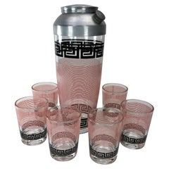
Vintage Mid Century Greek Key Hazel-Atlas Cocktail Set
By Hazel-Atlas
Located in Chapel Hill, NC
Vintage Art Deco Hazel Atlas Cocktail Set. Large cocktail shaker with matching six cocktail glasses
Category
Mid-20th Century American Mid-Century Modern Barware
Materials
Chrome
Bronze Sculptured Statue of an Atlas - European Woodwork from 1960's
Located in Lisboa, PT
and sculpture throughout history. Here are some key points in the history of Atlas sculptures
Category
Mid-20th Century European Figurative Sculptures
Materials
Wood
H 36.82 in W 32.68 in D 19.69 in
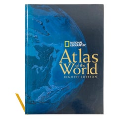
National Geographic Atlas of the World, Eighth Edition Hardcover Book
Located in North Hollywood, CA
visual key with corresponding plate numbers to all the maps. Every map spread in the atlas will include
Category
Early 2000s Maltese Mid-Century Modern Books
Materials
Paper
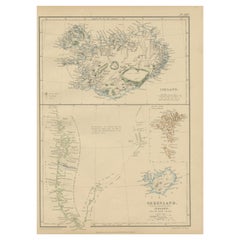
1859 Antique Arctic Vista: Greenland, Iceland and Faroe Islands, Blackie's Atlas
Located in Langweer, NL
from 'The Imperial Atlas of Modern Geography', published by W. G. Blackie in 1859. This map provides a
Category
Antique Mid-19th Century Maps
Materials
Paper
H 14.57 in W 10.63 in D 0.02 in
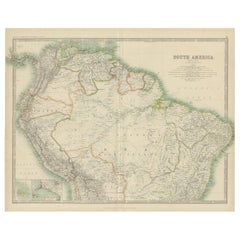
Exploring South America's North: Antique Map from the Royal Atlas of 1909
Located in Langweer, NL
Isles and Lima Callao. It is sourced from the 'Royal Atlas of Modern Geography,' which was published by
Category
Early 20th Century Maps
Materials
Paper
H 19.49 in W 24.41 in D 0.02 in
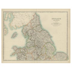
Original Antique Map of England and Wales from the 1909 Royal Atlas
Located in Langweer, NL
nations. This original antique map of England and Wales is sourced from the 'Royal Atlas of Modern
Category
Early 20th Century Maps
Materials
Paper
No Reserve
H 19.49 in W 24.41 in D 0.02 in
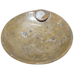
1 of 4 Decorative Moroccan Ammonite Atlas Mountains Fossil Bowls Marble Finish
Located in GB
We are delighted to offer for sale this very decorative original circa 180+ Million year old Atlas
Category
Antique 15th Century and Earlier Moroccan Other Natural Specimens
Materials
Marble
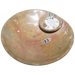
1 of 4 Lovely Moroccan Ammonite Atlas Mountains Fossil Bowls Marble Finish
Located in GB
We are delighted to offer this sublime original circa 180+ Million year old Atlas Mountains Morocco
Category
Antique 15th Century and Earlier Moroccan Other Natural Specimens
Materials
Marble
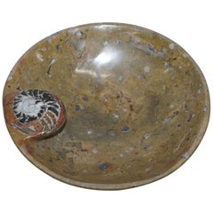
1 of 4 Sublime Moroccan Ammonite Atlas Mountains Fossil Bowls Marble Finish
Located in GB
We are delighted to offer for sale this lovely original circa 180+ Million year old Atlas Mountains
Category
Antique 15th Century and Earlier Moroccan Other Natural Specimens
Materials
Marble
1859 Denmark and Schleswig-Holstein Map: A Historical View from Blackie's Atlas
Located in Langweer, NL
The "Antique Map of Denmark with Schleswig & Holstein" from 'The Imperial Atlas of Modern Geography
Category
Antique Mid-19th Century Maps
Materials
Paper
H 14.57 in W 10.63 in D 0.02 in
1859 Detailed Map of North West Germany with Bavaria Inset - Blackie's Atlas
Located in Langweer, NL
'The Imperial Atlas of Modern Geography', published in 1859 by W. G. Blackie. This original antique map
Category
Antique Mid-19th Century Maps
Materials
Paper
H 21.26 in W 14.57 in D 0.02 in
1 of 4 Very Rare Moroccan Ammonite Atlas Mountains Fossil Bowls Marble Finish
Located in GB
We are delighted to offer this very rare original circa 180+ Million year old Atlas Mountains
Category
Antique 15th Century and Earlier Moroccan Other Natural Specimens
Materials
Marble
Old 18th Century Composite Map of Key Caribbean Islands with Descriptive Texts
Located in Langweer, NL
1702. Soon after publishing his first atlas in 1707 he became a member of the Berlin academy of
Category
Antique 1740s Maps
Materials
Paper
Free Shipping
H 21.26 in W 24.22 in D 0 in
1950s Italian Bar Cabinet with Dutch Maritime Oil Painting
Located in North Miami, FL
features a classical maritime oil painting with 17th Century Dutch vessels. Each of the original brass keys
Category
Vintage 1950s Italian Mid-Century Modern Dry Bars
Materials
Brass
Antique Map of Italy with Insets of Rome and Major Cities, Published in 1880
Located in Langweer, NL
from the "Spruner-Menke Atlas Antiquus," a historical atlas compiled by Karl Spruner von Merz, known
Category
Antique 1880s Maps
Materials
Paper
No Reserve
H 15.56 in W 18.51 in D 0 in
Historical Map of Canaan with Insets of Jerusalem and Surrounding Regions, 1880
Located in Langweer, NL
corresponds to modern-day Israel, Palestinian territories, Lebanon, and parts of Syria and Jordan.
Key
Category
Antique 1880s Maps
Materials
Paper
Free Shipping
H 15.56 in W 18.51 in D 0 in
The World in the Assyrian Empire's Era: A Historical Map, Published in 1880
Located in Langweer, NL
This map from the "Spruner-Menke Atlas Antiquus" is titled "ORBIS TERRARVM regni Assyrii tempore
Category
Antique 1880s Maps
Materials
Paper
Free Shipping
H 15.56 in W 18.51 in D 0 in
Roman Frontiers Engraved: Germania, Raetia, and Noricum, Published in 1880
Located in Langweer, NL
legend or key is provided, detailing the symbols used to represent cities, military sites, and other
Category
Antique 1880s Maps
Materials
Paper
No Reserve
H 15.56 in W 18.51 in D 0 in
L'isle De La Martinique Caribbean Copper Engraving Original Handcoloring, 1704
Located in Langweer, NL
Fer's Atlas Curieux, is a cartographic masterpiece offering an intricate portrayal of the island of
Category
Antique Late 19th Century Maps
Materials
Paper
H 10.63 in W 15.56 in D 0 in
Original Map of Greece at the Time of the Dorian Migration, Published in 1880
Located in Langweer, NL
cities and sanctuaries, which were key in the political, religious, and social life of Greece.
5
Category
Antique 1880s Maps
Materials
Paper
No Reserve
H 15.56 in W 18.51 in D 0 in
Map of Greece, Macedonia, Thrace from the time of the Peloponnesian War, 1880
Located in Langweer, NL
city-states.
2. **Inset Maps**: Detailed inset maps of key locations such as Macedonia, Marathon
Category
Antique 1880s Maps
Materials
Paper
No Reserve
H 15.56 in W 18.51 in D 0 in
Antique Plan of the City of Calcutta 'India' by Letts, 1883
Located in Langweer, NL
Beautiful colored plan showing buildings (with key), Fort William, race ground, canals, railroads
Category
Antique Late 19th Century Maps
Materials
Paper
Charting the Course of Empire: Bonne's 1770 Masterpiece Maps of the Indian Ocean
Located in Langweer, NL
the coveted Atlas Moderne circa 1770. Each map, a cartographic treasure, captures the intricate dance
Category
Antique 1770s Maps
Materials
Paper
Free Shipping
H 14.18 in W 20.28 in D 0 in
Italian 17th Century Walnut Credenza
Located in Troy, NY
carved moldings and center rosettes featuring brass pulls, flanked by Atlas and Caryatid figures, carved
Category
Antique 17th Century Italian Baroque Credenzas
Materials
Walnut
Empires of Antiquity: The Persian Realm and Beyond Engraved, Published in 1880
Located in Langweer, NL
. **Ancient Cities**: The map marks the locations of key cities such as Babylon, Susa, and Persepolis, which
Category
Antique 1880s Maps
Materials
Paper
Free Shipping
H 15.56 in W 18.51 in D 0 in
Ancient Italy: Regions and Rome in the Roman Empire, Published in 1880
Located in Langweer, NL
regions of ancient Italy.
Key Features of the Print:
1. **Regional Demarcations**: The map is divided
Category
Antique 1880s Maps
Materials
Paper
No Reserve
H 15.56 in W 18.51 in D 0 in
Antique Map of Silesia centered on Glogau
Located in Langweer, NL
especially ornate coat of arms and a key to the symbols used in the map. At bottom right is a fine scale of
Category
Antique Mid-17th Century Maps
Materials
Paper
Antique Map of The Kingdom of Alexander the Great, Published in 1880
Located in Langweer, NL
inset maps of significant battle sites and cities, like Halicarnassus and Tyre, reflecting key moments
Category
Antique 1880s Maps
Materials
Paper
Free Shipping
H 15.56 in W 18.51 in D 0 in
Original Old Bird's-Eye View Plan of Sint-Winoksbergen or Bergen in France, 1649
Located in Langweer, NL
key to locations and coats of arms. Text in Dutch on verso. This plan originates from the famous city
Category
Antique 1640s Maps
Materials
Paper
H 19.97 in W 23.75 in D 0 in
Antique Bird's-eye View Plan of Zierikzee in Zeeland, The Netherlands, 1649
Located in Langweer, NL
key to locations and coats of arms. After Matheo Rollando and Stephano Bellemo. Latin tekst on verso
Category
Antique 1640s Maps
Materials
Paper
H 21.46 in W 25.75 in D 0 in
Original Map with Bird's-Eye View of Zutphen in the Netherlands by Blaeu, 1649
Located in Langweer, NL
Antique print, titled: 'Zutphen.' - Bird's-eye view plan of Zutphen in The Netherlands, with key to
Category
Antique 1640s Maps
Materials
Paper
H 20.16 in W 23.78 in D 0 in
Original Antique Coloured Map of Western Africa, Published in 1882
Located in Langweer, NL
This is a map of Western Africa from the 1882 Blackie & Son atlas. The map details the West African
Category
Antique 1880s Maps
Materials
Paper
No Reserve
H 14.97 in W 22.45 in D 0 in
Original Antique Bird's Eye View Plan of Hoorn, The Netherlands by Blaeu, c.1700
Located in Langweer, NL
title cartouche, coats of arms and key. From an atlas published by De Wit, ca. 1698-1710 State: 2ns
Category
Antique Early 1700s Maps
Materials
Paper
H 17.92 in W 22.52 in D 0 in
Antique Map of Canada, The Province of Ontario and Part of Quebec, 1882
Located in Langweer, NL
This is a historical map from the 1882 Blackie Atlas, this time detailing "The Province of Ontario
Category
Antique 1880s Maps
Materials
Paper
Free Shipping
H 14.97 in W 22.45 in D 0 in
Antique Map Depicting Burma, Siam, Annam (Vietnam) and Japan, 1882
Located in Langweer, NL
The image shows two maps side by side from the 1882 atlas by Blackie & Son. On the left, the map is
Category
Antique 1880s Maps
Materials
Paper
Free Shipping
H 14.97 in W 22.45 in D 0 in
Antique Map of Northern Italy by Homann Heirs, c.1730
Located in Langweer, NL
, Mantua and Mirandol. Large title cartouche, key and scale. Source unknown, to be determined. Artists and
Category
Antique 18th Century Maps
Materials
Paper
Decorative Bird's-Eye View Plan of Ieper or Ypres in Belgium, 1649
Located in Langweer, NL
Antique print, titled: 'Ypra.'
Bird's-eye view plan of Ieper / Ypres in Belgium. With key to
Category
Antique 1640s Maps
Materials
Paper
Stunning Bird's-Eye View Plan of Hasselt by Blaeu in The Netherlands, 1649
Located in Langweer, NL
Antique print, titled: 'Hasselt.'
Bird's-eye view plan of Hasselt in The Netherlands. With key
Category
Antique 1640s Maps
Materials
Paper
H 20.08 in W 23.63 in D 0 in
Original Old Map of Leeuwarden, European Cultural Capital 2018, Holland, 1649
Located in Langweer, NL
of Leeuwarden in The Netherlands, with key to locations and coats of arms. Text in Dutch on verso
Category
Antique 1640s Maps
Materials
Paper
H 20.87 in W 25.79 in D 0 in
Antique Map of the Region of Bretagne by Janssonius '1657'
By Johannes Janssonius
Located in Langweer, NL
the title, key and scale, a large armorial and several vignette galleons. This map originates from
Category
Antique Mid-17th Century Maps
Materials
Paper
Detailed Antique Map of Slavonia, the Region in Eastern Croatia, ca.1745
Located in Langweer, NL
the Holy Roman Emperor and the Turks. Key and explaination and elaborate cartouche showing figures
Category
Antique 1740s Maps
Materials
Paper
H 20.95 in W 25.01 in D 0 in
Vintage Moroccan Beni Ouarain Berber Rug
By Beni Ourain
Located in North Hollywood, CA
Atlas of Morocco. Authentic Moroccan Beni Ouarain tribal rug from the Berber tribes of the Middle Atlas
Category
Vintage 1940s Moroccan Tribal Moroccan and North African Rugs
Materials
Wool
Vintage Reproduction 17th Century Map of Europe, American, Cartography, Blaeuw
Located in Hele, Devon, GB
in colour
Annotated with countries, key cities and examples of national dress
Dressed to the eye
Category
Late 20th Century Central American Mid-Century Modern Maps
Materials
Glass, Wood, Paper
H 30.32 in W 38.39 in D 1.38 in
Beautiful Bird's-Eye View Plan of Enkhuizen in The Netherlands by Blaeu, 1649
Located in Langweer, NL
Netherlands, with key to locations and coats of arms. Text in Dutch on verso. This plan originates from the
Category
Antique 1640s Maps
Materials
Paper
H 20.08 in W 23.55 in D 0 in
Great Antique Bird's-Eye View Plan of Brielle by Blaeu in The Netherlands, 1649
Located in Langweer, NL
Antique print, titled: 'Briela.'
Bird's-eye view plan of Brielle in The Netherlands. With key
Category
Antique 1640s Maps
Materials
Paper
H 20.08 in W 23.78 in D 0 in
Antique Map of Leeuwarden, Capital of Friesland, the Netherlands, by Blaeu, 1649
Located in Langweer, NL
. With key to locations and coats of arms. Text in Dutch on verso.
This plan originates from the famous
Category
Antique 17th Century Maps
Materials
Paper
H 22.37 in W 18.12 in D 0 in
Roseaux, St. Lucia Island Map by BELLIN, Handcolored Engraving, 1763
Located in Langweer, NL
part of Bellin's renowned "Petit atlas maritime," this map showcases an exquisite depiction of the
Category
Antique 1760s Maps
Materials
Paper
Original Steel Engraved Map of French Colonies in America, 1854
Located in Langweer, NL
from ‘Atlas National de la France Illustré’. Published by A. Combette, Paris, 1854.
On the antique map
Category
Antique Mid-19th Century Maps
Materials
Paper
Free Shipping
H 13.12 in W 18.71 in D 0.02 in
1960s Moroccan Vintage Ethnic Orange Organic Wool Rug Africa
By Berber Tribes of Morocco
Located in North Hollywood, CA
Berber women of the Middle Atlas of Morocco. Geometrical abstract designs, great clector pile ethnic
Category
Vintage 1960s Moroccan Tribal Moroccan and North African Rugs
Materials
Wool
Vintage Moroccan Brown Plum Tribal Berber Rug
By Berber Tribes of Morocco
Located in North Hollywood, CA
carpet is a gorgeous piece of Abstract Modernist Art.From the Atlas Mountain of Morocco, hand woven by
Category
Late 20th Century Moroccan Folk Art Moroccan and North African Rugs
Materials
Wool
Two Sheet Map of the Principality of Wales Divided into Counties, 1804
Located in Langweer, NL
outline and wash colour defines the county's hundreds which are also listed in a numbered key.
The map
Category
Antique Early 1800s Maps
Materials
Paper
H 21.26 in W 25.2 in D 0.02 in
Antique Map of the Region of Orleans by Homann Heirs, c.1760
By Homann Heirs
Located in Langweer, NL
. This map was published by Homann Heirs in 1762 and has decorative title and key/scale cartouches
Category
Antique 18th Century Maps
Materials
Paper
Duchy of Brunswick-Lüneburg, 1595: A Renaissance Cartographic Masterpiece
Located in Langweer, NL
creating the first modern atlas. He was a Flemish cartographer and geographer, recognized as the 'father of
Category
Antique 16th Century Maps
Materials
Paper
H 16.93 in W 11.03 in D 0 in
Antique Plan of the City of Grave in Holland With Coats of Arms and Compass Rose
By Isaak Tirion
Located in Langweer, NL
arms, compass rose and key. From: Isaak Tirion's 'Hedendaagsche Historie, of Tegenwoordige Staat van
Category
Antique 18th Century Maps
Materials
Paper
H 7.6 in W 9.38 in D 0 in
Amsterdam Burl long case clock . Wuba Warmink 1960s
By J. P. Kroese 1
Located in Den Haag, NL
middle is the figure Atlas.
This clock comes with original pendulum and key.
Please don't hesitate to
Category
Vintage 1960s Dutch Neoclassical Revival Grandfather Clocks and Longcase...
Materials
Burl
Antique Map of the Distribution of Vegetation throughout the World '1851'
Located in Langweer, NL
including the Andes, Himalayas and the Alps. Page includes a large key, statistical information and drawings
Category
Antique Mid-19th Century Maps
Materials
Paper
H 19.69 in W 21.86 in D 0.79 in
Crossroads of Empires: A John Tallis Map of the Isthmus of Panama, 1851
Located in Langweer, NL
Images on the Map:**
The illustrations typically featured on Tallis maps include key landmarks, economic
Category
Antique 1850s Maps
Materials
Paper
Vintage Moroccan Authentic Tribal Kilim Rug North Africa
By Berber Tribes of Morocco
Located in North Hollywood, CA
people of Morocco's Atlas Mountains have passed down the delicate art of rug-weaving. In Northern Africa
Category
Vintage 1950s Moroccan Tribal Moroccan and North African Rugs
Materials
Wool, Cotton
Antique Plan of the Battle of Marengo, Near Alexandria, Italy, 1852
Located in Langweer, NL
historical document illustrating the layout and key aspects of this significant military engagement
Category
Antique Mid-19th Century Maps
Materials
Paper
1859 Antique Swiss Panorama: Blackie's Detailed Map of Switzerland
Located in Langweer, NL
The "Antique Map of Switzerland" is a distinguished piece from 'The Imperial Atlas of Modern
Category
Antique Mid-19th Century Maps
Materials
Paper
- 1
Get Updated with New Arrivals
Save "Atlas Key", and we’ll notify you when there are new listings in this category.
Atlas Key For Sale on 1stDibs
With a vast inventory of beautiful furniture at 1stDibs, we’ve got just the atlas key you’re looking for. Frequently made of paper, marble and metal, every atlas key was constructed with great care. Whether you’re looking for an older or newer atlas key, there are earlier versions available from the 18th Century and newer variations made as recently as the 21st Century. Each atlas key bearing mid-century modern, Art Nouveau or Baroque hallmarks is very popular. You’ll likely find more than one atlas key that is appealing in its simplicity, but Emile Bertaux, Homann Heirs and Henry Schenck Tanner produced versions that are worth a look.
How Much is a Atlas Key?
An atlas key can differ in price owing to various characteristics — the average selling price 1stDibs is $1,040, while the lowest priced sells for $120 and the highest can go for as much as $16,500.
More Ways To Browse
Map Of South Pole
Antique Map Of Northern Italy
Greece Map Print
Art Deco Music Cabinet
Antique Map Of Maryland
Large Vintage Storage Trunk
Art Deco Transportation
Samuel Austin
Orange Ice Bucket
Streamline Modern Silver
Antique Map Storage
Burled Wood Box
Buffet Bas
Antique 18th C Corner Cabinet
Antique Map Of Florence
Antique Fish Stand
Antique Stafford
Stafford Antique
