Items Similar to Detailed Antique Map of Slavonia, the Region in Eastern Croatia, ca.1745

Want more images or videos?
Request additional images or videos from the seller
1 of 5
Detailed Antique Map of Slavonia, the Region in Eastern Croatia, ca.1745
About the Item
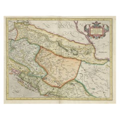
Antique map titled 'Tabula Geographica exhibens Regnum Sclavoniae.'
Detailed map of Slavonia, the region in eastern Croatia. Map is dated shortly after the Peace of Belgrade signed in 1739 between the Holy Roman Emperor and the Turks. Key and explaination and elaborate cartouche showing figures with regional costume. Many villages and towns are named, excellent detail of rivers, marshes, woods, lakes, etc. Source unknown, to be determined.
Artists and Engravers: Made by 'Homann Heirs' after an anonymous artist. Made by an anonymous engraver after 'Homann Heirs'. Following the long period of Dutch domination, the Homann family became the most important map publishers in Germany in the eighteenth century, the business being founded by J.B. Homann in Nuremberg about the year 1702. Soon after publishing his first atlas in 1707 he became a member of the Berlin academy of Sciences and in 1715 he was appointed Geographer to the Emperor. After the founder's death in 1724, the firm was continued under the direction of his son until 1730 and was then bequeathed to his heirs on the condition that it trades under the name of Homann Heirs. The firm remained in being until the next century and had a wide influence on map publishing in Germany. Apart from the atlases the firm published a very large number of individual maps. The Homanns produced a Neuer Atlas in 1714, a Grosser Atlas in 1737, and an Atlas Maior with about 300 maps in 1780. They also issued a special Atlas of Germany with full sized plans of principal cities, school atlases and an Atlas of Silesia in 1750 with 20 maps.
Condition: Good, given age. Damp stained top and bottom margin. Minor paper separation bottom middle fold, not affecting image. Light staining and soiling in the margins. A few small spots. Some minor crinkles. Original middle fold as issued. General age-related toning and/or occasional minor defects from handling. Please study image carefully.
- Dimensions:Height: 20.95 in (53.2 cm)Width: 25.01 in (63.5 cm)Depth: 0 in (0.02 mm)
- Materials and Techniques:
- Period:1740-1749
- Date of Manufacture:circa 1745
- Condition:Condition: Good, given age. Damp stained top and bottom margin. Minor paper separation bottom middle fold, not affecting image. Light staining and soiling in the margins. A few small spots. Some minor crinkles. Original middle fold as issued. General.
- Seller Location:Langweer, NL
- Reference Number:
About the Seller
5.0
Platinum Seller
These expertly vetted sellers are 1stDibs' most experienced sellers and are rated highest by our customers.
Established in 2009
1stDibs seller since 2017
1,916 sales on 1stDibs
Typical response time: <1 hour
- ShippingRetrieving quote...Ships From: Langweer, Netherlands
- Return PolicyA return for this item may be initiated within 14 days of delivery.
More From This SellerView All
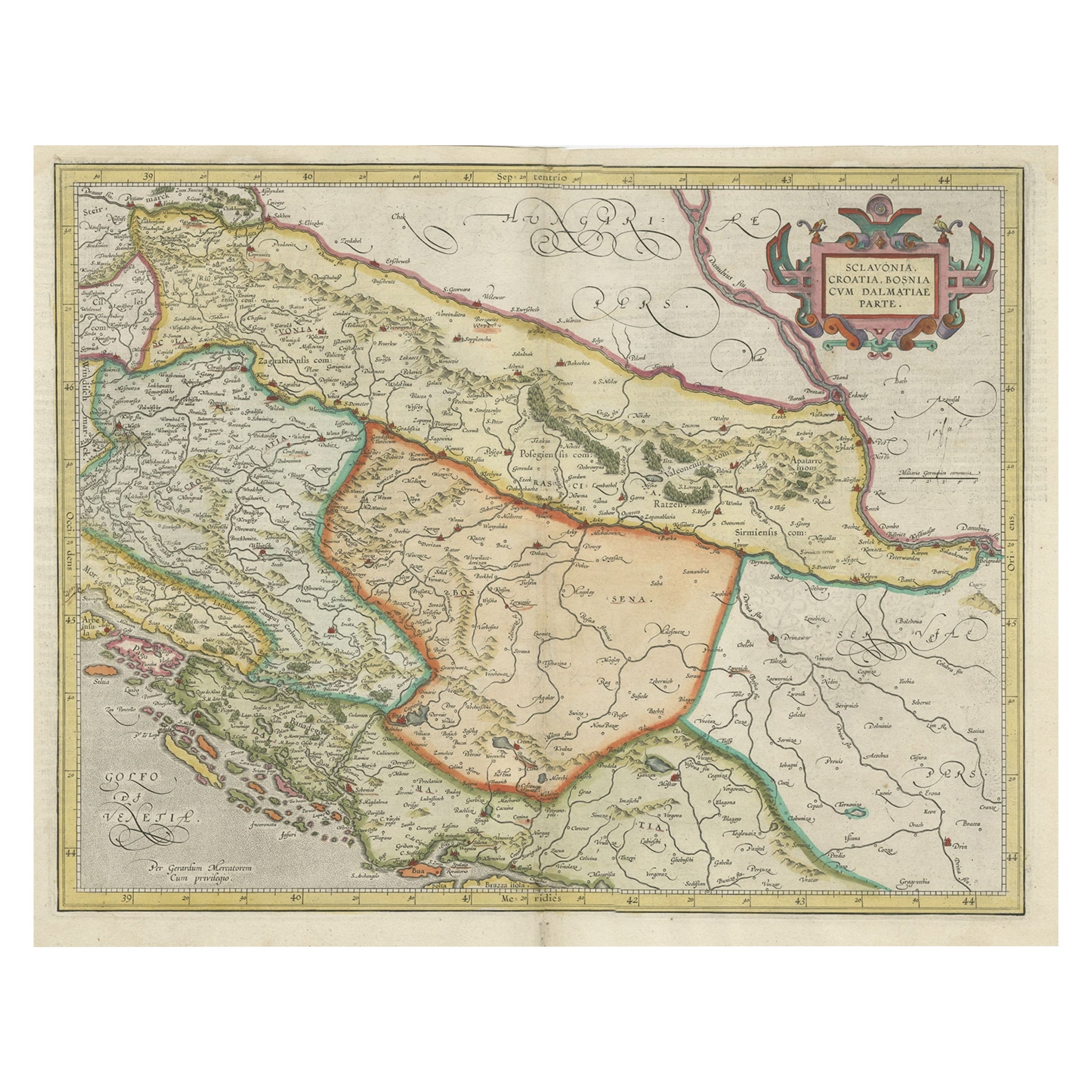
- Old Eastern Balkans Map, with Dalmatia, Croatia, Slavonia, Bosnia, Serbia, 1633Located in Langweer, NLAntique map titled 'Sclavonia, Croatia, Bosnia cum Dalmatiae Parte'. Old map of the Eastern Balkans with the geographical & political divisions of Dalmatia, Croatia, Slavonia, Bosnia, Serbia, etc. The map details the course of the Danube, Sauus, and Drauus Rivers. Originates from the 1633 German edition of the Mercator-Hondius Atlas Major, published by Henricus Hondius and Jan Jansson under the title: 'Atlas: das ist Abbildung der gantzen Welt, mit allen darin begriffenen Laendern und Provintzen: sonderlich von Teutschland, Franckreich, Niderland, Ost und West Indien: mit Beschreibung der selben.' Artists and Engravers: Gerard Mercator (1512 - 1594) originally a student of philosophy was one of the most renowned cosmographers and geographers of the 16th century, as well as an accomplished scientific instrument maker. He is most famous for introducing Mercators Projection, a system which allowed navigators to plot the same constant compass bearing on a flat map...Category
Antique 1630s Maps
MaterialsPaper
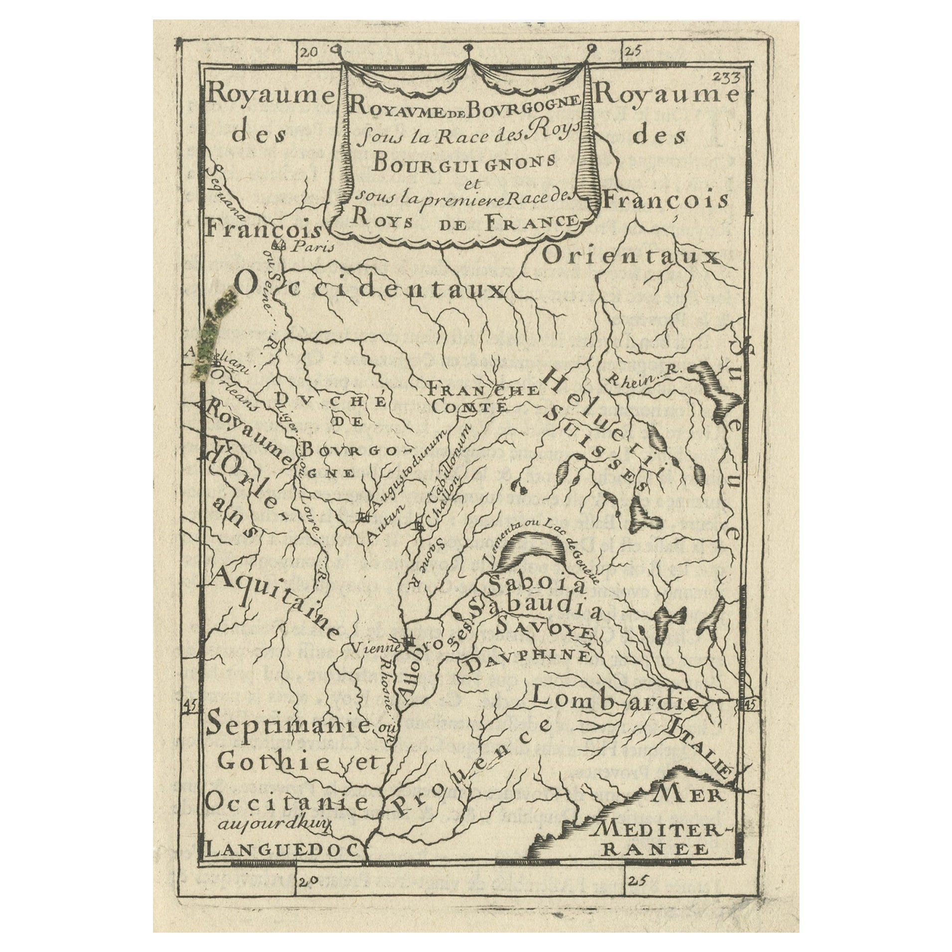
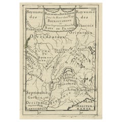
- Nice Detailed Antique Miniature Map of the Burgundy Wine Region, France, ca.1683Located in Langweer, NLAntique map titled 'Royaume de Bourgogne sous la Race des Roys Bourguignons (..)'. Detailed miniature map of the Burgundy region, France. Originates from Mallet's 'Description de...Category
Antique 1680s Maps
MaterialsPaper
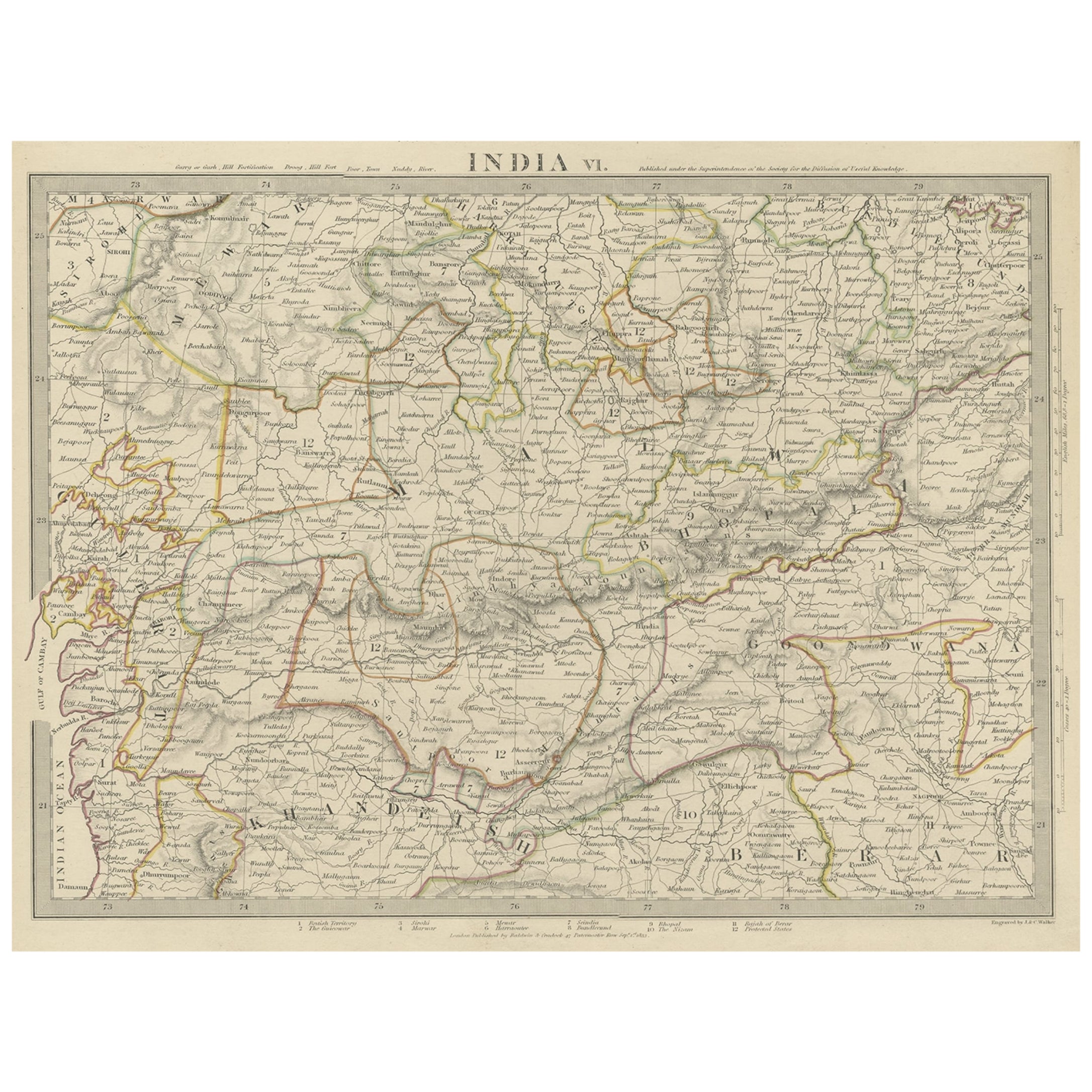
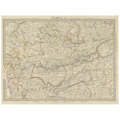
- Detailed Antique Map of the Region of Malwa in India, 1833Located in Langweer, NLAntique map titled 'India VI'. Old steel engraved map of the region of Malwa showing great detail. Artists and Engravers: Engraved by J. & C. Walker. Published under the superint...Category
Antique 19th Century Maps
MaterialsPaper
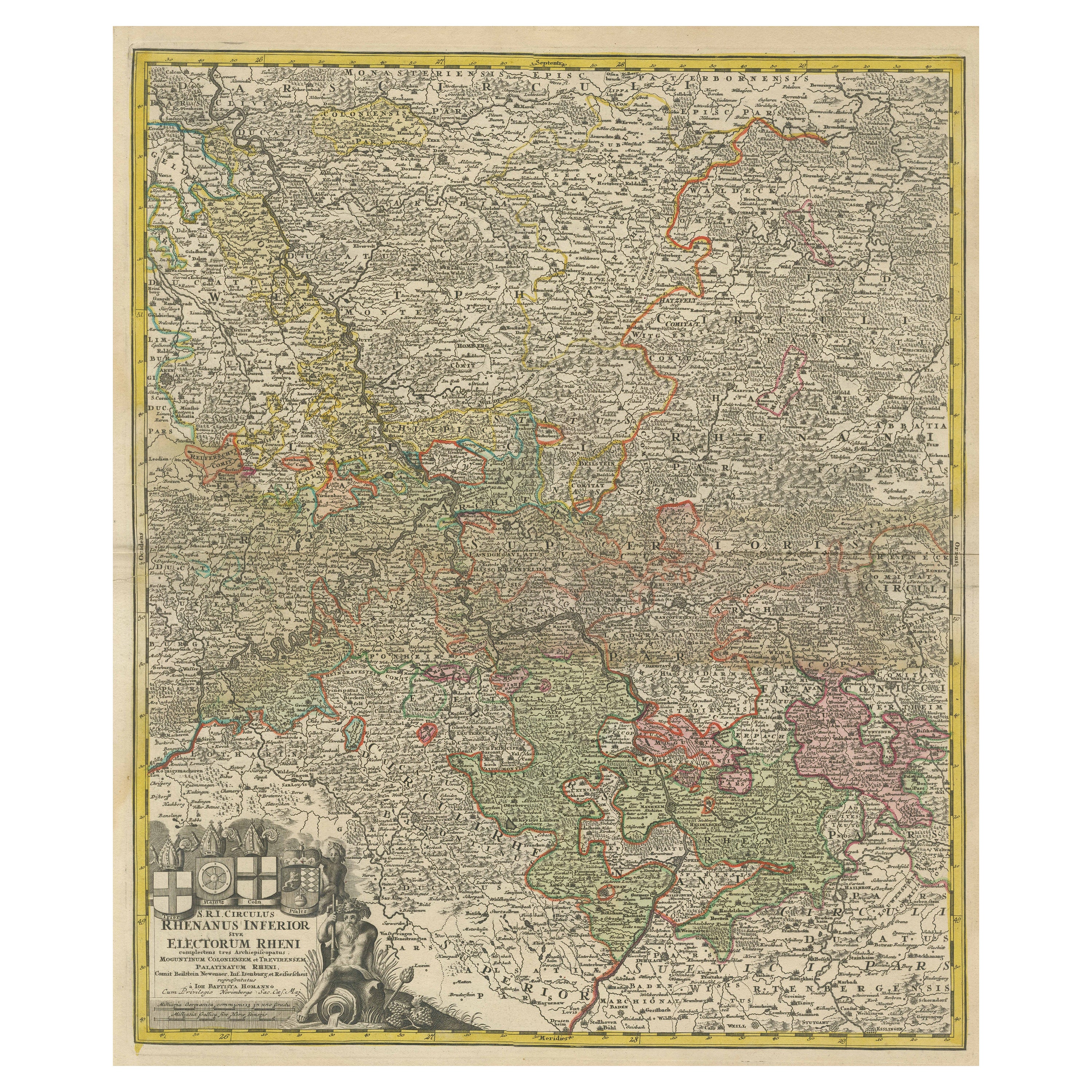
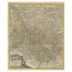
- Detailed Antique Map of the Lower Rhine region, GermanyLocated in Langweer, NLAntique map titled 'S.R.I. Circulus Rhanus Inferior sive Electorum Rheni (..)'. Detailed map of the Lower Rhine region, Germany. The title cartouche in the upper left quadrant featur...Category
Antique Mid-18th Century Maps
MaterialsPaper
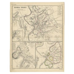
- Detailed Original Antique Map of the Region of Rome in Italy, c.1870By Heinrich KiepertLocated in Langweer, NLAntique map titled 'Roma Urbs'. Old map of Italy, it shows three inset maps of the region of Rome. This map originates from 'Atlas Antiquus, twaalf k...Category
Antique 19th Century Maps
MaterialsPaper
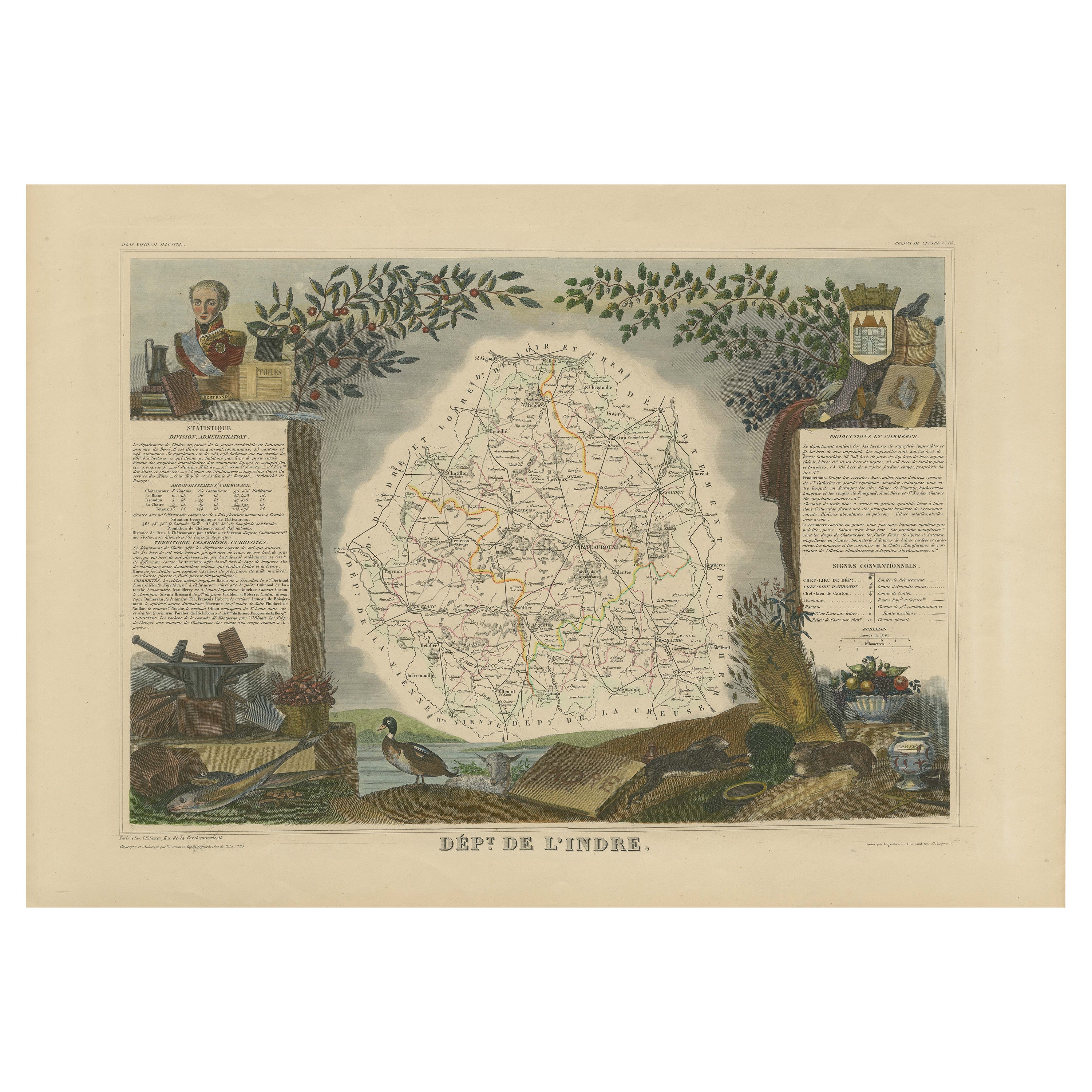
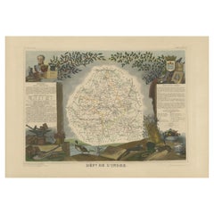
- Antique Map of the Indre Region in France, ca. 1852Located in Langweer, NLAntique map titled 'Dépt. de l'Indre'. Map of the French department of Indre, France. Part of the Loire Valley wine region, this area is known for its production of Chinon wines, typically red, and production of Pouligny-Saint-Pierre, goats'-milk cheese. It is also the birthplace of the great philosopher Rene Descartes...Category
Antique Mid-19th Century Maps
MaterialsPaper
You May Also Like
- Hand-Colored 18th Century Homann Map of the Danube, Italy, Greece, CroatiaBy Johann Baptist HomannLocated in Alamo, CA"Fluviorum in Europa principis Danubii" is a hand colored map of the region about the Danube river created by Johann Baptist Homann (1663-1724) in his 'Atlas Novus Terrarum', publish...Category
Antique Early 18th Century German Maps
MaterialsPaper
- 1594 Maurice Bouguereau Map of the Region Limoges, France, Ric0015Located in Norton, MA1594 Maurice Bouguereau map of the region Limoges, France, entitled "Totivs Lemovici et Confinium Pro Uinciarum Quantum ad Dioecefin Lemo Uicenfen Fpectant," Hand Colored Ric0015 Jean IV Le Clerc...Category
Antique 16th Century Dutch Maps
MaterialsPaper
- 17th Century Hand Colored Map of the Liege Region in Belgium by VisscherBy Nicolaes Visscher IILocated in Alamo, CAAn original 17th century map entitled "Leodiensis Episcopatus in omnes Subjacentes Provincias distincté divisusVisscher, Leodiensis Episcopatus" by Nicolaes Visscher II, published in Amsterdam in 1688. The map is centered on Liege, Belgium, includes the area between Antwerp, Turnhout, Roermond, Cologne, Trier and Dinant. This attractive map is presented in a cream-colored mat measuring 30" wide x 27.5" high. There is a central fold, as issued. There is minimal spotting in the upper margin and a tiny spot in the right lower margin, which are under the mat. The map is otherwise in excellent condition. The Visscher family were one of the great cartographic families of the 17th century. Begun by Claes Jansz Visscher...Category
Antique Late 17th Century Dutch Maps
MaterialsPaper
- 1861 Topographical Map of the District of Columbia, by Boschke, Antique MapLocated in Colorado Springs, COPresented is an original map of Albert Boschke's extremely sought-after "Topographical Map of the District of Columbia Surveyed in the Years 1856 ...Category
Antique 1860s American Historical Memorabilia
MaterialsPaper
- English Engraved Hand Colored Map of the North Eastern United States, circa 1817Located in Hollywood, SCEnglish copper engraved hand colored map of the North Eastern United States matted under glass in a gilt frame, Early 19th Century. Drawn and Engraved for Thomson's New General Atlas...Category
Antique 1810s English George III Maps
MaterialsGlass, Giltwood, Paint, Paper
- The Normandy Region of France: A 17th C. Hand-colored Map by Sanson and JaillotBy Nicolas SansonLocated in Alamo, CAThis large hand-colored map entitled "Le Duché et Gouvernement de Normandie divisée en Haute et Basse Normandie en divers Pays; et par evêchez, avec le Gouvernement General du Havre ...Category
Antique 1690s French Maps
MaterialsPaper


