Antique Roman Map

6
to
30
191
76
145
89
81
42
42
39
36
31
31
25
20
17
12
12
10
10
8
7
7
5
5
5
5
4
4
3
3
3
3
2
2
2
2
2
2
1
1
1
1
1
1
1
1
1
1
1
20
6
3
3
3
Sort By
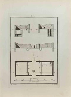
Architectural Roman Map - Etching by Vincenzo Scarpati - 18th Century
Located in Roma, IT
Architectural Roman Map from "Antiquities of Herculaneum" is an etching on paper realized by
Category

18th Century Old Masters Antique Roman Map

Materials

Etching

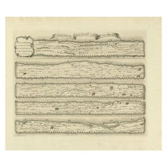
Antique Map Made After a Roman Papyrus Travel Map, Known as Peutinger Map, 1773
Located in Langweer, NL
as Peutinger's Tabula or Peutinger Table, is an illustrated itinerarium (ancient Roman road map
Category

18th Century Antique Roman Map

Materials

Paper

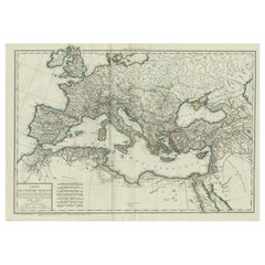
Original Antique Map of the Roman Empire
Located in Langweer, NL
Antique map titled 'Carte de l'Empire Romain'. Original antique map of the Roman Empire, two sheets
Category

Late 18th Century Antique Roman Map

Materials

Paper

Original Antique Map of the Roman Empire
H 19.06 in W 27.84 in D 0.02 in
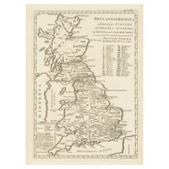
Antique Map of Britain in Roman Times
Located in Langweer, NL
Antique map titled 'Britannia Romana collected from Ptolemy (..)'. Map of Britain in Roman times
Category

Early 19th Century Antique Roman Map

Materials

Paper

Antique Map of Britain in Roman Times
H 17.6 in W 11.07 in D 0.02 in
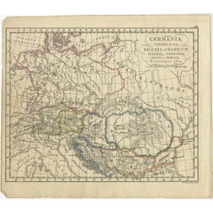
Antique Map of Germany in Roman Times, Showing Roman Provinces, 1825
Located in Langweer, NL
Antique map titled 'Germania, Vindelicia, Rhaetia et Noricum Jllyria, Pannonia, Dacie & Moesia
Category

19th Century Antique Roman Map

Materials

Paper

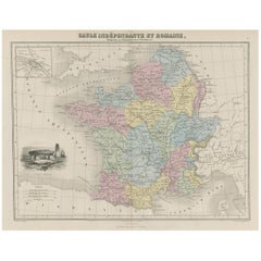
Antique Map of France in Ancient Roman Times, 1880
Located in Langweer, NL
Antique map titled 'Gaule indépendante et Romaine'. Old map of Gaul or France in ancient Roman
Category

19th Century Antique Roman Map

Materials

Paper

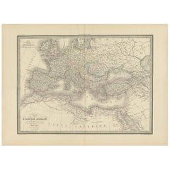
Antique Map of the Roman Empire by Lapie, 1842
Located in Langweer, NL
Antique map titled 'Carte de l'Empire Romain'. Map of the Roman Empire. This map originates from
Category

Mid-19th Century Antique Roman Map

Materials

Paper

Antique Map of the Roman Empire by Lapie, 1842
H 19.89 in W 26.78 in D 0.02 in
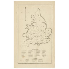
Antique Map of England and Wales with Roman Numerals
Located in Langweer, NL
Untitled original antique map of England and Wales. Drawn & Engraved for Cobbetts 'Geographical
Category

Mid-19th Century Antique Roman Map

Materials

Paper

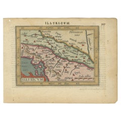
Antique Miniature Map of the Roman Province of Illyricum 'Dalmatia'
By Abraham Ortelius
Located in Langweer, NL
Antique miniature map titled 'Illyricum'. Original small map of Illyricum. The Roman province of
Category

Early 17th Century Antique Roman Map

Materials

Paper

Large Antique Map of Gaul under Roman Rule, ca.1760
Located in Langweer, NL
Antique map titled 'Gallia Augustiniana in suas provincias divisa (..)'. Large antique map of Roman
Category

1760s Antique Roman Map

Materials

Paper

Rare Antique Map of Friesland in Roman Times, Published 1778
Located in Langweer, NL
Antique map titled 'Carte de la Frise, entre les Embouchures du Rhin & de l'Eems, ij compris l'isle
Category

18th Century Antique Roman Map

Materials

Paper

Rare Antique Map of Friesland in Roman Times, Published 1778
Free Shipping
H 13.86 in W 16.54 in D 0 in
Antique Engraved Map of Italy in Roman Times, ca.1730
Located in Langweer, NL
Plain engr. map of Italy according to the division of Emperor Augustus by G. Delisle. Title
Category

1730s Antique Roman Map

Materials

Paper

Large Antique Map of Gaul, or France in Ancient Roman Times
Located in Langweer, NL
France in ancient Roman times, showing Roman provinces. Inset bottom left a detailed map of Roman
Category

Mid-18th Century Antique Roman Map

Materials

Paper

Antique Map of Germany of German in Roman Times, c.1660
Located in Langweer, NL
Antique map Germany titled 'Germaniae Veteris Typus'. Antique map probably by Blaeu or based on an
Category

17th Century Antique Roman Map

Materials

Paper

Antique Map of Germany of German in Roman Times, c.1660
No Reserve
H 20.87 in W 25.2 in D 0 in
Antique Latin Map of the Netherlands & Germany, Incl Roman Forts, Etc., 1631
Located in Langweer, NL
Antique map titled 'Scaldis Mosae, ac Rheni Ostiorum, gentiumque accolarum antiqua descriptio
Category

1630s Antique Roman Map

Materials

Paper

Asia Minor and Provinces: A Roman Empire Map from Spruner-Menke Atlas, 1880
Located in Langweer, NL
during the Roman Empire. The map is interesting for a number of reasons: 1. **Comprehensive Detail
Category

1880s Antique Roman Map

Materials

Paper

Imperium Romanum: A Detailed Map of the Roman Empire in its Zenith, 1880
Located in Langweer, NL
This original antique map, titled "IMPERIVM ROMANVM", is a detailed depiction of the Roman Empire
Category

1880s Antique Roman Map

Materials

Paper

Antique Map of France in Ancient Roman Times by d'Anville 'c.1795'
Located in Langweer, NL
Antique map titled 'Gallia Antiqua ex Aevi Romani Monumentis (..)'. Original, large, map of France
Category

Late 18th Century Antique Roman Map

Materials

Paper

Antique Map of Part of the Roman Empire by H. Kiepert, circa 1870
By Heinrich Kiepert
Located in Langweer, NL
Antique map titled 'Imperia Persarum et Macedonum'. Depicts part of the Roman Empire, from Greece
Category

Late 19th Century Antique Roman Map

Materials

Paper

Antique Map of The Regions of Italy and Sicily during the Roman Empire, 1880
Located in Langweer, NL
**: The map likely shows ancient roads such as the famous Roman roads (e.g., the Via Appia) and includes
Category

1880s Antique Roman Map

Materials

Paper

Antique Map of the British Isles According to the Geography of the Roman Empire
Located in Langweer, NL
Antique map titled 'Insulae Britannicae'. Interesting map of Britain, Scotland, and Ireland. It
Category

Late 18th Century Antique Roman Map

Materials

Paper

Antique Map of the Netherlands in the time of the Domination by the Roman Empire
Located in Langweer, NL
'. Copper engraved map of the Netherlands in the time of the domination by the Roman Empire. The map also
Category

Mid-18th Century Antique Roman Map

Materials

Paper

Antique Map of the Holy Land, c.1717
Located in Langweer, NL
Antique map Israel titled 'Tabula Geographica Terrae Sanctae'. Rare edition made after a map of the
Category

18th Century Antique Roman Map

Materials

Paper

Antique Map of the Holy Land, c.1717
H 9.85 in W 27.56 in D 0 in
Roman Italy and Provinces: A Cartographic Snapshot, 1880
Located in Langweer, NL
The map titled "ITALIA, Gallia Cisalpina, Sicilia, Sardinia, Corsica" focuses on Italy and its
Category

1880s Antique Roman Map

Materials

Paper

Roman Italy and Provinces: A Cartographic Snapshot, 1880
Free Shipping
H 15.56 in W 18.51 in D 0 in
Original Antique Map of the Duchy of Holstein
By Willem Blaeu
Located in Langweer, NL
Antique map titled 'Ducatus Holsatiae Nova Tabula'. Original old map of the Duchy of Holstein, the
Category

Mid-17th Century Antique Roman Map

Materials

Paper

Original Antique Map of the Duchy of Holstein
H 20.48 in W 24.53 in D 0.02 in
Ancient Iberia: Hispania Map from Spruner-Menke Atlas Antiquus, 1880
Located in Langweer, NL
particular map showcases the Iberian Peninsula with its ancient Roman provincial divisions, topographical
Category

1880s Antique Roman Map

Materials

Paper

Antique Map of Greece by J. Jansson, circa 1653
Located in Langweer, NL
This is an authentic antique map of the Greece by Jan Jansson. The map was published in Amsterdam
Category

Mid-17th Century Antique Roman Map

Materials

Paper

Antique Map of Hertfordshire in England by Speed, 1627
Located in Langweer, NL
Hertfordshire, England. Includes inset maps of Hertford and the Roman settlement of Verolanium, now St. Albans
Category

17th Century Antique Roman Map

Materials

Paper

Antique Map of the Jewish Land by Lindeman, 1761
Located in Langweer, NL
Antique map titled 'De VIde Landkaart Verbeeldende Het Joodsche Land (..).' Map of the Jewish Land
Category

18th Century Antique Roman Map

Materials

Paper

Cartographic Tapestry: Antique Map of Asia Minor, circa 1640
Located in Langweer, NL
Title: "Historical Tapestry: Antique Map of Asia Minor, circa 1640" Description: This authentic
Category

Mid-17th Century Antique Roman Map

Materials

Paper

Antique Lithography Map, Isle of Thanet, Kent, English, Cartography, Victorian
Located in Hele, Devon, GB
This is an antique lithography map of The Isle of Thanet in Kent. An English, framed atlas
Category

Mid-19th Century British Victorian Antique Roman Map

Materials

Wood

Antique Map of Alentejo: Land of Tradition and Tranquility, 1903
Located in Langweer, NL
center, Roman temple, and chapel of bones. The map also includes the coats of arms of Beja and Évora
Category

Early 1900s Antique Roman Map

Materials

Paper

Topographical and Infrastructure Map of the Province of Valencia, 1901
Located in Langweer, NL
A historical map of the province of Valencia, dated 1901. The map includes intricate details such
Category

Early 1900s Antique Roman Map

Materials

Paper

Black Sea in Antiquity: Pontus Euxinus Map, Published in 1880
Located in Langweer, NL
This map, titled "PONTUS EUXINUS," depicts the Black Sea region, historically known as the Pontus
Category

1880s Antique Roman Map

Materials

Paper

Black Sea in Antiquity: Pontus Euxinus Map, Published in 1880
Free Shipping
H 15.56 in W 18.51 in D 0 in
Roman Frontiers Engraved: Germania, Raetia, and Noricum, Published in 1880
Located in Langweer, NL
, which are central to Raetia, are prominently displayed. 3. **Roman Settlements and Roads**: The map
Category

1880s Antique Roman Map

Materials

Paper

Antique Map of Spain and Portugal by Tardieu, circa 1795
Located in Langweer, NL
. The map shows a detailed layout of the provinces with Roman settlements, roads, and topographic
Category

Late 18th Century Antique Roman Map

Materials

Paper

Antique Map of Spain by P.F. Tardieu, circa 1798
By Pierre François Tardieu
Located in Langweer, NL
and Portugal and the Roman provinces of Lusitania, Beatica & Hispania Tarraconensis. This map
Category

Late 18th Century Antique Roman Map

Materials

Paper

Roman Balkans: Pannonia, Illyricum, Dacia, Moesia, Thracia, Macedonia and Thyris
Located in Langweer, NL
This original antique map showcases the Roman provinces in the Balkan region and parts of Central
Category

1880s Antique Roman Map

Materials

Paper

Antique Map of the Region of Guyenne by Janssonius, 1657
By Johannes Janssonius
Located in Langweer, NL
Antique map of France titled 'Description du Guienne'. Decorative map of Guyenne region. Guyenne or
Category

17th Century Antique Roman Map

Materials

Paper

Map of Soria Province, 1901: Detailed Cartography of Northeastern Spain
Located in Langweer, NL
The map is a historical map of the province of Soria from 1901. A decorative coat of arms
Category

Early 1900s Antique Roman Map

Materials

Paper

Girona 1902: Geographic and Infrastructural Map of Catalonia’s Northern Province
Located in Langweer, NL
The map provided is of the province of Girona (in Catalan, Girona), located in the northeast of
Category

Early 1900s Antique Roman Map

Materials

Paper

Original Antique Map of Palencia Province, in Northern Spain, 1901
Located in Langweer, NL
This historical map is of Palencia, a province in the northern part of Spain. Palencia is
Category

Early 1900s Antique Roman Map

Materials

Paper

Orense in Depth: A 1902 Topographical Map of Galicia's Mountainous Province
Located in Langweer, NL
The map is a detailed cartographic representation of the province of Orense (Ourense in Galician
Category

Early 1900s Antique Roman Map

Materials

Paper

17th Century Toulouse, Savve, Sommieres Topographical Map by Iohan Peeters
Located in New York, NY
Fine topographical 17th century map of Toulouse, Savve and Sommieres by Iohan Peeters Beautiful
Category

17th Century Dutch Antique Roman Map

Materials

Paper

Large Map of Castile's Southern Realms - Granada, Andalusia, and Murcia, 1652
Located in Langweer, NL
This antique map, titled 'Les Etats de la Couronne de Castille', represents the southern regions of
Category

Mid-17th Century Antique Roman Map

Materials

Paper

Old Map of Vaucluse, France: A Cartographic Celebration of Viticulture, 1852
Located in Langweer, NL
This original hand-colored map is from the "Atlas National Illustré," a work by Victor Levasseur, a
Category

1850s Antique Roman Map

Materials

Paper

Antique Map of the Siege of Syracuse, Sicilia, Italy, 'ca.1675'
Located in Langweer, NL
Antique map titled 'Syracus beseeged by the Athenians.' This original uncommon antique map shows
Category

1670s Antique Roman Map

Materials

Paper

An Antique Map of Extremadura: Crossroads of History and Nature, 1903
Located in Langweer, NL
The image is a historical map of Extremadura, an autonomous community of Spain, from an unspecified
Category

Early 1900s Antique Roman Map

Materials

Paper

Antique Map of Israel Filled with Biblical Scenes, Published in 1748
Located in Langweer, NL
Antique map Holy Land titled 'Het beloofde landt Canaan doorwandelt van onsen Saligmaker Jesu
Category

1740s Antique Roman Map

Materials

Paper

Antique Map of the Ancient British Isles by Janssonius 'circa 1640'
Located in Langweer, NL
Antique map titled 'Insularum Britannicarum Acurata Delineatio'. Original antique map of the
Category

Mid-17th Century Antique Roman Map

Materials

Paper

Antique Map of Bohemia in the Present-Day Chech Repubic, 1730
Located in Langweer, NL
Antique map titled 'Nieuwe Kaart van t Koninkryk Bohemen t Hertogdom Silesien markgraafschap
Category

18th Century Antique Roman Map

Materials

Paper

Charming Miniature Map of Thrace or Thrake in Southeast Europe, 1685
Located in Langweer, NL
Antique map titled 'Thraciae Descriptio.' Charming miniature map of Thrace, from the pocket
Category

1680s Antique Roman Map

Materials

Paper

Scandinavia & Portions of Eastern Europe: 18th Century Hand-Colored Homann Map
By Johann Baptist Homann
Located in Alamo, CA
An early 18th century hand-colored copper-plate map entitled "Regni Sueciae in omnes suas
Category

Early 18th Century German Antique Roman Map

Materials

Paper

Senex Map of Castile, Leon & La Mancha in The Spanish Heartland, 1714
Located in Langweer, NL
might be key search terms related to historical maps. 4. **Estremadura**: Known for its Roman history
Category

Early 18th Century Antique Roman Map

Materials

Paper

1852 Map of Haut-Rhin: An Illustrated Gateway to Alsace's Viticultural Splendors
Located in Langweer, NL
This original hand-colored map is from the "Atlas National Illustré," a work by Victor Levasseur, a
Category

1850s Antique Roman Map

Materials

Paper

Antique Map of the British Isles with Walls, Settlements and Other Features
Located in Langweer, NL
Antique map titled 'Insulae Britannicae'. Interesting map of Britain, Scotland, and Ireland. It
Category

Late 18th Century Antique Roman Map

Materials

Paper

Algarve: A Tapestry of Sea and Sunlight in an Antique Map, 1903
Located in Langweer, NL
The image is a historical map of the Algarve, the southernmost region of Portugal. The map is
Category

Early 1900s Antique Roman Map

Materials

Paper

Ancient Gaul: A Cartographic Overview of Gallic Tribes and Roman Provinces, 1880
Located in Langweer, NL
representation of the Roman province before the fall of the Roman Empire. 2. **Rich Detail**: The map includes
Category

1880s Antique Roman Map

Materials

Paper

North African Coasts: Marmarica to Mauretania in Roman Times, Published in 1880
Located in Langweer, NL
significance of various locations. 5. **Roman Influence**: The map reflects the Roman division of territories
Category

1880s Antique Roman Map

Materials

Paper

Map of The Italian Peninsula with the islands of Sicily, Sardinia, Corsica, 1880
Located in Langweer, NL
This map, titled "ITALIA, Sicilia, Sardinia, Corsica," represents the Italian Peninsula along with
Category

1880s Antique Roman Map

Materials

Paper

  • 1
Get Updated with New Arrivals
Save "Antique Roman Map", and we’ll notify you when there are new listings in this category.

Antique Roman Map For Sale on 1stDibs

At 1stDibs, there are many versions of the ideal antique roman map for your home. Each antique roman map for sale was constructed with extraordinary care, often using paper. You’ve searched high and low for the perfect antique roman map — we have versions that date back to the 18th Century alongside those produced as recently as the 19th Century are available. A well-made antique roman map has long been a part of the offerings for many furniture designers and manufacturers, but those produced by Heinrich Kiepert are consistently popular.

How Much is a Antique Roman Map?

An antique roman map can differ in price owing to various characteristics — the average selling price 1stDibs is $529, while the lowest priced sells for $134 and the highest can go for as much as $1,800.

Read More

Pamela Shamshiri Shares the Secrets behind Her First-Ever Book and Its Effortlessly Cool Interiors

The sought-after designer worked with the team at Hoffman Creative to produce a monograph that beautifully showcases some of Studio Shamshiri's most inspiring projects.

Moroccan Artworks and Objects Take Center Stage in an Extraordinary Villa in Tangier

Italian writer and collector Umberto Pasti opens the doors to his remarkable cave of wonders in North Africa.

Montecito Has Drawn Royalty and Celebrities, and These Homes Are Proof of Its Allure

Hollywood A-listers, ex-pat aristocrats and art collectors and style setters of all stripes appreciate the allure of the coastal California hamlet — much on our minds after recent winter floods.

Whaam! Blam! Pow! — a New Book on Pop Art Packs a Punch

Publishing house Assouline and writer Julie Belcove have teamed up to trace the history of the genre, from Roy Lichtenstein, Andy Warhol and Yayoi Kusama to Mickalene Thomas and Jeff Koons.

The Sparkling Legacy of Tiffany & Co. Explained, One Jewel at a Time

A gorgeous new book celebrates — and memorializes — the iconic jeweler’s rich heritage.

What Makes a Gem-Encrusted Chess Set Worth $4 Million?

The world’s most opulent chess set, weighing in at 513 carats, is literally fit for a king and queen.

Tauba Auerbach’s Geometric Pop-Up Book Is Mighty Rare, Thanks to a Hurricane

This sculptural art book has an epic backstory of its own.

Step inside the Storied Mansions of Palm Beach’s Most Effervescent Architect

From Spanish-style courtyards to fanciful fountains, these acclaimed structures abound in surprising and elegant details.