Items Similar to Large Antique Map of Gaul under Roman Rule, ca.1760

Want more images or videos?
Request additional images or videos from the seller
1 of 5
Large Antique Map of Gaul under Roman Rule, ca.1760
About the Item
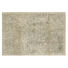
Antique map titled 'Gallia Augustiniana in suas provincias divisa (..)'. Large antique map of Roman Gaul, it refers to Gaul under provincial rule in the Roman Empire from the 1st century BC to the 5th century AD.
Artists and Engravers: Mattias Seutter (1678-1756) was an engraver, globe-maker and map publisher from Augsburg. He was a pupil of J.B. Homann in Nuremberg. Seutter was awarded the title of Imperial Geographer by Karl VI in 1731, and his son-in-law T.C. Lotter took over the business in 1758. He made several atlases as a folio-atlas in two versions in 1720, the most comprehensive Atlas Geographicus counted 46 cards and was reprinted several times.
- Dimensions:Height: 21.26 in (54 cm)Width: 24.41 in (62 cm)Depth: 0 in (0.02 mm)
- Materials and Techniques:
- Period:1760-1769
- Date of Manufacture:circa 1760
- Condition:Condition: Good, original/contemporary hand coloring. General age-related toning, minor wear/defects. Please study image carefully.
- Seller Location:Langweer, NL
- Reference Number:
About the Seller
5.0
Platinum Seller
These expertly vetted sellers are 1stDibs' most experienced sellers and are rated highest by our customers.
Established in 2009
1stDibs seller since 2017
1,932 sales on 1stDibs
Typical response time: <1 hour
- ShippingRetrieving quote...Ships From: Langweer, Netherlands
- Return PolicyA return for this item may be initiated within 14 days of delivery.
More From This SellerView All
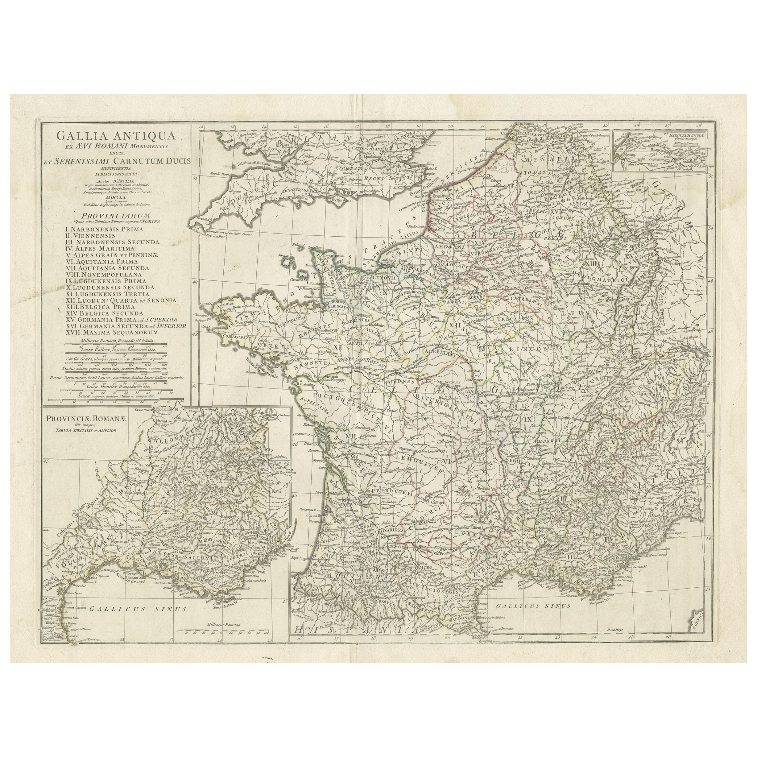
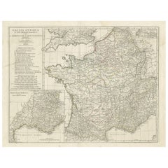
- Large Antique Map of Gaul, or France in Ancient Roman TimesLocated in Langweer, NLOriginal antique map titled 'Gallia Antiqua ex Aevi Romani Monumentis (..)'. Large map of Gaul, or France in ancient Roman times, showing Roman provinces. Inset bottom left a detaile...Category
Antique Mid-18th Century Maps
MaterialsPaper
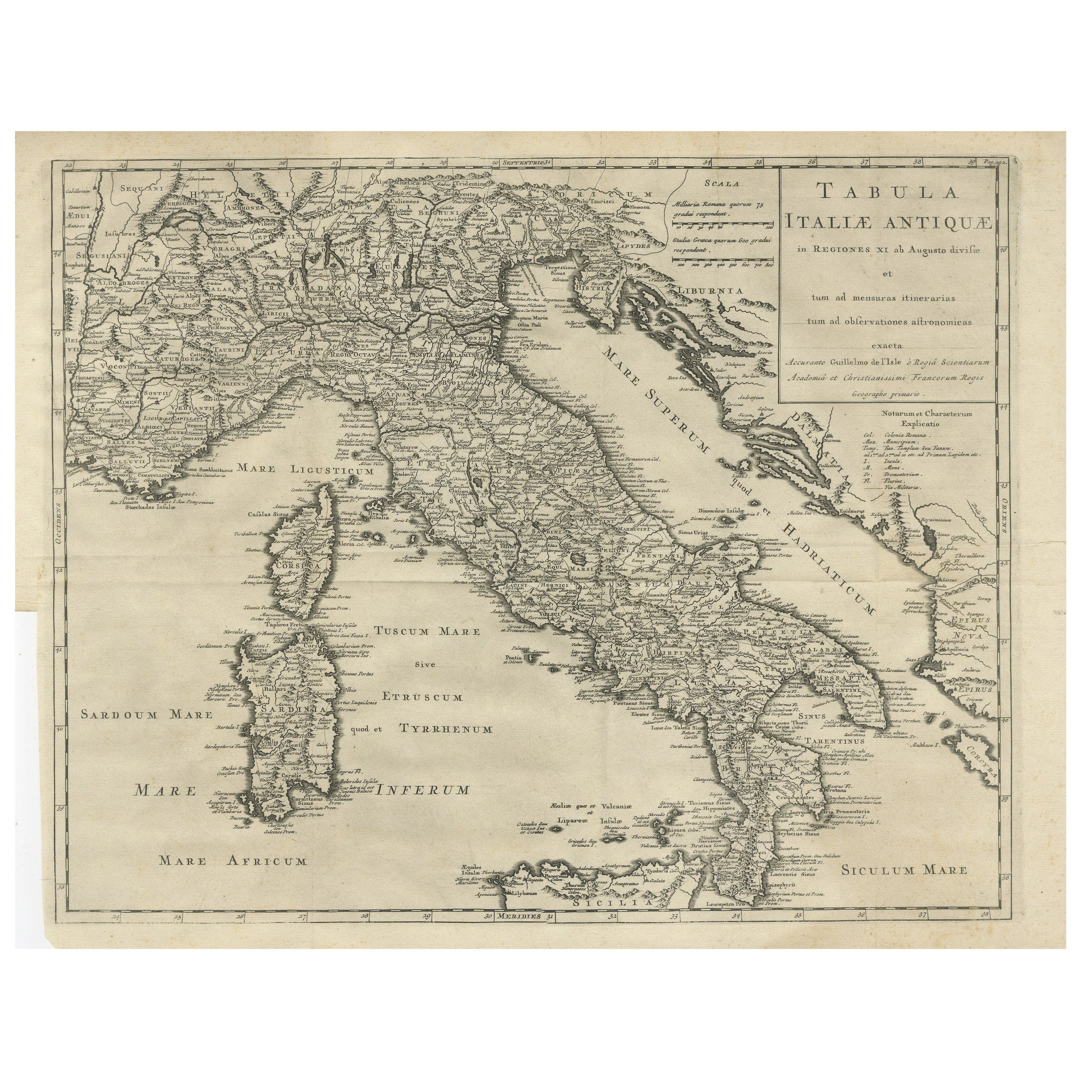
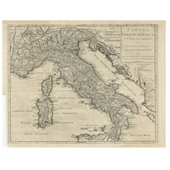
- Antique Engraved Map of Italy in Roman Times, ca.1730Located in Langweer, NLPlain engr. map of Italy according to the division of Emperor Augustus by G. Delisle. Title: "Tabula Italiae Antiquae In Regiones XI Ab Augusto Divisae Et Tum Ad Mensuras Itinerari...Category
Antique 1730s Maps
MaterialsPaper
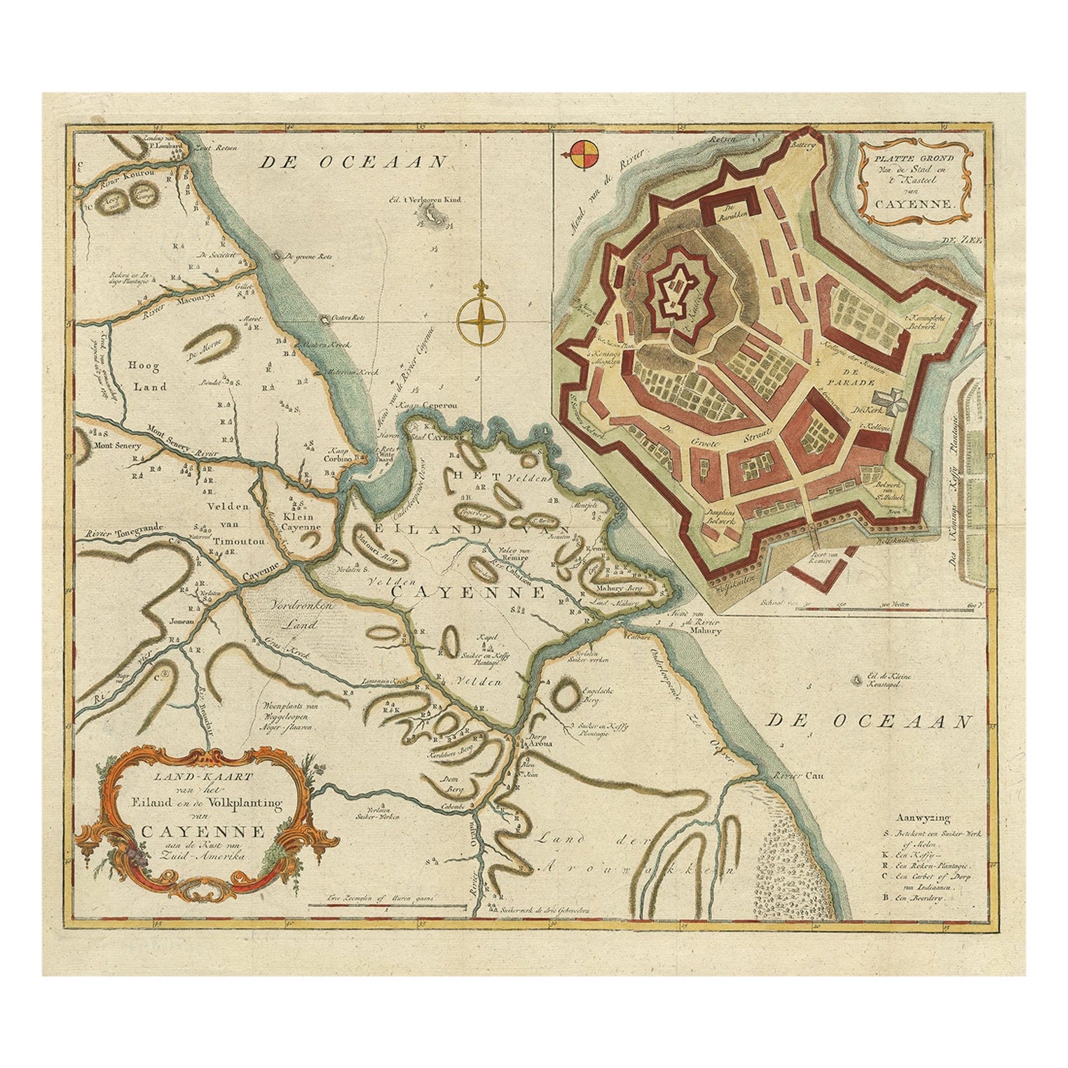
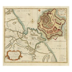
- Striking Antique Map of Cayenne in French Guyana, South America, ca.1760Located in Langweer, NLDescription: Antique map titled 'Land-kaart van het Eiland en de Volkplanting van Cayenne aan de Kust van Zuid-Amerika'. Striking map of the island and settlement of Cayenne in F...Category
Antique 1760s Maps
MaterialsPaper
- Antique Map of Asia by Tirion 'c.1760'Located in Langweer, NLAntique map titled 'Nuova Carta dell Asia'. Decorative map of Asia. Published by I. Tirion, circa 1760.Category
Antique Mid-18th Century Maps
MaterialsPaper
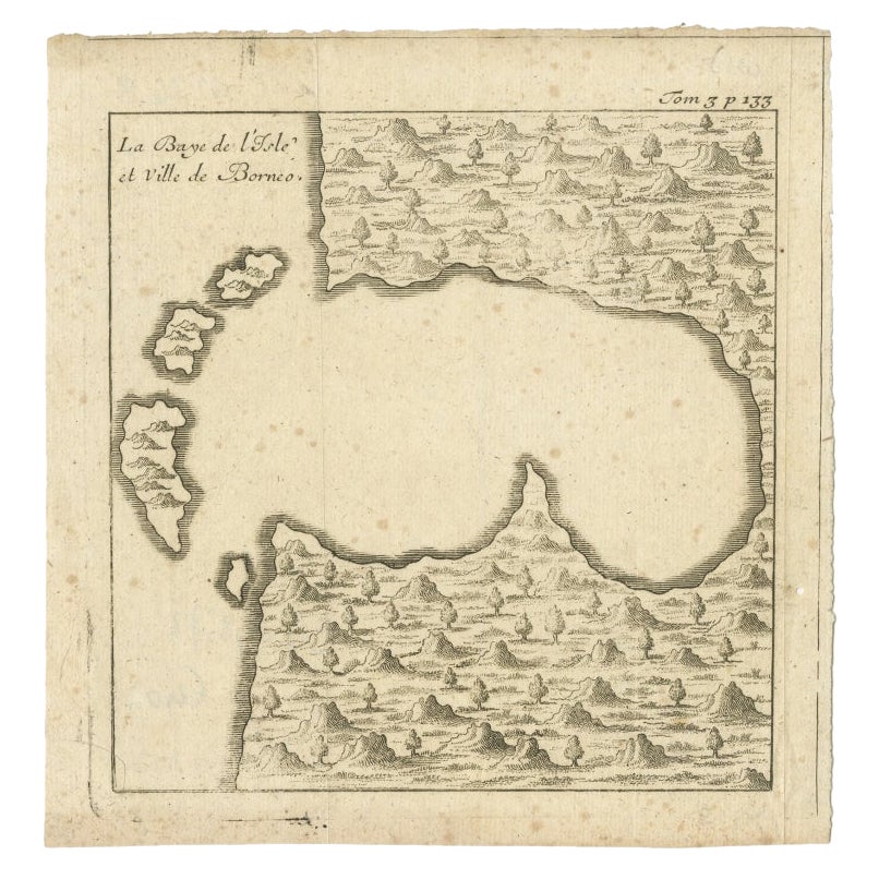
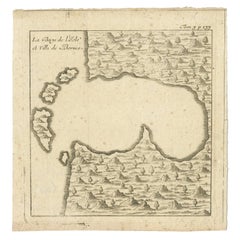
- Antique Map of a Bay of Borneo, Indonesia, c.1760Located in Langweer, NLAntique map titled 'La Baye de l'isle et Ville de Borneo'. Small map depicting a Bay of Borneo. Artists and Engravers: Anonymous. Condition: Good, general age-related toning. ...Category
Antique 18th Century Maps
MaterialsPaper
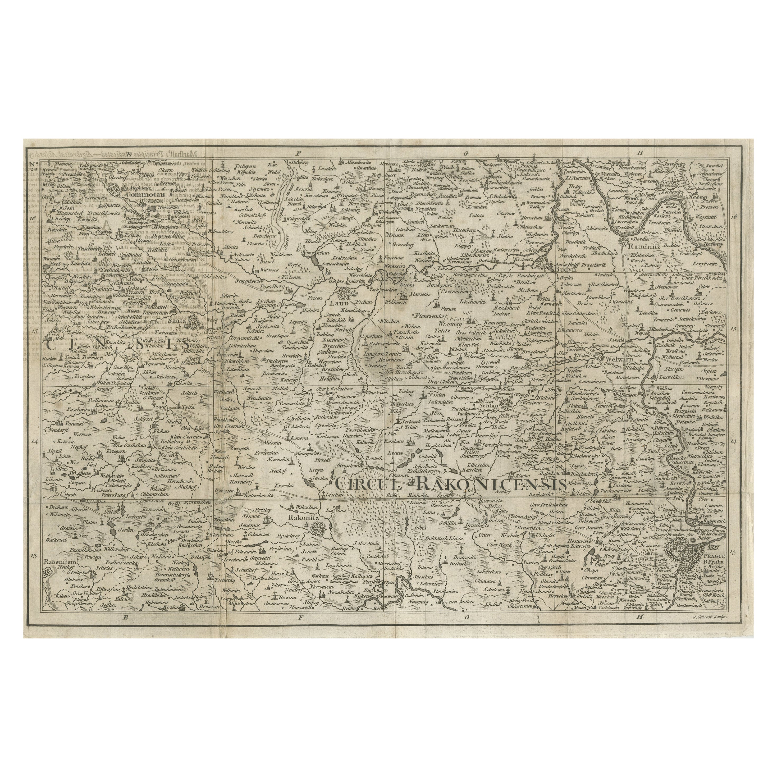
- Rare Detailed Antique Map of Prague and Its North West Environs, ca.1760Located in Langweer, NLDescription: original antique map of the environs of North West Prague. This map originates from the 'Gentlemans Magazine'. Published circa 1760. Artists and Engravers: Engraved ...Category
Antique 1760s Maps
MaterialsPaper

You May Also Like
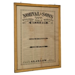
- Antique Billiard Rules Pool Rules Pyramid Rules Victorian Framed RulesLocated in Radstock, GBThis framed and printed sheet Rule frame is very unusual because it actually features the rules of three games Billiards, Life Pool and Pyramid pool. Printed by the famous Glasgo...Category
Antique Late 19th Century Scottish Victorian Sports Equipment and Memora...
MaterialsPine
- Large Antique 1859 Map of North AmericaLocated in Sag Harbor, NYThis Map was made by Augustus Mitchell in 1859 It is in amazing condition for being 163 years old. This price is for the rolled up easy to ship version of this piece. I will be Frami...Category
Antique Mid-19th Century American Maps
MaterialsCanvas, Paper

- Antique Map of Principality of MonacoBy Antonio Vallardi EditoreLocated in Alessandria, PiemonteST/619 - "Old Geographical Atlas of Italy - Topographic map of ex-Principality of Monaco" - ediz Vallardi - Milano - A somewhat special edition ---Category
Antique Late 19th Century Italian Other Prints
MaterialsPaper
- Original Antique Map of Italy. Arrowsmith. 1820Located in St Annes, LancashireGreat map of Italy Drawn under the direction of Arrowsmith Copper-plate engraving Published by Longman, Hurst, Rees, Orme and Brown, 1820 Unframed.Category
Antique 1820s English Maps
MaterialsPaper
- Original Antique Map of China, Arrowsmith, 1820Located in St Annes, LancashireGreat map of China Drawn under the direction of Arrowsmith Copper-plate engraving Published by Longman, Hurst, Rees, Orme and Brown, 1820 Unfr...Category
Antique 1820s English Maps
MaterialsPaper
- Original Antique Map of Canada, Arrowsmith, 1820Located in St Annes, LancashireGreat map of Canada. Drawn under the direction of Arrowsmith. Copper-plate engraving. Published by Longman, Hurst, Rees, Orme and Brown, 1820 ...Category
Antique 1820s English Maps
MaterialsPaper


Recently Viewed
View AllMore Ways To Browse
5th Century
Antique Large Globe
Antique Globes And Maps
Antique Maps And Globes
Antique Paper Globe
Empire Globe
Antique Map Globe
Atlas Globe
Antique Roman Map
Roman Map
Map Of Roman Empire
Roman Empire Map
18th Century Southern Antiques
Antique French Globe
Antique Furniture South Africa
South African Antique Furniture
Used Bookseller
Used Booksellers