Items Similar to Rare Detailed Antique Map of Prague and Its North West Environs, ca.1760

Want more images or videos?
Request additional images or videos from the seller
1 of 6
Rare Detailed Antique Map of Prague and Its North West Environs, ca.1760
About the Item
Description: original antique map of the environs of North West Prague. This map originates from the 'Gentlemans Magazine'. Published circa 1760.
Artists and Engravers: Engraved by Gibson.
Condition: Fair/good, age-related toning. Original folding lines, some wear. Small repair, blank verso. Please study image carefully.
- Dimensions:Height: 10.44 in (26.5 cm)Width: 14.97 in (38 cm)Depth: 0 in (0.02 mm)
- Materials and Techniques:
- Period:1760-1769
- Date of Manufacture:circa 1760
- Condition:Wear consistent with age and use.
- Seller Location:Langweer, NL
- Reference Number:
About the Seller
5.0
Platinum Seller
These expertly vetted sellers are 1stDibs' most experienced sellers and are rated highest by our customers.
Established in 2009
1stDibs seller since 2017
1,947 sales on 1stDibs
Typical response time: <1 hour
- ShippingRetrieving quote...Ships From: Langweer, Netherlands
- Return PolicyA return for this item may be initiated within 14 days of delivery.
More From This SellerView All
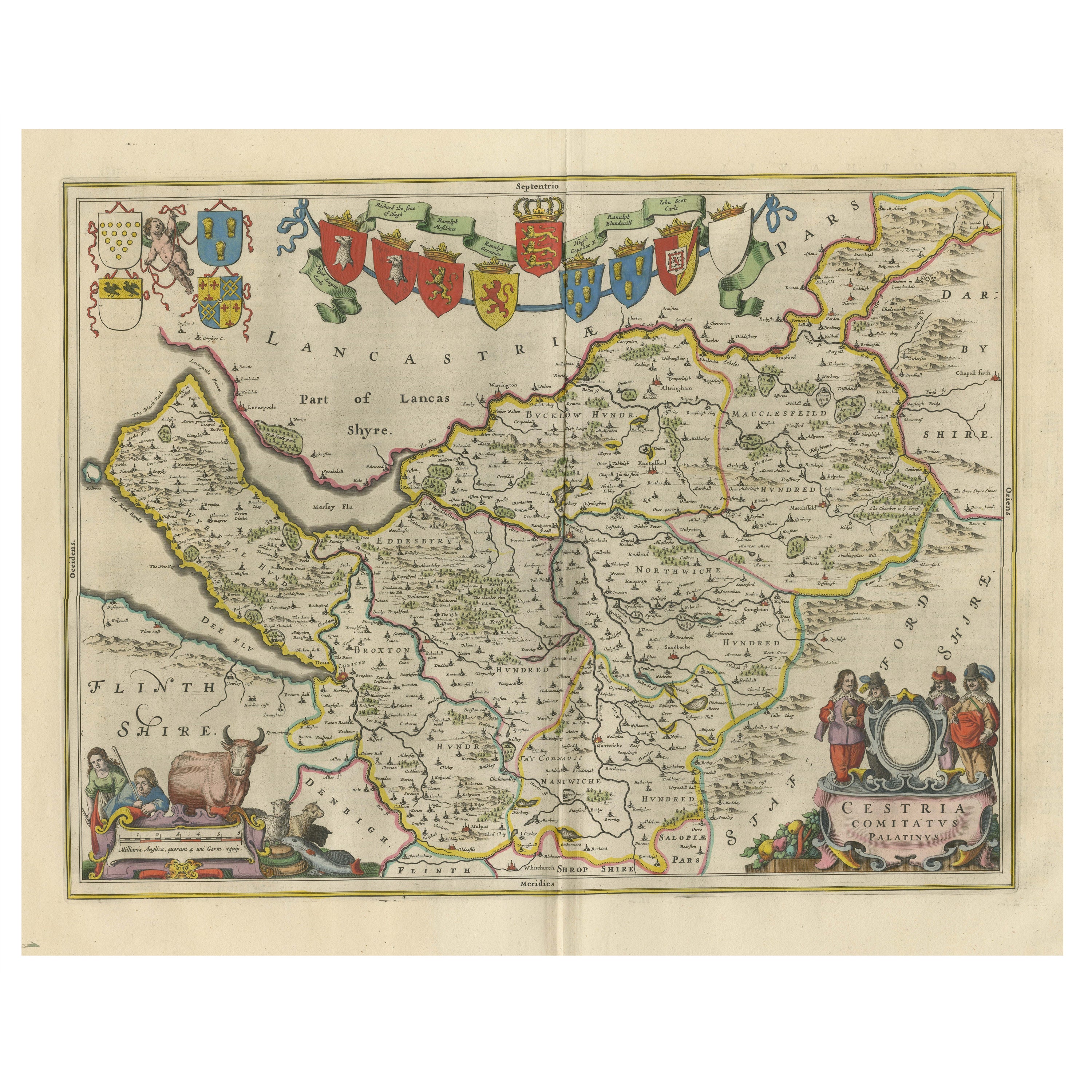
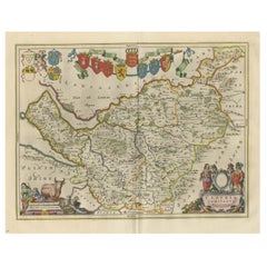
- Antique Map of Cheshire, North West EnglandBy Joan (Johannes) BlaeuLocated in Langweer, NLAntique map titled 'Cestria comitatus Palatinus'. Original old map of Cheshire, Northwest England. Published circa 1665 by J. Blaeu. Willem Jansz. Blaeu and his son Joan Blaeu are th...Category
Antique Mid-17th Century Maps
MaterialsPaper
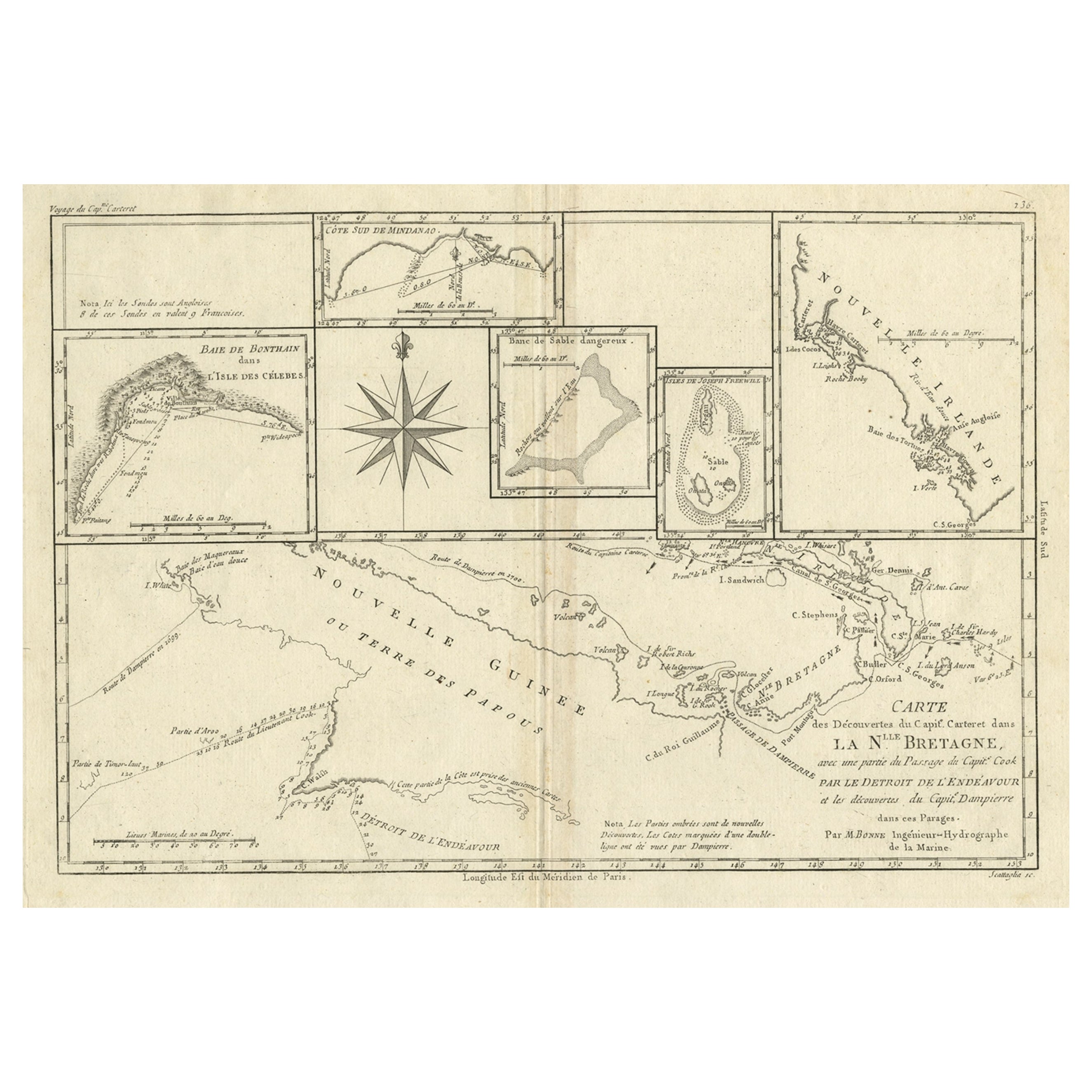
- Antique Detailed Map of Papua New Guinea and the Regions to the West, ca.1780Located in Langweer, NLAntique map titled 'Carte des Decouvertes du Capite. Carteret dans La Nlle. Bretagne avec une parte du passage du Capite. Cook Par Le Detroit De L'Endeavor ...Category
Antique 1780s Maps
MaterialsPaper
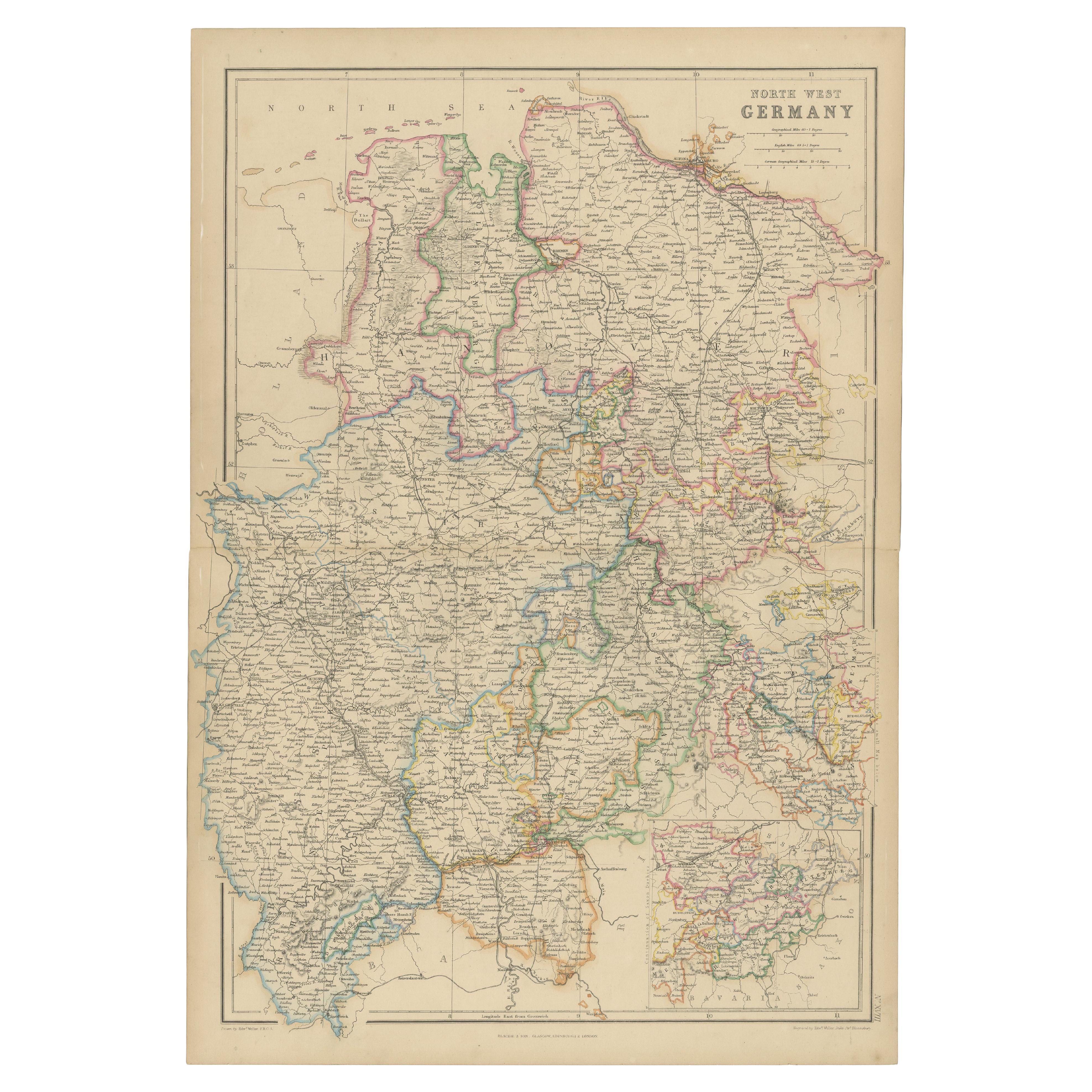
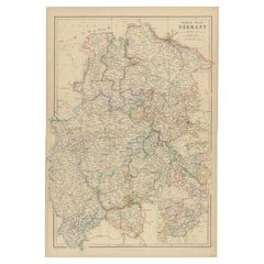
- 1859 Detailed Map of North West Germany with Bavaria Inset - Blackie's AtlasLocated in Langweer, NLThe "Antique Map of North West Germany" with an inset map of Bavaria is a distinguished piece from 'The Imperial Atlas of Modern Geography', published i...Category
Antique Mid-19th Century Maps
MaterialsPaper
- Antique Map of North America Including the West IndiesLocated in Langweer, NLOriginal antique map titled 'Nord-America'. Old map of North America and the West Indies. Also showing British Overseas Territories and Hudson Bay. This map originates from Stiel...Category
Antique Mid-19th Century Maps
MaterialsPaper
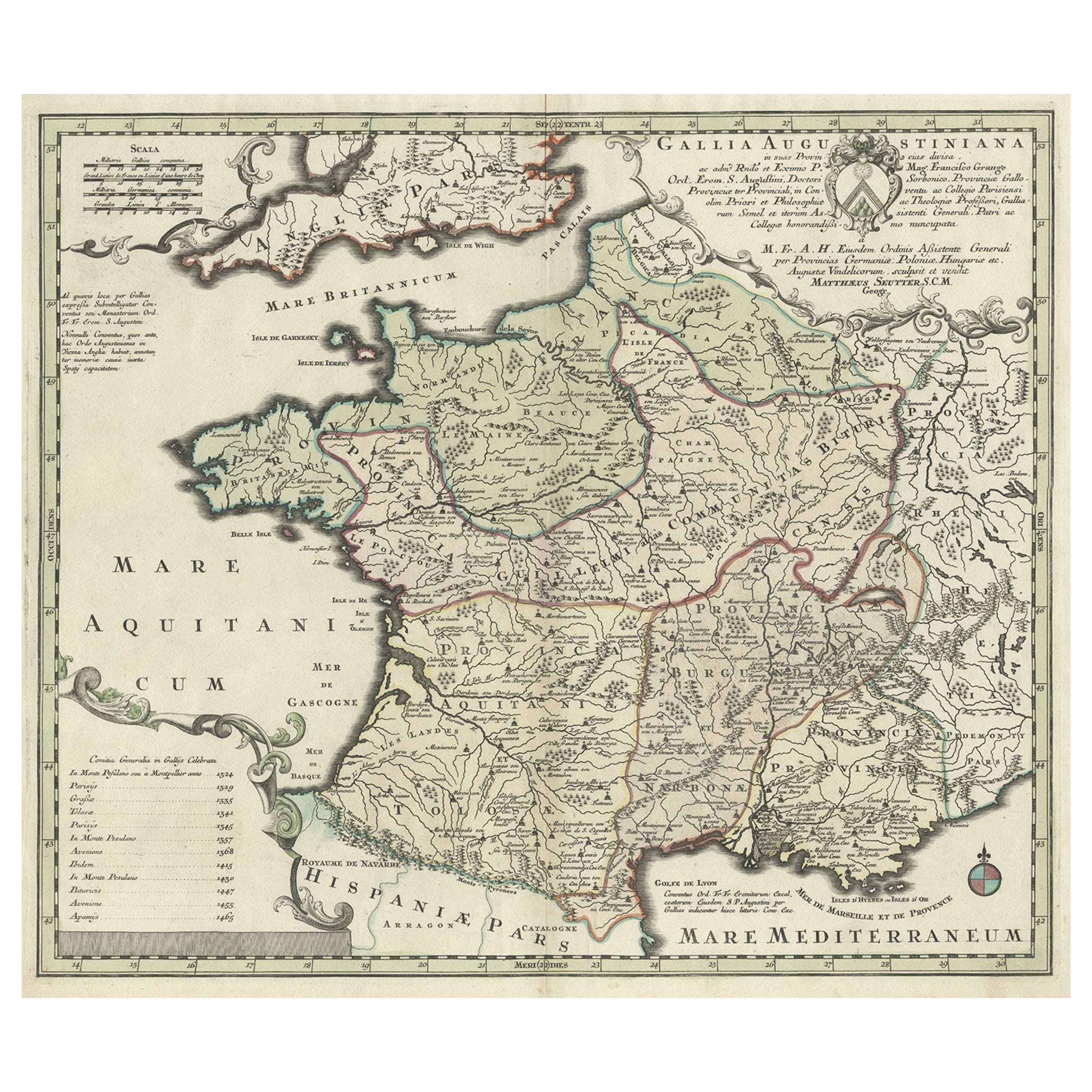
- Large Antique Map of Gaul under Roman Rule, ca.1760Located in Langweer, NLAntique map titled 'Gallia Augustiniana in suas provincias divisa (..)'. Large antique map of Roman Gaul, it refers to Gaul under provincial rule in ...Category
Antique 1760s Maps
MaterialsPaper
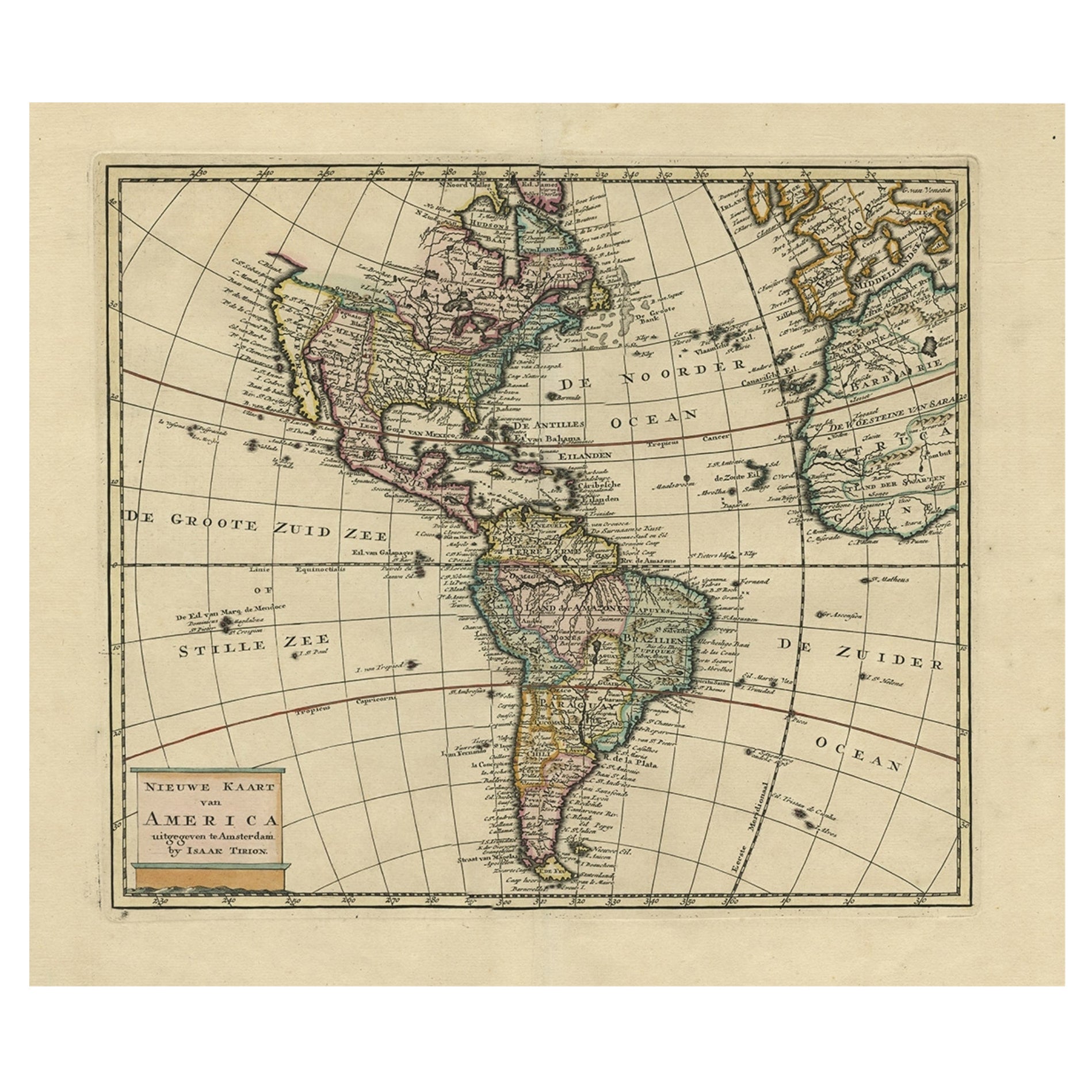
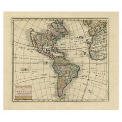
- Antique Hand-Coloured Map of North and South America, ca.1765Located in Langweer, NLDescription: Antique map titled 'Nieuwe Kaart van Amerika.' Attractive map of North and South America, the western part of Africa and south west Europe. Source unknown, to be determi...Category
Antique 1760s Maps
MaterialsPaper


You May Also Like
- Large Antique 1859 Map of North AmericaLocated in Sag Harbor, NYThis Map was made by Augustus Mitchell in 1859 It is in amazing condition for being 163 years old. This price is for the rolled up easy to ship version of this piece. I will be Frami...Category
Antique Mid-19th Century American Maps
MaterialsCanvas, Paper

- Antique Map of Paris, "Carte Routiere des Environs de Paris" 1841Located in Colorado Springs, COThis beautiful hand-colored road map of Paris was published in 1841. The map shows Paris and the surrounding area in a folding pocket map. Organized and detailed for travelers, this ...Category
Antique 1840s French Maps
MaterialsPaper
- Original Antique English County Map, North Yorkshire, J & C Walker, 1851Located in St Annes, LancashireGreat map of North Yorkshire Original colour By J & C Walker Published by Longman, Rees, Orme, Brown & Co. 1851 Unframed.Category
Antique 1850s English Other Maps
MaterialsPaper
- Original Antique English County Map - West Yorkshire. J & C Walker. 1851Located in St Annes, LancashireGreat map of The West Riding of Yorkshire Original colour By J & C Walker Published by Longman, Rees, Orme, Brown & Co. 1851 Unframed.Category
Antique 1850s English Other Maps
MaterialsPaper
- New Map of North America from the Latest Discoveries, 1763Located in Philadelphia, PAA fine antique 18th century map of the North American seaboard. Entitled "A New Map of North America from the Latest Discoveries 1763". By the Cartographer/Engraver - John Spil...Category
Antique Mid-18th Century English Georgian Maps
MaterialsPaper
- Antique Map of Principality of MonacoBy Antonio Vallardi EditoreLocated in Alessandria, PiemonteST/619 - "Old Geographical Atlas of Italy - Topographic map of ex-Principality of Monaco" - ediz Vallardi - Milano - A somewhat special edition ---Category
Antique Late 19th Century Italian Other Prints
MaterialsPaper


Recently Viewed
View AllMore Ways To Browse
Antique Furniture North West
Folding Magazine
Antique Gibson
Antique Map Of The United States
Antique Maps Of The United States
Antique African American
African American Antique
Antique Furniture East London
Antique Eastern European Furniture
Vintage Map Of The United States
Antique House Plans
Antique Metal Window
Antique Metal Windows
Antique Furniture Rollers
Antiques Compasses
India Map
Antique Map Book
Antique Maps Book