Items Similar to 1859 Detailed Map of North West Germany with Bavaria Inset - Blackie's Atlas
Want more images or videos?
Request additional images or videos from the seller
1 of 6
1859 Detailed Map of North West Germany with Bavaria Inset - Blackie's Atlas
About the Item
The "Antique Map of North West Germany" with an inset map of Bavaria is a distinguished piece from 'The Imperial Atlas of Modern Geography', published in 1859 by W. G. Blackie. This original antique map offers a detailed and historically significant portrayal of the northwestern region of Germany during the mid-19th century, supplemented by a focused inset of Bavaria.
**Key Features of the Map:**
1. **Geographical Coverage**: The map encompasses the northwestern part of Germany, including regions such as Lower Saxony, North Rhine-Westphalia, and parts of Hesse and Rhineland-Palatinate. It highlights the varied landscapes, from the North Sea coastline to the densely forested areas of the interior.
2. **Inset Map of Bavaria**: The inset provides a detailed view of Bavaria, a culturally and historically significant state in southeastern Germany. This additional map likely focuses on Bavaria's topography, major cities, and distinctive cultural landmarks.
3. **Political Divisions and Boundaries**: Reflecting the complex political landscape of 19th-century Germany, the map delineates the various kingdoms, principalities, and duchies that existed in the northwest region, offering insight into the political organization of the time.
4. **Urban Centers**: Key cities like Hamburg, Cologne, Frankfurt, and Düsseldorf are marked, along with other smaller towns and communities. The map provides a snapshot of urban development and population centers in northwestern Germany.
5. **Transportation Networks**: The map may illustrate the burgeoning railway lines, rivers, and roads, highlighting the transportation infrastructure that was instrumental in the region's economic development.
6. **Topographical Details**: Features such as the Harz Mountains, the Rhine River, and other natural landmarks are likely detailed, showcasing the geographic diversity of the region.
7. **Artistic and Aesthetic Elements**: In line with the Victorian era's cartographic style, the map likely includes ornate borders, an elegant title script, and possibly other artistic details, adding to its visual appeal.
8. **Educational and Historical Value**: As a historical document, this map is invaluable for educational purposes, providing insights into the geography and political divisions of northwestern Germany and Bavaria in the mid-19th century.
This map is not only a collector's item for enthusiasts of antique maps but also an important resource for historians, geographers, and anyone interested in the historical landscape and development of Germany.
- Dimensions:Height: 21.26 in (54 cm)Width: 14.57 in (37 cm)Depth: 0.02 in (0.5 mm)
- Materials and Techniques:
- Period:
- Date of Manufacture:1859
- Condition:Wear consistent with age and use. General age-related toning. some foxing, Please study image carefully.
- Seller Location:Langweer, NL
- Reference Number:
About the Seller
5.0
Platinum Seller
These expertly vetted sellers are 1stDibs' most experienced sellers and are rated highest by our customers.
Established in 2009
1stDibs seller since 2017
1,933 sales on 1stDibs
Typical response time: <1 hour
- ShippingRetrieving quote...Ships From: Langweer, Netherlands
- Return PolicyA return for this item may be initiated within 14 days of delivery.
More From This SellerView All
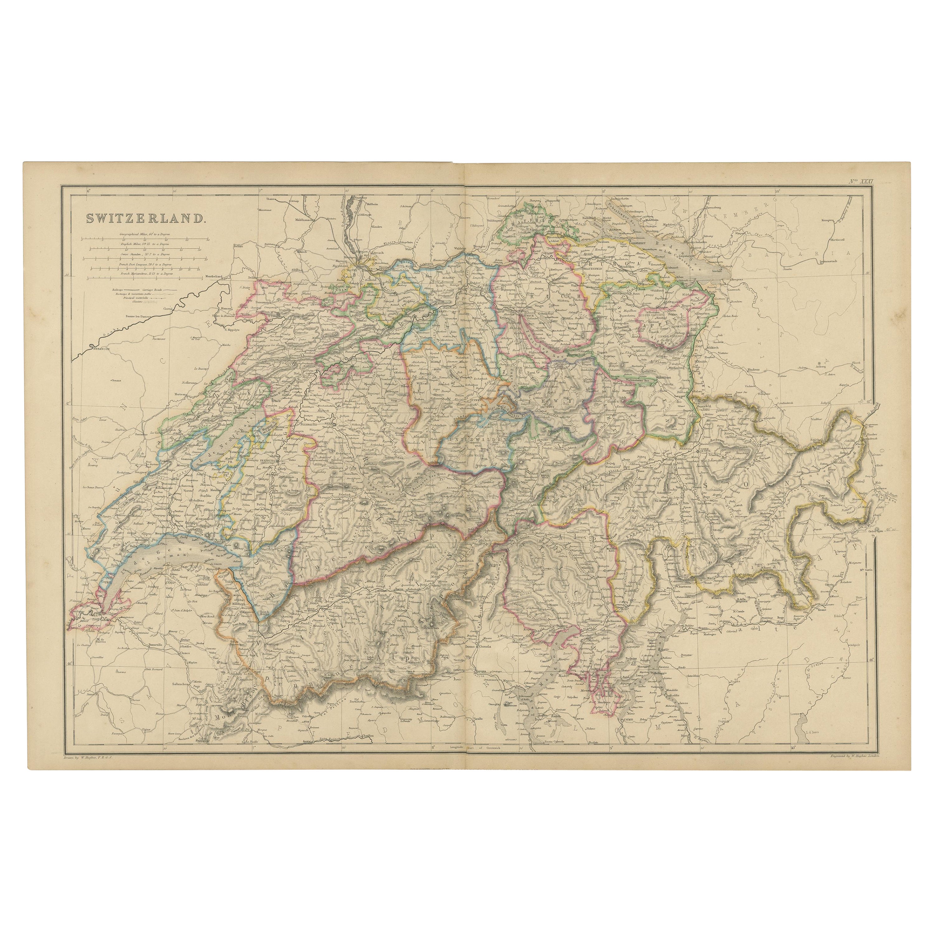
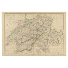
- 1859 Antique Swiss Panorama: Blackie's Detailed Map of SwitzerlandLocated in Langweer, NLThe "Antique Map of Switzerland" is a distinguished piece from 'The Imperial Atlas of Modern Geography', published in 1859 by the renowned cartographer W. G. Blackie. This map presen...Category
Antique Mid-19th Century Maps
MaterialsPaper
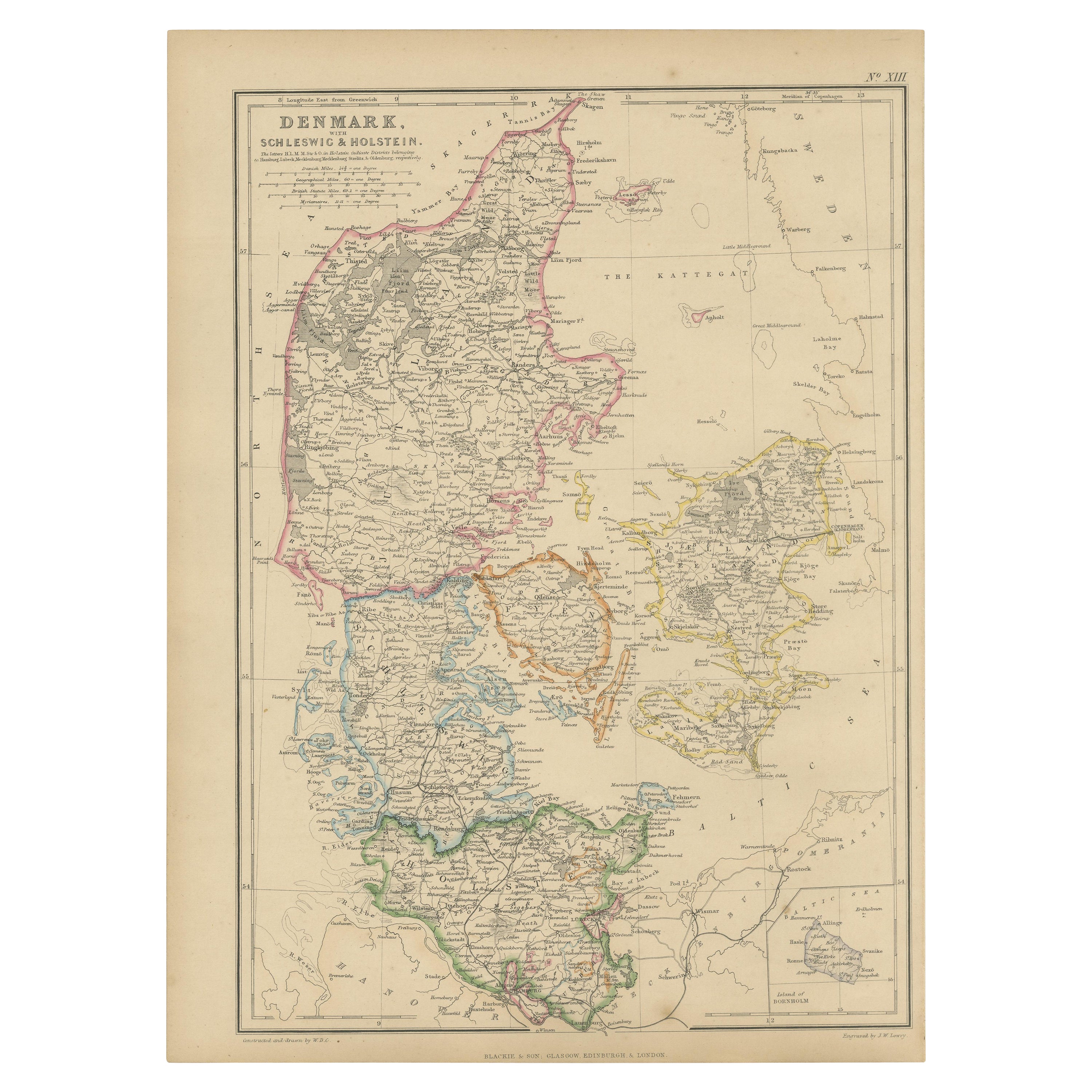
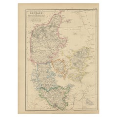
- 1859 Denmark and Schleswig-Holstein Map: A Historical View from Blackie's AtlasLocated in Langweer, NLThe "Antique Map of Denmark with Schleswig & Holstein" from 'The Imperial Atlas of Modern Geography', published by W. G. Blackie in 1859, is a valuable historical document that provi...Category
Antique Mid-19th Century Maps
MaterialsPaper
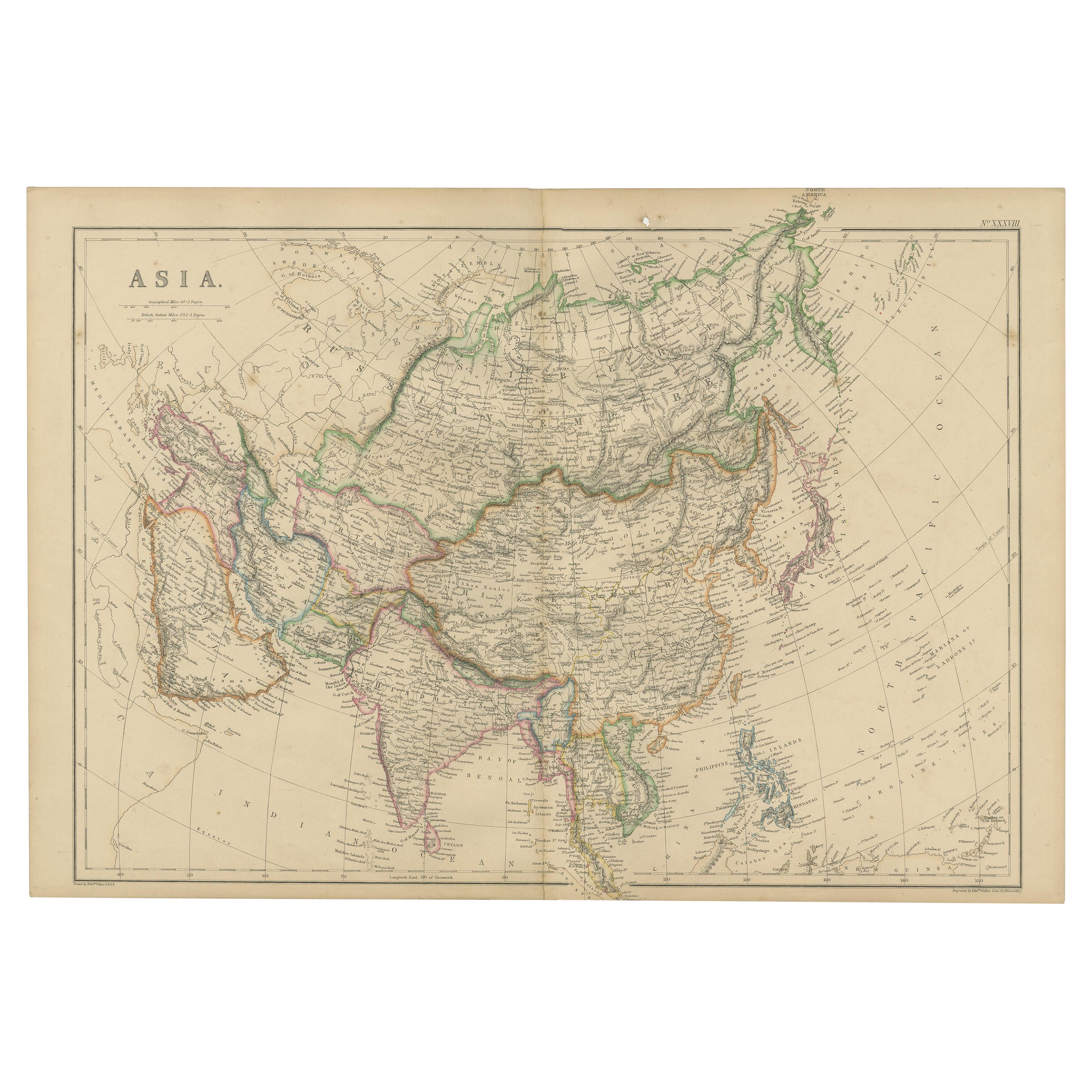
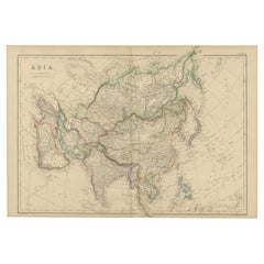
- Original 1859 Map of Asia from W.G. Blackie's Imperial Atlas of Modern GeographyLocated in Langweer, NLAntique map titled 'Asia'. Original antique map of Asia. This map originates from ‘The Imperial Atlas of Modern Geography’. Published by W. G. Blackie, 1859. The "Classic Cartograph...Category
Antique Mid-19th Century Maps
MaterialsPaper
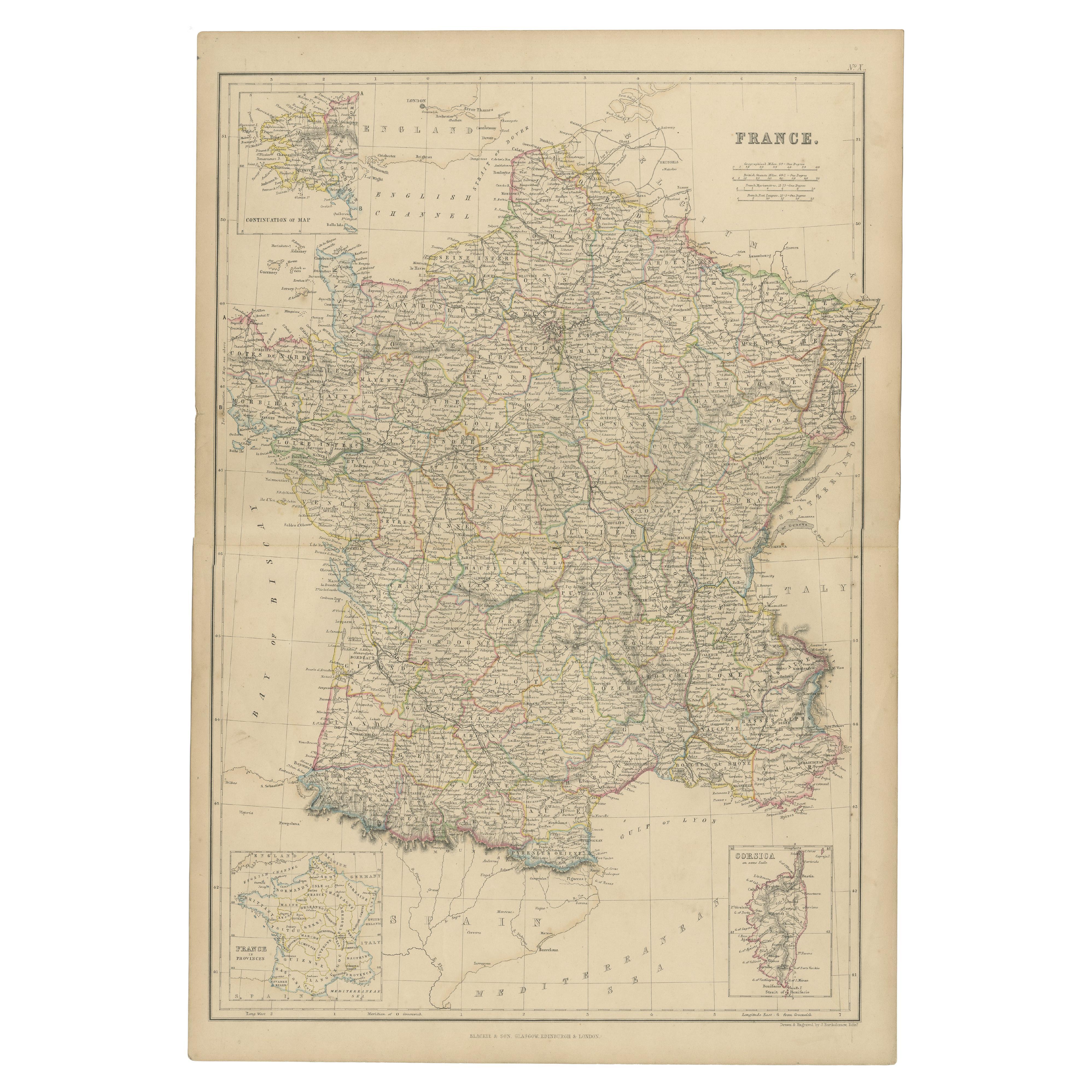
- 1859 Classic Map of France: Blackie's Imperial Geographic MasterpieceLocated in Langweer, NLThe "Antique Map of France" from 'The Imperial Atlas of Modern Geography', published in 1859 by W. G. Blackie, is a historically valuable cartographic work that offers a comprehensiv...Category
Antique Mid-19th Century Maps
MaterialsPaper
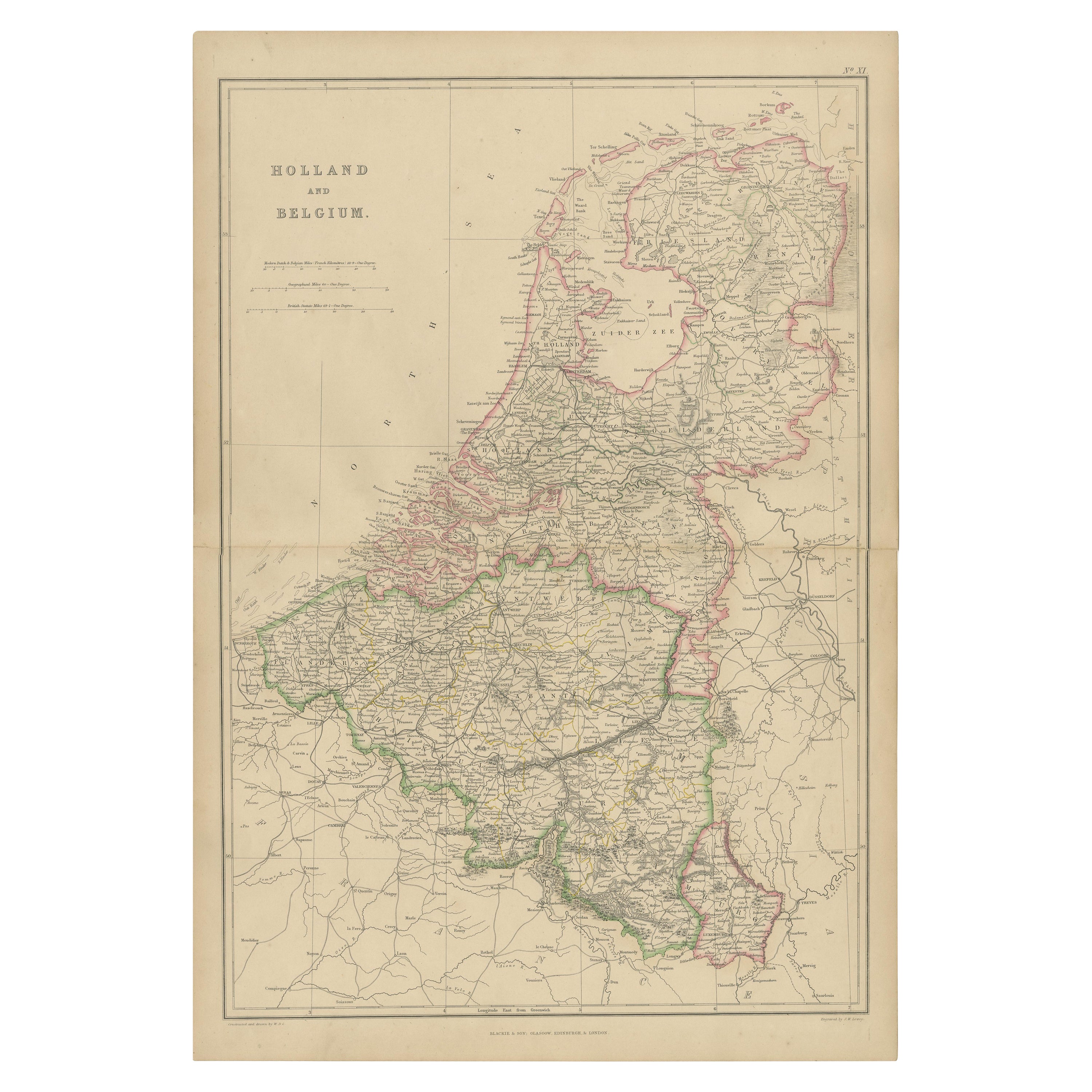
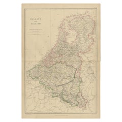
- 1859 Vintage Map of Holland and Belgium: Blackie's Imperial Geographic InsightLocated in Langweer, NLThe "Antique Map of Holland and Belgium" from 'The Imperial Atlas of Modern Geography', published by W. G. Blackie in 1859, is a significant hi...Category
Antique Mid-19th Century Maps
MaterialsPaper
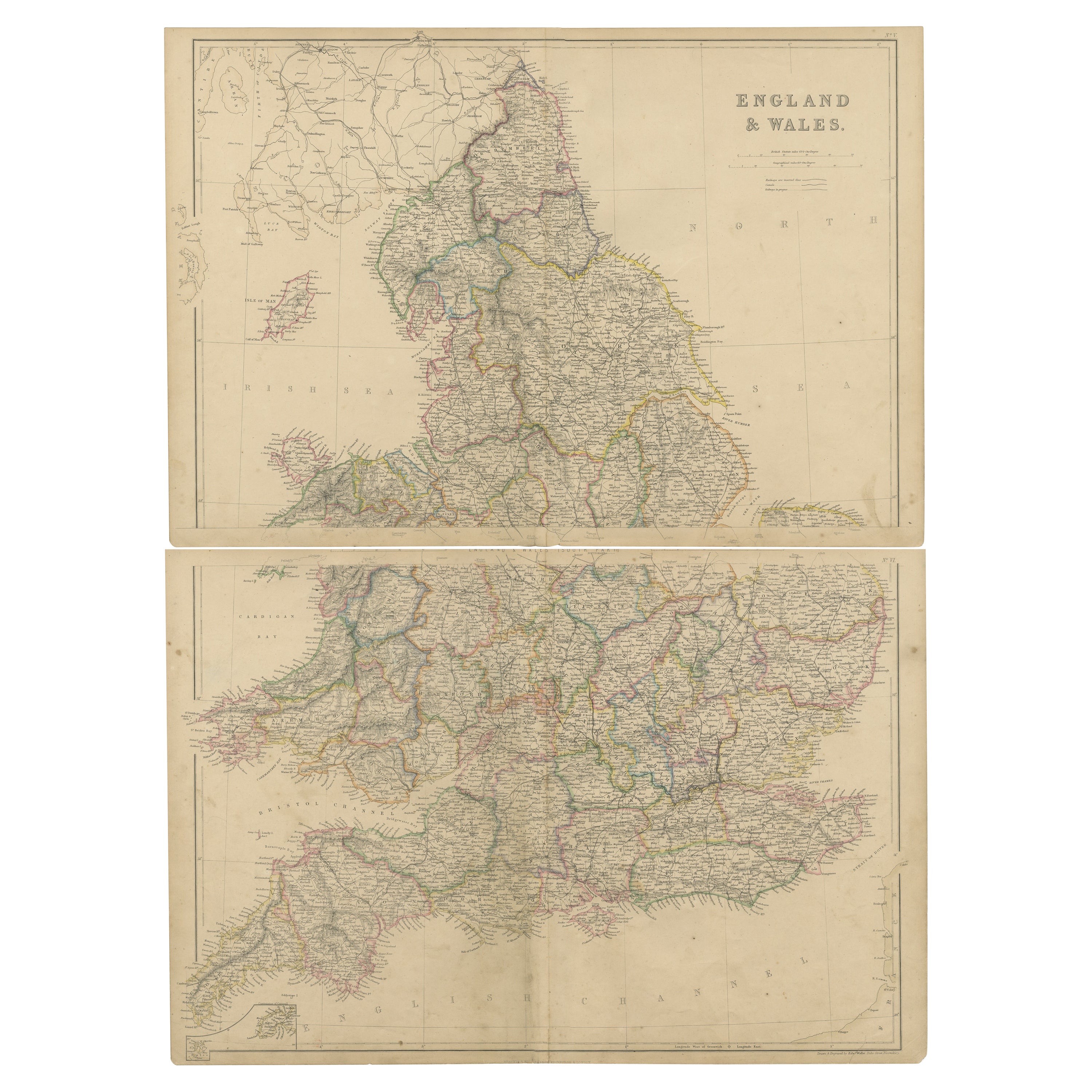
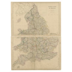
- 1859 Vintage Maps of England and Wales: Blackie's Imperial Geographic DetailLocated in Langweer, NLThe "Antique Map of England & Wales" from 'The Imperial Atlas of Modern Geography', published by W. G. Blackie in 1859, is an original antique map that provides a detailed depiction ...Category
Antique Mid-19th Century Maps
MaterialsPaper

You May Also Like
- Large Antique 1859 Map of North AmericaLocated in Sag Harbor, NYThis Map was made by Augustus Mitchell in 1859 It is in amazing condition for being 163 years old. This price is for the rolled up easy to ship version of this piece. I will be Frami...Category
Antique Mid-19th Century American Maps
MaterialsCanvas, Paper

- 17th Century Hand-Colored Map of a Region in West Germany by JanssoniusBy Johannes JanssoniusLocated in Alamo, CAThis attractive highly detailed 17th century original hand-colored map is entitled "Archiepiscopatus Maghdeburgensis et Anhaltinus Ducatus cum terris adjacentibus". It was published ...Category
Antique Mid-17th Century Dutch Maps
MaterialsPaper
- Germany West of the Rhine: A Hand-colored 18th Century Map by de WitBy Frederick de WitLocated in Alamo, CAThis original 18th century hand-colored map of the county of Moers, Germany entitled "Illustrissimo Celsissmo Principi GUILIELMO HENRICO D.G. Arausionum Principi Domino suo Clementis...Category
Antique Early 18th Century Dutch Maps
MaterialsPaper
- New Map of North America from the Latest Discoveries, 1763Located in Philadelphia, PAA fine antique 18th century map of the North American seaboard. Entitled "A New Map of North America from the Latest Discoveries 1763". By the Cartographer/Engraver - John Spil...Category
Antique Mid-18th Century English Georgian Maps
MaterialsPaper
- 17th Century Hand-Colored Map of West Africa by Mercator/HondiusLocated in Alamo, CAA 17th century hand-colored map entitled "Guineae Nova Descriptio" by Gerard Mercator and Jodocus Hondius, published in their 'Atlas Minor' in Amsterdam in 1635. It is focused on the...Category
Antique Mid-17th Century Dutch Maps
MaterialsPaper
- "Nova Barbariae Descriptio", a 17th Century Hand-Colored Map of North AfricaBy Johannes JanssoniusLocated in Alamo, CAThis original attractive 17th century hand-colored map of North Africa entitled "Nova Barbariae Descriptio" by Johannes Janssonius was published in Paris in 1635. It includes the Med...Category
Antique Mid-17th Century Dutch Maps
MaterialsPaper


Recently Viewed
View AllMore Ways To Browse
Used Furniture North West
19th Century German Collectibles
Antique Furniture North West
Antique German Map
Antique German Maps
Antique Map Germany
Antique Maps Germany
Antique Map Of Germany
Antique Maps Of Germany
Imperial German
Imperial Germany
Bavaria Antique
West German Antiques
Antique Bavaria
Map Bavaria
Map Of Bavaria
Old Maps Of World
16th Century Dutch