Items Similar to 1859 Classic Map of France: Blackie's Imperial Geographic Masterpiece
Want more images or videos?
Request additional images or videos from the seller
1 of 6
1859 Classic Map of France: Blackie's Imperial Geographic Masterpiece
About the Item
The "Antique Map of France" from 'The Imperial Atlas of Modern Geography', published in 1859 by W. G. Blackie, is a historically valuable cartographic work that offers a comprehensive depiction of France as it was understood in the mid-19th century.
**Key Features of the Map:**
1. **Geographical Coverage**: The map encompasses the entirety of France, illustrating the country's diverse landscapes, from the coastal regions of the Atlantic and the Mediterranean to the mountain ranges of the Alps and Pyrenees.
2. **Political Boundaries**: Reflecting the political divisions of the time, the map likely delineates the various departments of France, offering insight into the administrative organization of the country during the Second French Empire under Napoleon III.
3. **Urban and Rural Details**: Major cities like Paris, Marseille, Lyon, and Bordeaux are prominently marked, along with smaller towns and villages. The map provides a detailed view of France's urban landscape and rural settlements, highlighting key cultural and economic centers.
4. **Topographical Features**: The map would typically showcase France's topographical diversity, including river systems like the Seine, Loire, and Rhone, as well as significant geographical landmarks and natural features.
5. **Transportation Infrastructure**: Given the period, the map might detail the expanding network of railways and roads, reflecting the industrial growth and modernization of France during this era.
6. **Artistic and Aesthetic Elements**: True to the Victorian era's style, the map is likely to feature ornate borders, an elegant title script, and other artistic details, adding to its visual and historical appeal.
7. **Educational and Historical Significance**: As a part of 'The Imperial Atlas of Modern Geography', this map serves as an important educational tool, providing insights into the geographical understanding and perceptions of France in the mid-19th century.
This antique map of France is not only a collector’s item for enthusiasts of historical maps but also an invaluable resource for historians, geographers, and those interested in the historical development and geography of France. It captures a significant period in French history, making it a fascinating piece for anyone interested in the evolution of European geography and cartography.
- Dimensions:Height: 21.26 in (54 cm)Width: 14.57 in (37 cm)Depth: 0.02 in (0.5 mm)
- Materials and Techniques:
- Period:
- Date of Manufacture:1859
- Condition:Wear consistent with age and use. General age-related toning. some foxing, Please study image carefully.
- Seller Location:Langweer, NL
- Reference Number:
About the Seller
5.0
Platinum Seller
These expertly vetted sellers are 1stDibs' most experienced sellers and are rated highest by our customers.
Established in 2009
1stDibs seller since 2017
1,922 sales on 1stDibs
Typical response time: <1 hour
- ShippingRetrieving quote...Ships From: Langweer, Netherlands
- Return PolicyA return for this item may be initiated within 14 days of delivery.
More From This SellerView All
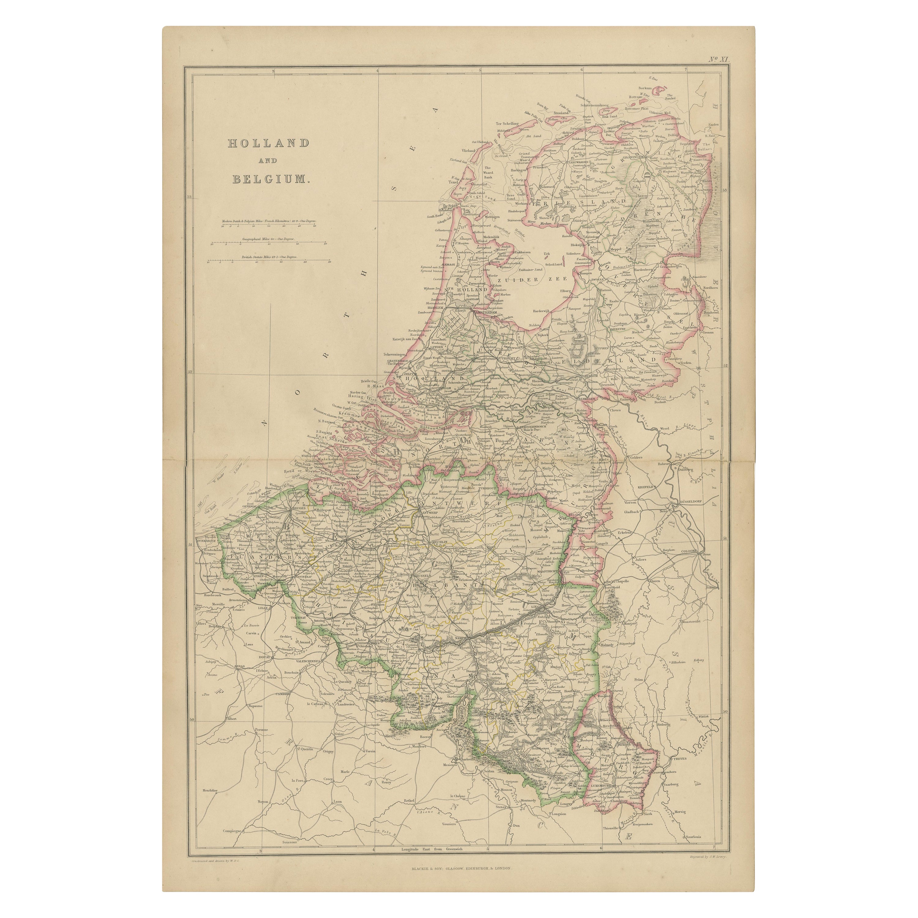
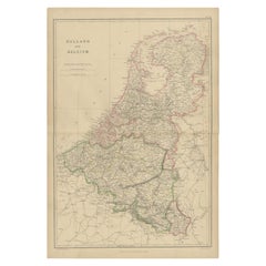
- 1859 Vintage Map of Holland and Belgium: Blackie's Imperial Geographic InsightLocated in Langweer, NLThe "Antique Map of Holland and Belgium" from 'The Imperial Atlas of Modern Geography', published by W. G. Blackie in 1859, is a significant hi...Category
Antique Mid-19th Century Maps
MaterialsPaper
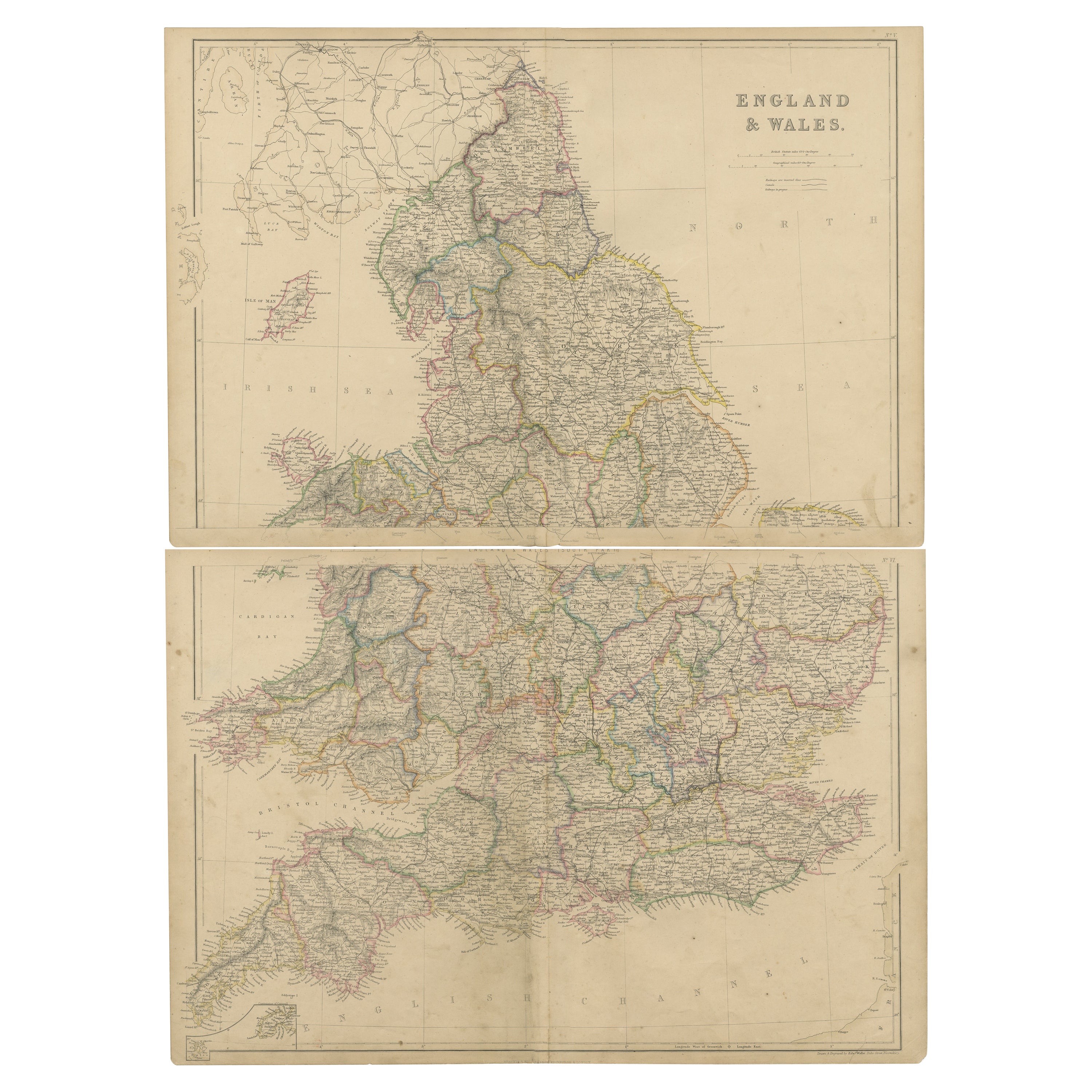
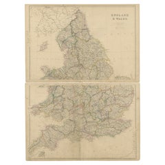
- 1859 Vintage Maps of England and Wales: Blackie's Imperial Geographic DetailLocated in Langweer, NLThe "Antique Map of England & Wales" from 'The Imperial Atlas of Modern Geography', published by W. G. Blackie in 1859, is an original antique map that provides a detailed depiction ...Category
Antique Mid-19th Century Maps
MaterialsPaper
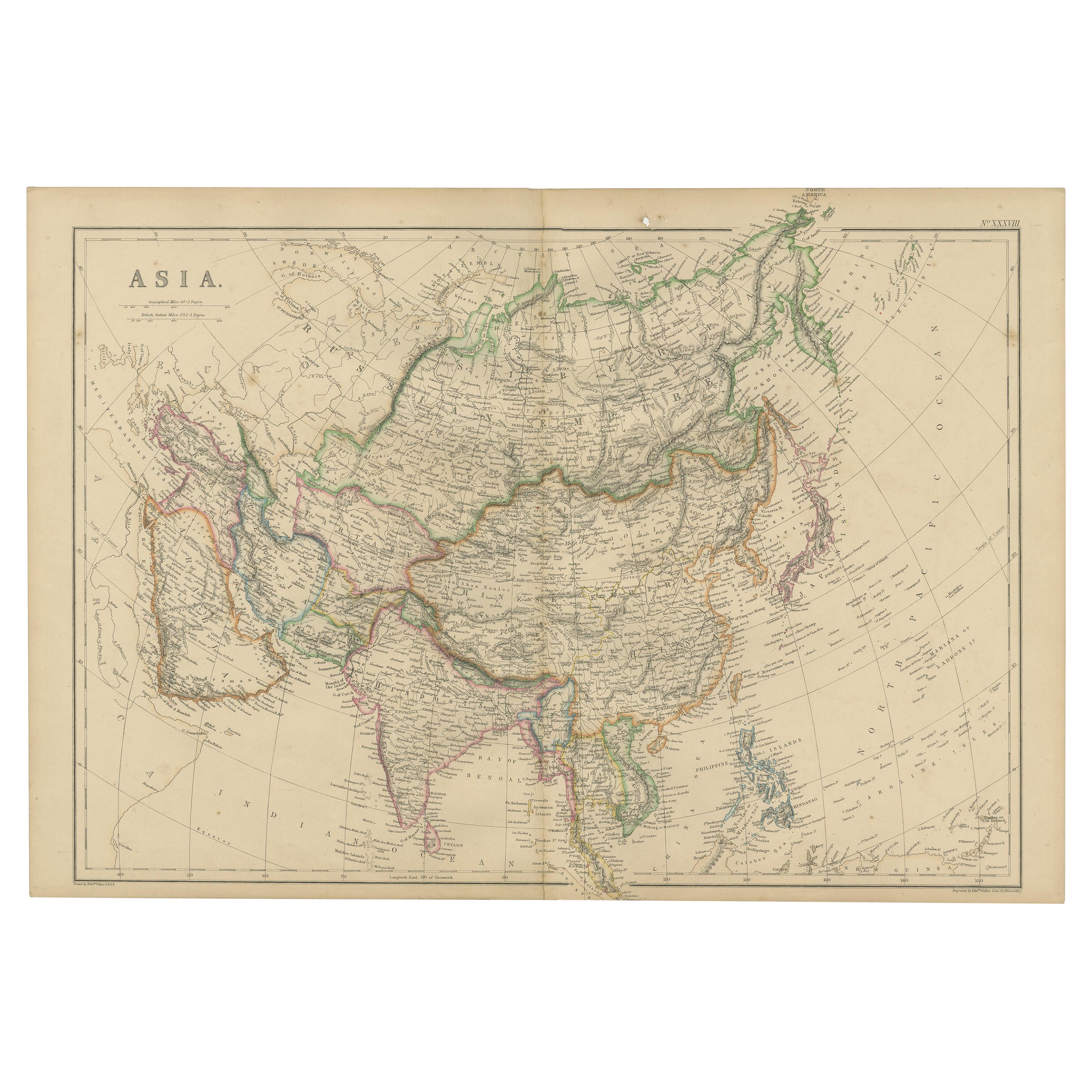
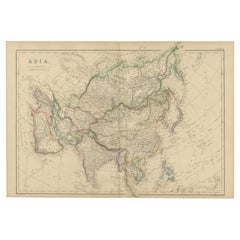
- Original 1859 Map of Asia from W.G. Blackie's Imperial Atlas of Modern GeographyLocated in Langweer, NLAntique map titled 'Asia'. Original antique map of Asia. This map originates from ‘The Imperial Atlas of Modern Geography’. Published by W. G. Blackie, 1859. The "Classic Cartograph...Category
Antique Mid-19th Century Maps
MaterialsPaper
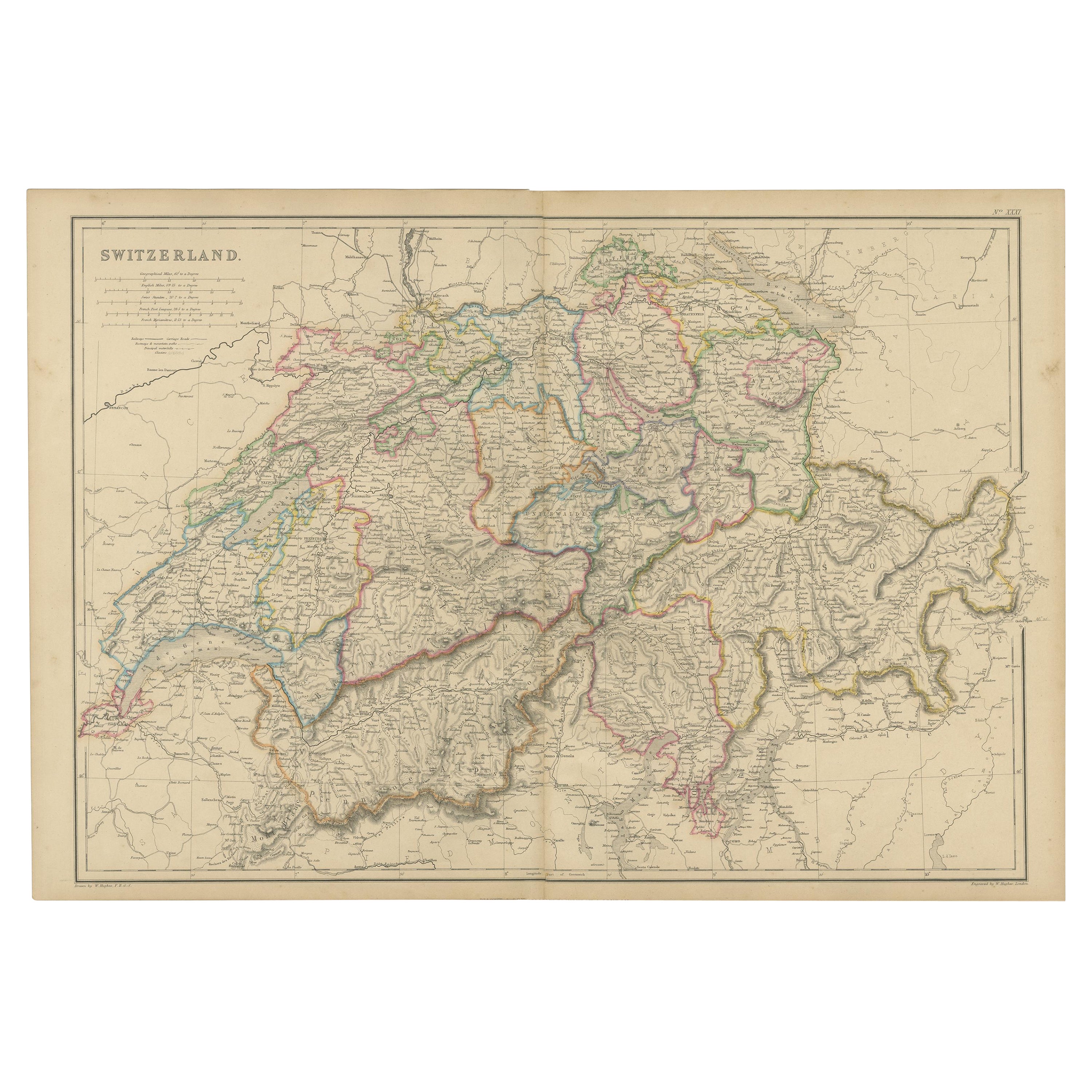
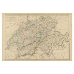
- 1859 Antique Swiss Panorama: Blackie's Detailed Map of SwitzerlandLocated in Langweer, NLThe "Antique Map of Switzerland" is a distinguished piece from 'The Imperial Atlas of Modern Geography', published in 1859 by the renowned cartographer W. G. Blackie. This map presen...Category
Antique Mid-19th Century Maps
MaterialsPaper
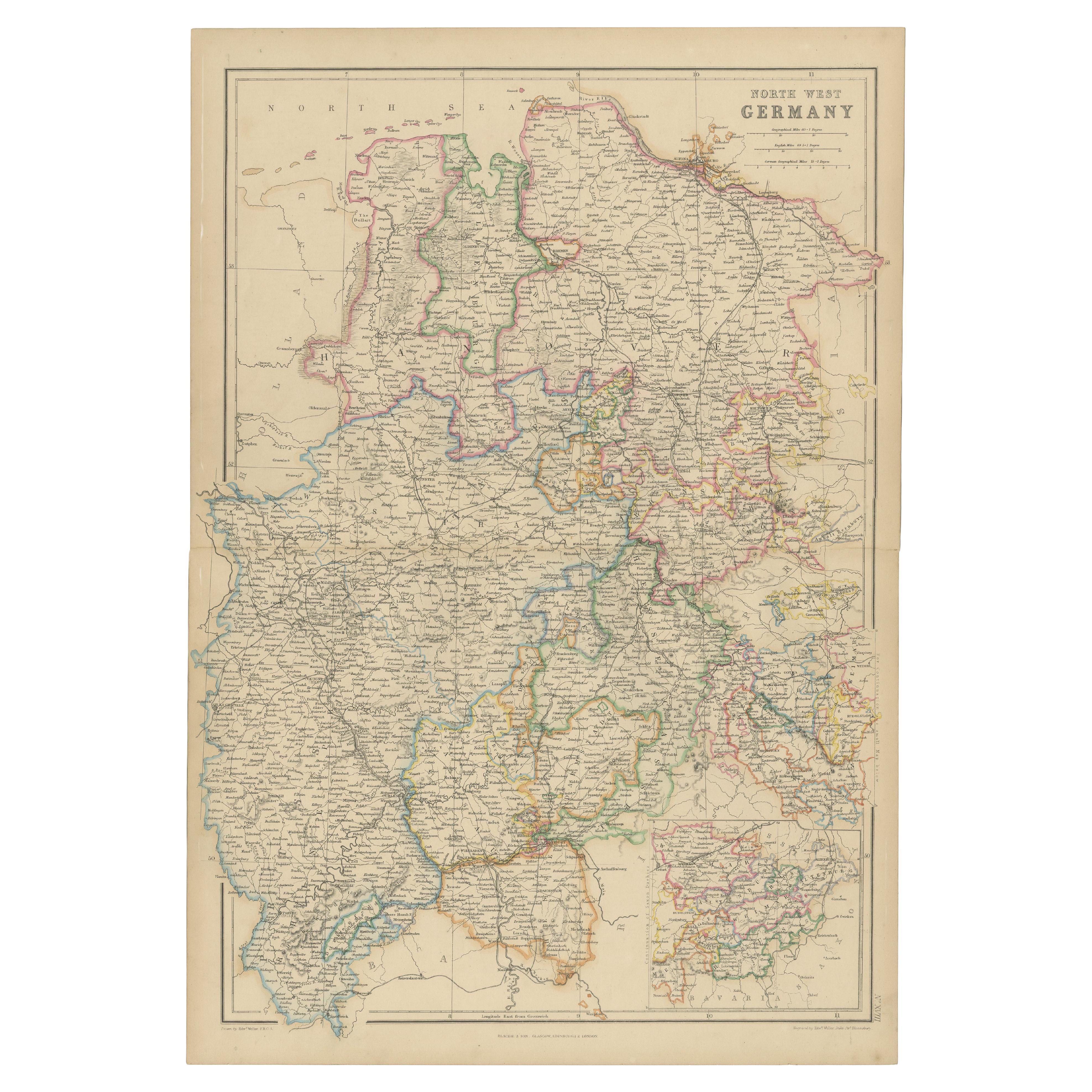
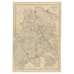
- 1859 Detailed Map of North West Germany with Bavaria Inset - Blackie's AtlasLocated in Langweer, NLThe "Antique Map of North West Germany" with an inset map of Bavaria is a distinguished piece from 'The Imperial Atlas of Modern Geography', published i...Category
Antique Mid-19th Century Maps
MaterialsPaper
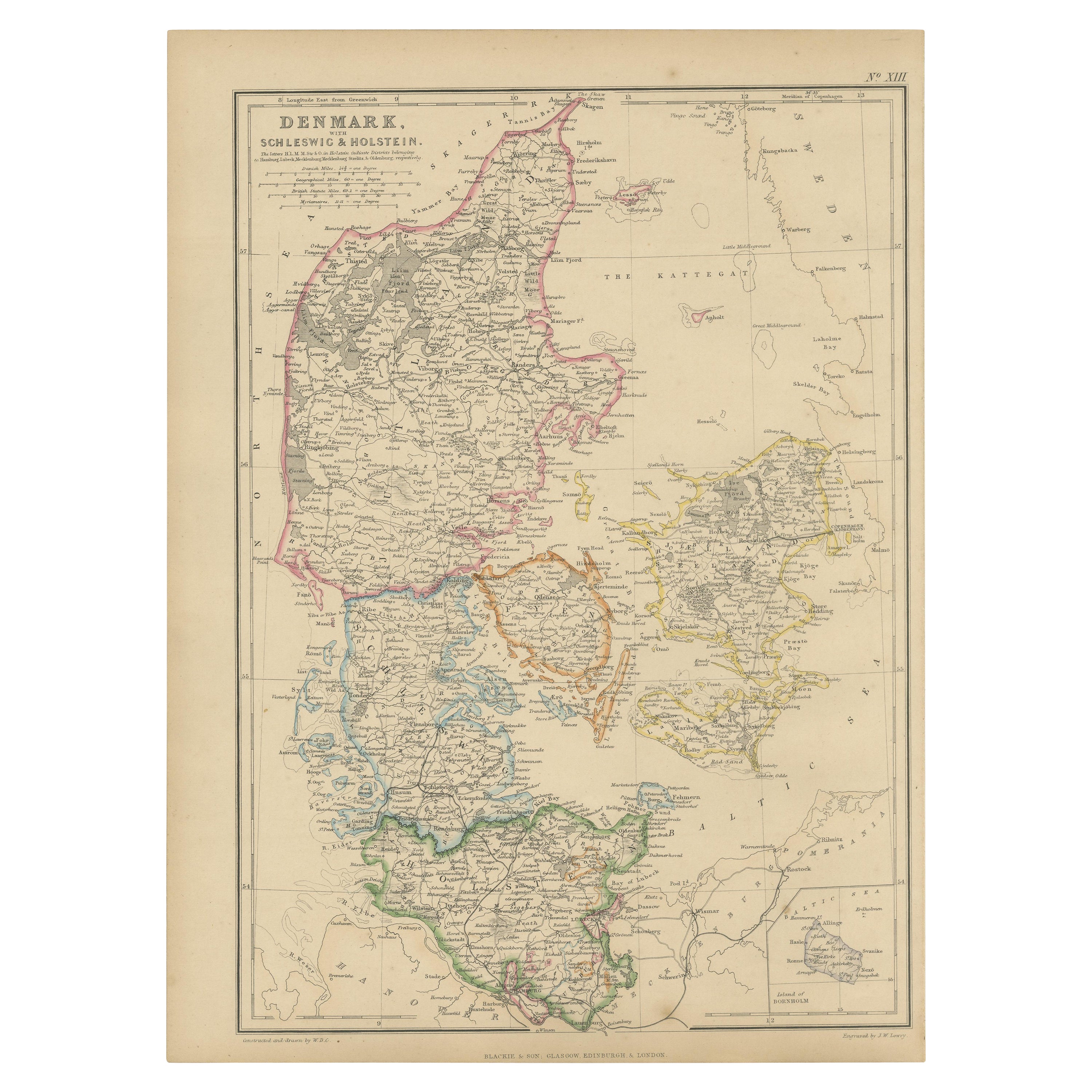
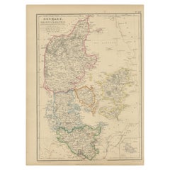
- 1859 Denmark and Schleswig-Holstein Map: A Historical View from Blackie's AtlasLocated in Langweer, NLThe "Antique Map of Denmark with Schleswig & Holstein" from 'The Imperial Atlas of Modern Geography', published by W. G. Blackie in 1859, is a valuable historical document that provi...Category
Antique Mid-19th Century Maps
MaterialsPaper
You May Also Like
- Large Antique 1859 Map of North AmericaLocated in Sag Harbor, NYThis Map was made by Augustus Mitchell in 1859 It is in amazing condition for being 163 years old. This price is for the rolled up easy to ship version of this piece. I will be Frami...Category
Antique Mid-19th Century American Maps
MaterialsCanvas, Paper

- Original Antique Map of France, Arrowsmith, 1820Located in St Annes, LancashireGreat map of France Drawn under the direction of Arrowsmith. Copper-plate engraving. Published by Longman, Hurst, Rees, Orme and Brown, 1820 Unframed.Category
Antique 1820s English Maps
MaterialsPaper
- Map of the Republic of GenoaLocated in New York, NYFramed antique hand-coloured map of the Republic of Genoa including the duchies of Mantua, Modena, and Parma. Europe, late 18th century. Dimension: 25...Category
Antique Late 18th Century European Maps
- Antique Map of Principality of MonacoBy Antonio Vallardi EditoreLocated in Alessandria, PiemonteST/619 - "Old Geographical Atlas of Italy - Topographic map of ex-Principality of Monaco" - ediz Vallardi - Milano - A somewhat special edition ---Category
Antique Late 19th Century Italian Other Prints
MaterialsPaper
- Original Antique Map of France, Sherwood, Neely & Jones, Dated 1809Located in St Annes, LancashireGreat map of France Copper-plate engraving by Cooper Published by Sherwood, Neely & Jones. Dated 1809 Unframed.Category
Antique Early 1800s English Maps
MaterialsPaper
- Old Nautical Map of CorsicaLocated in Alessandria, PiemonteST/556/1 - Old map of Corsica isle, surveyed by Captain Hell, of the French Royal Navy in 1824, engraved and published on 1874, with additions and corre...Category
Antique Early 19th Century English Other Prints
MaterialsPaper


Recently Viewed
View AllMore Ways To Browse
Old Maps Of World
16th Century Dutch
Orient Antique
Used House Windows
World Map Vintage Maps
World Map Vintage Map
Antique Maps Of Islands
18th Russian
Antique Maps Of Holland
B C Antiques
Antique Map America
Antique American Maps
Antique American Map
America Antique Map
Antique Map Of America
Antique Maps Of America
Antique Furniture In Edinburgh
Victorian Tear